Abandoned & Little-Known Airfields:
Southern Vermont
© 2003, © 2025 by Paul Freeman. Revised 12/29/25.
This site covers airfields in all 50 states: Click here for the site's main menu.
____________________________________________________
Please consider a financial contribution to support the continued growth & operation of this site.
Equinox Airport (revised 12/29/25) - Fair Haven Municipal Airport (revised 12/29/25) - Miller Airport (revised 1/29/25) - Mount Snow Airport / Deerfield Valley Regional Airport (revised 5/2/23)
____________________________________________________
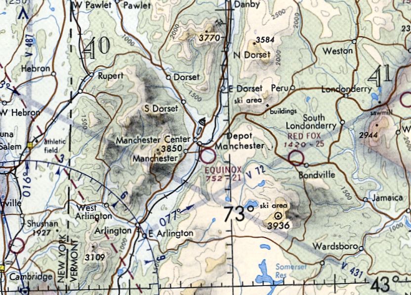
Equinox Airport, Manchester, VT
43.163, -73.045 (Northwest of Boston, MA)
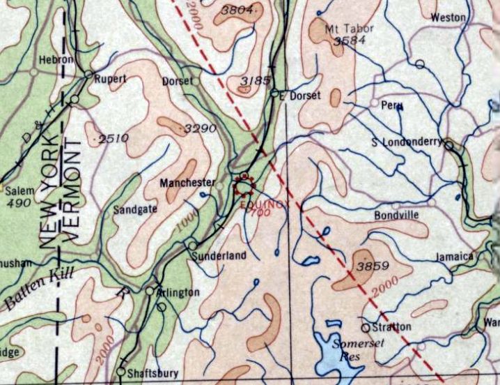
Equinox Airport, as depicted on the June 1933 Albany Sectional Chart.
The date of establishment of this early airport has not been determined.
The earliest reference which has been located to Equinox Airport was its listing in the 1931 Airports & Landing Fields in New England (courtesy of Jonathan Westerling).
It described Equinox as a commercial airport, measuring 27 acres, having a single 1,600' turf northeast/southwest runway, and a single 80' x 60' hangar.
The earliest depiction which has been located of Equinox Airport was on the June 1933 Albany Sectional Chart.
It depicted Equinox as a commercial/municipal airport.
A 1934 listing (courtesy of Tom Hildreth) described “Manchester – Equinox Airport” as a commercial airport, with one 1,600' runway, and with “Manchester Airport” marked on the field.
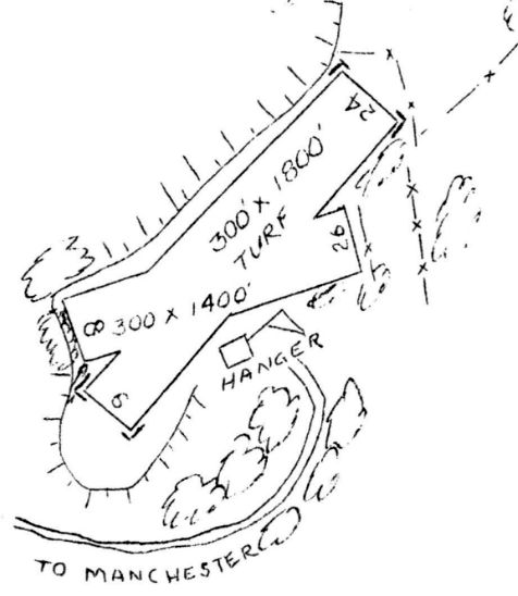
The 1/1/38 Commerce Department Airway Bulletin (courtesy of Bob McCormick)
described Equinox as a commercial airport, having 2 turf runways measuring 2,100' north/south & 1,800' east/west, and having “MANCHESTER AIRPORT embedded in field.”
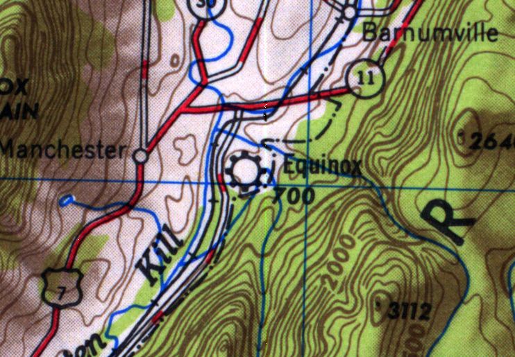
The earliest topo map depiction which has been located of Equinox Airport was on the 1950 USGS topo map.
The earliest photo which has been located of Equinox Airport was a 1952 aerial view.
It depicted Equinox Airport as a northeast/southwest clearing, with a checkerboard-roofed hangar on the south side.
There were no aircraft visible on the field.
The 1957 VT Airport Directory (courtesy of Jonathan Westerling) described Equinox Airport as having 2 turf runways (1,800' northeast/southwest & 1,400' east-northeast/west-southwest),
operated by Equinox Flying Service, and managed by Charles Hawkins.
A 1965 aerial view depicted Equinox Airport & its hangar in the same configuration.
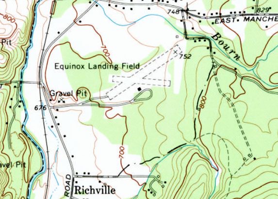
The 1968 USGS topo map depicted “Equinox Landing Field” as having 2 unpaved runways, and 1 building on the south side,
The last aeronautical chart depiction which has been located of Equinox Airport was on the June 1973 NY Sectional Chart (courtesy of Ron Plante).
It depicted Equinox Airport as having a 2,100' unpaved runway.
Equinox Airport was evidently closed (for reasons unknown) at some point between 1973-79,
as it was no longer depicted on the December 1979 NY Sectional Chart (courtesy of Ron Plante).
A 1985 aerial view showed that Equinox Airport's hangar had been removed at some point between 1965-85.
But 2 light single-engine aircraft were parked on the south side of the field.
A 1986 aerial view depicted Equinox Airport perhaps at the zenith of its popularity, with 5 light single-engine aircraft parked on its south side.
The earliest photo which is available of Equinox Airport was a 1992 aerial view. It depicted Equinox Airport as a northeast/southwest clearing, but with no buildings or aircraft.
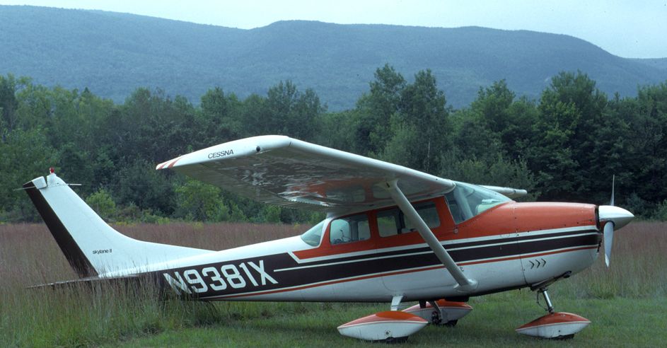
An 8/15/98 photo by Tom Hildreth of a Cessna 182E Skylane at Equinox Airport.
Tom recalled, “I was surprised to find an aircraft there, because it looked more like a gravel pit than an airport.”
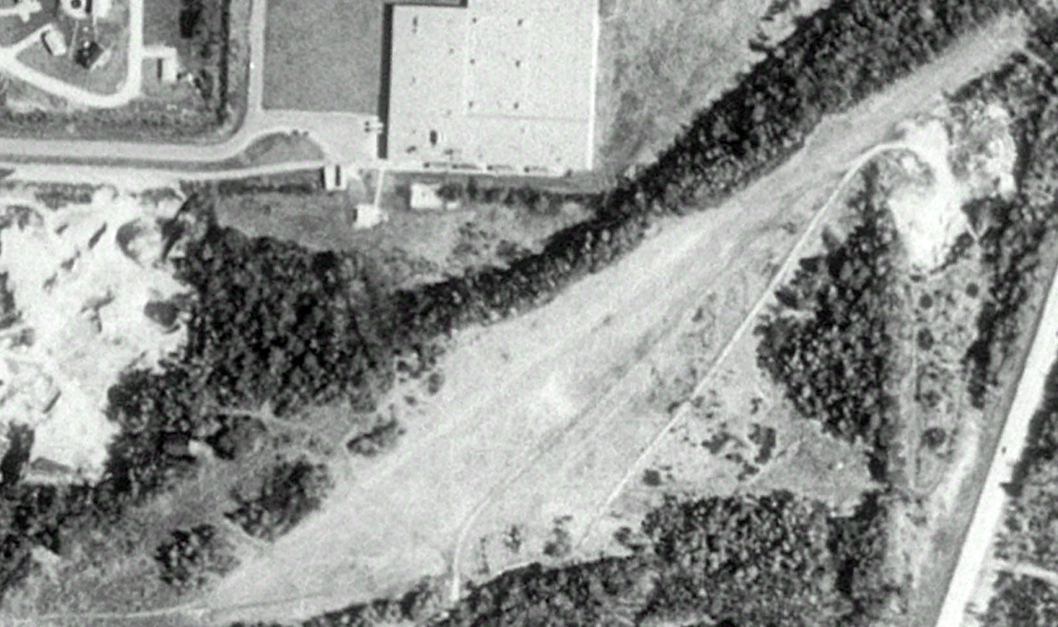
A 2003 aerial photo showed a paved northeast/southwest runway (or ramp) had been added on the northwest side of Equinox Airport at some point between 1992-2003.
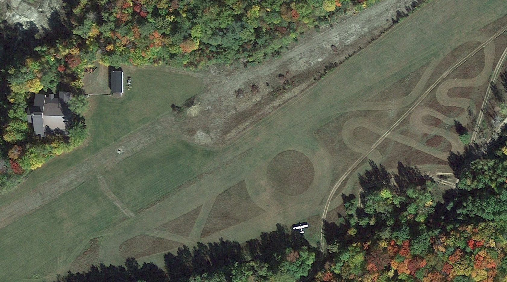
The last photo which has been located showing an aircraft at Equinox Airport was a 2016 aerial view, which showed 1 light single-engine plane parked on the south side.
A 2022 aerial photo showed the Equinox Airport site remained vacant though intact, but with no aircraft visible on the field.
An article entitled “Old airport to provide runway for creative process and conflict resolution” in the 6/18/23 Manchester Journal (courtesy of Andrew Laverdiere) reported,
“The 24 acre Equinox Airport property, sold in November to members of the Levis family, has a new & very different mission -
furthering the theory of creative process & conflict resolution advanced by the family patriarch, Dr. Albert Levis.
Although there remain unknowns about the project, including how the runway land will physically impact the think-tank proposal,
Melissa Levis said the purchase of the airport property seeks to finally focus a site to further her father’s ideas.”
The site of Equinox Airport is located at the end of Airport Road, appropriately enough.
____________________________________________________
Mount Snow Airport / Deerfield Valley Regional Airport (4V8), Dover, VT
42.927,-72.866 (Northwest of Boston, MA)
Mt Snow Airport, as depicted on the July 1970 Albany Sectional Chart.
Mt Snow Airport was apparently established at some point in 1970,
as it was not yet depicted on the February 1970 Albany Sectional Chart.
The earliest depiction which has been located of Mt Snow Airport was on the July 1970 Albany Sectional Chart.
Mt Snow Airport was still depicted as an active airport on the June 1973 Albany Sectional Chart.
Mt Snow Airport was evidently closed (for reasons unknown) at some point between 1973-79,
as it was depicted as “Mt Snow (closed)” on the December 1979 & June 1981 NY Sectional Charts (courtesy of Ron Plante).
Mt Snow Airport was evidently reopened in November 1982, as that was listed as its activation date in its FAA Airport/Facility Directory data.
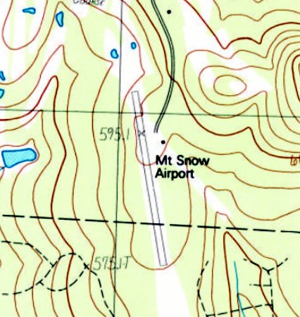
The earliest topo map depiction which has been located of Mt Snow Airport was a 1986 USGS topo map.
It depicted Mt Snow Airport as having a single paved northwest/southeast runway with a single small building on the northeast side.
Mt Snow Airport was depicted as an active airport on the December 1993 NY Sectional Chart (courtesy of Ron Plante).
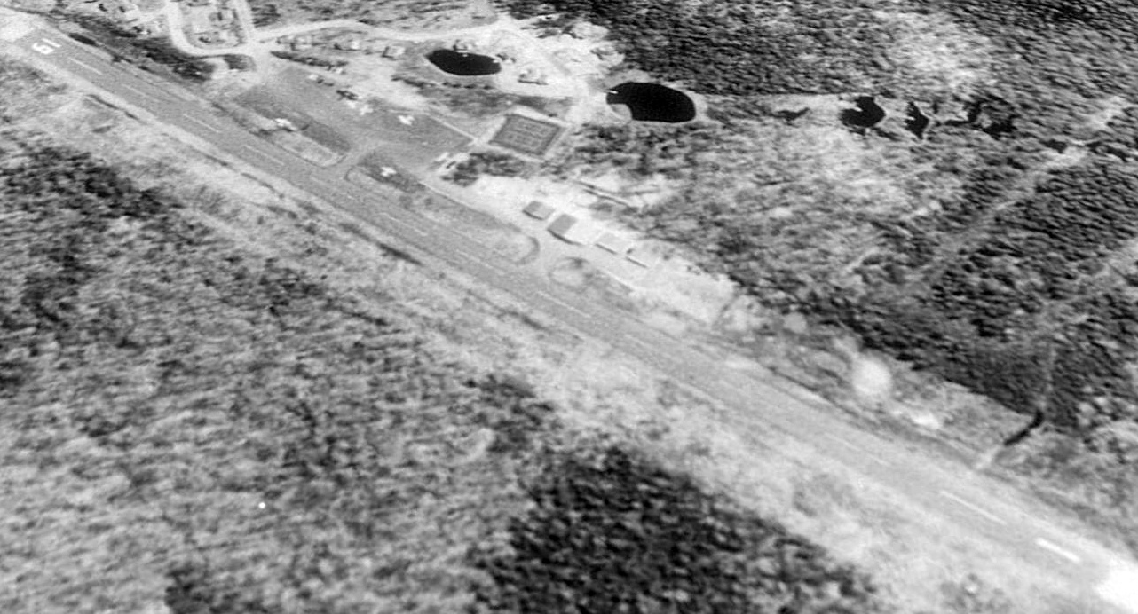
The earliest photo which has been located of Mt Snow Airport was a 1992 USGS aerial view looking northeast.
It depicted Mt Snow Airport as having a single paved Runway 1/19, with a ramp, several light aircraft, and several hangars on the northeast side.
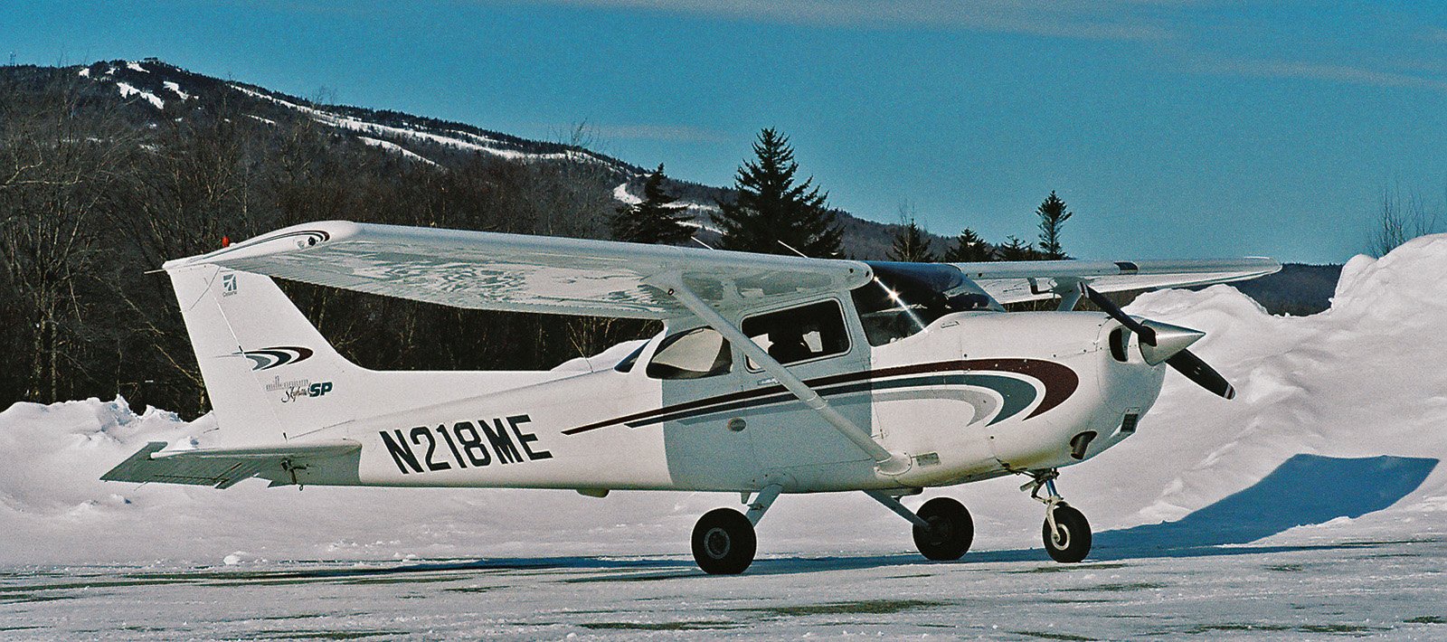
A 1/29/05 photo by Tom Hildreth of a Cessna 172 at Mt Snow Airport, with the downhill ski trails visible in the background.
According to Wikipedia, during the 2012-19 time period, seasonal passenger flights were available from Westchester County Airport NY to Mt Snow Airport,
provided by Tradewind Aviation, an air taxi service that operated 8-seat Pilatus PC-12 aircraft.
It was still depicted as Mt Snow Airport on the 2012 USGS topo map.
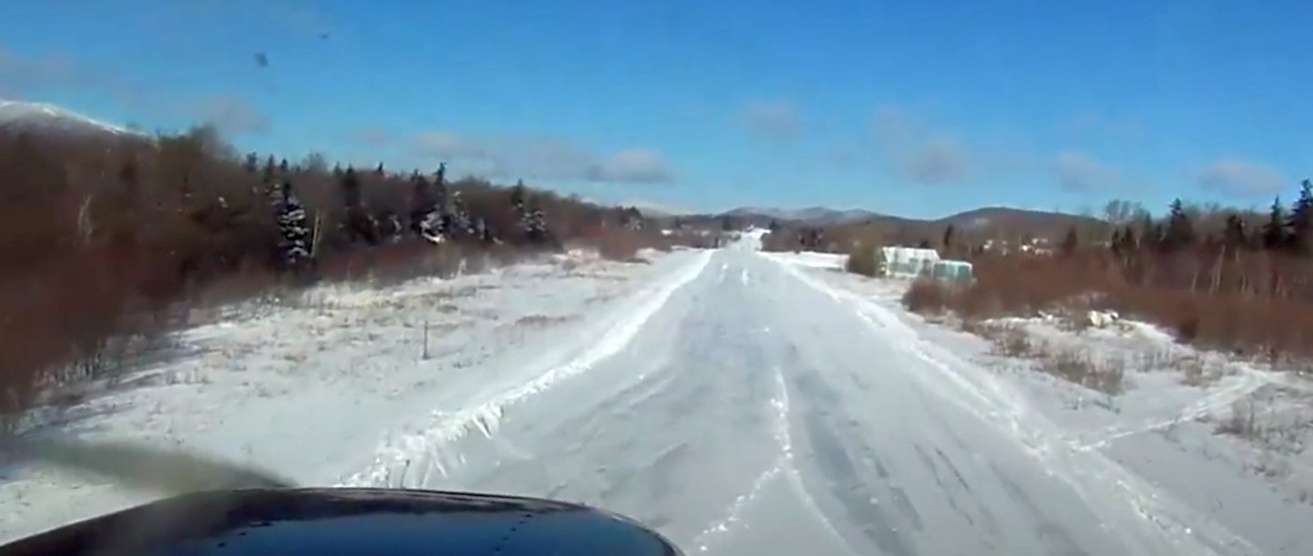
A still from short-final to Mt. Snow's Runway 1 from a 2012 video by Graeme Smith.
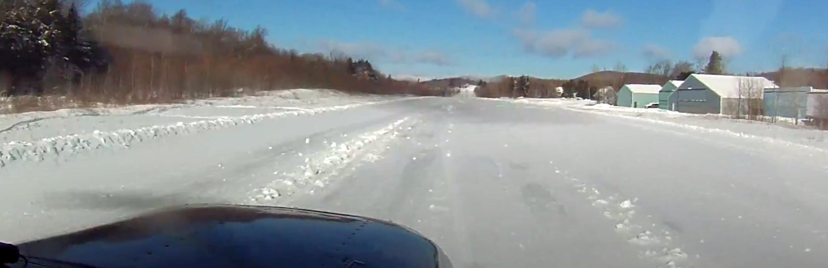
A still looking northeast at the Mt. Snow hangars from a 2012 video by Graeme Smith.
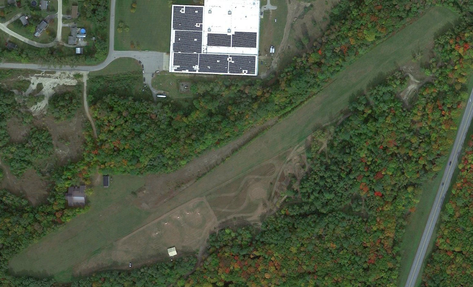
A 2014 aerial view looking northeast depicted Mt Snow Airport as remaining intact, but devoid of aircraft.
Gary Lampman noted, “At Mt. Snow, the runway lights are on extended poles so as to not be buried by yearly snowfall.
Anyone making a night landing would be surprised if their flare was above the lights only to find 4-6’ of altitude remaining.”
According to a 2019 article, at some point between 2011-17 the Mt Snow Airport was acquired by the Hermitage Club, which intended to operate a members-only ski report.
Mt Snow Airport was renamed Deerfield Valley Regional Airport at some point between 2012-15,
as that is how it was depicted on the 2015 USGS topo map.
According to its FAA Airport/Facility Directory data, Deerfield Valley Airport conducted an average of 59 takeoffs or landings per week, for the year ending 9/15/15.
It was said to have a total of 7 based aircraft: 5 single-engine & 2 multi-engine.
The owner was Deerfield Valley Regional Airport LLC, and the Manager was Jim Barnes.
Deerfield Valley Regional Airport was said to have a single 2,650' asphalt Runway 1/19, “in excellent condition.”
According to a 2019 article, the Hermitage Club (which owned the airport) was shut down in 2018 due to nonpayment of taxes.
A 6/3/19 FAA NOTAM declared Deerfield Valley Airport as permanently closed.
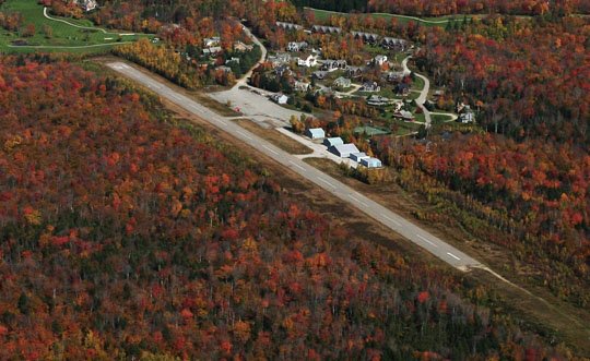
An undated aerial view looking northeast at Deerfield Valley Airport from the 2021 VT Agency of Transportation site.
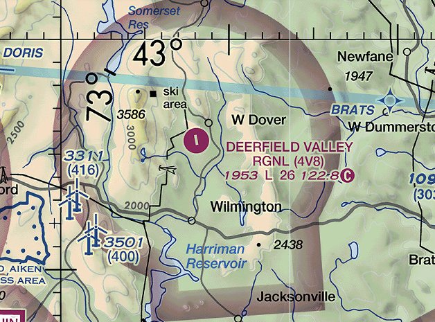
Deerfield Valley Regional Airport was still depicted on the 2021 Sectional Chart,
even though it had been NOTAMed permanently closed for 2 years by that point.
It was depicted as having a single 2,600' northwest/southeast paved runway.
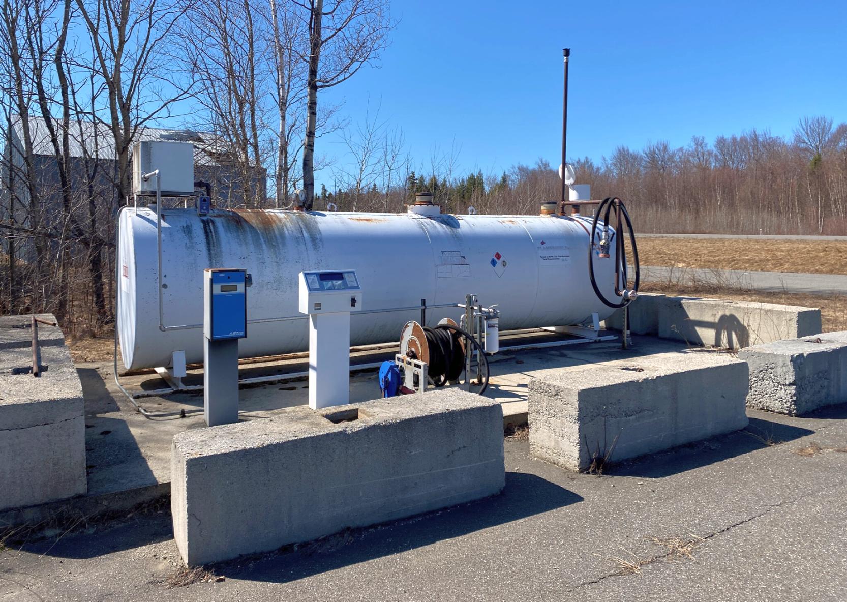
An undated photo of the Deerfield Valley Regional Airport fuel tank from a 2021 For Sale listing.
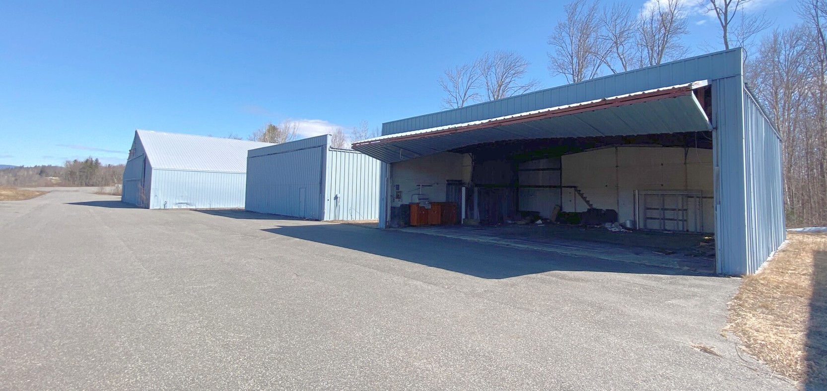
An undated photo of Deerfield Valley Regional Airport's hangars from a 2021 For Sale listing.
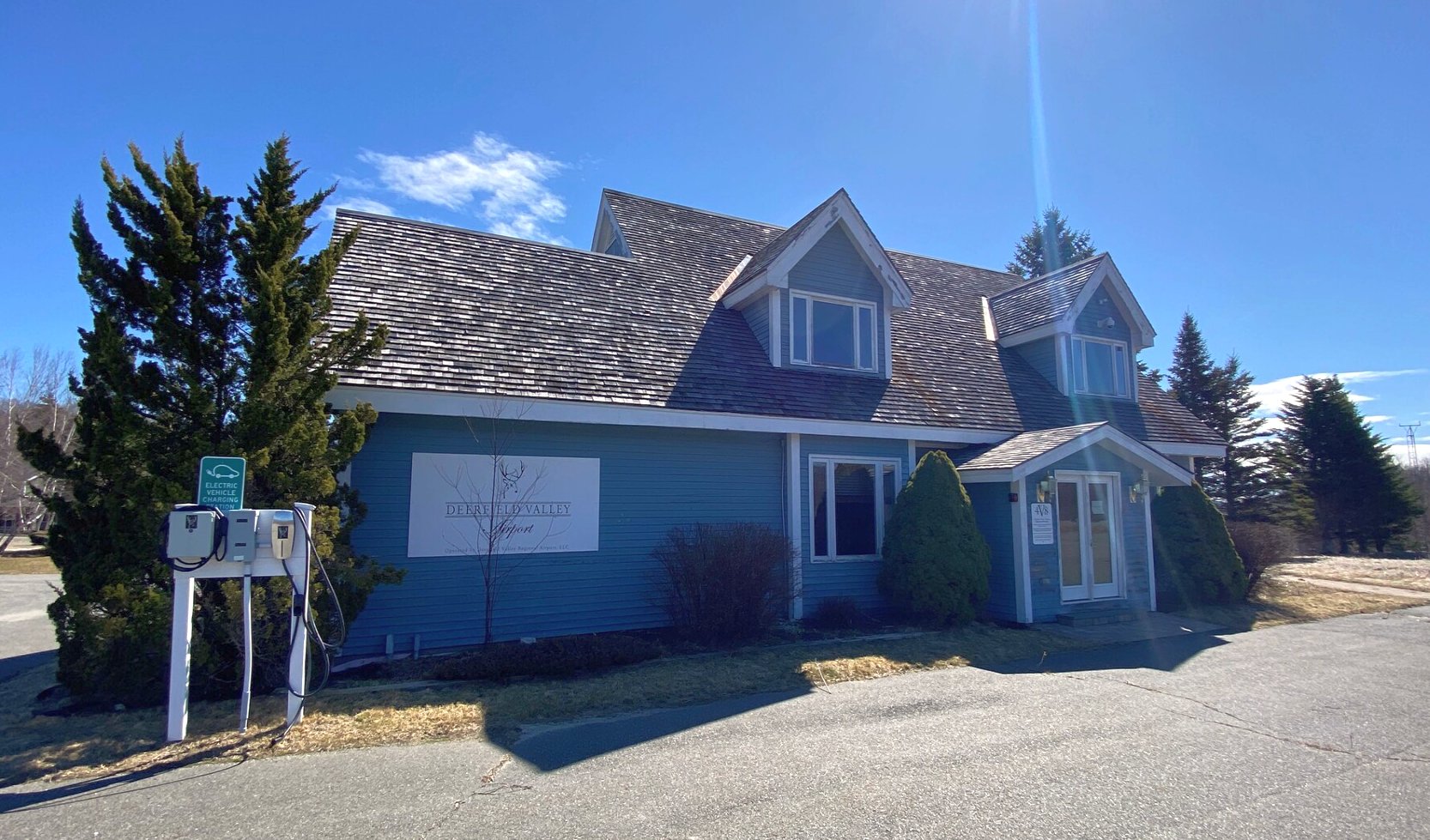
An undated photo of Deerfield Valley Regional Airport's office from a 2021 For Sale listing.
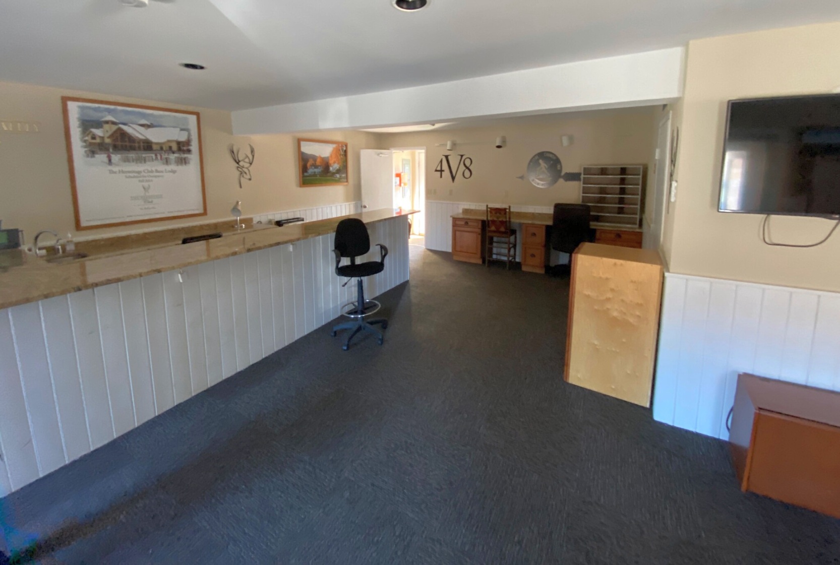
An undated photo of Deerfield Valley Regional Airport's office interior from a 2021 For Sale listing.
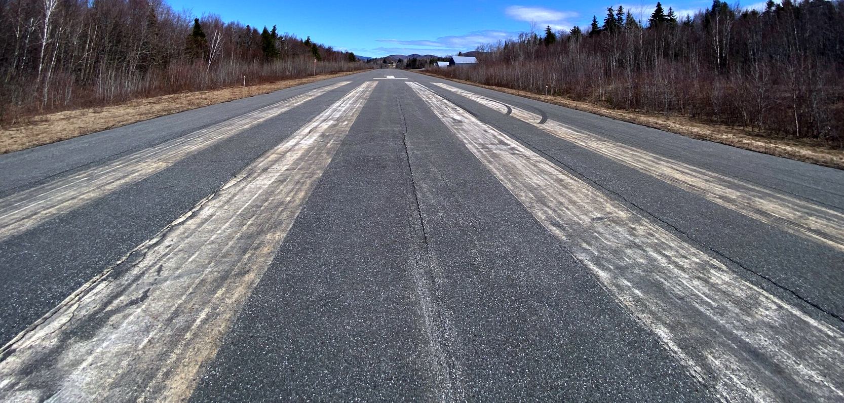
An undated photo of Deerfield Valley Regional Airport's Runway 1 from a 2021 For Sale listing.
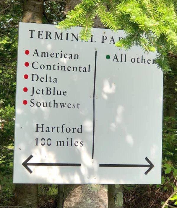
A 6/1/21 photo of a humorous sign indicating the distance from Deerfield Valley Regional Airport to airline parking.
A 6/1/21 photo of the Deerfield Valley Regional Airport office.
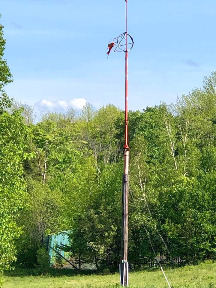
A 6/1/21 photo of the remains of the Deerfield Valley Regional Airport windsock frame.
Thanks to Brad Baisley for pointing out the closure of this airfield.
____________________________________________________
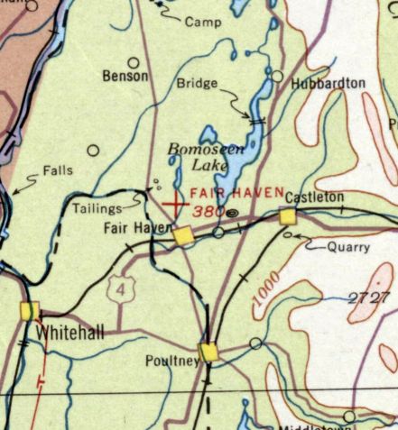
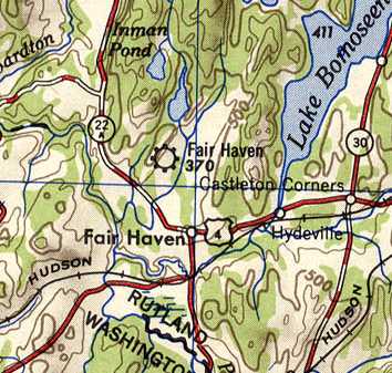
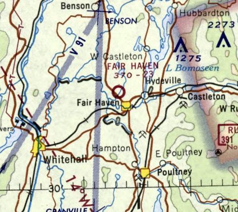
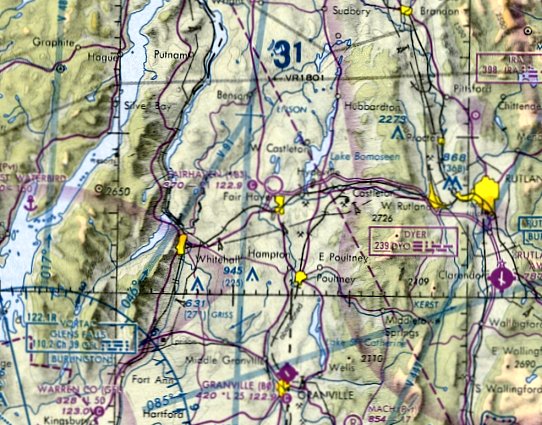
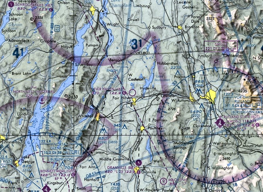
Fair Haven Municipal Airport (1B3), Fair Haven, VT
43.615, -73.274 (Northwest of Boston, MA)
Fair Haven Airport, as depicted on the August 1936 Albany Sectional Chart.
Fair Haven Airport may date back to the 1920s, as Louis Varricchio reported that it has a wooden hangar built in the 1920s.
However Fair Haven Airport was not yet depicted on the June 1933 Albany Sectional Chart.
The earliest depiction which has been located of Fair Haven Airport was on the August 1936 Albany Sectional Chart.
It depicted Fair Haven as an auxiliary airfield.
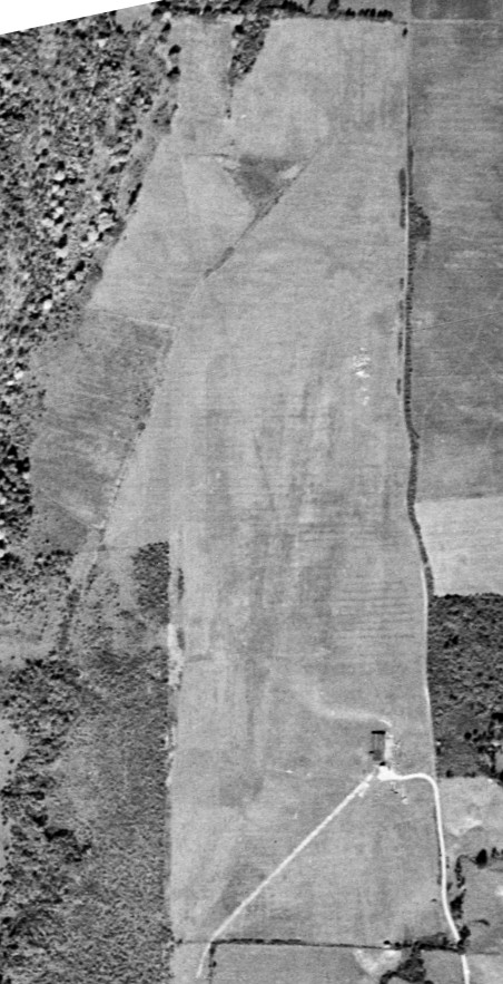
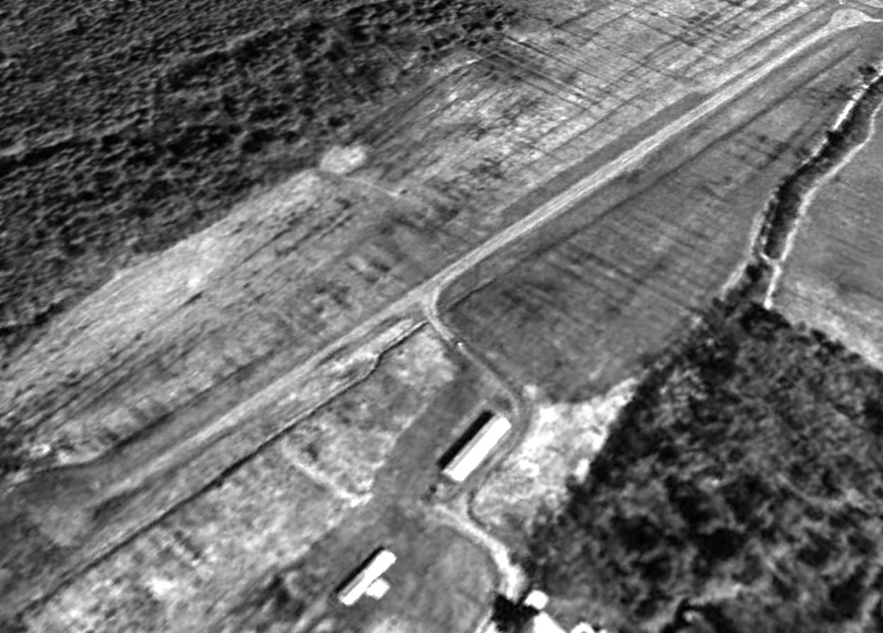
The earliest photo of Fair Haven Municipal Airport which has been located was a 10/3/42 USGS aerial view.
It depicted Fair Haven Municipal Airport as having a grass north/south runway with a single small building on the east side.
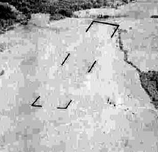
A circa 1942-45 aerial view looking north at Fair Haven Municipal Airport
from the 1945 AAF Airfield Directory (courtesy of Scott Murdock)
depicted Fair Haven Municipal Airport as having a single unpaved northeast/southwest runway.
The 1945 AAF Airfield Directory (courtesy of Scott Murdock) described Fair Haven Municipal Airport
as a 270 acre rectangular property having a single 2,000' turf north/south runway.
The field was said to have a single 100' x 48' wooden hangar,
to be owned by the Town of Fair Haven, and operated by private interests.
A 1947 aerial photo depicted Fair Haven as having a single unpaved northeast/southwest runway,
with a single building on the east side.
Fair Haven Airport, as depicted on the 1948 USGS topo map.
The 1950 USGS topo map depicted Fair Haven as a single northeast/southwest runway with 2 small buildings at the southeast end,
generically labeled as “Airport”.
The 1957 VT Airport Directory (courtesy of Jonathan Westerling) described Fair Haven Airport as having a single 1,800' north/south runway (turf with gravel center strip),
operated by the Town of Fair Haven.
A 1963 aerial photo depicted Fair Haven as having a single unpaved northeast/southwest runway, with a single building on the east side.
No aircraft were visible on the field.
The February 1970 Albany Sectional Chart depicted Fair Haven as having a 2,300' unpaved runway.
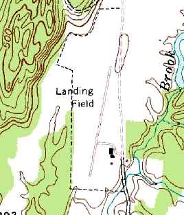
The 1972 USGS topo map depicted Fair Haven as a single northeast/southwest runway with 3 small buildings at the southeast end,
generically labeled as “Landing Field”.
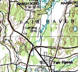
The 1989 USGS topo map depicted Fair Haven as a single northeast/southwest runway,
generically labeled as “Landing Strip”.
The December 1993 NY Sectional Chart (courtesy of Ron Plante) depicted Fair Haven as having a 2,100' unpaved runway.
A 5/3/94 USGS aerial view looking northwest depicted Fair Haven as having a single paved northeast/southwest runway, with 2 small buildings on the southeast end.
There were no aircraft visible on the field.
The last aeronautical chart depiction which has been located of Fair Haven Airport was on the May 2001 NY Sectional Chart (courtesy of Ron Plante).
It depicted Fair Haven as having a 2,100' unpaved runway.
A 7/20/03 aerial view showed that a non-airport related compound
had been constructed at some point between 1994-2003 at the southeast corner of the Fair Haven Airport property,
and it appeared as if the southern row of T-hangars had been relocated to the east side of the northern row of T-hangars.
Louis Varricchio reported, “I attended a 2005 air show there.
The next year I was told the town demanded insurance deposits from attendees of the upcoming airshow.
The show never happened & the airport closed.
A group submitted a nice new plan to upgrade the field. The drawings exit in Fair Haven Town Hall.
But the town officials were so dead set against aircraft bothering their precious 19th century sleep.”
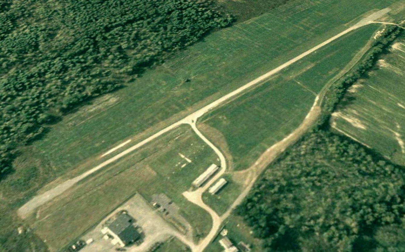
A 6/5/06 aerial view looking northwest showed Fair Haven Airport in an unchanged state.
Louis Varricchio reported, “The Fair Haven Airport was open until around the year 2006.”
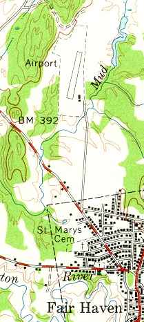
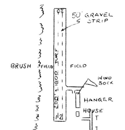
According to its 2008 FAA Airport/Facility Directory data, Fair Haven Municipal Airport had a single 2,000' gravel/dirt runway 2/20.
It conducted 150 takeoffs/landings per year, all of which were transient general aviation.
The airport was owned by the Town of Fair Haven, and the manager was listed as Jeff Shulz.
A 7/16/08 aerial view depicted 2 large yellow closed-runway “X” symbols on the runway ends.
Louis Varricchio reported in 2011, “The Fair Haven Airport... still has the oldest standing hangar in the state (a wooden structure, built in the 1920s!).
Said to be of historic value although the town officials & most residents couldn't care less, sadly.”
Mike Denja reported in 2014 that “a recent aerial photo shows it appears to be used for radio-controlled aircraft now
and the newer building adjacent to the south is definitely used by the Vermont Army National Guard.”
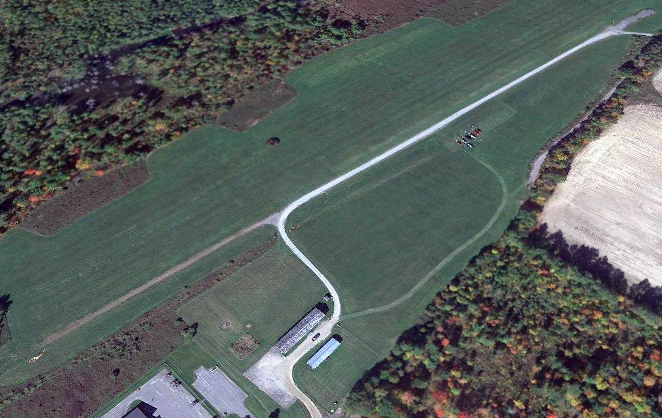
A 2016 aerial view looking northwest depicted Fair Haven Airport as remaining intact,
although the width of the runway pavement appears to have contracted over time.
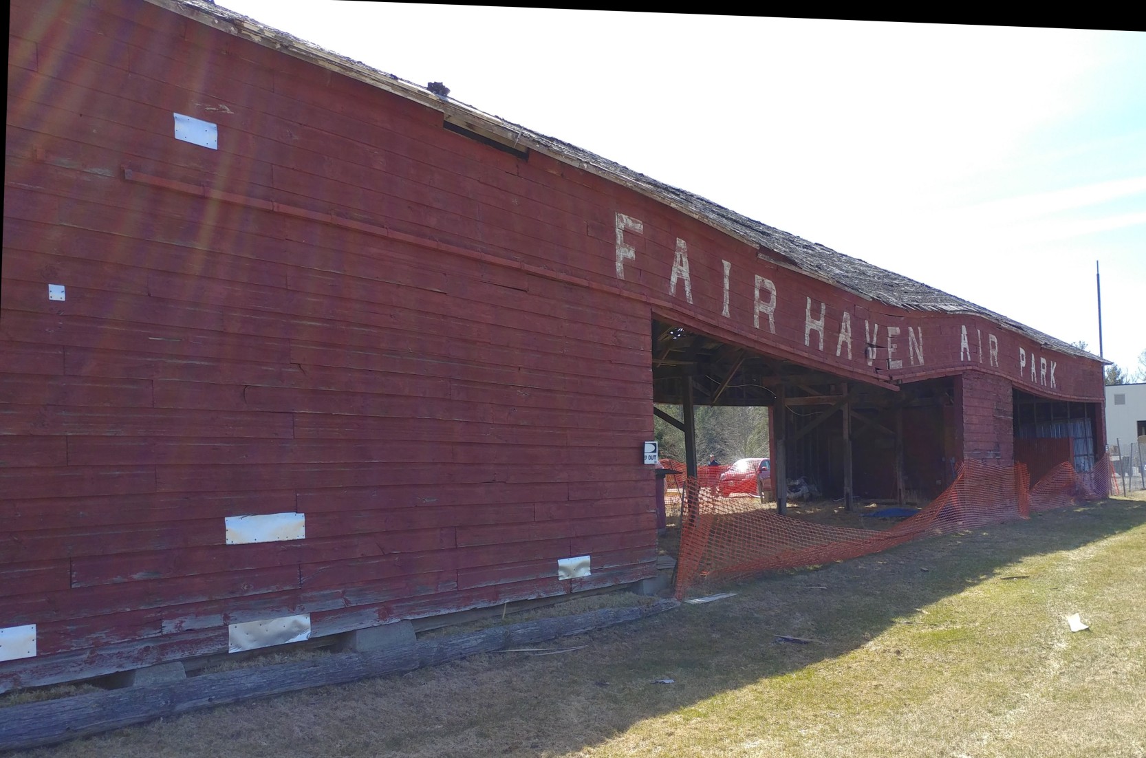
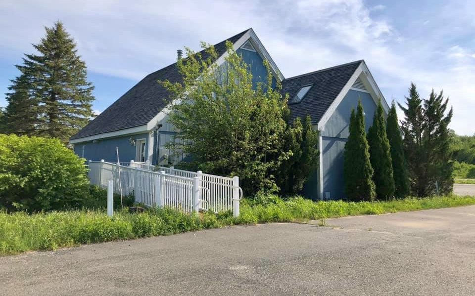
A 4/24/18 photo by Peter Galligan of the deteriorated Fairhaven Air Park hangar. Peter reported, “It had been in a state of disrepair for years.”
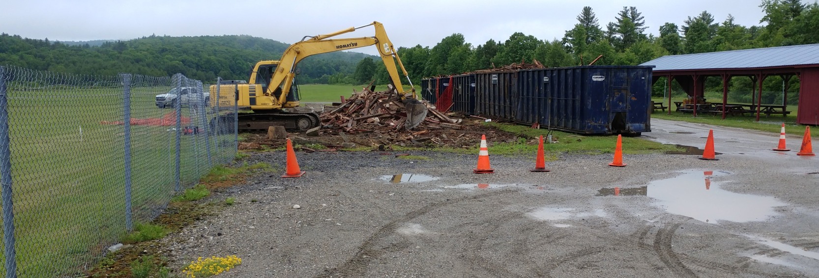
A 6/28/18 photo by Peter Galligan of the demolition of the Fairhaven Air Park hangar.
Peter reported, “This year, the hangar, said to have been the oldest free-standing hangar in the State of Vermont, was finally demolished by the town.
It was a valuable piece of aviation history. All that remains is an open space.
The airport property is now used by the Rutland County RC Flyers, a very active local radio-control [model] aircraft club.
The club maintains an 800'x75' grass runway for models, adjacent to the remains of the airport's original 2,000' gravel runway.”
Fair Haven Municipal Airport is located northeast of the intersection of Route 4 & Airport Road.
____________________________________________________
43.43, -72.4 (Northwest of Boston, MA)
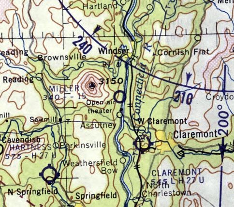
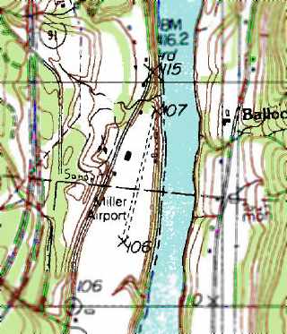
Miller Airport, as depicted on the 1957 USGS topo map.
“Located less than a mile from the base of Mt. Ascutney along the Connecticut river,
Miller airport was operated for 36 years by the Miller Construction company”, according to Jonathan Westerling.
According to Trumbull-Nelson’s Quarterly Construction Magazine,
the story of this airstrip revolves around O. W. Miller, known to everyone as “Chick”, who loved to fly.
In 1946, soon after finishing a project nearby,
Chick decided to stay in the Windsor area & establish his own construction company.
When he laid out the firm’s operating base between Route 5 & the Connecticut River about 3 miles south of Windsor,
he included his own landing strip.
However, no airfield at this location was yet depicted on the 1948 USGS topo map, a 1956 aerial photo,
or the May 1957 Albany Sectional Chart.
The earliest depiction of Miller Airport which has been located was on the 1957 USGS topo map.
It depicted a single north/south runway with a few small buildings on the west side, labeled simply as “Airfield”.
The earliest aeronautical chart depiction which has been located of Miller Airport was on the May 1960 Albany Sectional Chart.
It depicted Miller as having a mere 1,500' runway.
Roger Gilman, who had become Miller’s “right hand” after joining the company in 1964, recalled, “Chick flew everywhere, nearly every day.
If he had business in nearby Lebanon, he didn’t drive. He would jump into his plane & fly up the river.”
The July 1964 Albany Sectional Chart (courtesy of Chris Kennedy) depicted Miller as a public-use airfield having a 1,500' hard-surface runway.
Miller's runway was extended somewhat in the next 2 years,
as the February 1966 Albany Sectional Chart (courtesy of Chris Kennedy)
depicted the field as having a single 2,000' paved runway.
The 1967 AOPA Airports USA Directory (according to Jonathan Westerling) described Miller as being a public but unattended airport,
having a single 1,500’ north/south gravel runway.
Evidently the airfield was paved sometime thereafter.
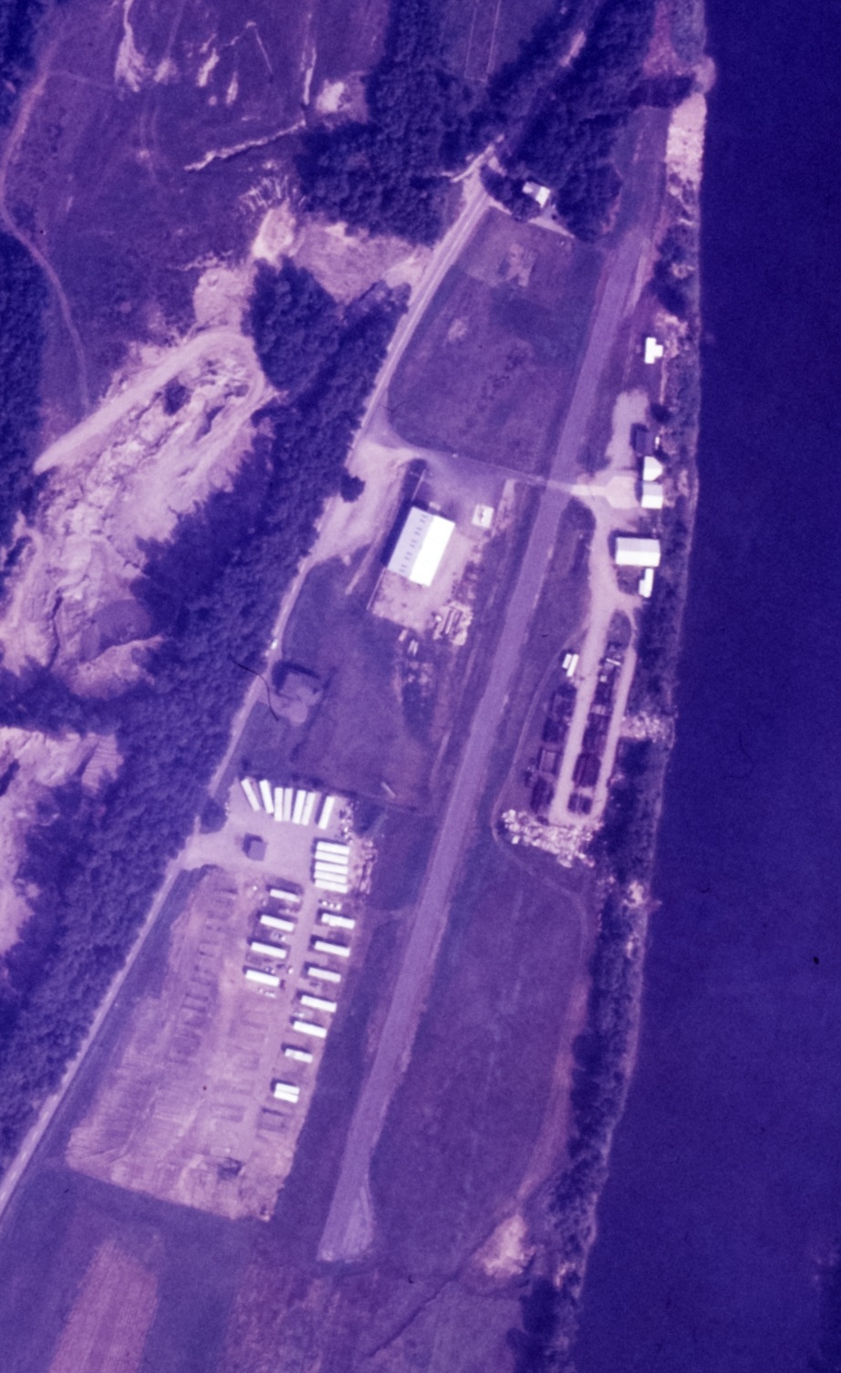
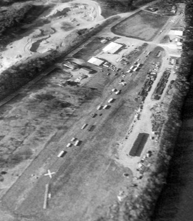
The earliest photo which has been located of Miller Airport was a 9/14/69 USGS aerial view.
It depicted Miller as having a paved northeast/southwest runway with over a dozen T-hangars on the east side.
When Roger Gilman came to work on 3/22/82, he carried tragic news.
Miller & his good friend, Dave Hall who owned Gateway Motors in White River Junction,
had been killed when Miller became disoriented while trying to fly through a snowy whiteout & crashed in North Stratford, NH.
The 1984 USGS topo map depicted Miller Airport as having a single north/south runway, with 2 small buildings on the west side.
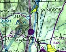
The 1984 NY Sectional Chart (courtesy of Jonathan Westerling) depicted Miller as having a single 1,800' paved runway.
Miller Airport evidently was closed at some point between 1984-88,
as it was no longer listed in the 1988 Airports USA Directory (according to Jonathan Westerling).
A 1994 aerial view looking northwest showed Miller Airport to still be completely intact,
with the hangars on the west side of the field still standing,
and the entire length of the runway still extant, though marked with closed-runway “X” symbols.
Trailers were stored on the southern portion of the runway.
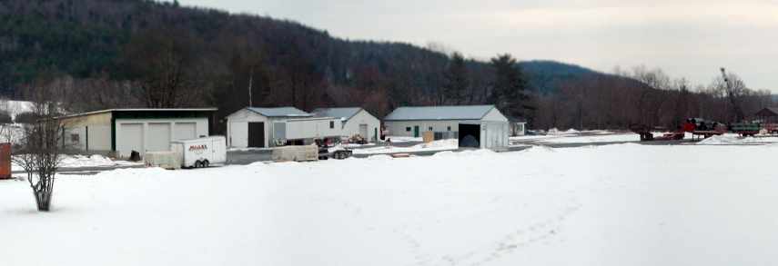
A January 2006 panorama by Jonathan Westerling of the snowy scene at the former Miller Airport.
Note that the former hangar (on the left) was converted at some point to a 3-port garage, and the runway still remains as well.
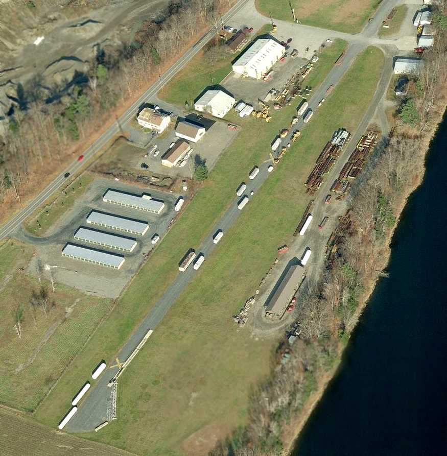
A circa 2006-2010 aerial view looking north showing the former Miller runway & hangars.
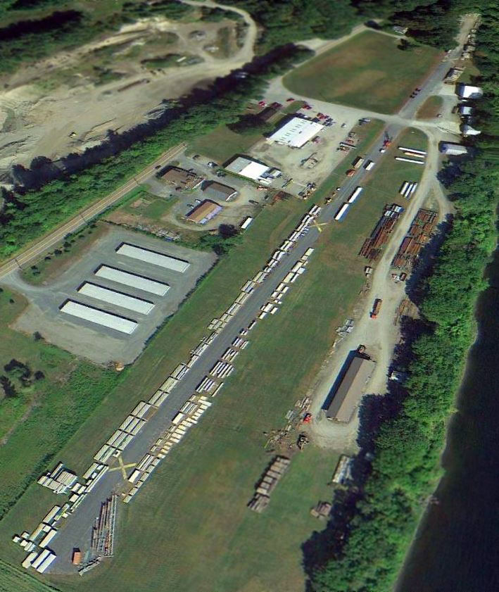
A 2014 aerial view looking northwest showed the Miller runway & hangars remained intact.

A 2024 photo looking east at the former T-hangars on the east side of the Miller Airport site.
The site of Miller Airport is located northeast of the intersection of Route 5 & Route 44A.
Thanks to Jonathan Westerling for pointing out this airfield.
____________________________________________________
Or if you prefer to contact me directly concerning a contribution (for a mailing address to send a check),
please contact me at: paulandterryfreeman@gmail.com
If you enjoy this web site, please support it with a financial contribution.
____________________________________________________
This site covers airfields in all 50 states.