Abandoned & Little-Known Airfields:
Virginia: Arlington County
© 2002, © 2025 by Paul Freeman. Revised 1/19/25.
____________________________________________________
Please consider a financial contribution to support the continued growth & operation of this site.
____________________________________________________
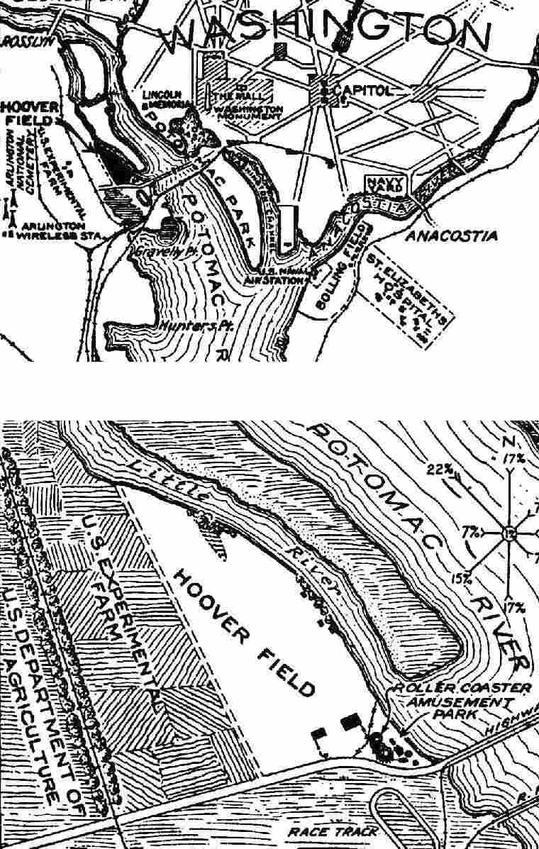
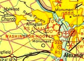
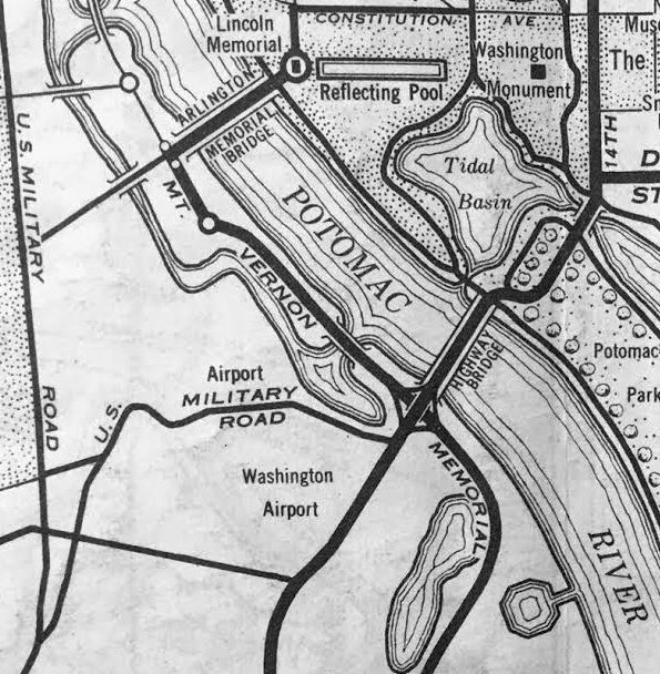
Hoover Field / Washington Airport, Arlington, VA
38.87, -77.055 (Northeast of Washington Reagan National Airport, VA)
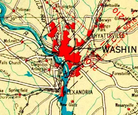
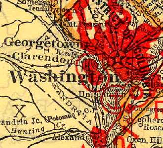
Hoover Field, as depicted (by an unlabeled red cross & circle symbol) on the 1923 Washington-NY Airway Map (courtesy of David Brooks).
The date of establishment of Hoover Field Hoover Airport, Washington's first commercial airport, has not been determined.
It was located across the river in nearby Arlington, VA,
southwest of the intersection of the George Washington Parkway & the 14th Street Bridge.
The earliest depiction which has been located of Hoover Field was on the 1923 Washington-NY Airway Map (courtesy of David Brooks),
which depicted it (unlabeled) with the red cross & circle airfield symbol.
Hoover Field was built by Thomas Mitten, the owner of the Pennsylvania Rapid Transit Company in Philadelphia.
He expected to make profits by flying Washingtonians to the Philadelphia Sesquicentennial International Exposition.
Christopher McQuale recalled, "My father, retired Captain for Pan American & Army Air Corps US Air Force Captain,
had told me this story about my grandfather on my mother's side,
Charles Ebert, who was one of Mitten's VPs & right-hand men.
Tom Mitten had set his sights on commercial flight transportation between Philly & Washington.
He therefore sent Charles Ebert down to locate & purchase a parcel of land wherein a landing field could be established.
This he did & the result is Hoover Field."
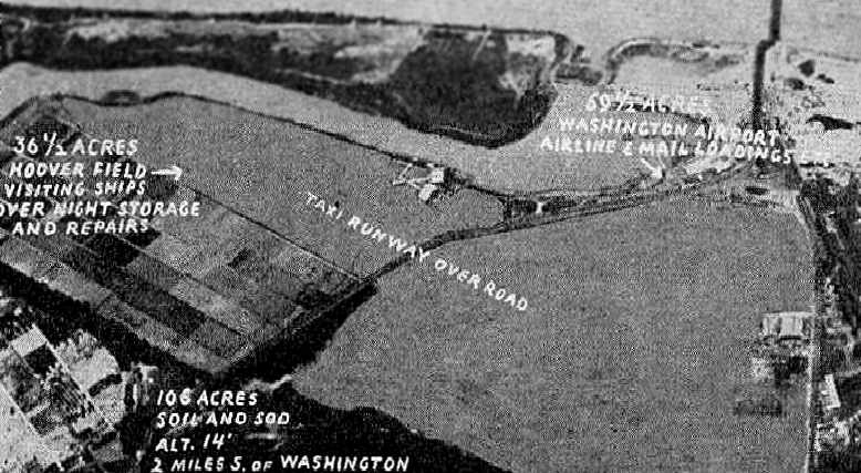
A 38-acre Arlington County equestrian racetrack was purchased (a very small site for an airport),
converted to a sod landing field, and a small terminal & 100' x 60' hangar were constructed.
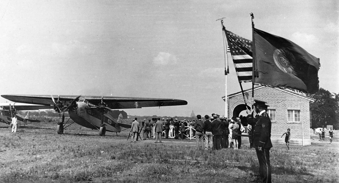
The earliest photo which has been located of Hoover Field was a 7/16/26 photo (courtesy of Peter de Jong) of the Hoover Field dedication, with the US Capitol visible in the background.
Peter de Jong observed, “Hoover, Thomas Mitten, and Anthony Fokker were present. Two Philadelphia Rapid Transit Fokker F.VIIa-3ms are seen.
PRT built a small terminal building”, presumably the brick building on the right.
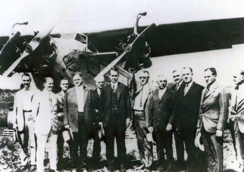
A 7/16/26 photo of the Hoover Field opening, with Secretary of Commerce Herbert Hoover (4th from left) & others in front of one of 3 Fokkers of Philadelphia Rapid Transit.
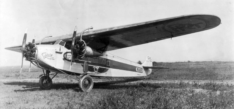
A 1926 photo at Hoover Field of Fokker F-VII Trimotor "Wilbur," operated by the Philadelphia Rapid Transit Air Service between Philadelphia, Washington, and Norfolk, VA for transportation of mail, freight, and passengers.
After operating his PRT airliners for only 6 months, Mitten sold Hoover Field,
as the Exposition had ended, and he was unable to renew his airmail contract.
According to Christopher McQuale, “Mitten Management had won one of the first contracts
to provide air mail service between Washington, D.C. & Philadelphia for the US Postal Service.
I do not think the contract proved to be profitable.”
Berliner Aircraft Company, owned by Washington aviation pioneer Henry Berliner, manufactured aircraft in a hangar at Hoover Field in 1926.
Berliner relocated after one year to a waterfront factory in nearby Alexandria.
Berliner & other investors purchased Hoover Field in 1927 & incorporated the Potomac Flying Service.
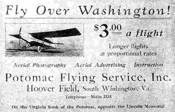
The location & layout of Hoover Field, as depicted on the 1927 Department of Commerce Airway Bulletin (courtesy of David Brooks).
It described the property as a 2,000' x 800' rectangular sod field,
with buildings on the southeast corner – including a roller coast & amusement park!
The owner was listed as R.W. Moore, operator of the Potomac Flying Service.
Another privately operated field, Washington Airport, began service in 1927,
across the road to the south (adjacent to Arlington Beach, an amusement park).
It was a 97 acre triangular-shaped field.
The owners of the new field established Seaboard Airlines, with a small fleet of 8-passenger planes.
They operated one daily round-trip to New York, starting in 1928.
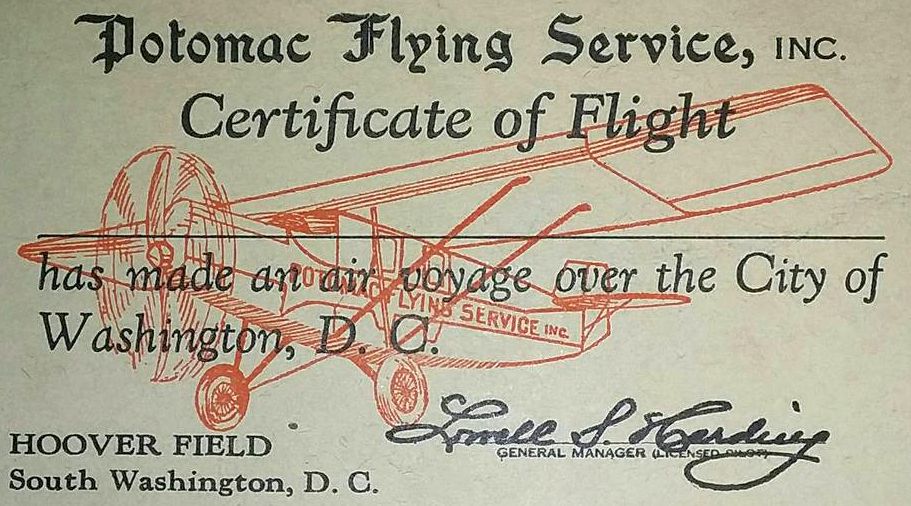
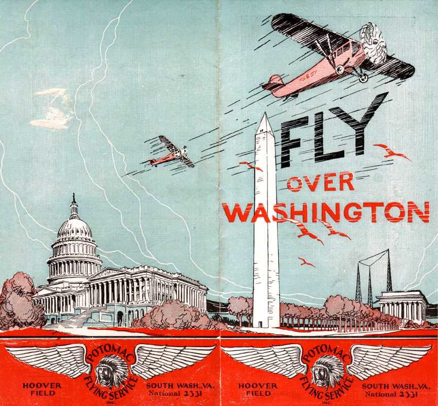
Potomac Flying Service took over 25,000 passengers for sightseeing flights over the nation's capital by 1928.
The original owners of Potomac Flying Service sold the firm & Hoover Field to E.W. Robinson (who also operated Hybla Valley Field) in 1928.
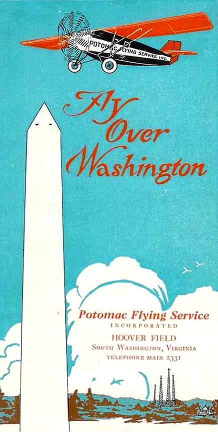
An advertisement for the Potomac Flying Service, Inc. (which flew sightseeing flights out of Hoover Airport)
from the 4/23/28 issue of "Aviation" magazine (courtesy of Chris Kennedy).
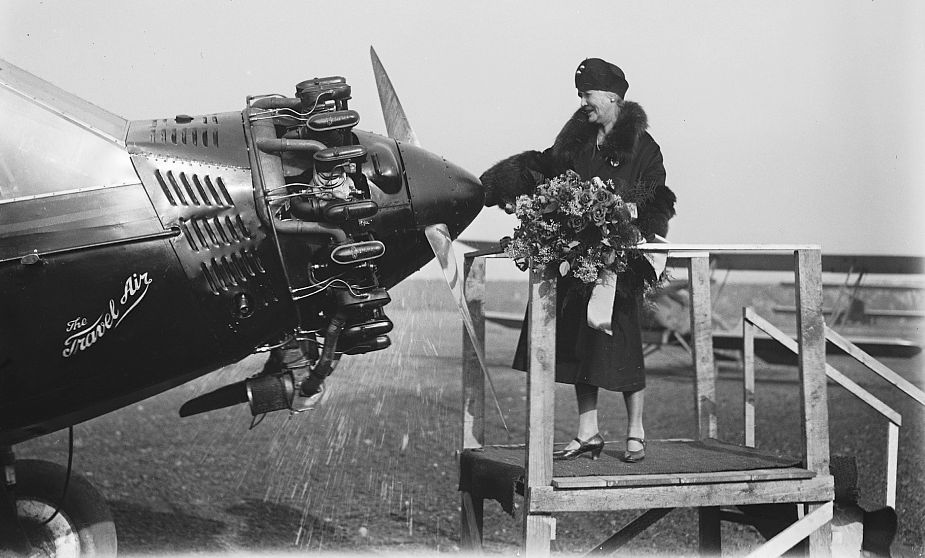
A circa 1920s-30s Certificate of flight from Hoover Field's Potomac Flying Service, Inc.
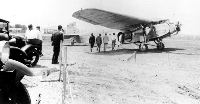
A 12/13/28 photo of the new Travelair cabin monoplane “Postmaster” being christened at Hoover Field by Mrs. Harry New, wife of the Postmaster General.
The “Postmaster” as chosen to attempt a world endurance record.
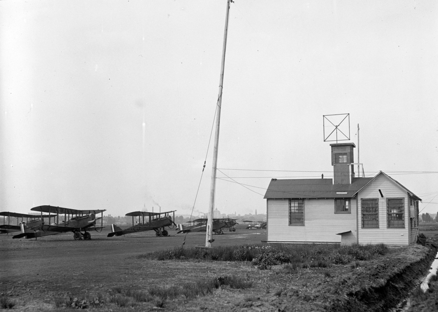
A circa 1928-30 photo of Curtis JN-4 Jenny biplanes parked next to a small building at Hoover Field, with the U.S. Capitol building dome in the background.
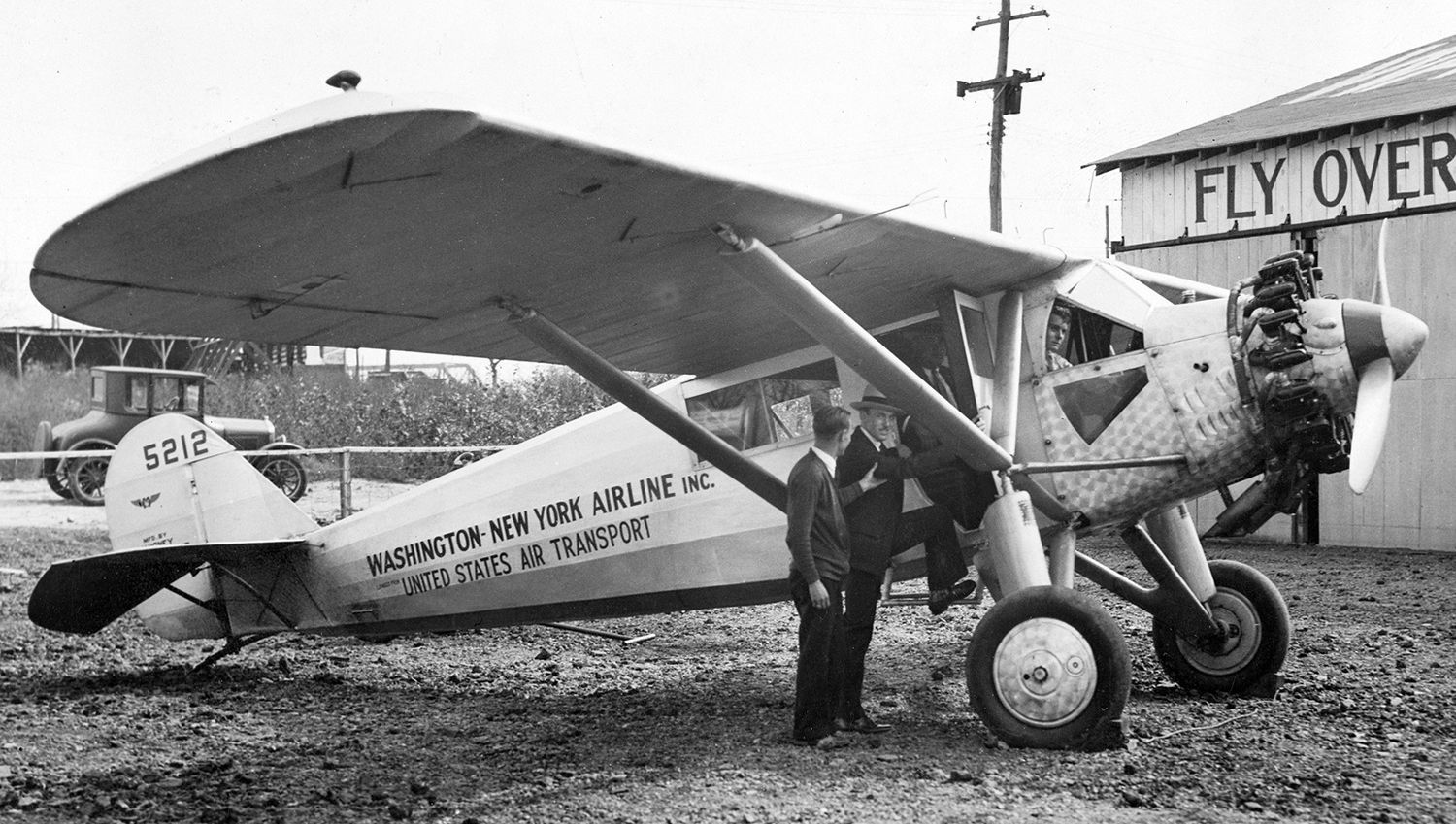
A circa 1928-30 photo of Washington – New York Airline Ryan B-1 Brougham C/n 100 NC5212 in front of a Hoover Field hangar.
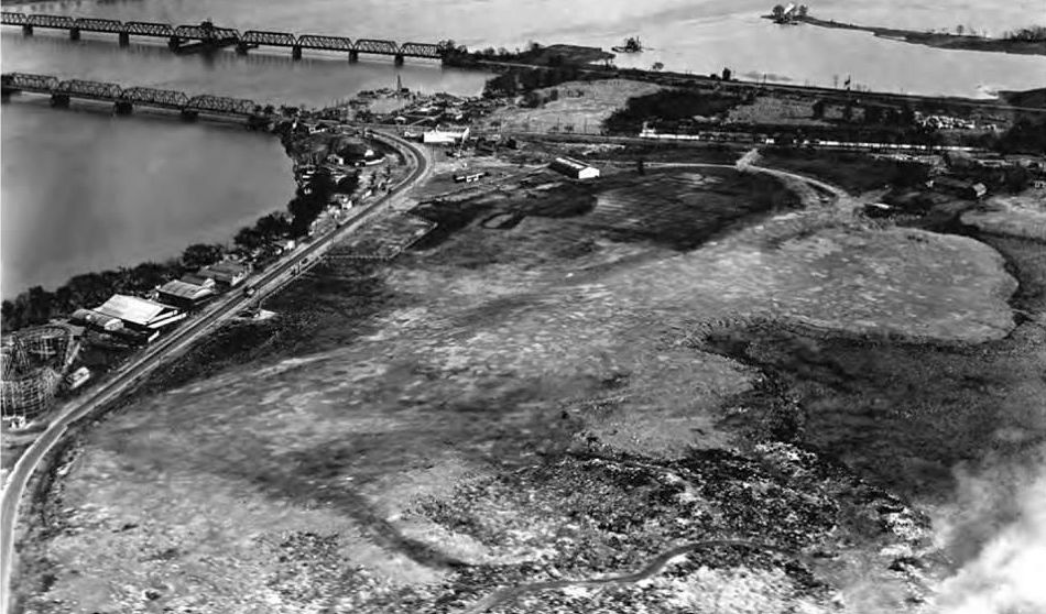
A circa 1920s (pre-1929) aerial view looking southeast at Washington Airport,
also showing Arlington Beach on the left, including the Roller Coaster, Yocum Canoe house, and various building between the highway & the Potomac River, which were razed in 1929.
The 2 airfields were separated by Military Road, which was becoming a busy thoroughfare.
Furthermore, the limited financial resources of the owners of both fields meant that the facilities at both were quite primitive,
particularly for the nation's capital.
Neither field was paved, and both were plagued with short runways, poor lighting, and obstructed approaches.
In 1929, Clifford Ball Airlines began passenger airline service at Hoover Field with six-passenger Fairchild 71s,
conducting flights to Pittsburgh's Allegheny County Airport.
Hoover Field & Washington Airport, as depicted on the 1929 "Rand McNally Standard Map of MD with Air Trails" (courtesy of Chris Kennedy).
The map described Hoover Field as being 2,000' x 800' in size, and Washington Airport as measuring 1,800' x 60' in size.
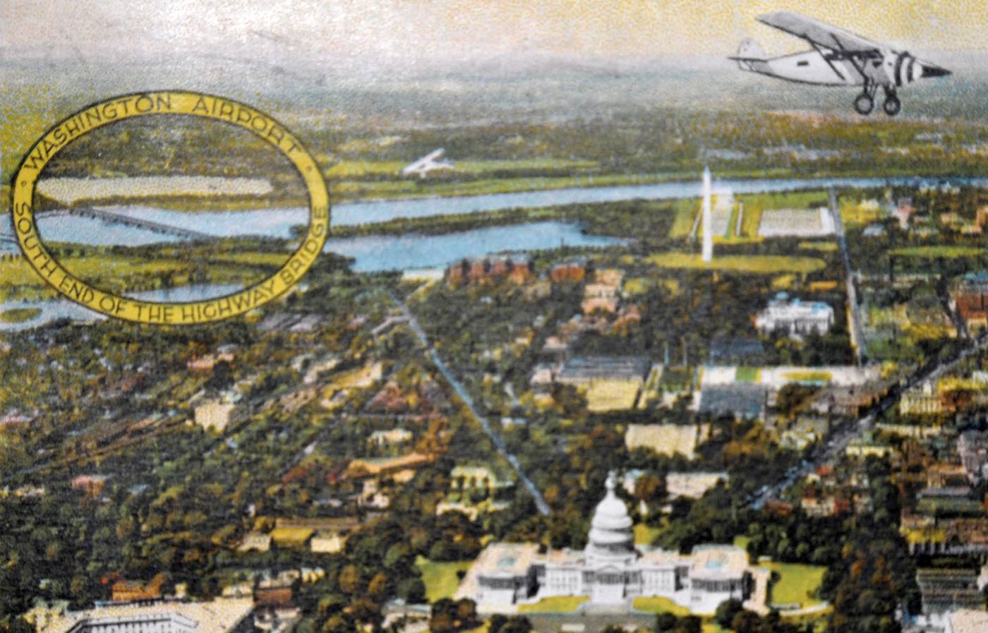
An undated colorized aerial view looking west at a Ryan Brougham overflying D.C. with Hoover “Washington Airport” circled at top-left,
from a postcard with a June 1929 cancellation (courtesy of Mark Sublette).
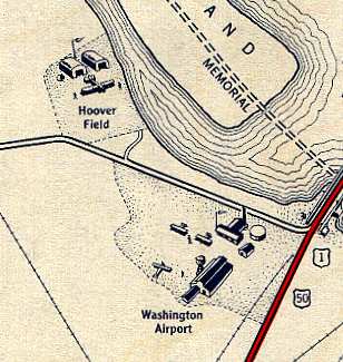
The earliest depiction which has been located of the separate Washington Airport on the southern half of this property was on a 1930 Standard Oil Company road map (courtesy of Mike Keefe).
It depicted Washington Airport as having buildings on the east side, whereas Hoover Field across the road to the north had hangars on its north side.
In 1930, the economics of the Great Depression caused the owners of both Hoover Airport & Washington Airport
to sell to the National Aviation Corporation.
This company merged the 2 fields, naming the new facility Washington-Hoover Airport,
and began to make improvements.
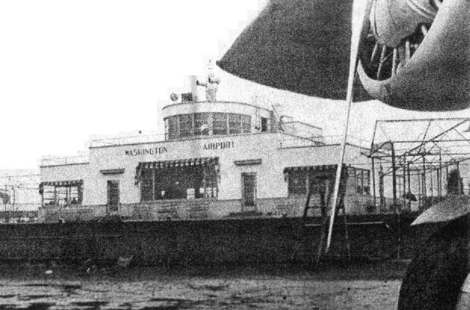
A streamlined Art-Deco terminal building & a new hangar were built in 1930.
The terminal building, designed by Holden, Stott, and Hutchinson, was "a trim structure with terraced roofs".
Generously windowed, the facility contained a passenger waiting room on the lower floor,
and the administration & control tower on the second level, and was very modern for its time.
The airport even boasted a large outdoor swimming pool,
to serve the ever-increasing sightseeing crows as well as provide an additional revenue stream.
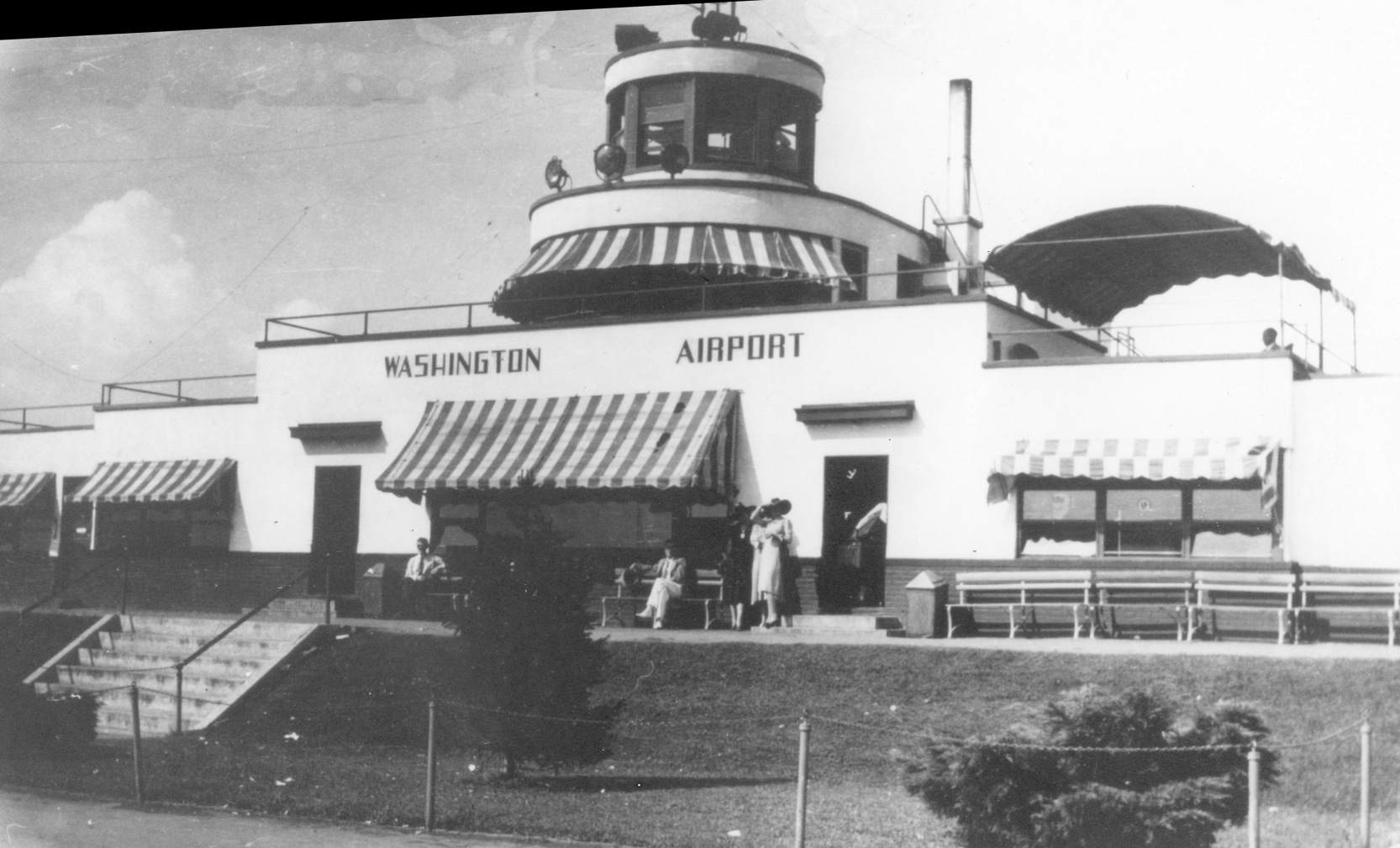
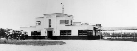
A 1930 photo of the Washington Airport terminal building (from the FAA History archive).
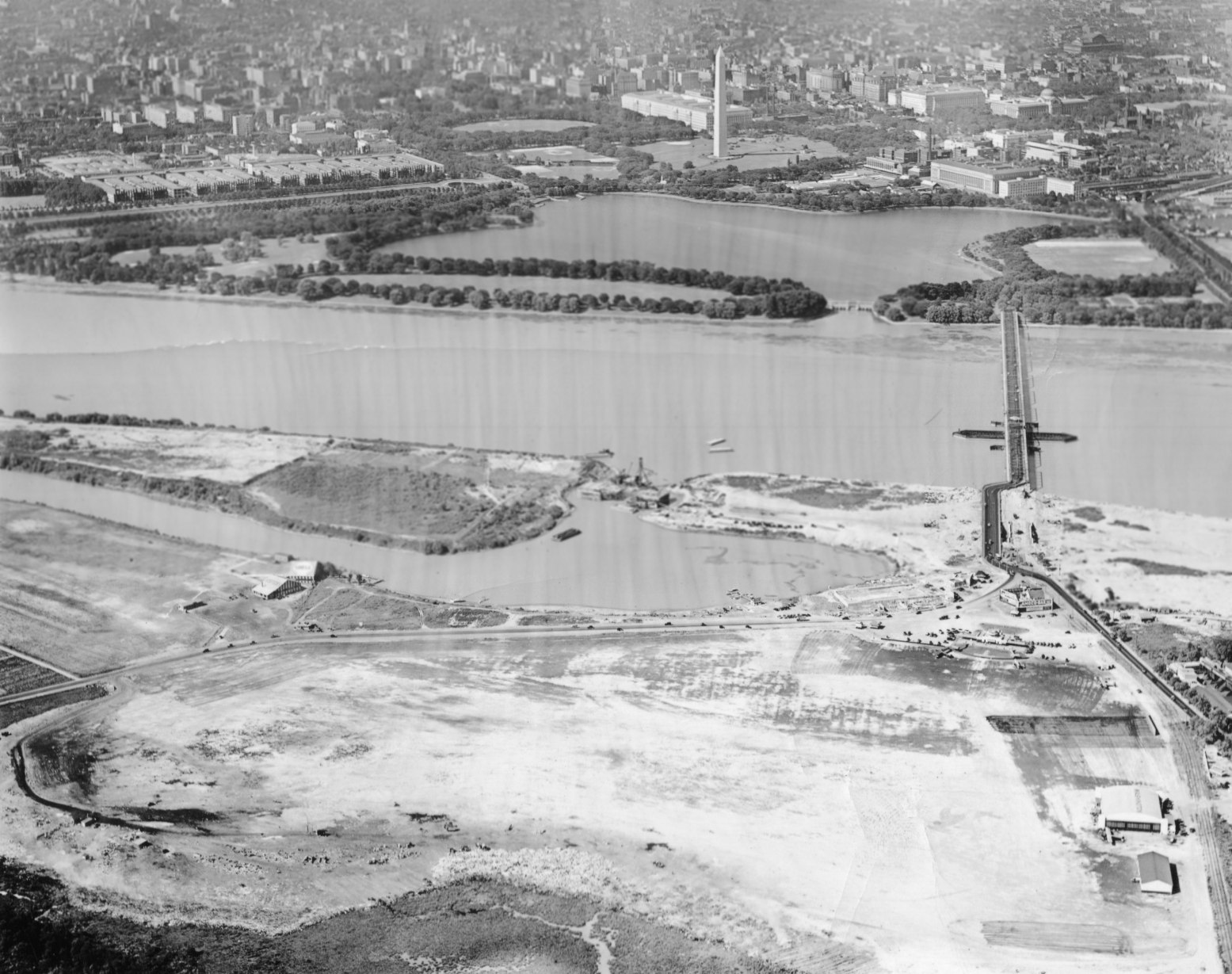
A 6/19/31 aerial view looking northeast (from the Dallin Aerial Survey Collection, courtesy of the Hagley Museum & Library)
showed both Hoover Field (at upper-left) & Washington Airport (bottom-right).
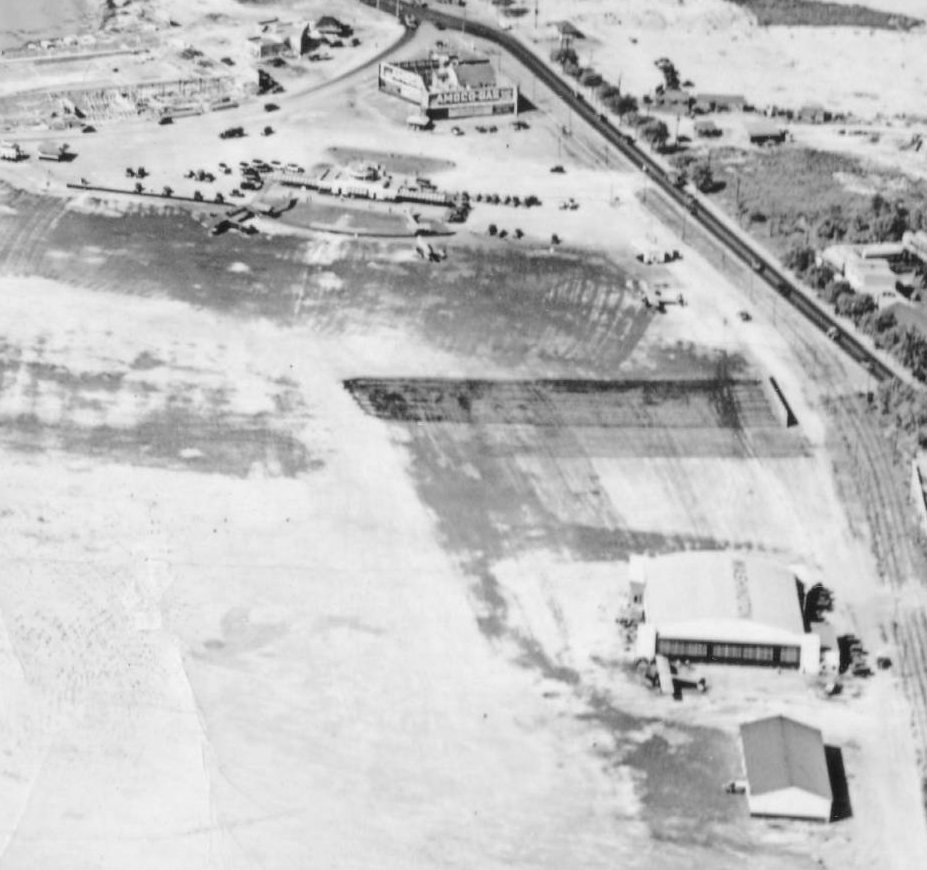
A closeup from the 6/19/31 aerial view looking northeast showing the hangars & buildings of Hoover Field.
No aircraft were visible on the field.
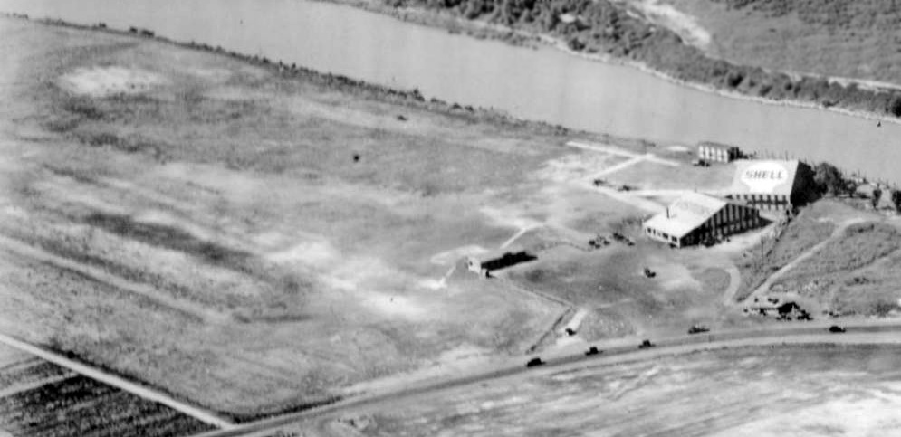
A closeup from the 6/19/31 aerial view looking northeast showing the hangars & buildings of Washington Airport,
showing 3 aircraft on the field.
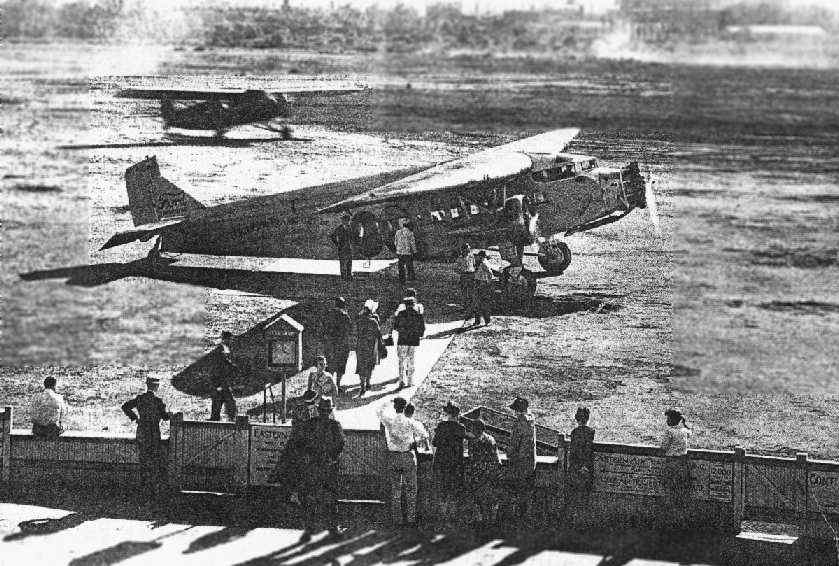
A 1931 photo showed passengers boarding an Eastern Air Transport Ford Tri-Motor at Washington Hoover Airport.
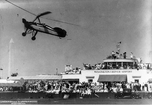
An autogiro (model unidentified) “steals the show” at the start of the 1932 Transcontinental Air Derby in front of the Washington-Hoover Airport terminal.
A 1932 photo of the start of the Transcontinental Air Derby at Washington-Hoover Airport.
Don Warrington observed, “The 'Transcontinental Air Derby' - I think that this is one & the same
with the Washington Air Derby that my grandfather led the organization of.
After one year at Washington-Hoover, he & the Association had the good sense to move it to College Park.”
Two April 1932 photos (courtesy of Don Warrington) of hangars at Washington-Hoover Airport.
A Ford Tri-Motor is visible inside the hangar in the lower photo.
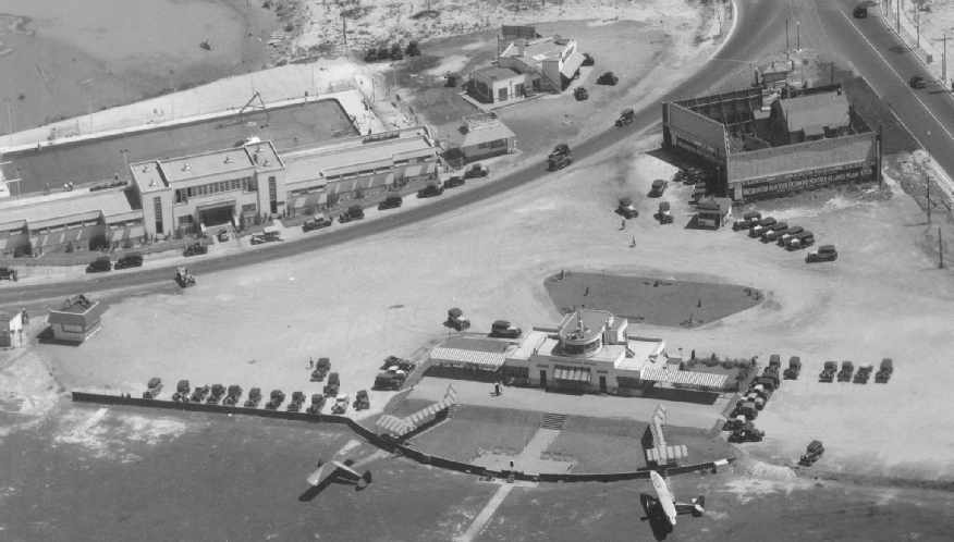
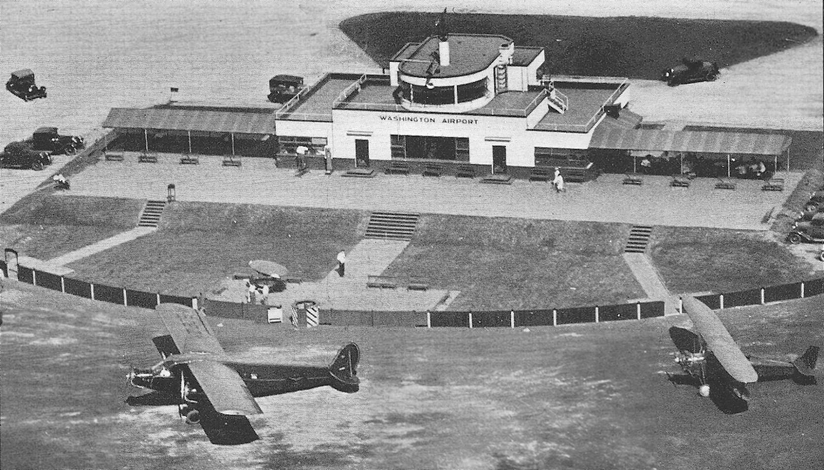
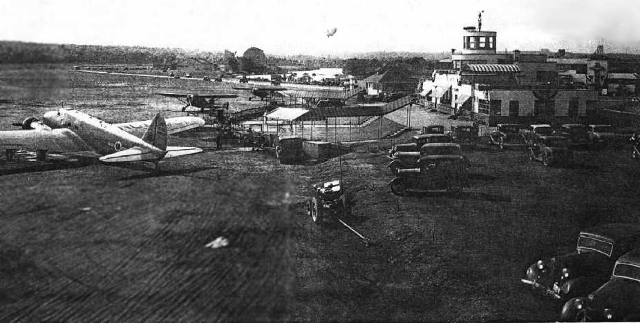
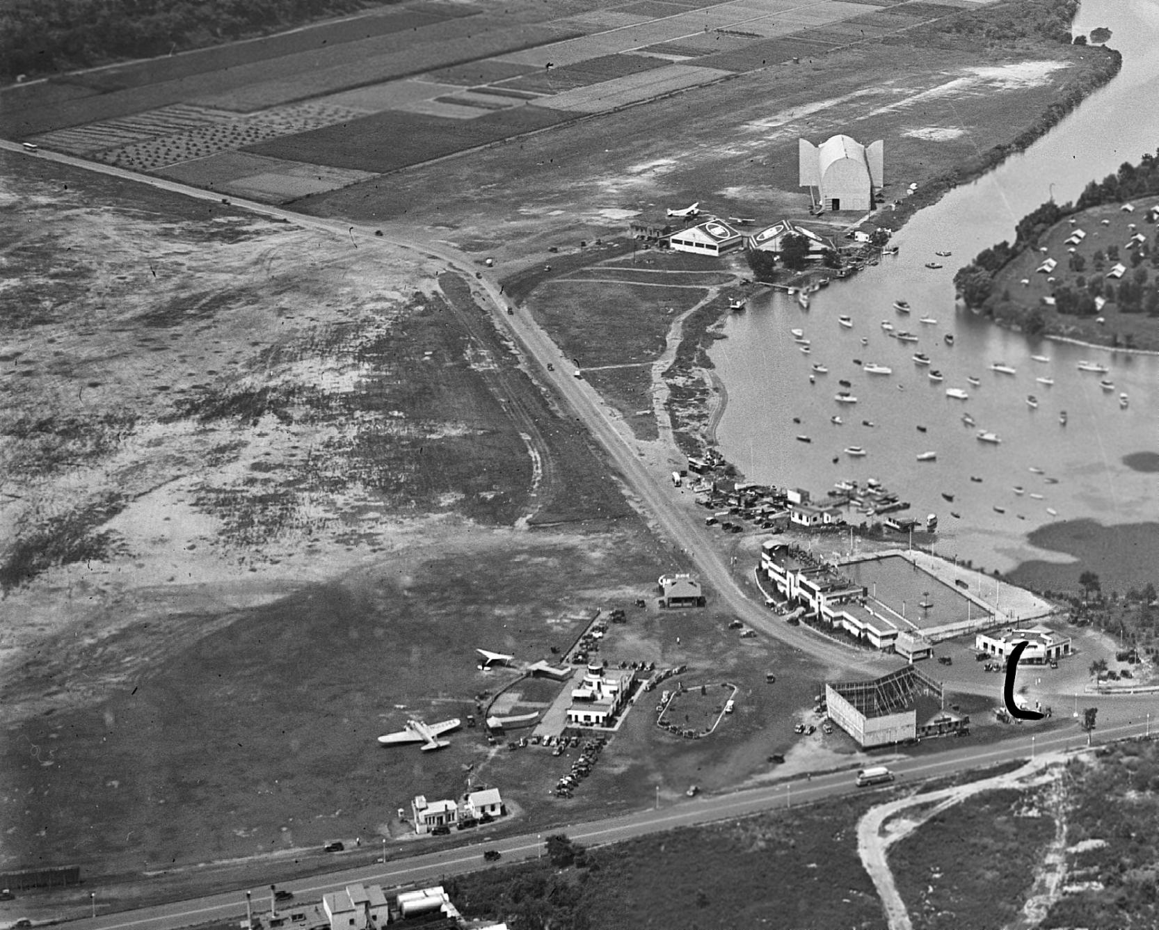
A 1932 aerial view looking northeast at Washington Hoover Airport (U.S. Bureau of Public Roads Photographs collection from the National Archives).
The terminal is at the center foreground, with the hangar behind it.
A private club with swimming pool is left of the hangar, across the street.
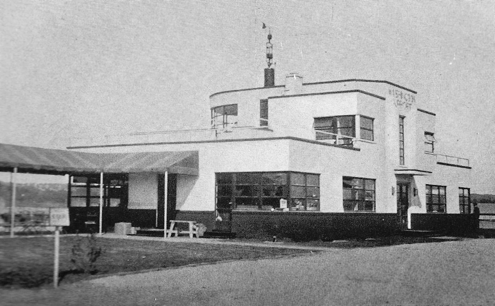
A circa 1932 photo of the Washington Airport terminal building (courtesy of George Miller).
According to a 2/78 article by Jack Perine in the Mid Atlantic Soaring Association's Convector,
“In the early 1930s, airline pilot Shelly Charles operated an open primary glider from auto-tow at the old Washington-Hoover Airport.
His flights were usually of short duration before an appreciative Sunday afternoon crowd.”
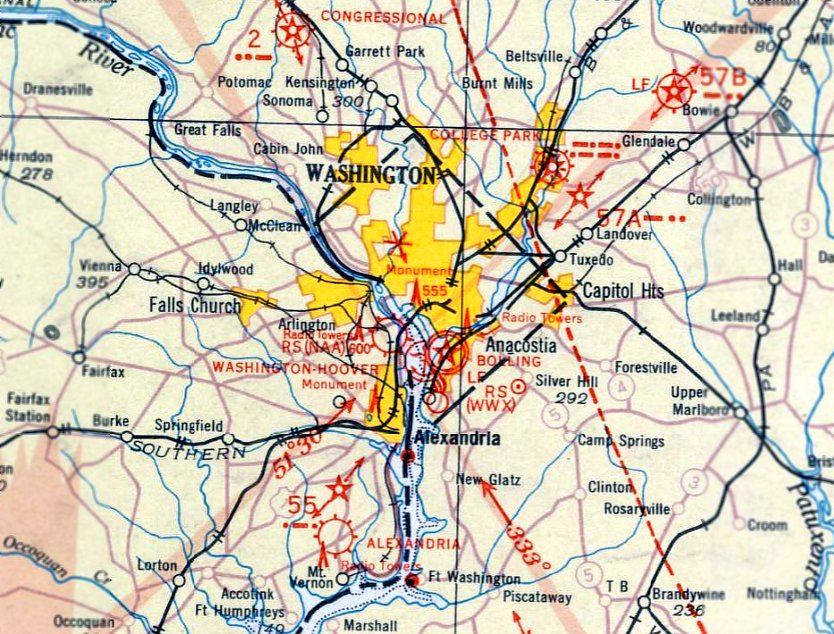
Washington-Hoover Airport, as depicted on the May 1932 Washington Sectional Chart.
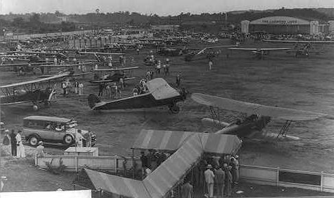
An aerial photo by Joe Roberts, looking east at Hoover Field & Washington Airport
from The Airport Directory Company's 1933 Airports Directory (courtesy of Chris Kennedy).
The directory described Washington-Hoover Airport as having 3 soil & sod runways,
with the longest being a 3,000' strip.
The manager was listed as John Wayne, General Manager of Atlantic Seaboard Airways, Inc.
The operators at the field were listed as Atlantic Seaboard Airways, Inc. (sightseeing, sales, and service),
Eastern Air Transport (scheduled transport), Luddington Lines, (scheduled transport),
Pennsylvania Airlines (scheduled transport), and William Payne (instruction).
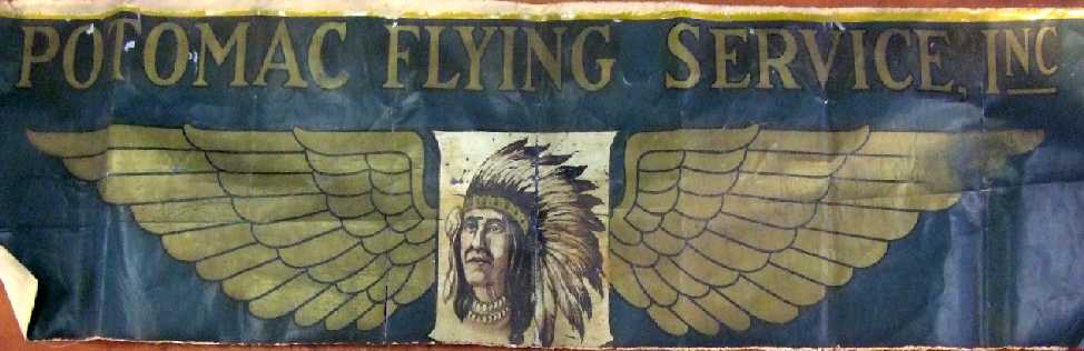
A 50” x 12” sign painted on cloth of the Potomac Flying Service, for sale by Michael Schultz.
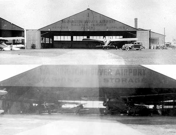
An undated photo of a horse-drawn wagon in front of the Hoover terminal building.
An undated aerial view looking northeast at 2 aircraft parked in front of the Washington Hoover Airport terminal building.
An undated photo of the Washington Hoover Airport terminal building.
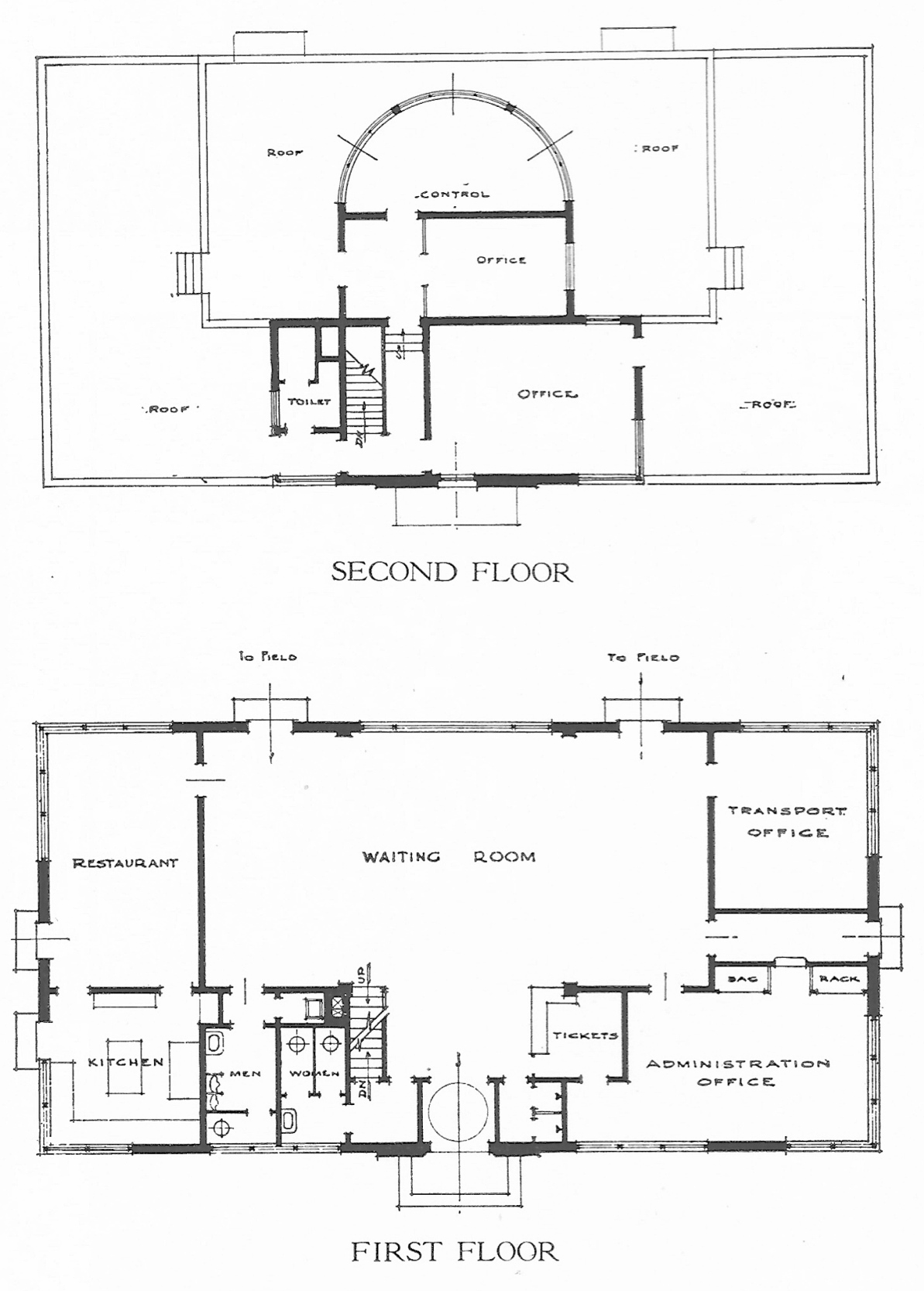
Undated architectural plans of the 1st & 2nd floors of the Washington Hoover Airport terminal building.
An undated photo of passengers boarding a Ford Tri-Motor at Washington Hoover.
In the early 1930s, airline pilot Shelly Charles operated an open primary glider
from an auto-tow at Washington-Hoover Airport.
His flights were usually of short duration before an appreciative Sunday afternoon crowd.
A mid-1930s view of a Boeing 247 in front of the Washington Hoover terminal.
What appears to be a dirigible hangar is visible in the background, on the former Hoover Field to the north.
The dirigible hangar was evidently constructed at some point after 1931.
Washington Hoover Airport, as depicted on a 1934 Navy Aeronautical Chart (courtesy of Chris Kennedy).
Two new wings were added to the terminal building in 1934, and a larger & more modern control tower was added as well.
The runway was slightly lengthened, but the overall boundaries of the site constrained the ultimate length of the field to a size that was becoming a liability.
A dirigible began conducting advertising & sightseeing flights from Washington-Hoover in 1934.
A large dirigible hangar was erected on the site of the original Hoover Field,
But this soon became a dangerous obstacle for the increasingly large airliners landing nearby.
"Washington Hoover" Airport, as depicted on the 1935 Washington Sectional Chart.
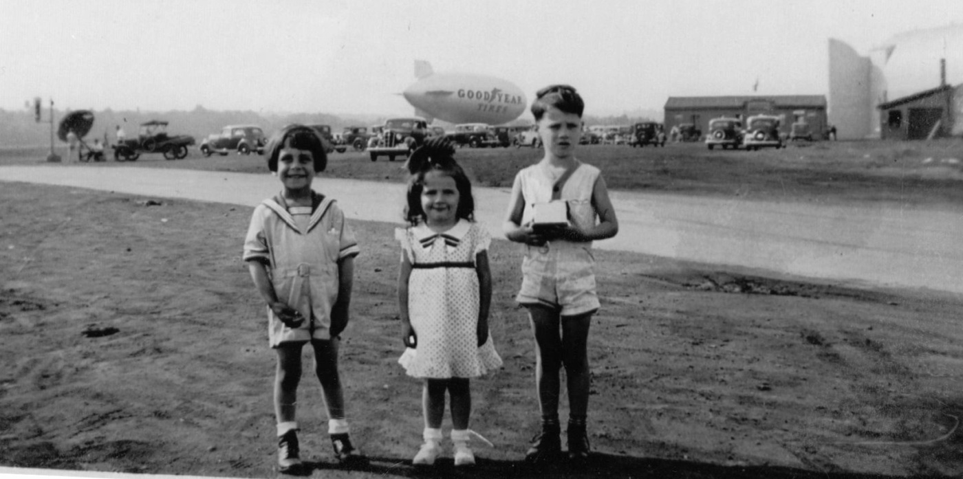
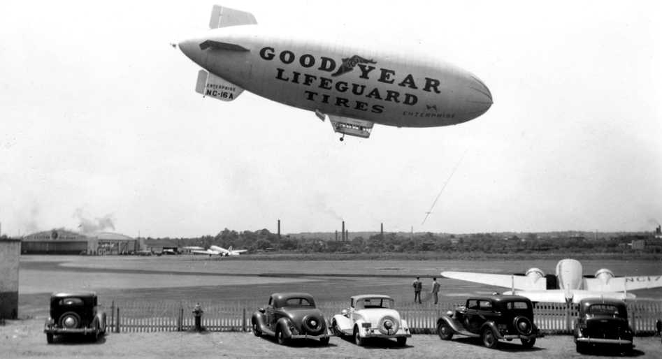
A circa 1935 photo of Phil Lefevre & his brother & sister at Hoover Field, with a Goodyear Blimp in the background.
A remarkable 1935 aerial view looking north at Washington Airport (foreground) & Hoover Field (background), as seen from the Goodyear Blimp 'Enterprise' (Harris & Ewing Collection, Library of Congress).
Two planes each were visible at Washington Airport & Hoover Field, which also had a blimp hangar in addition to 2 aircraft hangars.
A circa 1930s photo (courtesy of Dallam Oliver-Lee) of a DC-2 taxiing in front of Washington Hoover's hangar.
A 1935 street map (courtesy of Kevin Walsh) depicted “Washington Airport on the south side of Military Road,
but Hoover Field across the road to the north was only labeled generically as “Airport”.
A circa mid-1930s aerial view depicted “Washington Airport on the south side of Military Road, with 2 DC-3s (one near the southeast hangar & the other near the terminal on the east corner),
and Hoover Field across the road to the north (with its dirigible hangar).
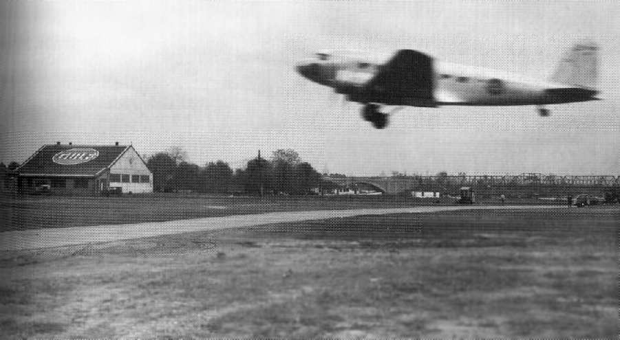
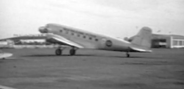
A 1935 Army Signal Corps photo (courtesy of Mike Keefe) of a DC-2 departing from Hoover Field,
over Washington Boulevard, on which vehicular traffic was blocked during takeoffs & landings.
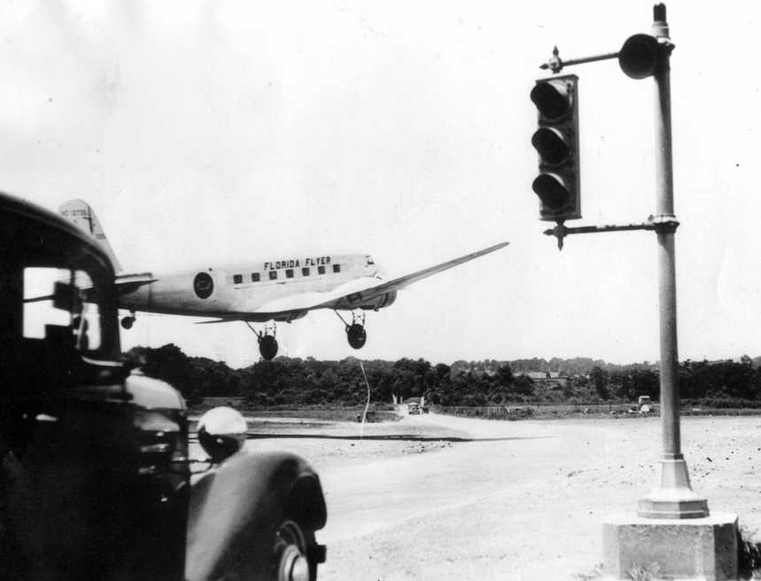
A 1935 photo (courtesy of Helen Marler) of a Florida Flyer DC-2 departing from Hoover Field,
showing the traffic light which blocked cars on adjacent Washington Boulevard during takeoffs & landings.
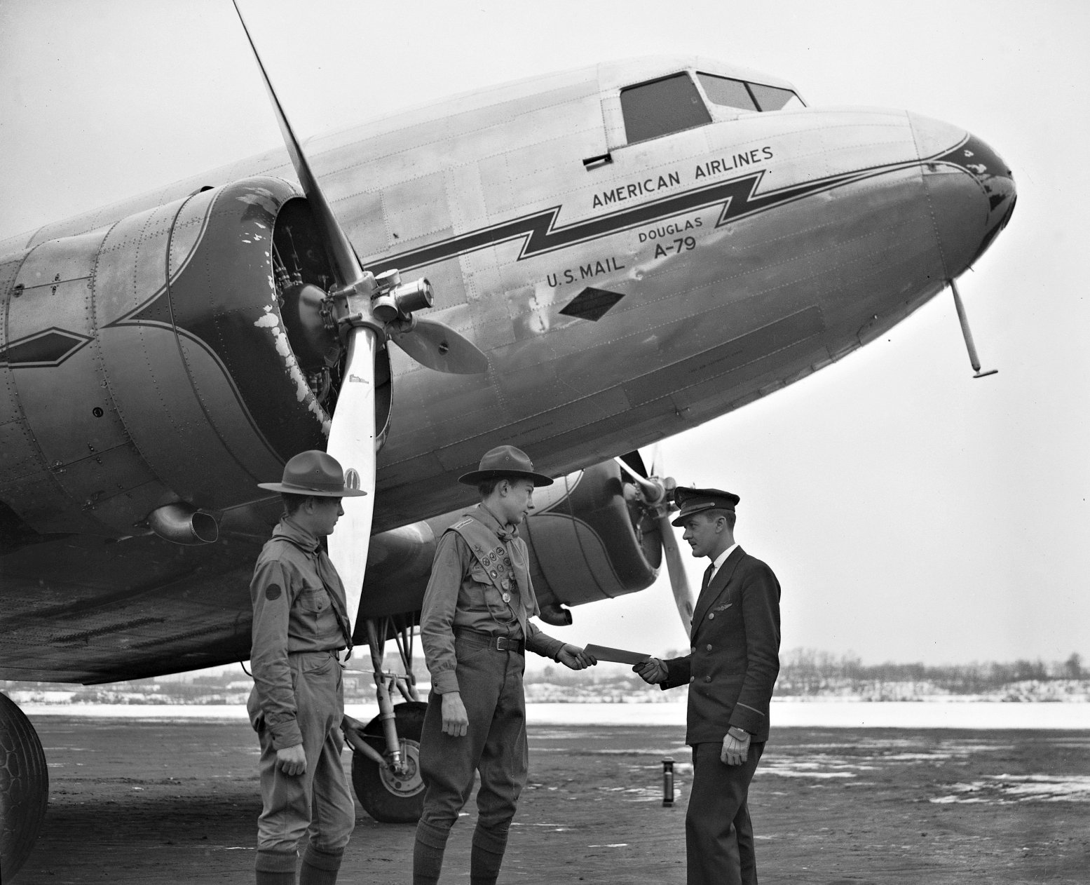
A January 1935 photo of 2 Boy Scouts & a pilot in front of an American Airlines Douglas DC-2 at Hoover Field,
A 1936 photo of a Pennsylvania Central Airlines Stinson Model A in front of the Washington-Hoover Airport terminal (courtesy of Fred Erdman).
The Airport Directory Company's 1937 Airports Directory (courtesy of Bob Rambo)
described Hoover Airport as having 2 sod runways, with the longest being the 4,200' north/south strip.
A circa late 1930s aerial view showing Washington Hoover in its later configuration, with 2 runways.
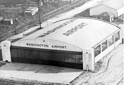
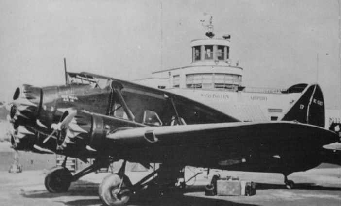
A circa 1930s photo of a hangar with “Washington Airport” painted on its side & roof (courtesy of Lester Hollans).
Washington-Hoover was reputed to have "the poorest aviation ground facilities of any important city in the United States or Europe."
Wiley Post remarked that "there were better landing grounds in the wilds of Siberia than at Washington."
Bordered on the east by Route 1, with its accompanying high-tension electrical wires,
and obstructed by a high smokestack on one approach & a dump nearby, the field was less than adequate.
Incredibly, the airport's single runway was intersected by a busy vehicular street, Military Road,
which had guards posted to flag down traffic during takeoffs & landings.
Furthermore, with a railway embankment to the southwest, there was no room for the airport to expand.
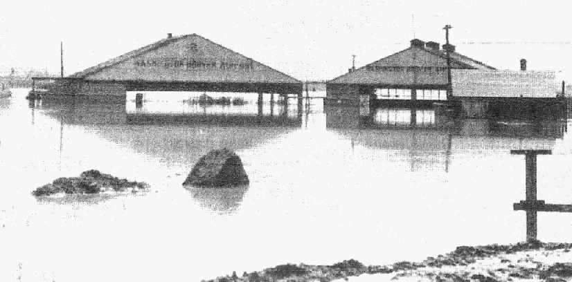
An undated photo (courtesy of George Miller) showing Hoover Field after it had been flooded.
Due to its low-lying location next to the Potomac River, and its poor drainage, the airport site was prone to such flooding.

A circa 1930s aerial view looking northeast at a group of military biplanes overflying Hoover Field, just visible at bottom-left.
A circa 1939 photo of the 1st Goodyear Blimp Enterprise over Washington Hoover Airport.
In the background is the Eastern Airlines hangar & an Eastern DC-2, and in the foreground is a twin Lockheed or Beech.
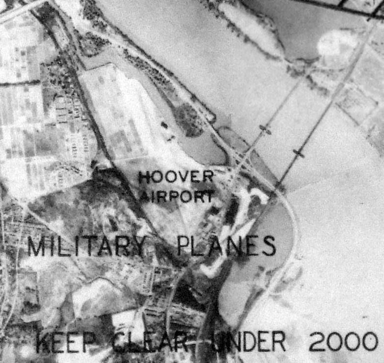
An undated aerial view of Hoover Airport from a November 1939 depiction of Washington Restricted Areas (from the Philadelphia National Archives, courtesy of Ron Plante).
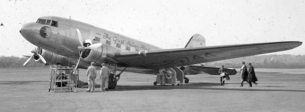
A 1939 photo of passengers loading onto an Eastern Airlines DC-3 of “The Great Silver Fleet” at Washington Hoover Field (courtesy of George Mihal of the Office of Image Archeology).
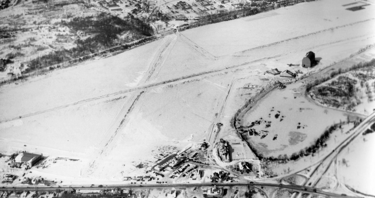
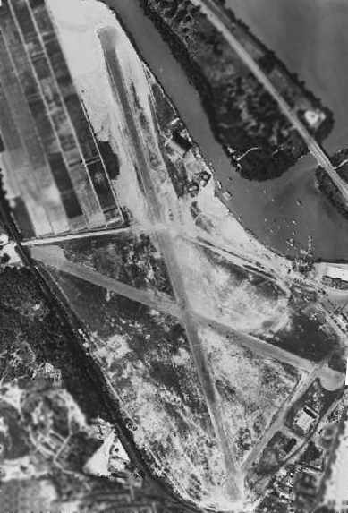
The last photo which has been located showing Washington Hoover Airport still in operation was a 1/27/40 aerial view looking northwest,
showing 2 snow-covered runways, and the buildings & hangars of both Washington Airport (bottom) & Hoover Field (upper-right).
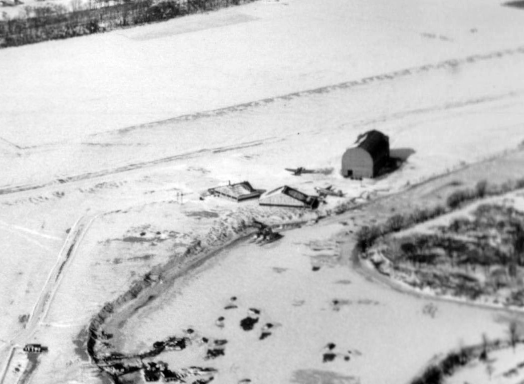
A closeup from the 1/27/40 aerial view looking northwest showing the 2 hangars, 2 aircraft, and a presumed dirigible hangar at Hoover Field.
The last aeronautical chart depicted which has been located of Washington-Hoover Airport was on the September 1940 Washington Sectional Chart.
With larger aircraft becoming commonplace in the 1940s, Hoover's geographic limitations became a serious liability.
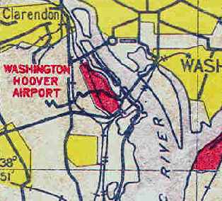
Hoover Field closed in 1941, when it was replaced by the much larger Washington National Airport, 2 miles southeast.
Hoover was no longer depicted on the November 1941 Washington Sectional Chart (courtesy of Ron Plante), but the new National Airport was.
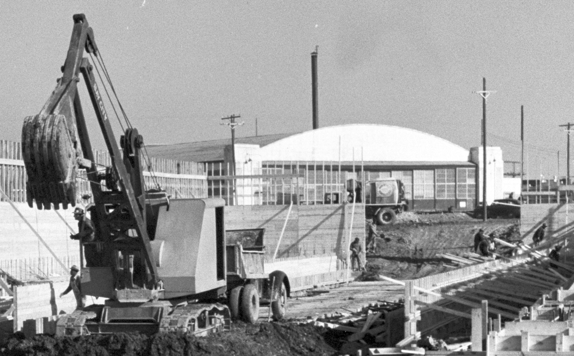
During the Pentagon's massive construction process, 1,000 architects produced blueprints of the new building inside the Hoover Airport hangar.
Lester Hollans relayed a story about a hangar from Washington Airport:
“In the summer of 1975 I was sent by the U. S. Army to become Airfield Commander of Blackstone AAF.
When I got there, I found a usable control tower & a huge cinder block hangar. This giant old hangar seemed to be totally out of place.
I went on the Virginia National Guard post to talk to the designated historian about where the hangar had come from.
I distinctly remember his telling me it had once been located in Washington, DC - on the site of what is now the Pentagon!
During the Great Depression it was disassembled block by block
and brought to Blackstone Army Airfield for reassembly as a make-work project for a group such as the Civilian Conservation Corps.
The historian went on to say that the hangar was reassembled at the field [Blackstone AAF] in time for its use in WW II.”
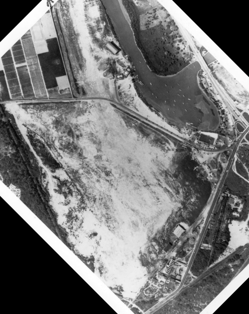
A 1949 aerial view showed that all traces of Hoover Airport had been erased.
In 2011, Geneva from the Leesburg Court of Shoppes reported,
“I have just gotten about 200 of the original windows that were in the Washington [Hoover] Airport before renovating & merging.
They are in fabulous condition & have been in a barn & out of the weather all these years. Panes are in good shape too!
I have original pictures of them in & the contractor who removed them is the person I bought them from.
He kept them instead of demolishing them.”
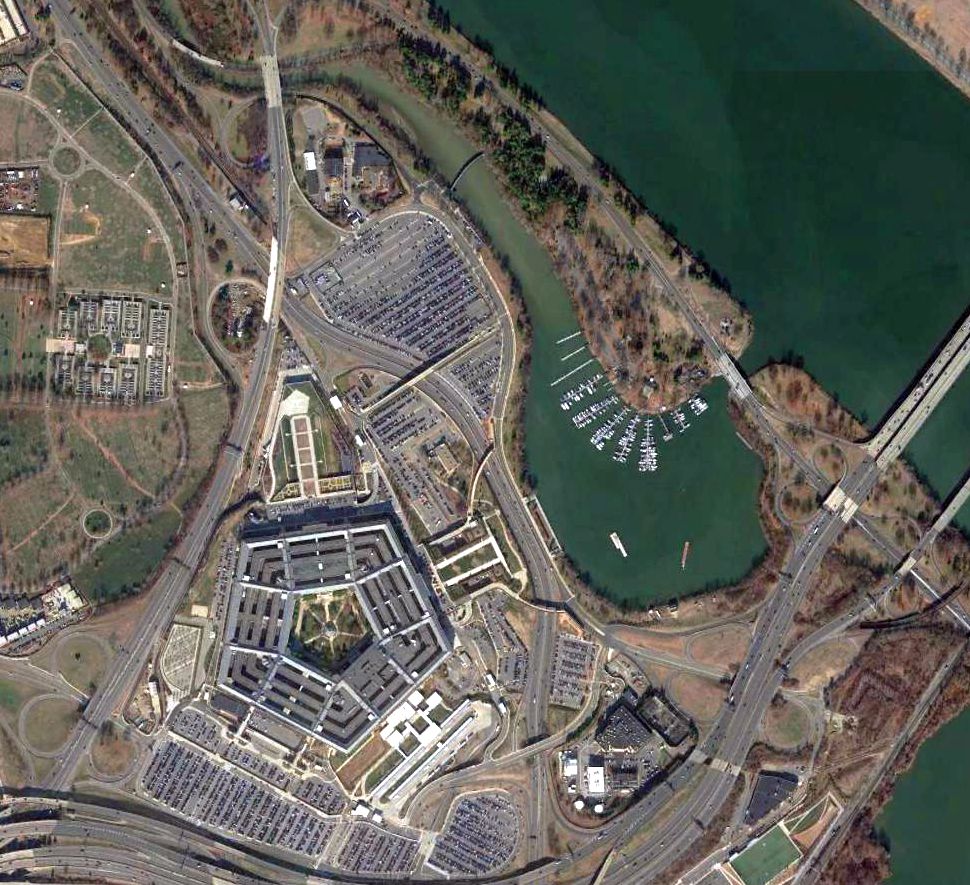
A 2016 aerial view shows no trace remains of Washington Hoover Airport.
See also:
Washington History Magazine, Fall 1989.
http://www.metwashairports.com/national/history.htm
____________________________________________________
Or if you prefer to contact me directly concerning a contribution (for a mailing address to send a check),
please contact me at: paulandterryfreeman@gmail.com
If you enjoy this web site, please support it with a financial contribution.
____________________________________________________
This site covers airfields in all 50 states.