Abandoned & Little-Known Airfields:
Central Oklahoma
© 2002, © 2026 by Paul Freeman. Revised 4/12/26.
This site covers airfields in all 50 states: Click here for the site's main menu.
____________________________________________________
Please consider a financial contribution to support the continued growth & operation of this site.
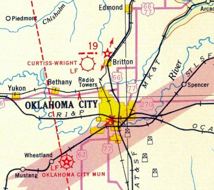
(Original) Ardmore Municipal Airport (revised 9/6/24) - Blackwell Municipal Airport / Earl Henry Airport (revised 9/6/24) - Crazy Horse Municipal Airport (added 5/18/22)
Curtiss-Wright Field / (Original) Wiley Post Airport (revised 2/13/21) - Ditch Witch Airfield (revised 5/19/22) - El Reno Airport (revised 3/12/26) - Hickok Country Club Airport / South Shields Airport (revised 12/29/20)
Jolly Aero Airport (added 4/12/26) - Lake Murray State Park Airport (added 6/9/21) - Northeast Airport / Expressway Junction Airpark (revised 3/13/23) - Oklahoma City Downtown Airpark (revised 4/28/21)
Shawnee Municipal Airport #2 (revised 9/6/24) - Tabler Airfield (added 9/6/24) - Twelfth Street Airpark / Moore Airport (revised 9/30/22) - Wheatley Airport / Barkhurst Field (revised 9/2/20)
____________________________________________________
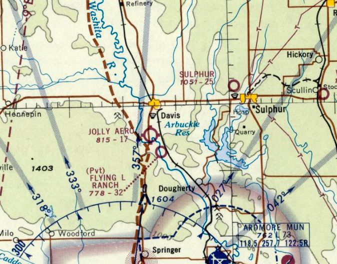
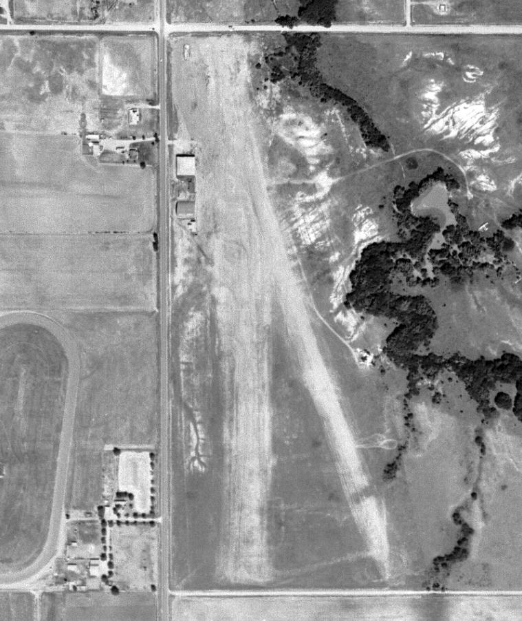
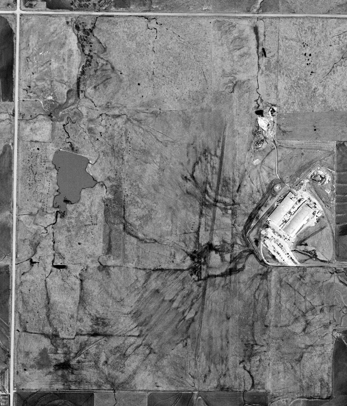
Jolly Aero Airport (F39), Davis, OK
34.46, -97.129 (Southeast of Oklahoma City, OK)
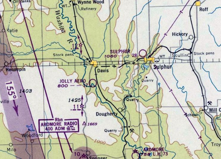
Jolly Aero Airport, as depicted on the September 1948 OK City Sectional Chart.
This small rural airport was evidently established at some point between 1946-48,
as it was not yet depicted on the 1946 OK City Sectional Chart.
The earliest depiction which has been located of Jolly Aero Airport was on the September 1948 OK City Sectional Chart,
which depicted Jolly Aero as having a mere 1,700' unpaved runway.
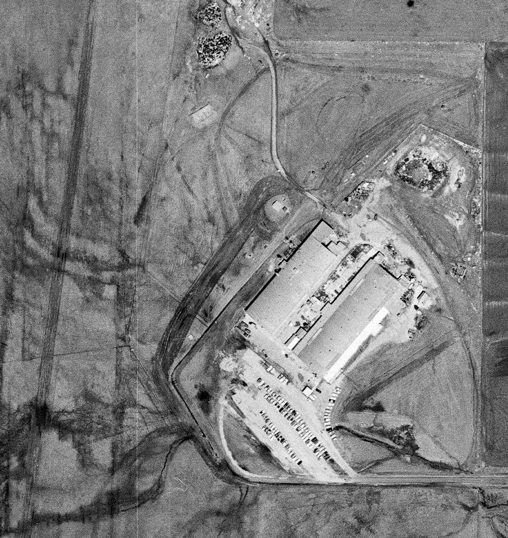
The earliest photo which has been located of Jolly Aero Airport was a 1956 aerial view.
It depicted a single unpaved northwest/southeast runway, with buildings on the west side, but no aircraft were visible.
The last photo which has been located showing Jolly Aero Airport's original runway configuration was a 1962 aerial view.
The earliest topo map depiction which has been located of Jolly Aero Airport was on the 1963 USGS topo map.
The 1966 USGS topo map depicted Jolly Aero Airport to have a single unpaved northwest/southeast runway & buildings on the west side.
The last aeronautical chart depiction which has been located of Jolly Aero Airport was on the November 1968 OK City Sectional Chart.
It depicted Jolly Aero as having a mere 1,700' unpaved runway.
Jolly Aero Airport was evidently closed (for reasons not determined), as a 1981 aerial photo showed streets & trailers had covered the site of the runway.
A 2015 aerial view showed no change in the property's configuration.
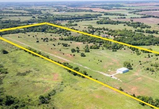
A 2017 aerial view showed a new unpaved northwest/southeast runway was in the process of being cleared, just slightly east of the former runway.
Aerial photos from 2019/21/23 showed the newer runway remained clear, but there were no aircraft visible on the field.
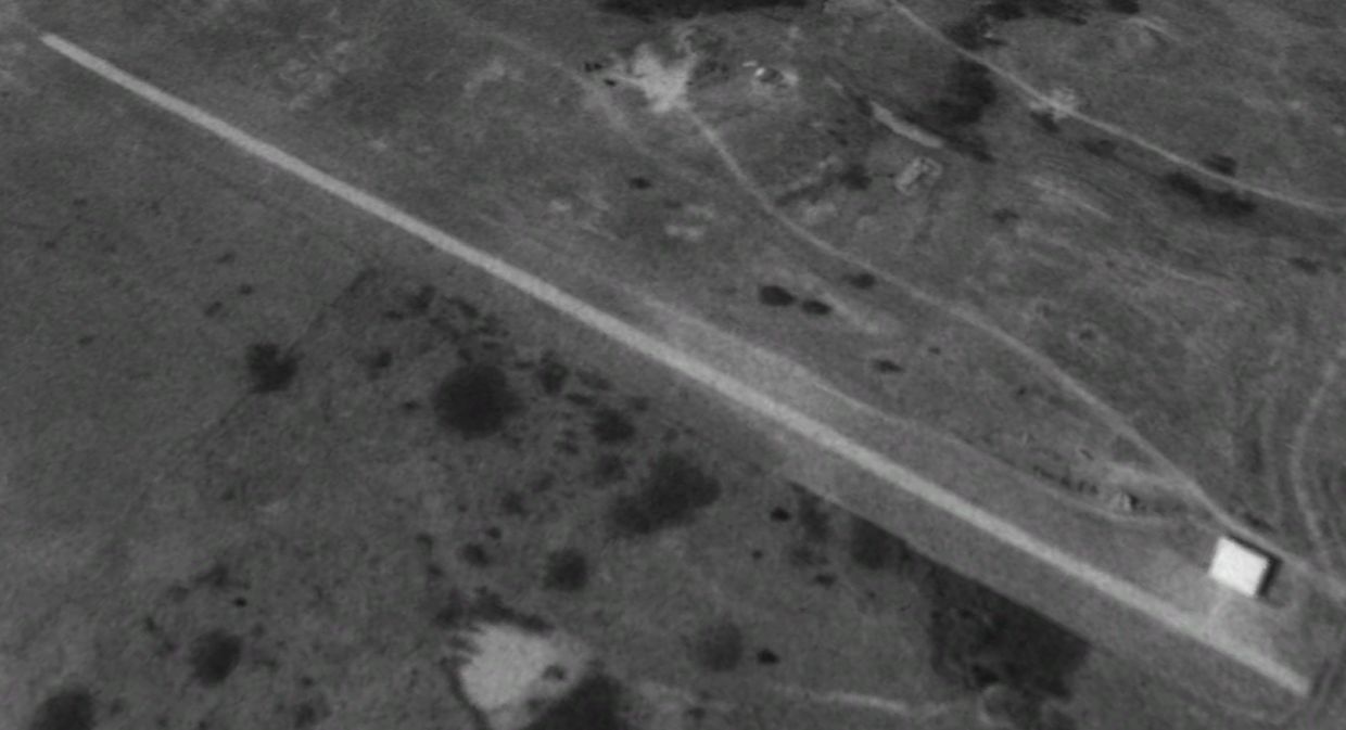
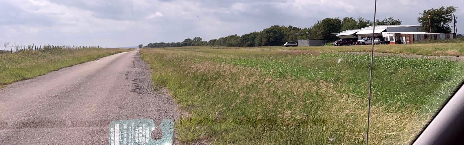
A 2024 aerial view looking east showed the more recent Jolly Aero runway.
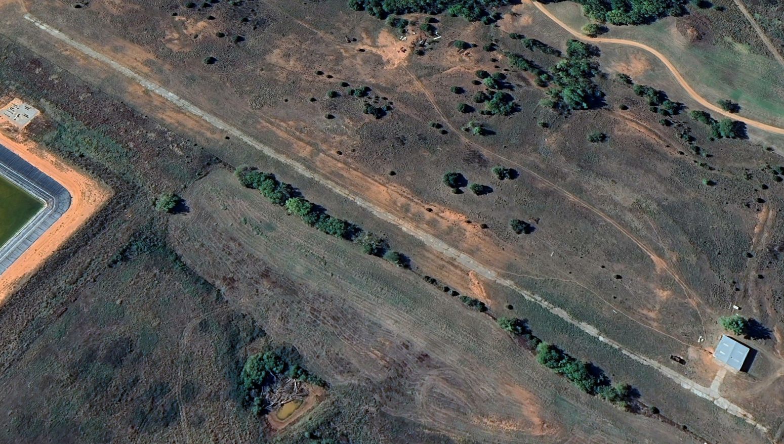
A 2026 photo looking southeast along the more recent Jolly Aero runway.
As of 2026, no airfield was registered in FAA records at the site of Jolly Aero.
Thanks to Tim Vasquez for pointing out this airfield.
____________________________________________________
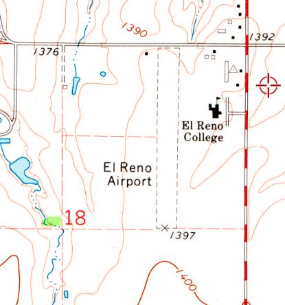
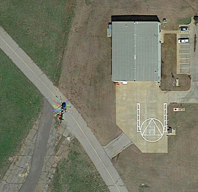
El Reno Airport (99F), El Reno, OK
35.52, -97.976 (West of Oklahoma City, OK)
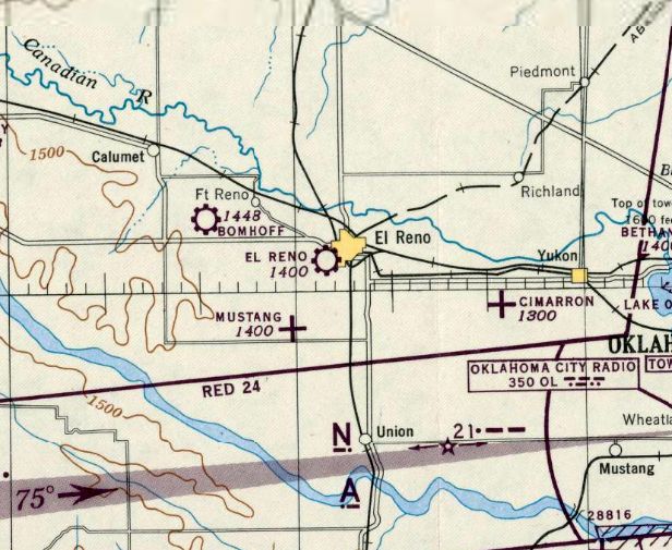
El Reno Airport, as depicted on the October 1945 OK City Sectional Chart.
According to Gibson Aviation, El Reno Airport was originally a military flight training airfield in WW2.
However, it was not depicted on WW2-era Sectional Charts.
The earliest depiction which has been located of El Reno Airport was on the October 1945 OK City Sectional Chart,
which depicted it as a commercial/municipal airport.
The earliest photo which has been located of El Reno Airport was a 1957 aerial view.
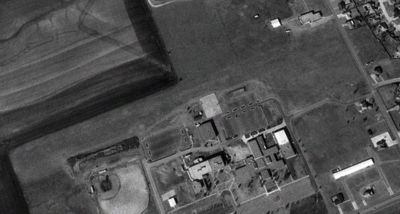
It depicted El Reno Airport as having a single unpaved north/south runway, with a hangar & few other small buildings on the northeast side.
The earliest photo which has been located showing an aircraft at El Reno Airport was a 1965 aerial view, which depicted 1 light single-engine plane parked near the northeast hangar.
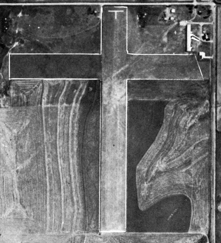
The earliest photo which is available of El Reno Airport was an undated aerial view from the 1966 OK Airport Directory.
It depicted El Reno Airport as having 2 turf runways: 2,600' Runway 17/35 & 2,200' Runway 9/27.
In 1970, James Gibson founded Gibson Aviation, a powerplant repair business, on the northwest side of El Reno Airport.
The earliest topo map depiction which has been located of El Reno Airport was on the 1972 USGS topo map.
It depicted El Reno Airport as having a single unpaved north/south runway, with a few small buildings on the northwest & northeast sides.
El Reno College had been built at some point between 1965-72 on the east side of the runway.
The last photo which has been located showing an aircraft at El Reno Airport was a 1981 aerial view, which depicted 1 light single-engine plane parked near the Gibson Aviation facility on the northwest side.
A 1995 USGS aerial view looking northwest depicted El Reno Airport, but did not show any aircraft on the field.
The campus of El Reno College began to expand on the east side, eventually encroaching on the little airport.

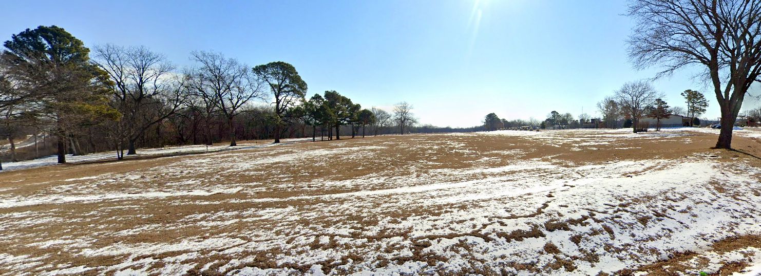
A 4/15/13 photo looking north from the south end of the El Reno Airport runway.
The photograhper remarked, “Note the houses at the far end of the runway & the community college on the east side. They were parking the trailers for their CDL training program next to the runway.”

The last aeronautical chart depiction which has been located of El Reno Airport was on the September 2018 DFW Sectional Chart.
It depicted El Reno Airport as having a 1,700' unpaved runway.
According to a local aviation enthusiast, further encroachment came from the construction of a cell tower immediately adjacent to the southeast side of the El Reno Airport runway in 2020,
and the little airport was closed in 2023.
The remainder of the runway was sold to Redlands Community College (as El Reno College was renamed).
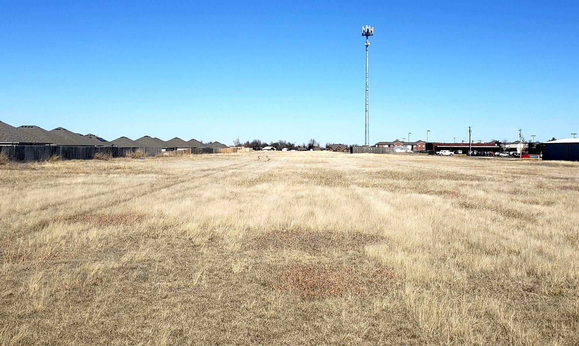
A 2/17/23 photo looking north along the former El Reno Airport runway.
The photographer noted, “The airport probably should have been closed earlier than it was due to the encroachment. The Gibsons wanted it open until they sold off the property.
I don’t know when the last landing happened at 99F; I’ve never spoken to anyone who had flown in there.”

A 2/17/23 photo looking southwest at the Gibson Aviation hangar & shop on the northwest side of the El Reno Airport site.
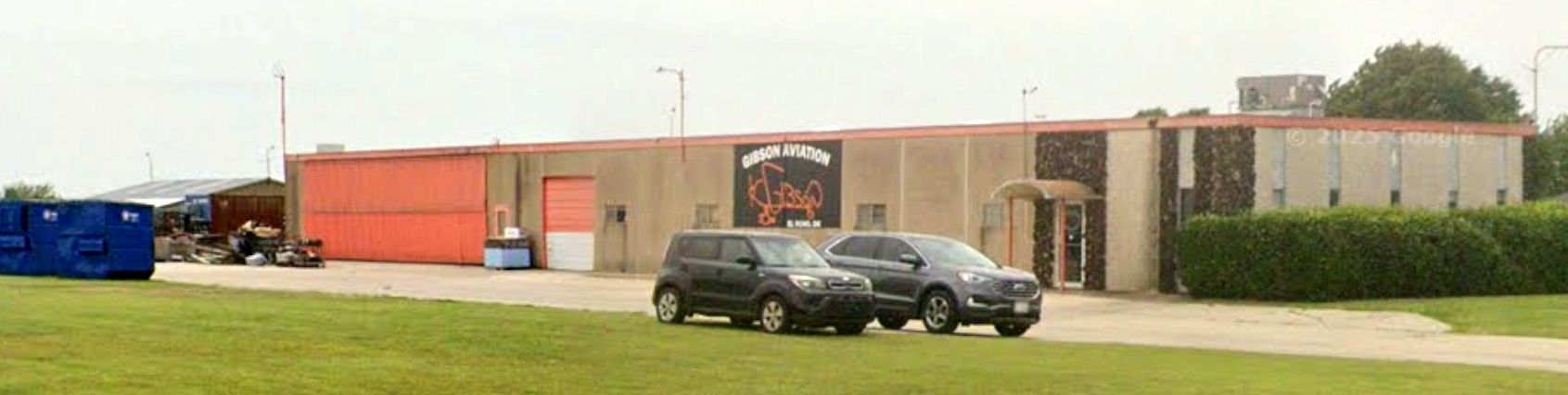
A 2025 photo looking southwest at the Gibson Aviation hangar & shop on the northwest side of the El Reno Airport site.
Note the windsock frame which remains on the left side of the shop building.
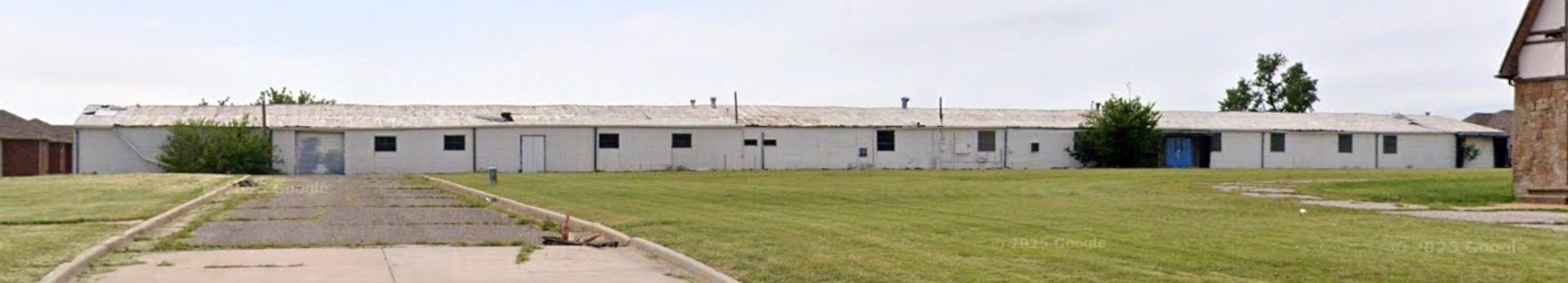
A 2025 photo looking west at the hangar on the east side of the El Reno Airport site.
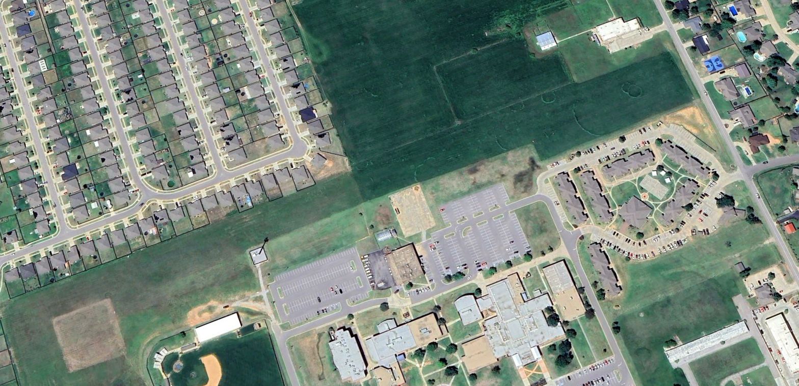
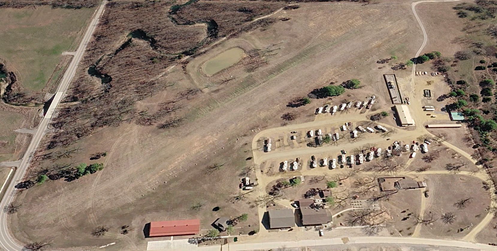
A 2025 aerial view looking northwest shows the El Reno Airport site remains largely intact.
____________________________________________________
35.04, -97.816 (Southwest of Oklahoma City, OK)
A 1995 USGS aerial view looking southwest at Tabler Airfield.
Not much is known about this former airfield, including its name or purpose.
Tabler Airfield was evidently established at some point between 1975-81,
as it was not yet depicted on a 1975 aerial photo, the 1976 USGS topo map, or Dallas Sectional Charts from 1973-2024.
The earliest depiction which has been located of Tabler Airfield was on a 1981 aerial view.
It depicted a single paved north/south runway, with 1 light single-engine plane & a small hangar on the northwest side.
The earliest photo which is available of Tabler Airfield was a 1995 USGS aerial view.
The airfield remained in an unchanged configuration, but there was no sign of recent aviation use.
The Tabler Airfield still was not depicted on the 2012 USGS topo map.
A 2023 aerial view looking southwest showed Tabler Airfield remained intact.
An undated aerial view looking southwest at Tabler Airfield from a 2024 property sale listing.
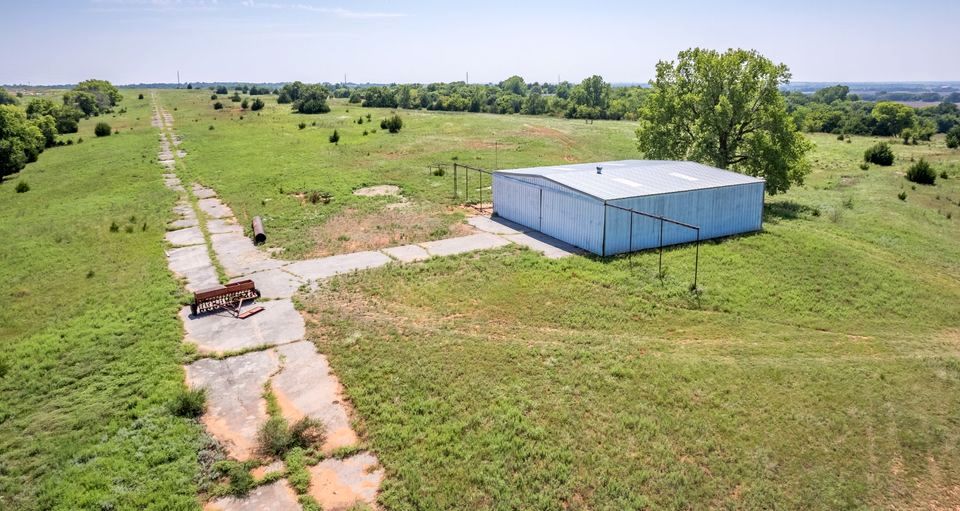
An undated aerial view looking southwest at Tabler Airfield's runway & hangar from a 2024 property sale listing.
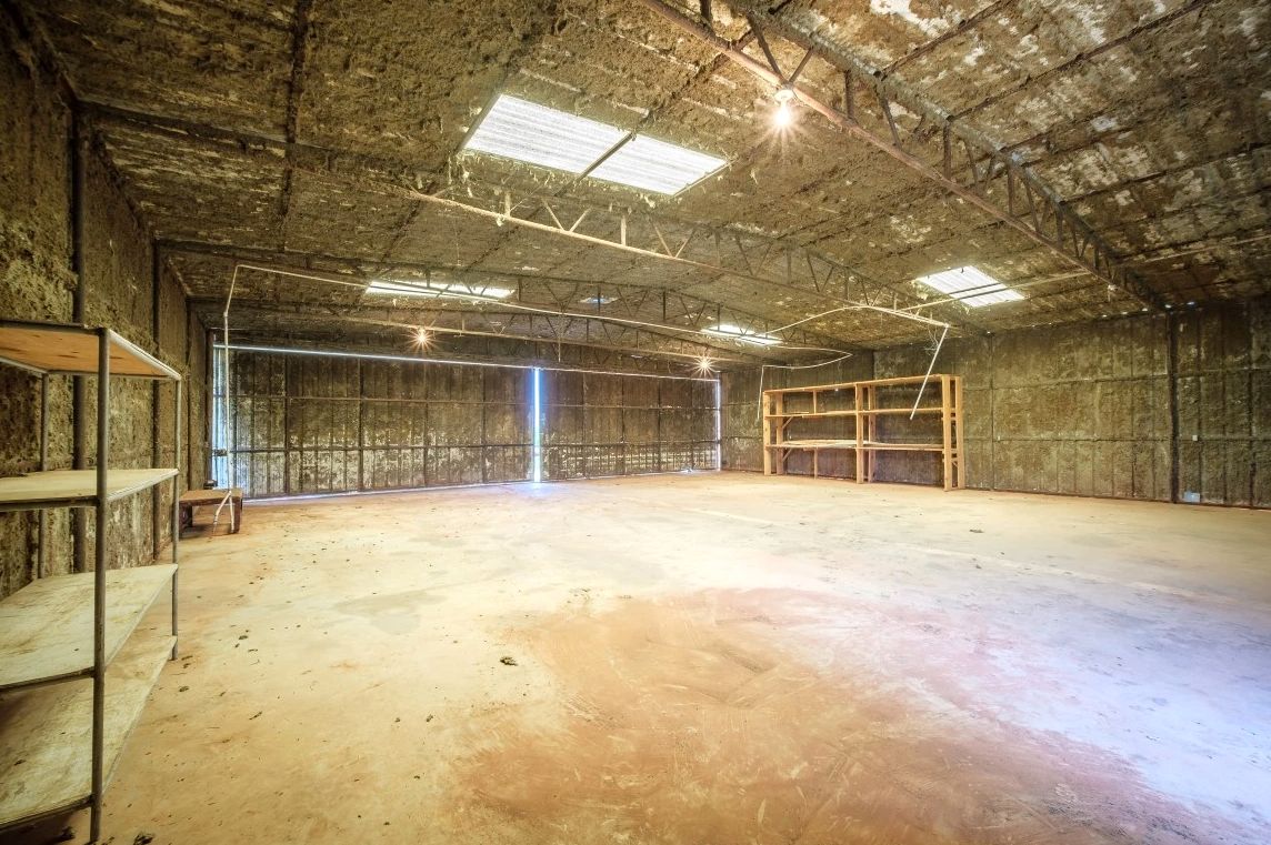
An undated photo of the Tabler Airfield hangar interior from a 2024 property sale listing.
Tom Solinski reported, “It’s in the middle of nowhere but paved, maybe a former oil company strip.”
Thanks to Tom Solinski for pointing out this airfield.
____________________________________________________
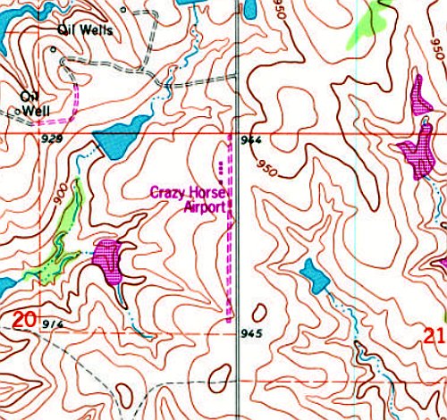
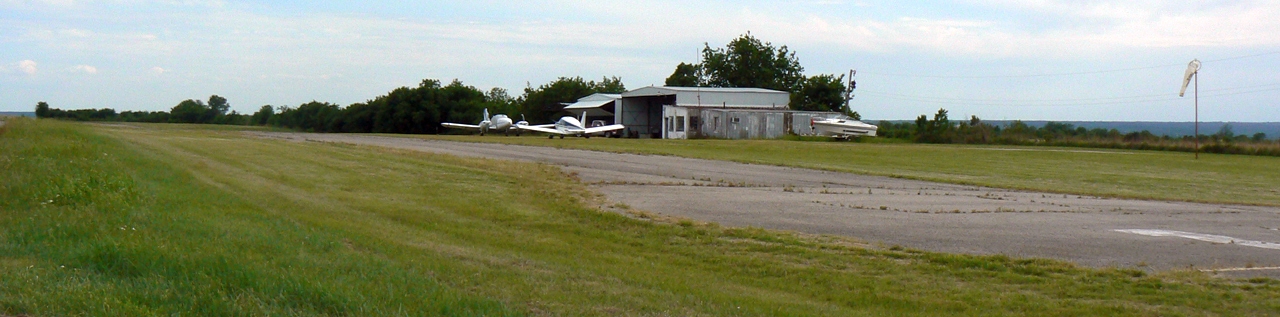
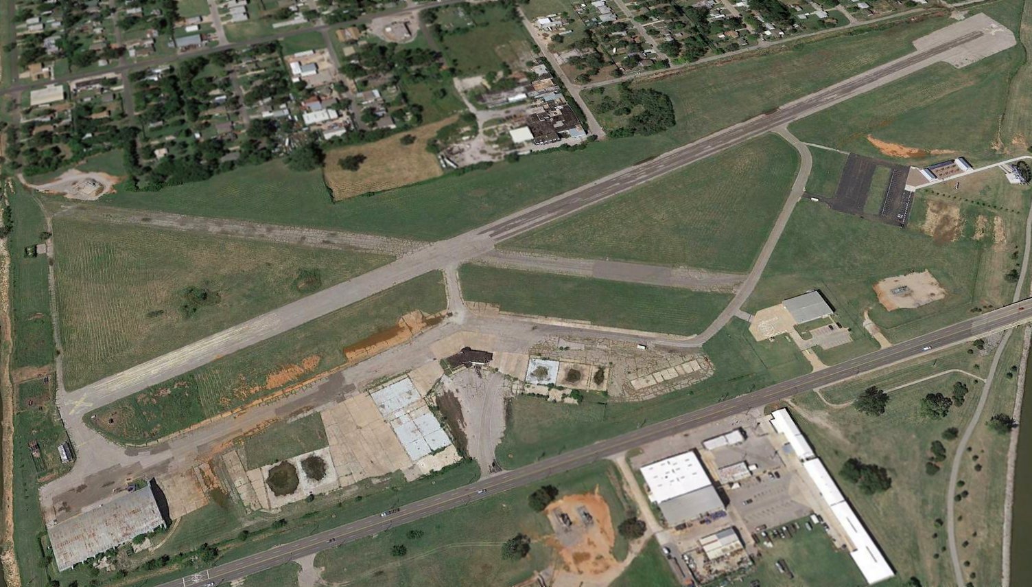
Crazy Horse Municipal Airport (97F), Davis, OK
34.546, -97.108 (Southeast of Oklahoma City, OK)
Crazy Horse Airport, as depicted on the 1978 Dallas Sectional Chart.
Crazy Horse Airport was evidently established at some point between 1962-78,
as a 1962 aerial photo did not yet show Crazy Horse Airport.
The earliest depiction which has been located of Crazy Horse Airport was on the 1978 Dallas Sectional Chart.
It depicted Crazy Horse Airport as having a single north/south 2,500' paved runway.
The earliest photo which has been located of Crazy Horse Airport was a 1981 aerial view.
It depicted Crazy Horse Airport as having a single north/south paved runway, with a few small hangars on the northwest side.
The earliest topo map depiction which has been located of Crazy Horse Airport was on the 1993 USGS topo map.
It depicted Crazy Horse Airport as having a single north/south unpaved runway, with a few small buildings on the northwest side.
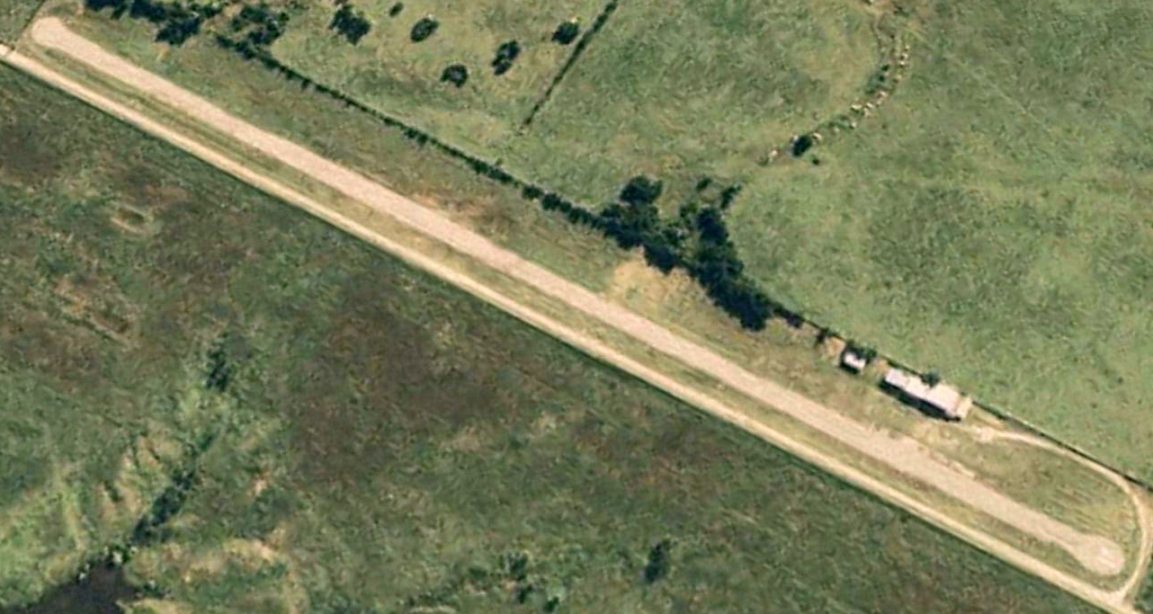
The earliest photo which is available of Crazy Horse Airport was a 1993 aerial view looking southwest.
It depicted Crazy Horse Airport as having a single north/south paved runway, with a few small hangars on the northwest side.
There were no aircraft visible on the field.
Brandon Albert recalled, “When I was a child (in the late 1990s), my family often went on day trips to the Chickasha National Recreation Area in Sulphur, OK.
We followed the winding route of U.S. 77 from my hometown of Norman, a pleasant drive which passes through prairies, wooded hills and valleys, and several small towns.
I had a keen interest in all things aviation related from a young age, and always noticed the green airport road sign north of Davis that pointed in the direction of Crazy Horse Airport.
On one trip, I asked my father to pull off the road so we could visit the field (this was a common ritual when passing small airports on family road trips, much to the chagrin of my mother & siblings).
Although not a pilot himself, Dad was a good sport, and would always oblige these requests.
This was in the days before smartphones, so we drove around the labyrinthine back roads for a while without success & eventually gave up.
I knew the airport was there SOMEWHERE, as I had seen it on aeronautical charts, as well as on an old OK road atlas of questionable accuracy.”
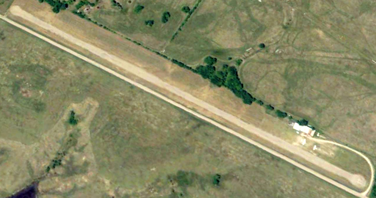
A 2008 aerial view looking southwest at Crazy Horse Airport showed the field to remain in the same physical configuration.
Two light aircraft were parked near the hangars.
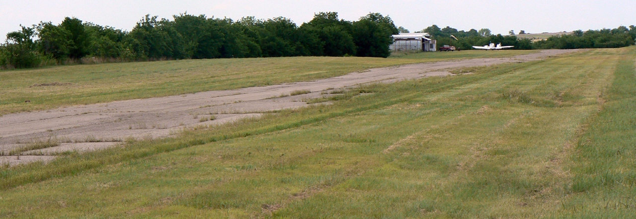
A 5/18/08 photo looking northwest at Crazy Horse Airport showed the paved runway to be very deteriorated.
One light twin-engine aircraft was parked near the hangars.
A 5/18/08 photo looking southwest at Crazy Horse Airport showed the paved runway to be very deteriorated.
Two light aircraft were parked near the hangars.
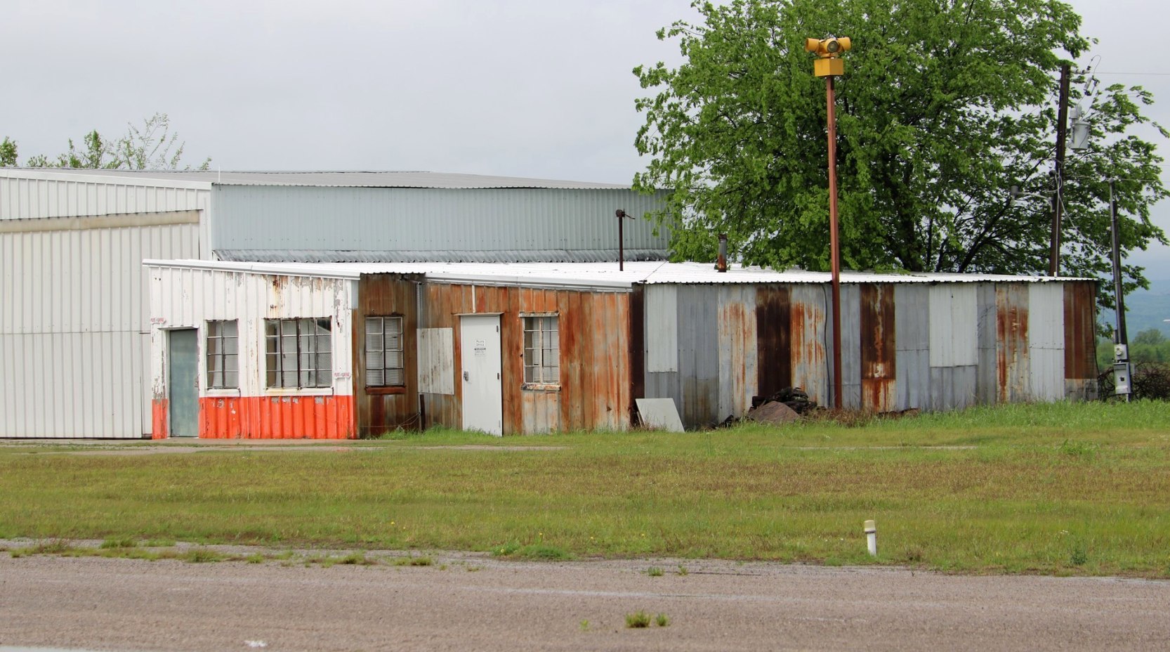
A 5/8/18 photo looking southwest at the office adjacent to the Crazy Horse Airport hangar.
Brandon Albert recalled, “I always thought of the airport on subsequent trips down that way
when I saw the fading green sign with an incongruous white jet silhouette, pointing off somewhere into the mysterious woods.
Finally, when I became a pilot myself, I encountered it again.
I did much of my flight training at the University of OK, and on a night cross-country in 2016 I passed directly over Crazy Horse Airport.
I saw its beacon still rotating bravely for planes that would never come (there were no runway lights), with only the white portion operational.
I assume the green had long since burned out. This re-piqued my interest in the place, although I couldn’t fly there from OU due to it not being on the list of approved student solo airports.”
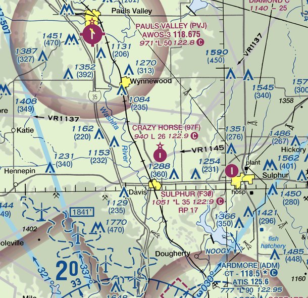
The last aeronautical chart depiction which has been located of Crazy Horse Airport was on the September 2018 Dallas Sectional Chart.
It depicted Crazy Horse Airport as having a single north/south 2,600' paved runway.
Brandon Albert recalled, “In September 2018 my family again went on a trip to Sulphur.
This time, armed with Google Maps, we found the place, which was in a sad state of disrepair.
I recall there being 3 hangars, 2 of which had closed doors. The open one contained a boat & the fuselage of an ultralight sans wings.
There was also a small, unattended office with the old beacon on top, and a tattered windsock.
The runway was cracked & partially overgrown by tall grass, with loose gravel & stones on the surface.
The markings had long since faded, and it looked marginal at best for anything other than a taildragger with bush tires.
It was very narrow due to the grass encroachment, and Dad commented that the parallel roadway looked like a better place to land a plane!”
Brandon continued, “I paid the place another visit in October of 2020, while driving down to a cabin in the Arbuckle Mountains.
This time, there was a small knot of hangar bums in front of the open doors, hanging out next to a grill & a couple motorcycles.
We went over and introduced ourselves. It turned out that the gentlemen weren’t pilots, just a group of friends who enjoyed hanging out in the open space of the airport.
They told me a bit about the aircraft they had seen land there, which included normal GA planes, Army helicopters, and, incredibly, a C-130 practicing tactical approaches!
Sadly, it seemed at the time of this visit that there were no longer any aircraft based on the field.”
Brandon continued, “Imagine, if you will, a youthful pilot in Davis walks out to his Ercoupe, hangared at the airport that is the pride of the city.
In the warm afternoon sun, he opens the canopy, slides into the comfortable seat, pumps the primer.
'Clear!' comes the shout, and clear are the piercing eyes that scan the gauges as the little Continental coughs to life.
He coaxes the throttle forward, taxies down the freshly-paved runway, and his runup stirs tornadoes in the freshly mown grass, mixing with the scent of leather & oil.
Plane & pilot turn into the snapping Sooner breeze, and all 85 mighty horses sing to life as the takeoff roll begins.
The wings bite the air, the wheels leave the ground, and the boy & Ercoupe become one living entity.
The prairie unfurls beneath them, spreading out to the blurred horizon like the limitless possibilities of plane, pilot, airport, and country.
A country where flying was magical & glamorous & no one would dream of closing an airport to build a strip mall.
As I flew west away from Crazy Horse, perhaps they were by my side, bidding a bittersweet farewell.”
According to its FAA Airport/Facility Directory data, Crazy Horse Municipal Airport was owned by the City of Davis, and managed by Tom Graham.
It consisted of 14 acres, and had a single 2,600' asphalt Runway 17/35, with “severe cracking & grass encroachment”.
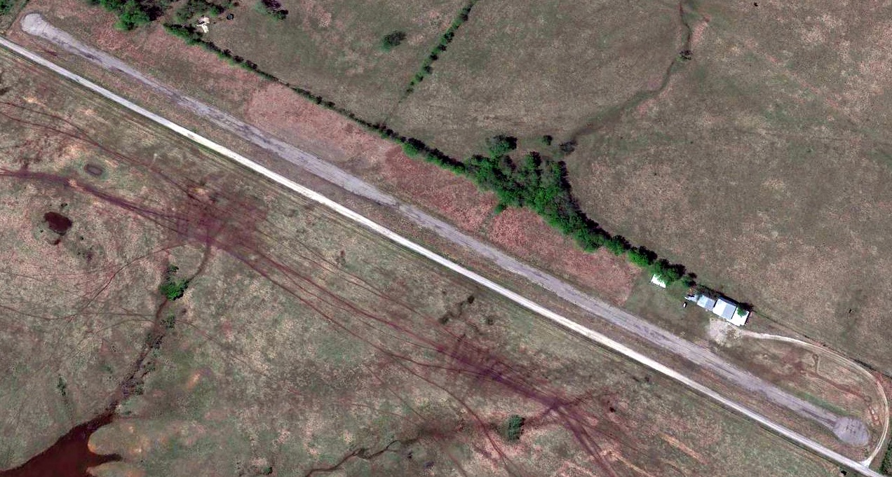
A 2019 aerial view looking southwest at Crazy Horse Airport showed the field to remain intact, but devoid of aircraft.
A September 2019 photo by Brandon Albert looking southwest at Crazy Horse Airport.
Brandon observed, “Two of the hangar doors were open. You can see that the runway isn’t in great shape & there are no signs of recent aviation use.
Even at this date, I suspect it was mainly used as a storage facility/hangout spot for the locals. The ultralight fuselage (possibly a Titan Tornado) is faintly visible behind the maroon truck.”
Brandon Albert recalled, “Finally, I determined to fly there myself during some downtime in summer of 2021.
I made the trip in a lovely vintage Ercoupe which I fly from time to time, dutifully making my calls on the CTAF & entering the pattern as any good pilot should.
I’m sure another airplane hadn’t done the same in many weeks, at least!
Remembering the past condition of the runway, I did a couple low approaches to assess its condition & scare off any wildlife that might be lurking in the grass.
The south end of the strip was covered in grass & even some small shrubs, so I glumly figured a full stop landing would be unwise.
The condition of the north end of the strip was better, and the middle was completely fine,
so I made one final approach & briefly set the wheels down on the smooth portion of the runway.
I rolled for a few seconds, then throttled up & headed for home through the electric blue summer sky studded with gentle puffs of cumulus, with a lump in my throat for the history I was leaving behind.
I could almost sense the old, unloved place crying out 'Come back! Come back to me!' to the little Ercoupe & its young pilot, fading into the summer haze & the mists of time.
I believe I am the last pilot to ever fly in there before its permanent closure.”
Brandon Albert reported, “A couple months after my flight, I noticed a NOTAM pertaining to Crazy Horse, stating the airport was permanently closed.
Dismayed but not surprised, I called the city manager & he told me, in essence, that it was no longer practical to fund the place with the low level of economic benefit it brings in today.
The site will be sold to a private owner soon. Perhaps, if I’m truly lucky, I can buy the place in the twilight of my possible career with a legacy airline & restore it to its former glory.
For now, the only overflights will be the vultures & hawks & eagles, circling as they have done for the past thousand years.”
Crazy Horse Municipal Airport appeared on Sectional Charts up until late 2021 (according to Brandon Albert),
but was no longer depicted on 2022 Sectional Charts.
Thanks to Brandon Albert for pointing out this airfield.
____________________________________________________
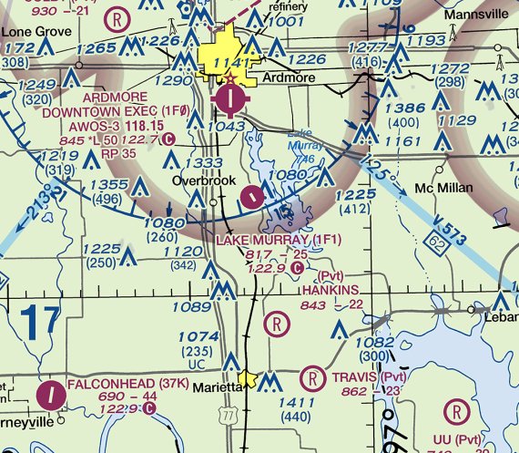
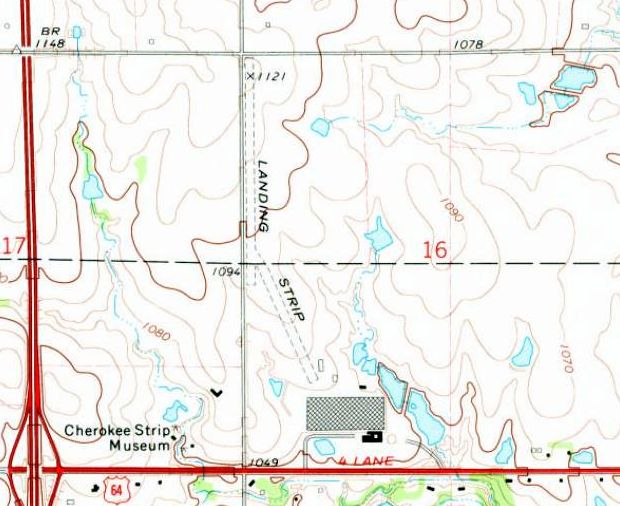
Lake Murray State Park Airport (1F1), Lake Murray, OK
34.074, -97.107 (North of Dallas, TX)
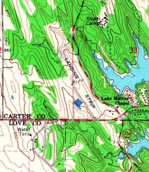
Lake Murray State Park Airport, as depicted on the 1964 USGS topo map.
Lake Murray State Park Airport was not yet depicted on a 1962 aerial photo.
According to its FAA Airport/Facility Directory data, Lake Murray State Park Airport was activated in September 1964.
The earliest depiction which has been located of Lake Murray State Park Airport was on the 1964 USGS topo map.
It depicted a single paved northwest/southeast runway, generically labeled as “Landing Strip”.
The earliest aeronautical chart depiction which has been located of Lake Murray State Park Airport was on the February 1965 Dallas Sectional Chart.
It depicted Lake Murray Airport as having a 2,000' unpaved runway.
The July 1968 Dallas Sectional Chart depicted Lake Murray State Park Airport as having a 2,500' paved northwest/southeast runway.
The earliest photo which has been located of Lake Murray State Park Airport was a 1981 aerial view.
It depicted a single paved northwest/southeast runway, with a paved ramp on the west side.
The earliest photo which is available of Lake Murray State Park Airport was a 5/24/03 photo showing a Cessna 172 on the ramp.
A 2003 aerial view looking east depicted Lake Murray State Park Airport as having an asphalt Runway 14/32, with 1 light single-engine plane on the ramp on the west side.
A 7/27/07 aerial view looking northwest depicted Lake Murray State Park Airport as having an asphalt Runway 14/32.
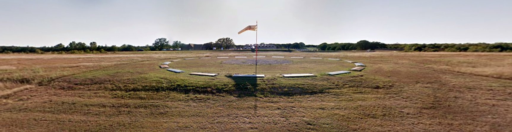
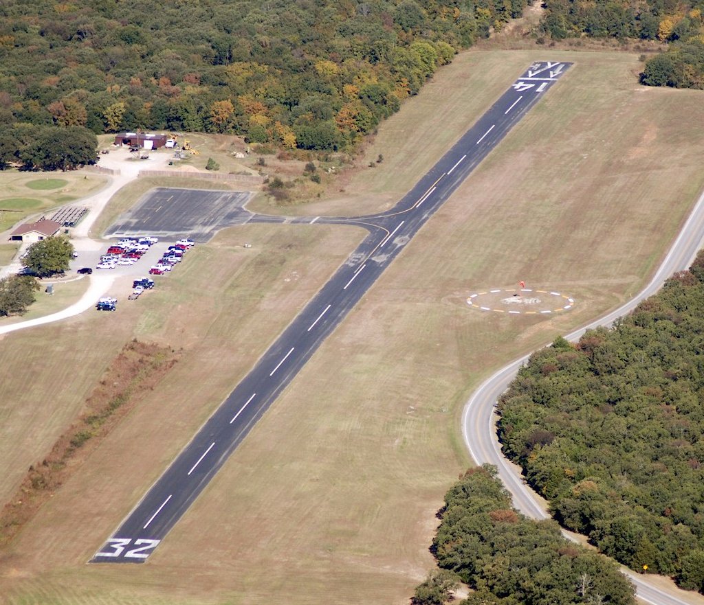
A September 2013 photo looking west at the Lake Murray State Park Airport windsock & segmented circle, with the runway in the background.
According to a 3/17/13 Tulsa Public Radio article entitled “Commission Votes to Close Lake Murray Airport” (courtesy of Brad Baisley):
“The OK Aeronautics Commission has voted to close the Lake Murray State Park Airport,
despite possibly having to repay up to $184,000 in federal grants awarded under a requirement that the airport remain open until 2027.
The OK Tourism Department has said it would like to see the airport closed in order to use the runway area as a new entrance into the adjacent Lake Murray Golf Course.”
A 2014 or earlier aerial view looking northwest depicted Lake Murray State Park Airport as having an asphalt Runway 14/32.
An October 2014 article by Judy Birchler entitled “NO, DON’T BRING YOUR FLY-IN HERE”
recounted her attempt to contact the manager of Lake Murray State Park Airport to inquire about hosting a fly-in,
in which the airport manager actively discouraged any aviation use of the facility:
“I spoke to Carol, the Park Manager. Carol, an employee of the state of OK, apparently views the airport as a liability rather than an asset to the park.
Something they have to put up with until such time the state closes it, probably due to inactivity.
She absolutely refused to discuss the possibility of a fly-in there. Airplanes are apparently discouraged from flying in.”
As of 2016, the FAA Airport/Facility Directory data described Lake Murray State Park Airport as having a 2,500' asphalt Runway 14/32, “in Fair Condition”.
It was said to conduct an average of 50 takeoffs or landings per year,
to be owned by the State of OK, and managed by Carol Conrad, Park Manager.
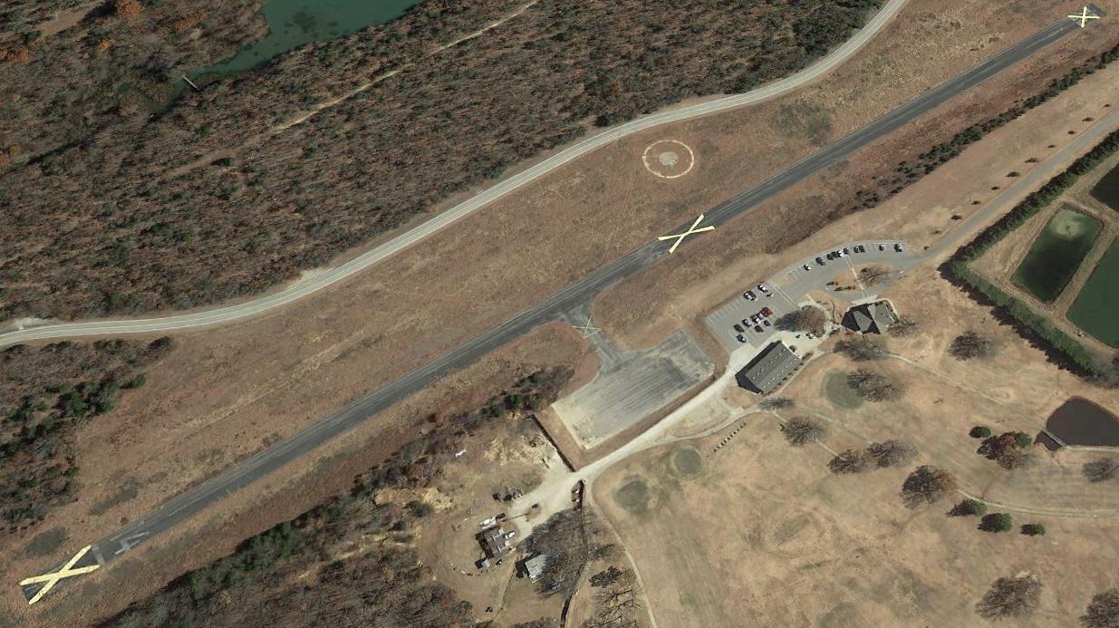
A 2018 aerial view looking east depicted Lake Murray State Park Airport as having closed-runway “X” symbols painted on the runway.
Brad Peden reported on 7/5/18, “Lake Murray State Park Airport is officially closed.
I flew over 7/1/18 & it had large Xs on both ends of the runway & in the middle.
I landed in Ardmore & drove there & the Lake Murray lodge registration was unaware of closure & still telling guests they could pick them up at the airport.
I drove to the airport & the manager for the golf course stated they put the Xs on it about a week earlier. He did not expect it to reopen.”
The September 2018 Dallas Sectional Chart still depicted Lake Murray State Park Airport as open, with a 2,500' paved runway, even though it was closed by that point.
As of 2021, Lake Murray State Park Airport was no longer depicted on Sectional Charts.
Thanks to Brad Baisley for pointing out this airfield.
____________________________________________________
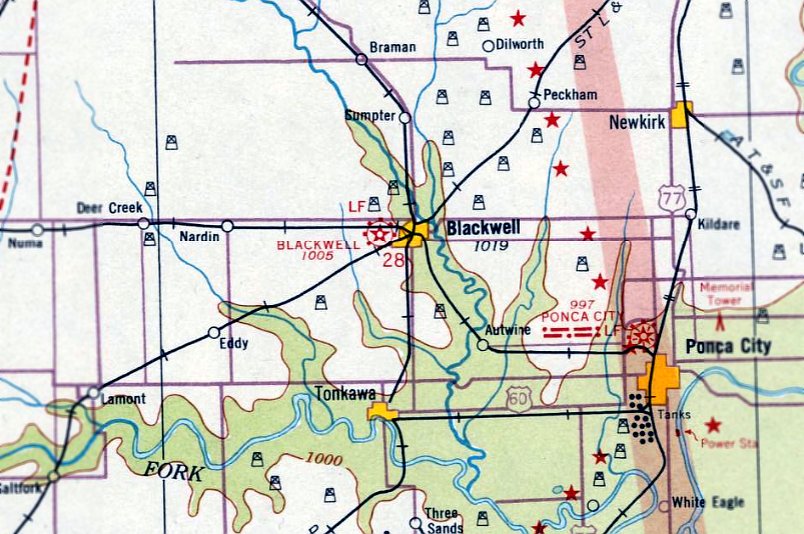
Blackwell Municipal Airport / Earl Henry Airport, Blackwell, OK
36.801, -97.314 (North of Oklahoma City, OK)
Blackwell Airport, as depicted on the March 1933 Wichita Sectional Chart.
According to Chuck Lipps, “Blackwell Airport was started in the early 1930s.”
The earliest depiction which has been located of Blackwell Airport was on the March 1933 Wichita Sectional Chart.
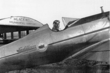
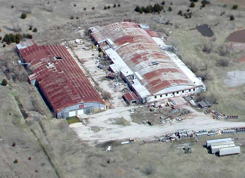
A circa 1940s-50s photo of Earl Henry in his Ryan STA in front of the hangar marked “Blackwell Municipal Airport” (courtesy of Chuck Lipps).
Henry used the Ryan to perform at airshows in the 1940s & 50s.
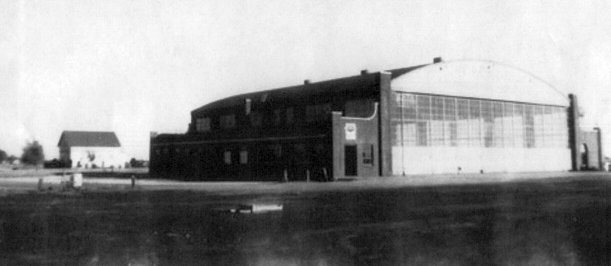
An undated photo of Blackwell Airport's large hangar (courtesy of Chuck Lipps).
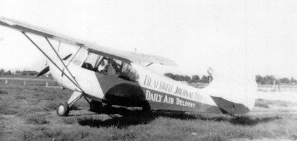
An undated photo of the 1947 Aeronca Champ which was used to deliver papers to farmers around Blackwell (courtesy of Chuck Lipps).

The earliest aerial photo which has been located of Blackwell Municipal Airport was a 4/16/54 USGS aerial view.
It depicted Blackwell as having a single north/south runway, with a building on the east side.
According to Chuck Lipps, “Blackwell Airport was bought by Earl Henry in the mid-1950s & its name was changed then.”
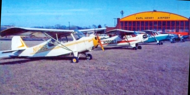
A circa 1960s photo of an Aeronca, Piper, Cessna, and other aircraft at Blackwell Airport, in front of the hangar which had been repainted “Earl Henry Airport” (courtesy of Chuck Lipps).
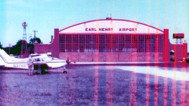
A circa 1960s photo of an unidentified man & a Piper at Blackwell Airport, in front of the hangar painted “Earl Henry Airport” (courtesy of Chuck Lipps).
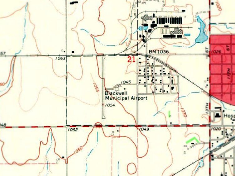
The 1968 USGS topo map depicted Blackwell Municipal Airport as having a single paved north/south runway, with a ramp & 1 small building on the east side.
The last aeronautical chart depiction which has been located of Blackwell Airport was on the January 1969 Wichita Sectional Chart.
It depicted Blackwell Airport as having a 2,400' unpaved runway.
According to Chuck Lipps, “The big hangar burned in the 1980s & the airport was closed.”
The 1985 USGS topo map depicted Blackwell Municipal Airport generically labeled as “Landing Strip”, which usually means the airport was closed by that point.
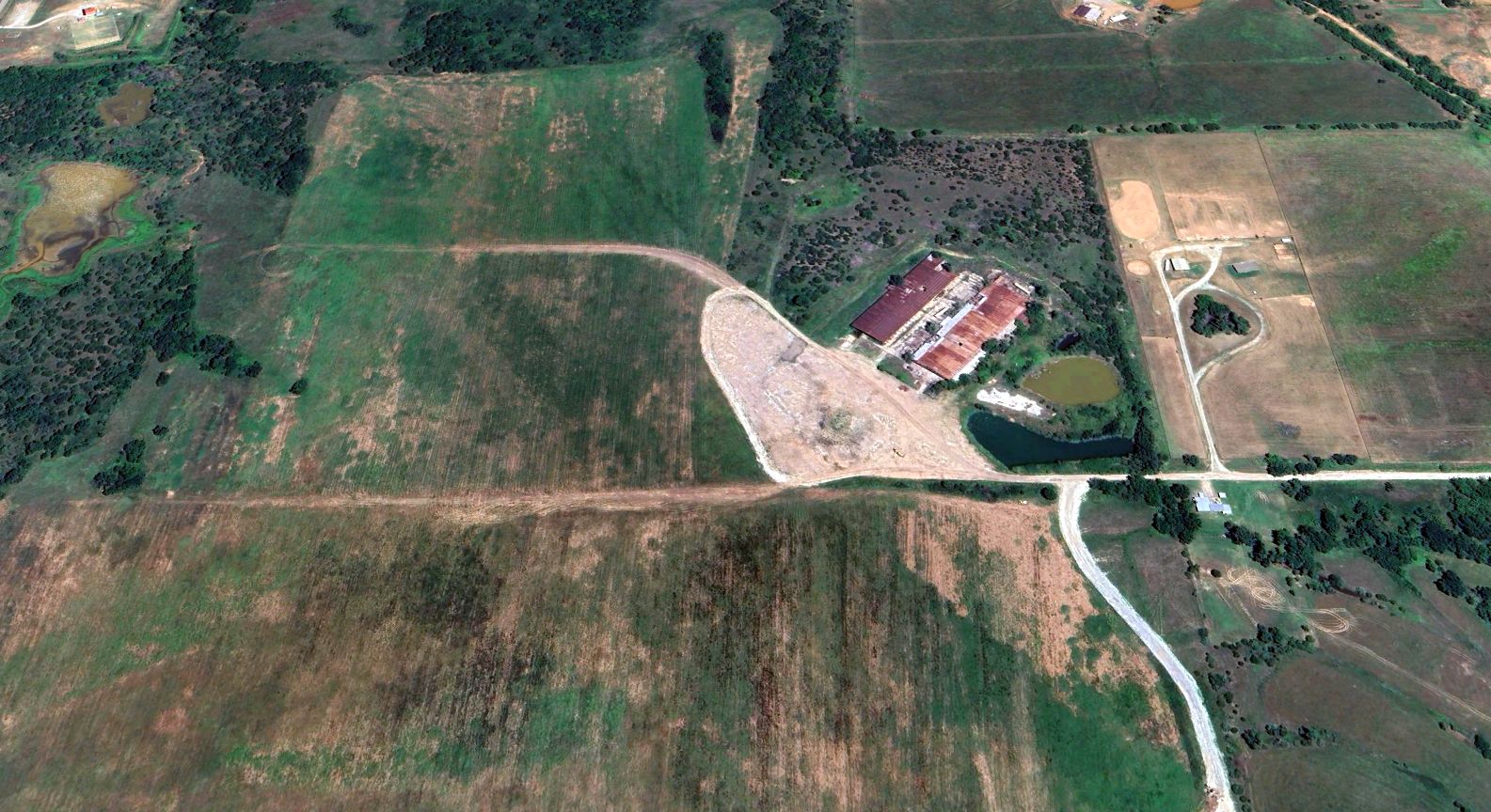
A 1995 USGS aerial view looking northwest at the Blackwell Municipal Airport site showed the remains of the former paved north/south runway, along with the foundation of the hangar on the east side.
According to Chuck Lipps, “The property [of the former hangar] was purchased in 2004 by Jim McBride.”
A 2017 aerial view looking northwest at the site of Blackwell Municipal Airport showed the remains of the middle portion of the former runway remained intact,
but the southern portion had been cleared for a house lot, and softball diamonds had been built over the northern portion.
Chuck Lipps reported in 2020, “Jim McBride recently built a shop on the slab of the old hangar.
My daughter-in-law's father owns the site of the old Blackwell Airport.
The runway is grown over but still can be used since it's still smooth & he keeps it mowed.
The usable portion is about 1,800’ with a wire at one end & trees at the other.
You can see the old runway & the north end terminated by the railroad tracks just by the softball complex.”
Thanks to Chuck Lipps for pointing out this airfield.
____________________________________________________
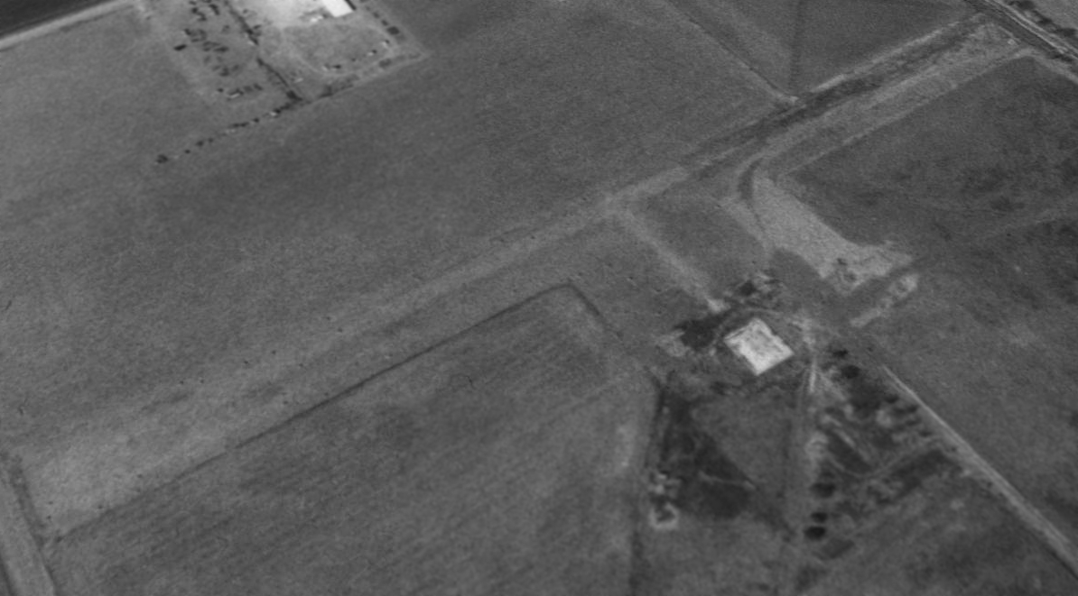
Ditch Witch Airfield, Perry, OK
36.296, -97.318 (North of Oklahoma City, OK)
The Ditch Witch Airfield, as depicted on the 1972 USGS topo map.
Photo of the airfield while in use has not been located.
According to a local resident, “This manufacturing concern under the direction of Ed Malzahn created the world-leading trench/boring equipment in the town of Perry.
The asphalt strip was there from early 1960s. I knew the pilot he had on staff. They a larger hangar & a King Air.
The pilot told the story about one time while taking off to the north - 2 B-52s were being flown from Tinker to McConnell AFB at low altitude.
He did not see them & came up under them pretty close. Said he had return back to change his shorts.
Mr. Malzahn loved to fly & the pilot got lots of hours. Oklahoma Highway Patrol used to land there for coffee at a local coffee shop.”
The Ditch Witch Airfield was not yet depicted on the January 1969 Wichita Sectional Chart.
The earliest depiction which has been located of Ditch Witch Airfield was on the 1972 USGS topo map.
It depicted a single unpaved north/south runway, with a long taxiway leading toward the factory to the southeast.
The earliest photo which has been located of the Ditch Witch Airfield was a 1981 aerial view.
It depicted Ditch Witch Airfield as having 2 grass runways with a few small buildings at the southeast end.
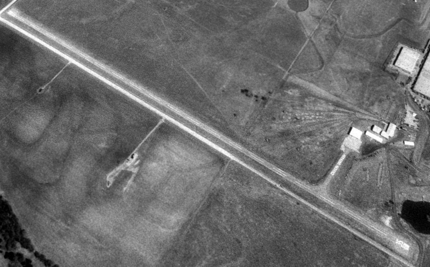
The earliest photo which is available of the Ditch Witch Airfield was a 1995 USGS aerial view looking northeast.
The airfield had evidently gained a paved north/south runway at some point between 1981-95,
and a paved taxiway (on which “Ditch Witch” was painted in large letters) led to a ramp & hangar on the southeast side.
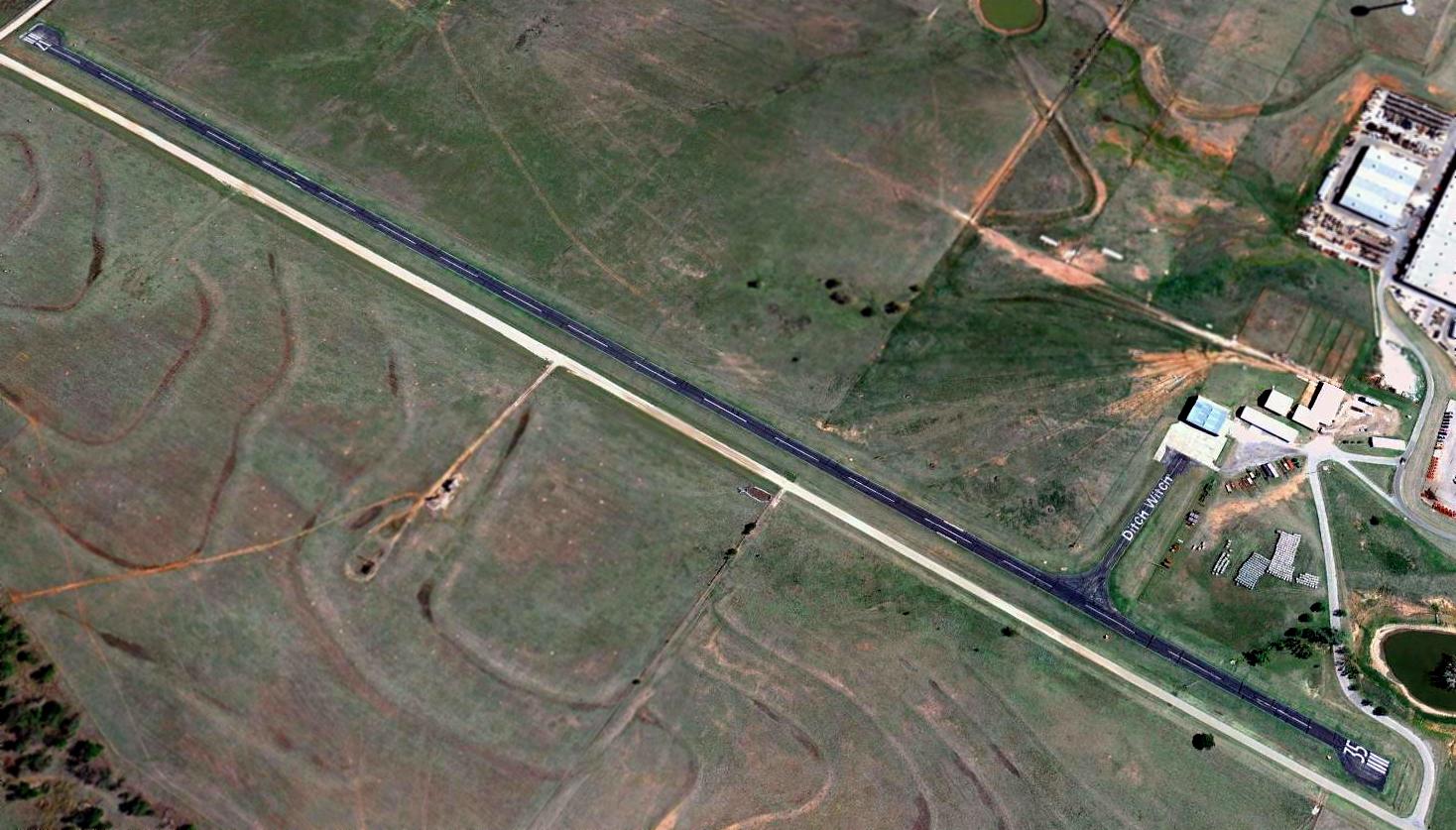
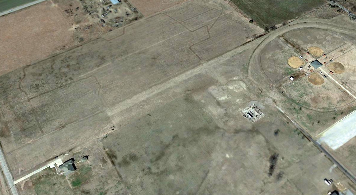
The last photo which has been located showing the Ditch Witch Airfield still painted with active runway markings was a 2011 aerial view looking southeast.
According to a local resident, “The asphalt strip was cleared in the early 2010s.”
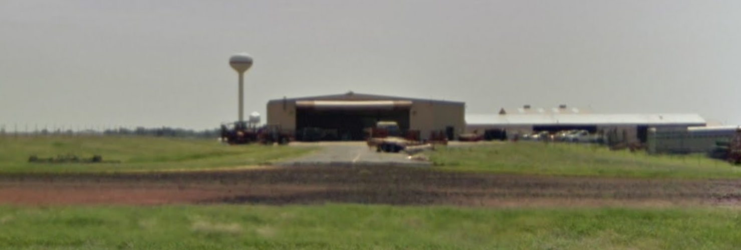
A June 2013 photo looking east at the Ditch Witch Airfield hangar & runway.
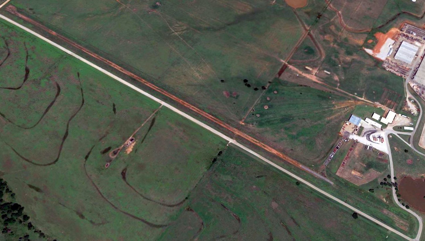
A 2015 aerial view looking southeast at the Ditch Witch Airfield showed the majority of the runway pavement had been removed, but the “Ditch Witch” lettering was still visible on the taxiway.
The site of Ditch Witch Airfield is located northeast of the intersection of Fir Street & 25th Street.
____________________________________________________
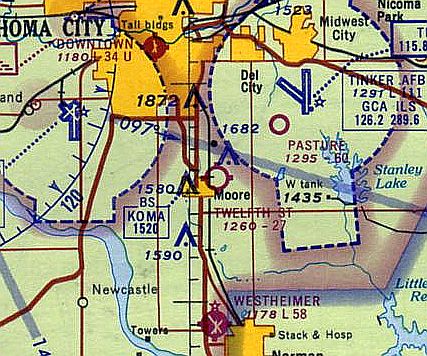
Wheatley Airport / Barkhurst Field, Moore, OK
35.35, -97.48 (South of Oklahoma City, OK)
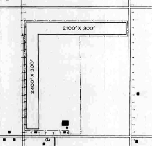
Wheatley Airport / Barkhurst Field, as depicted in the 1945 AAF Airfield Directory (courtesy of Scott Murdock).
This small general aviation airport on the south side of OK City was evidently established at some point between 1944-45,
as it was not yet listed among active airfields in The Airport Directory Company's 1937 Airport Directory (courtesy of Bob Rambo)
nor depicted on the 1938 USGS topo map or the April 1944 OK City Sectional Chart (courtesy of Ron Plante).
The earliest depiction which has been located of Wheatley Airport / Barkhurst Field
was a depiction in the 1945 AAF Airfield Directory (courtesy of Scott Murdock).
The directory described Wheatley Airport / Barkhurst Field as a 160 acre square property
having 2 sod runways, measuring 2,400' north/south & 2,100' east/west.
The field was said to have 3 hangars, of which the largest was a 82' x 70' steel structure.
Wheatley Airport / Barkhurst Field was described as being owned & operated by private interests.
Wheatley Airport was depicted as a commercial/municipal airport on the 1945 OK City Sectional Chart (courtesy of Chris Kennedy).
The last aeronautical chart depiction which has been located of Wheatley Airport was on the February 1950 OK City Sectional Chart,
which depicted Wheatley as having a 2,400' unpaved runway.
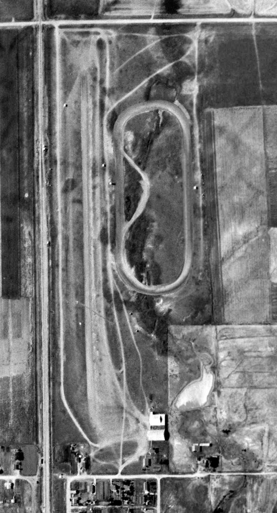
The earliest photo which has been located of Wheatley Airport was a 6/25/54 USGS aerial view.
It depicted a north/south runway, whereas the previous crosswind runway had been replaced with an oval racetrack.
Two hangars were on the southeast side of the airport, but there were no aircraft visible, so the airport may have already been closed by that point.
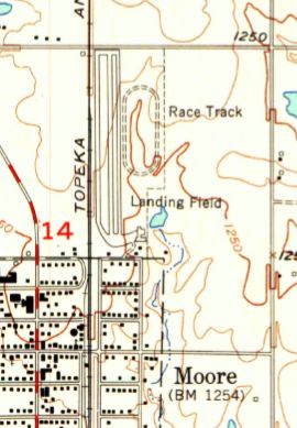
The last topo map depiction which has been located of Wheatley Airport was on the 1956 USGS topo map.
It depicted a north/south runway with a parallel taxiway on either side, labeled simply as “Landing Field”.
A ramp with a few small buildings was depicted on the southeast side.
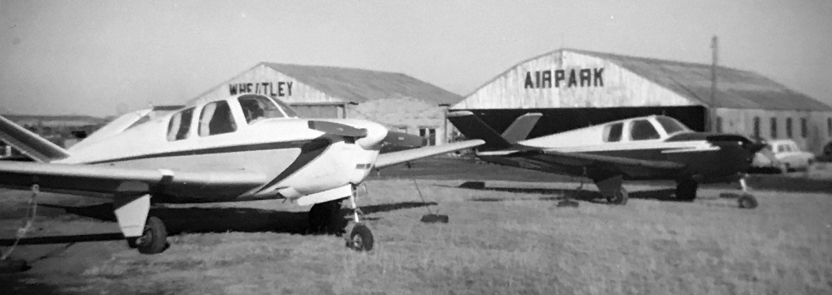
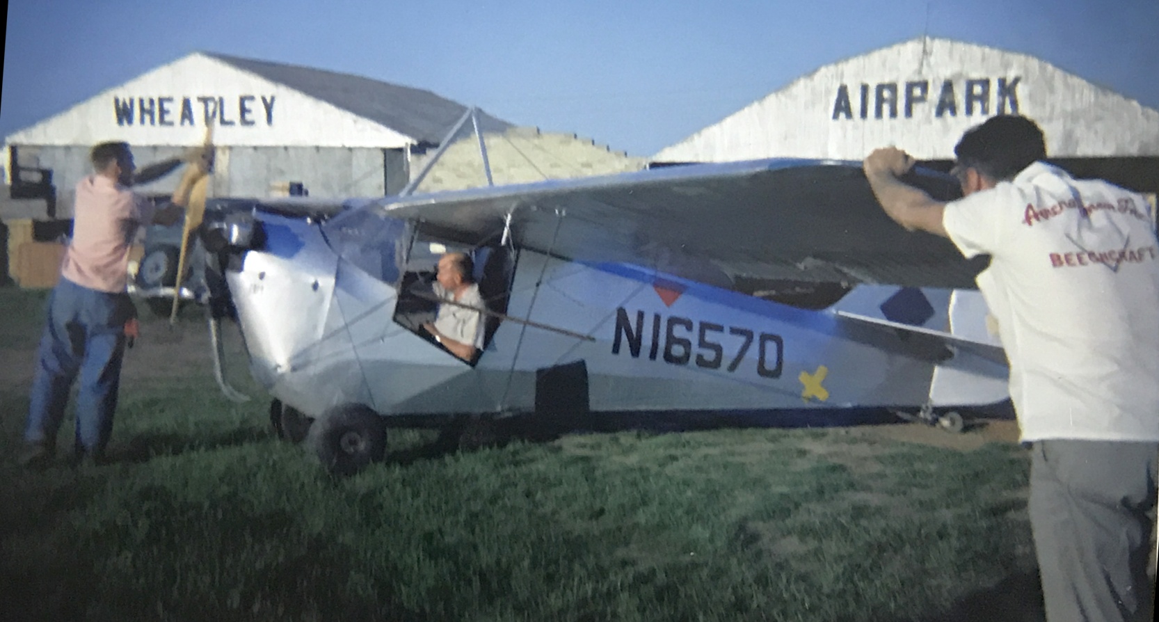
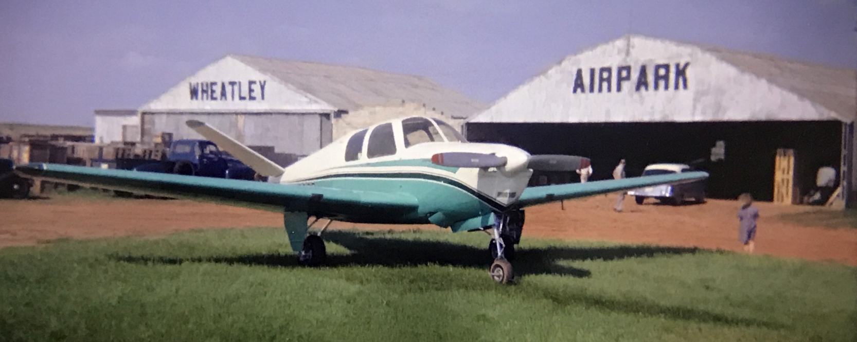
A circa 1958-62 photo (courtesy of Mike Redpath) of 2 Beech Bonanzas in front of the Wheatley Airpark hangars.
Mike Redpath recalled, “My grandfather Roy Good ran Wheatley from 1958-1962.”
A circa 1958-62 photo (courtesy of Mike Redpath) of a 1936 Aeronca C-3 in front of the Wheatley Airpark hangars.
A circa 1958-62 photo (courtesy of Mike Redpath) of a Beech Bonanza in front of the Wheatley Airpark hangars.
Mike recalled, “My grandfather ran Wheatley [until] the tornado blew the airport away & moved across the street & opened Twelfth Street Airpark.”
Wheatley Airport was no longer depicted on the March 1960 OK City Sectional Chart.
A 1995 USGS aerial photo showed a large building had been constructed on the north side of the Wheatley Airport site,
but the majority of the property remained clear.
But there was no specific recognizable remains of the airfield.

An 8/9/12 aerial view showed the site of Wheatley Airport had been covered with buildings.
The site of Wheatley Airport is located southwest of the intersection of Northeast 12th Street & Messenger Drive.
____________________________________________________
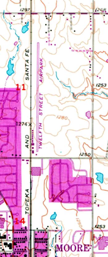
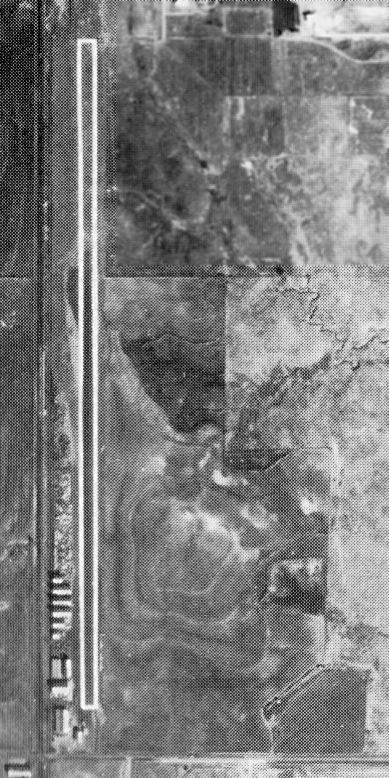
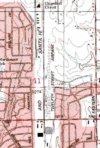
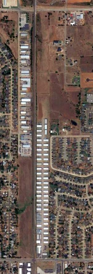
Twelfth Street Airpark / Moore Airport, Moore, OK
35.36, -97.48 (South of Oklahoma City, OK)
Twelfth Street Airpark, as depicted on the 1965 OK City Sectional Chart (courtesy of John Price).
This small general aviation airport on the south side of OK City was evidently established at some point between 1961-65,
as it was not yet depicted on the 1956 USGS topo map or the February 1961 OK City Sectional Chart.
Mike recalled, “My grandfather ran Wheatley Airpark [until he] moved across the street & opened Twelfth Street Airpark.”
The earliest depiction which has been located of Twelfth Street Airpark was on the 1965 OK City Sectional Chart (courtesy of John Price),
which depicted Twelfth Street as having a 2,700' unpaved runway.
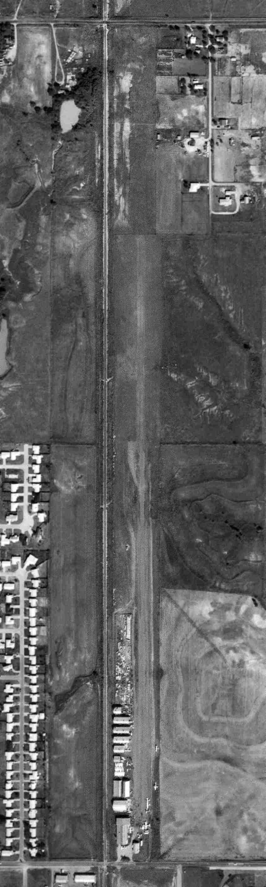
The earliest photo which has been located of Twelfth Street Airpark was a 9/10/69 USGS aerial view.
It depicted 6 single-engine aircraft parked along the southeast side of a single north/south runway, along with a cluster of small hangars on the southwest side.
The 1969 USGS topo map depicted Twelfth Street Airpark as having a north/south runway with a row of small buildings along the southwest side.
The last aeronautical chart depiction which has been located of Twelfth Street Airpark was on the February 1973 Dallas Sectional Chart (courtesy of Ron Plante).
It depicted Twelfth Street Airpark as having a single paved 1,900' north/south runway.
An undated aerial view from the 1978 OK Airport Directory (courtesy of Frank Holbert)
depicted several light aircraft parked along the southeast side of Twelfth Street Airpark's north/south runway.
The last labeled depiction which has been located of Twelfth Street Airpark was on the 1986 USGS topo map.
It depicted the field in basically the same manner as was depicted on the 1969 topo map.
At some point between 1986-88, Twelfth Street Airpark was evidently renamed Moore Airport,
as that is how it was labeled on the January 1988 Dallas Sectional Chart (courtesy of Ron Plante).
It depicted Moore as having a 3,200' unpaved runway.
The last aeronautical chart depiction which has been located of Moore Airport was on the June 1993 Dallas Sectional Chart (courtesy of Ron Plante).
It depicted Moore as a private airfield having a 2,200' unpaved runway.
Tom Solinski reported in 2022, “I got to meet the man that owns the property.
He said the major reason for the airport to shut down was the installation of a tall broadcasting tower just north of the field.
The FAA sent them a letter & said the FAA no longer considered it safe for public use. So it got shut down.”
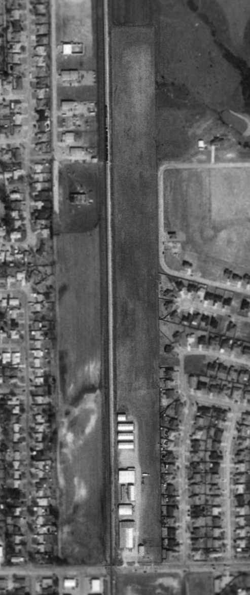
The last photo which has been located showing Twelfth Street Airpark still intact a 1996 USGS aerial view.
The airport may already have been closed by this point, as there were no aircraft visible on the property.
A 2002 aerial photo showed a row of small buildings (storage units?) had been built at some point between 1995-2002 to the north of the hangars.
An 8/9/12 aerial view of the Twelfth Street Airpark site, with a row of small buildings (storage units?) having been built along the runway,
but some former hangars remained on the southwest side of the property.
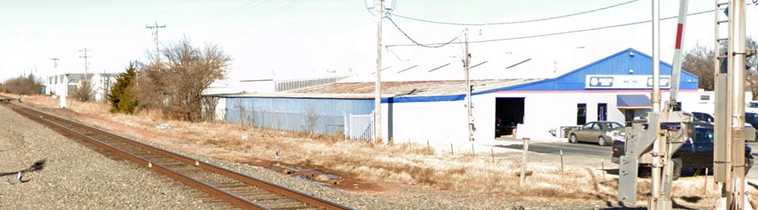
A January 2022 photo looking northeast at former Twelfth Street Airpark hangars on the southwest side of the airport site.
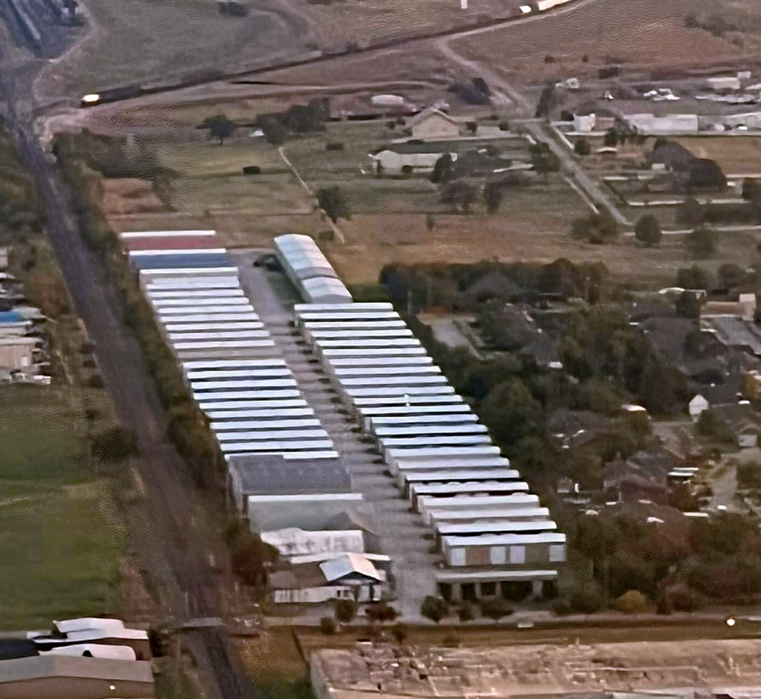
A September 2022 aerial view by Mike Redpath looking northeast at the Twelfth Street Airpark site, with a row of small buildings (storage units?) having been built along the runway,
but some former hangars remained on the southwest side of the property.
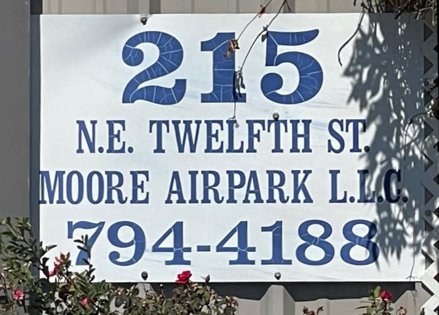
A September 2022 photo by Tom Solinski of a sign on a former Twelfth Street Airpark building.
The site of Twelfth Street Airpark is located northwest of the intersection of Northeast 12th Street & Smoking Tree Street.
____________________________________________________
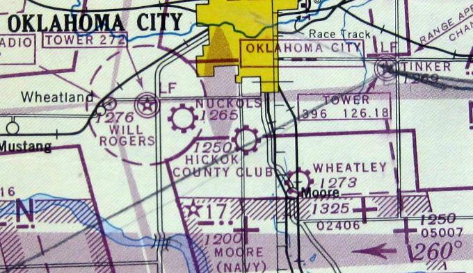
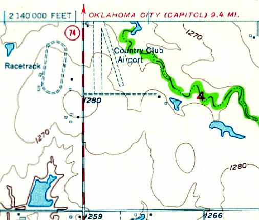
Hickok Country Club Airport / South Shields Airport, Oklahoma City, OK
35.38, -97.53 (Southwest of Downtown Oklahoma City, OK)
A circa 1943-45 aerial view looking north at Hickok Country Club Airport
from the 1945 AAF Airfield Directory (courtesy of Scott Murdock).
This small general aviation airport on the south side of OK City was evidently established at some point between 1939-45,
as it was not yet depicted on the June 1939 OK City Sectional Chart (courtesy of Paul Columbus).
The earliest depiction which has been located of Hickok Country Club Airport was a circa 1943-45 aerial view
from the 1945 AAF Airfield Directory (courtesy of Scott Murdock).
It depicted Hickok as having 2 unpaved runways.
The earliest aeronautical chart depiction which has been located of Hickok Country Club Airport
was on the April 1944 OK City Sectional Chart (courtesy of Ron Plante).
The 1945 AAF Airfield Directory (courtesy of Scott Murdock) described Hickok Country Club Airport
as a 150 acre rectangular property having 2 sod 2,100' runways, of which the north/south runway also had a 1,900' asphalt stabilized inset.
The field was said to have 2 hangars, of which the largest was a 75' square brick, wood, and metal structure.
Hickok Country Club Airport was described as being owned & operated by private interests.
The 1949 OK City Sectional Chart (courtesy of John Price) depicted Country Club Airport as having a 2,100' unpaved runway.
Mike Lane recalled, “Country Club, also later known at Keith Kale, southwest of 89th & Western was were my Dad & 2 brothers learned to fly a J3 Cub.
Our instructor was Vernon Westbrook.”
The last photo which has been located of Country Club Airport was a 6/25/54 USGS aerial view.
The airport consisted of 2 unpaved runways, with 2 hangars & a T-hangar on the northwest side.
But the airport may already have been closed by this point, as there were no aircraft visible on the field.
The last topo map depiction which has been located of Country Club Airport was on the 1955 USGS topo map.
It depicted Country Club Airport as having 2 unpaved runways, with 2 small buildings on the northwest side.
The last depiction which has been located of Country Club Airport was on the August 1958 OK City Sectional Chart.
It depicted Country Club Airport as having a 2,400' unpaved runway.
Country Club Airport was evidently closed (for reasons unknown) at some point between 1958-59,
as it was no longer depicted on the March 1959 OK City Sectional Chart.
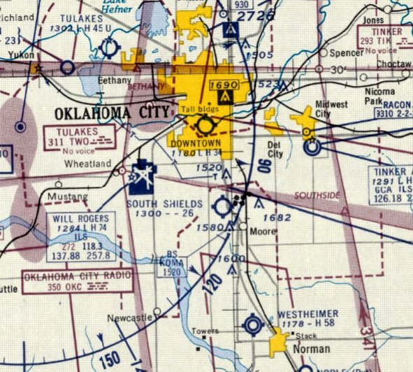
Country Club Airport was evidently reopened as South Shields Airport at some point in 1959,
as that is how it was labeled on the August 1959 OK City Sectional Chart.
It was depicted as having a 2,600' unpaved runway.
The last depiction which has been located of South Shields Airport was on the February 1961 OK City Sectional Chart.
It depicted South Shields Airport as having a 2,500' unpaved runway.
Mike Lane recalled, “South Shields Airport ran southwest from what is now 27th & Janeway in Moore.
The owner was Leo Overturf. My instructor for one flight was Burrell Tibbs who flew with Wiley Post. Another instructor was John Gardner.”
South Shields Airport was evidently closed (for reasons unknown) at some point between 1961-65,
as it was no longer depicted on the April 1965 OK City Sectional Chart.
The 1970 USGS topo map just depicted a blank area on the site of South Shields Airport.
The 1976 USGS topo map depicted Brookwood Drive having been built through the southern portion of the South Shields Airport site.
A 1990 USGS aerial photo showed the Brookwood North Shopping Center on the north side of the South Shields Airport site,
and housing filling the southern portion.
An 8/9/12 aerial view showed no trace remaining of Country Club Airport / South Shields Airport.
Thomas Solinski recalled, “I lived in a duplex that was built on the diagonal runway! [I always] wondered why I liked living there - I was on an airport.
The apartment complex is called Country Club Village. There used to be a miniature golf course through the wooded lake area in the middle of the picture.”
Tom Solinski reported, “While working for the FAA I rented a duplex close to work.
That duplex sits on what would have been the southeast end of the diagonal runway at the Hickok Country Club Airport.
I was drawn to an aviation site & I didn’t even know it.”
The site of South Shields Airport is located southeast of the intersection of Southwest 89th Street & South Western Avenue.
____________________________________________________
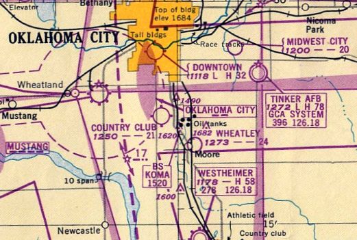
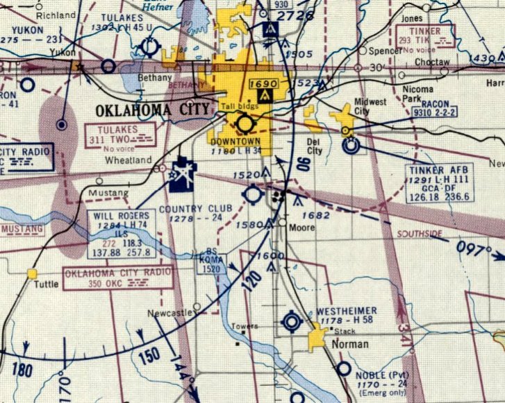
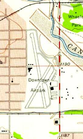
Oklahoma City Downtown Airpark (2DT), Oklahoma City, OK
35.45, -97.53 (Southwest of Downtown Oklahoma City, OK)
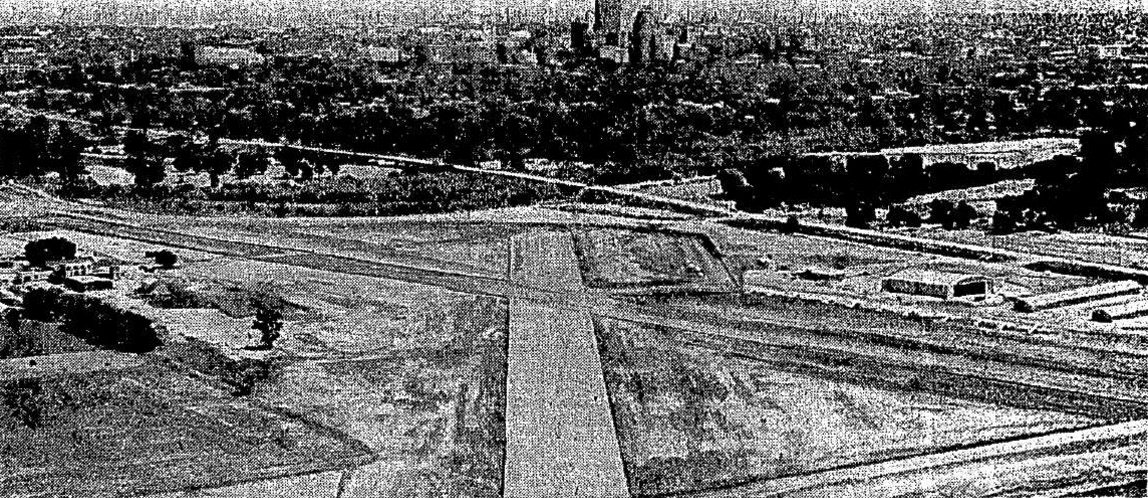
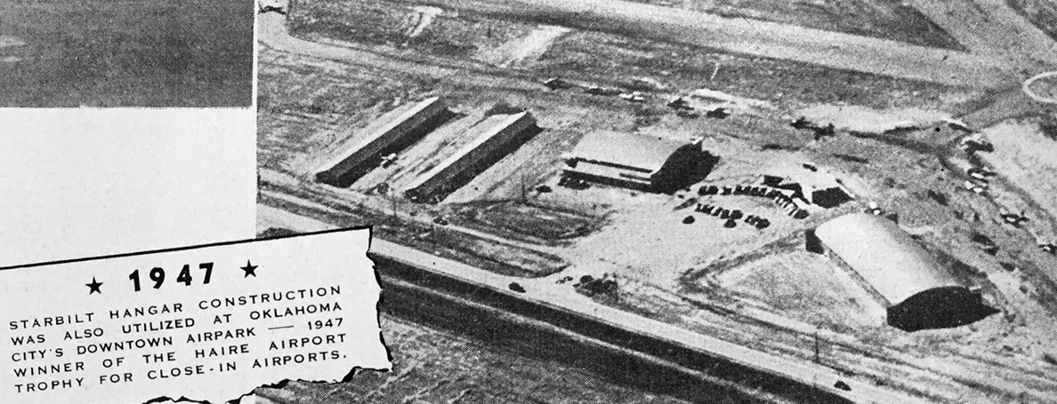
An undated aerial view looking northeast at Oklahoma City Downtown Airpark from a 6/29/47 article (courtesy of Wesley Horton).
Downtown Airpark was not yet depicted on the April 1944 OK City Sectional Chart (courtesy of Ron Plante).
Downtown Airpark was begun by W.D. "Bill" Amis, Dean McGee, Hudgins-Thompson-Ball Associates, OG&E, and several other investors.
Upon it's opening, it was declared to be a "pioneer" for privately owned airport facilities.
The earliest depiction which has been located of Oklahoma City Downtown Airpark
was an undated aerial view looking northeast from a 6/29/47 article (courtesy of Wesley Horton).
It depicted Downtown Airpark as having 2 runways, with 1 arch-roof hangar & 2 long T-hangars on the east side.
According to a 7/25/46, Oklahoman article, “The only other large city in the nation with landing facilities in the downtown section [is] Indianapolis.
Actually, the Oklahoma City airpark is the first experiment to determine if such a landing field
is a practical investment for private capital, aviation leaders say.”
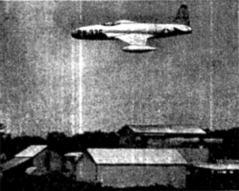
A 7/4/47 photo from the Oklahoman of a Lockheed P-80 jet fighter flyby over Downtown Airpark,
part of the Airpark's opening celebrations, which drew 3,500 attendees.
An undated aerial view looking northeast at Oklahoma City Downtown Airpark from a January 1948 article (courtesy of Kevin Walsh)
showed that a 2nd arch-roof hangar had been added since the earlier aerial view.
An undated aerial view looking west at Oklahoma City Downtown Airpark's hangars from a January 1948 article (courtesy of Kevin Walsh).
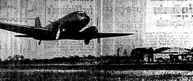
A 11/14/48 photo from the Oklahoman of a Douglas DC-3 departing from Downtown Airpark.
The caption read, “The Downtown Airpark Saturday was opened to DC-3-class airplanes.
And to prove the 21-passenger airplanes can land & takeoff at the small field with safety,
Harry Reed, manager, made arrangements for one to come in. It's shown here on takeoff.
A Kerr-McGee Oil Industries Inc. plane, it's flown by K.B. Hunter, company pilot.
Hunter landed the large plane on the north-south runway on less than the 1st half of the runway which is 3,200' long.
At takeoff he was airborne in even less space, as can be seen above.”
Don Williams recalled, “Downtown Airpark... I worked at the airport in 1948-49, learned to fly there, knew Byford the bootlegger,
the Amis Brothers, Beverly Osborne (who owned the flight school) and ate at the Airpark restaurant when I worked there.
I even took lessons from a guy who charged me a meal per flight hour, to be taken at the restaurant.
I bought 10 hours (with or without instructor) for $85 from Beverly's flight school.
I was what they called a Jr. Mechanic & I did some work on planes, but also gassed them, parked them, and dealt with fly-in visitors.
I also swept the hangars & mowed the grass.
We had a 'long' runway which would probably be called runway 0x. There was a shorter runway which would be 4 or so.
That main runway headed straight for downtown OKC, just across the river so we had to turn & climb fairly quickly.
At the end of the runway there was a willow-tree grove, associated with the river & you had to clear that.”
Don continued, “My primary instructors were Cal Appleby & the famous Burrell Tibbs, who taught Wiley Post to fly.
Post first joined Tibbs' flying circus as a parachute jumper.
I also took lessons from an unemployed preacher; I paid for the plane & he earned one meal per flight hour.
About the J-3: it was indeed difficult to fly & impossible to land, in contrast to what most folks claim.
I flew pretty well, but had one incident when landing South on the long runway.
I got down early but wasn't really settled when I got to the cross-runway intersection.
I ended up making a right turn onto that runway, riding only on the left wheel (no one saw me, luckily).
The first Aero Commander was purchased by the airport owners & they built a factory for it & for years afterwards had a giant service facility at that airport.
We did a lot of airplane rebuilding there.”
The earliest aeronautical chart depiction which has been located of Downtown Airpark was on the 1949 OK City Sectional Chart (courtesy of John Price),
which depicted Downtown as having a 3,200' paved runway.
Don Williams recalled, “Downtown Airpark... I have many fond memories from working there in the 1950 timeframe.
I was a 'Junior Mechanic' there while in Capital Hill HS, graduating in 1950.
I serviced & parked planes, including the prototype Aero Commander. I ran a tractor mower & many times mowed the entire property.
The drainage ditch along South Western was much deeper & steeper than now & the tractor had to deal with a nearly 45 degree slope.
I remember Byford the bootlegger & his evening stories, and the DC-3 he ran at night, the plane coming in with red mud all over it.
He described the olden days when he ran semitrailers & returned with cash-filled shoe boxes.
Beverly's flying service: Learned to fly, and my instructors included two notable guys, Cal Appleby & Burrell Tibbs.
I remember flying with Tibbs & he would sometimes fall asleep during my lessons.
Someone once quoted Tibbs as saying he 'could teach a rock to fly'.”"
Don continued, “The airport manager, Major Harry Reed went to Dallas on weekends to fly Marine Corps Corsairs.
He was called up for the Korean war & didn't survive. In my mind, and others, he was a man to be looked up to, before James Bond came to be.
He played a joke with me at a party in the terminal.
After we replaced the windshield in a plane Major Reed owned (windshields turned yellow in those days), the mechanic suggested we 'test hop' it to 'check the installation'.
I had previously had some lessons in that plane & knew it's poor gliding characteristics.
With me in the back seat, we went around one time & on the approach, the plane stalled about 100' up & we pancaked short of the runway (just over a high canal embankment) and the plane was totaled.
The only serious crash at the airport. We were scratched but otherwise uninjured. The plane had just been gassed, but no fire.
The main hangar had a car lift & I was able, with the volunteer help of a mechanic, to rebuild the engine & front suspension of my family Pontiac.
I remember the restaurant & the lady who owned it. Very good for a small airport in those days.”
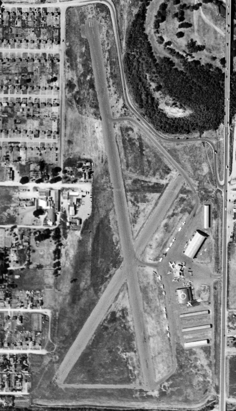
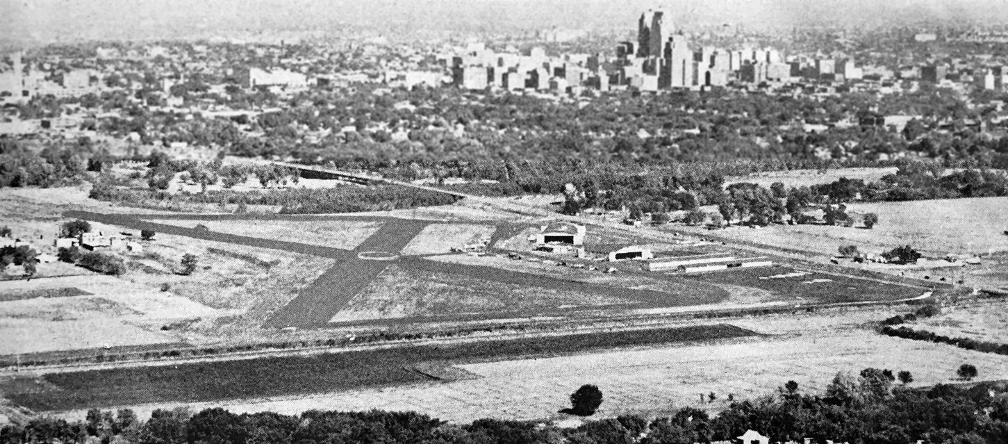
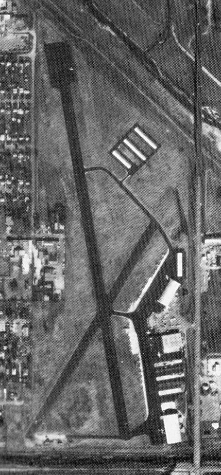
A 6/24/54 USGS aerial view depicted Downtown Airpark as having 2 paved runways, taxiways, and several hangars along the east side of the field,
near which were parked more than 2-dozen general aviation aircraft.
A 7/28/55 Oklahoman article described the small terminal building as "vaguely art deco."
The article said, "The restaurant at the north end [of the terminal], with its blue vinyl booths & wobbly pedestal tables,
serves grilled hamburgers & fries & chicken fry with mashed potatoes & fried okra."
In a 1955 Oklahoman article, it was said that of the 300 private planes then said to be owned by Oklahoma Citians,
100 of them were housed in the Downtown Airpark.
Mike Lane recalled, “I flew at Downtown Airpark at 1700 South Western in 1955. My instructor there was Archie Huff.”
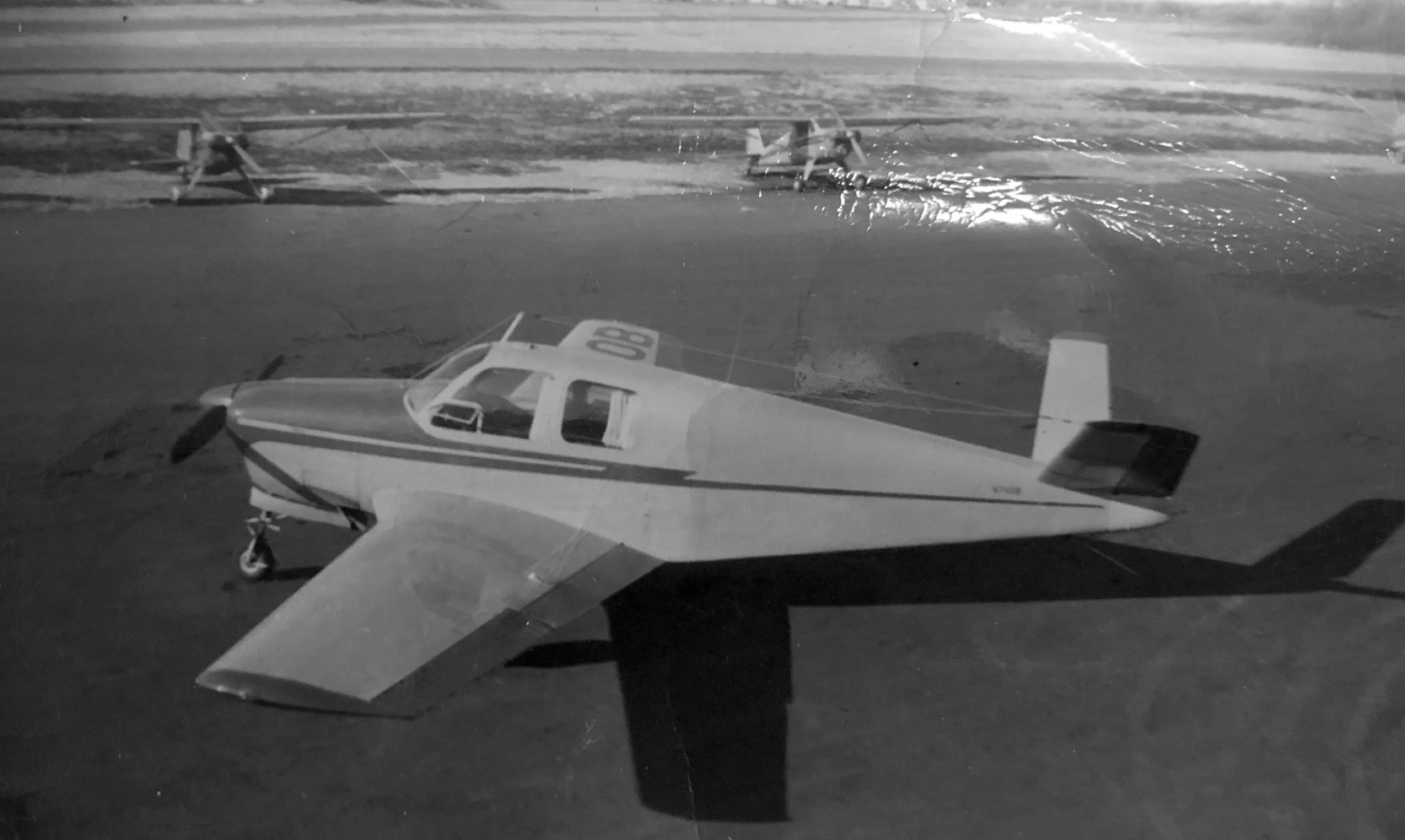
A 1956 photo of Mike Lane's father's Beech Bonanza at OK City Downtown Airpark.
A proposal to annex the Downtown Airpark property into the city limits failed in 1956.
The 1956 USGS topo map depicted Downtown Airpark as having 2 paved runways, taxiways, and several hangars along the east side of the field.
Ralph Compton, recalled, “Burl Tibbs was my flight instructor at Downtown Airpark in Oklahoma City in the summer of 1957.
I later found out that Tibbs was quite a aviation pioneer & very well known in the early days.
As a kid in 1957 I had no idea about that & thought that he was just a very exacting instructor that expected a student to perform well.
I don't recall any positive comments from him until I left OK City & he said to me, 'Son you are going to be a damn good pilot.'”
The Downtown Airpark property was brought within Oklahoma City's limits in 1959.
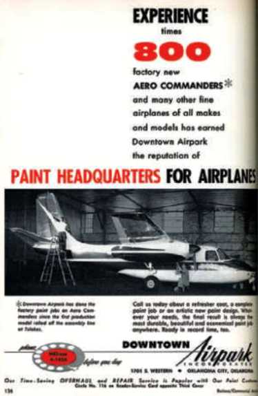
An advertisement for Downtown Airpark in the April 1960 Business & Commercial Aviation magazine
boasted that Downtown Airpark was the “Paint headquarters for airplanes.”
Downtown Airpark became a full service facility, and housed a major service center for Aero Commander aircraft.
It came to include 5 large hangars, several other small hangars, and an administration / terminal building which included a restaurant.
The 1965 OK City Sectional Chart (courtesy of John Price)
depicted Downtown Airpark as having a 3,400' paved runway.
The February 1973 Dallas Sectional Chart (courtesy of Ron Plante)
depicted Downtown Airpark as having 2 paved runways, with the longest being 3,200'.
A 11/4/76 Oklahoman article was entitled "World Flies Into 'Small-Town' Airpark."
It said, “The small privately owned airpark does an annual business totaling more than $2 million, reports Ray Wilson, General Manager.”
"Most of our business comes from out of Oklahoma," Wilson said.
The article continued, “Aircraft are flown in for modification from practically every state in the nation & many foreign countries.
Right now the airpark is converting a North American Rockwell 690A turboprop into a photographic plane
for a department of the United Nations in Geneva, Switzerland.”
"They're going to use it to take infrared photographs of opium fields in Turkey," Wilson said.
The article continued, “The airfield, which is in the shadow of downtown buildings, is also a distributorship for Aero Commander aircraft.
For a number of years, the airpark has had contracts with the manufacturers of small aircraft
and with the U.S. Department of Defense to install interior trim, radio & electronic equipment & to paint the exterior of planes.”
An undated aerial view from the 1978 OK Airport Directory (courtesy of Frank Holbert) depicted Downtown Airpark
as having 2 asphalt runways, with numerous hangars on the east side.
In April 1985, Mayor Andy Coats proposed that the airpark be acquired by the city via condemnation or other procedures & that it become the site of a new racetrack facility.
Luckily that plan did not come to pass.
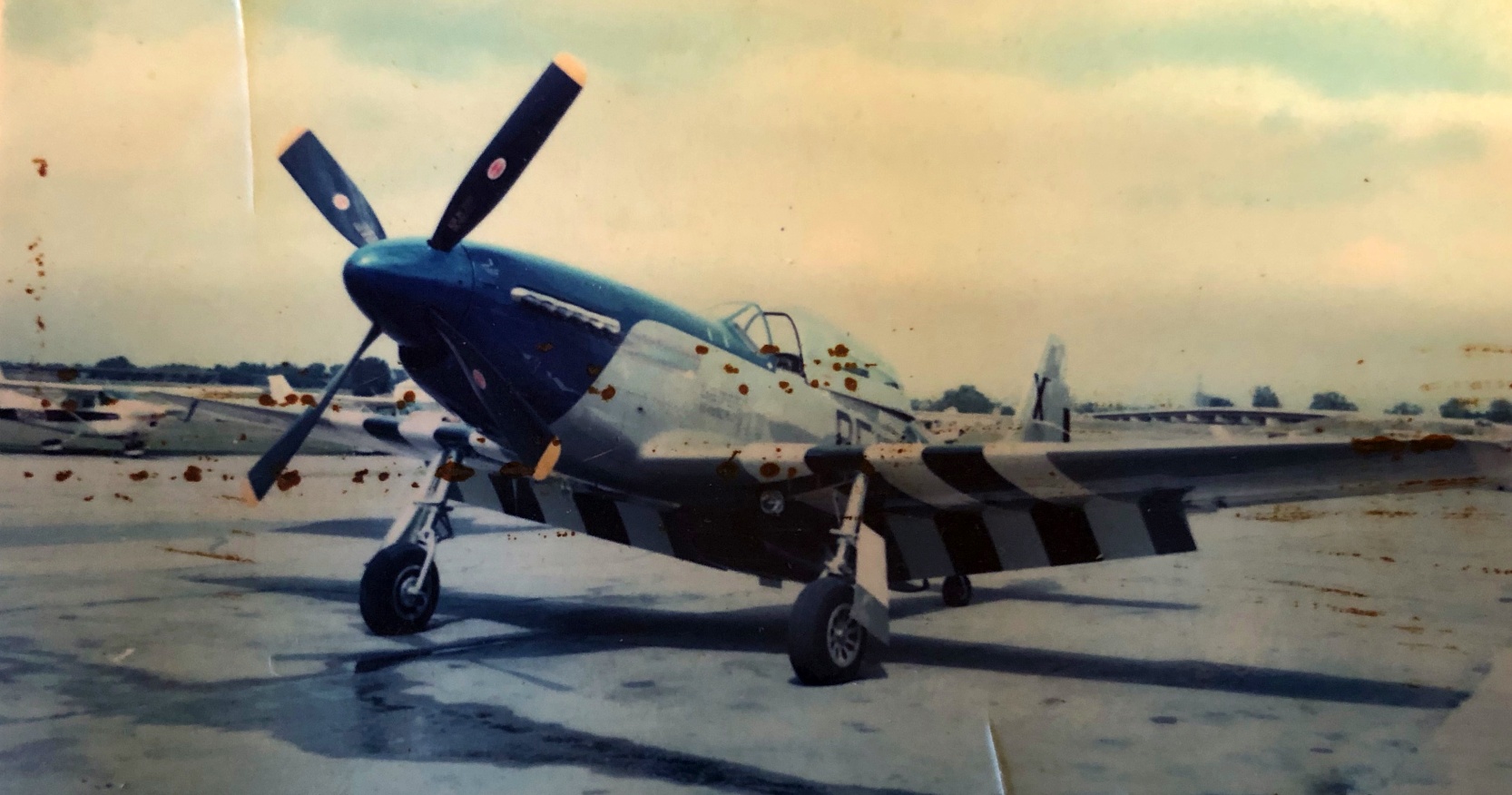
A 1985 photo (courtesy of Mike Lane) of a North American P-51D Mustang fighter at OK City Downtown Airpark.
A circa 1985 photo (courtesy of Mike Lane) of a Ford Tri-Motor at OK City Downtown Airpark.
The 1986 USGS topo map depicted Downtown Airpark as having 2 paved runways, taxiways, and several hangars along the east side of the field.
A 7/11/87 Oklahoman article said that Downtown Airpark claimed to have the largest Commander parts inventory in the world.
A 1990 USGS aerial view looking northwest depicted a total of 11 aircraft parked at Downtown Airpark.
The last aeronautical chart depiction which has been located of Downtown Airpark
was on the June 1993 Dallas Sectional Chart (courtesy of Ron Plante).
It depicted Downtown Airpark as having 2 paved runways, with the longest being 3,200'.
A 6/15/95 photo of a Rockwell 690B Turbo Commander at Oklahoma City Downtown Airpark.
The airpark's connection with Aero Commander was significant enough for it to host a reunion in 1995.
A 6/16/95 Oklahoman article reported that "Dozens of venerable twin-engine 'Aero Commander' aircraft
are expected as far away as Germany, Australia & Sweden for the inaugural meeting
of the 'Twin Commander Flight Group' today at Downtown Airpark.
Defense attorney F. Lee Bailey, also a twin-Commander flier, is expected for the gathering."
An October 1996 photo (courtesy of Mike Lane) of a group with an Aero Commander in front of a Downtown Airpark Inc. hangar.
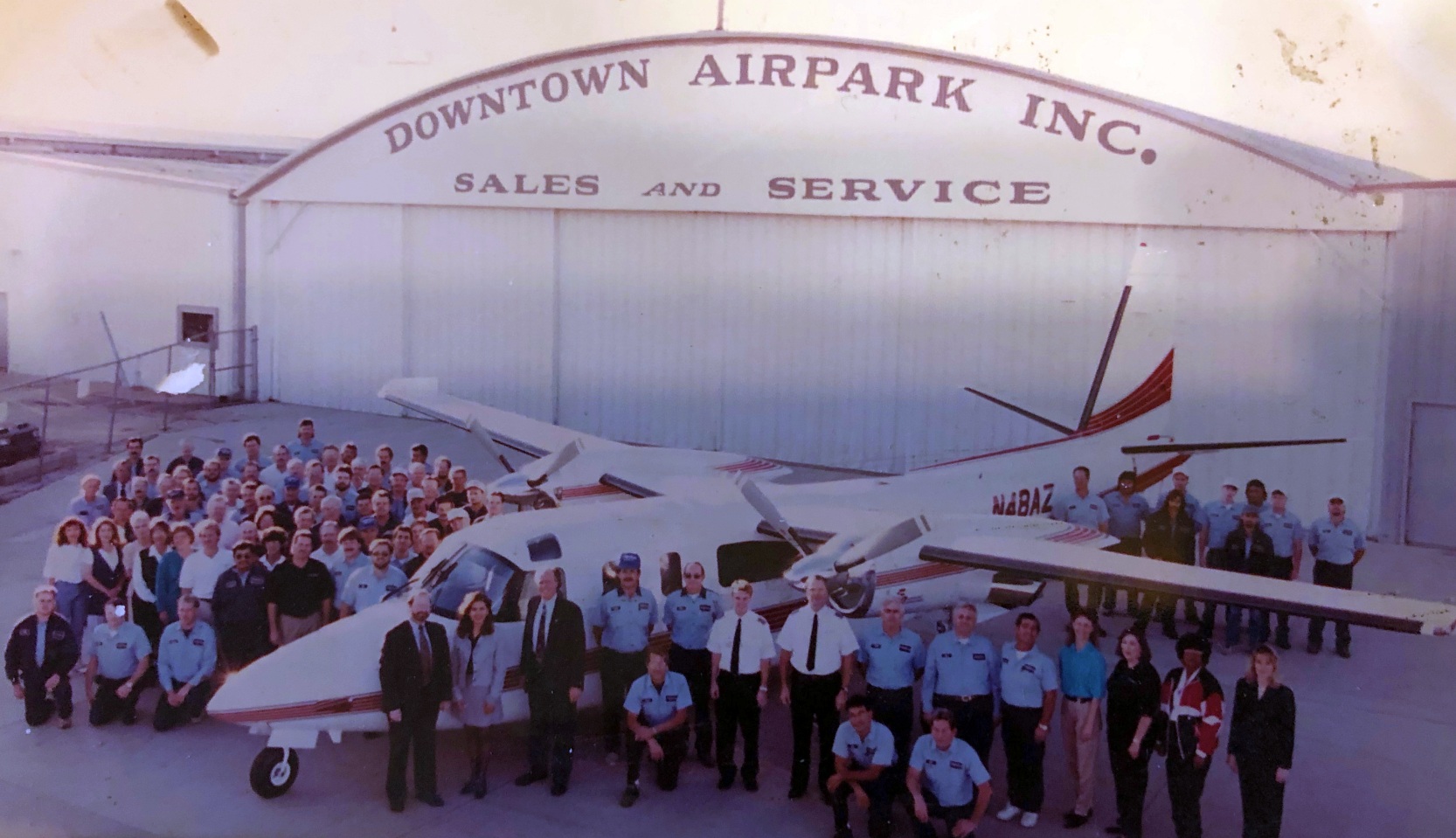
Downtown Airpark employed more than 140 people in the mid-1990s,
according to an 6/1/05 Oklahoman article by Steve Lackmeyer & Julie Bisbee.
A 10/10/99 photo of an exotic & rare Beech 2000 Starship at Oklahoma City Downtown Airpark.
Note that the Starship is missing its wingtip rudders.
The last aerial view which has been located showing fixed-wing aircraft at Downtown Airpark was a 2002 aerial view looking northwest,
which showed 2 aircraft parked in front of the terminal building.
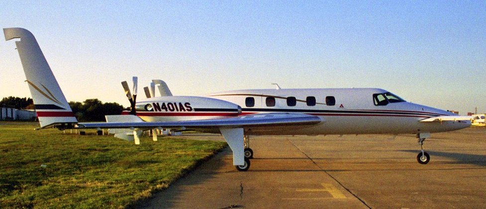
A 9/15/03 photo of a Rockwell 690B Turbo Commander at Downtown Airpark.
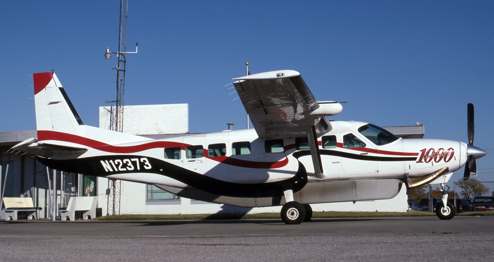
The last photo which has been located showing fixed-wing aircraft at Downtown Airpark was an 11/21/03 photo by Jarrod Wilkening of a Cessna 208B Grand Caravan N12373.
Jarrod reported, “It was home-based in the hangar just north of the terminal building / restaurant & was owned by a Part 135 operator called Westward Aircraft Services Incorporated.”
Downtown Airpark recorded 7,500 landings & takeoffs per year from 3/03-3/04,
according to an 6/1/05 Oklahoman article by Steve Lackmeyer & Julie Bisbee.
A 6/2/05 Oklahoman article, "Left on the Ground," described the beginning of the end.
The airpark closed the day earlier, the owners (members of the Amis family) telling employees "not to come back."
The article quoted Dave Amis III, grandson of co-founder W.D. Amis,
as saying, "We tried to stick it out [after the 9/11 terrorist attack in New York City], and we made a gallant go of it."
Airplane owners storing their planes there were sent looking for new space,
even though landings & takeoffs continued for a time – but without refueling there.
Amis said, "This has been quite a 48 hours for my dad & me.
This business has been in our family for 58 years.
We're just sitting back taking a breather & not making a decision when we are emotional & stressed."
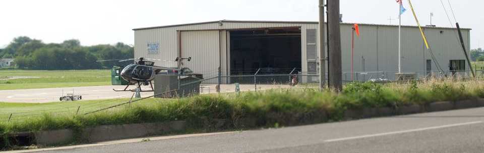
A 2005 photo by Doug Dawg looking northeast at the only aviation activity which remained at Downtown Airpark after its closure,
the Oklahoma City Police Department's hangar with an MD500 helicopter visible on the helipad.
Thomas Solinski reported in 2005, “The last known operators there are the OKC PD Helicopter branch (2 500Es & 1 C-182).
The OKC Downtown Airpark is not long for this world.
With the city damming up the North Canadian River, the land will probably go to tourist-related development.”
A circa 2005 aerial photo looking northeast at Downtown Airpark.
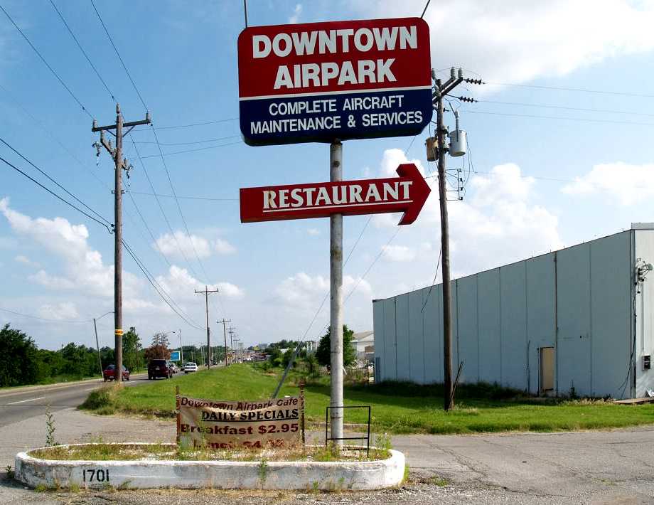
A circa 2005 photo of the entrance sign for the Downtown Airpark & its restaurant.
Despite the airpark's closure, the restaurant it housed lingered on for a time.
An 8/6/05 Oklahoman article described the plight of Lundy's Restaurant:
“The café, which has shared building space with the Downtown Airpark for nearly 51 years,
is still hanging on while the air airpark faces foreclosure.
But [Kay] Lundy plans to stay on until she's forced to shut down the restaurant.
Lundy's mother, Iva, started the restaurant at the Downtown Airpark when business in the area was bustling.
She redesigned the restaurant to include a counter so workers who only had 30 minutes for lunch could get their food quicker.”
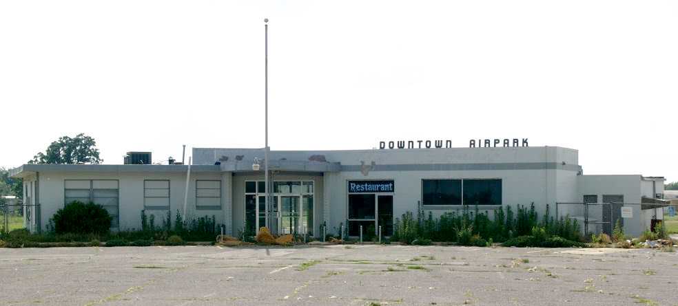
A 2005 photo by Doug Dawg looking west at the Downtown Airpark terminal & restaurant after its closure,
showing its stylish Art Deco lettering.
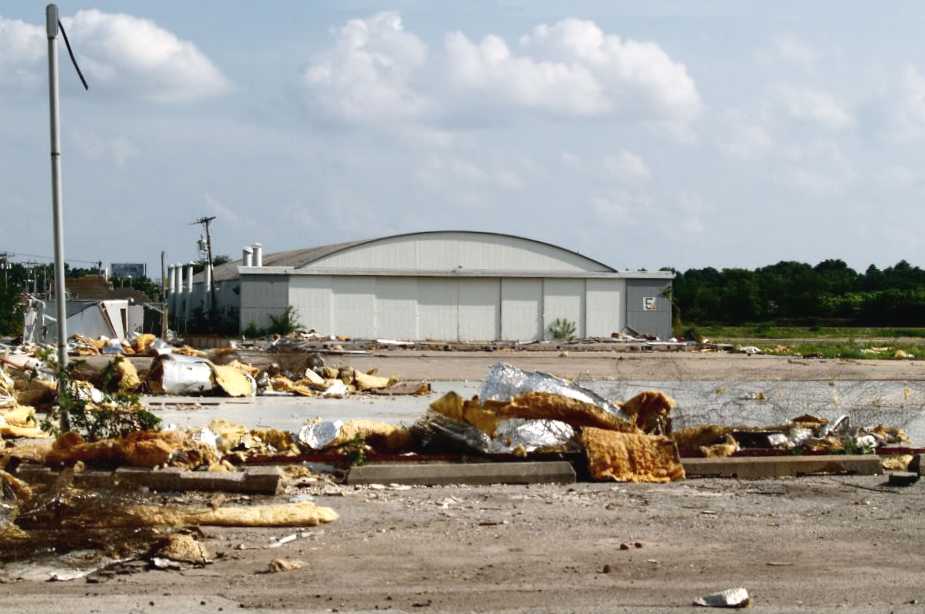
A 2005 photo by Doug Dawg looking south at a Downtown Airpark hangar, with remains of a demolished building in the foreground.
Some interest existed by the Seminole Tribe in acquiring the property to make it a casino,
but in a 11/19/05 Oklahoman article, the tribe's chief, Kelly Haney, described the notion as "far fetched."
In any event, that didn't happen.
A 12/8/05 Oklahoman article documented that the airpark was placed in receivership after accumulating more that $1.5 million in debt
and that various items of real & personal property owned by the airpark were to be sold for public auction.
In a 1/7/06 Oklahoman article, Julie Bisbee & Steve Lackmeyer noted that, “Speculators interested in turning the acreage
of a defunct airpark into a riverfront development got a nod Friday from a state judge overseeing the foreclosure case of the Downtown Airpark.
Judge Daniel Owens approved a motion that allows prospective buyers to make bids on the 81 acres of land just west of downtown Oklahoma City
to help pay off the debts of Downtown Airpark Inc.
The corporation owes more an $5 million to creditors.”
The article said that more than $193,000 was owed to employees when the airpark closed.
It also identified several interested bidders, including former Oklahoma City mayor Kirk Humphreys & his sons Grant & Blair.
The article concluded, “Jim Hasenbeck, a partner with Studio Architecture who did the master plan for the Oklahoma River,
has said that the airpark site is a prime development spot because of its view of the downtown skyline & proximity to the new Interstate 40 Crosstown Expressway.”
Finally, after initiating the purchase in February 2006, the property was acquired by Aduddell-Humphreys Partners for $7 million in November 2006,
according to a 11/11/06 Oklahoman article.
The article said that the partnership also included the Jim Brewer family & others.
A 11/30/06 article in the Journal Record opined about the new owners' options:
“Several options for the land have been discussed, including diverting the Oklahoma River to possibly establish shoreline.
Grant Humphreys has, however, said the property will be held for 3-5 years while Interstate 40 is realigned & a master plan is established.
Some of the uses the new owners have suggested include a mixed- use development as well as the possibility of a restaurant row & hotel.”
Jarrod Wilkening reported, “I used to spend a lot of time at that airport with my camera. Sad to see it go.”
A circa 2007 aerial view looking east at Downtown Airpark restaurant & hangars.
Jarrod Wilkening reported in 2009, “The city government is contemplating putting a casino there, but for now it sits abandoned.”
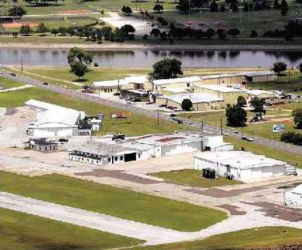
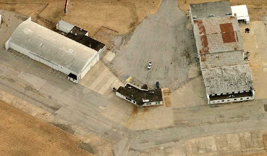
A 9/8/12 aerial view by Nick Newcomb looking west at Downtown Airpark, showing that the airport remains largely intact.
What a shame to see such nice aviation infrastructure simply ignored & unused.
The last photo which has been located showing an aircraft at Downtown Airpark was a 2015 aerial view
which showed a helicopter approaching the Oklahoma City Police Department's hangar on the northeast side.
Don Williams reported in 2015, “Downtown Airpark has serves as a concert venue now.”
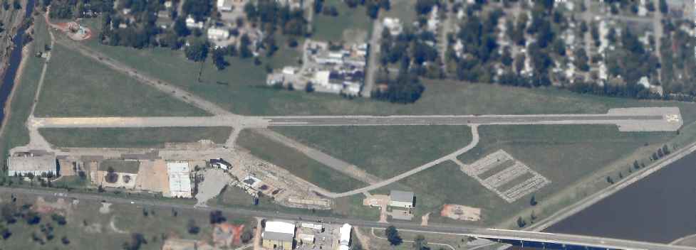
A 2016 aerial view looking northwest showed Downtown Airpark's runways & taxiways remained intact, but deteriorated.
All buildings except for 3 had been removed: a hangar on the southeast corner (bottom-left), the airport Administration building (just below the runway intersection), and the Oklahoma City Police Department's hangar on the northeast side (center-right).
Don Williams reported in 2018, “Oklahoma City Downtown Airpark... The condo development seems to have stalled.
At the north end, at the riverbank there is a Ferris wheel, the old Santa Monica Ferris wheel, purchased on eBay some time ago, moved from Santa Monica & upgraded with LED lights.”
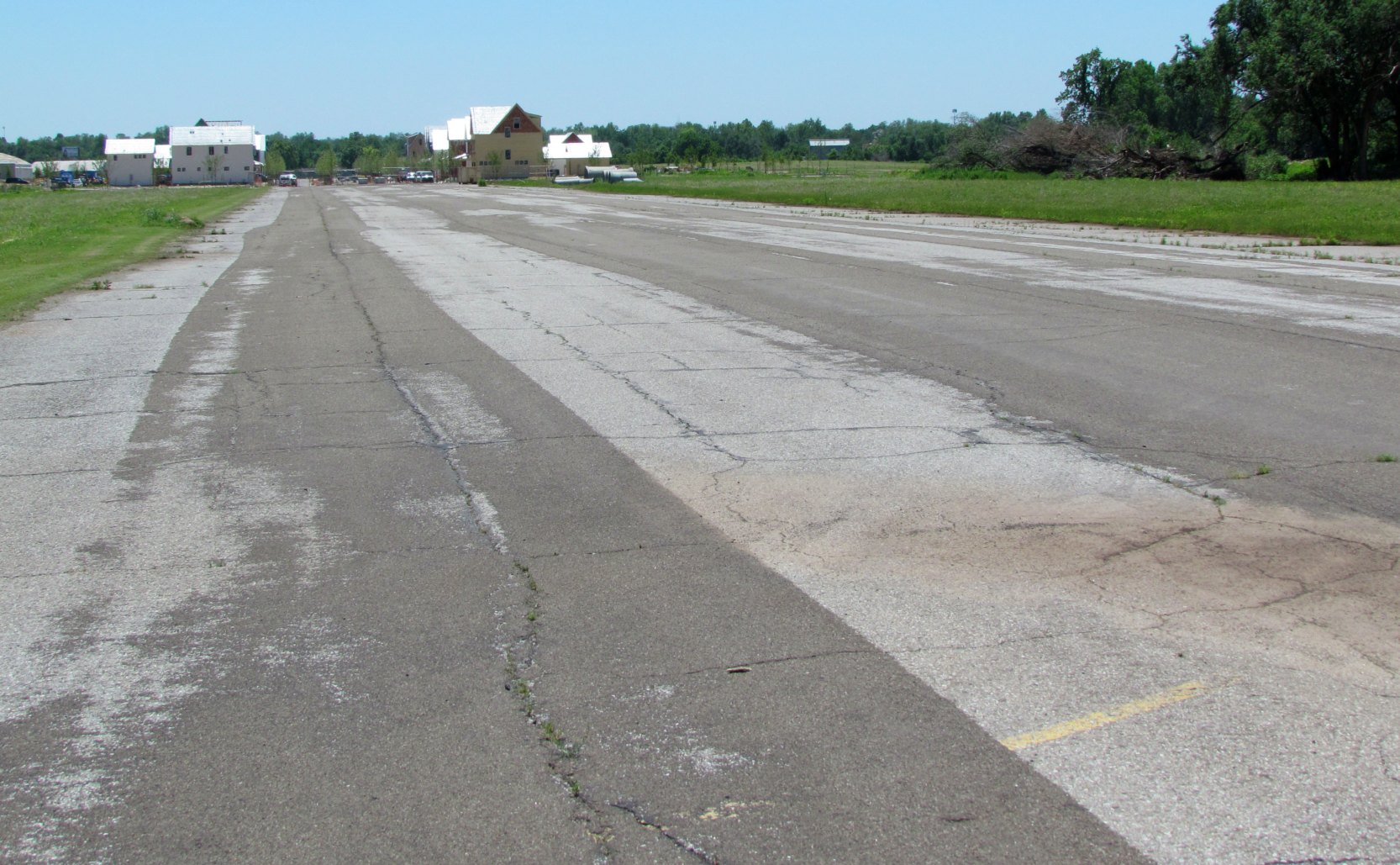
A 5/15/19 photo by Don Williams looking south along the remains of the former Downtown Airpark Runway 16, showing houses being built.
Don reported, “Downtown Airpark... the long-planned construction of homes & condos is now underway.
There remains only one main building which was, at one time, the service & paint facility for Aero Commander.
The OKC Police helicopter base is now at the field.”
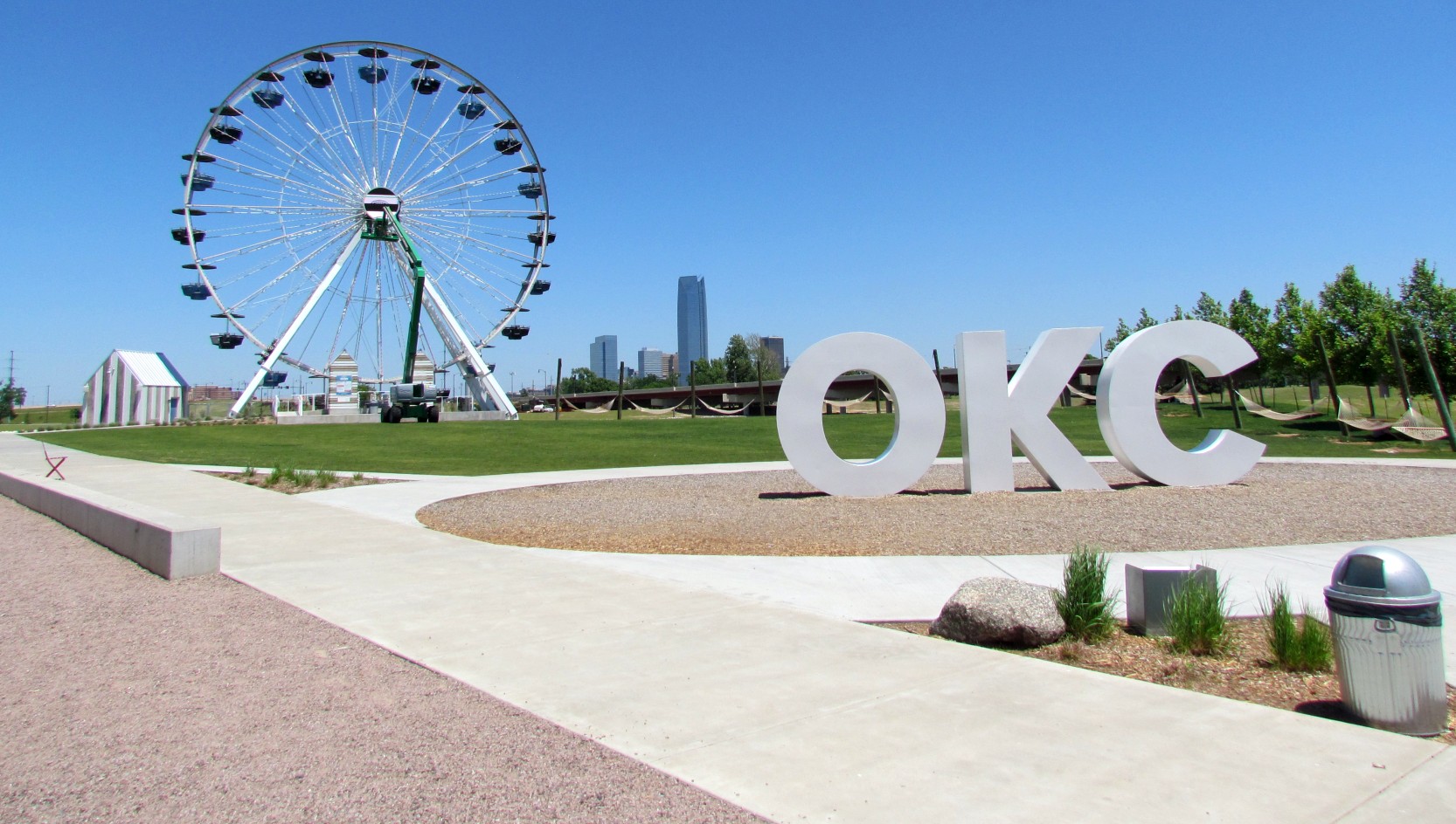
A 5/15/19 photo by Don Williams at the site of Downtown Airpark, “at the North end is the old Santa Monica Ferris wheel.”
Don Williams reported in 2020, “There is still an active hangar for police helicopters 2/3rd the way up the street.”
A 2021 photo by Don Williams looking west at the former Downtown Airpark terminal building, now nicely restored & reused as a restaurant.
Don reported, “The only remaining original building is the headquarters building which has been restored.
The center was a lobby, the left wing was offices & ground school, and the right wing was a restaurant, which is once more a restaurant.”
____________________________________________________
Shawnee Municipal Airport #2, Aydelotte, OK
35.44, -96.92 (East of Oklahoma City, OK)
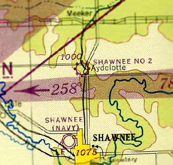
Shawnee Municipal Airport #2, as depicted on the April 1944 Oklahoma City Sectional Chart (courtesy of Chris Kennedy).
In 1942 the Navy leased the Shawnee Municipal Airport from the City,
and insisted that the Regan Flying Service vacate the airport.
The Regan Flying Service had been operating a Contract Flying School for the Army with Piper J-3 Cubs.
The City purchased land 8 miles north of the existing airport & established Shawnee Municipal Airport #2,
according to “U.S. Naval Air Stations of WW2” by Mel Shettle.
Shawnee Municipal Airport #2 was evidently opened at some point between 1943-44,
as it was not yet depicted on the February 1943 Oklahoma City Sectional Chart (according to Chris Kennedy).
The earliest depiction which has been located of Shawnee Municipal Airport #2
was on the April 1944 Oklahoma City Sectional Chart (courtesy of Chris Kennedy).
It depicted “Shawnee No 2” as a commercial/municipal airport.
The 4/1/44 US Army/Navy Directory of Airfields (courtesy of Ken Mercer) listed “Shawnee #2” as having a 2,900' unpaved runway.
“Shawnee No 2” was still depicted as a commercial/municipal airport on the 1945 Oklahoma City Sectional Chart (courtesy of John Voss).
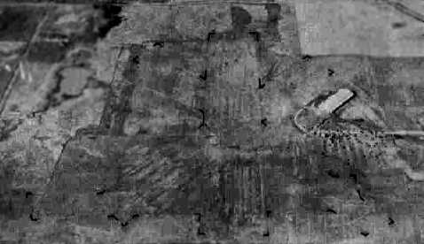
A circa 1942-45 aerial view looking north at Shawnee Municipal Airport #2
from the 1945 AAF Airfield Directory (courtesy of Scott Murdock)
depicted the field as having 3 grass runways, with a large hangar on the northeast side of the field.
Shawnee Municipal Airport #2 was evidently closed (for the 1st time) at some point between 1945-46,
as it was no longer depicted on the September 1946 Oklahoma City Sectional Chart (according to Chris Kennedy).
Shawnee Municipal Airport #2 was evidently reopened at some point between 1946-48,
as it was listed in the 8/31/48 Airman's Guide (according to Chris Kennedy).
It described Shawnee Municipal Airport #2 as having 4 unpaved runways, with the longest being 2,900'.
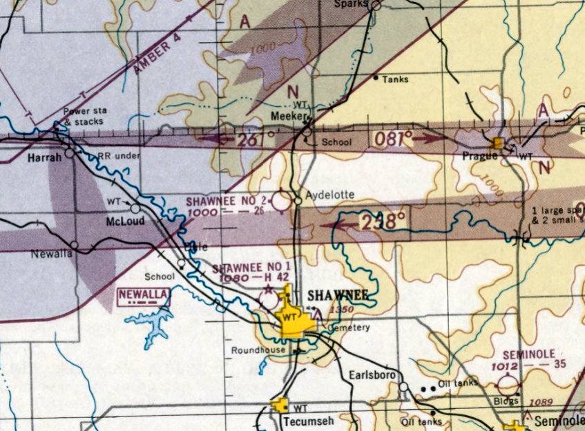
The last aeronautical chart depiction which has been located of Shawnee Municipal Airport #2 was on the February 1951 Oklahoma City Sectional Chart.
It depicted “Shawnee No 2” as having a 2,600' unpaved runway.
Shawnee Municipal Airport #2 was evidently closed (again) at some point in 1951,
as it was no longer depicted on the August 1951 Oklahoma City Sectional Chart nor on the 1954 USGS topo map.
A 4/6/64 USGS aerial view of the site of Shawnee Municipal Airport #2 showed the 2 hangars on the east side.
The airfield on the west appeared to have a single northeast/southwest runway.
A close-up from the 4/6/64 USGS aerial view of the site of Shawnee Municipal Airport #2 showed the 2 hangars to be evidently reused for some non-aviation purpose.
The 1967 USGS topo map depicted the 2 large hangars, the largest being 400' long.
It did not depict any runways or other features, and did not label the site at all.
The 1979 USGS topo map depicted the 2 hangars in the same fashion as depicted on the 1967 topo map.
The 2 former hangars of Shawnee Municipal Airport #2 were visible in the 1995 USGS aerial photo.

A March 2003 aerial view by Steve Link looking southwest at the site of Shawnee Municipal Airport #2.
Steve observed that there do not appear to be any trace of the former runways recognizable from the air.
A March 2003 aerial view by Steve Link looking northeast at the 2 former hangars at the site of Shawnee Municipal Airport #2.
Steve reported, “Though abandoned, the 2 huge hangars are still there; it looks like they are still used as some kind of storage.”
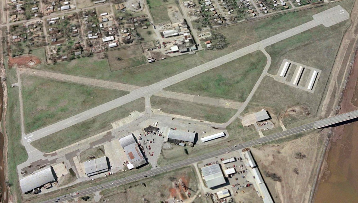
A 2024 aerial view looking north at the site of Shawnee Municipal Airport #2, showing that the 2 big hangars remain standing, and the airfield area to the west of the hangars remains clear.
The site of Shawnee Municipal Airport #2 is located at the western terminus of Jonco Road, a half-mile west of Route 18.
____________________________________________________
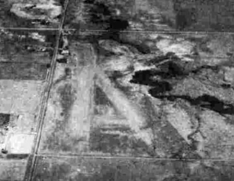
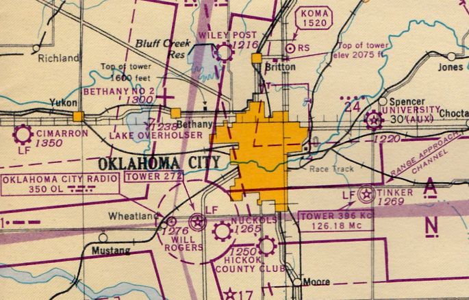
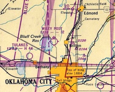
Curtiss-Wright Field / (Original) Wiley Post Airport, Oklahoma City, OK
35.57, -97.57 (Northwest of Downtown Oklahoma City, OK)
Curtiss-Wright Airport, as depicted on the June 1932 Oklahoma City Sectional Chart.
The original name of this airport was Curtiss-Wright Field.
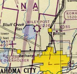
It was located north of Oklahoma City, near the Bluff Creek Reservoir (later known as Lake Hefner).
Curtiss-Wright Field was established in 1928 (according to Kristopher Crook).
According to Jeff Wilkinson, in 1928, "a hangar was built to showcase Curtis-Wright products.
Wiley Post the aviator used that hangar from 1929 until his death in 1935 for his own projects."
Curtiss-Wright was also the original base for Braniff Airways (according to Kristopher Crook).
"Braniff was based at Curtiss-Wright throughout the 1930s, maintaining operations at the field
even after the opening of the Municipal Air Terminal (now Will Rogers World Airport) in 1932."
The earliest depiction which has been located of Curtiss-Wright Airport was on the June 1932 Oklahoma City Sectional Chart.
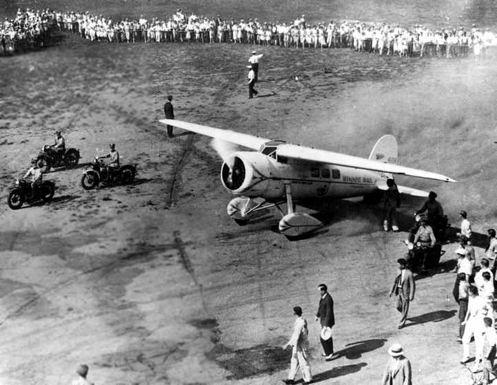
A 1934 photo (courtesy of Jeff Wilkinson) of the Winnie Mae on the ground at Curtiss-Wright Field.
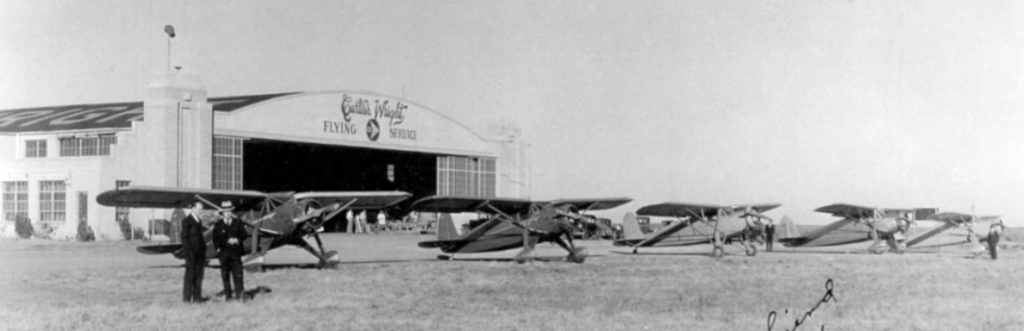
A 1935 photo looking northeast at a Curtiss Wright Flying Service hangar (courtesy of Thomas Solinski).
Thomas observed, “To my best estimation those are Fairchild Model 24-C8As, Cs and possibly the then-new Ds.”
The Airport Directory Company's 1937 Airports Directory (courtesy of Bob Rambo)
described Curtiss-Wright Field as a commercial airport with a 2,640' square landing area.
According to Jeff Wilkinson, the field was sold to Mr. John Burke in 1940.
The field had been renamed Wiley Post Airport by 1941,
as that is how it was listed in The Airport Directory Company's 1941 Airports Directory (courtesy of Chris Kennedy).
This aerial photo from the directory looked northwest at the field.
The directory described Wiley Post Airport as consisting of a 2,640' square grass area,
and one of 2 buildings (hangars?) were depicted along the east side of the field.
The April 1944 US Army/Navy Directory of Airfields (courtesy of Ken Mercer)
described Wiley Post Airport as having a 3,000' unpaved runway,
and indicated that Navy flight operations were conducted from the field.
The April 1944 OK City Sectional Chart (courtesy of Ron Plante) depicted Wiley Post as a commercial/municipal airport.
Jim Shaw recalled, “I remember Wiley Post well.
I grew up 3 blocks south & one block east of the intersection of May Avenue & Britton Road, (the southeast corner of the field).
Dad used to tell stories of me toddling around the yard (1944-45), constantly looking up at the yellow Navy PT-13s
that were constantly overhead & repeatedly falling on my face as I wasn't watching where I was going.”
The March 1945 Oklahoma City Sectional Chart (courtesy of Jeff Wilkinson)
depicted Wiley Post as a commercial or municipal airport.
It also showed that the Bluff Creek Reservoir had been constructed adjacent to the west side of the field
(note the reservoir was not present on the 1935 chart).
Robert Paschal recalled, “During the time between the end of the war in 1945 & my graduation from Classen High I learned to fly at the old Wiley Post Airport.
My instructor was Calvin Appleby. Cal had a contract with the Air Corps to give students their first experience of flight, and at the end of the war Cal was left with 3 J-3 Cubs.
I was 16-17 years old. Cal was running the whole show, what would be a fixed-base operator.
He seemed to have plenty of students. I paid $7.50/hour with or without an instructor.”
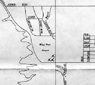
As depicted on a 1949 street map (courtesy of Jeff Wilkinson),
Wiley Post Airport was bounded by Britton Road to the south & May Avenue to the east.
The 1949 OK City Sectional Chart (courtesy of John Price) depicted the original Wiley Post Airport as having a 3,200' unpaved runway.
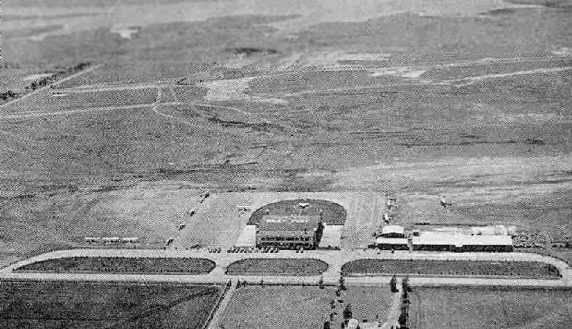
An aerial photo looking west at the original Wiley Post Airport from the 1950 OK Airport Directory (courtesy of Chris Kennedy).
The directory described Wiley Post as consisting of a 2,640' "allway" field, which offered major repairs, fuel, and hangars.
The manager was listed as John Burke.
A circa 1950 photo looking southeast at the ramp of the original Wiley Post Airport,
showing Mooneys, Bonanzas, a Navion, a Piper, and Cessnas (courtesy of Wesley Horton).
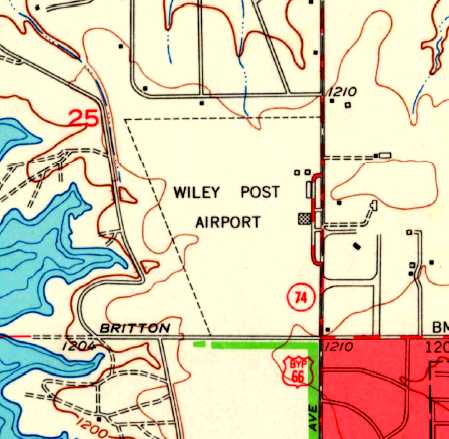
The 1951 USGS topo map depicted Wiley Post Airport as an open field with several buildings along the east side.
Jim Shaw recalled, “I remember one incident (I think I was still in grade school),
when a bootlegger overloaded his plane & attempted to takeoff to the south after dark.
He got off the ground, but failed to clear the line of trees on the south side of Britton Road.
Word spread throughout the neighborhood like wildfire & all the dads rushed to the scene
(bear in mind that Oklahoma still had prohibition until 1959).
Everything that wasn't broken was cleaned out before the police arrived. I don't know what became of the bootlegger.
The Goodyear blimp always operated out of Wiley Post whenever it was in OKC,
and I remember a Navy blimp or two there on occasion.”
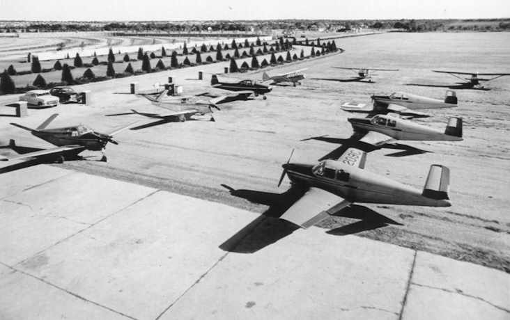
A circa 1953-55 aerial photo looking east at Wiley Post's hangar,
with 4 single-engine aircraft parked to the right (courtesy of Charlie McClure).
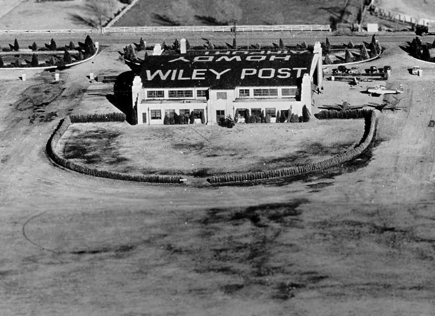
The last photo which has been located of the original Wiley Post Airport was a 6/24/54 USGS aerial view.
It depicted a total of 8 light single-engine aircraft parked on the east side of the field, near the main hangar on which was painted “Howdy, Wiley Post Airport”.
The last aeronautical chart depiction which has been located of the original Wiley Post Airport was on the August 1955 OK City Sectional Chart.
It depicted Wiley Post Airport as having a 3,200' unpaved runway.
According to Jeff Wilkinson, Wiley Post Airport was closed in 1955.
“I can imagine that what led to the closure was the nearby Tulakes Airport,
built in 1942 as an auxiliary to the Army's Will Rogers Field located at the Oklahoma City Municipal Airport
[Tulakes Airport eventually became known as the current Wiley Post Airport].
The field was subsequently developed into a residential neighborhood.”
The original Wiley Post Airport was no longer depicted on the March 1956 OK City Sectional Chart.
According to Jeff Wilkinson, the hangar built at the field in 1928 by Curtiss-Wright Company
was in 1960 converted into a shopping center & then a church.
According to Christopher Crook, a car dealership occupies the southeast portion of the former airport site.
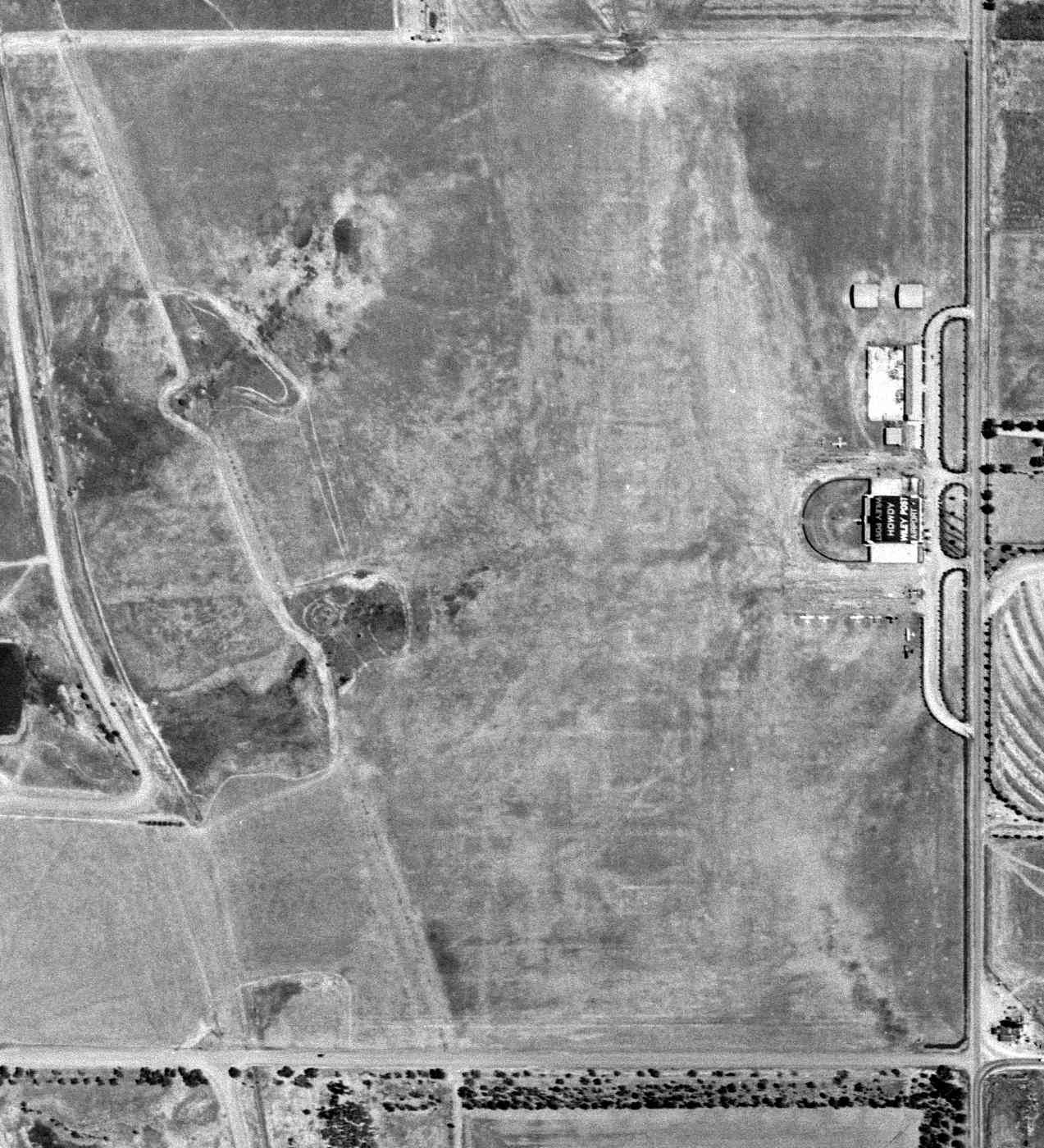
The 1991 USGS aerial photo showed that the location of the original Wiley Post Airport had been redeveloped with housing.
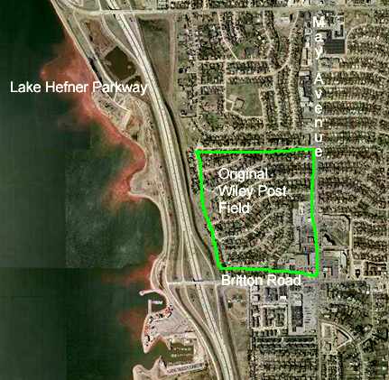
The location of the original Wiley Post Airport has been superimposed over the 2002 USGS aerial photo by Jeff Wilkinson.
According to Jeff Wilkinson reported in 2004 that the 1928-vintage former hangar
had "stood empty for a time when it was purchased by the auto dealership located nearby.
The dealer wanted to demolish the building,
but (thanks to the intervention of a group of pilots) the hangar was carefully dismantled.
An area of the current Wiley Post Airport has been dedicated for the reconstruction of the hangar.
It will be reconstructed to be historically accurate, but up to modern standards."
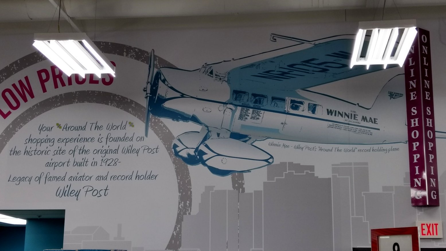
A 3/17/17 photo by Tom Solinski of a mural commemorating the site of the original Wiley Post Airport.
Tom reported, “About a year ago an 'Uptown Grocery' store was built on the site. I was shocked to see the mural on the wall over the cash registers.
They paid a very nice homage to the history of the site.”
____________________________________________________
(Original) Ardmore Municipal Airport, Ardmore, OK
34.3, -97.15 (North of Dallas, TX)
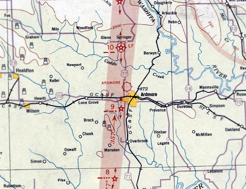
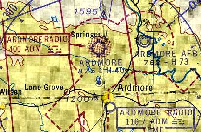
The original Ardmore Municipal Airport, as depicted on the June 1932 OK City Sectional Chart.
The original municipal airport for the town of Ardmore was located north of the town.
The date of construction of Ardmore Airport has not been determined.
The earliest depiction of the Ardmore Municipal Airport which has been located was on the June 1932 OK City Sectional Chart.
Ardmore Municipal Airport was listed as CAA Intermediate Site 10 on the Fort Worth-Wichita Airway
in the 1934 Department of Commerce Airfield Directory (according to Chris Kennedy).
It was described as having 2 sod runways, with the longest being a 3,900' northwest/southeast strip.
The Airport Directory Company's 1937 Airports Directory (courtesy of Bob Rambo)
described Ardmore Airport as being the Department of Commerce's Site 10 along the Fort Worth - Wichita Airway.
It was described as having 2 sod runways, with the longest being a 3,900' northwest/southeast strip.
A hangar was said to be at the field.
Ardmore was described in the same manner in The Airport Directory Company's 1938 Airports Directory (according to Chris Kennedy).
The runway at Ardmore was evidently paved at some point between 1937-44,
as the 1944 US Army/Navy Directory of Airfields (courtesy of Ken Mercer) described the field as having a 4,000' hard-surface runway.
A circa 1942-45 aerial view looking north from the 1945 AAF Airfield Directory (courtesy of Scott Murdock)
depicted Ardmore Intermediate Field as having a single paved northwest/southeast runway, with a building along the east side.
The 1944 OK City Sectional Chart (courtesy of Chris Kennedy)
depicted both the original Ardmore Municipal Airport (north of the town of Ardmore) as well as the newer Ardmore AAF (to the east).
The 1945 AAF Airfield Directory (courtesy of Scott Murdock) described Ardmore Intermediate Field
as a 168 acre irregularly-shaped field having a 4,000' asphalt northwest/southeast runway & 3 sod runways.
The field was said to have a single 120' x 60' metal hangar,
to be owned by the City of Ardmore, and operated by the Civil Aeronautics Bureau.
Billie Jo recalled of Ardmore, “My father-in-law, Max Jones, used to operate the airport. He has many fond memories of those years.”
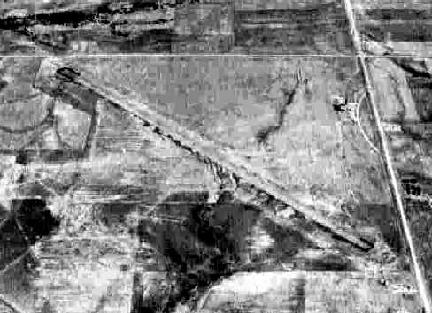
An 11/20/54 USGS aerial view depicted Ardmore Municipal Airport as having a single paved northwest/southeast runway, with taxiway leading to several buildings on the east side.
Ardmore was still an active airport in 1959,
as it was depicted on the 1959 Wichita Mountains World Aeronautical Chart (courtesy of Chris Kennedy).
However, the field was apparently closed within the next year,
as it was labeled "Ardmore (abandoned)" on the 1960 OK City Sectional Chart (courtesy of Chris Kennedy).
By that time, the much larger Ardmore AFB (a few miles to the east)
had been vacated by the military, and had become the new Ardmore Municipal Airport.
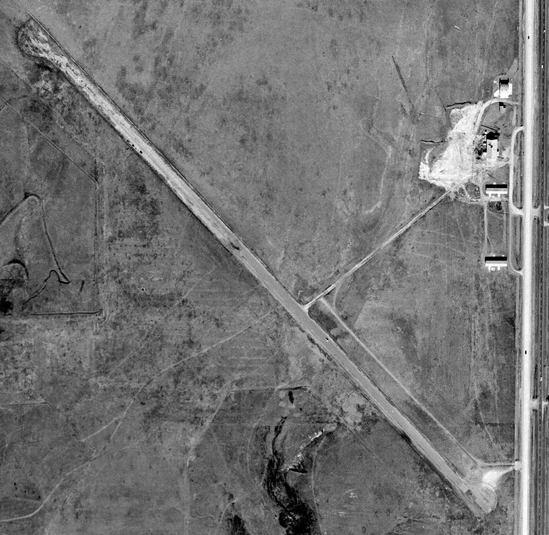
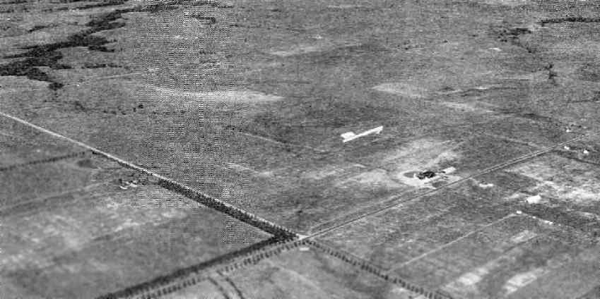
A 1/28/624 USGS aerial view depicted Ardmore Municipal Airport apparently shortly after its closure. The runway & hangars remained intact, but there was no sign of recent aviation use.
Rob Lucy recalled, “My grandfather had a livestock operation across the street to the north of old Ardmore Field.
During visits as a youth, I was always intrigued by the place.
My grandmother, who grew up in the area, would only say that everything moved to 'the base'.
Unfortunately, having openly declared my curiosity,
my grandmother put the place off limits thus ensuring that I would live long enough to send this note.
I had to find more agrarian ways to get into trouble.
However, I can say that I recall an occasional hangar queen aboard in the 1960s -
but I never observed anything move or make noise.
Also, I can verify there was a turf landing zone or taxiway roughly parallel to US77 & a turf ramp just north of the hangar.
The place was pretty much a ghost town.”
By the time of the 1964 USGS topo map, the abandoned former runway of the original Ardmore Municipal Airport was labeled "Drag Strip".
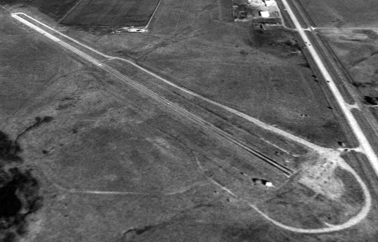
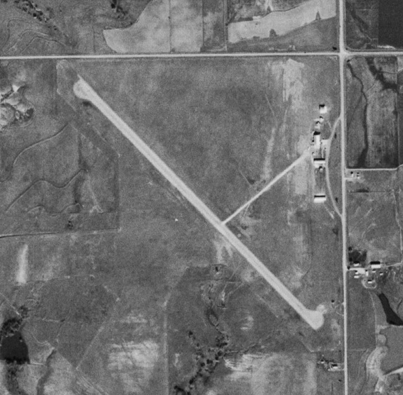
In a 1995 USGS aerial view looking north, the former runway & parallel taxiway of the original Ardmore Airport still remained in quite good condition.
It was not apparent from the photo whether the site is still actively reused as a drag strip.
According to Kristopher Crook, the building at the northeast corner of the field was a former hangar.
"Ardmore apparently also had a north-south turf runway (at least, I've never been able to confirm if it was ever paved, though)
that ran to the west of the building in the picture.
The hangar is still in use today [2003], and easily visible from US 77 & Brooks Road (77 is the road to the east).
I believe it is now used by the city of Ardmore for equipment storage."
According to Chris Kennedy, the Ardmore Airport site is still labeled as a "Drag Strip" on the 2003 Sectional Chart.
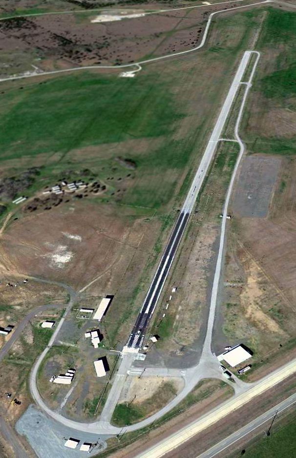
A 2/24/12 aerial view looking northwest along the former runway of the original Ardmore Airport, reused as a drag racing strip.
The original Ardmore Airport site is located southeast of the intersection of Interstate 35 & Brooks Road.
____________________________________________________
Northeast Airport / Expressway Junction Airpark (2EJ, 120K), Oklahoma City, OK
35.54, -97.45 (Northeast of Downtown Oklahoma City, OK)
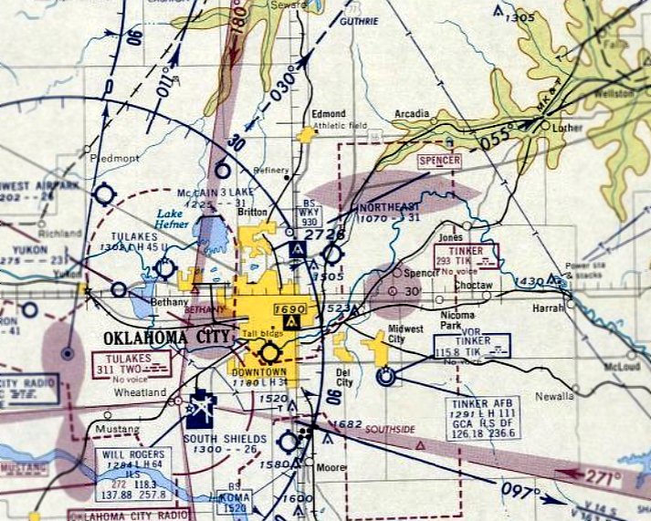
"Northeast" Airport, as depicted on the March 1960 OK City Sectional Chart.
Northeast Airport was evidently built at some point between 1959-60,
as it was not depicted on the 1956 USGS topo map or the August 1959 Oklahoma City Sectional Chart.
Anne Lynch recalled, “That airport was near my childhood home at Lake Aluma.
A vivid childhood memory is of my uncle's airplane in the creek bed just to the south of the airport.
My uncle, Ray Lynch, flew a Navion. In the late 1950s, he tried to abort a landing but clipped the power lines along 63rd Street.
After spinning around a bit, the plane came to rest upright in the creek bed facing north. No one in his family was injured – amazingly.
We could see the not-too-damaged plane from our living room.
You can see in the photographs that the power line was then moved some distance further south to prevent further such accidents.”
The earliest depiction which has been located of Northeast Airport was on the March 1960 OK City Sectional Chart.
It depicted "Northeast" Airport as having a 3,100' unpaved runway.
Northeast Airport was subsequently renamed Expressway Junction Airport.
According to the obituary of James Adair in the 11/2/14 Daily Oklahoman (courtesy of Anne Lynch),
"Jim's fear of flying turned into a lifelong passion when he learned to fly in his twenties.
In 1960, he built Expressway Airpark in OKC, turning a bootlegging grass strip into a legitimate airport, where many private pilots shared their love of flying."
The 1962 AOPA Airport Directory described Expressway Junction Airport as having a single 3,000' paved Runway 4/22,
and listed the operator as Expressway Junction Airport.
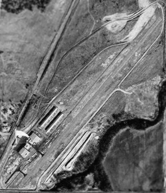
"Expressway Airpark", as depicted in the 1963 OK Airport Directory (courtesy of Chris Kennedy).
The directory described the field as having a single 3,000 asphalt Runway 3/21.
Four hangars were depicted on the west side of the runway.
The airport appeared quite well-used, with at least 16 aircraft visible on the field in the aerial photo.
The operator was listed as Estel Husted.
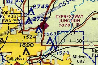
Expressway Junction Airport, as depicted on the 1967 OK City Sectional Chart (courtesy of Chris Kennedy).
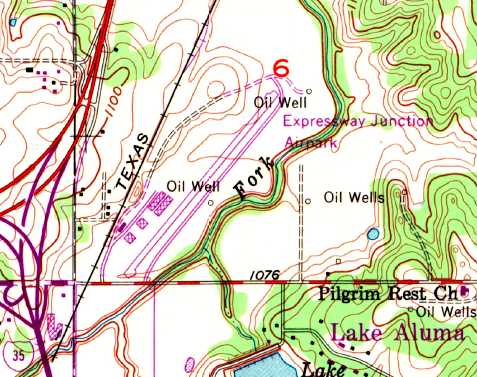
The 1969 USGS topo map depicted Expressway Junction Airpark as having a single northeast/southwest paved runway, with several buildings on the west side..
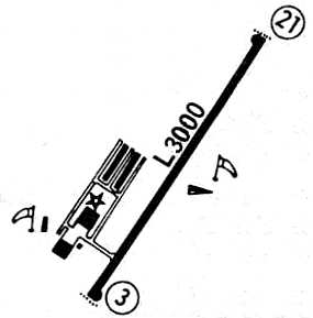
A 1971 airport directory (courtesy of Chris Kennedy) depicted Expressway as having a single 3,000' paved Runway 3/21,
with a ramp west of the runway, with a total of 4 hangars.
Jim Carter recalled, “In 1972-73 I flew a Lake LA-4 amphibian out of Expressway for Aero-Flight as in instructor.
We also flew Cherokee 140s & a Cherokee 180 for an instrument trainer.
The field had a very active contingent at the time with a waiting list for hangar space.
I think all we were using the 2/20 strip at the time
because the taxiway that had been built parallel to [Runway] 3/21
intersected the active runway such that the last 300’ or so were on the runway itself.
There was also a Lockheed Lodestar that operated out of the field at the time
so the strip was in pretty good shape to support an aircraft that size.
The towers to the west have been there for years.
When we made an instrument departure and needed a westerly heading
we were always given a climb to enroute clearance that included a 270 degree turn to the east.
This kept us out of the OKC & Wiley Post inbound traffic flow & kept us from hitting those man-made mountains.”
The February 1973 Dallas Sectional Chart (courtesy of Ron Plante) depicted Expressway Junction Airpark as having a 3,000' paved runway.
In the 1982 AOPA Airport Directory (courtesy of Ed Drury), Expressway Airpark was described as having a single 3,000' paved Runway 2/20.
The operator was listed as Aero Flite Inc.
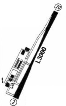
A 1982 airport directory (courtesy of Jonathan Westerling) depicted Expressway Airpark as having an unusual hourglass-shaped Runway 2/20,
which evidently was the result when the previous Runway 3/21 was repaved along a slightly different alignment.
A parallel taxiway had also been constructed at some point between 1971-82, as well as 2 more hangars.
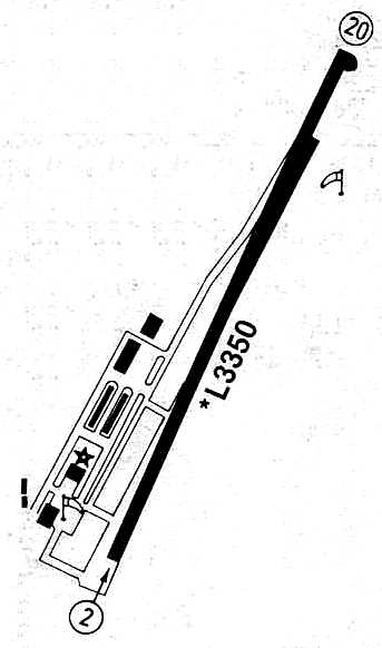
The airfield layout of Expressway Junction Airport, from a 1986 airport directory (courtesy of Chris Kennedy).
The northeast end of the previous Runway 21 was still apparent in the diagram.
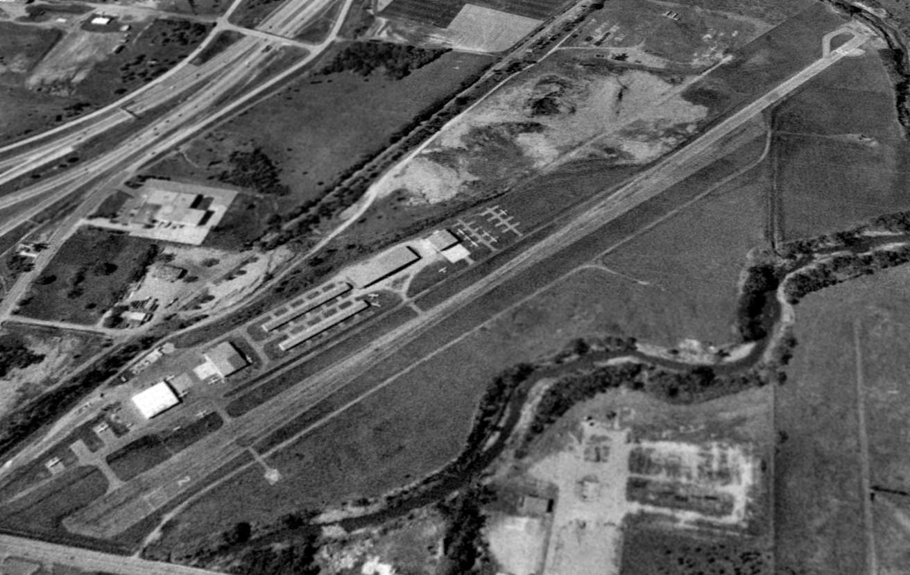
In a 1990 USGS aerial view looking northwest, Expressway Junction Airport appeared to be fairly well-used,
with a total of at least 15 aircraft visible parked outside, in addition to having 6 hangars.
According to Kristopher Crook, “Back in the early 1990s,
then-Governor David Walters proposed having the state purchase the airport & make it the base for the state's aircraft fleet.
The airport was far closer to the State Capitol than Will Rogers or Wiley Post,
which is where the state's aircraft have been based over the years.
However, the runway was considered too rundown, too narrow, and too short
for the King Air that was being used at the time as the Governor's plane.
There was some talk of the runway being extended to 5,000' to provide the extra safety margin,
but bridging or rechannelling the creek to the north was deemed too expensive & the whole idea was quickly dropped.”
At some point Expressway Junction ceased to be a public-use general aviation airport.
Kristopher Crook observed in 2003, "Expressway Junction Airpark is now mostly abandoned, though the runway remains for emergency use.
The hangars have been taken over as some sort of church camp, I'm not clear as to the specific use. Most of it is still visible."
The published statistics for Expressway Junction in the 2003 Airport Facility Directory
tell a story of an airfield that is well on its way to being closed.
The single runway, 2/20, is listed as being 3,350' long & asphalt,
but its condition is listed as "In Poor Condition Cracking; Asphalt Breaking Up."
Just about every other aspect of the airport's condition is listed with significant problems:
"Runway Edge Markings: Markings & Centerline Faded - Poor Condition.
Rotating Beacon Out of Service Indefinitely. Parallel Taxiway Closed Indefinitely.
Runway 20 Obstacle Free Zone Contains Much Debris (Broken Concrete/Rocks).
A total of 16 aircraft were listed as still being based on the field,
but that was doubtful, given the long list of woes described for the airport.
The owner & manager are listed as John A Sabolich, but the AFD also includes the remark, "Owner Desires Airport Not Be Charted."
Blake Bowers reported in 2003, "Some of the old hangers are used by a bible school,
but the main hanger, and FBO building are now used by AirEvac Lifeteam, out of West Plains, MO.
They use this as a regional headquarters for their OK, KS, and TX operations.
They fly their choppers, and KCPD flys their choppers into there from time to time go across the street & get ice cream cones at Braums.
AirEvac has flown some fixed wing in there also.
AirEvac is trying to upgrade the place, taking bids on fixing the lights & all."
Blake continued, "Dr. John Sabolich purchased the airport as a place to race his cars, and for a while this was very popular,
but his fantastic advances in the field of prosthetics has taken up his time, so he does not mess with the airport anymore.
Only one fixed wing is based there, I don't believe it has flown since the FBO closed,
it supposedly belongs to the widow of the old owner, and she does not care to deal with it.
It just sits out there in the field - a [Cessna] 152 I think."
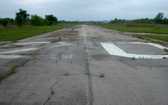
A 2005 photo by Keith Wood looking along Expressway Junction Airport's Runway 20.
Keith Wood visited Expressway Junction Airport in 2005.
He reported: “I've never been anywhere which reminded me so much of the early scenes in '12 O'Clock High!'
when Harvey Stovall (Dean Jagger) is looking at the abandoned runway at Archbury.
All that was missing was the cows on the runway.
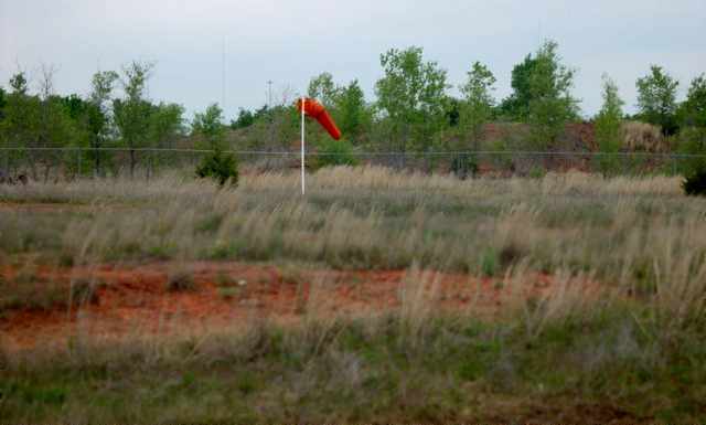
A 2005 photo by Keith Wood of a windsock which remains intact at Expressway Junction Airport.
Keith continued, “I found no tiremarks on the runway.
Another windsock frame is on the opposite side of the runway [opposite side from the intact windsock pictured above].
The runway & taxiway were resurfaced at least once.
The surface is in good condition, except for the grass growing up through it.”
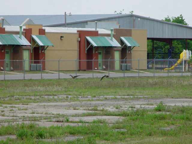
A 2005 photo by Keith Wood of former hangars at Expressway Junction Airport, now reused for a school.
Keith continued, “The buildings shown in the 1990 overhead are still there.
The long hangars are now classrooms for a private, church-run school,
and the large roof to the north of them is an open area.
The tiedown areas to the north of the hangar area are now fenced off
and there is debris & old appliances dumped there.
The small pad opposite the southern hangars was the original helipad.
The white-roofed hangar belonged to the Cessna dealer, and now houses the air-evac operation.
All of the other buildings are part of the church school.”
Keith continued, “As can be seen by the runway pics, approach & departure were unobstructed,
and the only air traffic that I saw during the whole hour that I spent there were birds.
However, just across Interstate 35 to the west were over a dozen very tall broadcasting towers.
There was no sign of major population pressure... the place is just closed. I saw no aircraft of any type.”
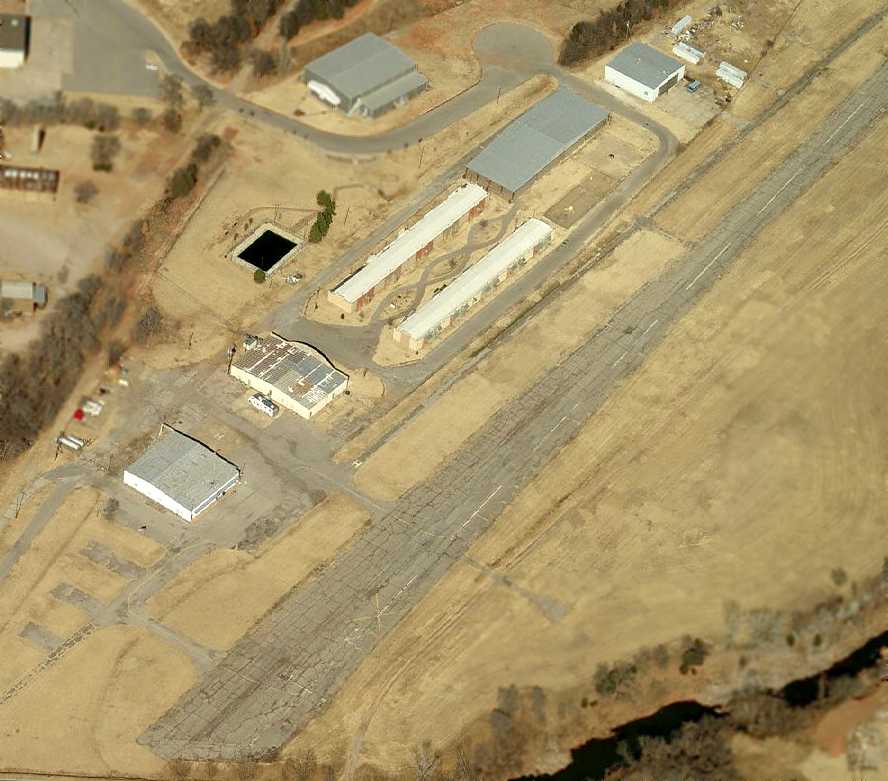
A circa 2006 aerial view looking north at the Expressway Junction Airpark hangars & runway.
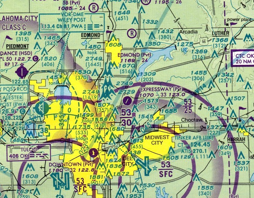
The last aeronautical chart depiction which has been located of Expressway Junction Airpark was on the March 2008 Dallas Sectional Chart.
It depicted Expressway Junction Airpark as a private airfield having a single 3,000' paved northeast/southwest runway.
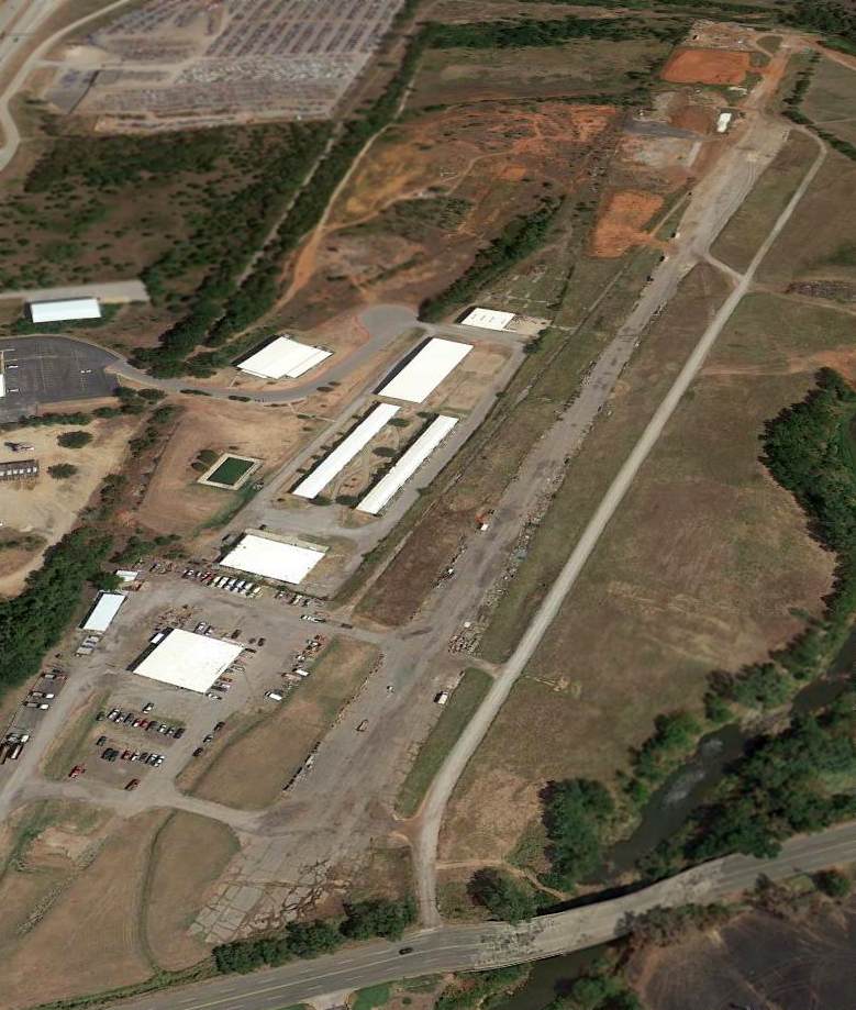
An 8/9/12 aerial photo looking northeast at Expressway Junction Airpark.
Expressway Junction Airpark was evidently closed at some point between 2008-2016,
as it was depicted as an abandoned airfield on the September 2016 Dallas Sectional Chart.
Expressway Junction Airpark is located east of the intersection of Interstates 35 & 44.
____________________________________________________
Or if you prefer to contact me directly concerning a contribution (for a mailing address to send a check),
please contact me at: paulandterryfreeman@gmail.com
If you enjoy this web site, please support it with a financial contribution.
____________________________________________________
This site covers airfields in all 50 states.