
Abandoned & Little-Known Airfields:
Northwestern Ohio
© 2002, © 2026 by Paul Freeman. Revised 7/4/26.
This site covers airfields in all 50 states: Click here for the site's main menu.
____________________________________________________
Please consider a financial contribution to support the continued growth & operation of this site.
Bellefontaine Municipal (revised 6/18/26) - Camp Perry National Guard Airfield (revised 6/16/23) - Ellington Aircraft Salvage Airfield (added 12/21/24) - Franklin Airport (revised 10/23/24)
Fremont Airport (1st location) / Slager Airport (1st location) (added 3/5/23) - Hareport / Tanger Airport (revised 10/23/24) - Korn Field (revised 10/23/24) - Lansdowne Airport (revised 9/21/21) - Lima Airport / Allen County Airport (revised 5/5/23)
Montpelier Airport / Woodruff Airport (revised 1/24/26) - National Airport (revised 2/9/21) - Nickell Field (revised 12/11/20) - Norwalk Airpark / Norwalk Airport (revised 7/4/26)
Parker Airport / Sandusky Airport / Hinde Airport / Griffing Sandusky Airport (revised 6/18/26) - Paulding Airport (revised 8/21/23) - Sandusky Airport / Griffing Airport (revised 8/21/23)
Slager Airport (2nd location) (added 3/5/23) - Tiffin Airport (added 10/5/21) - Toledo Municipal Airport / Stickney Avenue Airport (revised 6/8/22)
Treaty City Airport (revised 10/23/24) - Upper Sandusky Airport (added 6/2/22) - Waco Aircraft Company / Troy-Waco Airport (revised 10/21/22) - Wapakoneta Airport (revised 6/18/26)
____________________________________________________
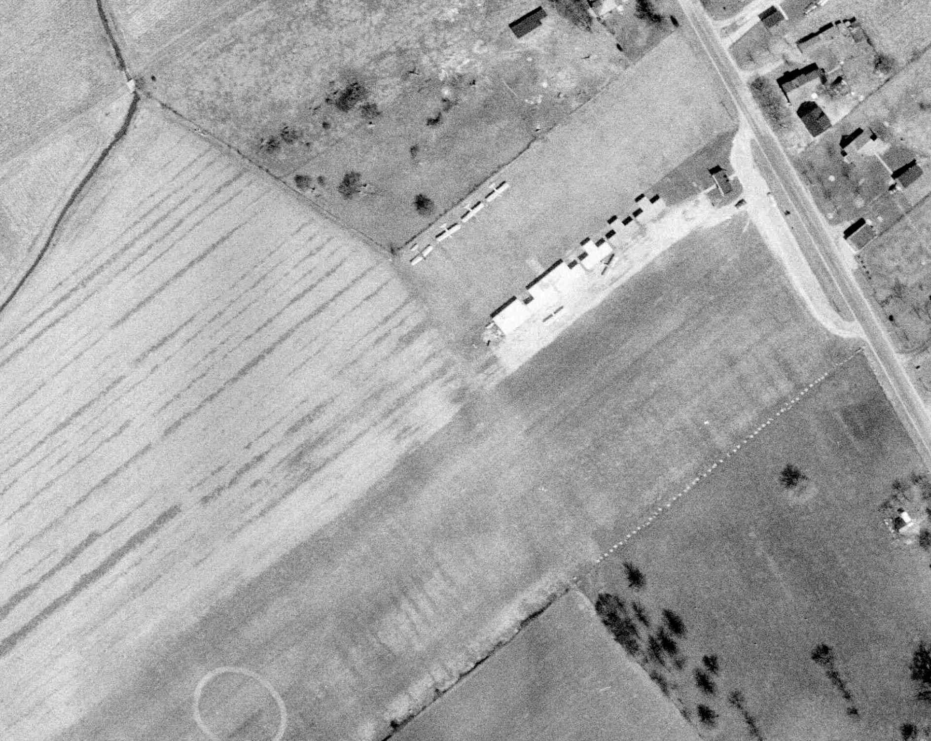
Ellington Aircraft Salvage Airfield, Wallbridge, OH
41.601, -83.511 (West of Cleveland, OH)
Ellington Airfield, as depicted on the May 1963 Cleveland Sectional Chart.
This small private airfield was apparently established at some point between 1962-63,
as it was not yet depicted on a 1957 aerial photo nor on the 1962 Cleveland Sectional Chart.
The earliest depiction which has been located of Ellington Airfield was on the May 1963 Cleveland Sectional Chart.
It depicted Ellington as a private airfield having a mere 1,300' unpaved runway.

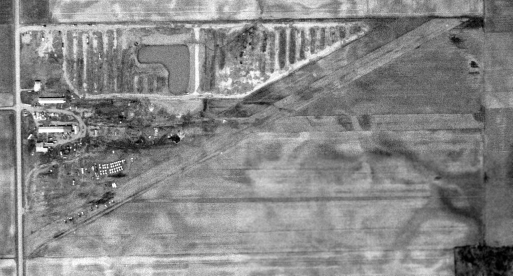
The earliest photo which has been located of Ellington Airfield was a 5/3/63 USGS aerial view.
It depicted 2 perpendicular unpaved runways, with at least 6 light single-engine aircraft parked near some small buildings to the northwest of the runway intersection.
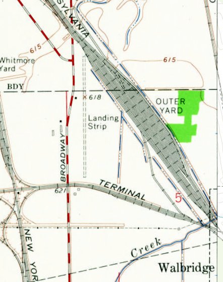
The only topo map depiction which has been located of Ellington Airfield was on the 1965 USGS topo map.
It depicted a single unpaved north/south runway, labeled generically as “Landing Strip”, with 1 small building on the west side.
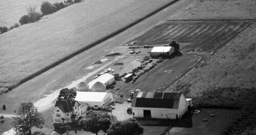
A 1966 aerial photo depicted Ellington Aircraft Salvage at perhaps its zenith of usage, with over 2-dozen light single-engine & twin-engine aircraft on the property.
Jim Davis recalled, “I lived in the Walnut Creek mobile home park on Drouillard Road. My interest in flying was because the airplanes flying over our trailer were in the pattern for the Ellington Field on East Broadway.
I learned to fly in 1967 in Piper Colt N5836Z. There was an 1,800' runway at the Ellington Aircraft Salvage Corporation on East Broadway in Wallbridge.
It was owned by Dick Ellington, who used to buy & sell wrecked airplanes & rebuild them & teach kids like myself to fly.”

A 6/11/72 USGS aerial photo appeared as if Ellington Airfield's former 2 perpendicular runways had been replaced with a longer northwest/southeast strip,
and at least a dozen aircraft remained in the Ellington Aircraft Salvage company's compound, including what appeared to be a DC-3.

The last aeronautical chart depiction which has been located of Ellington Airfield was on the 1974 Detroit Sectional Chart.
It depicted Ellington as a public-use airport, with its runway length having significantly increased to 3,900'.
Ellington Airfield was evidently closed (for reasons unknown) at some point between 1974-85,
as it was no longer depicted on the October 1985 Detroit Sectional Chart.

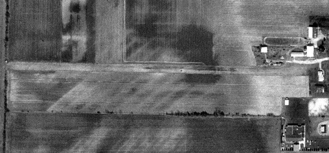
The last photo which has been located showing an aircraft at Ellington Airfield was a 1994 aerial view looking northeast, which showed 1 light single-engine aircraft remaining in the salvage yard.
The northwest/southeast runway remained intact.
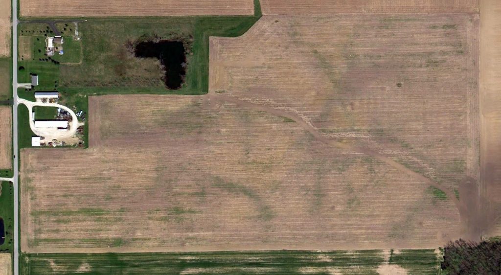
A 2000 aerial view no longer showed any aircraft at the Ellington Airfield site.
Ellington Aircraft Salvage Company owner Richard Ellington passed away in 2001.
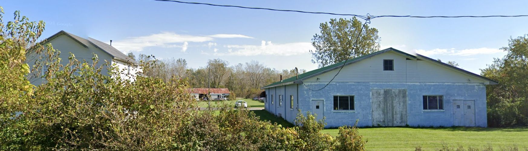
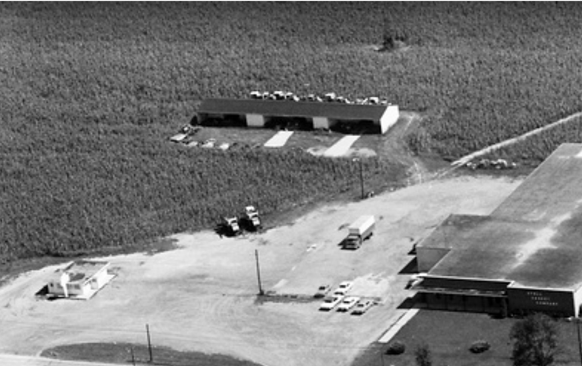
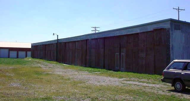
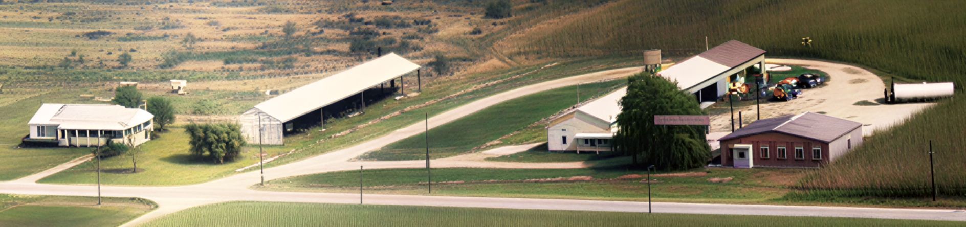
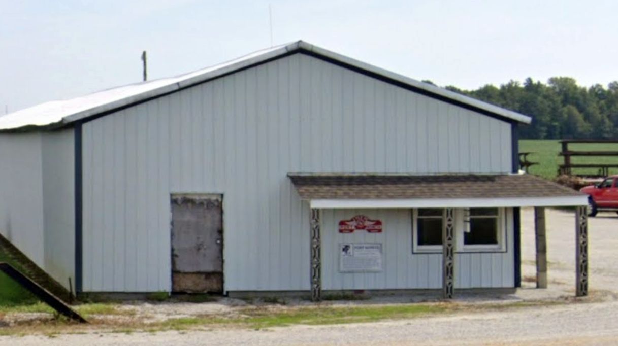
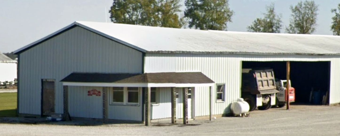
A 2021 photo looking east at the former Ellington Aircraft Salvage Company hangars.
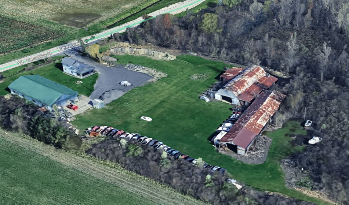
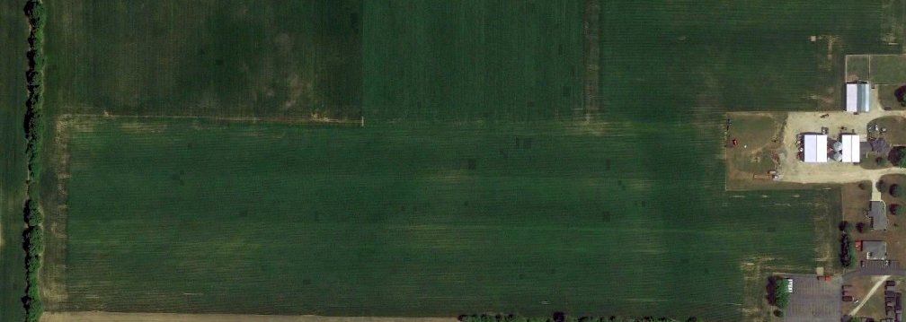
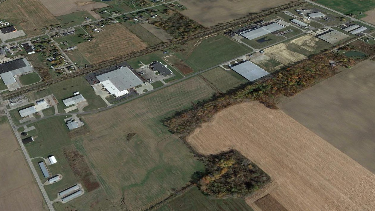
A 2024 3-D aerial image photo looking northwest at the former Ellington Aircraft Salvage Company hangars.

A 2024 aerial view looking northeast showed the Ellington Aircraft Salvage Company buildings remained intact, along with the northwest/southeast runway.
Thanks to Jim Davis for pointing out this airfield.
____________________________________________________
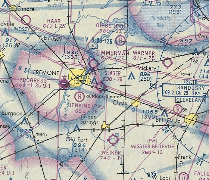
Fremont Airport (1st location) / Slager Airport (1st location), Fremont, OH
41.363, -83.142 (West of Cleveland, OH)
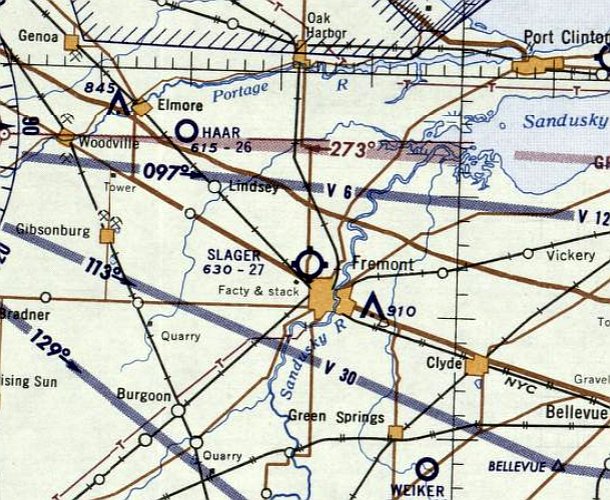
Fremont Airport, as depicted on the June 1933 Cleveland Sectional Chart.
This early general aviation airport was apparently established at some point in 1933,
as it was not yet depicted on the April 1933 Cleveland Sectional Chart.
The earliest depiction which has been located of Fremont Airport was on the June 1933 Cleveland Sectional Chart.
It depicted Fremont as a commercial/municipal airport.
It was still depicted as Fremont Airport on the March 1940 Cleveland Sectional Chart.
Fremont Airport may have been closed during WW2 (like many other small American airports),
as it was not listed in the 1945 AAF Airfield Directory (courtesy of Scott Murdock).
Fremont Airport was evidently renamed Slager Airport at some point between 1940-47,
as that is how it was depicted on the 1947 Cleveland Sectional Chart.
An article entitled “Plan Air Show” in the 7/31/48 Sandusky Register Star News (courtesy of Dennis Thompson) reported,
“Plans for an air show to be held here at Slager Airport were made at an organization meeting of the Fremont Pilots Association.
Officers are Col. Earl Baskey, President, Richard Newman, Vice-President, and Joe Slager, Secretary-Treasurer.”
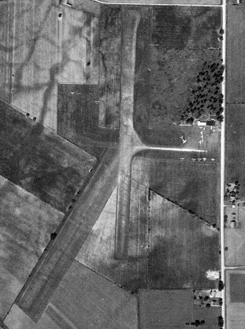
The only photo which has been located of the 1st location of Slager Airport was an 8/25/51 USGS aerial view.
It depicted Slager Airport as having 2 grass runways, and the field was apparently quite well-used, with no less than 17 light aircraft parked near a few small buildings on the east side.
The last aeronautical chart depiction which has been located of the 1st location of Slager Airport was on the January 1957 Cleveland Sectional Chart.
It depicted Sandusky Airport as having a northeast/southwest grass runway with an airport circle marking, and 7 light single-engine planes & 6 T-hangars on the north side.
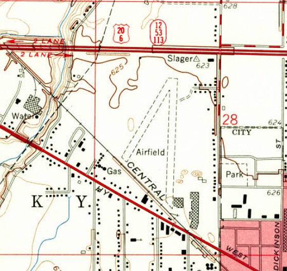
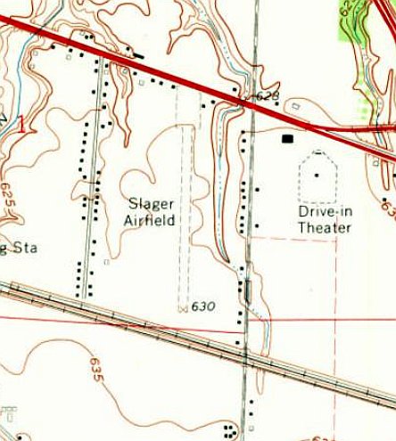
The earliest topo map depiction which has been located of the 1st location of Slager Airport was on the 1958 USGS topo map.
It depicted 2 unpaved runways, generically labeled as “Airfield”, with 3 large buildings to the southeast.
The 1st location of Slager Airport was evidently closed at some point between 1957-58,
as it was no longer depicted on the January 1958 Cleveland Sectional Chart.
A 2nd location of Slager Airport was eventually established a few miles to the southeast at some point between 1963-65.
A 1969 aerial view showed no trace remaining of the 1st Slager Airport location runways, with several buildings having been constructed on the site.
But several small buildings from Slager Airport remained on the east side of the airport site.
A 1983 aerial view showed the last remaining trace of the 1st Slager Airport had been removed at some point between 1969-83,
with the former airport buildings having been replaced by a parking lot for the industrial facility which covered the majority of the airport site.
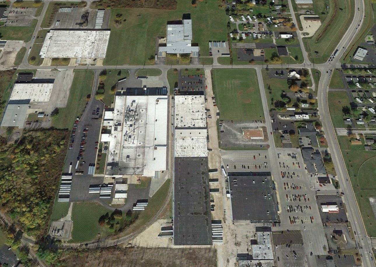
A 2015 aerial view looking north showed no trace remaining of the 1st location of Slager Airport.
Thanks to Dennis Thompson for pointing out this airfield.
____________________________________________________
Slager Airport (2nd location), Fremont, OH
41.337, -83.073 (West of Cleveland, OH)
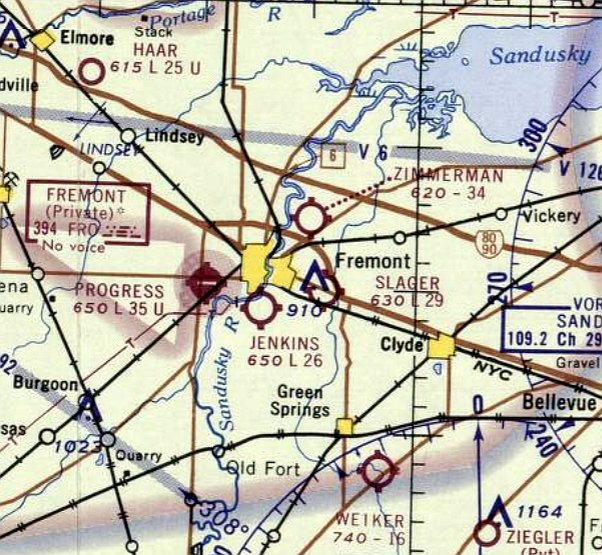
The 2nd location of Slager Airport, as depicted on the May 1965 Cleveland Sectional Chart.
A predecessor Slager Airport was located prior to 1958 a few miles to the northwest.
This small general aviation airport was apparently established at some point between 1963-65,
as it was not yet depicted on a 1951 aerial photo nor on the May 1963 Cleveland Sectional Chart.
The earliest depiction which has been located of the 2nd location of Slager Airport was on the May 1965 Cleveland Sectional Chart.
It depicted Slager Airport as having a 2,900' unpaved runway.
The earliest topo map depiction which has been located of the 2nd location of Slager Airport was on the 1969 USGS topo map.
It depicted Slager Airfield as having a single unpaved north/south runway with a few small buildings on the northwest & northeast sides.
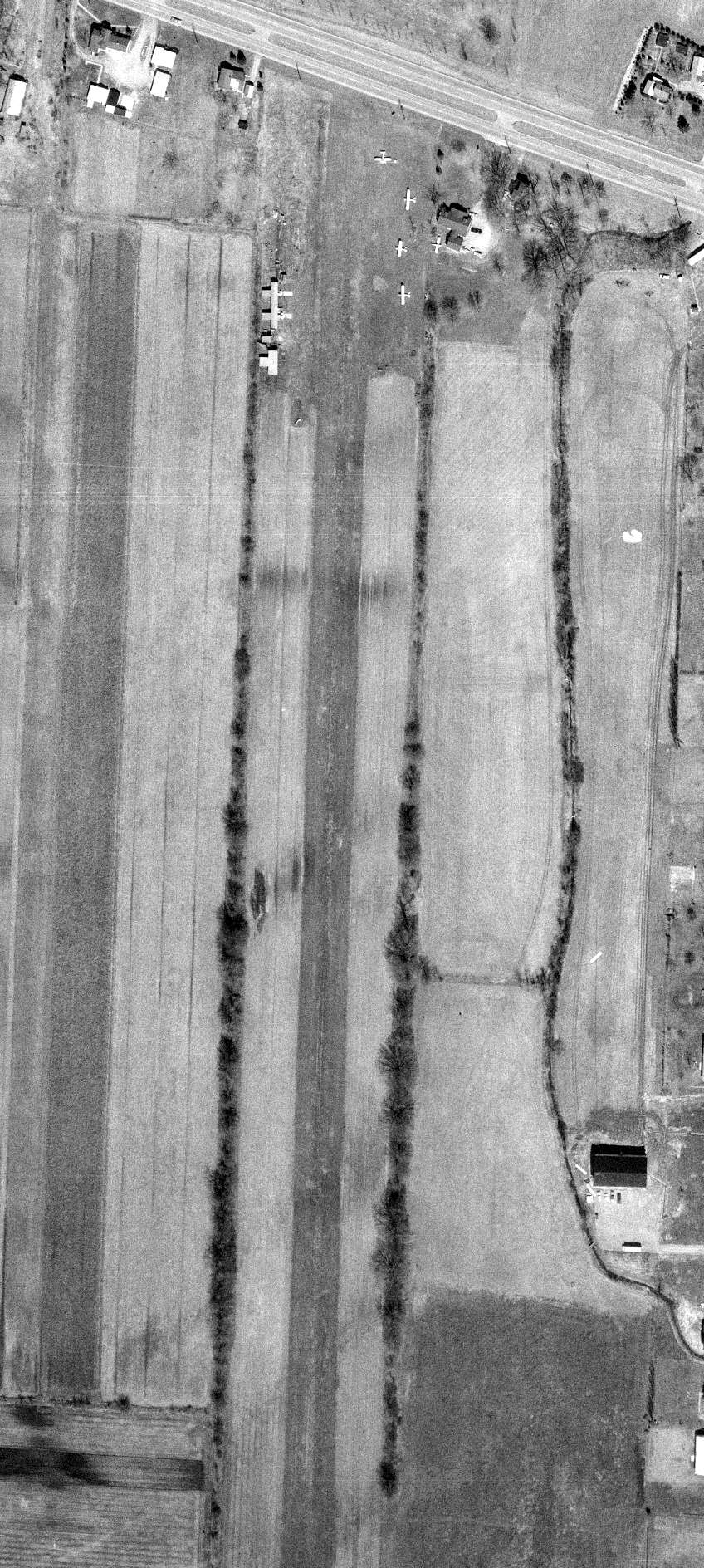
The only photo which has been located of the 2nd location of Slager Airport was a 1970 ODoT aerial view (courtesy of Dennis Thompson).
It depicted Slager Airport as having a single grass north/south runway with 3 T-hangars on the northwest side & 5 light single-engine planes on the northeast side.
The last depiction which has been located of Slager Airport was on the November 1974 Cleveland Sectional Chart (courtesy of Ron Plante).
It depicted Slager Airport as having a 2,600 unpaved runway.
Slager Airport was evidently closed (for reasons unknown) at some point between 1974-81,
as it was no longer depicted on the May 1981 Cleveland Sectional Chart (courtesy of Ron Plante).
A 2015 aerial view looking southwest showed the former Slager Airport runway remained clear, but under cultivation.
A June 2019 photo looking south showed the former Slager Airport runway remained clear, but under cultivation.
There was no sign of the former T-hangars along the west side.
Thanks to Dennis Thompson for pointing out this airfield.
____________________________________________________
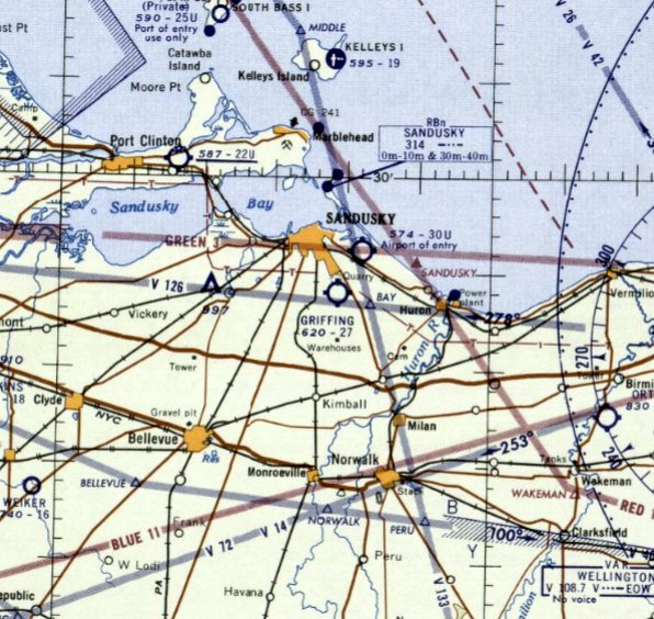
Sandusky Airport / Griffing Airport, Sandusky, OH
41.404, -82.682 (Northwest of Columbus, OH)
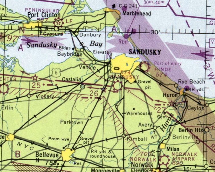
Sandusky Airport, as depicted on the January 1948 Cleveland Sectional Chart.
This small general aviation airport south of Sandusky was apparently established at some point between 1947-48,
as it was not yet depicted on the 1947 Cleveland Sectional Chart.
The earliest depiction which has been located of Sandusky Airport was on the January 1948 Cleveland Sectional Chart.
Note that the location depicted on the 1948 chart may have been somewhat erroneous,
as the 1949 & subsequent Sectionals depicted Sandusky Airport on the opposite (east) side of the river & railroad, about a half-mile east.
The earliest depiction which has been located of Sandusky Airport was a 1950 ODoT aerial view (courtesy of Dennis Thompson).
It depicted Sandusky Airport as having a northeast/southwest grass runway with an airport circle marking, and 6 light single-engine planes & 6 T-hangars on the north side.
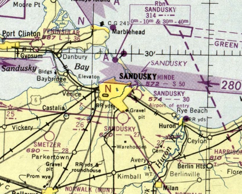
Sandusky Airport was depicted on the June 1950 Cleveland Sectional Chart as having a 2,700' unpaved runway.
To confuse matters, there was also another Sandusky Airport depicted on the east side of the town.
It was still labeled as Sandusky Airport on the 1953 Cleveland Sectional Chart,

The last depiction which has been located showing Sandusky Airport in operation was a 1956 ODoT aerial view (courtesy of Dennis Thompson).
It depicted Sandusky Airport as having a northeast/southwest grass runway with an airport circle marking, and 7 light single-engine planes & 6 T-hangars on the north side.
Sandusky Airport was evidently renamed Griffing Airport at some point between 1953-58,
as that is how it was labeled on the January 1958 Cleveland Sectional Chart, and depicted as having a 2,700' unpaved runway.
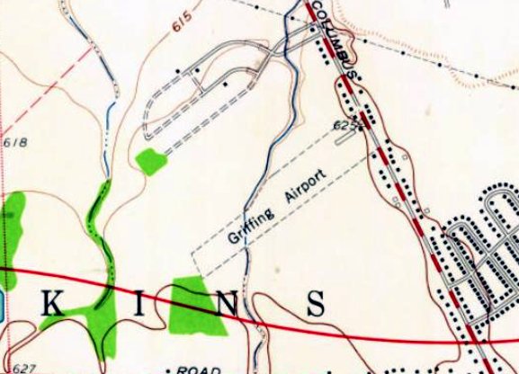
The only topo map depiction which has been located of Griffing Airport was on the 1959 USGS topo map (courtesy of Dennis Thompson).
It depicted Griffing Airport as having a northeast/southwest unpaved runway with several small buildings on the north side.
Griffing Airport was evidently closed at some point between 1958-60,
as a 1960 ODoT aerial view (courtesy of Dennis Thompson) showed a road (Industrial Parkway) had been built along the runway, and most of the hangars had been removed.
The closure of Griffing Airport was presumably due to the proximity of the larger Griffing Sandusky Airport a few miles to the north.
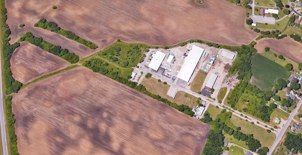
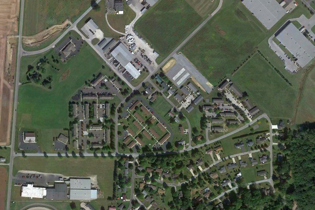
A 2022 aerial view looking west showed Industrial Drive covering the alignment of the former Griffing Airport, of which no other trace remained.
Thanks to Dennis Thompson for pointing out this airfield.
____________________________________________________
Upper Sandusky Airport, Upper Sandusky, OH
40.849, -83.279 (Northwest of Columbus, OH)
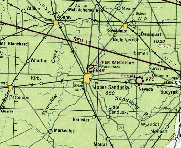
Upper Sandusky Airport, as depicted on the June 1948 Cleveland Sectional Chart.
According to a 11/28/45 article (courtesy of Dennis Thompson),
“Frederick McConnell has purchased the 130 farm north of the Wyandot County Fairground & is opening an airport there as soon as possible.
The land was purchased from Charles Hickson. The new field will be known as the Upper Sandusky Airport.”
The Upper Sandusky Airport was not yet depicted on the January 1948 Cleveland Sectional Chart.
The earliest depiction which has been located of Upper Sandusky Airport was on the June 1948 Cleveland Sectional Chart.
It depicted Upper Sandusky Airport as a commercial/municipal airport.
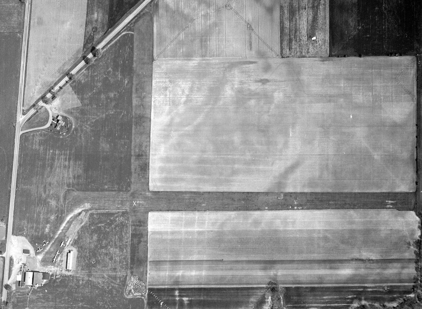
The earliest photo which has been located of Upper Sandusky Airport was a 1955 ODoT aerial view (courtesy of Dennis Thompson).
It depicted Upper Sandusky Airport as having 2 perpendicular grass runways, with 5 light aircraft parked near some small buildings on the southwest side.
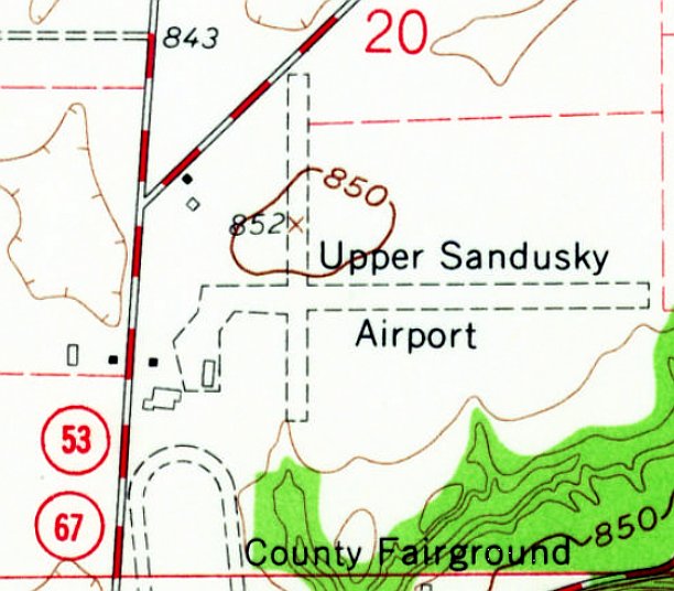
The earliest topo map depiction which has been located of Upper Sandusky Airport was on the 1960 USGS topo map.
It depicted Upper Sandusky Airport as having 2 perpendicular unpaved runways, with 3 small buildings on the southwest side.
The last photo which has been located showing Upper Sandusky Airport still in operation was a 1960 ODoT aerial view (courtesy of Dennis Thompson).
It depicted Upper Sandusky Airport in the same configuration as the 1955 photo, and with 4 light aircraft parked near some small buildings on the southwest side.
According to an 11/11/65 article (courtesy of Dennis Thompson),
“David Myers & Calvin Thome announced that the tentative county airport site has been approved.
The county commissioners have rejected the idea that the present Upper Sandusky Airport could be extended to fit the needs of a county airport.”
Upper Sandusky Airport was evidently closed at some point between 1960-68,
as a 1968 oblique aerial view looking east (courtesy of Dennis Thompson) showed that the northeastern hangar remained,
but the southwestern hangar had been replaced by a larger non-airport building at some point between 1959-68, and no aircraft were visible.
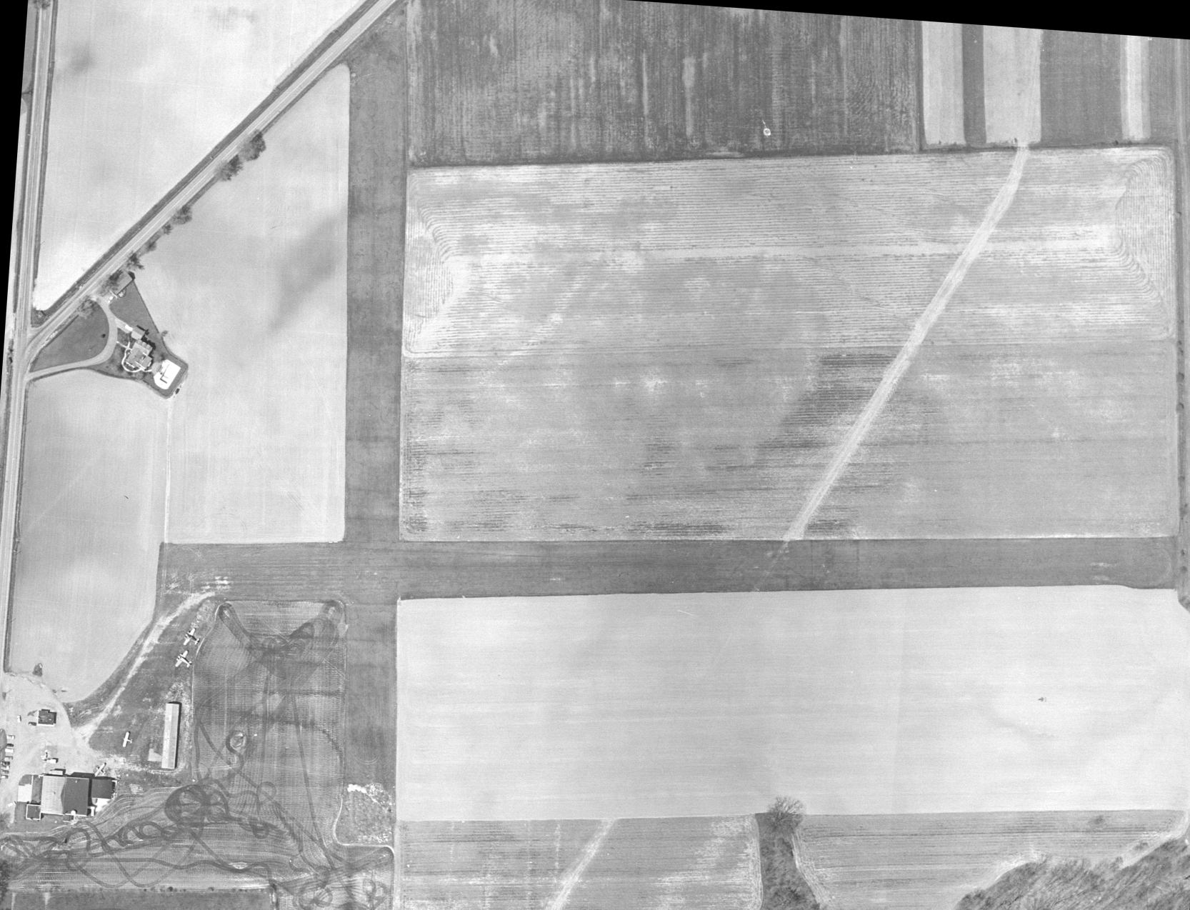
A 1971 ODoT aerial view (courtesy of Dennis Thompson) showed the Upper Sandusky Airport runways as having been plowed under,
but the northeastern hangar remained.
A 1980 aerial view showed the last hangar was removed at some point between 1971-80,
erasing the last trace of Upper Sandusky Airport.
A 2021 aerial view showed no trace remaining of Upper Sandusky Airport.
Thanks to Dennis Thompson for pointing out this airfield.
____________________________________________________
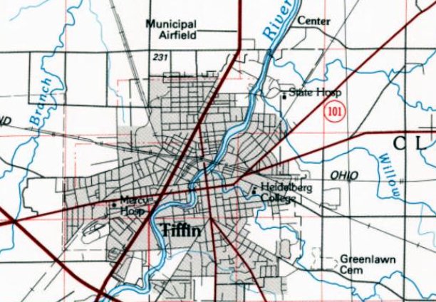
41.142, -83.172 (Southwest of Cleveland, OH)
A 1946 aerial view of Tiffin Airport (from the OH DOT, courtesy of Dennis Thompson).
The earliest depiction which has been located of Tiffin Airport was a 1946 aerial view (from the OH DOT, courtesy of Dennis Thompson).
It depicted Tiffin Airport as having 7 light single-engine planes parked next to a grass east/west runway, with several buildings & hangars on the northeast side.
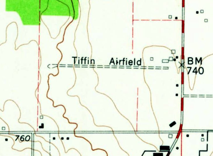
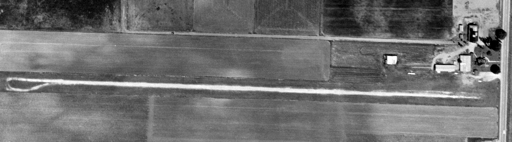
The earliest topo map depiction which has been located of Tiffin Airport was on the 1960 USGS topo map.
It depicted “Tiffin Airfield” as having a single unpaved east/west runway & a few small buildings on the east side.
Dennis Thompson reported of Tiffin Airport, “In 1962 the manager was Wilbur Scheer.”
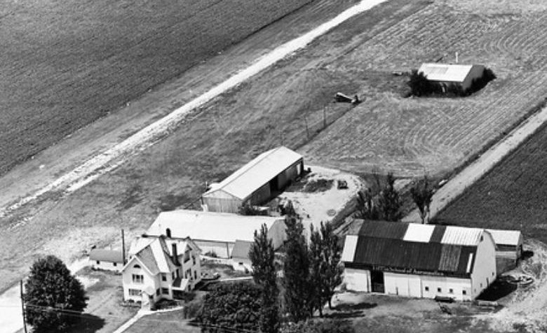
A 1964 aerial view looking southwest at Tiffin Airport (courtesy of Dennis Thompson) showed 2 light single-engine planes parked next to the grass runway,
with several buildings & hangars on the northeast side.
The barn at bottom-right had “Tiffin School of Aeronautics” visible painted along its east side.
A 1964 aerial view of Tiffin Airport (from the OH DOT, courtesy of Dennis Thompson) showed 1 light single-engine plane parked next to the grass runway, with several buildings & hangars on the northeast side.
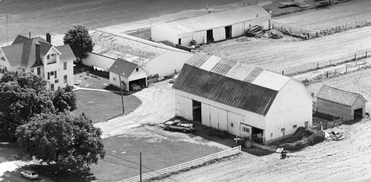
A 1979 aerial view looking southwest at Tiffin Airport (courtesy of Dennis Thompson) showed 3 light single-engine planes parked next to the grass runway,
with several buildings & hangars on the northeast side.
The “Tiffin School of Aeronautics” marking previously visible on the barn at bottom-right had been removed at some point between 1964-79.
The 1986 USGS topo map depicted Tiffin Airport as a single east/west runway, labeled as “Municipal Airfield”.
A 1994 aerial view looking southwest at Tiffin Airport (courtesy of Dennis Thompson) showed 2 light single-engine planes parked next to the grass runway,
with several buildings & hangars on the northeast side.
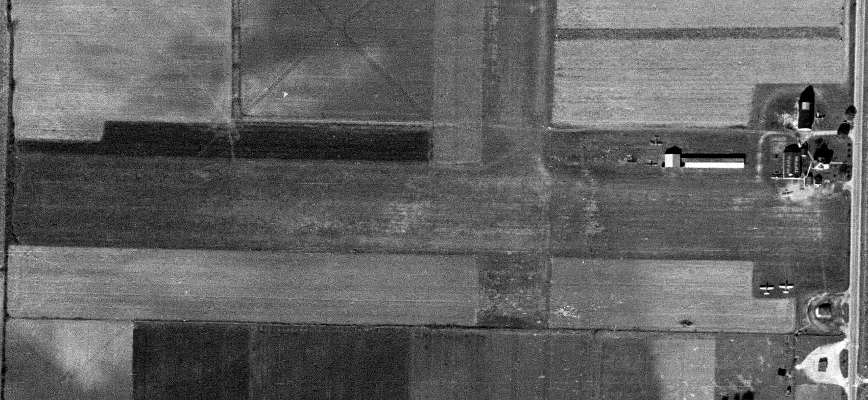
The last depiction which has been located showing an aircraft at Tiffin Airport was a 1995 USGS aerial view (courtesy of Lee Corbin).
It depicted 1 light single-engine plane parked next to the grass runway, with several buildings & hangars on the northeast side.
Tiffin Airport was evidently closed (for reasons unknown) at some point between 1995-2018,
as a 2018 aerial view (courtesy of Lee Corbin) showed the runway had been plowed over, with no evident aviation use.
Thanks to Lee Corbin & Dennis Thompson for pointing out this airfield.
____________________________________________________
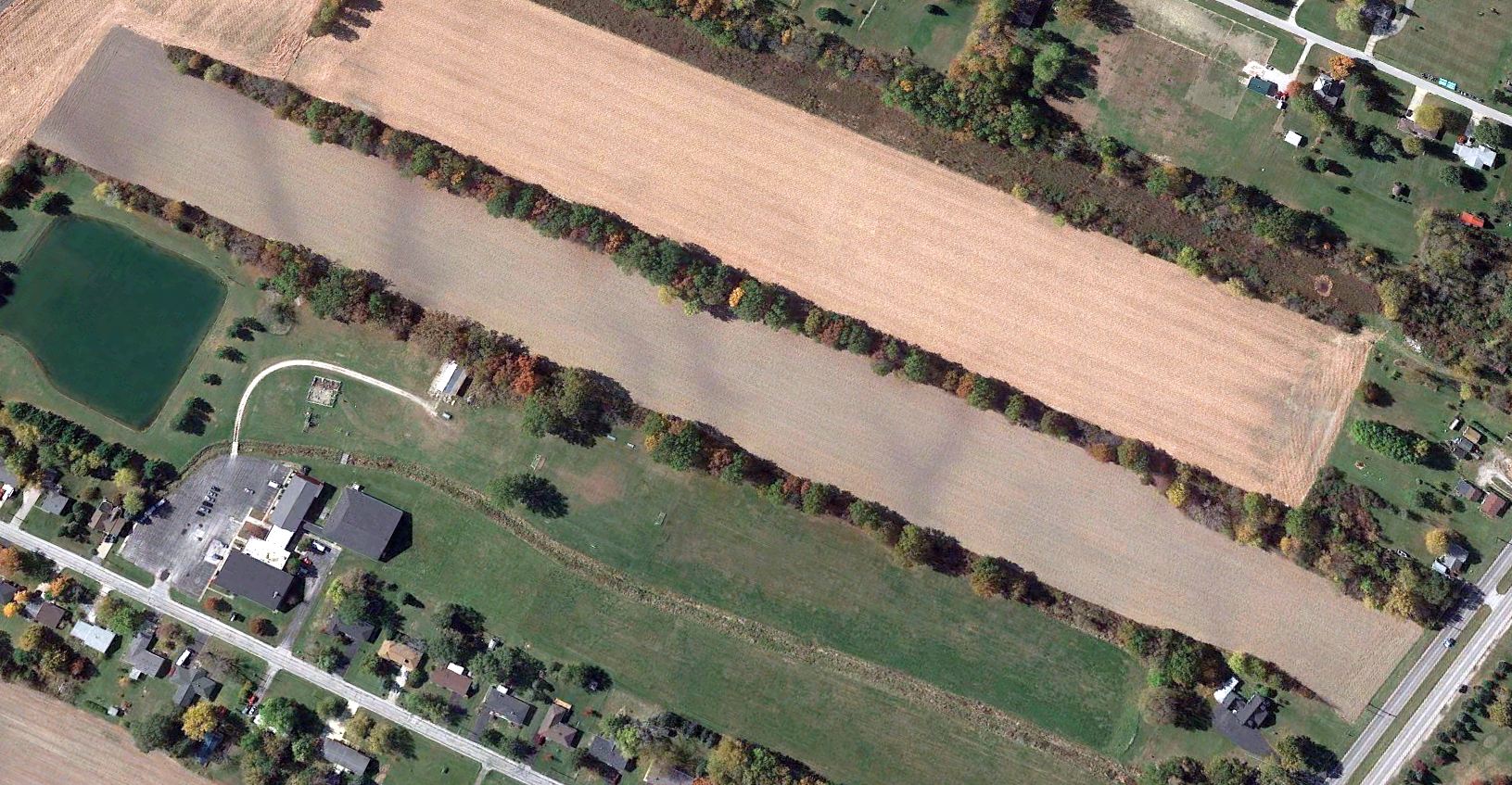
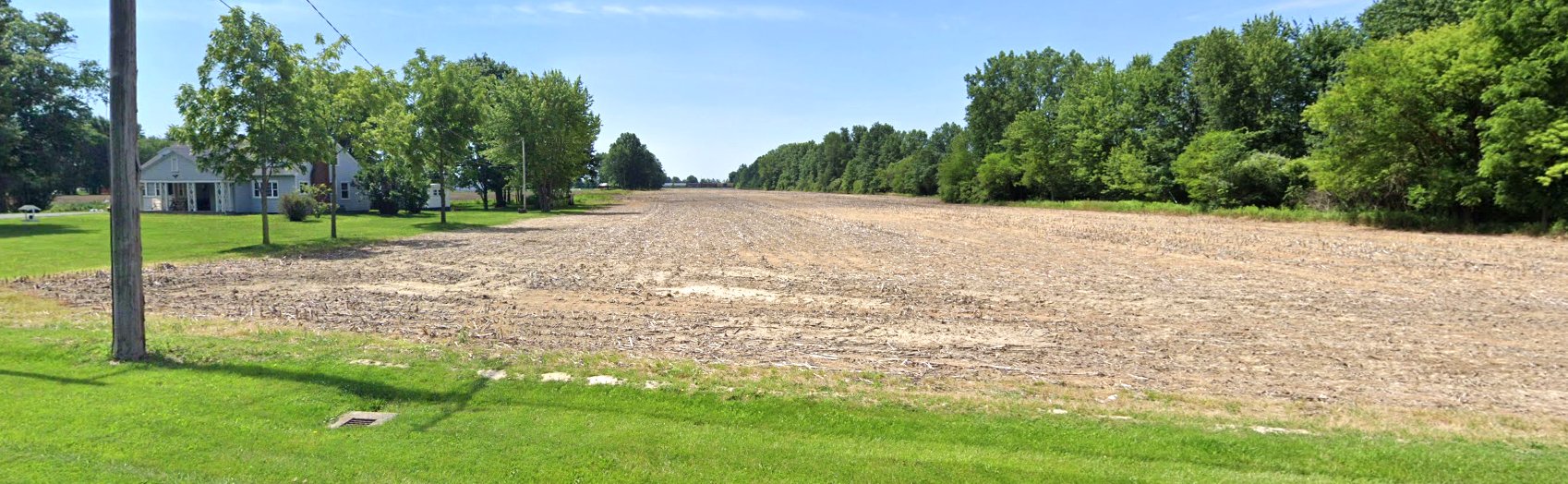
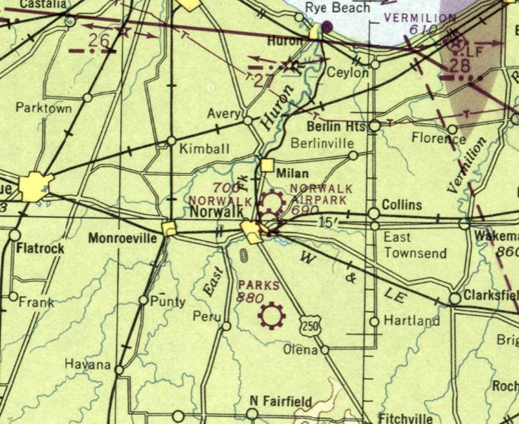
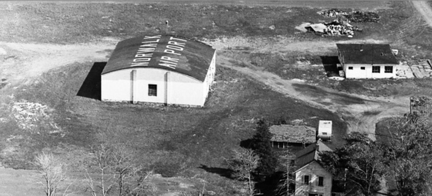
Norwalk Airpark / Norwalk Airport, Norwalk, OH
41.266, -82.609 (Southwest of Cleveland, OH)
A 10/2/43 aerial view looking north at Norwalk Airport from the 1945 AAF Airfield Directory (courtesy of Scott Murdock).
Norwalk Airport was evidently established at some point between 1940-43,
as it was not yet depicted on the March 1940 Cleveland Sectional Chart.
The earliest depiction which has been located of Norwalk Airpark was a 10/2/43 aerial view from the 1945 AAF Airfield Directory (courtesy of Scott Murdock).
It depicted Norwalk Airpark as 2 unpaved runways.
The 1945 AAF Airfield Directory (courtesy of Scott Murdock) described Norwalk Airpark as a 57 acre property having an 1,800' sod east/west runway & a 1,950' sod northeast/southwest runway under construction.
The field was said to have a single hangar, to by owned by the City of Norwalk, and operated by private interests.
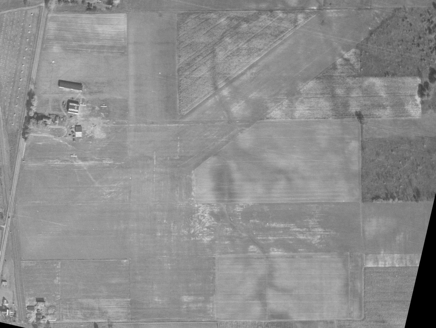
A 1946 aerial view (from the OH DOT, courtesy of Dennis Thompson) depicted Norwalk Airpark as having 3 grass runways.
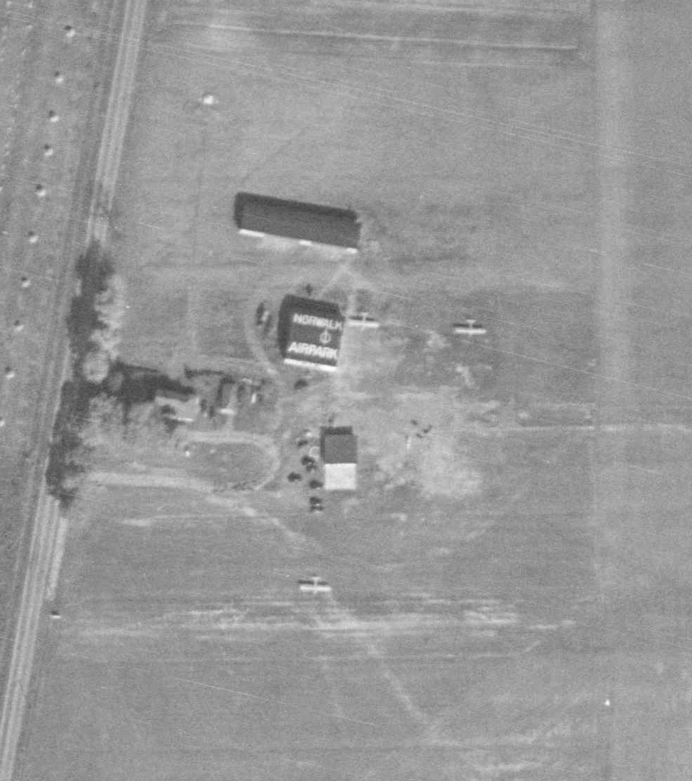
A closeup from the 1946 aerial view of Norwalk Airport (from the OH DOT, courtesy of Dennis Thompson),
showing 3 light single-engine planes & 3 small buildings on the northwest side, one of which had “Norwalk Airpark” painted on its roof.
The earliest aeronautical chart depiction which has been located of Norwalk Airpark was on the January 1947 Cleveland Sectional Chart.
Note that it also depicted the similarly-named Norwalk Airport almost adjacent to the southwest.
The airfield had been renamed Norwalk Airport by the June 1950 Cleveland Sectional Chart,
as the airfield to the south had been renamed Norwalk Municipal Airport.
A 1956 aerial view (from the OH DOT, courtesy of Dennis Thompson) depicted Norwalk Airpark as having a 3 grass runways.
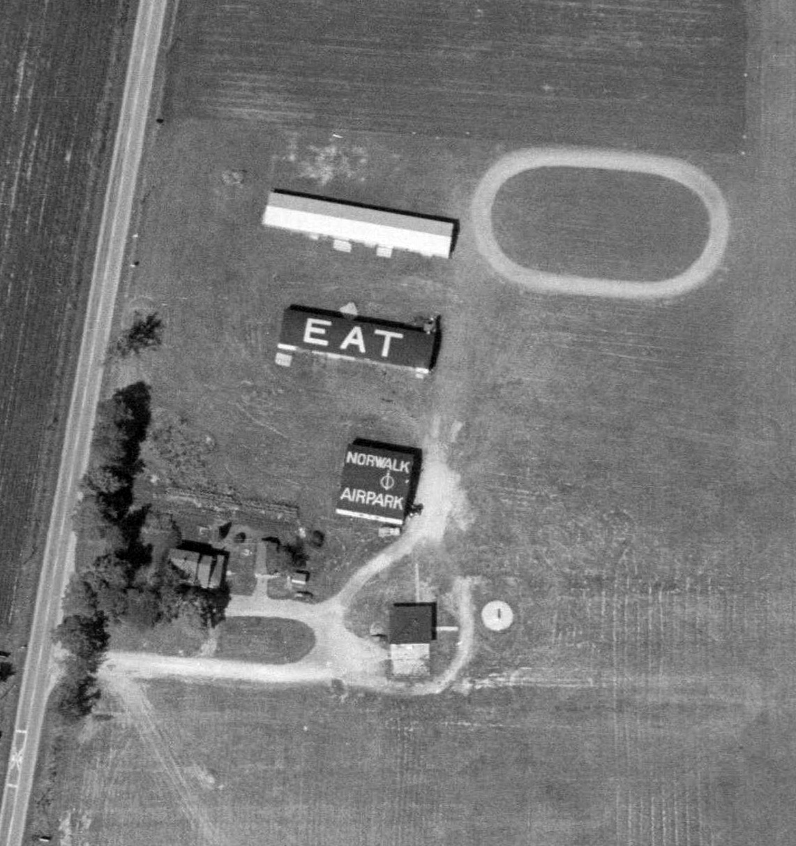
A closeup from the 1956 aerial view of Norwalk Airport (from the OH DOT, courtesy of Dennis Thompson).
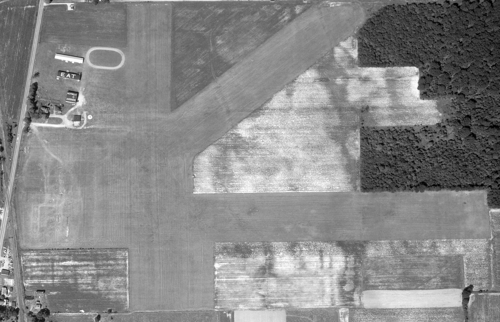
A 4th building had been added at some point between 1946-56, and “EAT” had been painted on another building's roof.
However, no planes were visible on the field.
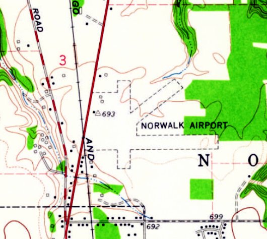
The earliest topo map depiction which has been located of Norwalk Airport was on the 1959 USGS topo map.
It depicted Norwalk Airport as having a 3 unpaved runways & 3 small buildings on the northwest side.
The last aeronautical chart depiction which has been located of Norwalk Airport was on the May 1966 Cleveland Sectional Chart.
It depicted Norwalk Airport as having a 2,400' unpaved runway.
Norwalk Airport was evidently closed (for reasons unknown) at some point in 1966,
as it was no longer depicted on the November 1966 Cleveland Sectional Chart.
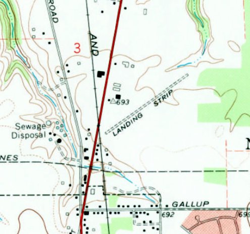
The 1969 USGS topo map only depicted a single unpaved northwest/southeast runway, labeled generically “Landing Strip”, at the site of Norwalk Airport.
A 1969 aerial view looking east at the Norwalk Airport buildings (courtesy of Dennis Thompson)
showed that the “Norwalk Airpark” on the hangar roof had been changed at some point between 1956-69 to “Norwalk Airport”.
Norwalk Airport was no longer depicted on a 1978 aerial view (from the OH DOT, according to Dennis Thompson).
A 1983 aerial photo showed no trace remaining of Norwalk Airport,
with roads & buildings of an industrial park having been built over the airport site at some point between 1969-83.
Norwalk Airport was no longer depicted on the 2013 USGS topo map,
which instead depicted Industrial Parkway & other roads covering the airport site.
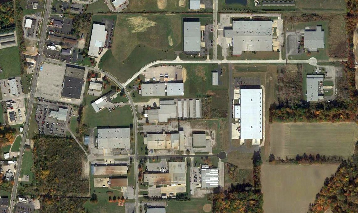
A 2015 aerial photo showed no trace remaining of Norwalk Airport, with roads & buildings of an industrial park covering the airport site.
Thanks to Dennis Thompson for pointing out this airfield.
____________________________________________________
Montpelier Airport / Woodruff Airport, Montpelier, OH
41.581, -84.573 (West of Toledo, OH)
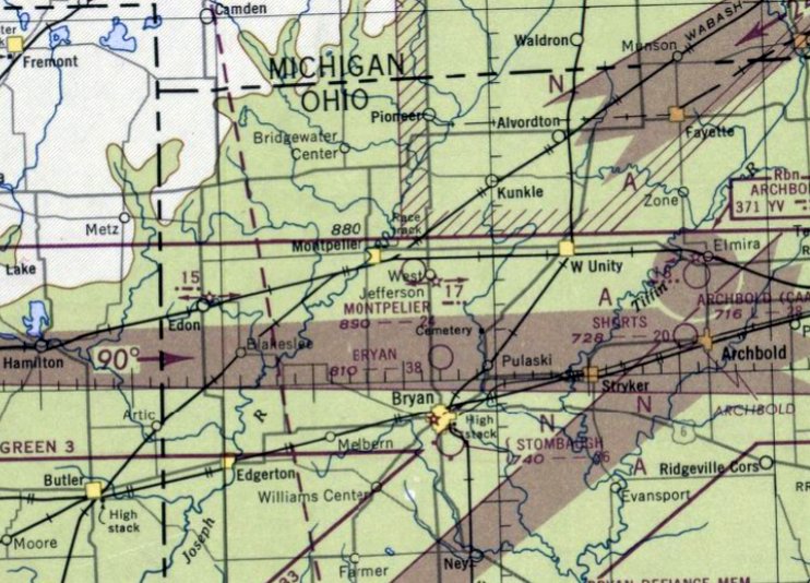
Montpelier Airport, as depicted on the June 1947 Chicago Sectional Chart.
This small general aviation airport in the northwest corner of OH was established at some point in 1946
(like hundreds of other small airports, in the US post-WW2 aviation boom).
An article entitled “Airport 1946” from the 1946 Leader Enterprise (courtesy of Bill David) reported,
“Montpelier was assured an airport this week as Eugene Cox, local businessman & aviation enthusiast,
purchased a 135-acre farm east of here for the site of the proposed air center of Williams County.”
According to a 1995 Village of Montpelier business history (courtesy of Bill David),
Montpelier Airport was owned by Gene Cox from 1946-48.
Montpelier Airport was not yet depicted on the December 1946 Chicago Sectional Chart.
The earliest depiction which has been located of Montpelier Airport was on the June 1947 Chicago Sectional Chart.
It depicted Montpelier Airport as having a 2,400' unpaved runway.
According to a 1995 Village of Montpelier business history (courtesy of Bill David), Montpelier Flying Service was owned by Robert Nutter in 1947.
According to a 1995 Village of Montpelier business history (courtesy of Bill David),
Montpelier Airport's Ross Flying Service was owned by Jesse Leonard from 1948-53.
According to a 1995 Village of Montpelier business history (courtesy of Bill David), Montpelier Airport's Tesmer Flying Service was managed by Theodore F. in 1953.
The earliest photo which has been located of Montpelier Airport was a 1956 aerial view.
It depicted Montpelier Airport as having 3 unpaved runways, with a small hangar & 4 T-hangars along the west side.
There were no aircraft visible on the field.
The earliest photo which is available of Montpelier Airport was a 4/28/60 USGS aerial view.
It depicted Montpelier Airport as having 3 unpaved runways, with a small hangar & 4 T-hangars along the west side.
There were no aircraft visible on the field.
According to a 1995 Village of Montpelier business history (courtesy of Bill David), Timbers Aviation operated at Montpelier Airport in 1960.
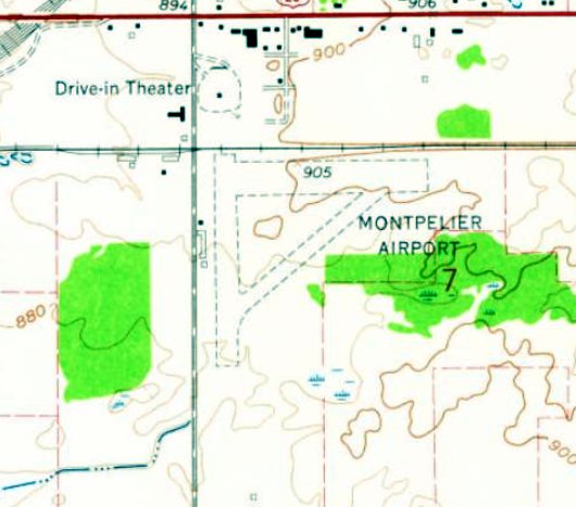
The earliest topo map depiction which has been located of Montpelier Airport was on the 1961 USGS topo map.
It depicted Montpelier Airport as having 3 unpaved runways, with a row of small hangars along the west side.
According to a 1995 Village of Montpelier business history (courtesy of Bill David),
Woodruff Field was managed by Larry White in 1962.
According to a 1995 Village of Montpelier business history (courtesy of Bill David),
Montpelier Airport was owned by Fay Woodruff from 1969-74.
Montpelier Airport was evidently renamed Woodruff Airport at some point between 1961-70,
as that is how it was labeled on the 1970 Chicago Sectional Chart.
It depicted Woodruff Airport as having a 4,100' unpaved runway.
According to a 1995 Village of Montpelier business history (courtesy of Bill David),
Woodruff Field was managed by Lee Fisher from 1972-88.
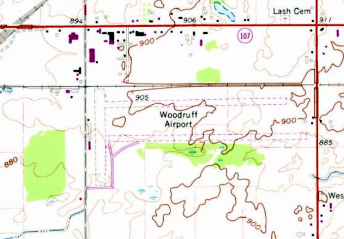
The 1973 USGS topo map showed Woodruff Airport as having been expanded since the 1961 topo map,
with the north/south runway having been roughly doubled in length toward the east,
a parallel east/west runway of similar length having been added along the south,
and the northeast/southwest runway having been removed.
Bill David recalled, “Woodruff Airport... I taught a student pilot & soloed him there in a Beech Debonair in the mid 1970s.
It was an east/west grass [runway].”
According to a 1995 Village of Montpelier business history (courtesy of Bill David),
Elf Soaring Enterprises operated at Woodruff Airport from 1976-81, owned by Edward Frappier.
The last aeronautical chart depiction which has been located of Woodruff Airport was on the May 1981 Detroit Sectional Chart (courtesy of Ron Plante).
It depicted Woodruff Airport as having a 4,200' unpaved runway.
According to a 1995 Village of Montpelier business history (courtesy of Bill David),
Thermal Flights operated a glider business at Woodruff Airport from 1982-83, owned by P. Cameron & L. Kuehme.
According to the Village of Montpelier's Sandra Gordon (courtesy of Bill David),
“The airport was annexed to Montpelier in 1985 but closed in 1988.”
The specific reason for the airport's closure has not been determined.
The 1990 USGS topo map depicted Woodruff Airport as having a single east/west runway.
Woodruff Airport was no longer depicted on the October 1993 Detroit Sectional Chart (courtesy of Ron Plante).
A 1995 USGS aerial photo showed a road (Magda Drive) & several buildings had been built along the north side of the Woodruff Airport site,
but 4 former airport buildings (possibly including 3 hangars) remained along the west side.
A 2015 aerial view looking northeast at the site of Woodruff Airport shows the hangars remaining along the west side.
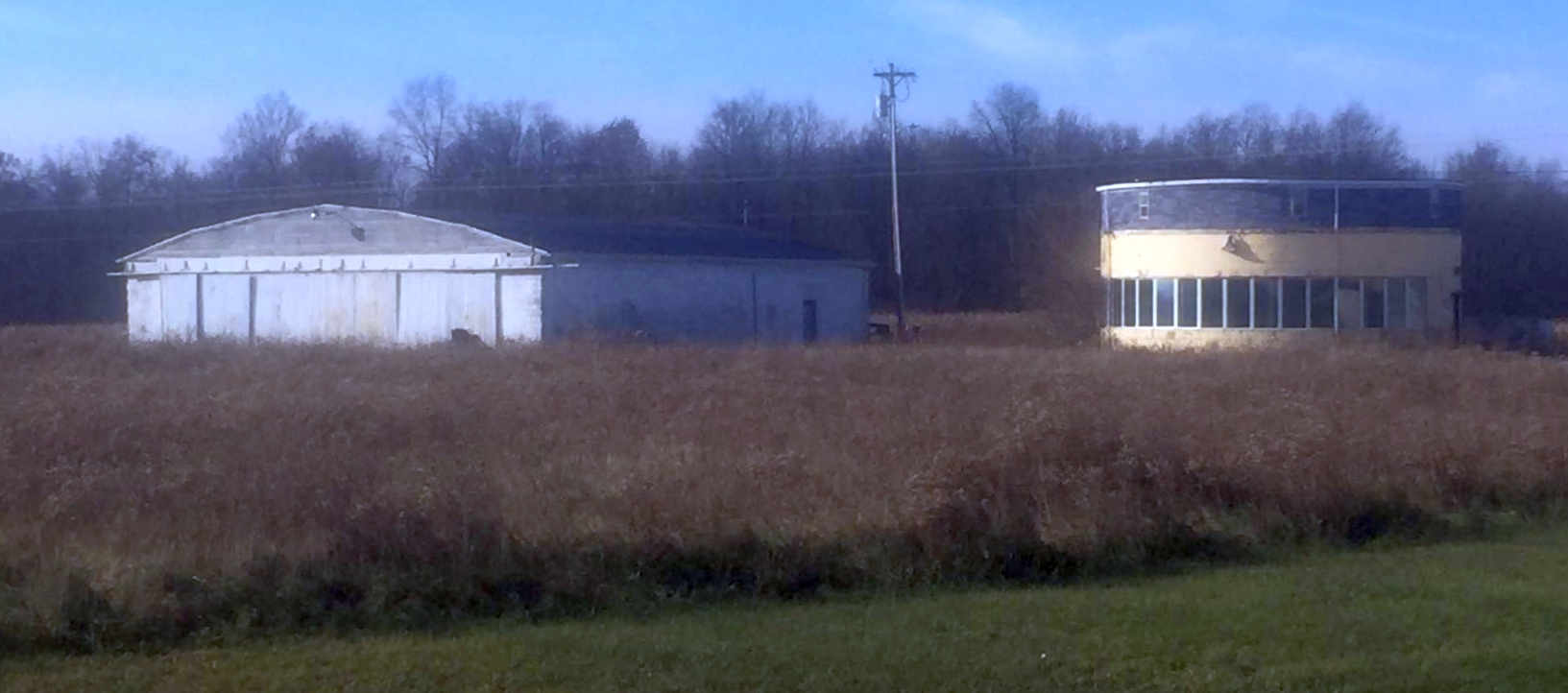
A circa 2018 photo by Phillip Riter looking southwest at a hangar & an unusual curved 2-story office building which remain along the west side of the Woodruff Airport site.
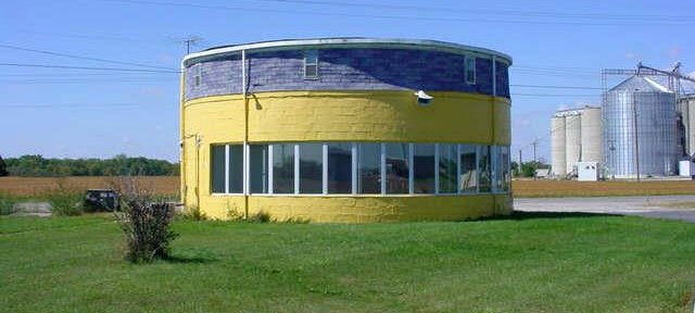
An undated photo (found in 2020 on the Williams County Auditor’s website, courtesy of Sandra Gordon) of the round building at the northwest corner of the Woodruff Airport site.
The Village of Montpelier's Sandra Gordon reported in 2020 (courtesy of Bill David),
“It looks like the property was split into different parcels after the airport closed.
The buildings on the property are currently used for storage with the exception of the round building which has recently been converted to a residence.”
The round building looks nicer now than in the [previous] picture.
That area is now also part of an industrial park.”
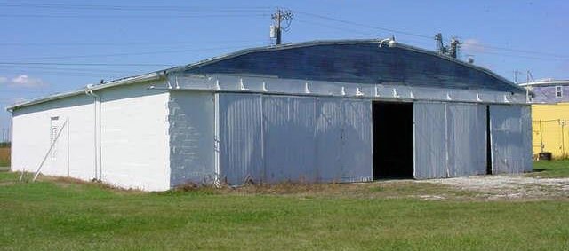
An undated photo (found in 2020 on the Williams County Auditor’s website, courtesy of Sandra Gordon) of a former arch-roof hangar on the west side of the Woodruff Airport site.
An undated photo (found in 2020 on the Williams County Auditor’s website, courtesy of Sandra Gordon) of a former hangar on the west side of the Woodruff Airport site.
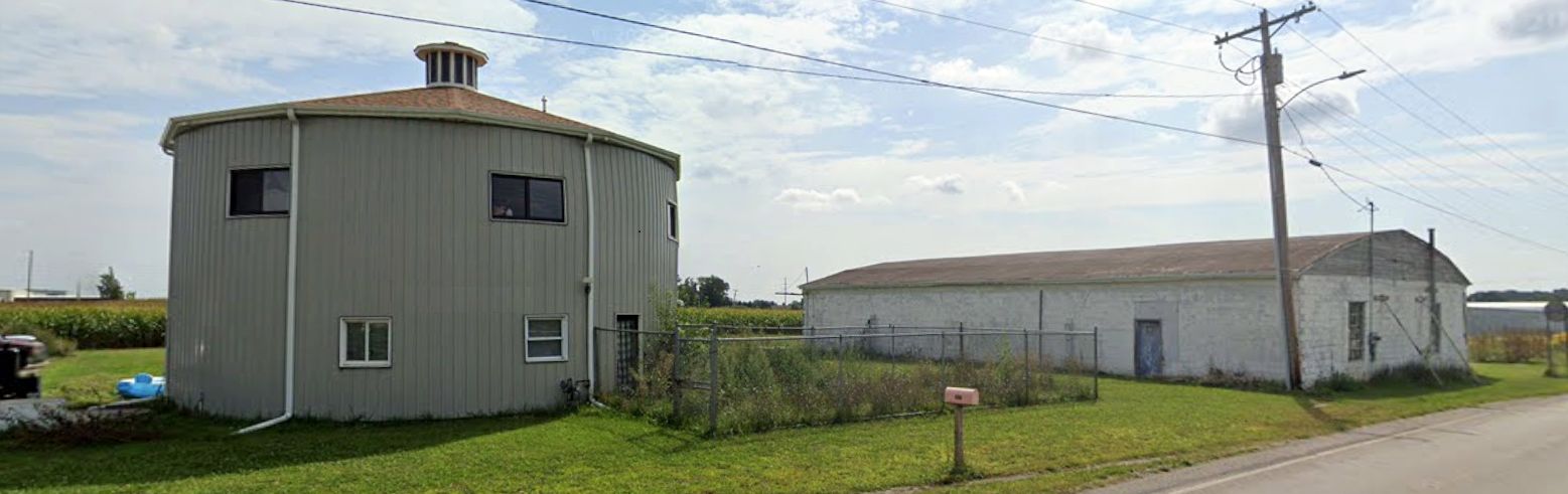
A 2023 photo looking east at the curved 2-story office building & hangar which remain along the west side of the Woodruff Airport site.
The office building had been refinished at some point between 2018-2023.
Thanks to Bill David & Lee Corbin for information about this airfield.
____________________________________________________
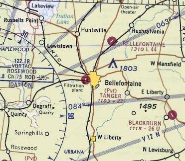
Hareport / Tanger Airport, Bellefontaine, OH
40.36, -83.78 (Northwest of Columbus, OH)
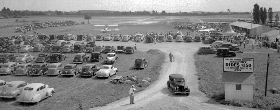
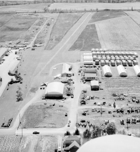
A circa 1946-47 photo of an airshow at Hareport / Tanger Airport (courtesy of Lee Corbin).
According to a historical plaque, Lawrence Rausenberger, pioneer designer & builder of aircraft engines, made the first flight off this field on 8/1/1912.
However, Hareport was not depicted on the February 1935 Cleveland Sectional Chart.
The earliest depiction which has been located of Hareport as a circa 1946-47 photo of an airshow.
A large number of spectactors were in attendence, and several biplanes were parked on a grass airfield next to some small hangars.
Hareport still was not depicted on the July 1947 Cleveland Sectional Charts.

The earliest aeronautical chart depiction which has been located of Hareport was on the January 1948 Cleveland Sectional Chart,
which depicted Hareport as a commercial/municipal airport.
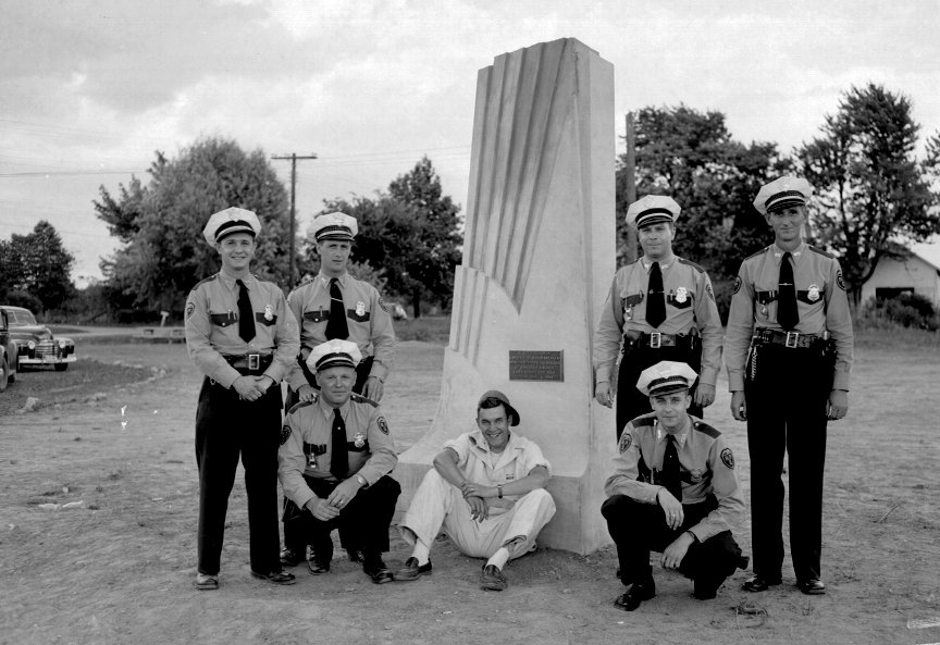
An 8/1/48 photo (courtesy of Lee Corbin) of several policemen at the dedication of the scale replica of the Wright Brothers Memorial Pylon at Hareport,
which was erected to commemorate the 36th anniversary of the first flight from the airfield.
The pylon was erected by the Bellefontaine Air Squadron #2, a program of the Boy Scouts, sponsored by the Bellefontaine Police Department.
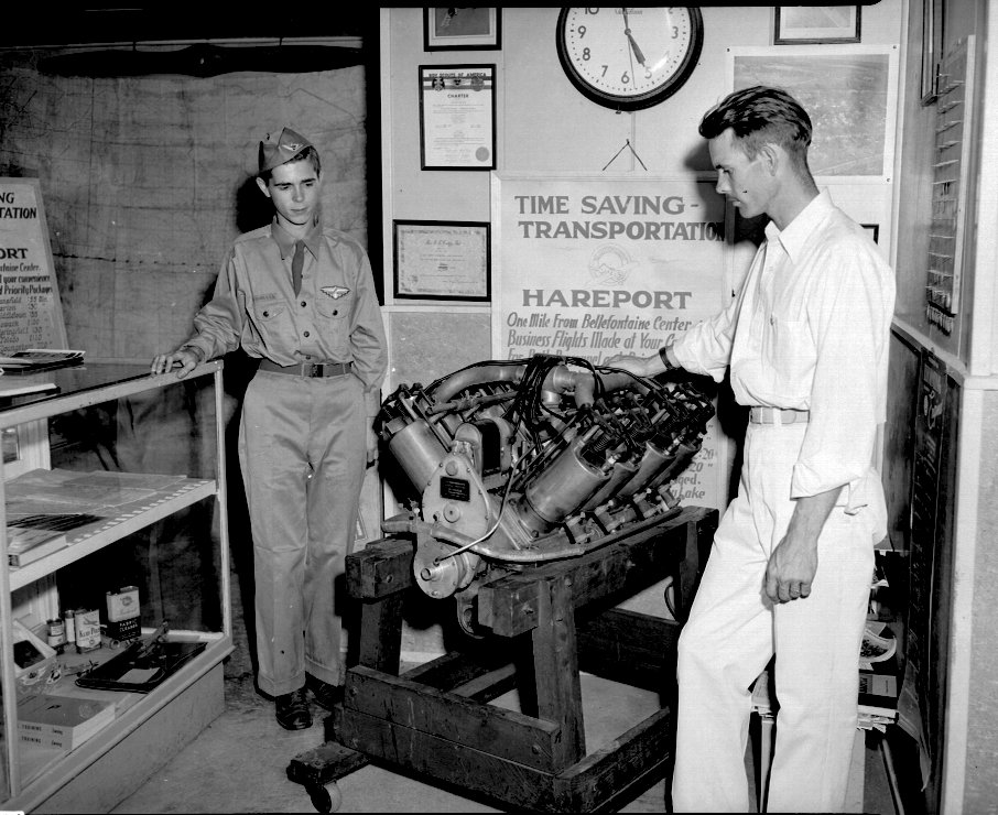
A 1948 photo (courtesy of Lee Corbin) of a display of an aircraft engine at a Hareport airshow.
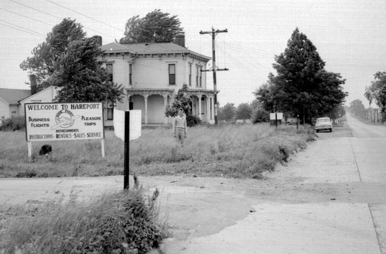
A circa 1940s photo (courtesy of Lee Corbin) of the Hareport welcome sign.
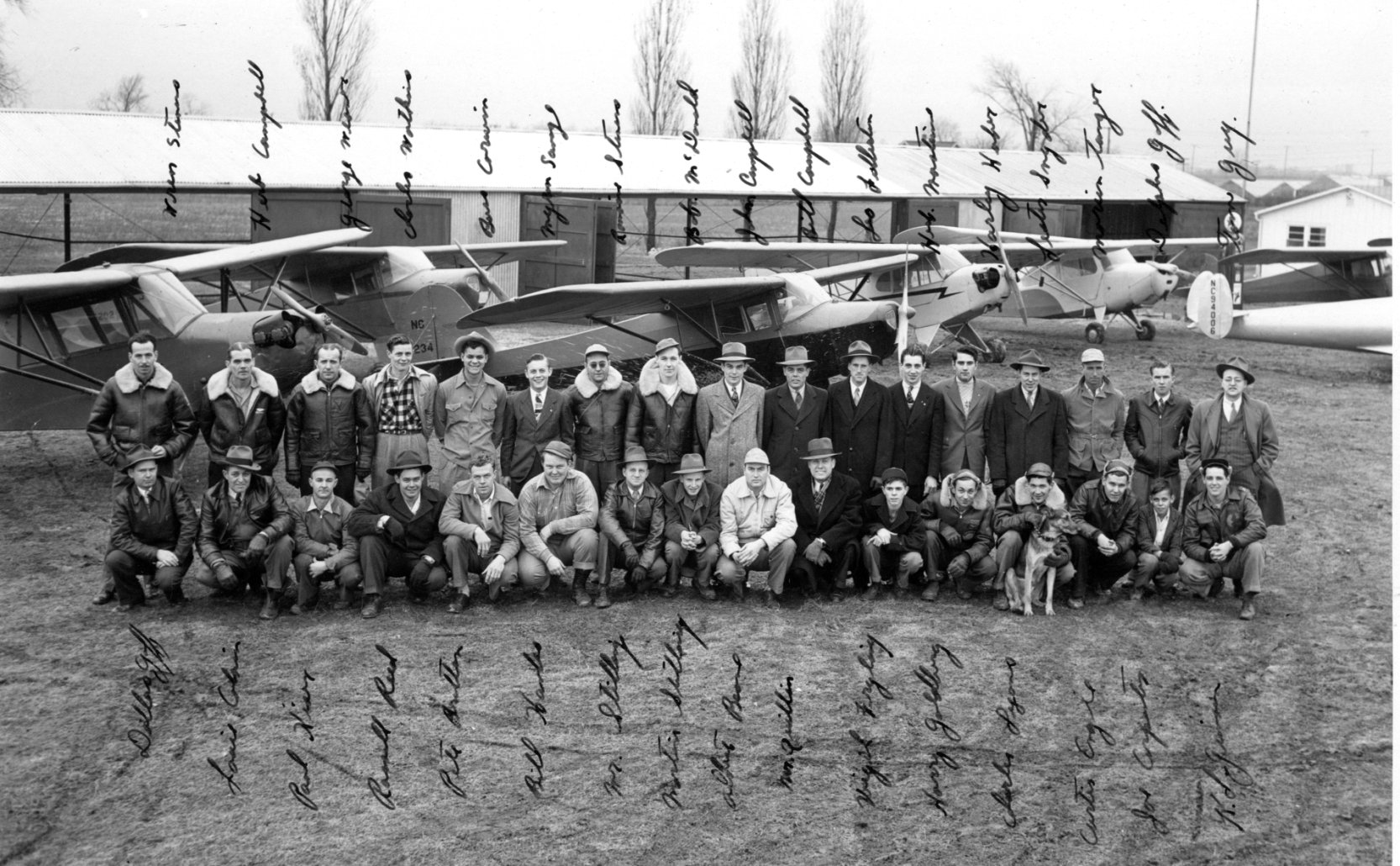
A circa 1940s photo (courtesy of Lee Corbin) of a group of pilots in front of a variety of single-engine aircraft & hangars at Hareport.
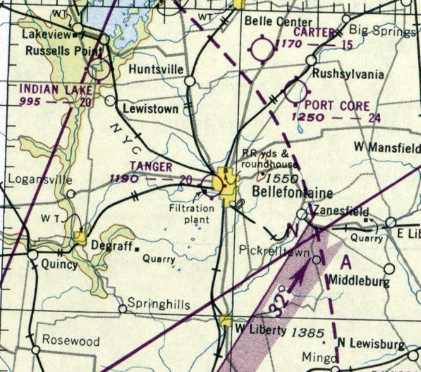
The earliest aeronautical chart depiction which has been located of Tanger Airport was on the November 1950 Cleveland Sectional Chart,
which depicted Tanger Airport as having a 2,000' unpaved runway.
A 1959 aerial view looking south (courtesy of Lee Corbin) depicted Tanger Airport as having a single unpaved northeast/southwest runway,
with 2 hangars & 2 single-engine aircraft on the northeast side.
The last aerronautical chart depiction which has been located of Tanger Airport was on the May 1968 Cleveland Sectional Chart,
which depicted Tanger Airport as having a 2,200' paved northeast/southwest runway.
Tanger Airport was evidently closed (for reasons unknown) at some point between 1968-70,
as it was no longer depicted on the May 1970 Cleveland Sectional Chart.
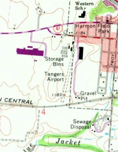
The 1972 USGS topo map depicted “Tangers Airport” as having an unpaved northeast/southwest runway, with a few small buildings on the north side.
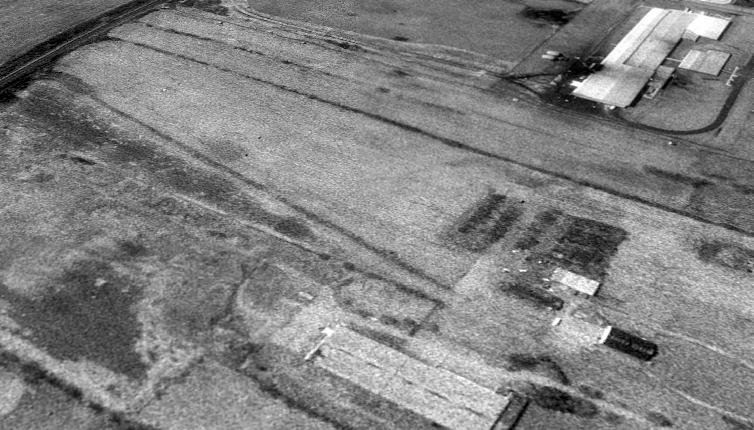
A 1994 USGS aerial view looking southwest at the site of Tanger Airport showed the runway remained recognizable though deteriorated, and the former hangars remained on the north side.
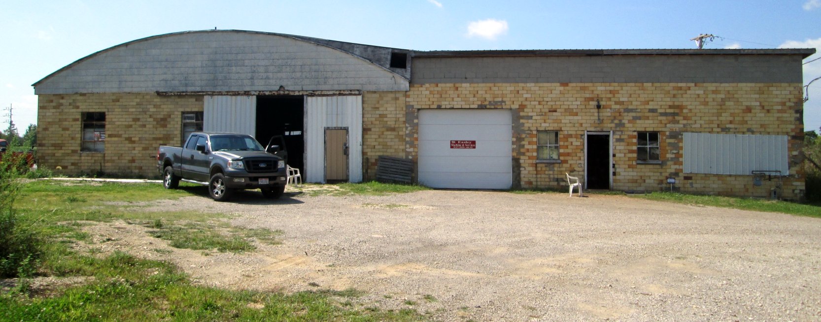
An 8/26/14 photo by Ronald Irick of the former hangar which remains at the site of Tanger Airport.
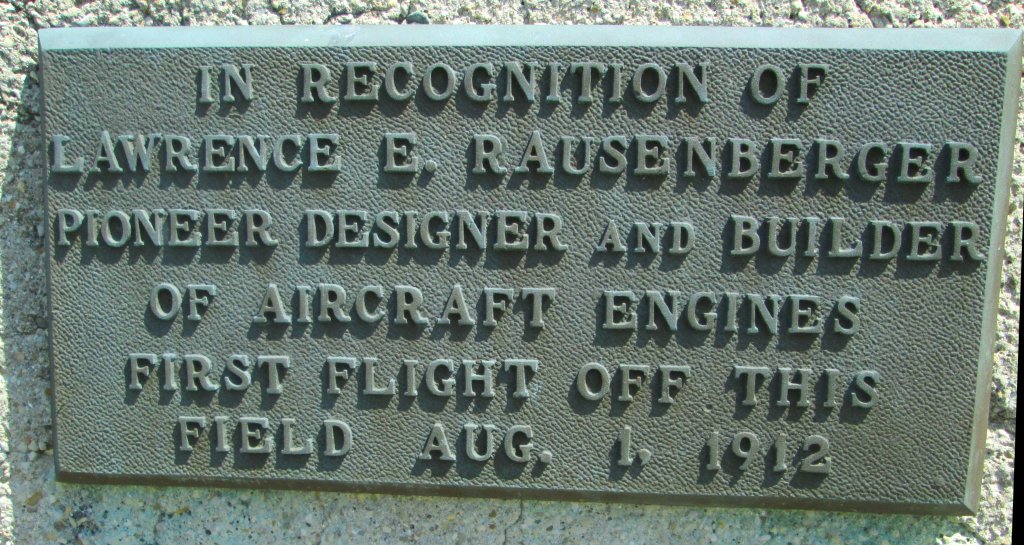
An 8/26/14 photo by Ronald Irick of the historical plaque commemorating the first flight from Hareport / Tanger Airport.
Although originally located at Hareport, in 2002 the plaque was moved to the Bellefontaine Regional Airport.
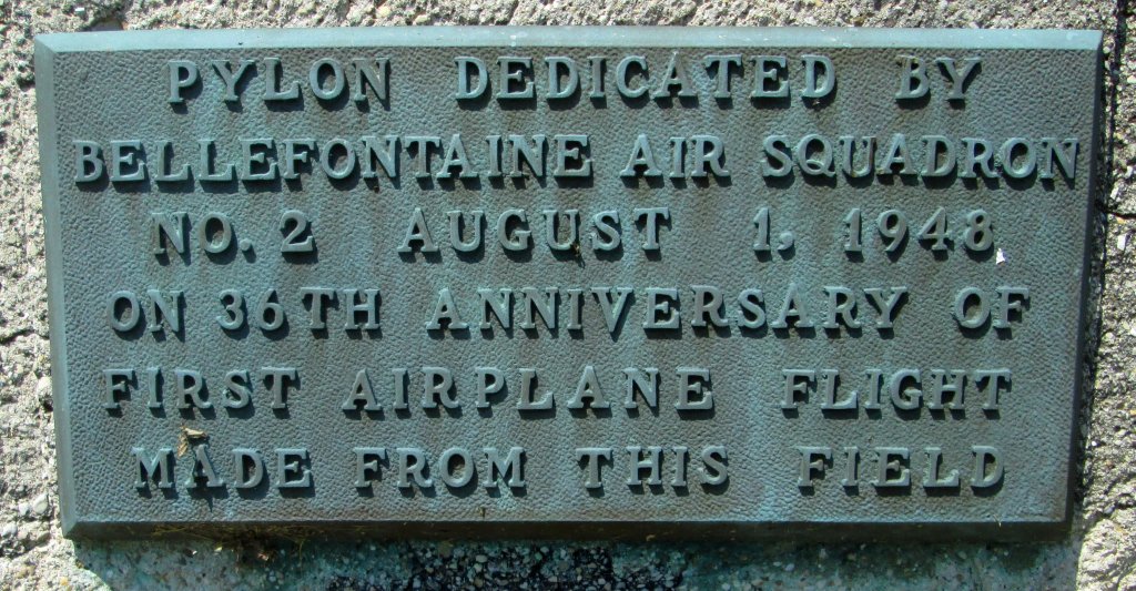
An 8/26/14 photo by Ronald Irick of the historical plaque on the scale replica of the Wright Brothers Memorial Pylon at Hareport.
Although originally located at Hareport, in 2002 the pylon was moved to the Bellefontaine Regional Airport.
A 2016 aerial view looking southwest at the site of Tanger Airport showed a small portion of the runway pavement remained, along with the former hangars on the north side.
Thanks to Lee Corbin for pointing out this airfield.
____________________________________________________
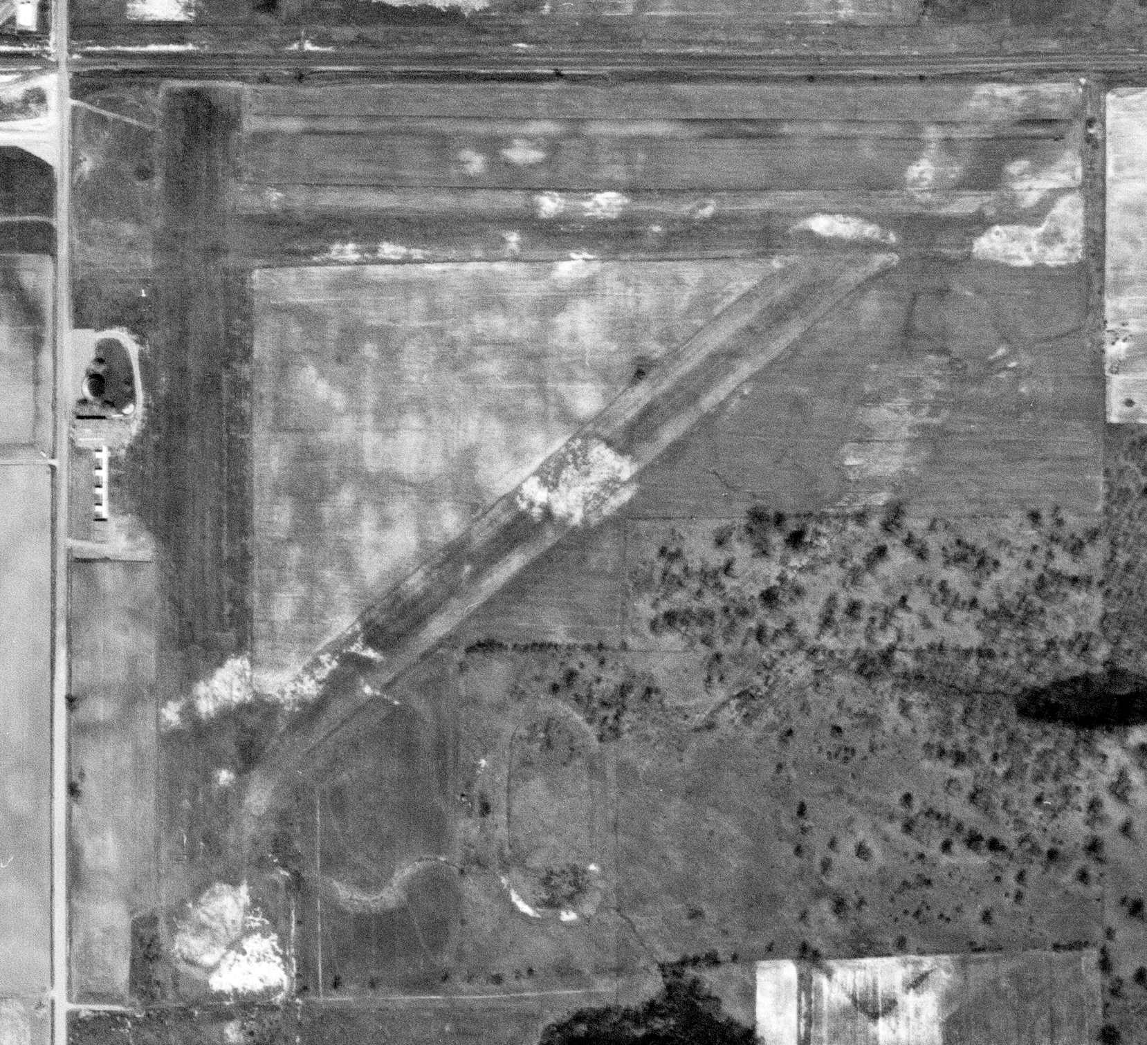
Paulding Airport (2H8), Paulding, OH
41.17, -84.555 (East of Fort Wayne, IN)
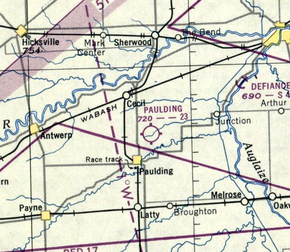
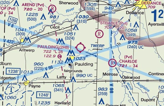
Paulding Airport, as depicted on the November 1950 Chicago Sectional Chart.
This small general aviation airport was evidently established at some point between 1946-50,
as it was not yet depicted on the June 1946 Chicago Sectional Chart.
The earliest depiction which has been located of Paulding Airport was on the November 1950 Chicago Sectional Chart.
It depicted Paulding Airport as having a 2,300' unpaved runway.
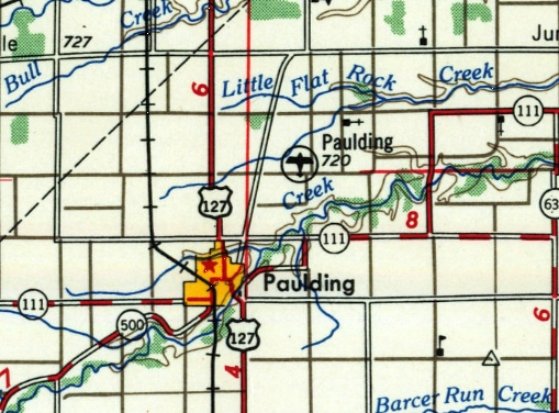
The earliest topo map depiction which has been located of Paulding Airport was on the 1956 USGS topo map.
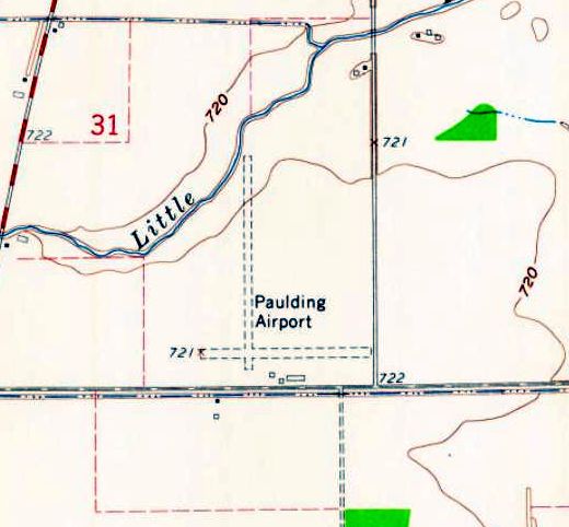
The 1960 USGS topo map depicted Paulding Airport as having 2 perpendicular unpaved runways, and 3 small buildings on the south side.
According to its FAA Airport/Facility Directory data, Paulding Airport had an “activation date” of May 1972,
even though other sources show it existed for several decades before that.
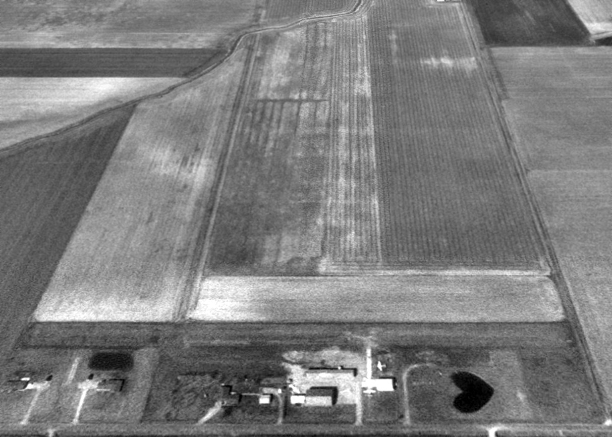
The earliest photo which has been located of Paulding Airport was a 1994 USGS aerial view looking north.
It depicted Paulding Airport as having 2 perpendicular unpaved runways, with 2 light single-engine aircraft parked near some small buildings on the south side.
According to its FAA Airport/Facility Directory data, as of 2008 Paulding Airport had a total of 8 aircraft based on the field,
and it conducted an average of 40 takeoffs or landings per week.
The owner was listed as Jim Calvin, and the manager as Ron Weck.
Paulding was said to have a single 2,861 turf Runway 18/36, “in good condition”.
The 2016 Sectional Chart depicted Paulding Airport as having a 2,800' unpaved runway.
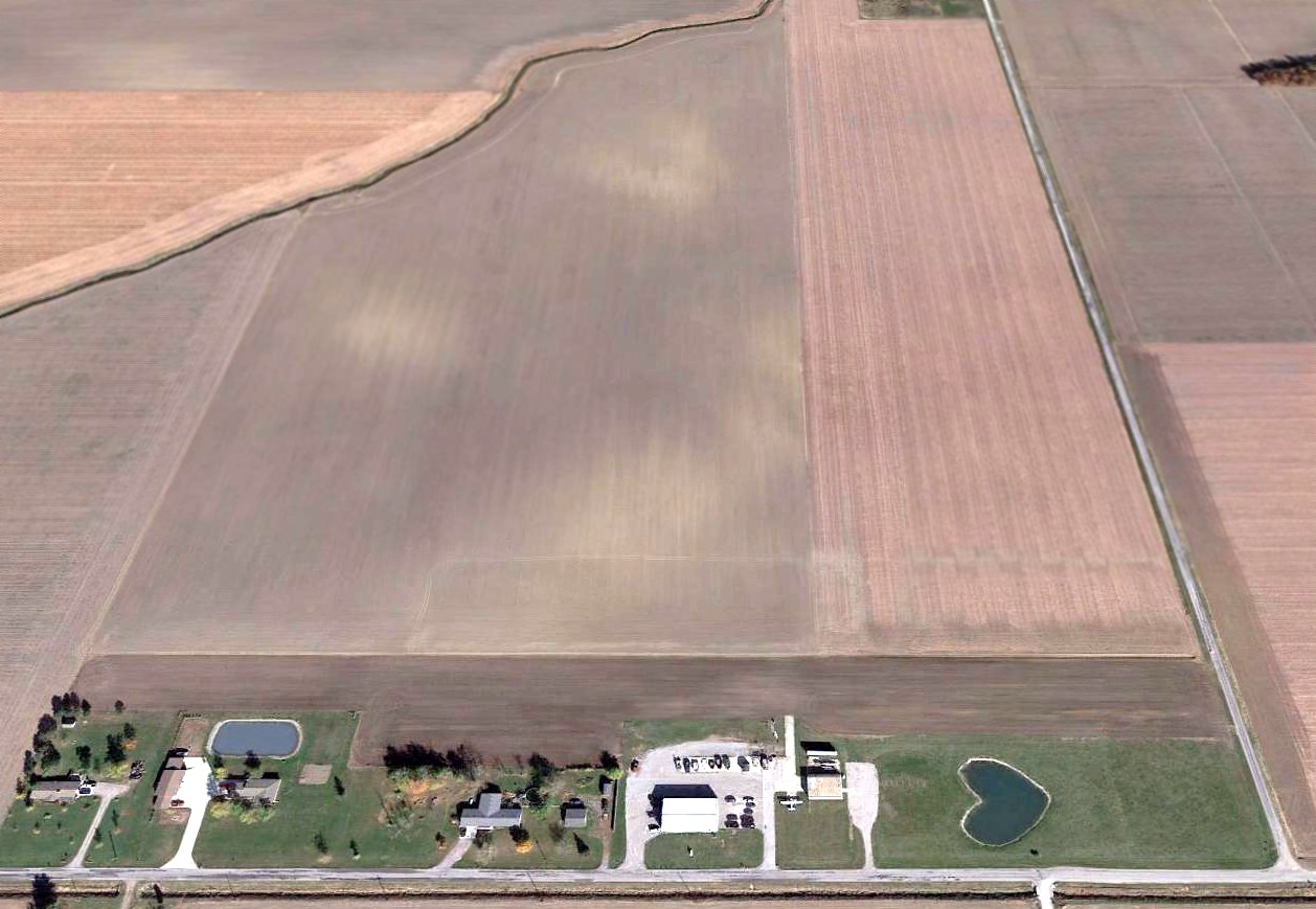
A 2016 aerial view looking north showed Paulding Airport's north/south runway was no longer perceptible, but the east/west runway remained intact.
One Cessna was still visible parked on the south side of the runway.
According to its FAA Airport/Facility Directory data, as of 2016 Paulding Airport was listed as “Airport closed indefinitely”.
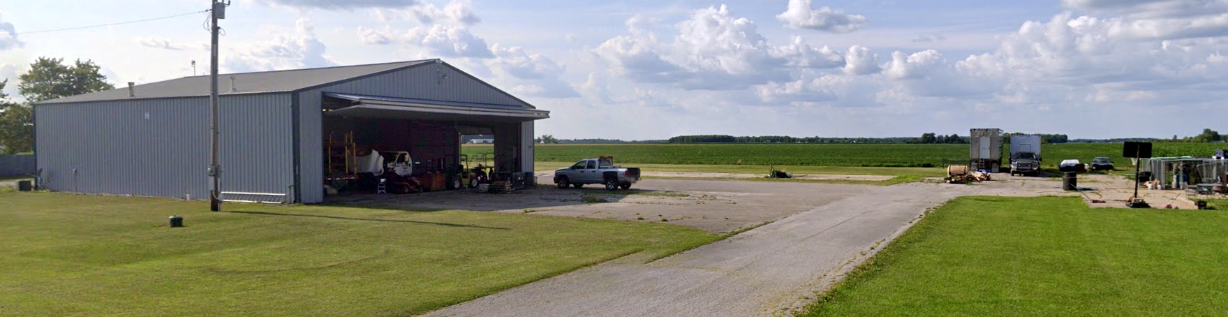
A 2023 photo looking northwest at the former hangar & ramp at the site of Paulding Airport. The previously-seen Cessna was no longer visible.
Paulding Airport is located northwest of the intersection of Road 162 & Town Highway 119.
Thanks to Randy Coller for pointing out this airfield.
____________________________________________________
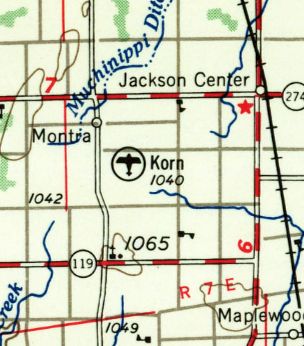
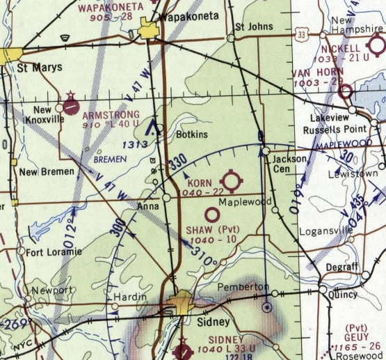
Korn Field, Jackson Center, OH
40.42, -84.08 (Northwest of Columbus, OH)
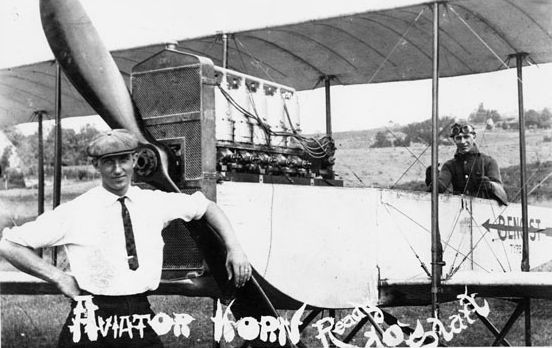
A circa 1912 photo of Milton Korn in front of a Benoist Type XII while his brother Edward is at the controls, presumably at Korn Field (courtesy of Jim Hackman).
According to the Historical Marker Project (courtesy of Jim Hackman), “The first airport in Shelby County & one of the earliest in OH
was opened July, 1908, by the Korn brothers, Edward & Milton.”
According to the Wright State Library (courtesy of Jim Hackman), “Milt & Ed Korn began building flying machines in 1908.
Altogether they built 4 airplanes, of which the first 2 never got off the ground.
The 3rd one, powered with a marine motor, made successful flights in 1911, taking off & landing at Korn Airport.”
According to the Historical Marker Project (courtesy of Jim Hackman), “They flew the length of the field, a half mile in a half minute & landed safely.
Their plane was a pusher-type monoplane with a 34' wingspan,40 horsepower, water-cooled, 4-cylinder, 2-cycle engine, and weighed 650 pounds.”
According to the Wright State Library (courtesy of Jim Hackman), “The 4th airplane, called a Benoist Type XII, was put together in 1911-12 out of parts from a number of different airplanes.
It was used in 1912 to carry the first air mail in the state of IL.”
The Wright State Library continued, “The Korn brothers’ only crash occurred on 8/13/1913.
With Edward at the controls & Milton riding as passenger, the Benoist Type XII plane crashed in an open field on George Linker’s property in Shelby County.
On August 18, Milton died from his injuries. Edward Korn’s injuries healed, but, haunted by the accident & the loss of his brother, he stopped flying.
From 1913-46, public operations & services at the Korn Airport were discontinued,
but a younger brother of the Korns, Arlington Korn, continued to fly, using the field as his base of operations.”
Korn Field was not depicted on the 1934 Chicago Sectional Chart.
According to the Historical Marker Project, “It was used by the Flying Farmers organization, and following World War II, pilots were trained here under the G.I. Bill of Rights.”
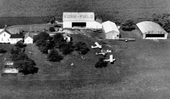
The earliest photo which has been located showing the facilities of Korn Field was a circa 1948 aerial view (courtesy of Jim Hackman).
It depicted Korn Field as having 2 hangars (one of which had “Korn Field” painted on the roof) along with other building & a house.
A total of 5 light single-engine planes were parked on the field.
Korn Field still was not depicted on the July 1948 Chicago Sectional Chart.
The Wright State Library continued, “In 1949, Ed Korn donated the Benoist Type XII
to the Smithsonian Institution’s National Air & Space Museum in Washington, DC, where it is now on permanent display.”

The earliest aeronautical chart depiction which has been located of Korn Field was on the December 1949 Chicago Sectional Chart.
It depicted Korn as having a mere 2,200' unpaved runway.
The earliest topo map depiction which has been located of Korn Field was on the 1956 USGS topo map.
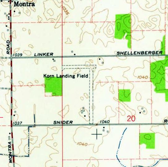
The 1961 USGS topo map depicted Korn Landing Field as having 2 perpendicular unpaved runways, with 3 small buildings on the southwest side.
The last aeronautical chart depiction which has been located of Korn Field was on the May 1968 Chicago Sectional Chart.
It depicted Korn as having a mere 2,200' unpaved runway.
Korn Field was evidently closed (for reasons unknown) at some point in 1968, as it was no longer depicted on the December 1968 Chicago Sectional Chart.
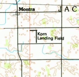
The 1989 USGS topo map still depicted Korn Landing Field as having 2 perpendicular runways.
A 1994 aerial view showed the site of the Korn Field runways remained clear, but there was no indication of any recent aviation usage.
The Wright State Library continued, “The Korn Airport property was later owned by Arlington’s son Wayne Korn until 2009.
It is now [as of 2013] part of Creative Plastics International, a business owned & operated by members of the Korn & Wurm families.”
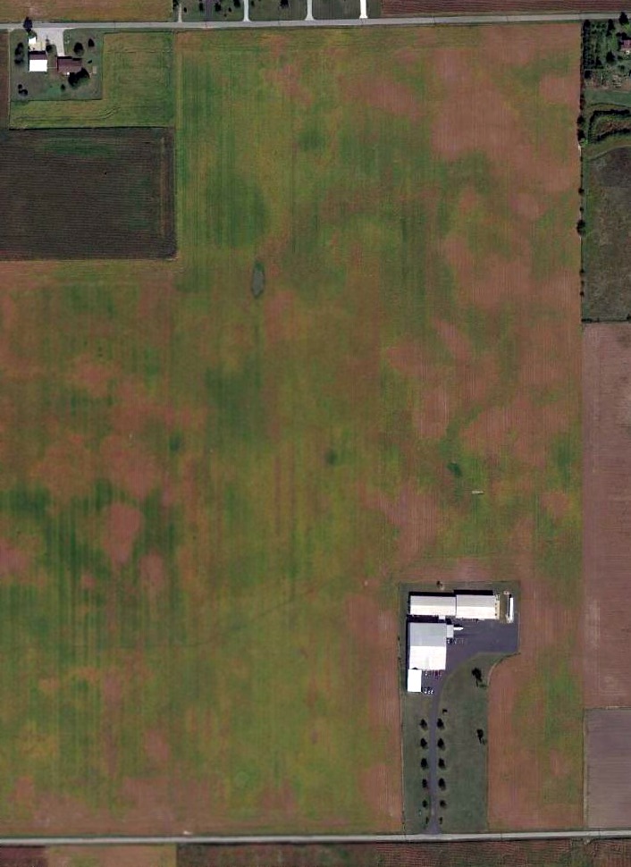
A 2014 aerial view of the site of Korn Field showed the airport buildings at the south end had been added onto, and the runway area remained clear.
The site of Korn Field is located northeast of the intersection of Pasco-Montra Road & Snyder Road.
Thanks to Jim Hackman for pointing out this airfield.
____________________________________________________
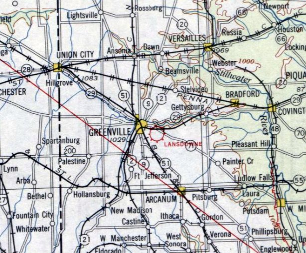
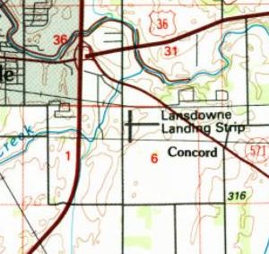
Lansdowne Airport, Greenville, OH
40.09, -84.6 (Northwest of Columbus, OH)
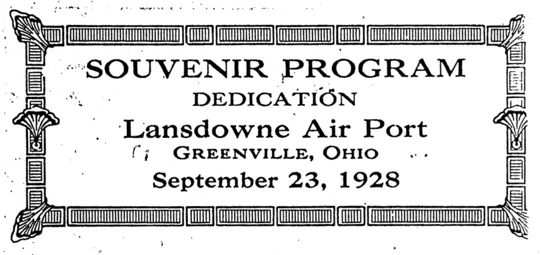
A Souvenir program of the 9/23/28 Dedication of Lansdowne Airport (courtesy of Jim Hocker).
This general aviation airport on the southeast side of the town of Greenville
was dedicated on 9/23/28, according to a Souvenir Program of the Dedication (courtesy of Jim Hocker).
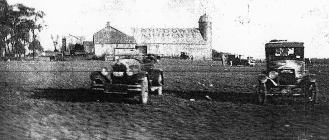
The earliest photo which has been located of Lansdowne Airport was a circa 1920s/30s photo (courtesy of Jim Hocker) of a barn with “Lansdowne Airport” painted on its roof.
The earliest aeronautical chart depiction which has been located of Lansdowne Airport was on the December 1930 Chicago Sectional Chart.
It depicted Lansdowne Airport as a commercial/municipal airport.
Lansdowne Airport may have gone through a period of closure during WW2, (like many other small civilian airports)
as it was not listed among active airfields in the 1945 AAF Airfield Directory (courtesy of Scott Murdock).
The 1953 Chicago Sectional Chart depicted Lansdowne Airport as having a mere 1,800' unpaved runway.
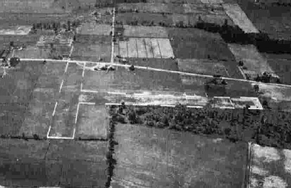
An undated diagram (courtesy of Jim Hocker) depicted Lansdowne Airport as having 3 runways, and 2 small buildings on the northwest side.
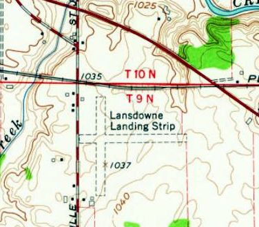
The 1961 USGS topo map depicted “Lansdowne Landing Strip” as having 2 unpaved perpendicular runways,
with a few small buildings on the northwest & southwest sides.
Lansdowne Airport was evidently closed (for reasons unknown) at some point between 1953-61,
as it was no longer depicted on the June 1961 Chicago Sectional Chart.
The 1989 USGS topo map still depicted 2 runways labeled as “Lansdowne Landing Strip”,
even though the airport had evidently been closed for at least 28 years by that point.
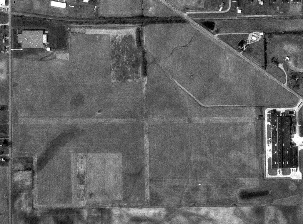
A 1994 USGS aerial view still depicted traces of 2 perpendicular unpaved runways at the site of Lansdowne Airport,
although a building had been built over the east end of the east/west runway.
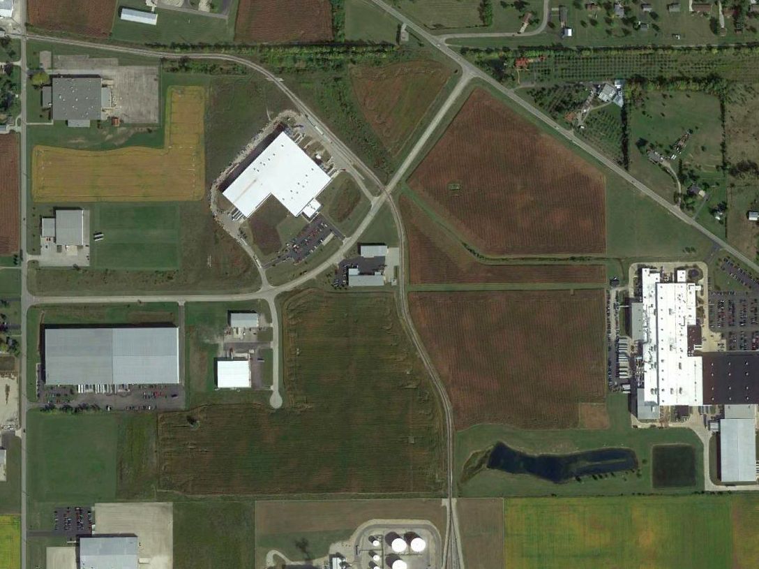
A 2014 aerial view of the site of Lansdowne Airport showed buildings & roads had covered most of the airport site,
but amazingly the outline of the east end of the former east/west runway is still recognizable as a gap in the planted crops.
The site of Lansdowne Airport is located east of the intersection of Jaysville - St. Johns Road & Lansdowne Road.
Thanks to Jim Hocker for pointing out this airfield.
____________________________________________________
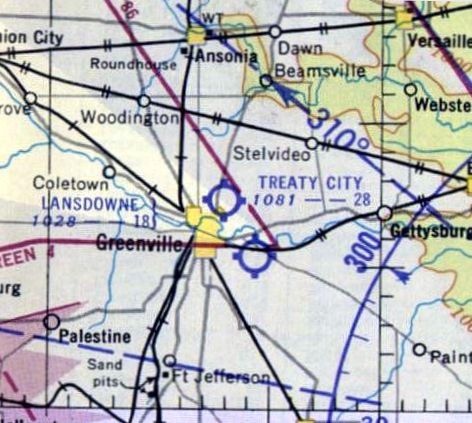
Treaty City Airport, Greenville, OH
40.122, -84.617 (Northwest of Columbus, OH)

Treaty City Airport, as depicted on the November 1936 Chicago Sectional Chart.
This general aviation airport was located on the northeast side of the town of Greenville was evidently established at some point in 1936,
as it was not yet depicted on the April 1936 Chicago Sectional Chart.
The earliest depiction which has been located of Treaty City Airport was on the November 1936 Chicago Sectional Chart.
It depicted Treaty City as a commercial/municipal airport.
The earliest photo which has been located of Treaty City Airport was a 9/28/43 aerial view from the 1945 AAF Airfield Directory (courtesy of Scott Murdock).
It depicted Treaty City Airport as having 2 unpaved perpendicular runways.
The 1945 AAF Airfield Directory (courtesy of Scott Murdock) described Treaty City Airport
as a 67 acre irregularly-shaped field having 2 sod runways, measuring 1,980' north/south & 1,850' east/west.
The field was said to have 2 hangars, the largest being a 95' x 50' wood & metal structure.
Treaty City Airport was was described as being owned & operated by private interests.
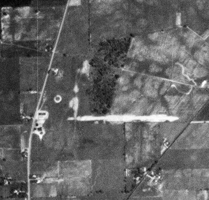
A 9/6/52 USGS aerial view depicted Treaty City Airport as having an unpaved east/west runway, with several small hangars on the west side.
The 1953 Chicago Sectional Chart depicted Treaty City Airport as having a 2,800' unpaved runway.
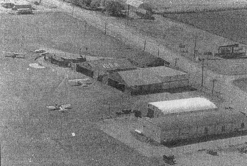
An undated aerial view of Treaty City Airport (courtesy of Jim Hocker) depicted 3 light aircraft parked near several hangars.
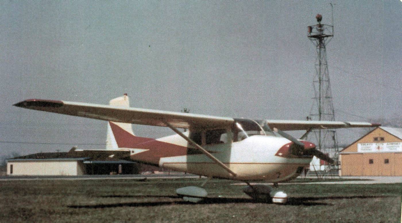
An undated photo (courtesy of Jim Hocker) of a Cessna 172 part-owned by Harry Campbell in front of the Treaty City Airport hangars & beacon tower.

The 1960 OH Airport Directory (courtesy of Jim Hocker) depicted Treaty City Airport as having 3 sod runways & several buildings on the west side.
It listed the manager as Mrs. Wm. Bleyle.
The June 1961 Chicago Sectional Chart depicted Treaty City Airport as having a 2,800' unpaved runway.
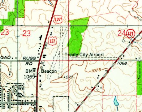
The 1961 USGS topo map depicted Treaty City Airport as having 3 unpaved runways, and several small buildings & a beacon on the west side.
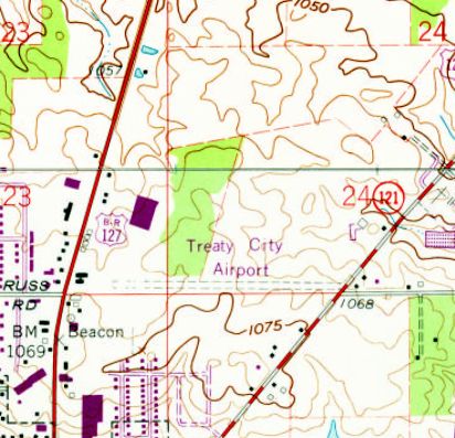
Treaty City Airport apparently lost 2 of its 3 runways at some point between 1961-73,
as the 1973 USGS topo map showed a large building had been built over the north portion of 2 of the runways,
and only the east/west runway was still depicted.
The last photo which has been located showing Treaty City Airport still in operation was a 10/14/73 USGS aerial view.
It depicted the single east/west unpaved runway, and the hangars on the west side.
The last aeronautical chart depiction which has been located of Treaty City Airport was on the November 1974 Detroit Sectional Chart (courtesy of Ron Plante).
It depicted Treaty City Airport as having a 2,800' unpaved runway.
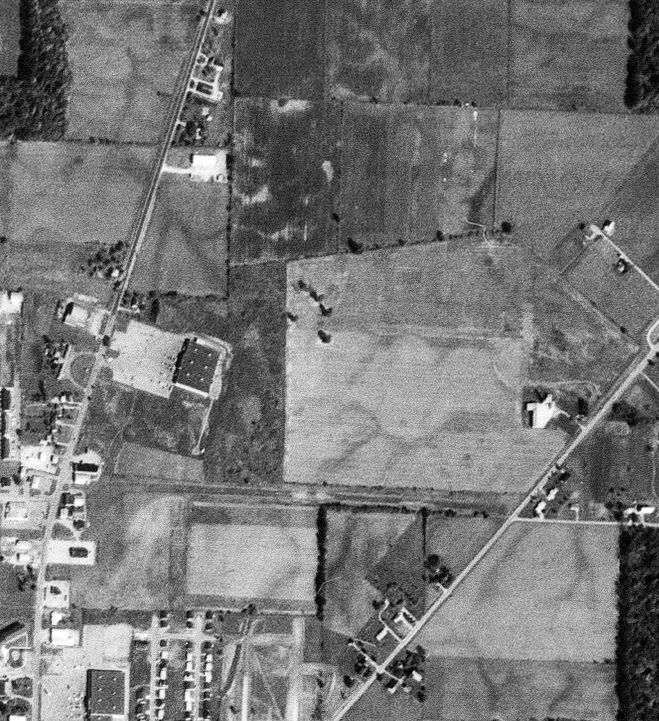
Treaty City Airport was evidently closed at some point between 1974-94,
as a 1994 USGS aerial view showed another large building had been constructed over the west portion of the east/west runway.
But the eastern portion of the east/west runway remained recognizable, along with the hangars on the west side.
A 2014 aerial view of the site of Treaty City Airport showed buildings had covered the remainder of the east/west runway,
with several hangars on the west side remaining as the last trace of this airport.
A 5/2/15 photo by Jim Hocker of 2 former Treaty City Airport hangars.
Jim observed, “Both are drive-through structures, one selling beverages & the other animal feed.”
A 5/2/15 photo by Jim Hocker of the back side of a former Treaty City Airport hangar.
The site of Treaty City Airport is located east of the intersection of Wagner Avenue & Russ Road.
Thanks to Jim Hocker for pointing out this airfield.
____________________________________________________
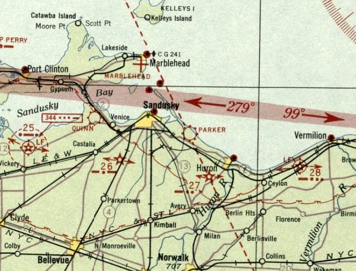
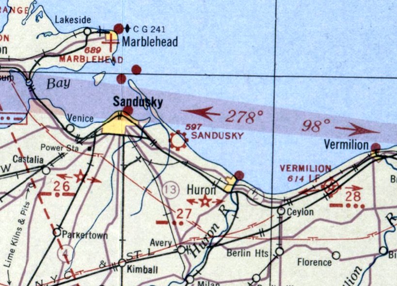
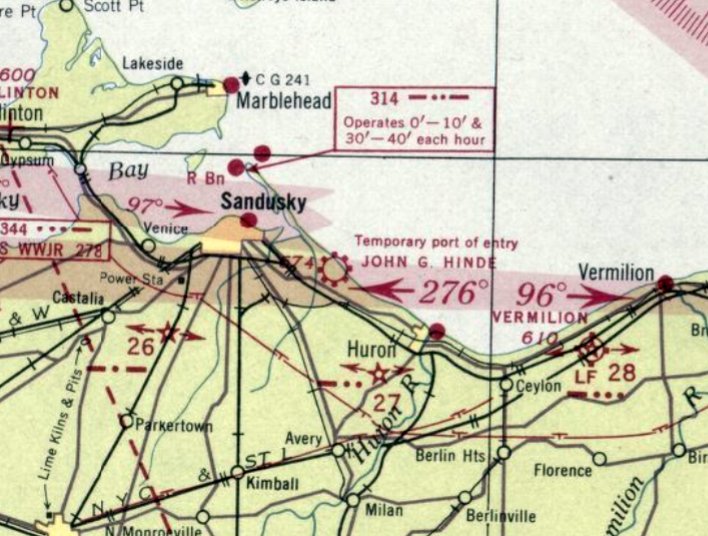
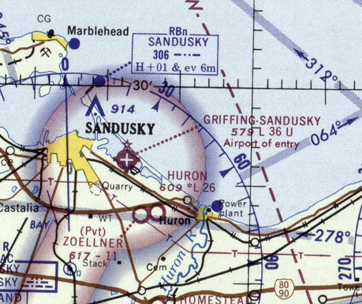
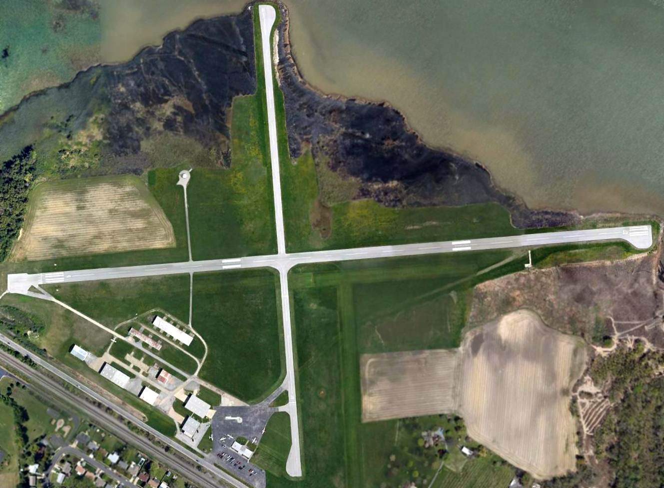
Parker Airport / Sandusky Municipal Airport / John G. Hinde Airport / Griffing Sandusky Airport (KSKY), Sandusky, OH
41.43, -82.65 (Northwest of Columbus, OH)
A circa late 1920s photo of the Parkers' first plane (biplane model undetermined) presumably at Parker Airport (courtesy of David Parker).
This general aviation airport was located directly along the shore of Lake Erie, southeast of Sandusky.
David Parker reported, “I am the son of Lucius Parker & nephew of John Parker, the brothers who were pretty much the pioneers in creating a commercial airport in Sandusky.
I have Sandusky newspaper articles citing that the Parker Brothers leased land & established an airport in 1927-28.
A Commerce Department Aeronautics Branch document designated Parker Field as a commercial airport in 1929.”
The earliest depiction which has been located of Parker Airport was a circa late 1920s photo of the Parkers' first plane (biplane model undetermined) (courtesy of David Parker).
A circa late 1920s photo of Lucius Parker in front of a Waco biplane at Parker Airport (courtesy of David Parker).
A circa late 1920s photo of 3 men & a Stinson high-wing monoplane at Parker Airport (courtesy of David Parker).
A circa late 1920s photo of Lute Parker (2nd from left) & 3 fellow aviators & a Parker Brothers Lincoln-Page biplane at Parker Airport (courtesy of David Parker).
David Parker reported, “They are standing in front of the original hangar that Dad & my Uncle John used when they began their aviation business. The is a Lincoln-Page for which they were the local distributors.”
The earliest aeronautical chart depiction which has been located of Parker Airport was on the December 1932 Cleveland Sectional Chart.
It depicted Parker Airport as a commercial/municipal airport.
Parker Airport was evidently renamed Sandusky Airport at some point between 1932-35,
as that is how it was labeled on the July 1935 Cleveland Sectional Chart.
It was once again labeled Parker Airport on the 1937 Cleveland Sectional Chart.
Parker Airport was evidently renamed John G. Hinde Airport some point between 1937-40,
as that is how it was labeled on the March 1940 Cleveland Sectional Chart.

A circa 1940s photo of Hinde Airport operator Bill Hinde & 3 other men in front of a Hinde Airport hangar labeled “Hinde”.
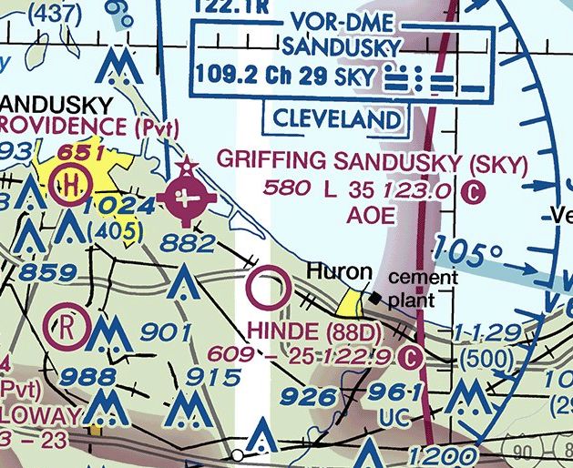
Hinde Airport, as depicted on the January 1948 Cleveland Sectional Chart.
Hinde Airport was evidently renamed Sandusky Airport (again) at some point between 1948-50,
as that is how it was labeled on the June 1950 Cleveland Sectional Chart.
To further confuse matters, there was already another Sandusky Airport on the south side of the town.
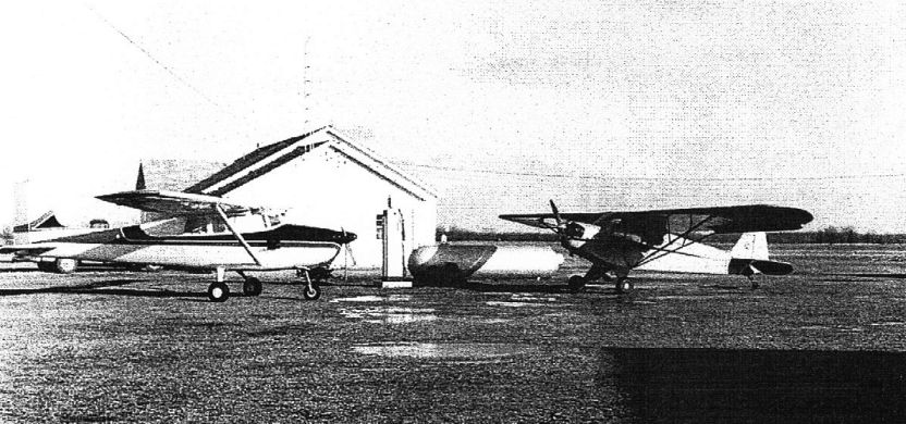
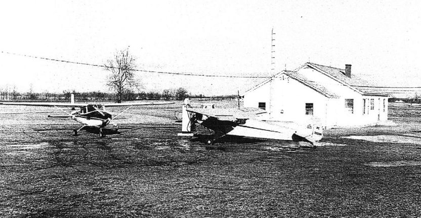
The earliest photo which has been located of Sandusky Airport was a 1950 ODoT aerial view (courtesy of Dennis Thompson).
It depicted Sandusky Airport as having 2 grass runways, with 8 light single-engine planes parked near a gaggle of small buildings & hangars on the southwest side.
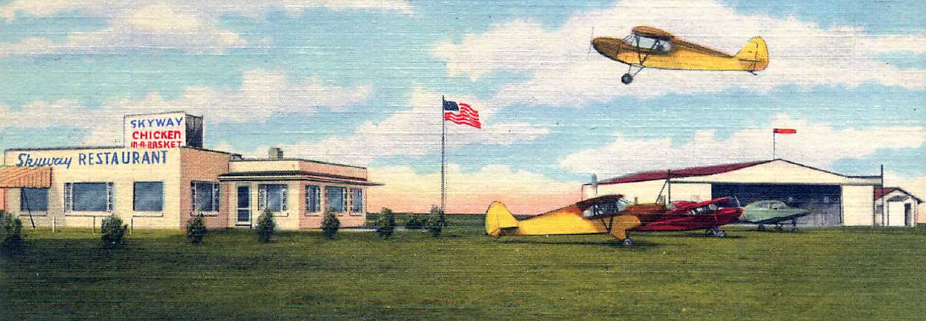
A colorized circa 1950s photo of the Skyway Restaurant & several planes & a hangar at Sandusky Airport (courtesy of Daniel Frohman).
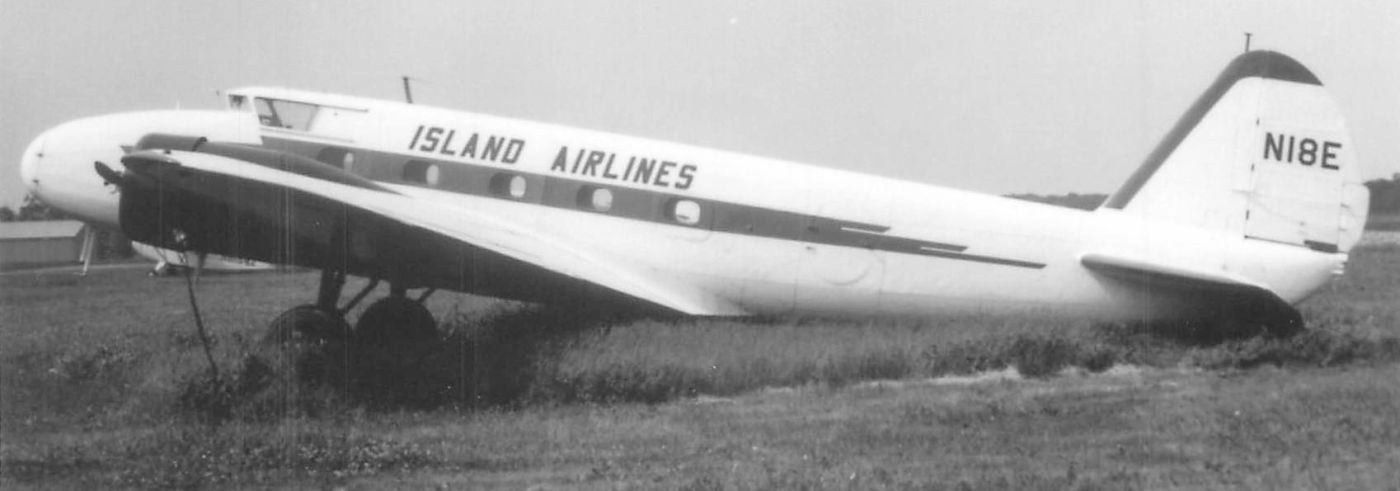
A circa 1950s photo of an Island Airways Boeing 247D at Sandusky Airport (courtesy of Daniel Frohman).
Daniel reported, “The Boeing was based at Sandusky & flown where needed, mostly the Lake Erie islands.”
A 1956 ODoT aerial view (courtesy of Dennis Thompson) continued to depict Sandusky Airport as having 2 grass runways.
A hangar was painted with “Sandusky” & “Parker” on its roof.
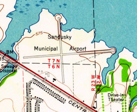
The 1959 USGS topo map depicted Sandusky Municipal Airport as having 2 paved perpendicular runways, with 6 small buildings on the southwest side.
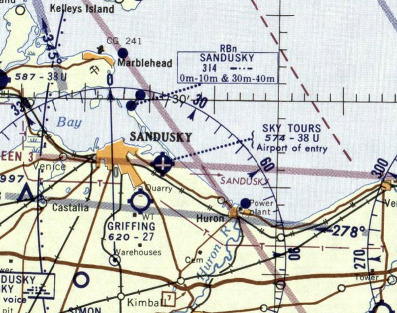
Sandusky Municipal Airport was evidently renamed Sky Tours Airport at some point between 19The May 1970 Cleveland Sectional Chart depicted Griffing Sandusky Airport as having 2 paved runways, with the longest being 3,600'.
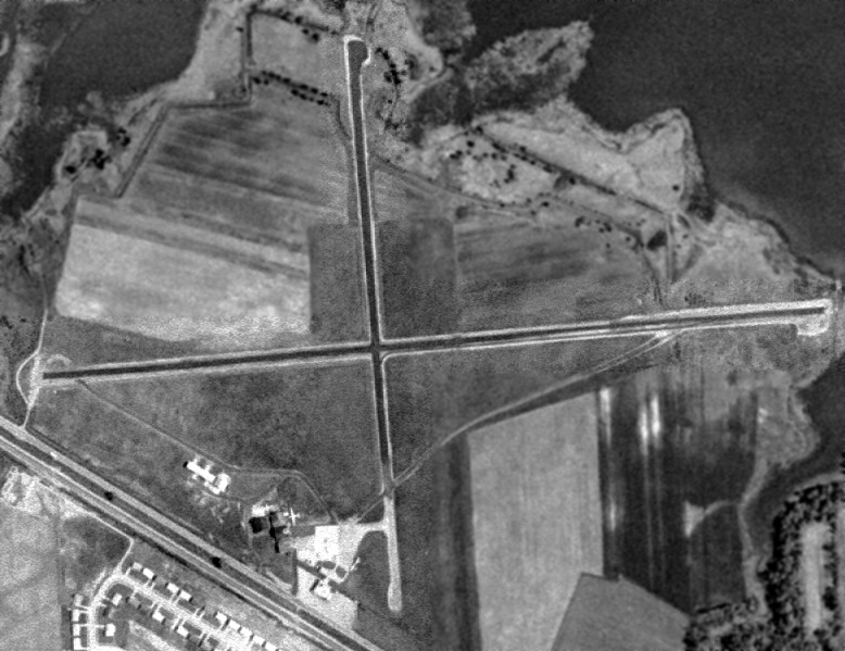
A 1960 USGS aerial view depicted Griffing Sandusky Airport as having 2 perpendicular paved runways, with a ramp with several hangars & aircraft on the southwest side.
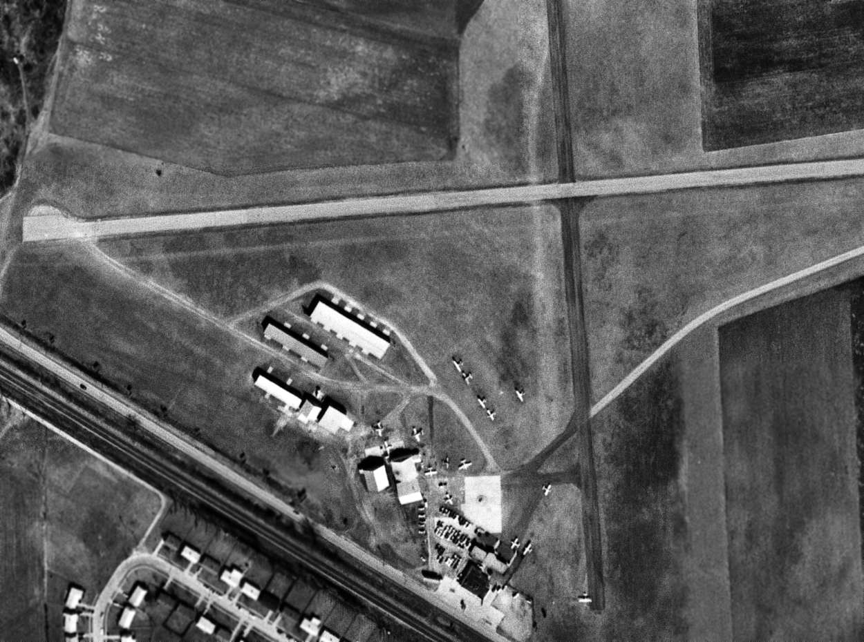
A 1969 USGS aerial photo depicted a dozen light aircraft parked among the hangars on the southwest side of Griffing Sandusky Airport.
The May 1970 Cleveland Sectional Chart depicted Griffing Sandusky Airport as having 2 paved runways, with the longest being 3,600'.
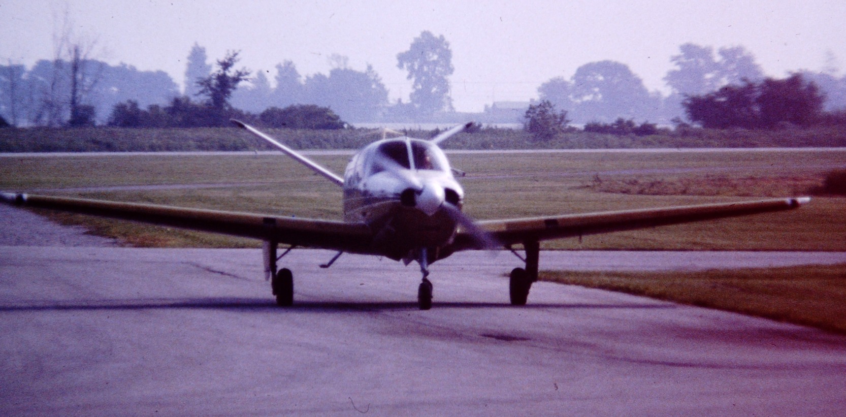
A circa 1976-77 photo by Daun Yeagley of his father taxiing in his Beech Bonanza at Griffing-Sandusky Airport.
A circa 1976-77 photo by Daun Yeagley of his father taking off in his Beech Bonanza at Griffing-Sandusky Airport.
A 1996 photo by Daniel Frohman of a Cessna 414 at Sandusky Airport. Daniel reported, “The 414 is one of the early corporate planes I flew.”
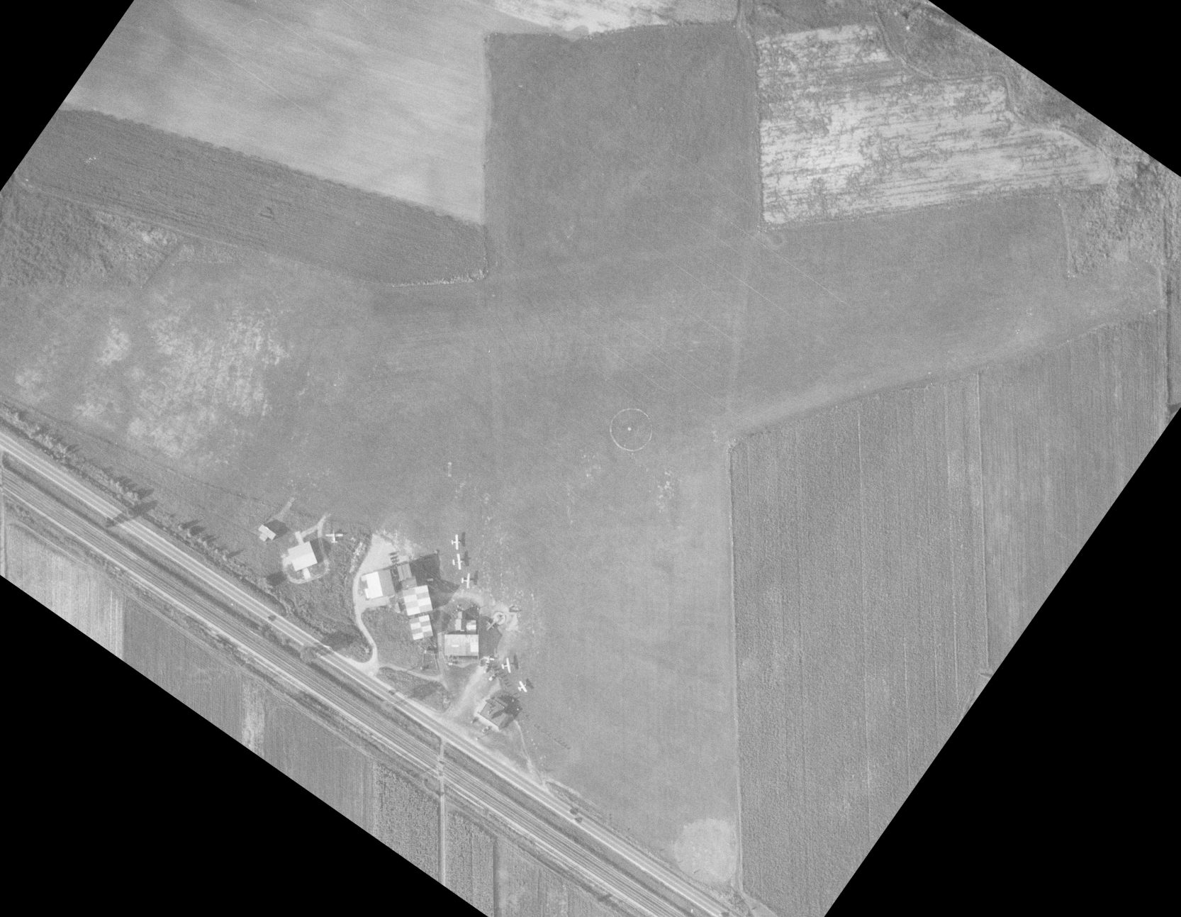
A 2007 aerial view looking southeast at a large number of planes gathered for a fly-in at Griffing Sandusky Airport.

A 6/30/08 aerial view looking west along Griffing Sandusky Airport's Runway 27.
A circa 2010 aerial view looking north showed only a single plane visible at Griffing Sandusky Airport.
A 2012 aerial view showed 6 light aircraft at Griffing Sandusky Airport.
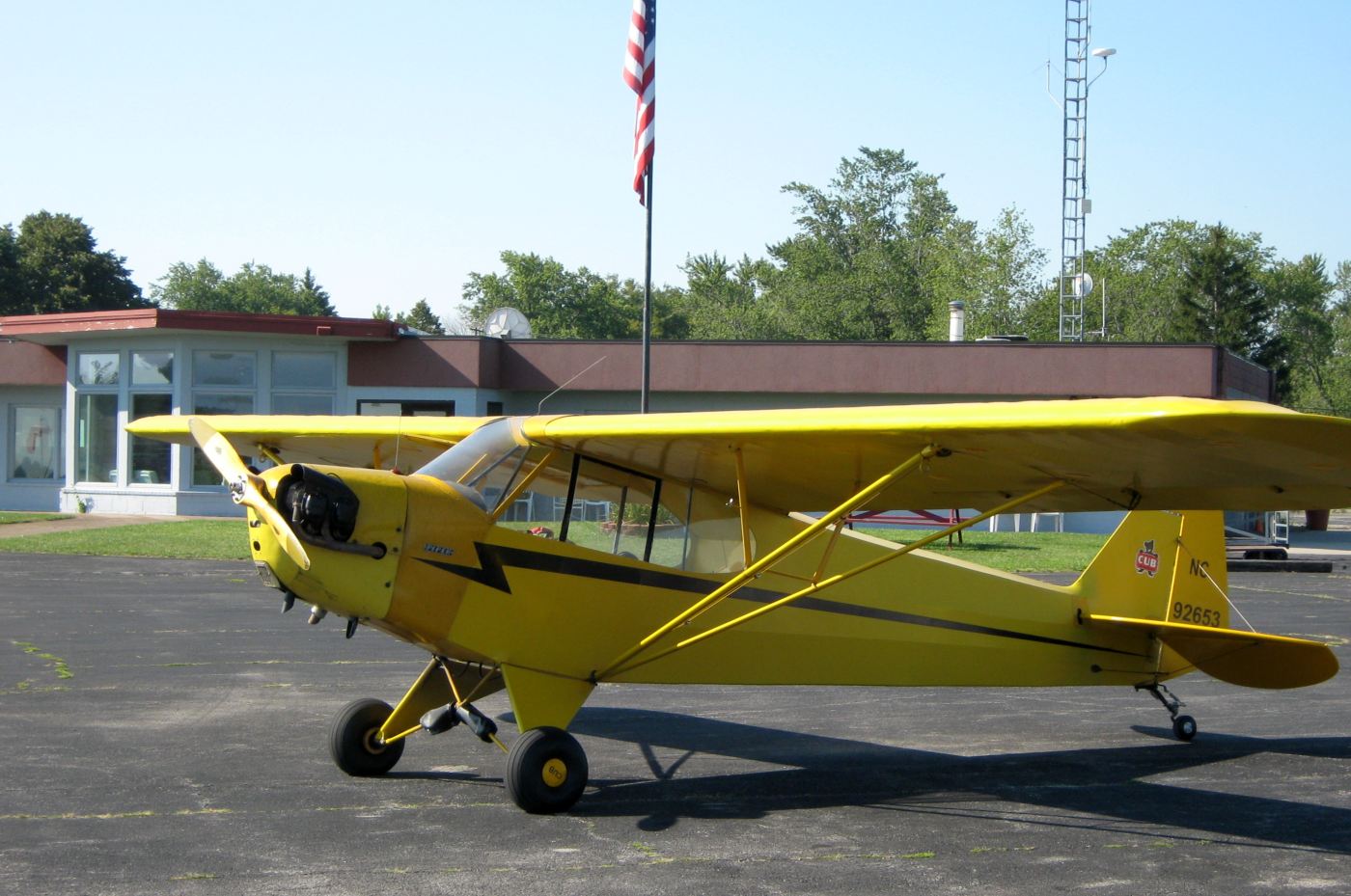
The last photo which has been located showing an aircraft at Griffing Sandusky Airport is an August 2012 photo by Darren Gaines of his beautiful Piper Cub during a fuel stop.
Darren reported, “Tom Griffing is loitering in the terminal when I walk in. We discussed the closure of this historic flying field started by his father, Harry in 1937.
Griffing Flying Service is moving the operation to Port Clinton Airport (PCW) sometime in 2013.”
According to its FAA Airport / Facility Directory data, as of 8/30/13 Griffing Sandusky Airport was said to conduct an average of 307 takeoffs or landings per day.
Griffing Sandusky Airport was officially closed on 12/31/13, and its instrument approach procedures were cancelled.
However some aircraft remained on the field, and it continued to be depicted on aeronautical charts & listed in the FAA Airport / Facility Directory.
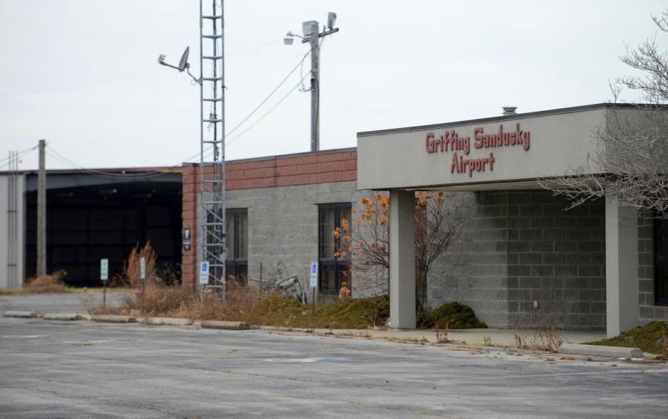
A sad 2014 photo of Griffing Sandusky Airport's terminal building, having seen better days.
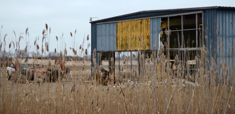
A 2014 photo of a Griffing Sandusky Airport hangar in the process of being demolished.

A 2014 photo of a Griffing Sandusky Airport taxiway.
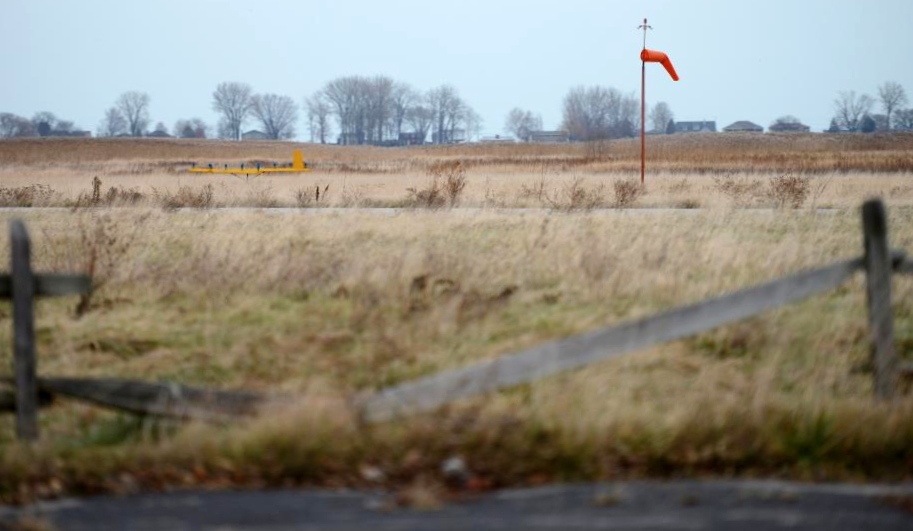
A 2014 photo of the windsock & illuminated wind direction indicator at Griffing Sandusky Airport.
Showing that you can't always trust aeronautical charts, the 2015 Sectional Chart continued to depict Griffing Sandusky Airport as an open airport,
even though it had been closed for more than a year by that point.
Griffing Sandusky Airport continued to be listed in the FAA Airport / Facility Directory as of 2015.
It was described as being comprised of 133 acres, and having 2 asphalt runways: 3,559' Runway 9/27 & 2,593' Runway 18/36.
The owner was listed as Griffing-Sandusky Airport Inc., and the manager listed as Tom Griffing.
Griffing Sandusky Airport was said to be home to 44 aircraft.
Daniel Frohman reported in 2016, “Griffing Sandusky Airport: The property has been sold for a large sports complex now under construction.
All remaining buildings have been removed. This was a favorite airport of mine as I learned to fly there & made corporate aviation my career.”
Randy Coller reported in 2016, “In June I ran into Tom Griffing (former owner of Griffing Sandusky Airport).
He indicated the airport had been sold to Cedar Point Amusement Park.
I visited the site 6/17/16 & lots of construction activity was underway, not airport related.”
According to a 6/1/17 article (courtesy of Christopher Sobienak), the nearby Cedar Point amusement park
has proposed constructing an indoor water park on the Griffing Sandusky Airport site.
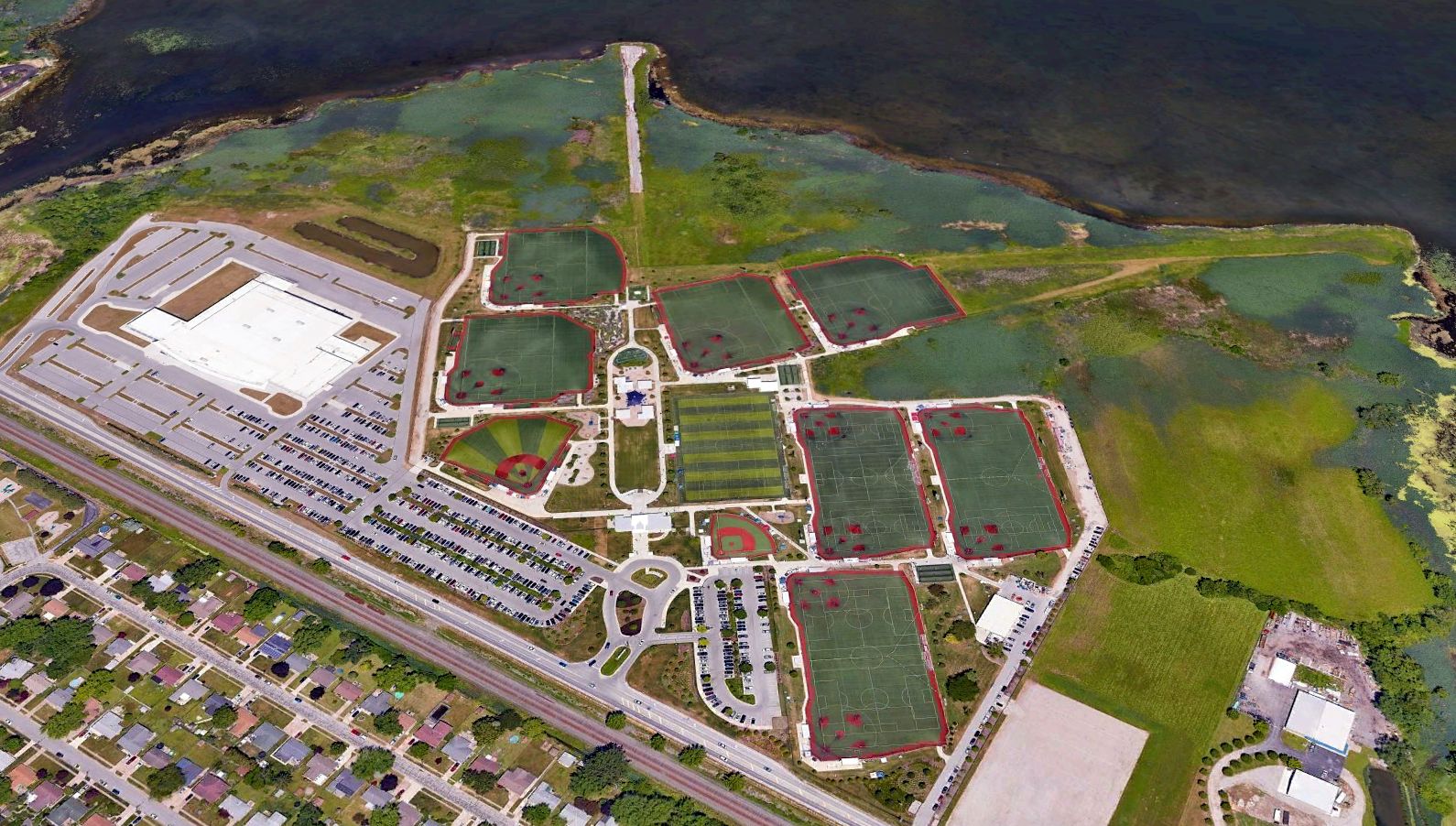
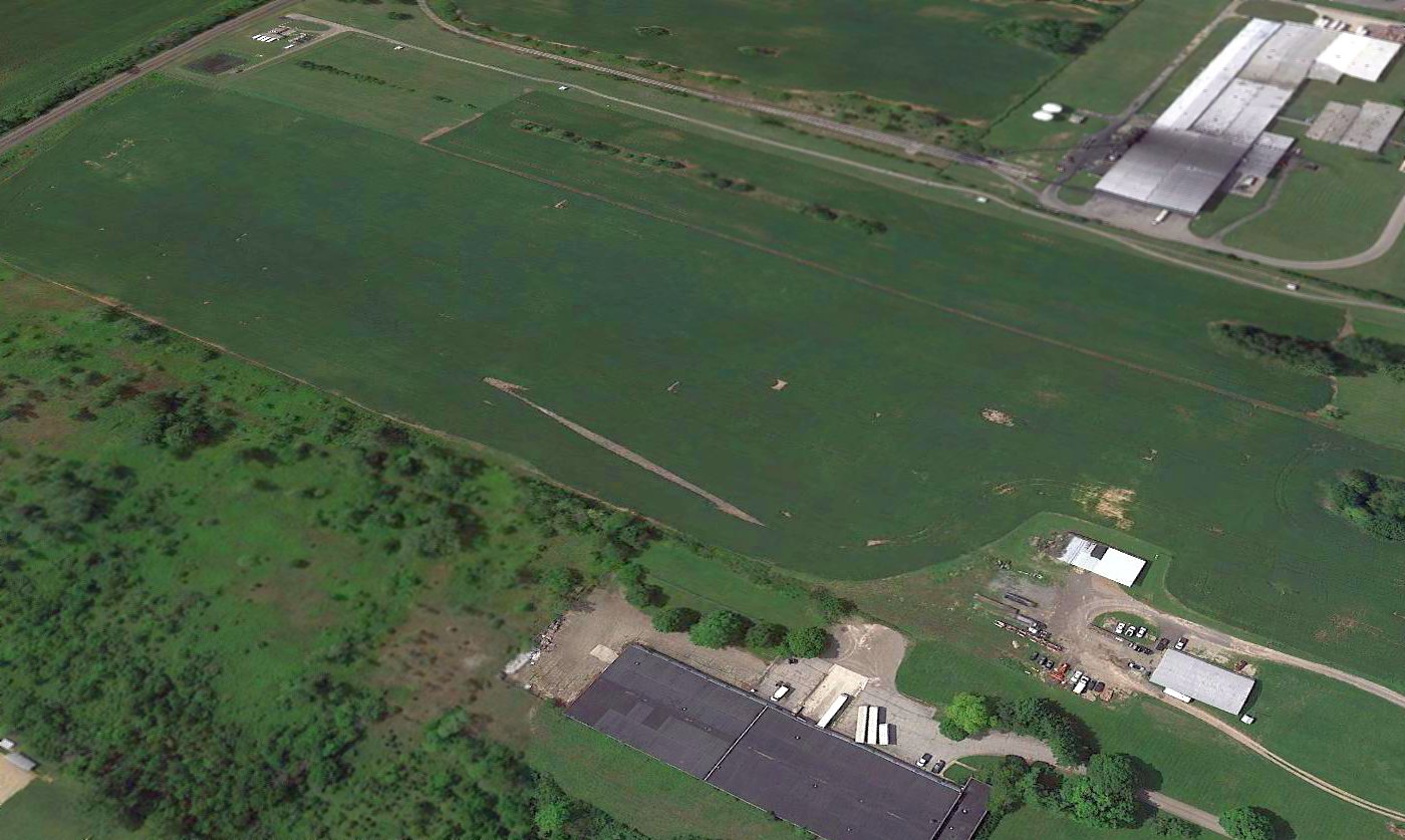
A 2022 aerial view looking north showed the Cedar Point Sports Center which covers most of the Griffing Sandusky Airport site.
All of the airport buildings had been removed, but pavement remained on the northern portion of the north/south runway, along with traces of the eastern portion of the east/west runway.
Griffing Sandusky Airport is located east of the intersection of Cleveland Road & East Shoreway Drive.
Thanks to Aaron Swank for pointing out this airfield.
____________________________________________________
40.55, -83.87 (Northwest of Columbus, OH)
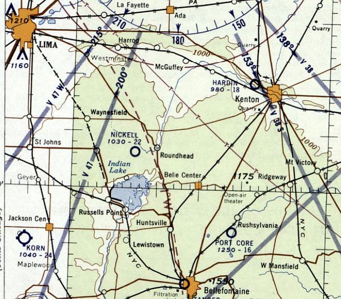
Nickell Field, as depicted on the December 1955 Cleveland Sectional Chart.
Nickell Field was not yet depicted on the July 1955 Cleveland Sectional Chart.
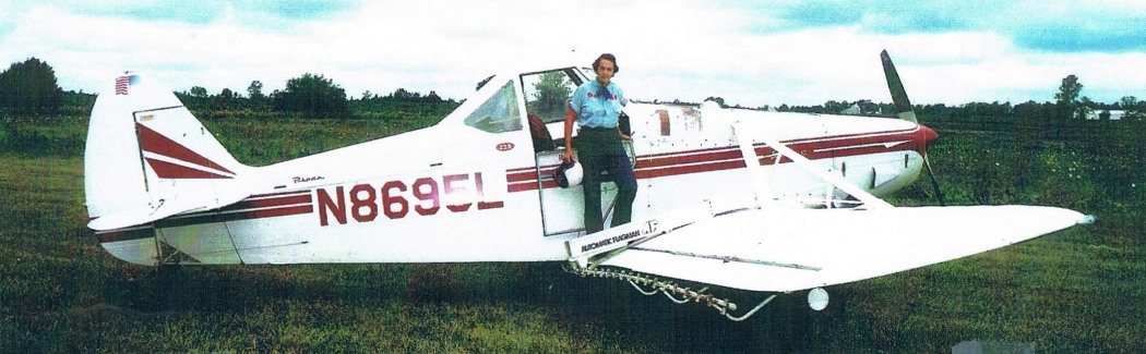
According to Jim Hackman, “Bernite & Riger Nickell owned & operated a popular grass field providing fuel, hangar, and airplane rentals.
For obvious reasons it was often called '5 Cent Field'. In 1955 they began their cropdusting service.
Bernita was a pioneer female agricultural pilot. Even today it is rare to find a lady in a duster.
They operated Super Cubs, Pawnees, a Grumman Ag Cat, and even a Piper Cherokee with spray booms.
Roger did maintenance & loading while Bernita did the majority of the flying.”
The earliest depiction which has been located of Nickell Field was on the December 1955 Cleveland Sectional Chart.
It depicted Nickel Field as having a 2,200' unpaved runway.
Jim Hackman continued, “Bernita Nickell was a local legend.
The rumors were that Roger [Nickell] was unable to read well enough to take & pass the Commercial [pilot's license] written exam.
The Nickells & their family farmed nearly 200 acres.
Roger apparently did the flying on the family land; Bernita did the outside customers.
When not cropdusting, '5 Cent Field' was a good spot to get coffee & stories.”
A circa 1950s photo (courtesy of David Moore via Jim Hackman) of a Cessna 170 & Piper Cub in front of the Nickell Field gas pump.
A circa 1950s photo (courtesy of of David Moore via Jim Hackman) of a Cessna 170 & Piper Cub in front of the Nickell Field gas pump.
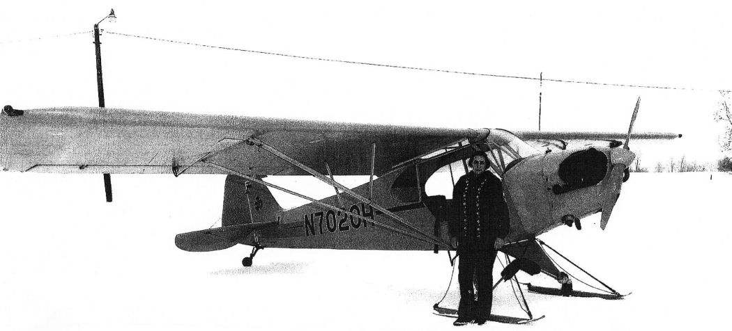
A circa 1950s photo (courtesy of of David Moore via Jim Hackman) of Bernita Nickell in front of her ski-equipped 1946 Piper Cub.
Jim Hackman recalled, “Flying in winter in Ohio from grass airports made staying current & having some fun a challenge.
There were 'Cub Tracks' on many local farms from visiting pilots who rented this Cub. Remember, no brakes!”
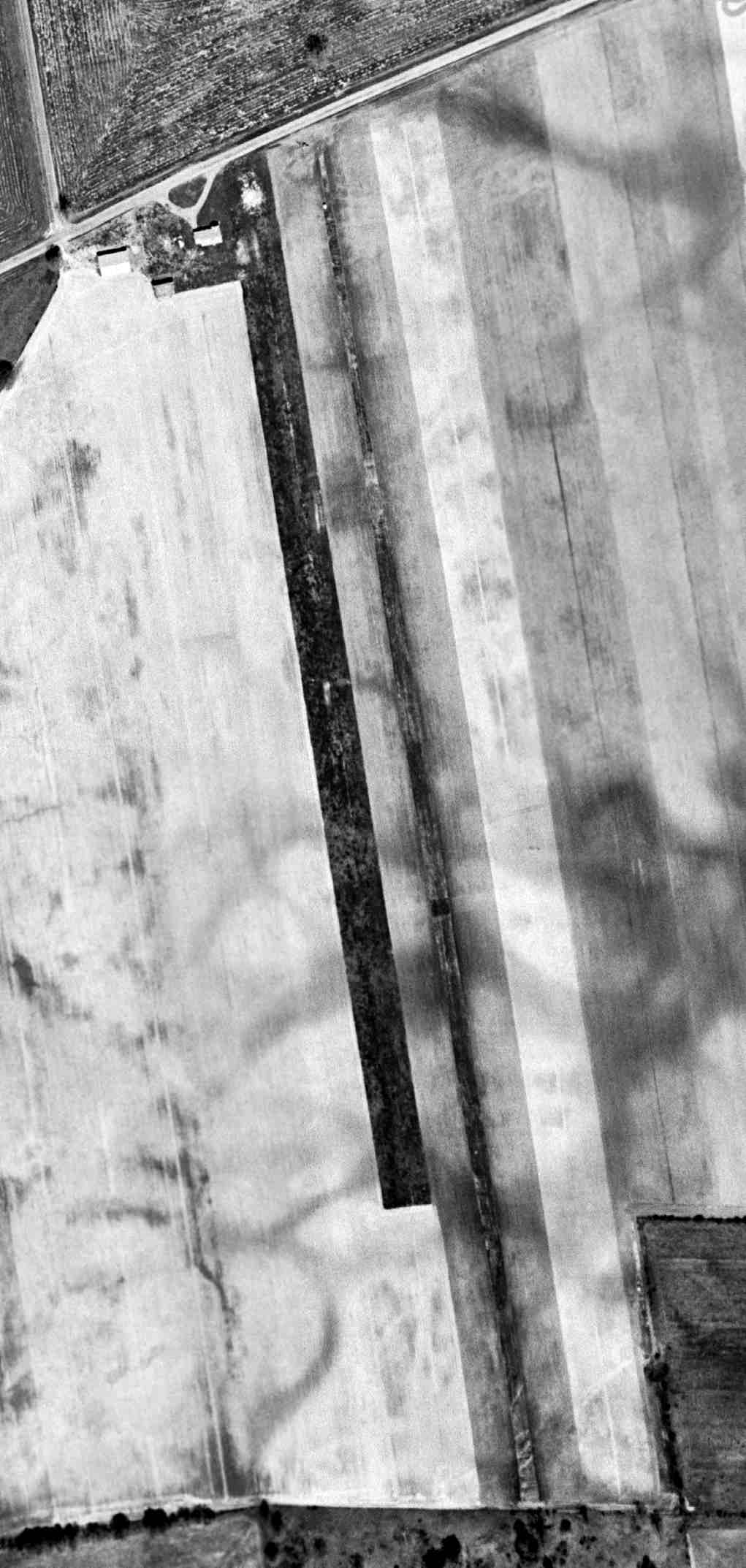
The earliest aerial view which has been located of Nickell Field was a 5/8/59 USGS aerial view.
It depicted Nickell Field as a single grass north/south runway, with a few small buildings at the northwest end.
There were no aircraft visible on the field.
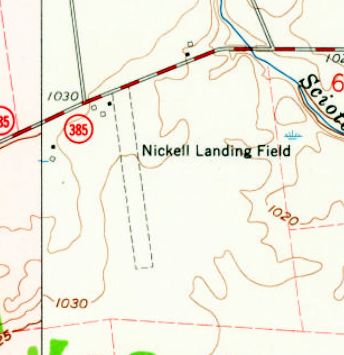
The 1960 USGS topo map depicted “Nickell Landing Field” as a single unpaved north/south runway, with a few small buildings at the northwest end.
Jim Hackman recalled, “They had annual fly-in breakfasts.
I flew in for breakfast on 5/19/63 in Colt N5033Z while enroute back to Phoenix.
A non-profit sponsored & served the breakfasts in their hangar... Flying Farmers? Lions Club?”
A circa 1960s photo (courtesy of of David Moore via Jim Hackman) of Bernita Nickell on her Piper Pawnee cropduster.
Jim Hackman recalled, “There were not many female agricultural pilots in the 1960s. Note the helmet.”
The last aeronautical chart depiction which has been located of Nickell Field was on the 1969 Chicago Sectional Chart,
which depicted Nickell as having a 2,700' unpaved runway.
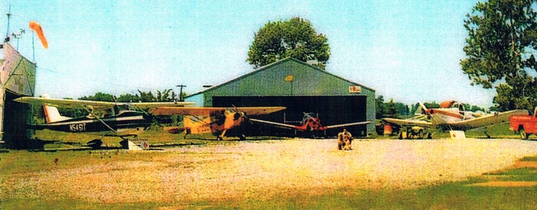
The last photo which has been located showing aircraft at Nickell Field was a circa 1970 photo (courtesy of of David Moore via Jim Hackman) of an Open House,
showing a Cessna 172, Piper Cub, Ercoupe, and Piper Pawnee in front of 2 hangars.
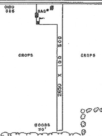
The 1974 OH Airport Directory (courtesy of the Ohio Department of Aviation via Jim Hackman) depicted Nickell Field as having a 2,700' sod Runway 18/36.
It listed the owner as Roger & Bernita Nickell, and the Fixed-Base Operator as Nickell Flying Service – Aerial Application.
A 6/12/79 aerial view (courtesy of the Ohio Department of Aviation via Jim Hackman) depicted Nickell Field
as having a single grass north/south runway, with a few small buildings at the northwest end.
The last depiction which has been located of Nickell Field was in the 1981 OH Airport Directory (courtesy of the Ohio Department of Aviation via Jim Hackman).
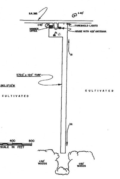
It depicted Nickell Field as having a 2,650' sod Runway 18/36, and remarked, “Lights on west side of runway.”
Jim Hackman recalled, “It was local knowledge that there were only lights on one side!”
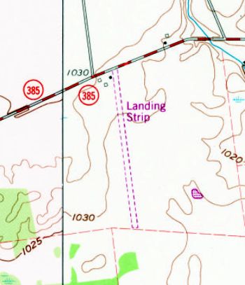
Nickell Field may have closed at some point between 1981-82, as it was still depicted on the 1982 USGS topo map,
but labeled simply as “Landing Strip”.
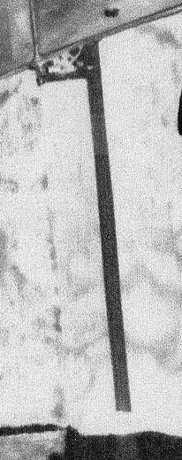
A 1994 USGS aerial view looking southwest showed the site of Nickell Field remained clear, but with no indication of any recent aviation use.
A 2012 aerial view looking southwest showed the site of Nickell Field remained clear, but with no indication of any recent aviation use.
The site of Nickell Field is located south of the intersection of Route 385 & Route 15.
Thanks to Jim Hackman for pointing out this airfield.
____________________________________________________
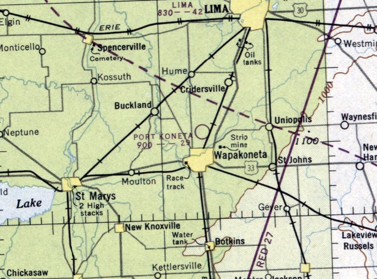
Wapakoneta Airport / Port Koneta, Wapakoneta, OH
40.6, -84.18 (South of Toledo, OH)
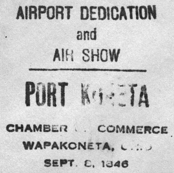
A postmark commemorating the 9/8/46 Airport Dedication & Airshow at Port Koneta.
Photo of the airport while in use has not been located.
Port Koneta Airport was not yet depicted on the June 1946 Chicago Sectional Chart.
According to “Memories of Port Koneta” by Richard Schwer (courtesy of Jim Hackman),
“It all started during the spring & summer of 1946.
A group of local people built an airport north of Wapakoneta on what was know as 'the Brewery Road' now known as the Wapakoneta-Cridersville Road.
The original hangar, a long wooden building that extends to the east from near the road, was the only building that was there in 1946.”
The most famous product of Wapakoneta Airport was the man who would later be first to walk on the moon, astronaut Neil Armstrong.
According to Wikipedia, “[Neil] Armstrong took flying lessons at the grassy Wapakoneta airfield.
He earned a student flight certificate on his 16th birthday [8/5/46], then soloed later in August; all before he had a driver's license.”
According to “Memories of Port Koneta” by Richard Schwer (courtesy of Jim Hackman),
“It was estimated by the Wapakoneta Daily News that 10,000 persons visited Port Koneta airfield on 9/8/46 for the dedication of the new airport.
Spectators were entertained by the U.S. Army Air Force show with a thrilling aerobatic performance.
On exhibit were many planes & a helicopter which made it a most successful & gratifying event.”
According to “Memories of Port Koneta” by Richard Schwer (courtesy of Jim Hackman),
“The original air field only lasted about 18 months & was closed due to the lack of support by the people.
The original thought behind the opening of the airport was that many of the returning WW2 pilots would want & need a place to continue flying,
which turned out to be far from the truth.”
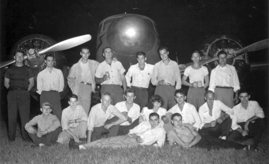
A 1946 photo of Wapokoneta's flight class (The "Port Koneta Gang") in front of a Cessna T-50 (courtesy of Jim Hackman).
Wapokoneta's eventual most famous flight student was Neil Armstrong (on bended knee, 3rd from left), who would go on to become the 1st man to walk on the moon.
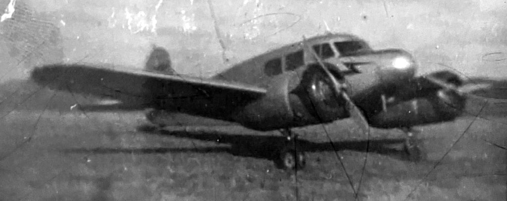
A circa 1940s photo by Neil Armstrong (who would go on to become the 1st man to walk on the moon) of a Cessna T-50 at “Port Koneta”.
The earliest aeronautical chart depiction which has been located of Port Koneta Airport was on the December 1946 Chicago Sectional Chart.
It depicted Port Koneta Airport as having a 2,900' unpaved runway.
According to “Memories of Port Koneta” by Richard Schwer (courtesy of Jim Hackman),
“The building on the south side of the hangar was added in the 1950s
when the airport was reopened for a few short years by Burdette Metzger, a Wapakoneta man.”
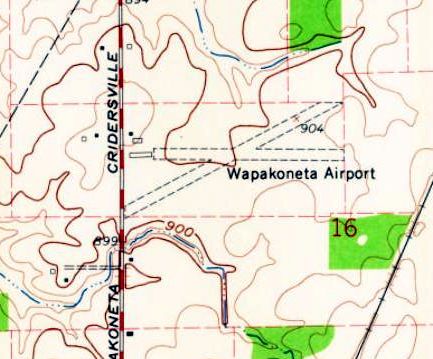
The earliest map depiction which has been located of Wapakoneta Airport was on the 1961 USGS topo map.
It depicted Wapakoneta as having 2 unpaved runways, with 3 small buildings on the west side.
Jim Hackman recalled, “Wapakoneta Airport... I got my Certified Flight Instructor [rating] there & instructed in 1962.”
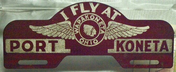
An undated license plate frame, promoting “I fly at Port Koneta”.
Wapakoneta Airport was apparently closed at some point between 1962-69,
as only the new Neil Armstrong Airport (to the southwest) was depicted on the 1969 Chicago Sectional Chart.
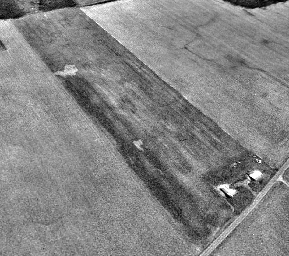
The earliest photo which has been located of the site of Wapakoneta Airport was a 4/16/71 USGS aerial view.
The 3 airport buildings still stood along the west side, and the remnants of the 2 grass runways were still recognizable.
The 1973 USGS topo map still depicted the 3 buildings (hangars?) from Wapakoneta Airport, but the runways were no longer depicted.
A 1976 aerial view (colorized & enhanced by Mike Denja) looking northeast a the former Wapakoneta Airport hangars.
The former runways were no longer discernible on a 1994 USGS aerial photo.
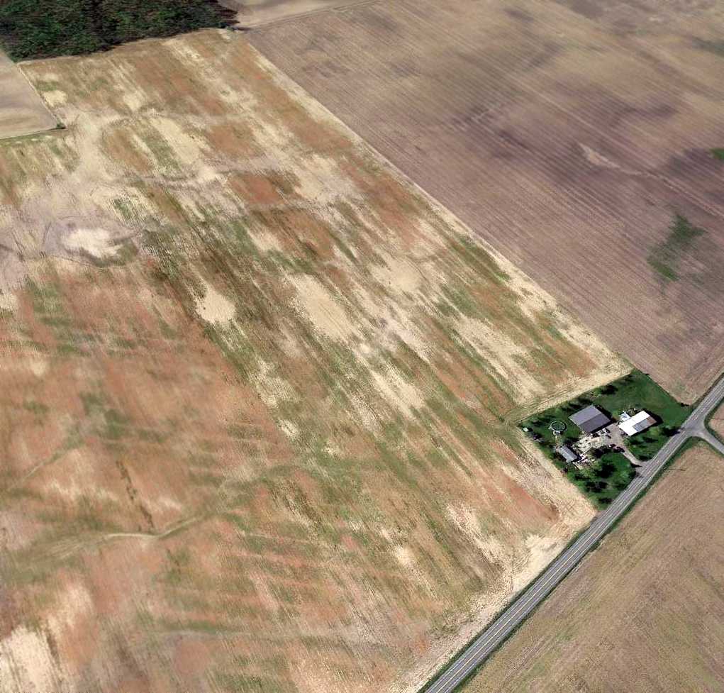
A 4/6/12 aerial photo shows the 3 airport buildings still stood along the west side of the site of Wapakoneta Airport, with the runway site having been returned to cultivation.
Does the farmer of the property realize this is the hallowed ground where the first man to walk on the moon learned to fly?
A 2019 photo looking southeast at a former Wapakoneta Airport hangar, on which the “Port Koneta” sign is visible, along with possibly another historical sign below it.
A 2024 photo (courtesy of Mike Denja) looking northeast at a former Wapakoneta Airport hangar, on which the “Port Koneta” sign is visible.
The site of Wapakoneta Airport is located southeast of the intersection of Wapakoneta Cridersville Road & Wapakoneta Buckland Road.
Thanks to Jim Hackman for pointing out this airfield.
____________________________________________________
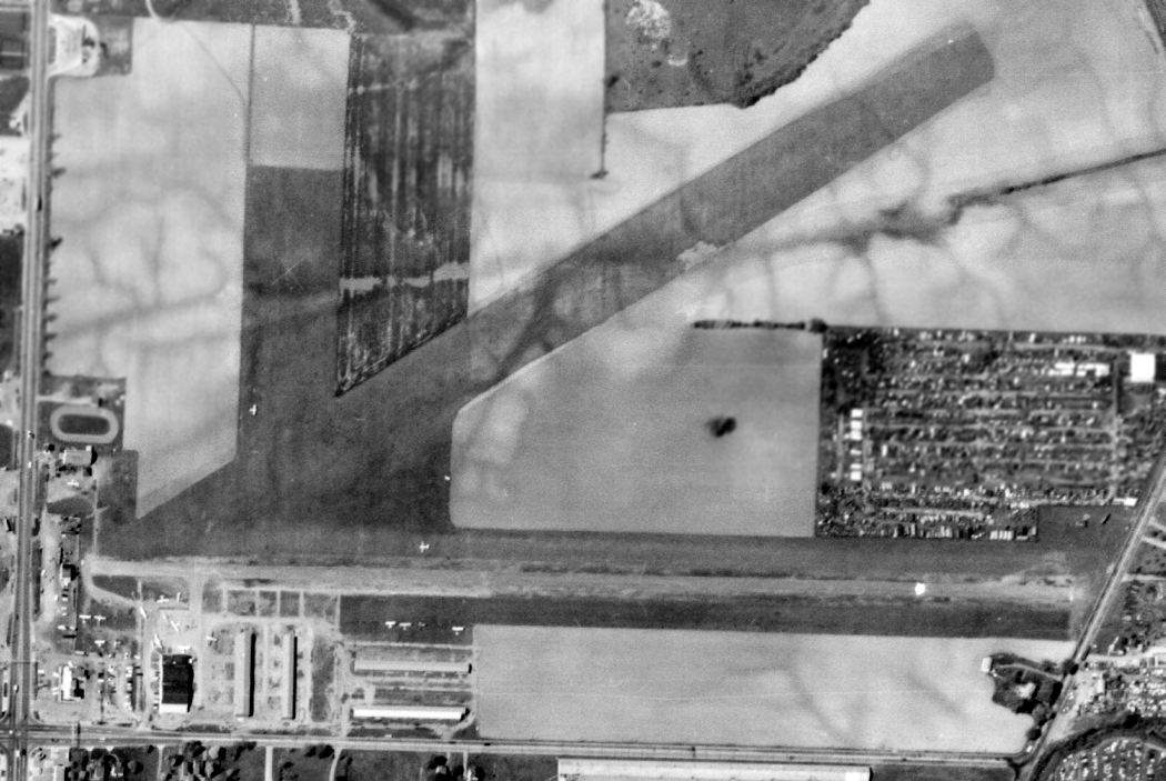
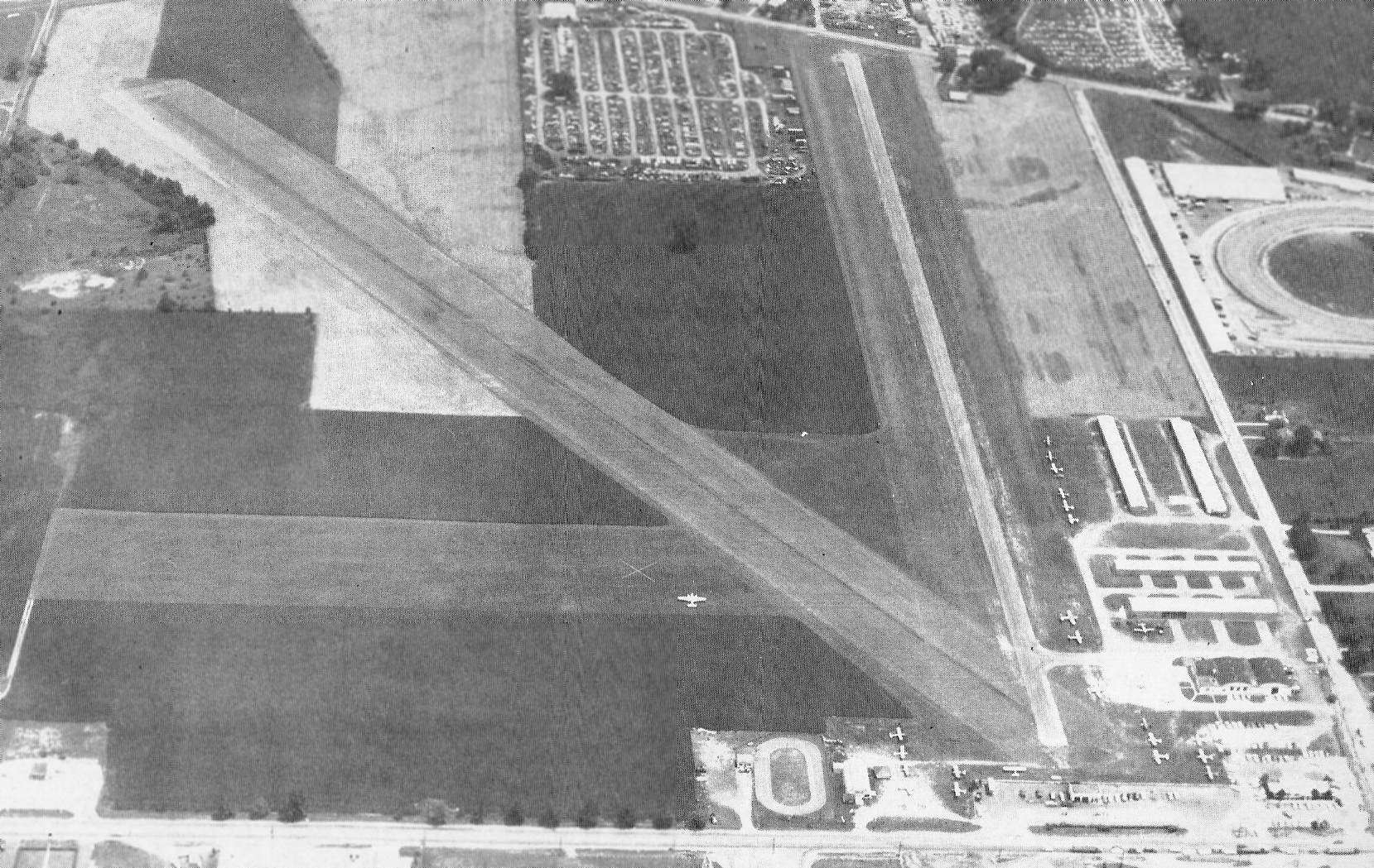
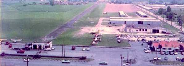
Toledo Municipal Airport / Stickney Avenue Airport, Toledo, OH
41.7, -83.52 (Northwest of Columbus, OH)
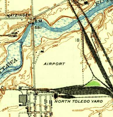
The location & layout of Toledo Municipal Airport, as depicted on the Commerce Department 1928 Airway Bulletin (courtesy of Mike Denja).
Photo of the airport has not been located.
According to the Toledo City Paper, Toledo Municipal Airport / Stickney Avenue Airport opened in October 1927.
The earliest depiction which has been located of Toledo Municipal Airport was on the Commerce Department 1928 Airway Bulletin (courtesy of Mike Denja).
It described Toledo Municipal Airport as owned & operated by the City of Toledo.
The airport consisted of a 220 acre rectangular clay field measuring 3,616' x 2,656'. A hangar & office were depicted on the northwest.
According to the Toledo City Paper, “1928: Due to poor planning, Stickney is replaced 8 months later by the more effectively located Toledo Transcontinental Airport.”
The earliest aeronautical chart depiction which has been located of Toledo Municipal Airport was on the December 1932 Cleveland Sectional Chart.
It depicted “Toledo” as an auxiliary airfield.
The 1938 USGS topo map (courtesy of Don Reed) depicted Toledo Municipal Airport as an open area, generically labeled as “Airport”, with 2 small buildings on the northwest side.
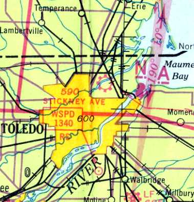
The last aeronautical chart depiction which has been located of Stickney Avenue Airport was on the March 1940 Cleveland Sectional Chart.
It depicted Stickney Avenue as a commercial/municipal field.
Stickney Avenue Airport was evidently closed at some point between 1940-42,
as it was no longer depicted on the February 1942 Cleveland Sectional Chart (courtesy of Chris Kennedy).
The Stickney Plant, a large factory, was opened in 1942 by auto parts manufacturer Autolite on the site of the Stickney Avenue Airport.
The 1952 USGS topo map showed 2 airport buildings remained depicted on the northwest side of the airport property,
but a large factory had covered the southern portion of the airfield.
A 1963 USGS aerial photo showed an airport building remained on the northwest side of the airport property,
but a large factory had covered the southern portion of the airfield.
The 1968 USGS topo map showed a 2nd large building had been added on the south side of the property between 1954-68.
Amazingly, the 2 airport buildings were still depicted on the northwest side of the airport site on the 1980 USGS topo map.
In 1981, the Stickney Plant was converted for vehicle production, building the Jeep Grand Wagoneer.
The 2 former airport buildings were no longer depicted on the 1993 USGS aerial photo
(the earliest photo which has been located of the airport property).
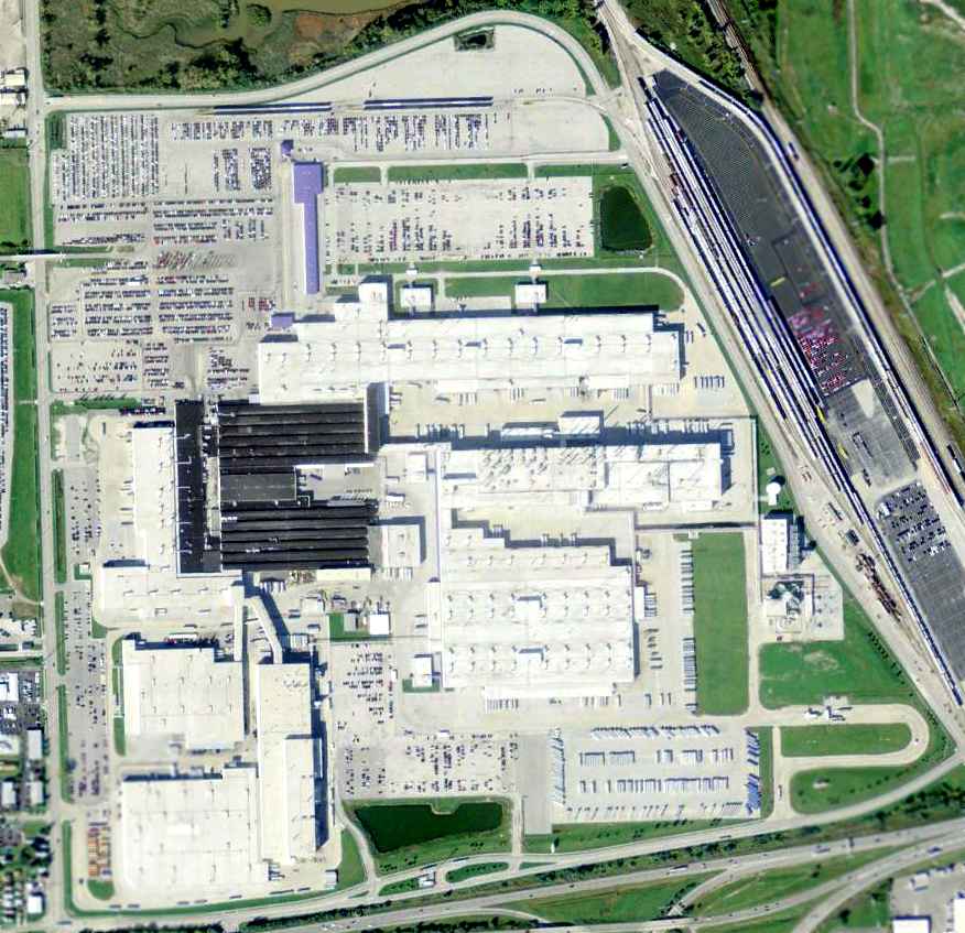
A 10/28/11 aerial view showed no trace of the former Stickney Avenue Airport, now covered by a massive truck factory.
As of 2012, the site of Stickney Avenue Airport is the location of the Toledo Supplier Park, which produces the Jeep Wrangler.
The site of Stickney Avenue Airport is located northeast of the intersection of Stickney Avenue & Interstate 75.
Thanks to Don Reed for pointing out this airfield.
____________________________________________________
41.7, -83.64 (Northwest of Columbus, OH)
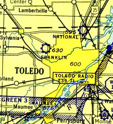
Franklin Airport, as depicted on the February 1942 Cleveland Sectional Chart (courtesy of Chris Kennedy).
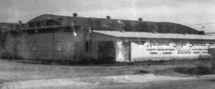
According to an article in the 6/26/52 Toledo Blade (courtesy of Phil Alloy), Franklin Airport opened in 1939.
However, Franklin Airport was not yet depicted on the 1940 March Cleveland Sectional Chart (courtesy of Richard Finley).
George Ritter recalled, “'At the Franklin Airport on 7/2/40, this was my first flight at the age of 3 & it was in a 1939 Stinson 105, maroon low-power 3-place bird.
The airport was a large grass field with no runway depiction.
Franklin Flight Service was an unknown and later (a year or so) got combined to National Flight Service.”
The earliest depiction which has been located of Franklin Airport
was on the February 1942 Cleveland Sectional Chart (courtesy of Chris Kennedy).
It depicted Franklin as a commercial/municipal airfield.
The earliest dated photo which has been located of Franklin Airport
was a 10/10/43 aerial view looking north from the 1945 AAF Airfield Directory (courtesy of Scott Murdock).
It depicted Franklin Airport as an open unpaved landing area.
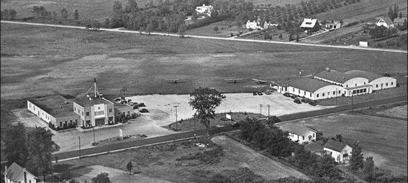
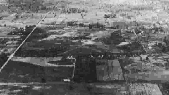
A circa early 1940s aerial view looking at the buildings of the Franklin Ice Cream Company & the hangars of Franklin Airport along Monroe Street (courtesy of Don Reed)
showed at least 3 single-engine aircraft on the grass airfield.
Roger Blackburn recalled, “The Franklin Ice Cream store on the left... the tall stand on the top of the building may have held a wind sock.”
Don Reed recalled that he learned to fly at Franklin Airport in 1944.
According to Don, “My instructor was a World War ! pilot that could preform a ballet with a J3 Cub.
I was to young to drive so I would hitchhike to the airport.”
The 1945 AAF Airfield Directory (courtesy of Scott Murdock) described Franklin Airport
as a 104 acre irregularly-shaped field having 3 sod runways, the longest being a 3,000' northwest/southeast strip.
The field was said to have 3 concrete block hangars, the largest measuring 90' x 51'.
Franklin Airport was was described as being owned & operated by private interests.
Roger Blackburn recalled, “The airport was owned by a man named Aiken who also owned National airport.
After the war, about 1/3 of the way down Talmadge Road on the west side of the field, some additional metal hangars were built to accommodate additional planes.”
The earliest topo map depiction which has been located of Franklin Airport was on the 1948 USGS topo map.
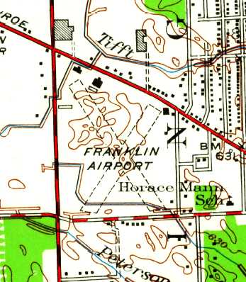
The last depiction which has been located of Franklin Airport was on the 1951 USGS topo map.
It depicted Franklin as having 2 unpaved runways in an X-shape, with several buildings on the northwest & northeast sides.
An article entitled “Franklin Airport Slated to Close on Sep. 15” appeared in the 6/26/52 Toledo Blade (courtesy of Phil Alloy).
It described the field as a 104 acre site, with 3 sod runways, 1 T-hangar & 3 cinderblock buildings.

The last aeronautical chart depiction which has been located of Franklin Airport was on the January 1954 Cleveland Sectional Chart.
It depicted Franklin Airport as having a 3,200' unpaved runway.
Franklin Airport was evidently closed at some point in 1954, as it was no longer depicted on the July 1954 Cleveland Sectional Chart.
Roger Blackburn recalled, “After the airport closed, Imperial Wayside Furniture on Telegraph Road converted the hangars near the northwest corner of the field to a furniture store,
Franklin Park Furniture, which opened in the summer of 1955 & remained open until it burned in December 1958. I worked there.”
Franklin Airport was no longer depicted on the 1958 USGS topo map.
According to Phil Alloy, “Franklin Field... By the 1960s the large site was used as a location for radio control model airplane flights.”
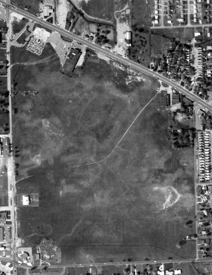
A 5/1/63 USGS aerial photo showed the majority of the Franklin Airport site remained clear, although runways were no longer recognizable.
According to Phil Alloy, “Due to the growth of the city into the west suburbs the property became increasingly valuable for development.
In the 1970s the site was used for a mall [originally called 'Franklin Park Mall', it is now renamed as 'Westfield Mall'].
No trace of the original airfield exists.”
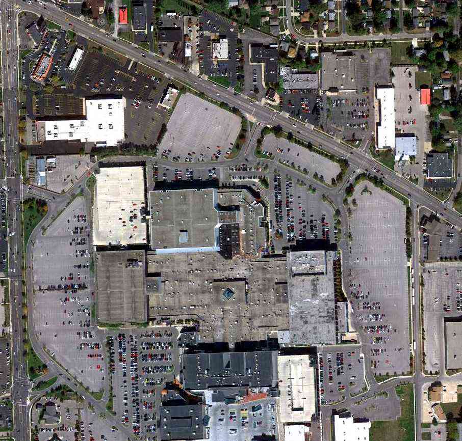
A 10/7/10 aerial view of the site of Franklin Airport, now the location of Westfield Mall.
The site of Franklin Airport is located southeast of the intersection of Monroe Street & Tallmadge Road.
____________________________________________________
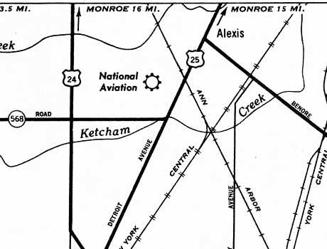
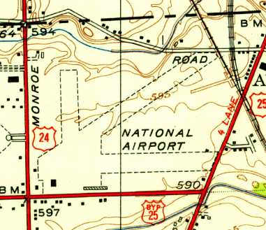
National Aviation Airport / National Airport, Toledo, OH
41.72, -83.54 (Northwest of Columbus, OH)
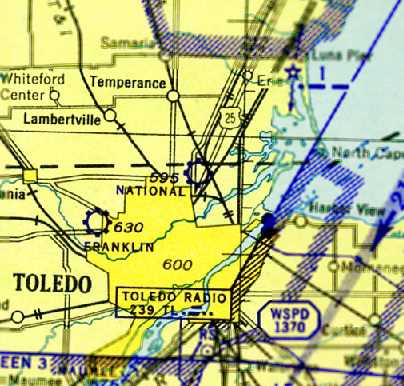
National Airport, as depicted on the February 1942 Cleveland Sectional Chart (courtesy of Chris Kennedy).
This general aviation airport was evidently established at some point between 1935-42,
as it was not yet depicted on the 1935 Regional Aeronautical Chart.
The earliest depiction which has been located of National Airport
was on the February 1942 Cleveland Sectional Chart (courtesy of Chris Kennedy).
It depicted National as a commercial/municipal airfield.
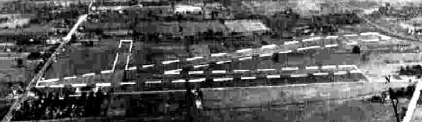
The earliest photo which has been located of National Aviation Airport
was a 10/10/43 aerial view looking north from the 1945 AAF Airfield Directory (courtesy of Scott Murdock).
It depicted National Aviation Airport as having 3 grass runways.
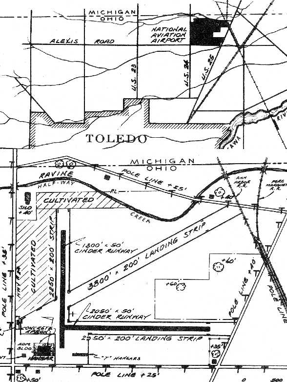
The 1945 AAF Airfield Directory (courtesy of Scott Murdock) described the National Aviation Airport
as a 165 acre irregularly-shaped field having 3 loam & sod runways, the longest being a 3,800' northeast/southwest strip.
The field was said to have 2 concrete block hangars, the largest measuring 120' x 80'.
National Aviation Airport was was described as being owned & operated by private interests.
The 1945 Haire Publishing Company Airport Directory (courtesy of Chris Kennedy)
described “National Aviation Airport” as a “class 3” airfield, owned & operated by National Aviation Corporation.
The manager was listed as W.J. Thompson.
The field was said to have 3 sandy & loam runways, with the longest being the 3,800' northeast/southwest strip.
The field was said to have 2 hangars.
National Aviation Airport, as depicted on the 1948 USGS topo map.
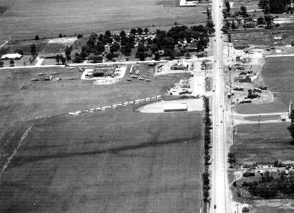
A circa 1950 aerial view looking south at National Aviation Airport (from the Toledo Lucas County Public Library, courtesy of Brian Nelson).
It depicted the field as having a grass airfield area, with several hangars on the southwest side,
and a large number of light aircraft.
The 1952 USGS topo map depicted National Airport as having 3 unpaved runways, with a ramp & hangars at the southwest corner.
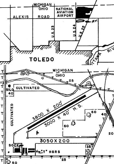
The 1953 OH Airport Directory (courtesy of Hank Lehrer) depicted National Aviation Airport
as having 3 runways, including a 3,800' northeast/southwest unpaved runway & a 2,950' east/west cinder runway.
Several hangars were depicted on the southeast side. The manager was listed as J.E. Akin.
Tgsaul recalled, “National Airport... I learned to fly there from Aiken Aircraft Corporation starting in 1954,
and later becoming a commercial pilot & flight instructor for John Aiken.”
National Aviation Airport gained a paved runway at some point between 1953-61, as the 1961 OH Airport Directory (courtesy of Hank Lehrer)
depicted National Airport as having 2 runways, including a 3,800' northeast/southwest runway within which was a 3,000' paved section.
Several hangars were depicted on the southeast side. The manager was listed as Richard Macauley.
A 5/6/63 USGS aerial photo showed National Airport having 3 runways, and over a dozen single-engine aircraft parked on the southwest side.
An undated aerial view by Tom Root looking west at National Airport from the December 1963 issue of “The Flyer” magazine (courtesy of Daun Yeagley).
It described National Airport as having a 3,050' paved east/west runway & a 3,800' northeast/southwest sod strip with a 3,000' paved portion.
It was said to be the location of the newly-formed Wright-National School of Aviation, and the airport manager was listed as Harvey Mahrt.
A circa pre-1965 aerial view looking east at National Airport (courtesy of Tom McClain).
The airport had a single asphalt east/west runway, with several hangars on the south side of the field.
The airport appeared well-used, with several single-engine aircraft parked on the field.
Note the building which appeared to be directly at the west end of the runway.
According to Hans Friedebach, “National Airport... During the 1960s it was the home base & operated by National Flightservices Inc.”
A circa 1965 photo of the National Flight Service Inc. hangar at National Airport (from the Toledo Lucas County Public Library).
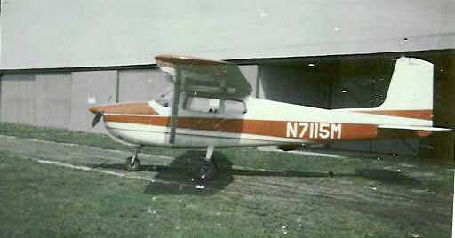
A circa 1965 photo by Don Reed of his Cessna 175, N7115M, in front of a National Airport hangar.
Roger Johnson recalled of National Airport, “As a kid in the 1960s growing up on the north side of Toledo,
an east wind would have private planes approaching subject airport right over my parent's house.”
The 1969 USGS topo map still depicted National Airport.
The last aeronautical chart depiction which has been located of National Airport
was on the May 1971 Detroit Sectional Chart (courtesy of Chris Kennedy).
It depicted National as having a single 3,100' paved east/west runway.
According to Tom McClain, National Airport was “closed sometime in the early 1970s.
I remember it a an open field where people would fly their radio-controlled planes.”
According to Hans Friedebach, “National was closed sometime around the early 1970s since it could not support itself financially.
It was developed as a shopping center site without a trace of the former airport.”
John Arnold was evidently the last person to land & takeoff at National Airport.
He recalled, “My logbook shows this to have been 7/13/76.
I landed there dead stick in a Piper Arrow on a flight from Alabama to Monroe, MI.
I had run out of gas & had to have some brought to me from Wagon Wheel Airport.
The airport was closed & there were some barrels on the paved runway where kids had bonfires at night.
Wagon Wheel personnel brought me 5 gallons of gas & needless to say you can't see it as viewed from the filler port.
I then flew to Wagon Wheel to top the tanks. I managed to get out of there before the press showed.
A city policeman was there & took me to a payphone to call for gas to be brought from Wagon Wheel Airport.
Airport buildings had been cleared for the construction of the shopping center.”
According to Roger Johnson, “A major regional mall was built on the site of National during the late 1970s, obliterating every hint of the very active site.”
By the time of the December 1976 CF-18 World Aeronautical Chart (courtesy of Chris Kennedy), National Airport was depicted as an abandoned airfield.
Tom McClain recalled of National Airport, “I'm pretty sure that some time in the 1980s a small plane was forced to use the field in an emergency landing.”
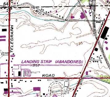
The 1981 USGS topo map still depicted the east/west paved runway at National Airport, as well as the taxiways, ramp, and hangars at the southwest corner.
The property was labeled as “Landing Strip (Abandoned)”.
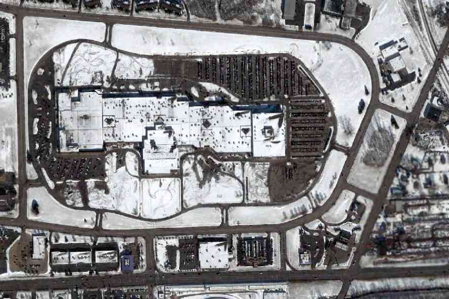
A February 2005 aerial photo showed the mall covering the site, with no trace visible of the former National Airport.
Roger Johnson reported in 2008, “NorthTowne Mall didn't remain viable very long, and while the buildings remain, there is little or no activity
and the parking lots are used for vehicle staging by Chrysler's Jeep plant nearby.”
The site of National Airport is located northwest of the intersection of North Detroit Avenue & East Alexis Road.
____________________________________________________
Lima Airport / Allen County Airport (LIA), Lima, OH
40.76, -84.18 (Northwest of Columbus, OH)

Lima Airport, as depicted on the March 1935 Chicago Sectional Chart.
The Lima Airport was not yet depicted on the August 1932 Chicago Sectional Chart.
According to the WTLW 44 website, Lima Airport was built in 1933.
The earliest directory listing which has been located of Lima Airport
was in the 1934 Department of Commerce Airport Directory (courtesy of Chris Kennedy).
It described Lima as a Municipal Airport, located 3 miles northwest of the town of Lima.
The airfield was said to consist of 3 sod runways, with the longest being a 2,640' northeast/southwest strip.
A hangar was said to be located in the northwest corner.
The earliest depiction which has been located of Lima Airport was on the March 1935 Chicago Sectional Chart.
The Airport Directory Company's 1937 Airports Directory (courtesy of Bob Rambo)
described Lima as having 3 sod runways, with the longest being the 3,960' east/west strip.
A hangar on the west side was said to have "Lima" painted on the roof.
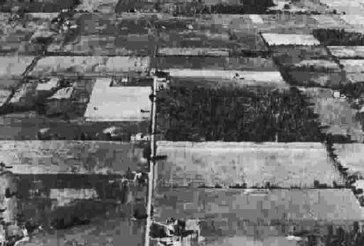
The only photo which has been located showing Lima Municipal Airport while in operation
was a 9/28/43 aerial view looking north from the 1945 AAF Airfield Directory (courtesy of Scott Murdock).
It depicted the field as being an open grass area.
The 1944 US Army/Navy Directory of Airfields (courtesy of Ken Mercer)
described Lima Airport as having a 4,200' unpaved runway.
The 1945 AAF Airfield Directory (courtesy of Scott Murdock) described the Lima Municipal Airport
as a 144 acre L-shaped field having 2 sod runways, the longest being a 4,200' east/west strip (described as “rough”).
The field was said to have 3 concrete & steel hangars, the largest measuring 75' x 60'.
Lima Municipal Airport was was described as being owned & operated by private interests.
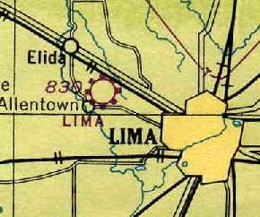
Lima Airport, as depicted on the June 1946 Chicago Sectional Chart (courtesy of Chris Kennedy).
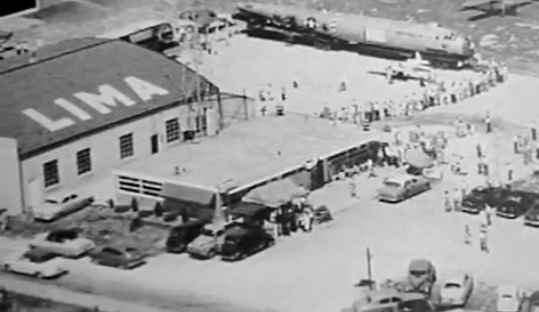
A circa 1940s-50s aerial view of Lima Airport, presumably during some kind of display – note the B-29 bomber fuselage.
According to the WTLW 44 website, the golden years for the Allen County Airport were 1953-63,
when Lake Central Airlines ran DC-3 service to Pittsburgh, Cincinnati and Columbus.
Starting on the June 1960 Chicago Sectional Chart (courtesy of Chris Kennedy)
the field was labeled as the Allen County Airport.
It had also gained a paved runway, as it was depicted as having a single 3,500' paved runway.
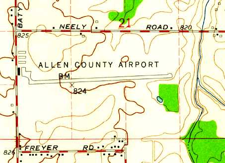
The 1960 USGS topo map depicted Allen County Airport as having a single paved east/west runway,
with a ramp & 4 buildings on the west side.
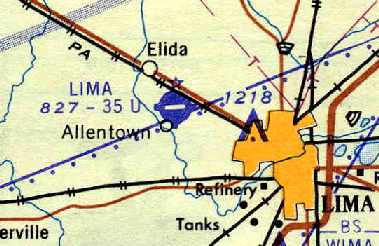
By the next year, the Lima Airport had apparently reverted to its previous name,
as depicted on the December 1961 Chicago Sectional Chart (courtesy of Chris Kennedy).
A newer airport was built on the east side of Lima in 1963, but the original airport continued in operation.
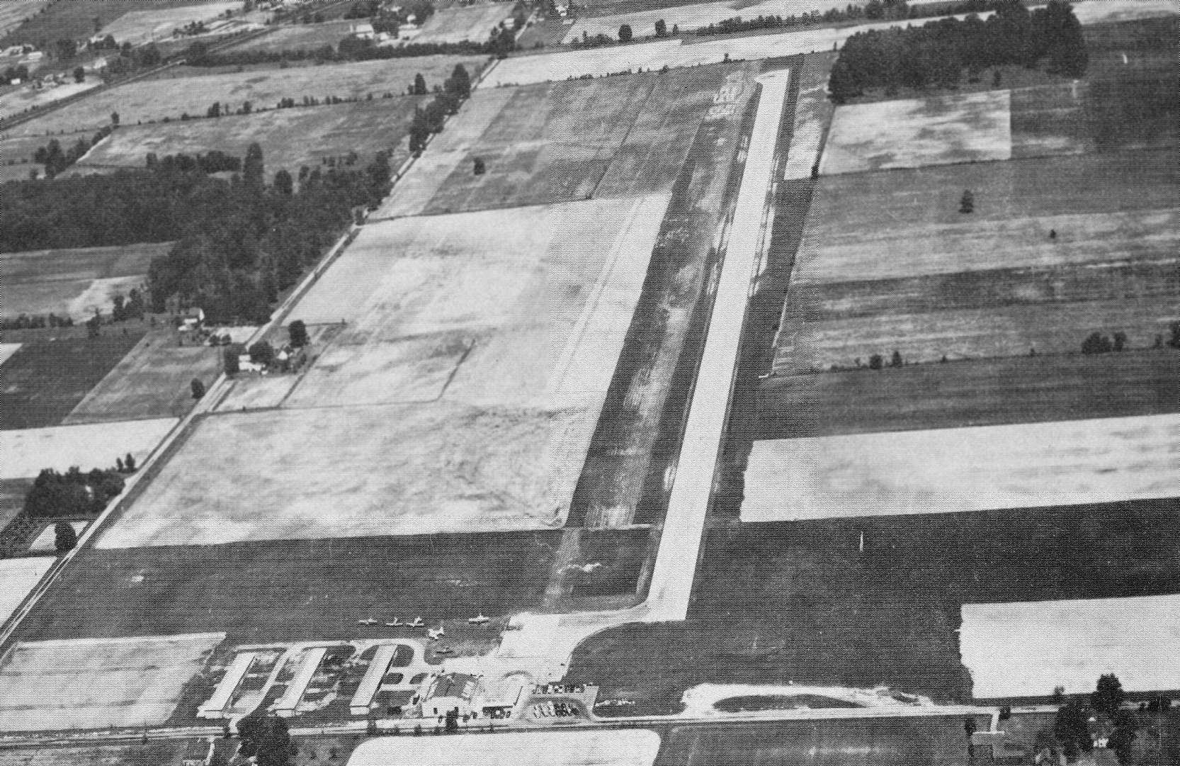
An undated aerial view looking east at Lima Airport from the December 1964 issue of “The Flyer” magazine (courtesy of Daun Yeagley).
It described Lima Airport as having a 3,600' paved east/west runway & a 2,650' north/south sod strip with a 3,000' paved portion.
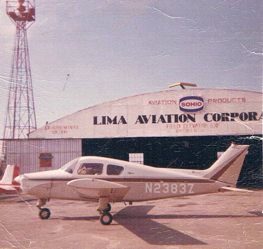
A 1965 photo by Jim Hackman of his Beech Muskateer in front of the Lima Aviation Corporation hangar.
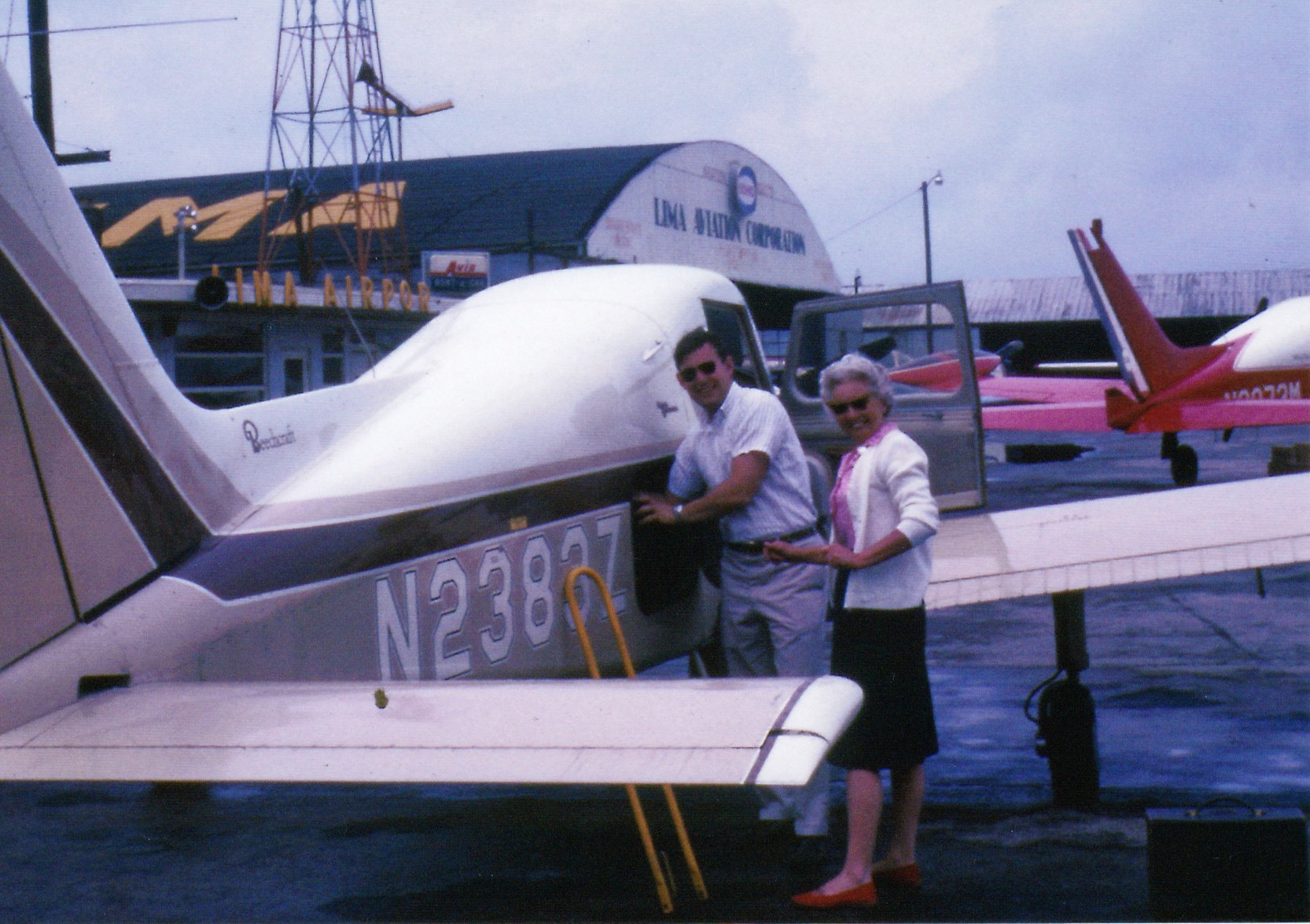
A 1966 photo (courtesy of Jimn Hackman) of Jim Hackman & his mother Betty loading his 1963 Beech BE-23 Muskateer or a trip to CA in front of the Lima Aviation Corporation hangar.
Jim recalled, “My mother was an awesome passenger. We flew over some wide-open spaces in some challenging weather, with no complaints.
The Cessna 310 in the background was one of 3 owned by Lima Aviation Corporation. I was flying charter & instructing for Lima Aviation.
A 'busman's holiday': flying my folks to AZ & CA, one year Phoenix & San Diego, the next year to AZ & San Francisco, OR, Cheyenne, and return.”
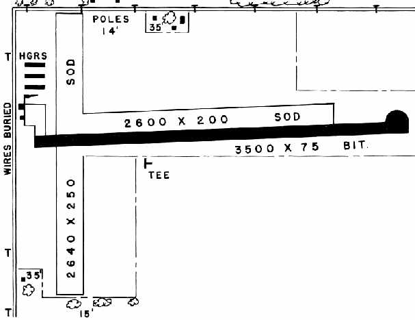
The 1966 OH Airport Directory (courtesy of Chris Kennedy) depicted Lima as having a single 3,500' bituminous east/west runway,
with a parallel 2,600' sod runway on the north side of the paved runway, and a 2,640' sod north/south runway.
A total of four hangars were depicted on the northwest side of the field. The manager was listed as Walt Plezia.
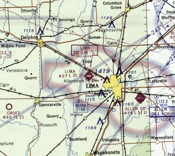
The last aeronautical chart depiction which has been located of the Lima Airport was on the May 1970 Chicago Sectional Chart.
It depicted Lima as having a 3,500' paved east/west runway.
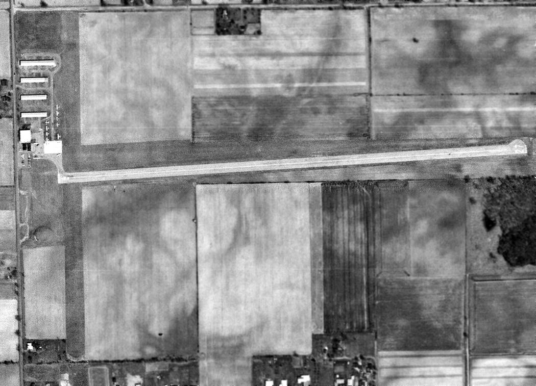
The last photo which has been located showing the Lima Airport in operation was a 4/16/71 USGS aerial view.
It showed Lima as having a paved Runway 9/27 & a grass crosswind runway.
A dozen single-engine aircraft were visible parked around the hangars on the west side.
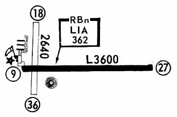
The 1972 Flight Guide (courtesy of Chris Kennedy) showed that Lima had gained an NDB navigational beacon on the field.
The runway configuration had not changed.
The Lima Airport's status had changed at some point between 1972-76 to a private field,
as that is how it was described in the 1976 AOPA Airport Directory (courtesy of Chris Kennedy).
By 1977, the USGS topo map depicted that a new Allen County Airport had been constructed, 5 miles southeast of the town of Lima.
The original Lima Airport was apparently closed at some point between 1976-80.
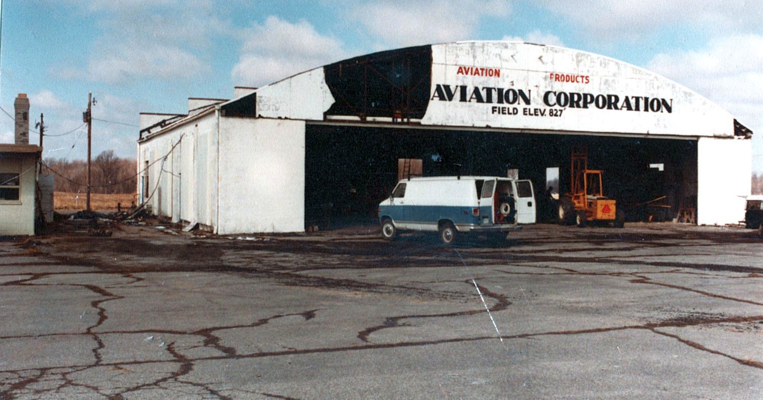
A circa 1980 photo of the former Lima Airport hangar, with the words “Aviation Corporation” still visible, during the hangar's conversion into a TV studio.
According to the WTLW 44 website, after the closure of Lima Airport,
“Ron Mighell toured the large 80' x 80' hangar & envisioned it as the largest television studio in Northwest Ohio.
In 1980, scores of volunteers pooled their talents to renovate the dilapidated building into a modern television production facility.”
The original Lima Airport was no longer listed at all in the 1982 AOPA Airport Directory (courtesy of Ed Drury).
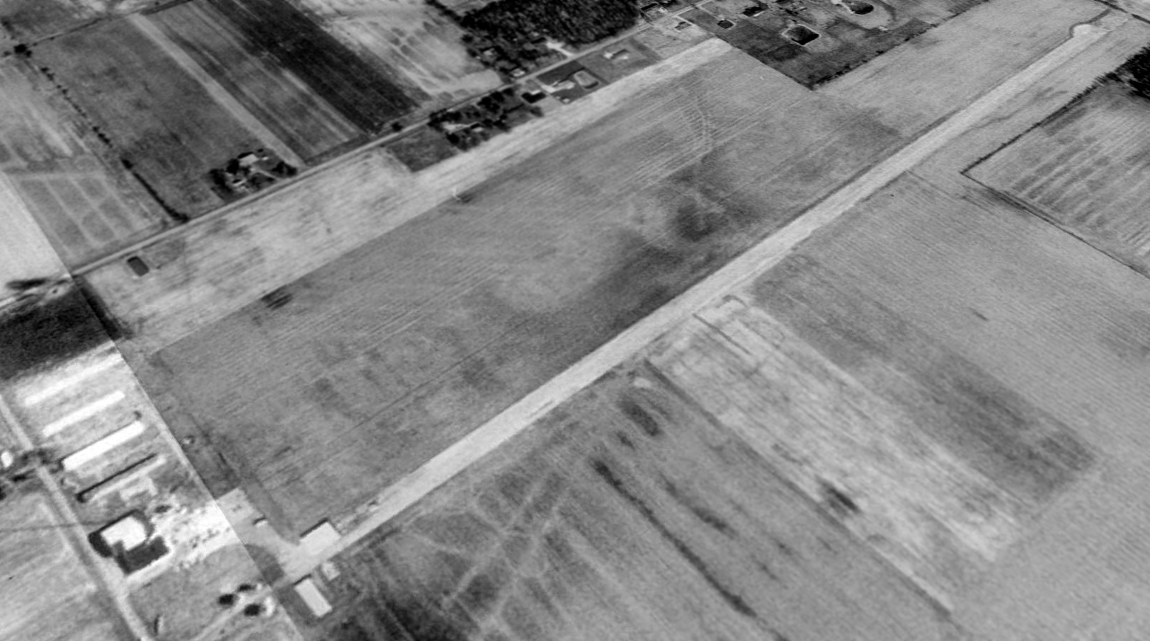
In a 1988 USGS aerial view looking northeast, the former Lima Airport appeared to remain largely intact,
with the runways & most of the hangars appearing to remain completely untouched.
The TV transmitter tower could be seen just northwest of the west end of the runway.
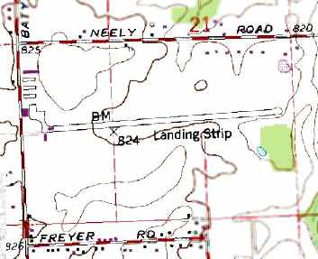
The 1994 USGS topo map depicted a single paved east/west runway,
labeled simply as “Landing Strip”, along with several hangars on the west side of the field.
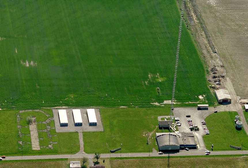
A circa 2007 aerial view looking east at the Lima Airport site showed (from the left) the pavement from the former 3 t-hangars,
the former hangar, the TV transmitter tower, and the remains of the paved runway.
John Sams reported in 2007, “The old main hangar is now the main studio / office for the local Christian TV station 44.
Nothing appears to remain of the old runway except the clearing [however the runway appears to remain intact in the 2006 photo].
The small hangars to the north of the main are only slabs foundations.
The main transmission tower for the TV station
(which appears on the current Detroit Sectional as a lighted obstruction of 1,532' MSL to the northwest of the city)
appears to be sitting right at the start of Runway 9.
New houses are being built close to the east side of the old runway clearing.
It will not be long & they will be on the old runway site.”
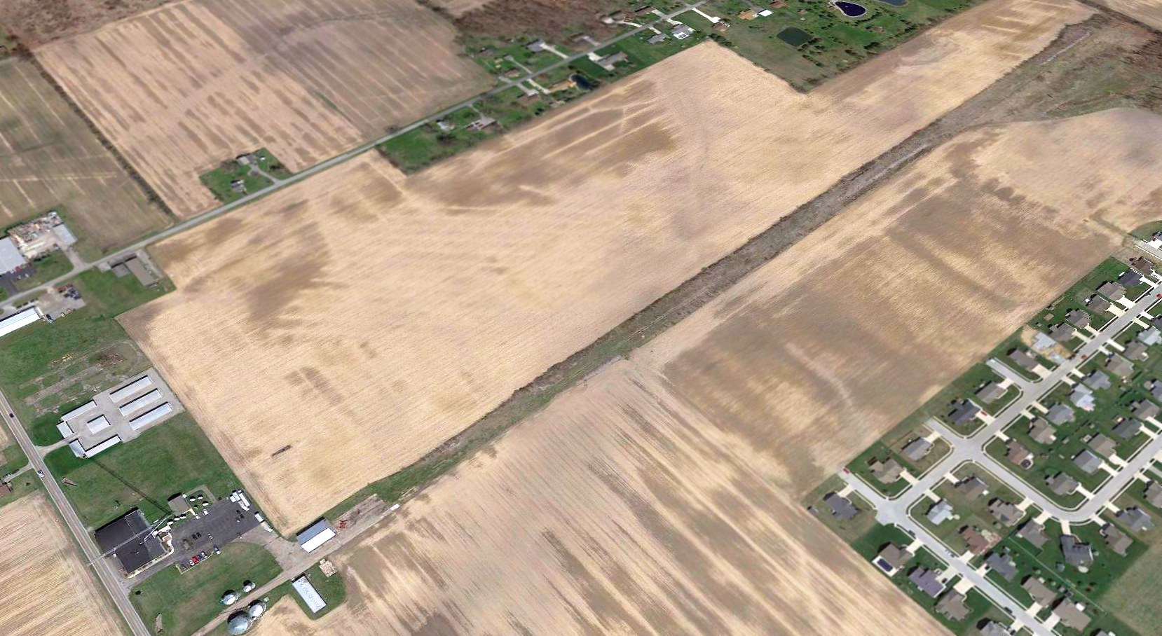
A 2016 aerial view looking northeast showed the former Lima Airport appeared to remain largely intact, with the runway & one hangar still recognizable.
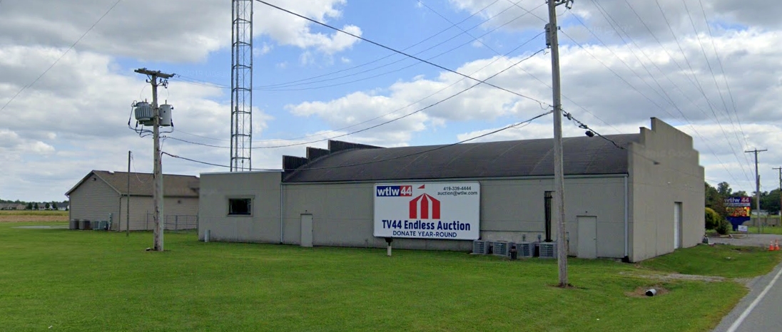
A 2019 photo looking southeast at the former Lima Airport hangar, reused by TV Channel 44.
The site of Lima Airport is located southeast of the intersection of Neely Road & Baty Road.
____________________________________________________
Camp Perry National Guard Airfields #1 & #2, Camp Perry, OH
41.55, -83.04 (West of Cleveland, OH)
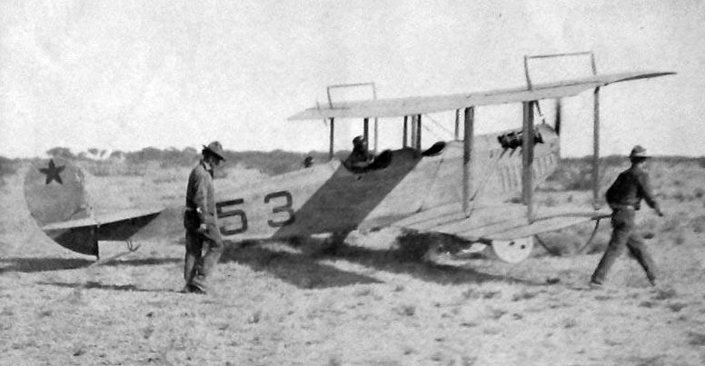
A 1922 photo of a Curtiss JN-4 Jenny at Camp Perry (courtesy of Mike Denja).
The state legislature authorized the purchase of 300 acres of land at what would become Camp Perry in 1906,
to establish a rifle range for the state militia.
The date of construction of the first airfield at Camp Perry has not been determined.
Historical accounts of the Camp do not mention anything about an airfield.
The earliest depiction which has been located of an aircraft at Camp Perry was a 1922 photo of a Curtiss JN-4 Jenny (courtesy of Mike Denja).
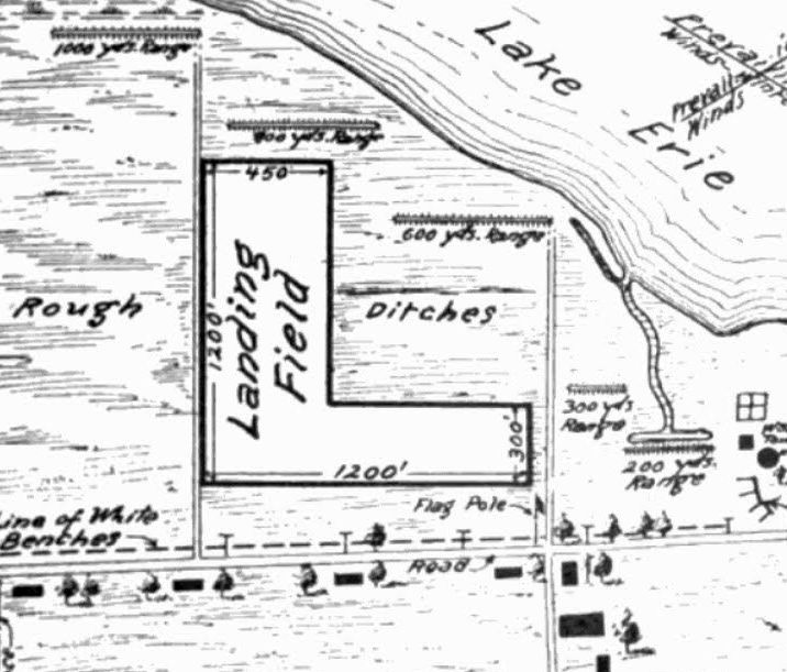
The earliest aerial directory listing which has been located of the Camp Perry Airfield was in the 12/15/23 Commerce Department Airway Bulletin (courtesy of Mike Denja).
It described the Camp Perry Airfield as a state facility, “held for National Guard of OH & national rifle meets.”
It was described a sodded over clay & sand field with two 1,200' runways in an L-shape.
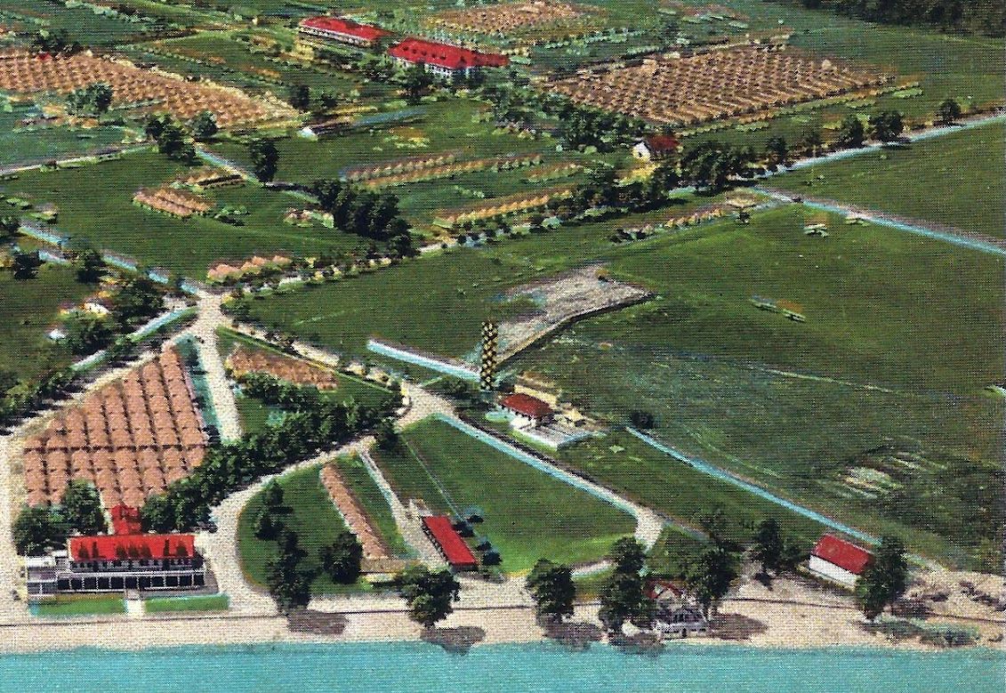
A circa 1920s colorized postcard aerial view looking southwest at Camp Perry (courtesy of Mike Denja), showing 4 biplanes parked on the grass on the right side.
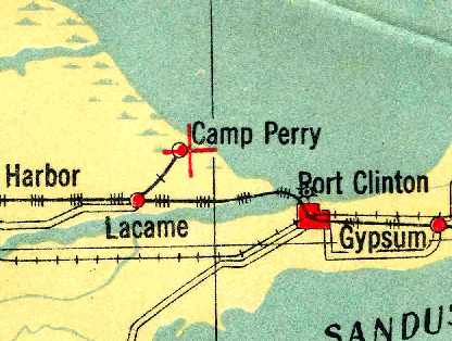
The earliest map depiction which has been located of the Camp Perry Airfield was on the 1928 Air Navigation Map (courtesy of Chris Kennedy),
which depicted Camp Perry as an auxiliary airfield.
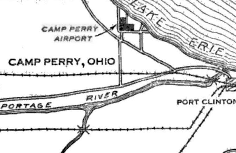
“Camp Perry Airport”, as depicted on the 2/3/30 Commerce Department Airway Bulletin (courtesy of Mike Denja).
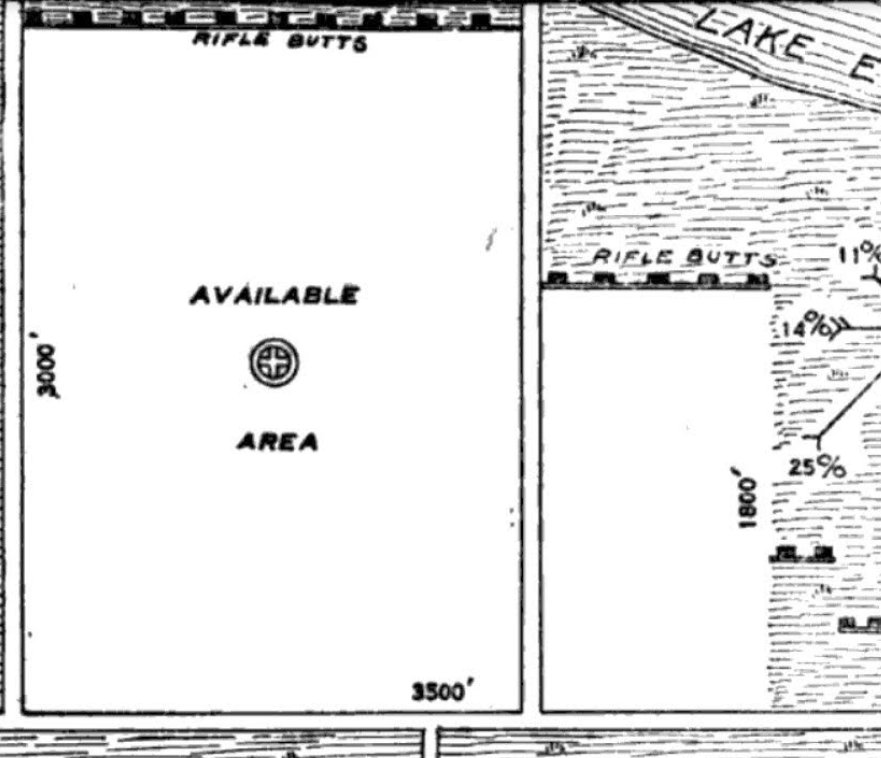
The 2/3/30 Commerce Department Airway Bulletin (courtesy of Mike Denja) described “Camp Perry Airport”
as an Army airfield owned by the State of OH & operated by the OH National Guard.
It was said to consist of a 240 acre L-shaped sod area measuring 3,500' east/west.
The field was said to not have any hangars, but a few small buildings were depicted on the east side.
An article in the 5/21/32 issue of the Sandusky Star Journal (courtesy of Tom Kowalczk) described the “new” Camp Perry Airfield:
“The new airfield which is being made at Camp Perry for the Ohio National Guard maneuvers,
was Inspected by Adjutant General Frank Henderson; Assistant Adjutant General Lt. Col. John Volka,
and Capt. Fred Smith, Director of Aeronautics of the State, who came to the camp yesterday afternoon by airplane from Columbus,
and Major Errol Zlstel, Commander of the 112th Observation Squadron, who also came by plane from Cleveland.
The new field, which is to the west of the Camp Perry grounds, contains more than 100 acres,
and will replace the present field which is used along the firing line & ranges of the camp.
The new field will eliminate the Interference of the training activities on the old field, when national matches or camp training maneuvers were being held.
This new field will also be used as an emergency field for other air traffic.”
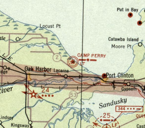
"Camp Perry" was depicted as a military airfield on the December 1932 Cleveland Sectional Chart.
The 1934 Department of Commerce Airport Directory (courtesy of Chris Kennedy)
listed 2 airfields at Camp Perry, both under the title of "Camp Perry Field, National Guard".
The first field was described as being located "at the Camp Perry Rifle Range",
and was described as having two sod landing strips, forming an "L" shape, of 4,000' & 3,000'.
The second field was described as being located "One-half mile west of Camp Perry",
and was described as being an irregularly-shaped sod field, measuring 2,508' x 3,163'.
The 1935 9M Night Flying Chart depicted "Camp Perry Rifle Range" as a military airfield.
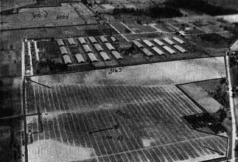
An undated aerial view of the Camp Perry Airfields from The Airport Directory Company's 1937 Airports Directory (courtesy of Bob Rambo).
The directory described the "Camp Perry (#1) Rifle Range Field" as being located on the east side of the Camp, and the "Camp Perry (#2) Camp Perry Airport" on the west side of the Camp.
Both fields were otherwise described in the same manner as in the 1934 directory.
Major John Kachenmeister recalled, "I used to have some photos of the airfield.
The planes were flown by the 112th Observation Squadron,
and included at least one O-47, and two types of biplanes that I could not identify.
The 112th Observation Squadron was the air reconnaissance element of the 37th Infantry Division, OH National Guard.
The airfield was a sod runway aligned north/south,
with the large building on the east side of the post serving as a maintenance hangar."
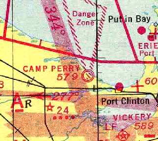
"Camp Perry" was still depicted as an active military airfield on the 1941 Regional Aeronautical Chart (courtesy of Chris Kennedy).
The Camp Perry Airfields apparently were closed (for reasons unknown) at some point between 1941-43,
as no airfields were depicted at the Camp on the April 1943 Cleveland Sectional Chart (according to Chris Kennedy)
or the January 1949 Cleveland Sectional Chart (according to Chris Kennedy).
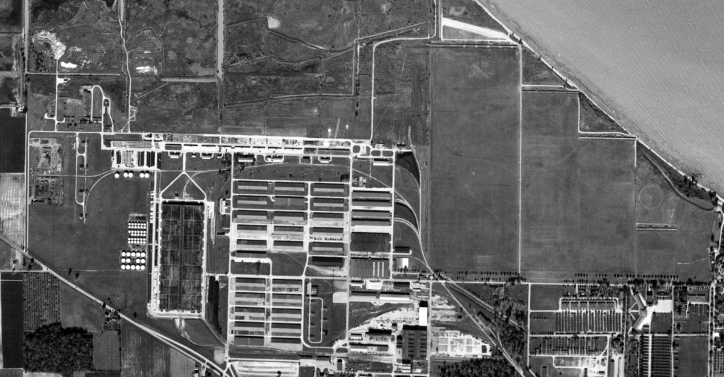
A 10/1/51 USGS aerial photo showed the site of the Camp Perry #1 Airfield on the east side of the Camp & the "Camp Perry #2 Airfield on the west side of the Camp.
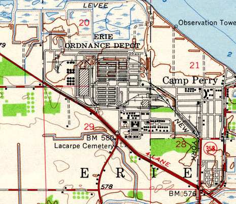
The 1952 USGS topo map seemed to indicate that both Camp Perry airfields were closed at that point,
as it did not label the site of the Camp Perry #1 as an airfield of any kind, and it depicted a large building on the site of the Camp Perry #2 airfield.
Furthermore, it did not depict any other airfields on the Camp property nearby.
However, apparently one of the two Camp Perry Airfields was reopened at some point between 1943-53,
as the 1953 Flight Chart (courtesy of Scott O'Donnell) depicted "Camp Perry (Army)" as an active airfield, with a 3,800' unpaved runway.
The July 1956 Cleveland Sectional Chart (courtesy of Chris Kennedy) depicted "Camp Perry (Army)" as an active military airfield.
The Aerodromes table on the chart described the field as having a 3,800 turf all-way landing area,
and the remarks said, "Restricted to official use. Operated by National Guard."
The Camp Perry airfield was closed (again) at some point within the next year,
as it was no longer depicted at all on the January 1957 Cleveland Sectional Chart (according to Chris Kennedy) or subsequent aeronautical charts.
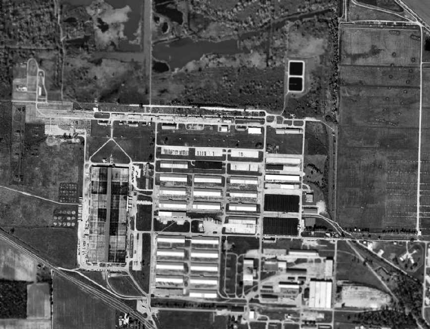
A 1995 USGS aerial photo showed the property of Camp Perry Rifle Range #1 Airfield remained undeveloped - presumably still used as a rifle range.
A large building occupied the site of the #2 Airfield, on the west side of the Camp.
Camp Perry continued to operate as of 2003 as a National Guard training center, but without an airfield.
Major John Kachenmeister (who was "stationed at Camp Perry off & on since the 1970s") reported in 2005,
"The airfield is still semi-active, as several helicopter pads are installed on what was formerly the runway.
It is not listed on the current sectional charts, however, upon occasion helicopters are used for dignitary visits or for airmobility training of Guard troops."
The site of the Camp Perry Airfields is located north of the intersection of Route 2 & Avenue K.
____________________________________________________
Bellefontaine Municipal Airport (7I7), Bellefontaine, OH
40.41, -83.74 (Northeast of Dayton, OH)
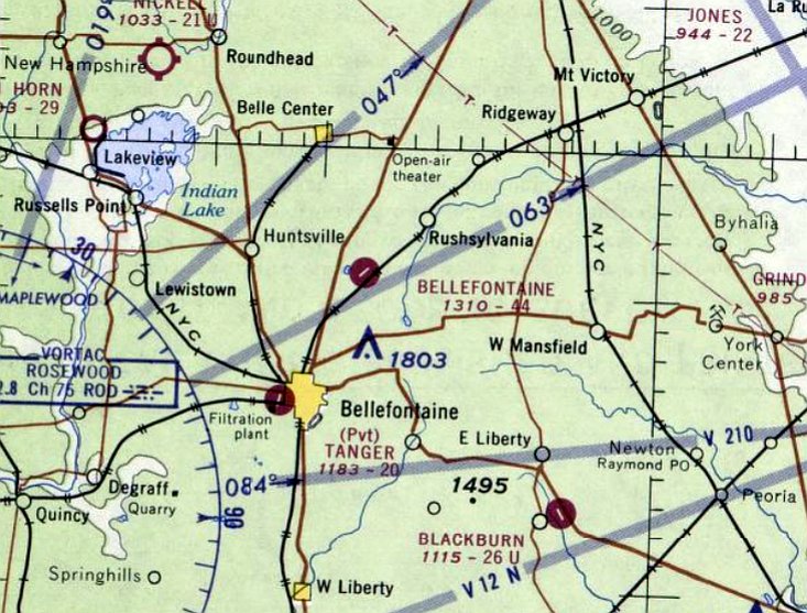
Bellefontaine Airport, as depicted on the May 1967 Cleveland Sectional Chart.
This municipal airport was apparently built at some point between 1966-68,
as it was not depicted on a 1959 aerial photo, the 1961 USGS topo map, nor the November 1966 Cleveland Sectional Chart.
The earliest depiction which has been located of Bellefontaine Airport was on the May 1967 Cleveland Sectional Chart.
It depicted Bellefontaine Airport as having a single 4,400' paved northeast/southwest runway.
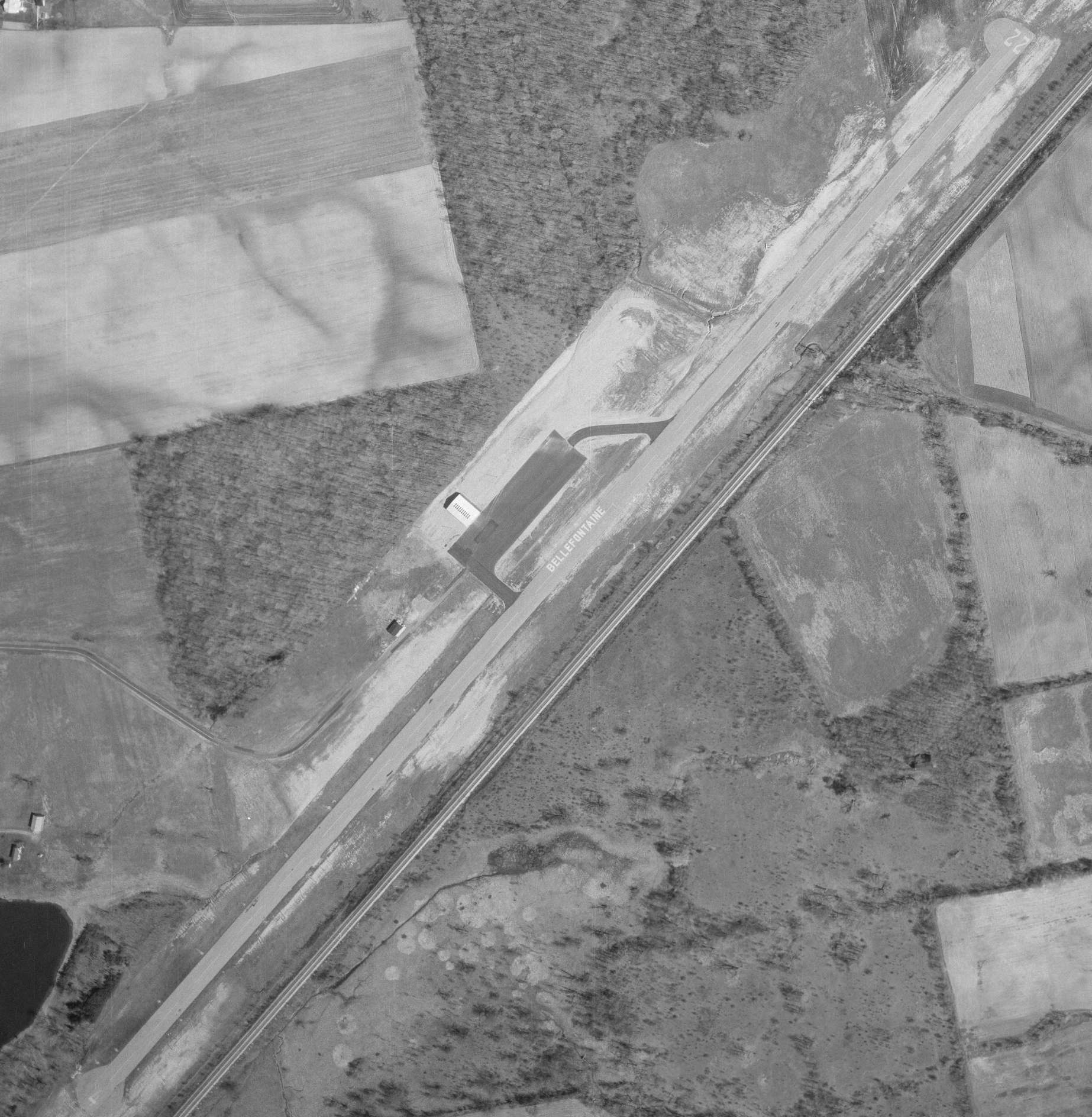
The earliest photo which has been located of Bellefontaine Airport was a 1971 aerial view (courtesy of Dennis Thompson).
It depicted Bellefontaine Airport as having a paved Runway 4/22, with the airport name painted on on, and a paved ramp with a hangar on the northwest side.
But there were no aircraft visible on the field.
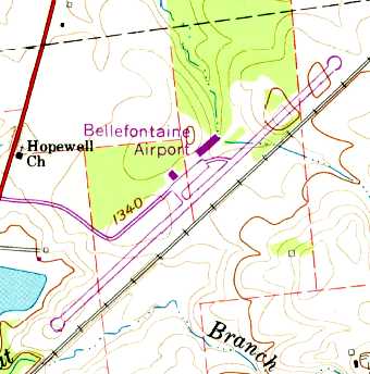
The 1973 USGS topo map depicted Bellefontaine Airport as having a single paved northeast/southwest airport with a ramp & 2 buildings on the northwest side.
The 1976 AOPA Airport Directory (courtesy of Chris Kennedy) described Bellefontaine Municipal as having a single 4,400' asphalt Runway 4/22,
and said that the field offered hangars, flight instruction, and charters.
The operator was listed as Dynamic Aviation, Inc.
The 1982 AOPA Airport Directory (courtesy of Ed Drury) described Bellefontaine Municipal
as having a single 4,400' asphalt Runway 4/22, and listed the operator as Brenner Air Service.

The earliest photo which has been located showing Bellefontaine Airport while in operation was a 1982 aerial view (courtesy of Dennis Thompson), which showed 5 light single-engine aircraft on its ramp.
A 2nd hangar had also been added at some point between 1971-82.
Unfortunately, constraints on the growth of the original Municipal Airport would eventually cause its replacement.
The existing airport had a 4,400' runway, with turn-arounds on each end.
The landing thresholds for both runway ends were displaced 200' due to obstructions in the approaches.
Expanding the existing airport to meet forecasted demand would be limited due to existing constraints,
including State Road 68 & a nearby railroad & landfill.
As described in AOPA Online, planning for a replacement airport for the city of Bellefontaine began in the 1980s,
when Robert Lentz, then a city councilman began pushing for a replacement airfield.
The plan originally faced strong opposition, but over time, and with the help of the aviation community,
Lentz won enough support for the project to go ahead.
The community effort continued when a local businessman & area pilot agreed to buy
the current FBO (Midwest Corporate Air) & take over management of the airport for the city.
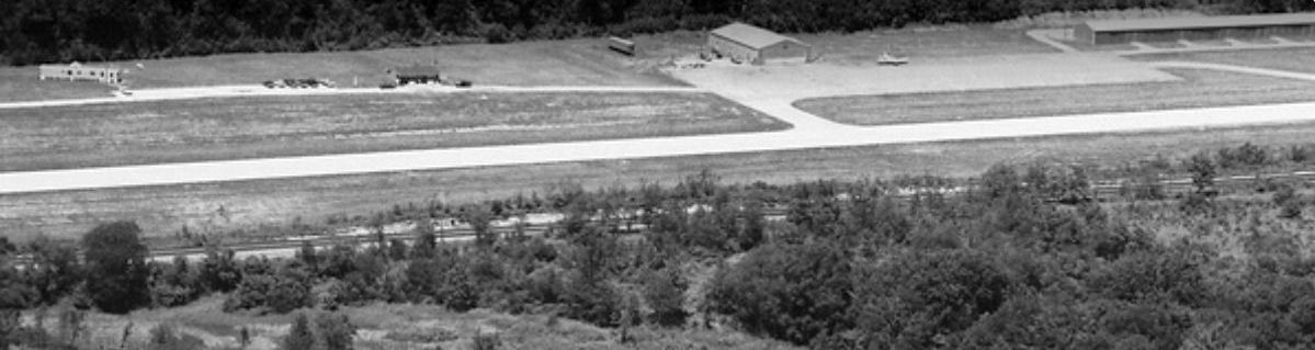
A 1990 aerial view looking northwest at Bellefontaine Airport (courtesy of Dennis Thompson) showed 1 light aircraft on its ramp.
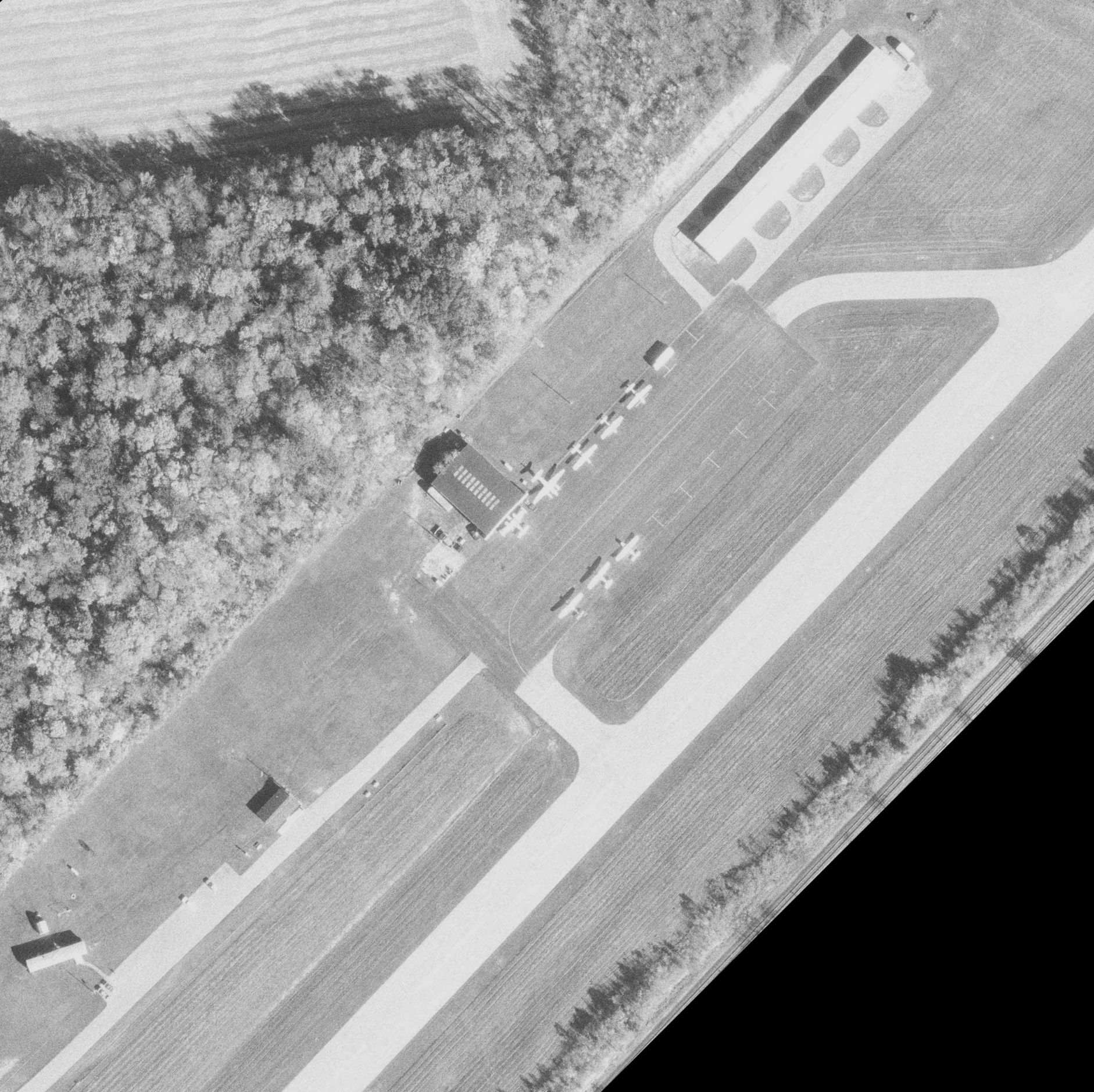
The last photo which has been located showing Bellefontaine Airport while in operation was a a 1995 aerial view (courtesy of Dennis Thompson), which showed 8 light aircraft aircraft on its ramp, including 2 twin-engine aircraft.
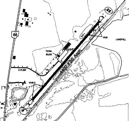
The 2001 OH Airport Directory depicted Bellefontaine Airport as having a 4,400' asphalt Runway 4/22.
In 2002, AOPA President Phil Boyer joined Mayor Robert Lentz & other local dignitaries in Bellefontaine
for the grand opening of the brand-new $13 million Bellefontaine Regional Airport.
It was only the second new airport in Ohio in 30 years.
The new airport is located 4 miles west of the original Municipal Airport, which was presumably be closed at the same point.
A 2004 aerial view confirmed that the original Bellefontaine Airport had been closed, as it had closed-runway “X” symbols painted on the runway.

A 2021 aerial view looking north showed Bellefontaine Municipal Airport to remain intact.
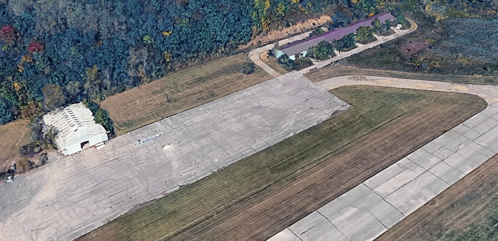
A 2026 3-D aerial image looking north at the former Bellefontaine Municipal Airport hangars.
Bellefontaine Municipal Airport is located southeast of the intersection of Route 68 & Twp Highway 57, 3 miles north-northeast of the town of Bellefontaine.
____________________________________________________
Waco Aircraft Company Factory Airfield / Troy-Waco Airport, Troy, OH
40.03, -84.22 (North of Dayton, OH)
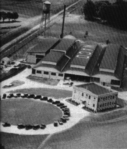
A 1929 aerial view looking southwest at the Waco Troy Factory.
The Waco Aircraft Company came to Troy, OH, in 1923.
Their facility in Troy built a long series of Waco biplanes.
The complex eventually consisted of a factory, a cafeteria building,
and 2 hangars which served as a final assembly building.
The earliest photo which has been located of the Waco complex was a 1929 aerial view,
depicting the factory, with the cafeteria building in front, next to a circular driveway.
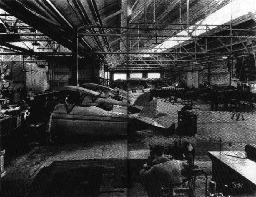
An undated view of the interior of the Waco Troy Factory.
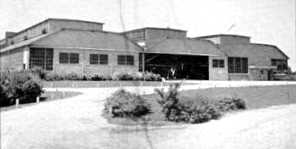
A circa 1930 photo of the Waco Troy factory, showing an aircraft visible inside the door.
Waco-Troy Airport was not yet depicted on the August 1932 Chicago Sectional Chart.
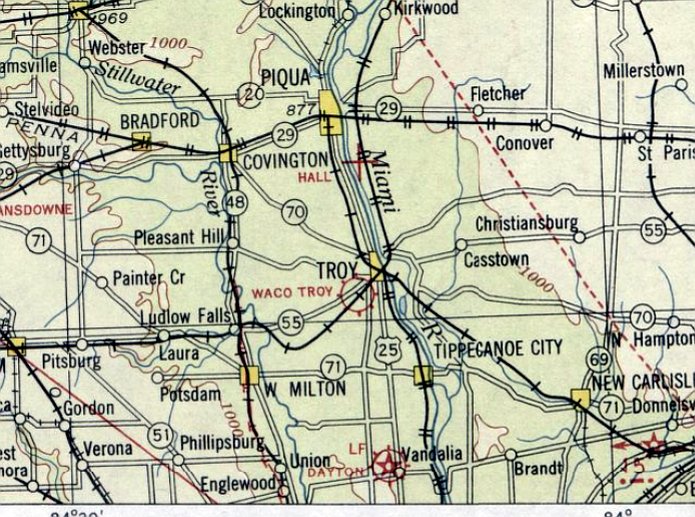
The earliest aeronautical chart depiction which has been located of Waco-Troy Airport was on the August 1933 Chicago Sectional Chart.
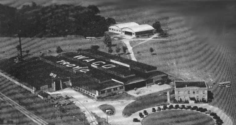
An aerial view looking west from The Airport Directory Company's 1937 Airports Directory (courtesy of Bob Rambo).
It depicted the factory, with the hangars in the background, and the cafeteria building in front, next to the circular driveway.
The directory described the Waco airfield as consisting of a 90 acre sod field.
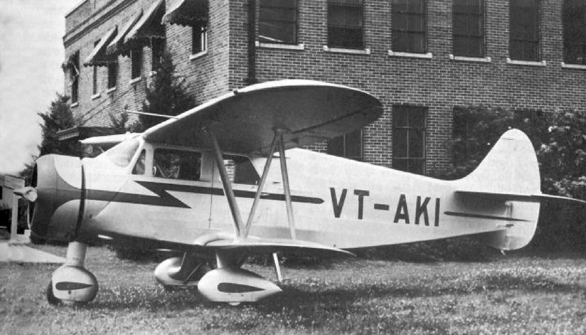
A 1938 photo of Waco ZVN-8 VT-AKI C/n 5026 in front of the Waco Troy administration building.
The Waco factory also built military gliders during WW2.
A 9/28/43 aerial view looking north from the 1945 AAF Airfield Directory (courtesy of Scott Murdock)
depicted the “Waco-Troy Airport” as an irregularly-shaped grass field, with the factory on the east side.
The 1944 US Army/Navy Directory of Airfields (courtesy of Ken Mercer)
described the Waco-Troy Airfield as having a 2,900' runway.
The 1945 AAF Airfield Directory (courtesy of Scott Murdock) described the “Waco-Troy Airport”
as a 130 acre L-shaped sod field measuring 2,850' x 2,500'.
The field was said to have 2 hangars, the largest being a 120' x 80' wood & metal structure.
Waco-Troy Airport was was described as being owned & operated by private interests.
After WW2, Waco concentrated on building airplane parts & small machinery due to lower demand but the company continued to make parts for its planes.
The 1946 Chicago Sectional Chart (according to Chris Kennedy) depicted the field as "Waco-Troy".
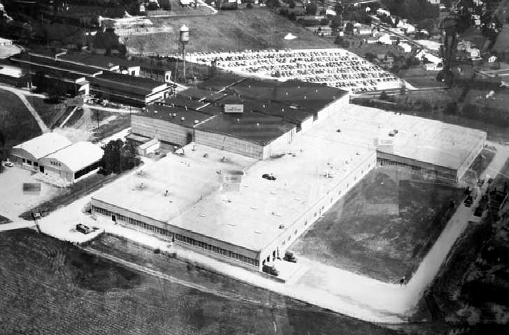
A circa 1950s aerial view looking southeast at the Waco Troy factory.
The aerodromes table on the June 1960 Chicago Sectional Chart (according to Chris Kennedy) described Waco as having a total of 5 runways,
with the longest being a 3,100' turf strip, but also described it as an "all way" landing area.
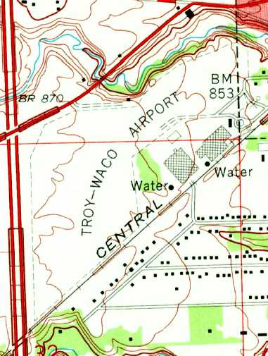
The last topo map depiction which has been located of the Troy-Waco Airport was on the 1961 USGS topo map.
It depicted Troy-Waco Airport as an irregularly-shaped outline to the northwest of the factory buildings.
In 1963, Waco founder Clayton Brukner sold his company to Allied Aero Industries Inc. of Syracuse, N.Y,
and the Troy plant was closed soon after.
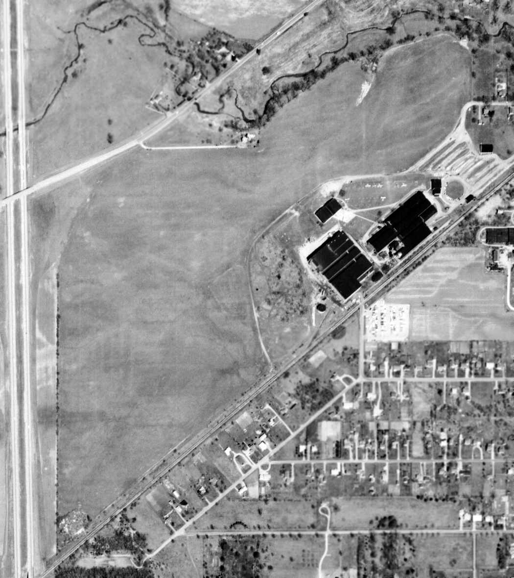
The last photo which has been located showing the Troy-Waco Airport in operation was a 4/15/64 USGS aerial view.
It depicted Troy-Waco Airport as an irregularly-shaped grass field on the northwest side of the factory buildings.
There were 6 single-engine aircraft visible parked near the hangars.
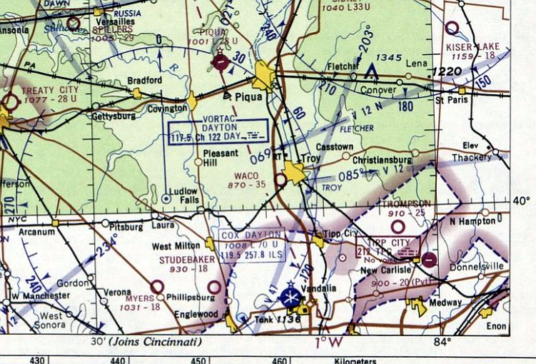
The last aeronautical chart depiction which has been located of the Troy-Waco Airport was on the May 1965 Chicago Sectional Chart.
It depicted Waco as having a 3,500' unpaved runway.
The Waco airfield was evidently closed at some point between 1965-66,
as it was no longer depicted on the May 1966 Chicago Sectional Chart.
A 1972 aerial photo showed a number of industrial buildings had been constructed over the former airfield area of the Troy-Waco Airport at some point between 1964-72.
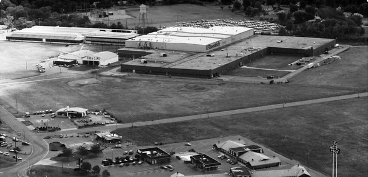
A 1983 aerial view looking east at the Troy-Waco Airport site (courtesy of Dennis Thompson).
By this point the Goodrich company was reused the former Waco factory (upper-left), and had added a significantly larger facility (top-right).
The former hangars (top-left) were being reused by Chem Lawn.
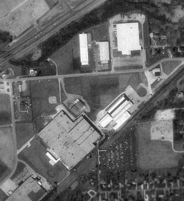
As seen in the 1994 USGS aerial photo, the original Waco factory with the circular driveway pictured in the 1929 photo was still visible (center-right).
The hangars still remained as well, but the cafeteria building adjacent to the driveway had evidently been removed at some point between 1937-94.
As of 2002, the former Waco factory was being used as a warehouse.
Amazingly, the equipment used to steam & shrink the fabric onto the Waco airframes
was reportedly still stored up in the rafters of the former factory.
A 2004 aerial view showed that the majority of the circular driveway had been removed at some point between 1994-2004.
A link to aviation remained at the Waco factory site,
as the Goodrich Corporation Aircraft Wheels & Brakes Division manufactured brakes for military aircraft & the Space Shuttle.
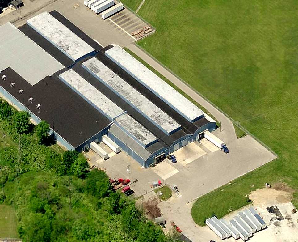
A circa 2007 aerial view looking west at the former Waco factory.
The circular driveway in front of the factory had evidently been removed at some point between 1994-2007.
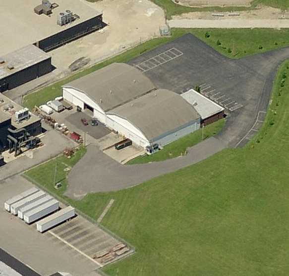
A circa 2007 aerial view looking west at the 2 former Waco hangars on the northwest side of the complex.
The east side of the hangars were marked with “GOKOH Corp.”
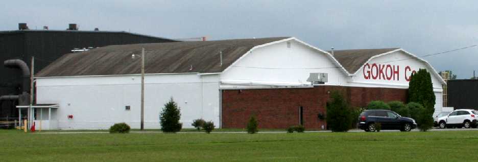
A July 2010 photo by Dick Merrill looking south at the 2 former Waco hangars on the northwest side of the complex.
A July 2010 photo by Dick Merrill looking west at the former Waco factory.
The site of the Waco factory is located southwest of the intersection of Peters Road & Archer Drive.
The Waco Air Museum maintains a small museum a short distance away from the former Waco Factory.
____________________________________________________
Or if you prefer to contact me directly concerning a contribution (for a mailing address to send a check),
please contact me at: paulandterryfreeman@gmail.com
If you enjoy this web site, please support it with a financial contribution.
____________________________________________________
This site covers airfields in all 50 states.