Abandoned & Little-Known Airfields:
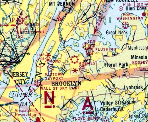
New York City: Queens
© 2002, © 2026 by Paul Freeman. Revised 2/20/26.
This site covers airfields in all 50 states: Click here for the site's main menu.
____________________________________________________
Please consider a financial contribution to support the continued growth & operation of this site.
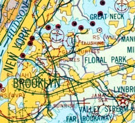
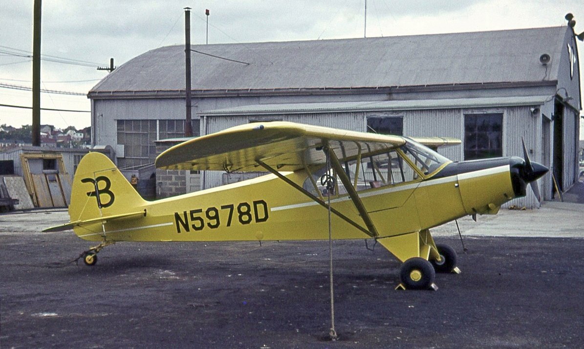
Flushing Airport (revised 2/20/26) - Fort Tilden Blimp Field (revised 2/27/17) - Glen H. Curtiss Airport / North Beach Airport (revised 10/14/22)
Holmes Airport / Grand Central Air Terminal (revised 2/20/26) - Jamaica Sea Airport / Jamaica Airport (revised 6/20/19)
New York Worlds Fair Heliport (added 9/5/25) - Rockaway NAS (revised 2/20/26) - Rockaway Airport / Edgemere NOLF (revised 2/27/25)
____________________________________________________
New York Worlds Fair Heliport, Queens, NY
40.744, -73.851 (East of Manhattan)
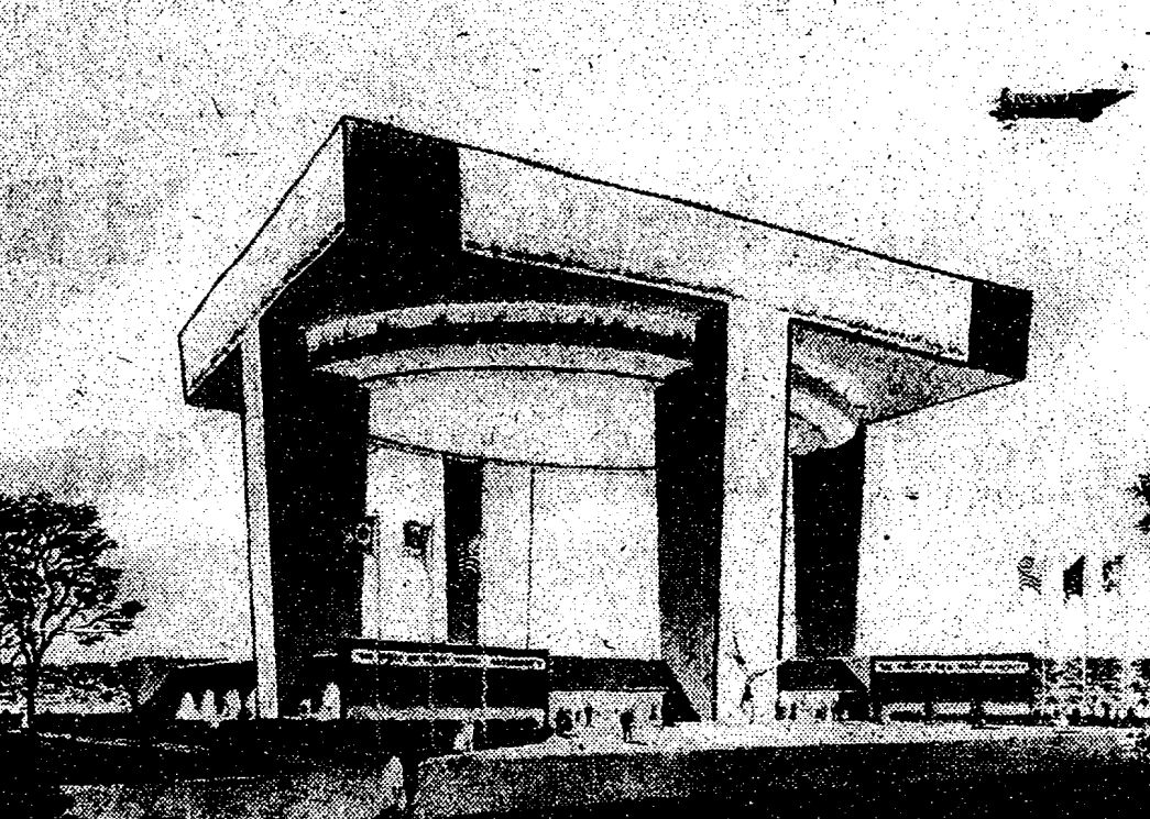
An artist's conception of a BV107 helicopter approaching the Worlds Fair Heliport, captioned “World's Fair heliport in planned by Port Authority”, published 9/18/61.
According to Wikipedia, Robert Moses, the president of the World's Fair Corporation, had wanted to develop a heliport with a restaurant as part of the 1964 World's Fair.
In September 1961, the Port of New York Authority announced that it would erect an exhibition building & heliport on a 1-acre lot in the fair's Transportation section.
Plans called for a 120' tall structure with a 1,000-seat restaurant, which was to cost about $2 million.
Additionally, New York Airways proposed operating a fleet of seven 25-seat helicopters between the heliport & Manhattan; the helicopters were Boeing 107s that could operate at up to 155 mph.
At the time, the building was projected to be completed in January 1964.
The WFC created a scale model of the fairground, including the heliport, in early 1962.
The Port Authority awarded a general construction contract for the heliport to the W. J. Barney Corporation in November 1962 for $4 million.
United Aircraft was hired to operate the building's heliport; it would pay the Port Authority $750,000, plus a portion of any revenue exceeding $2.6 million.
The building's opening date was pushed forward to October 1963 to allow exhibitors to begin hosting events there.
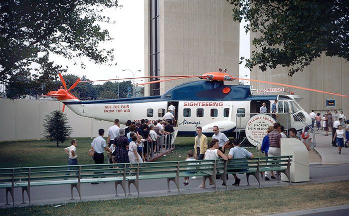
The Port Authority Building opened on 10/16/63, with a ceremony attended by hundreds of people; it was the first completed structure on the World's Fair site.
During late 1963, helicopters began making test flights between the Port Authority Pavilion & heliports in Manhattan.
United Aircraft & New York Airways signed an agreement in early 1964, allowing New York Airways to operate helicopters from the building.
New York Airways also received the exclusive right to use the heliport.
The earliest map depiction which has been located of the Worlds Fair Heliport was on a 1964 map (courtesy of Kevin Walsh), which labeled it “Port Authority Heliport”.
The World's Fair formally opened on 4/22/64, but New York Airways' flights from the building did not begin for another 5 days because of bad weather.
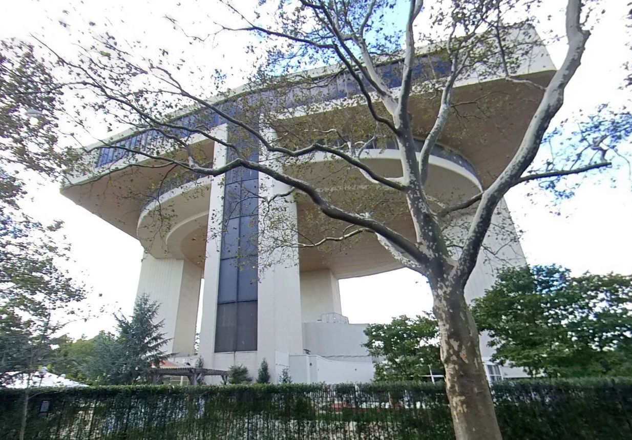
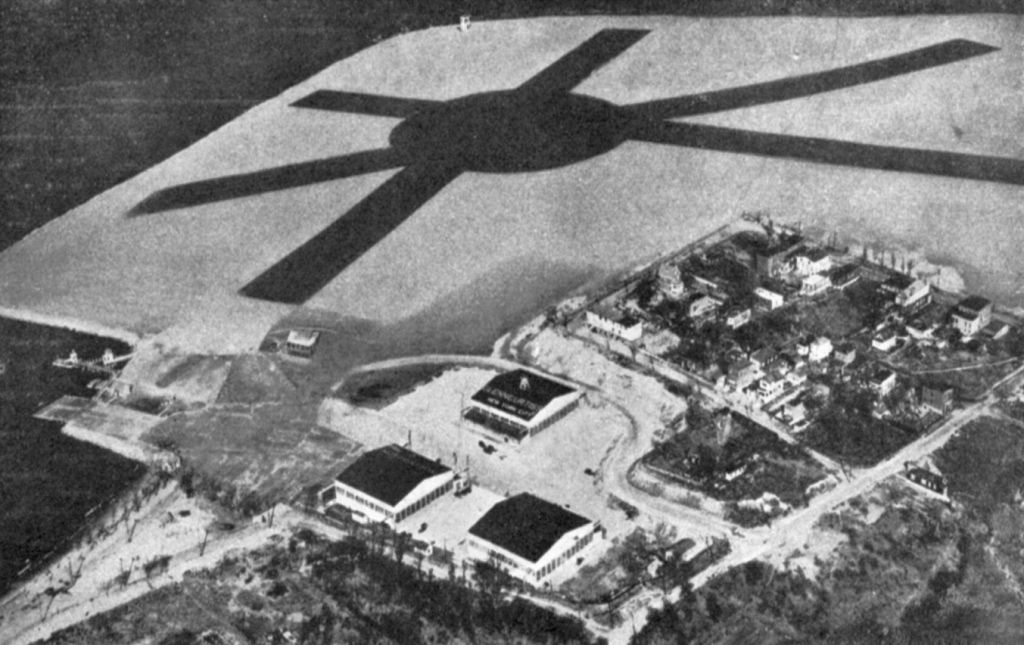
The structure was an icon of the fairground's transportation zone, since it could be seen from almost any other part of the fairground.
During the fair, the Port Authority referred to the building as the fair's "aerial gateway" or the "air gateway to the fair".
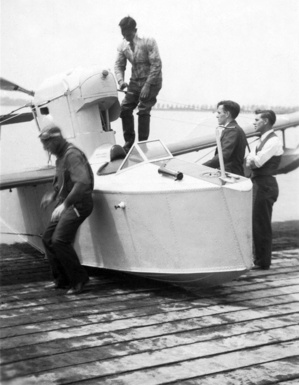
A 1964 of a New York Airways Sikorsky S-21 in static display at the base of the Worlds Fair Heliport.
New York Airways operated flights to JFK Airport, Newark Airport, and the Downtown Manhattan Heliport, as well as sightseeing flights across the fairground.
There had been plans to operate flights to & from the Pan Am Building, but that heliport was not operating because of complaints from tenants in Midtown Manhattan.
The heliport could accommodate 20 flights / hour, and visitors paid up to $6 for a 6-minute helicopter ride.
Initially, the helicopters carried 800-900 guests / day.
That June, as part of an agreement between New York Airways & Trans World Airlines, helicopters began operating between the Port Authority Pavilion & the TWA Flight Center at JFK Airport.
The 1964 NY Sectional Chart did not depict the Worlds Fair Heliport.

A 1964-65 photo looking west at a New York Airways Sikorsky S-21 approaching the Worlds Fair Heliport, with the Manhattan skyline in the background.

A 1964-65 photo of a New York Airways Sikorsky S-21 approaching the Worlds Fair Heliport.
According to Wikipedia, the second Worlds Fair season ended on 10/17/65, and presumably that was also the end of the heliport.
Though Moses had recommended that most pavilions be demolished after the fair ended, the Port Authority heliport was among the few structures that were to be preserved.
The Port Authority put aside some funds to pay for the structure's demolition, but Moses had rejected the Port Authority's offer.
The Worlds Fair Heliport was still depicted on a 1966 map (courtesy of Kevin Walsh), labeled simply as “Heliport”.
The Worlds Fair Heliport was not depicted on the 1967 NY Sectional Chart or the 1968 NY Local Aeronautical Chart.
The 1969 USGS topo map depicted the building of the Worlds Fair Heliport, but without any label.
According to Wikipedia, after taking over Terrace on the Park in 1969, Continental Hosts constructed an additional ballroom named the Penthouse on the old heliport.
=
A $9 million renovation of Terrace on the Park was completed in September 2017.
The building continues to be operated by the privately held Crystal Ball Group, which operates the building as a catering hall for weddings, proms and other events.
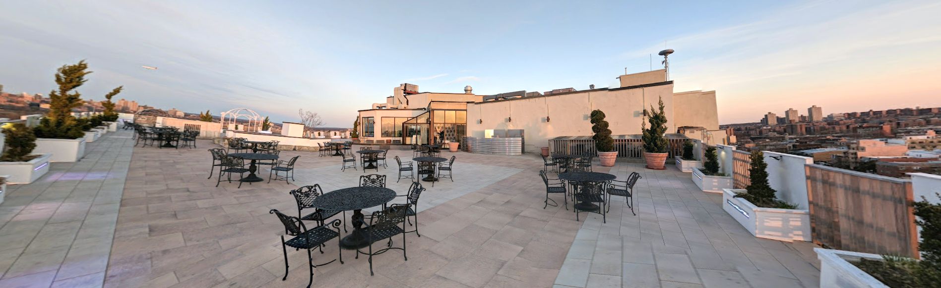
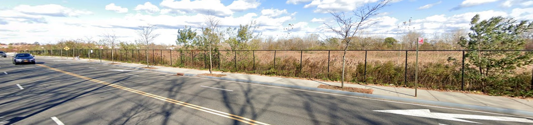
An April 2019 photo looking southeast at the rooftop terrace which occupies the site of the Worlds Fair Heliport.
An October 2021 photo looking southeast at the former Worlds Fair Heliport, now the Terrace On The Park.
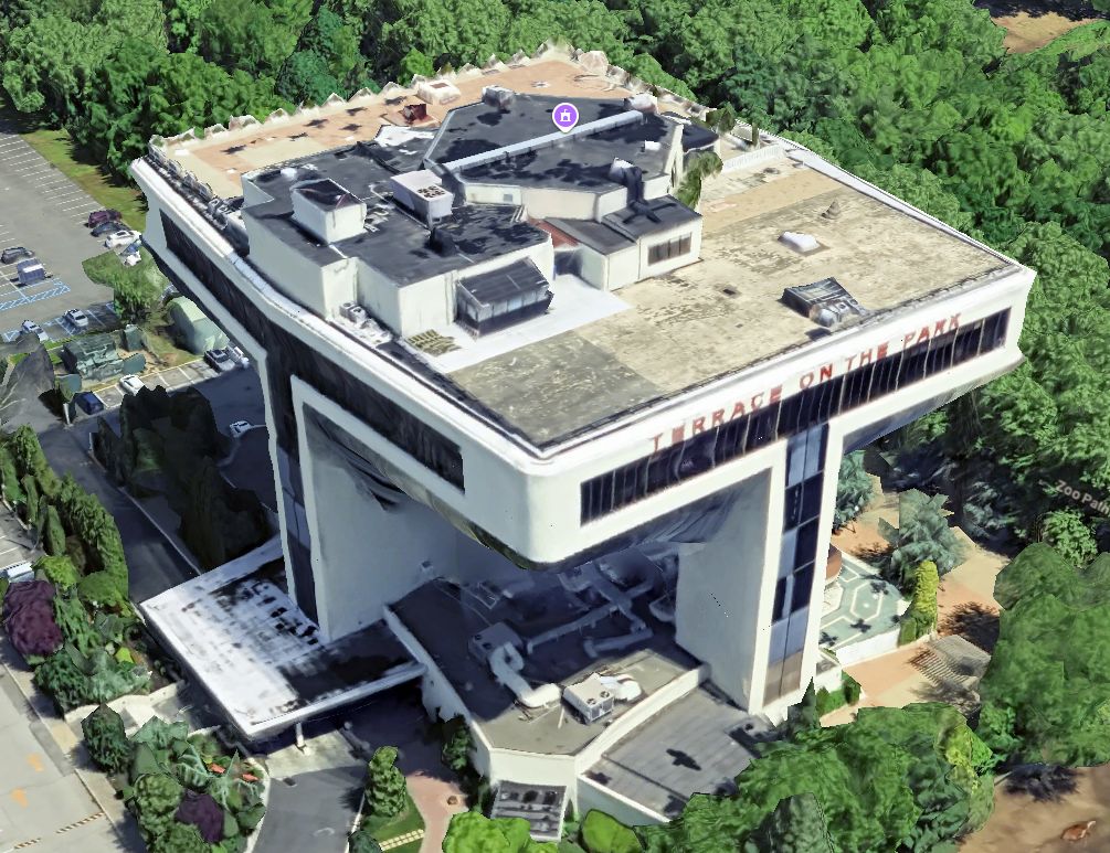
A 2025 3-D aerial image looking north at the former Worlds Fair Heliport, now the Terrace On The Park.
Thanks to Kevin Walsh for pointing out this heliport.
_______________________________________________
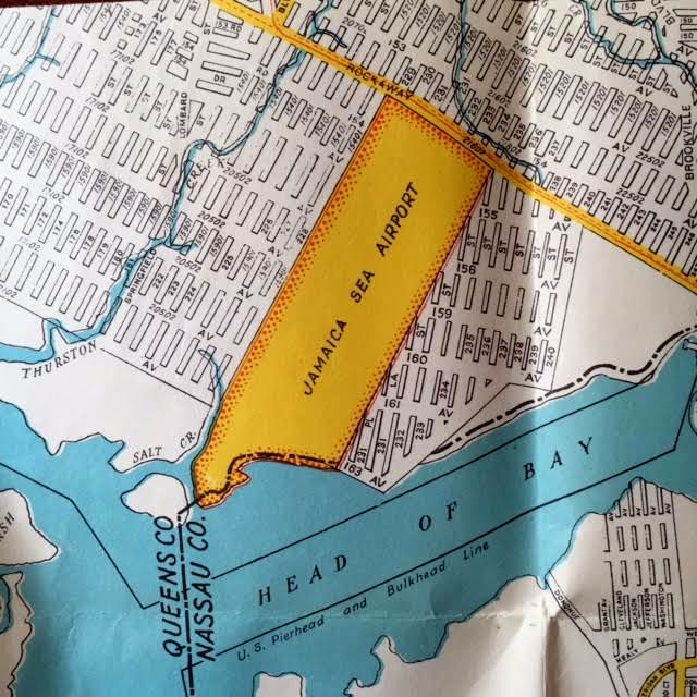
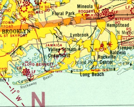
Jamaica Sea Airport / Jamaica Airport, Idlewild, NY
40.64, -73.758 (Southeast of Manhattan)
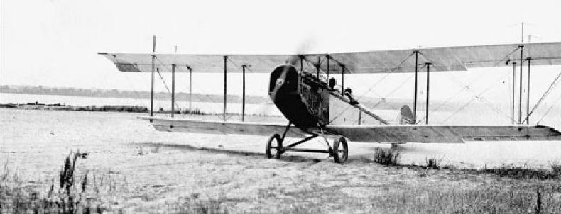
The earliest photo which has been located of Jamaica Sea Airport was a circa 1927 photo of a Curtiss Jenny biplane.
Very few of the millions of people who pass through New York's Kennedy International Airport
are aware that a portion of the airport property was occupied by a much-smaller predecessor airport.
The tiny Jamaica Sea Airport opened in 1927 as the first airport to open on city land in Queens.
It was founded by Martin Devereaux, and its primary function was to operate sightseeing flights over Queens & Brooklyn.
Jamaica Bay Airport had 3 dirt runways measuring between 1,500'-3,000', one small tin hangar, and office, and a seaplane ramp,
all located on a narrow property along the shore of the bay.
Jim Traver reported, “My great, great grandfather, Philip Traver, was one of the early investors in Jamaica Sea Airport
(he is listed as aeronautical consultant in some press releases & as a director in others).
He was the inventor of the dirigible mooring mast & a new type of dirigible - both of which were to be a big part of the Jamaica Sea Airport’s business plan.”
The earliest depiction which has been located of Jamaica Sea Airport was a circa 1927 photo of a Curtiss Jenny biplane.
The earliest aeronautical chart depiction which has been located of Jamaica Sea Airport
was on the 1929 Washington-NYC Air Navigation Map #3.
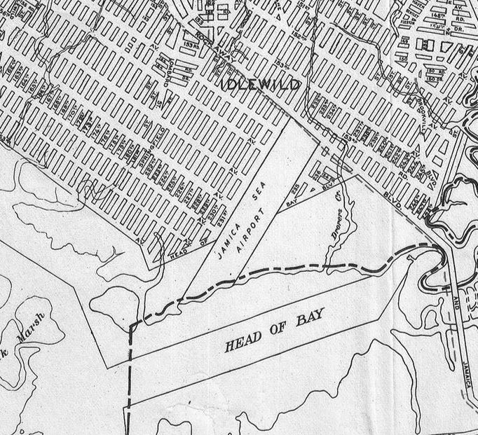
A 1930 Geographia Map of Queens depicted “Jamaica Sea Airport”, as a narrow property extending from Rockaway Boulevard to the southwest toward the waterfront.
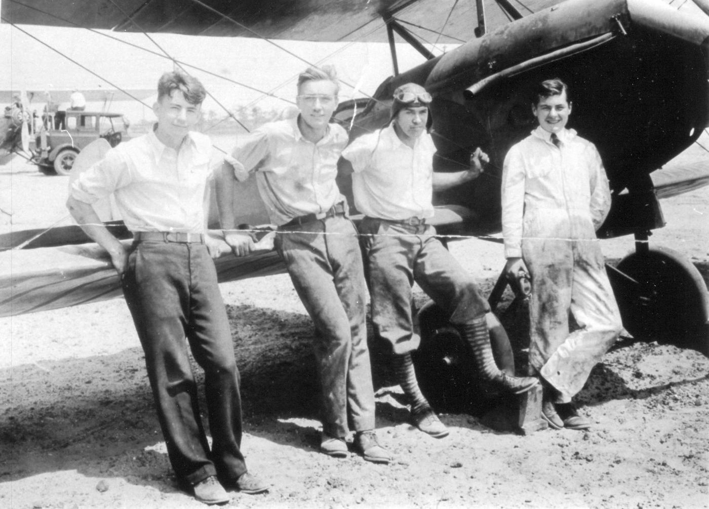
A 1930 photo of Al Meadows, John Martin, Bob Leib, Edward Harrington in front of an American Eagle biplane at Jamaica Sea Airport.
The earliest Sectional Chart depiction which has been located of Jamaica Sea Airport was on the August 1932 NY Sectional Chart.
It depicted Jamaica Sea Airport as an unlabeled seaplane base.
Note also the adjacent “Sunrise” Airport to the northwest: was this a separate facility?
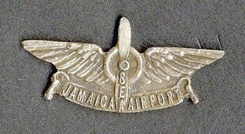
An undated lapel pin from Jamaica Sea Airport.
Jamaica Sea Airport was depicted on the 1934 NY Sectional Chart, but only with the symbol of a seaplane base.
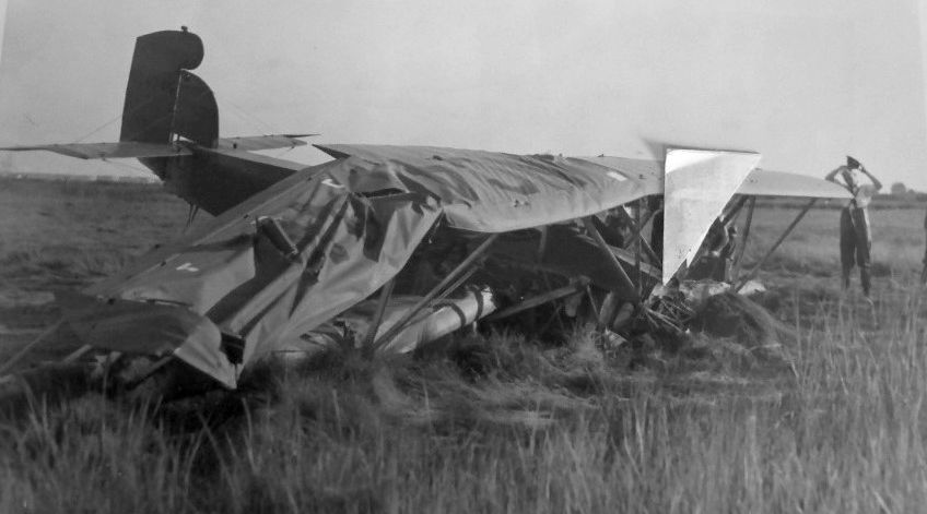
An 8/18/35 photo of an aircraft (type unidentified) which ended up half buried in the marshland near Jamaica Sea Airport
after a crash which injured pilot Edward Anderson & his brother Albert Anderson.
A 1935 photo of a Savoia-Marchetti S-56 flying boat at Jamaica Sea Airport, with Cross Bay Boulevard visible in the background.
A 1936 Hagstroms map (courtesy of Kevin Walsh) depicted “Jamaica Sea Airport”, as a narrow property extending from Rockaway Boulevard to the southwest toward the waterfront.
Note that the airport property appeared slightly wider than was depicted on the 1930 map.
Judith Maggiore recalled, “My father, Clarence Place, learned to fly at Jamaica Sea Airport during the Depression for $1/lesson.”
The last aeronautical chart depiction which has been located of Jamaica Sea Airport was on the June 1936 NY Sectional Chart.
Jamaica Sea Airport was evidently closed at some point between 1936-38,
as it was no longer depicted on the April 1938 NY Sectional Chart.
The Jamaica Sea Airport property was taken over by New York City in 1942,
and eventually leveled for the construction of a small portion of the huge New York International Airport (eventually known as Kennedy International Airport).
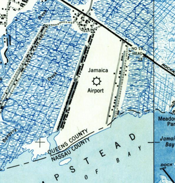
The last depiction which has been located of “Jamaica Airport” was on the 1947 USGS topo map (even though the little airport had ceased to exist for 5 years by that point).
A row of buildings was depicted along both the west & east sides of the airport property.
Sam Berliner recalled, “Idlewild... circa 1948, I used to ride my bike over from Cedarhurst to fly my 4' Waco CG-4A tow-line glider behind the bike.
That was on a long old northwest/southeast concrete runway half-buried in sand roughly where [present-day JFK Runway] 4R/22L is but further southeast.
I got access through a gap in a cyclone fence down by the Queens-Nassau line, roughly where Head-of-Bay ends in Thurston Basin at Meadowmere.
The runway was parallel to the Rockaway Turnpike (now Boulevard), northwest of the bend, where Eastern Road runs now.”
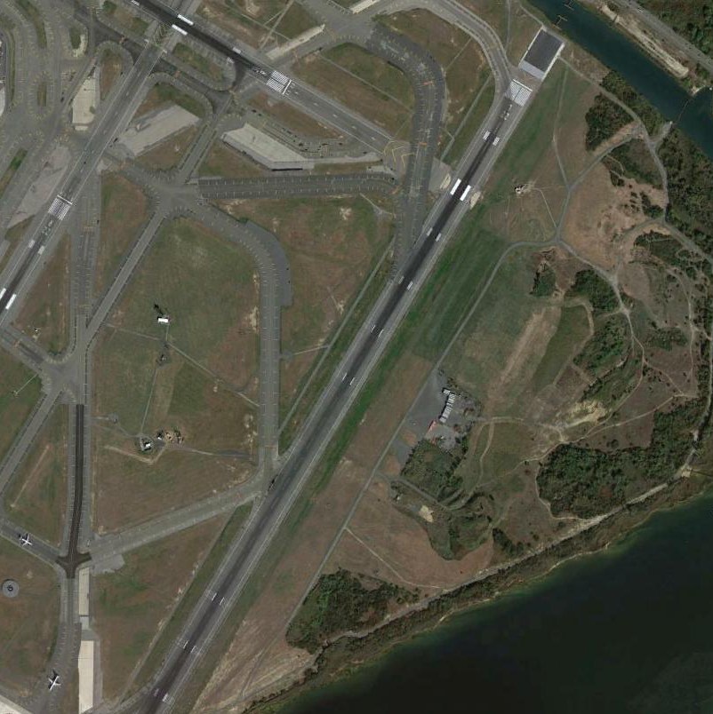
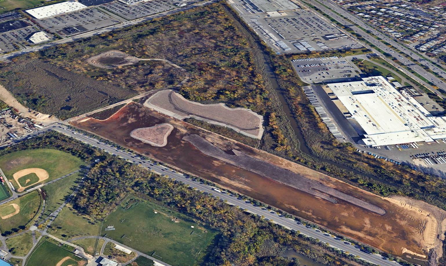
A 2014 aerial view shows the site of Jamaica Sea Airport, roughly the location of the northern half of Kennedy International Airport's Runway 4R/22L.
No trace of the tiny Jamaica Bay Airport remains.
Thanks to Kevin Walsh for pointing out this airport.
_______________________________________________
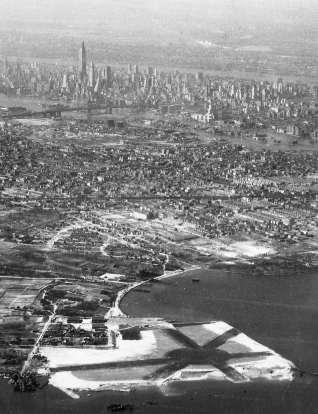
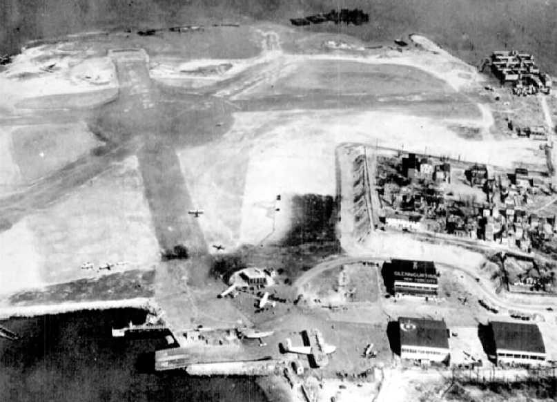
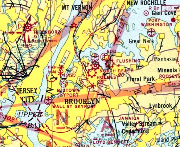
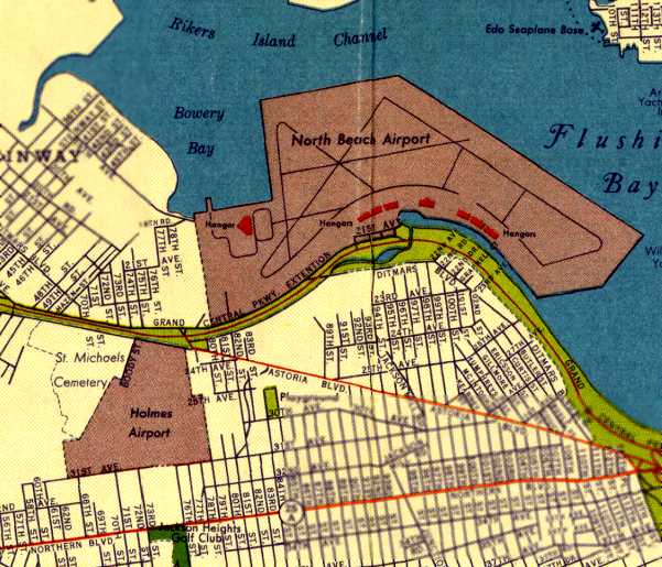
Glen H. Curtiss Airport / North Beach Airport, Jackson Heights, NY
40.76, -73.89 (Southwest of La Guardia Airport)
Glenn Curtiss Airport, as depicted on the 1929 Washington-NYC Air Navigation Map #3.
This peninsula was originally occupied by the Gala Amusement Park, owned by the Steinway family.
According to Peter Maefield's 1972 Wings Club of NYC speech (courtesy of Dave Kanzeg),
“Flying began on the shores of the East River's Bowery & of Flushing Bay in 1925 on land owned by New York Air Terminals.
In 1927 the land was bought by Glenn Curtiss as a base for distribution of Curtiss Robin light aircraft.
It was sold to the Curtiss-Wright Airports Corporation in 1929 as a private landing ground of 105 acres extent.
It was named the Glenn H. Curtiss Airport, North Beach.”
The field was located on the waterfront so that it could service both landplanes & seaplanes.
It had 3 gravel runways, the longest measuring 2,300', 3 hangars, and was illuminated.
The earliest aeronautical depiction of Glenn Curtiss Airport which has been located
was on the 1929 Washington-NYC Air Navigation Map #3.
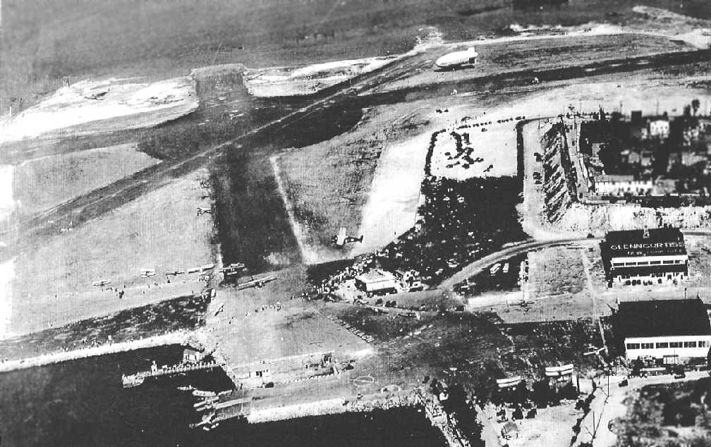
The earliest photo which has been located of North Beach Airport was a circa 1929 aerial photo looking northeast at Glen Curtiss Airport from a brochure from the Glen Curtiss Flying Service (courtesy of Tom Heitzman).
It showed the airport to have 3 asphalt runways & 3 large hangars on the southwest side.
In 1929, Glenn Curtiss Airport boasted 120' wide hangars which were state of the art.
More than 70 planes were based at the field, many owned by wealthy sportsmen from Manhattan, Westchester, and Queens.
It was only 15 minutes from Manhattan by boat or 30 minutes by subway or automobile.
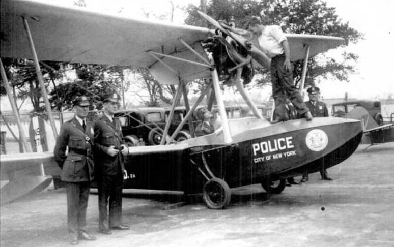
A 1930 photo at Glenn Curtiss Airport of a Savoia Marcheitti S-56 amphibian operated by the NYPD.
The Police operated a squadron of 5 amphibians built by Keystone & Savoia Marchetti at Glenn Curtiss Airport for patrol & rescue.
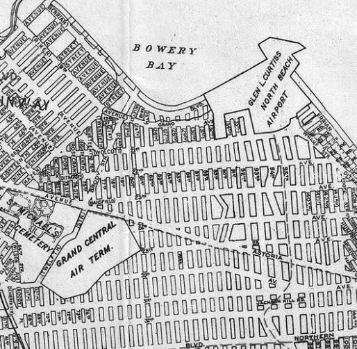
A 1930 Geographia Map of Queens depicted “Glen L. Curtiss North Beach Airport”, along with the nearby “Grand Central Air Terminal”.
According to Michael Traynor, “Irish aviator Adelaide Cleaver who flew from Glen Curtiss Airport in 1930.
She departed from Glenn Curtis Airfield to embark on a solo flight in her Gipsy Moth to fly across the United States to San Diego.”
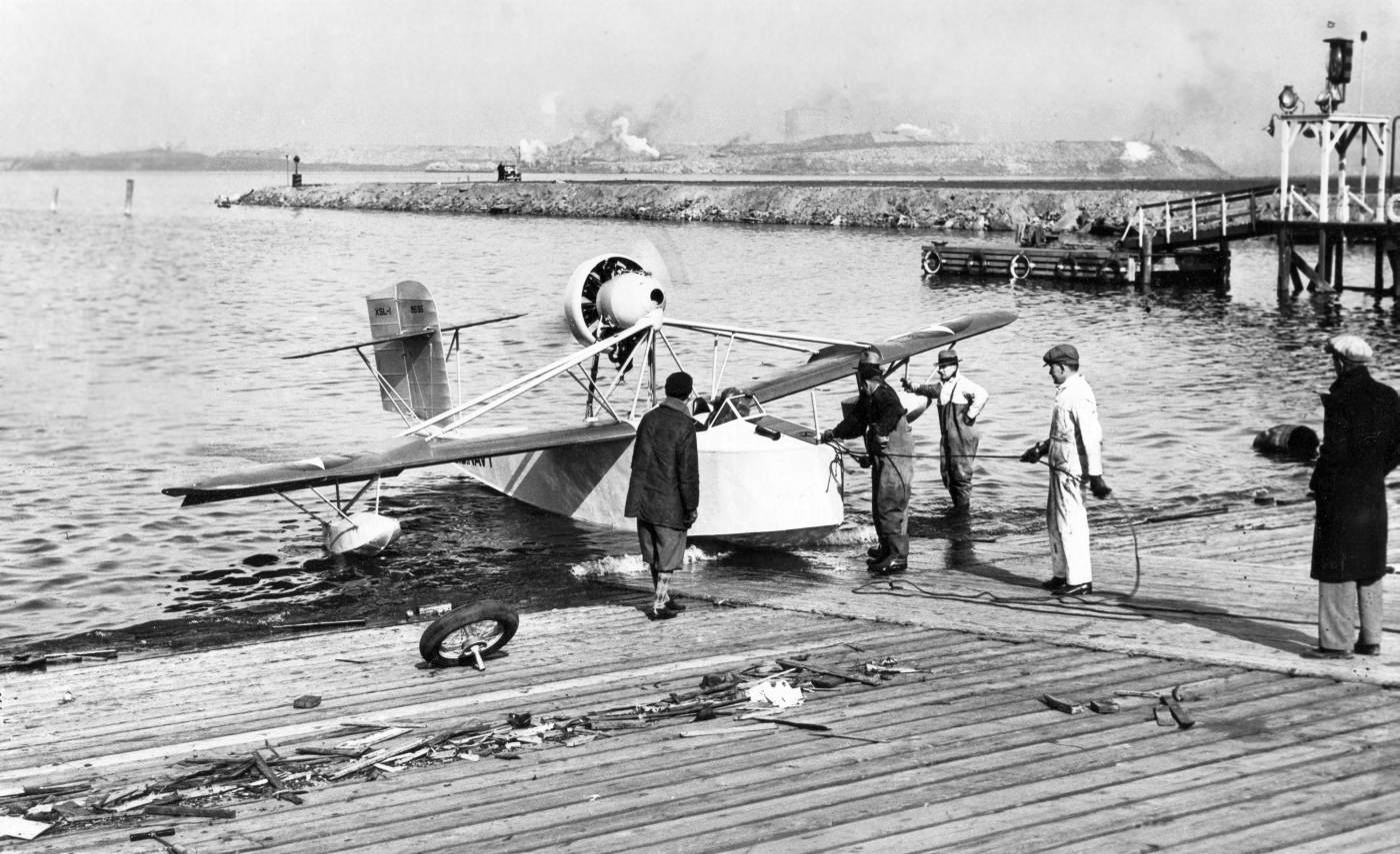
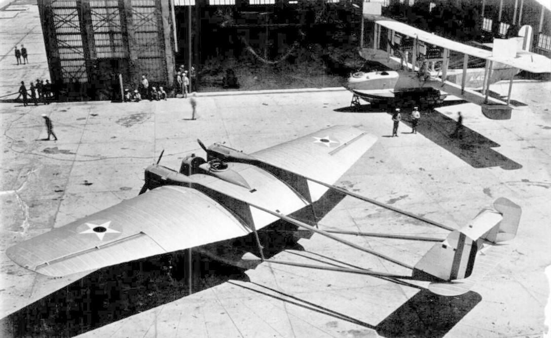
A 1931 photo (courtesy of Alan Reddig, from his father James Reddig's collection). Alan noted, “Dad’s penciled notation on the back is 'XSL-1 North Beach seaplane ramp.'
Riker’s Island is on the horizon at the left of the photo. The XSL-1 was Grover Loening’s first design for a folding airplane to be carried in a tube on the deck of a submarine; note the U.S. Navy identification on the fuselage.
Unfortunately, I can not identify any of the individuals in this photo, although Allison 'Bud' Gillies is almost unquestionably the pilot; he was already Loening’s chief test pilot by that time.
Note the wheel sitting on the ramp (and the bicycle pump at the lower left).
Because the aircraft was designed to be 'launched' from the sub by simply submerging the sub’s bow from underneath it,
there was no provision for maneuvering the XSL-1 around on dry land; it’s a true seaplane, not an amphibian.
For the kind of activity depicted in the photo, the wheel you see was [attached to] the aircraft as needed.
A transcript of comments made by my father & Loening’s test pilot Bud Gillies... Their entry for the XSL-1 segment was:
'Test flights of Loening submarine flying boat XSL-1 with Warner 125 H.P. radial engine, November-December 1931, at North Beach Airport.'
I think this is almost certainly the activity depicted in the photograph (the outfits worn by the men in the photo would alone support a suggestion of a 'November-December' timeframe).”
A beautiful 3/31 aerial photo looking west (courtesy of Tom Heitzman) showed the proximity of Glen Curtiss Airport to Manhattan.
A circa 1931 aerial view of North Beach (Glen Curtis) Airport
showed the Enna Jettick blimp along w/ a dozen other aircraft (courtesy of Alan “AirshipAl” Gross).
A 1931 photo of an unidentified biplane & a Ford 4-AT Trimotor at Glenn Curtiss Airport.
Curtiss-Wright Flying Service operated 2 Ford Trimotors from Curtiss Airport from 1931-32,
with hourly departures to Floyd Bennett Field, Newark, Atlantic City, and Philadelphia.
Although many thousand passengers were carried safely, the service was unprofitable.
A 8/27/31 aerial view looking south at Glenn Curtiss Airport showing the arrival of the sole prototype of the 12-engined Dornier Do X flying boat,
the world's largest , heaviest, and most-powerful heavier-than-air aircraft.
The Do X & crew spent the next 9 months there as its engines were overhauled,
and thousands of sightseers made the trip to Glenn Curtiss Airport to tour the leviathan of the air.
An undated (circa 1930s?) aerial photo looking east at Glen Curtiss Airport (courtesy of Richard Porcelli).
Glenn Curtiss Airport's most famous visiting aircraft was the first example of the Dornier Do X flying boat, at the time the world's largest aircraft.
It arrived at Glenn Curtiss Airport on 8/27/31 after completing its first Transatlantic flight.
The Do X & crew spent the next 9 months there as its engines were overhauled, and thousands of sightseers made the trip to Glenn Curtiss Airport to tour the leviathan of the air.
The earliest Sectional Chart depiction which has been located of Glen Curtiss Airport was on the August 1932 NY Sectional Chart.
A 1932 aerial view looking north depicted Glenn Curtiss Airport as having 3 runways,
3 hangars, and at least a dozen planes were visible, including the massive Dornier Do X seen at the bottom.
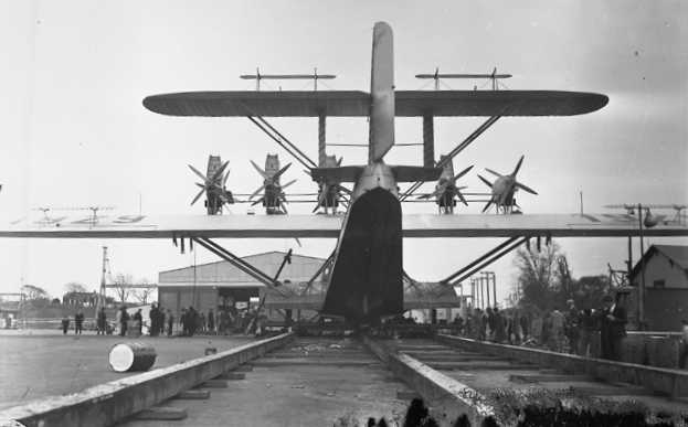
A 1932 photo looking at the massive Dornier Do X on mooring rails at North Beach Airport.
The massive Do X departed from Glenn Curtiss Airport on 5/21/32 on its return trip to Berlin.
A 1932 or later photo (courtesy of Alan Reddig) of “Bud Gillies at the left, jumping down from the cockpit of the Loening XSL2 after a test flight.
My father [James Reddig] is third from the left. The guy standing on the wing is a mechanic, and I believe the gentleman at the right was a draftsman.”
A 1934 photo of a Bellanca Model 77-140 twin-engine floatplane at Glenn Curtiss Airport (courtesy of Mark Hess).
According to Peter Maefield's 1972 Wings Club of NYC speech (courtesy of Dave Kanzeg),
“The name was changed to the North Beach Municipal Airport in 1935
when the site was bought by the City as a light aircraft field & as a base for the crating of aircraft flown in for export.”
A 1935 aerial photo looking northwest at North Beach Airport showed the airport to have 3 asphalt runways & 3 large hangars on the southwest side (courtesy of Paul Siwulich).
A 1935 photo of a Beech Staggerwing on straight floats at Glenn Curtiss Airport (courtesy of Mark Hess).
It was still labeled Glenn Curtiss Airport on the August 1935 NY Sectional Chart.
In 1935, Glen Curtiss Airport was renamed North Beach Airport, as that is how it was labeled on the December 1935 NY Sectional Chart.
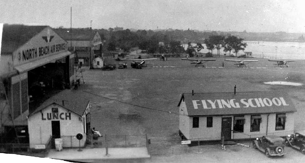
A circa 1936 photo by Henry Seitz (courtesy of Charles Clackett)
showing 2 hangars of the North Beach Flying Service, a lunch shack, flying school, and 7 single-engine aircraft.
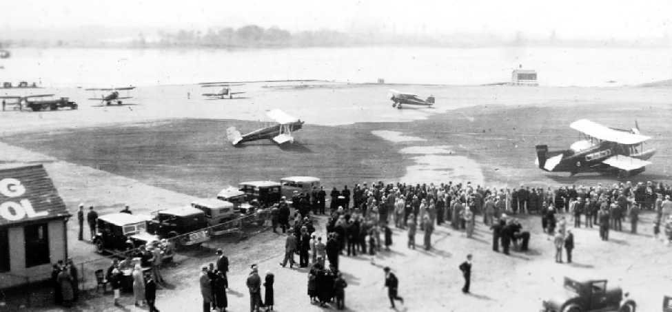
A circa 1936 photo by Henry Seitz (courtesy of Charles Clackett)
showing 5 aircraft next to the flying school building of the North Beach Flying Service, during evidently some kind of public exhibition.
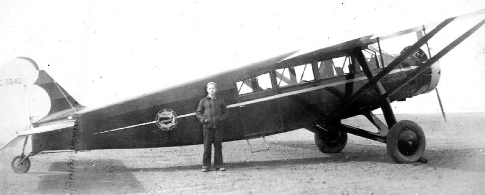
A circa 1936 photo of Henry Seitz in front of a Travel Air 6000 at North Beach Airport (courtesy of Charles Clackett).
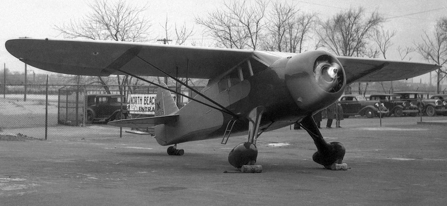
A 4/28/36 photo of Rudy Arnold of Howard DGA-7 NX14835 C/n 71 at North Beach Airport, with an airport entrance sign in the background.
The last aeronautical chart depiction which has been located of North Beach Airport was on the January 1937 NY Sectional Chart.
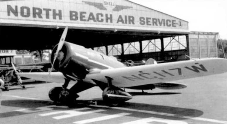
A 1937 photo of a Lockheed Sirius in front of a North Beach Air Service hangar.
At the behest of New York Mayor Fiorello La Guardia, an effort began to develop a new commercial airport for New York City,
and the site of the existing North Beach Airport was chosen.
The city purchased the airport property in 1937.
In the same year the owners of nearby Holmes Airport sought a court injunction
to stop New York City from spending $8,444,300 to develop North Beach Airport,
but Supreme Court Justice Ernest Hammer denied the request.
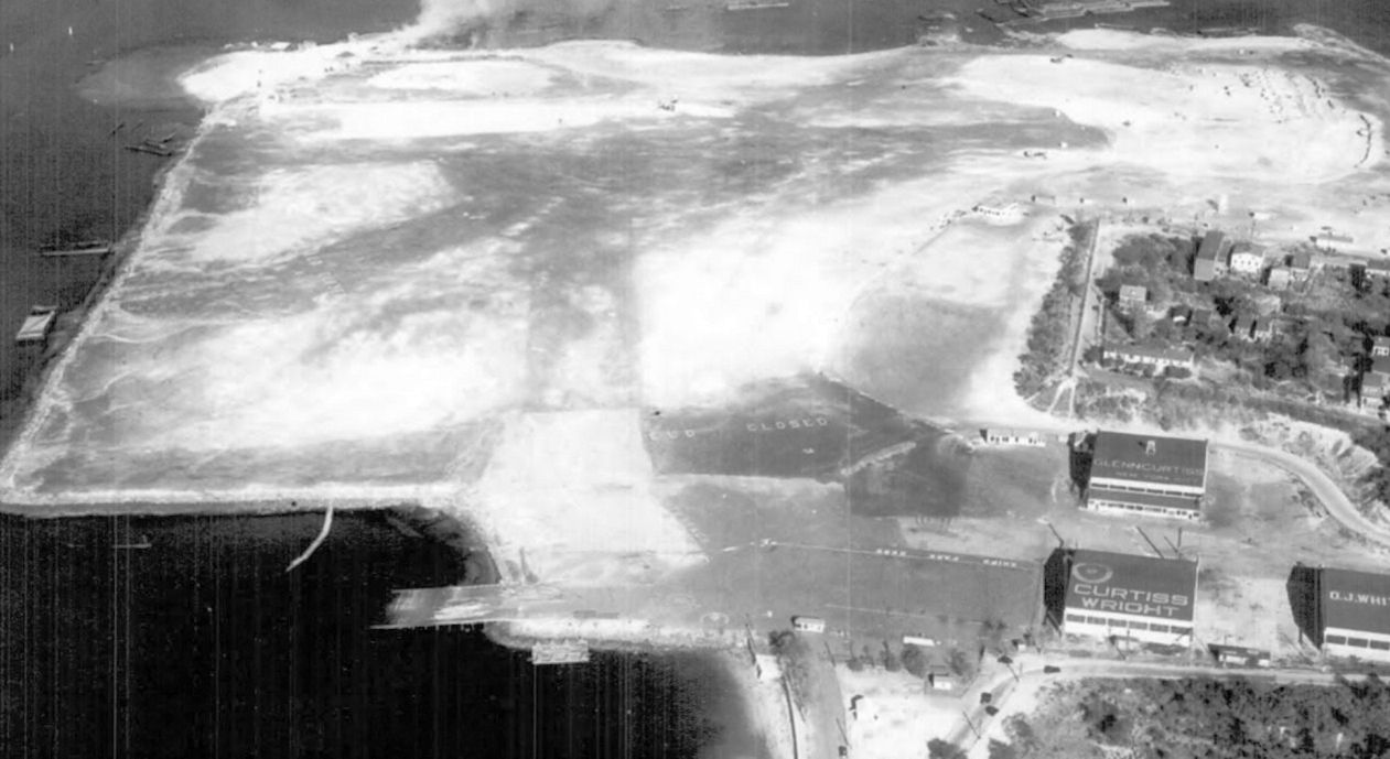
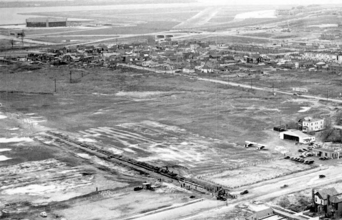
The last photo which has been located showing North Beach Airport before its transformation was a 1937 aerial view looking southeast.
The field had been closed in preparation for its redevelopment (with the word “Closed” visible in the center), with no aircraft were visible on the field.
The airport was otherwise intact, including 3 hangars, one of which had “Glenn Curtiss” painted on its roof, another had “Curtiss Wright”.
A massive construction effort started in 1937, transforming the site & erasing all traces of the former North Beach Airport.
North Beach Airport was no longer depicted on the June 1937 NY Sectional Chart.
The 1938 Aviation Facilities in NY State (courtesy of Bob Parmerter) described North Beach Airport as having 3 black oxide 2,200' runways & 3 hangars.
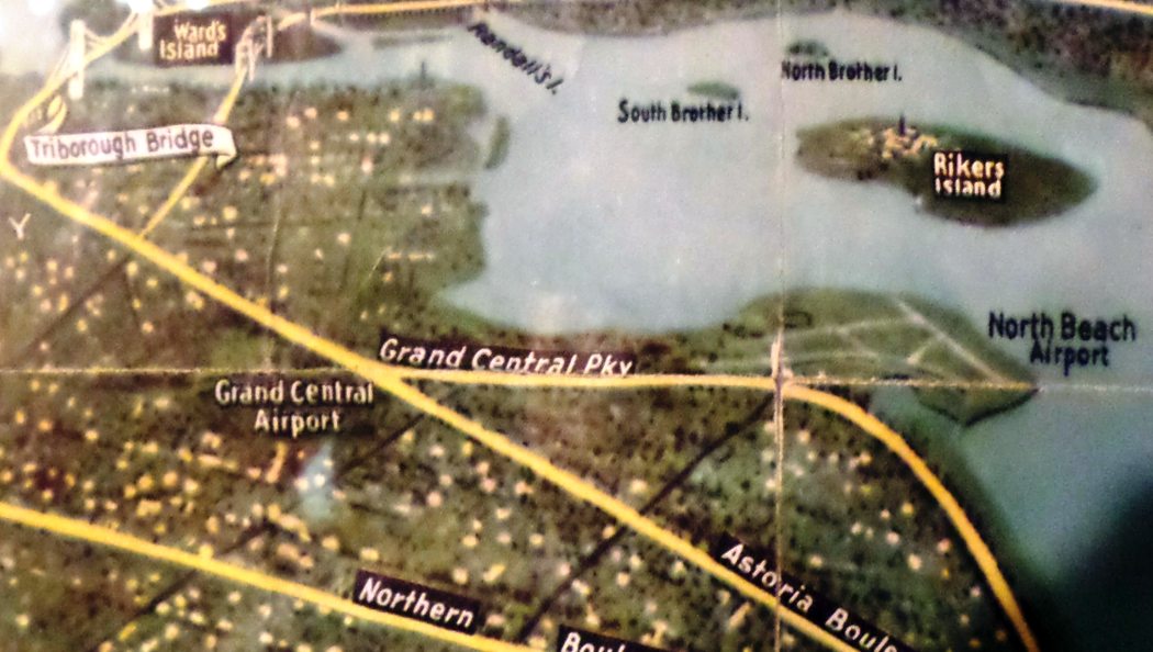
North Beach Airport, as depicted on a 1939 street map (courtesy of Kevin Walsh).
The last depiction which has been located of North Beach Airport was on a 1939 street map (courtesy of Chris Kennedy).
Curiously, it still labeled the site as North Beach Airport,
even though the configuration depicted was that of the massively-expanded, newly-constructed facility which would eventually be known as La Guardia Airport.
The new airport was dedicated on 10/15/39, initially with the name New York Municipal Airport (later to be renamed La Guardia Airport),
ending the history of the much smaller North Beach Airport which had originally occupied the property.
_______________________________________________
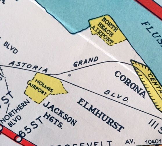
Holmes Airport / Grand Central Air Terminal / Grand Central Airport, Jackson Heights, NY
40.76, -73.89 (Southwest of La Guardia Airport)
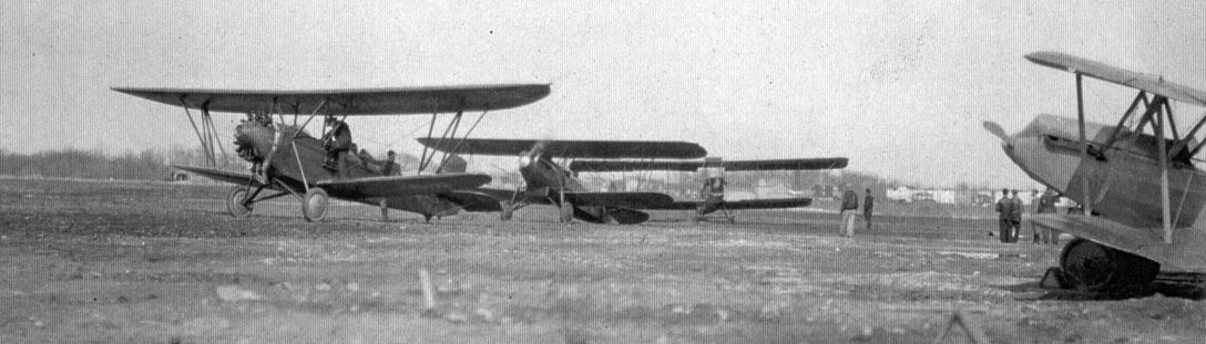
A 1929 photo of a group of biplanes (models undetermined) at Holmes Airport's opening day (courtesy of Peter Lubig).
A 1924 aerial photo did not yet show any sign of an airport at this location.
Real estate developer E. H. Holmes built this small airport on 220 acres of undeveloped land in the Jackson Heights neighborhood of Queens.
He organized & sold stock in Holmes Airport, Inc. E.H. Holmes felt that he had opposition.
He complained, "There are a lot of people who would like to see me fail.
Some of them have done everything they can to hinder me, except drop a bomb in my apartment.”
In February, 1929, Clarence Chamberlin, aviatrix Viola Gentry, and Dorothy Stone broke ground for the new airport.
It had 2 hangars, an office, and 2 gravel runways, measuring 3,000' & 2,800'.
Holmes Airport opened on 3/16/29, attracting 100,000 on its 2nd day of operation.
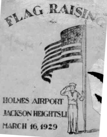
A postmark commemorated the 3/16/29 Flag Raising of Holmes Airport.
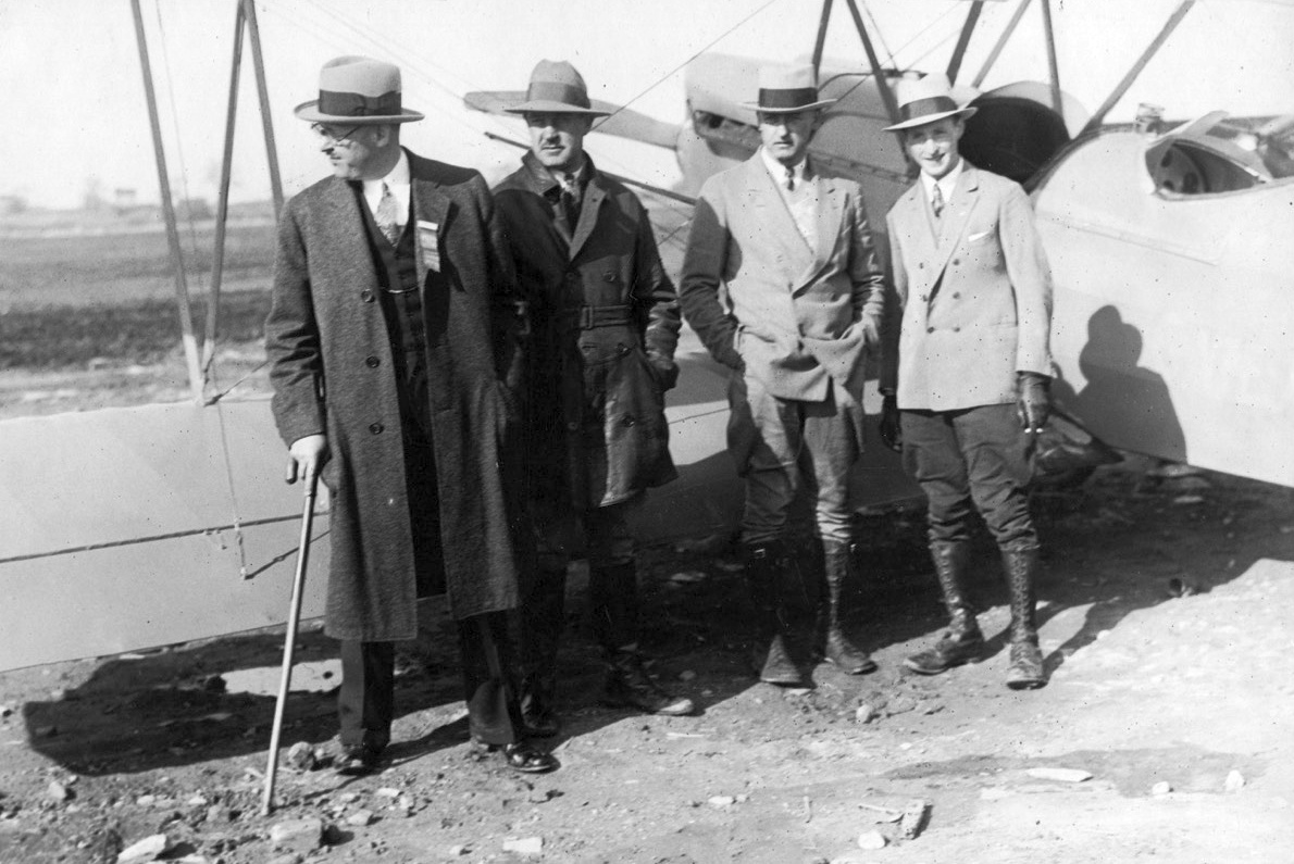
A 1929 photo of a biplane (models undetermined) of Gates Flying Service at Holmes Airport's opening day (courtesy of Peter Lubig).
Later in 1929, the first scheduled flights from New York City began operations from Holmes Airport
when Eastern Air Express started a 2-day run to Miami using a Ford Trimotor.
Holmes Airport was not yet depicted on the 1929 New York – Bellefonte Air Navigation Map #19 (courtesy of David Brooks).
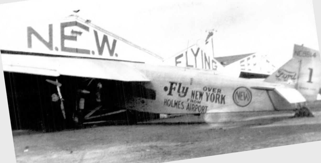
A 1929 photo of a Ford Tri-Motor in front of a the “N.E.W. Flying Service” hangars at Holmes Airport.
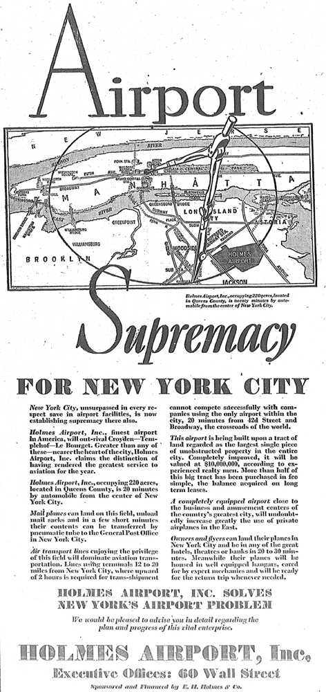
A 1929 ad (courtesy of Mark Hess) promoted the “Airport supremacy for New York City”, graphically portraying Holmes Airport's proximity to Manhattan.
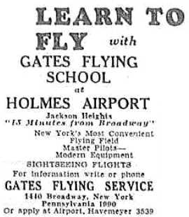
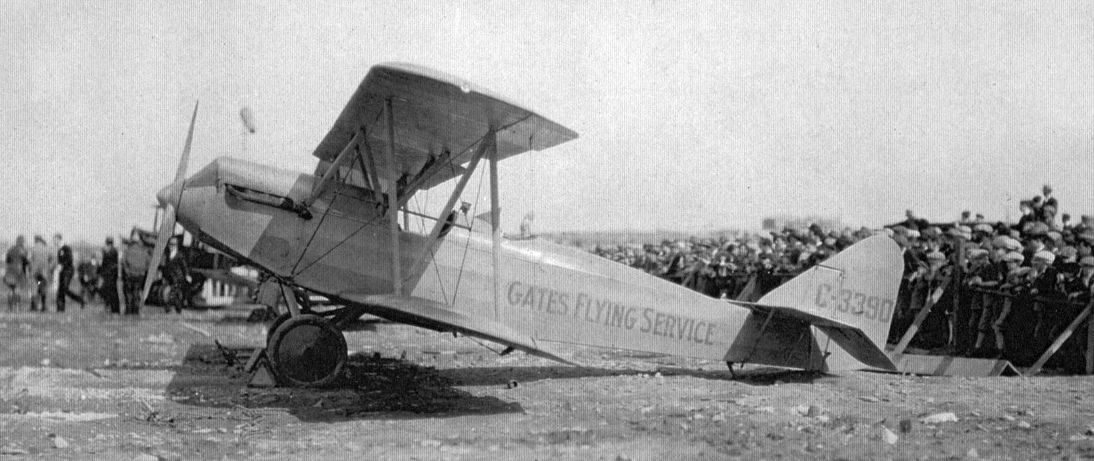
A 1929 ad (courtesy of Mark Hess) for Gates Flying School at Holmes Airport.
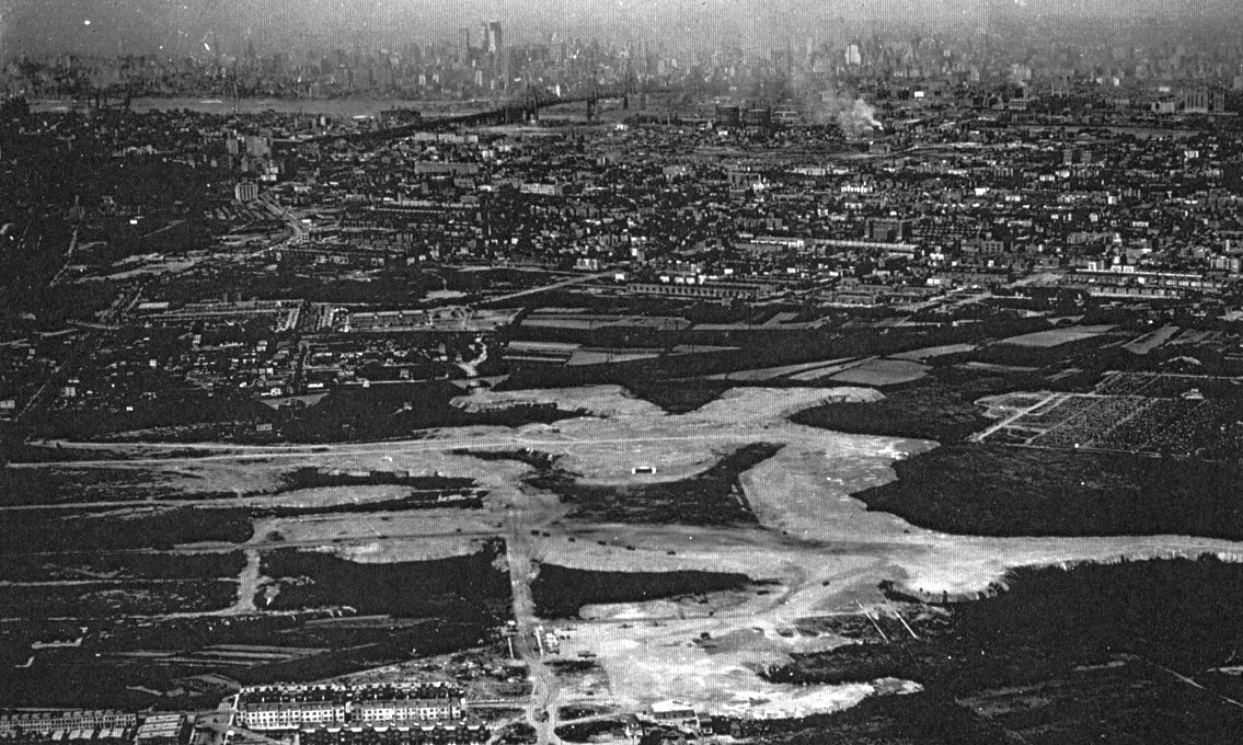
A 1929 aerial view looking west at Holmes Airport, with the Manhattan skyline in the background (courtesy of Peter Lubig).
A 1929 photo of a group of men (including Holmes Airport manager Hans Lubig at far right) in front of a biplane at Holmes Airport (courtesy of Peter Lubig).
Peter Lubig recalled, “Hans Lubig, my dad’s uncle, was the first airport manager of Holmes Airport.”
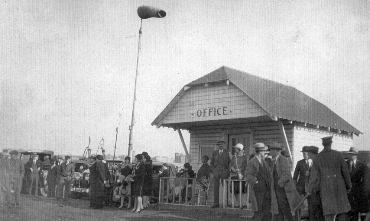
A 1929 photo of Holmes Airport's first office (courtesy of Peter Lubig).
A 1930 Geographia Map of Queens depicted “Grand Central Air Terminal”, along with the nearby “Glen L. Curtiss North Beach Airport”.
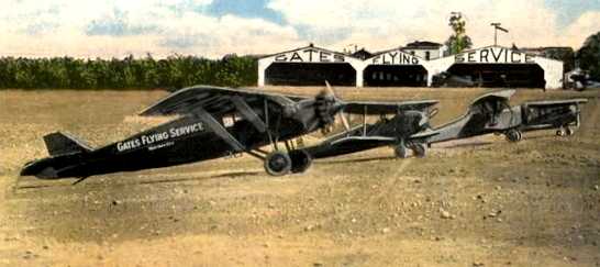
An undated (circa early 1930s?) colorized photo of 4 planes of the Gates Flying Service in front of their hangars at Holmes Airport.
The photo's caption was “Grand Central Air Terminal, Holmes Airport”.
In April 1930, thousands of people took plane rides for the price of $1.
It was promoted as an experiment to see if it was the expense or fear that kept the public from flying.
The Holmes Airport Trimotor airline service was short-lived due to the expense & lack of interest,
and by 1931 the Trimotor was used solely for sightseeing rides over the city.
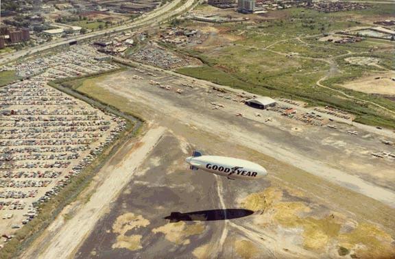
Goodyear erected a 220' blimp hangar at Holmes Airport in 1931 & conducted sightseeing flights.
The earliest aeronautical chart depiction of Holmes Airport which has been located was on the November 1931 NYC-Albany Air Navigation Map.
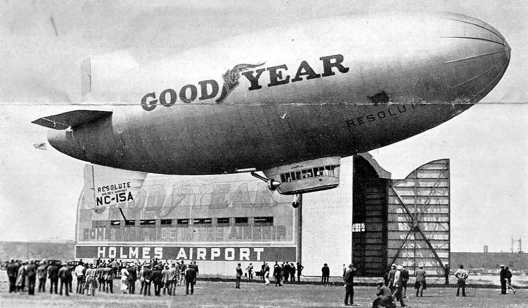
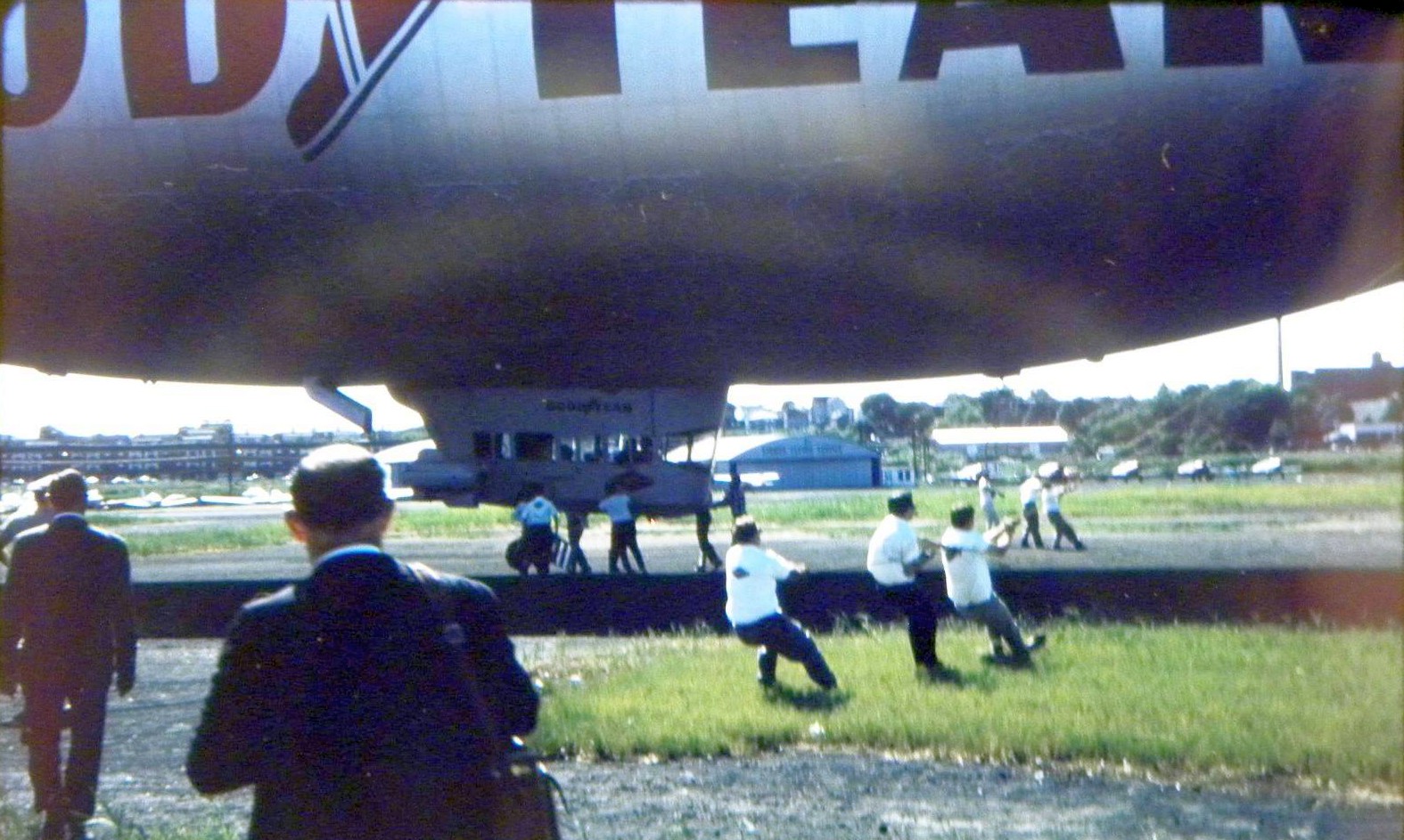
An undated brochure with a 5/18/32 photo of the Goodyear blimp Resolute over the Holmes Airport blimp hangar (courtesy of Alan “AirshipAl” Gross), following her christening.
The earliest Sectional Chart depiction which has been located of Holmes Airport was on the August 1932 NY Sectional Chart.
A map (oriented west-up) from an undated (circa 1930s) brochure highlighting the proximity of Holmes Airport to Manhattan (courtesy of Alan “AirshipAl” Gross).
On 11/11/34, 64 planes took part in a 30-mile novelty race involving a treasure hunt & pie-eating contest, the winner returning in 28 minutes.
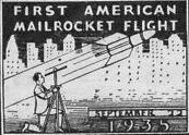
A postmark commemorating the 9/22/35 “First American Mailrocket Flight”, in which 2 rockets were launched by rocket experimenter William Sykora from Holmes Airport.
Both rockets exploded after launch, but some mail was recovered from the wreckage.
In 1936, a Goodyear blimp based at Holmes Airport provided the world's first aerial traffic reports.
An undated (circa 1930s) photo of a Fairchild monoplane & Waco biplane at Holmes Airport (courtesy of Adam Raines).
In 1937, Holmes Airport's owners sought a court injunction to stop New York City from spending $8,444,300
to develop North Beach Airport (what would become LaGuardia Airport) only a mile or so to the northeast.
Supreme Court Justice Ernest Hammer denied the request.
The last aeronautical chart depiction which has been located of Holmes Airport was on the June 1937 NY Sectional Chart.
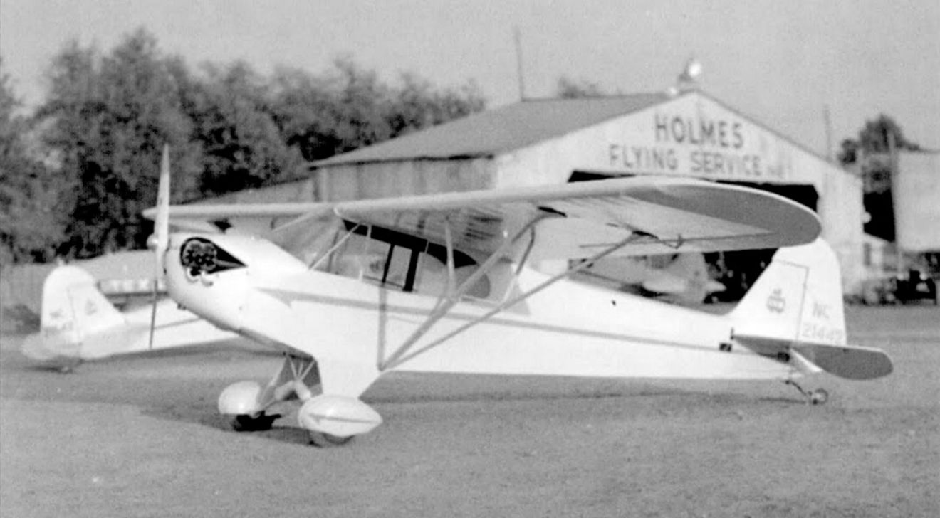
A 1938 photo of 2 Piper Cubs in front of a hangar marked Holmes Flying Service at Holmes Airport, with another aircraft in the hangar.
Jonathan Krull reported, “A good friend of mine owns a 1935 Waco CUC-1 (registration # NC-15233) that was owned (in 1938) by Holmes Flying Service.
The airplane in the background of the photo (parked in the hangar) could be a Waco CUC.”
The 1938 Aviation Facilities in NY State (courtesy of Bob Parmerter) described Holmes Airport as having 4 oiled runways, with the longest measuring 3,300', and 2 hangars, one of which was a Goodyear dock.
Holmes Airport was no longer depicted on the April 1938 NY Sectional Chart.
Holmes Airport, as depicted on a 1939 street map (courtesy of Kevin Walsh).
The last map depiction which has been located of Holmes Airport was on a 1939 street map (courtesy of Chris Kennedy).
Notably the map shows the proximity to the much-larger North Beach Airport (today's LaGuardia Airport), which was opened in 1939.
Holmes Airport was also known (perhaps only briefly) as Grand Central Airport,
as that is how it was labeled on a map the 1939 NY World's Fair (courtesy of George Holt).
The last photo which has been located of Holmes Airport was on a 1939 aerial view looking northeast, showing the hangars of Holmes Airport & 2 aircraft at the lower-right,
and the runways & hangars of the newly-built New York Municipal Airport in the background.
Holmes Airport operated alongside the much larger North Beach Airport / New York Municipal Airport for 6 months before closing in 1940.
Veterans' housing was built on a portion of the Holmes Airport site,
and a Bulova watch factory was later built on the the northern portion of Holmes Airport's land.
By the time of the 1947 USGS topo map, Holmes Airport was no longer depicted,
and it was heavily built-over in a 1948 aerial photo.
As seen in a June 5, 2006 aerial view, not a trace remains of the former Holmes Airport.
The site of Holmes Airport is located southeast of the intersection of Astoria Boulevard & East Brooklyn Queens Expressway.
________________________________________________
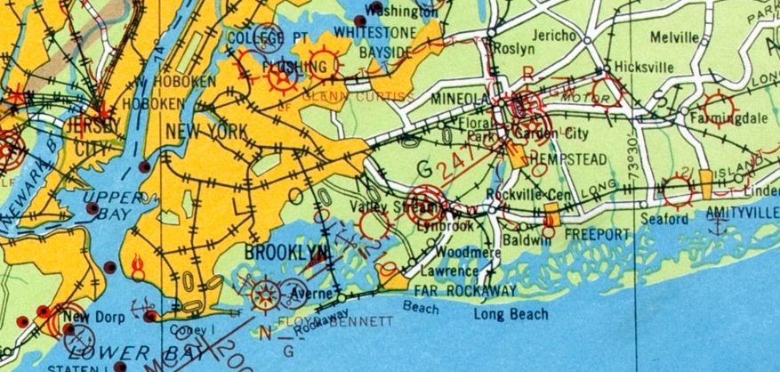
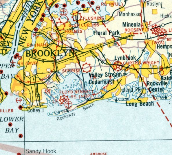
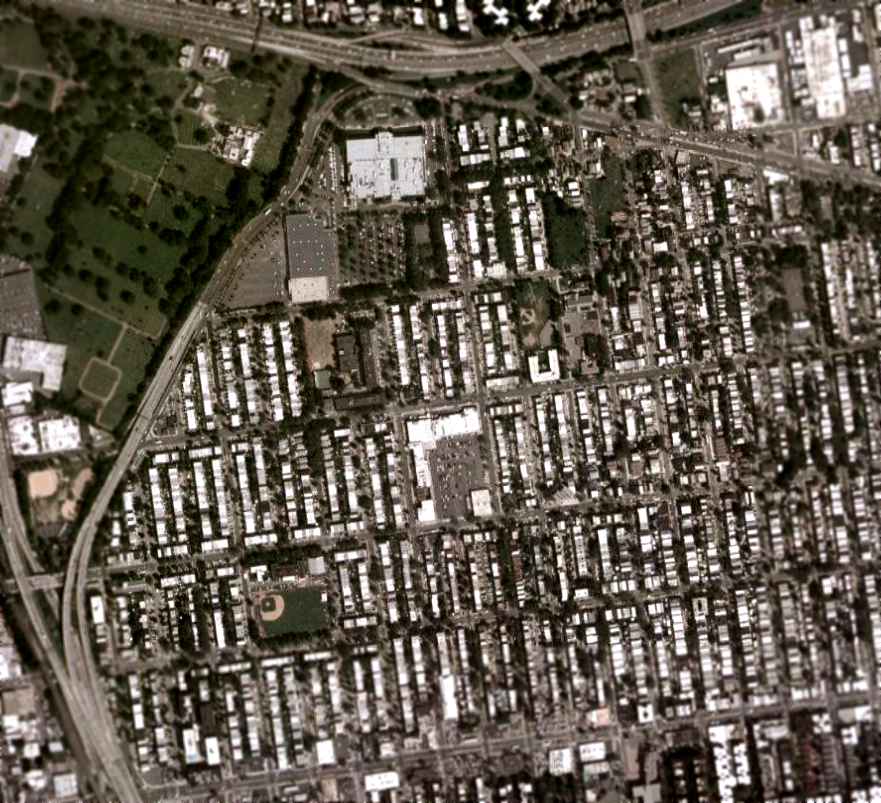
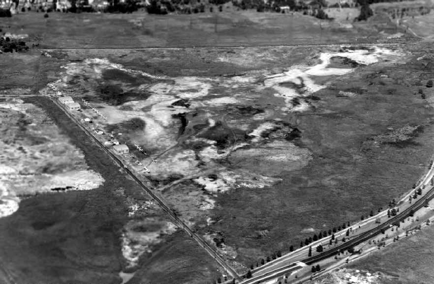
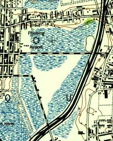
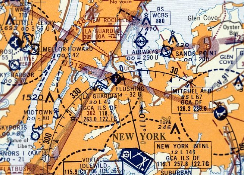
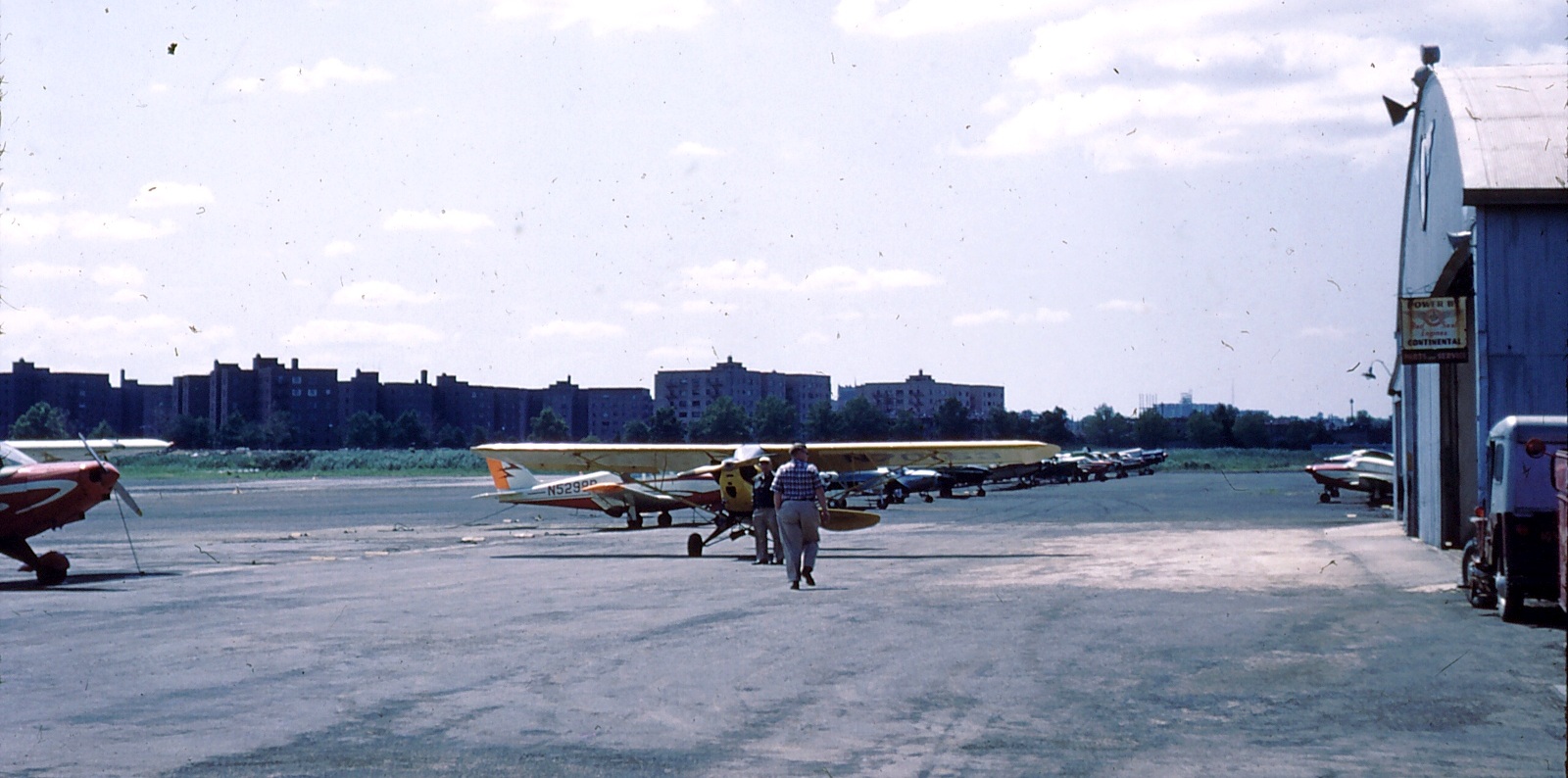
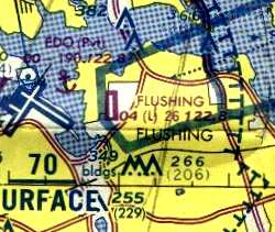
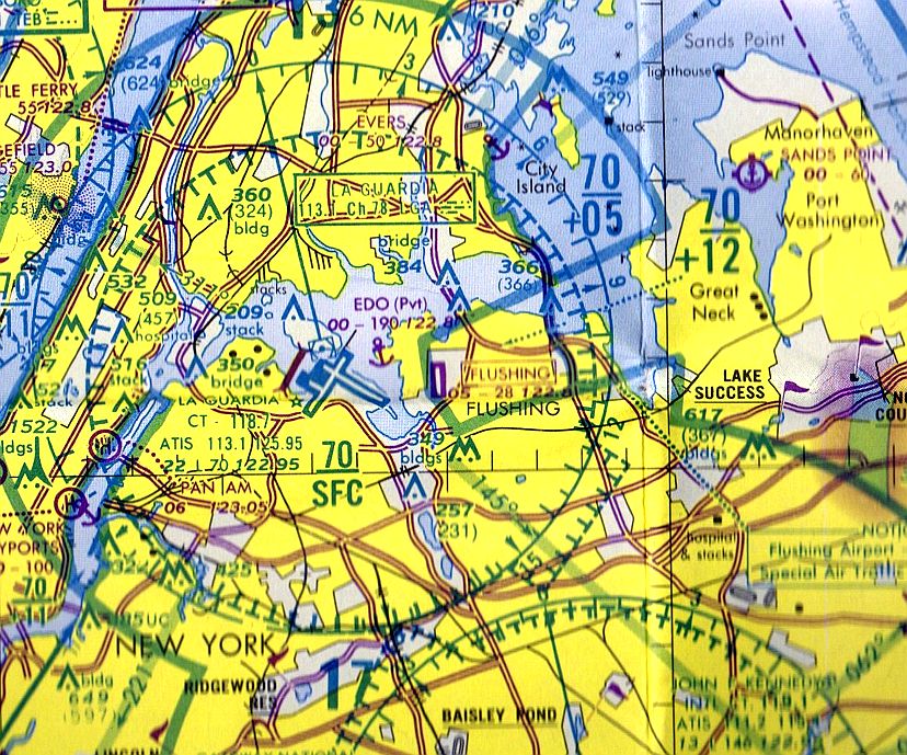
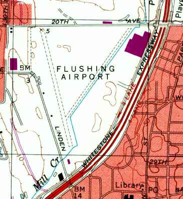
Flushing Airport (FLU), Queens, NY
40.78, -73.83 (East of La Guardia Airport)
Flushing Airport, as depicted on the 1929 Washington-NYC Air Navigation Map #3.
Flushing Airport was one of New York City's early municipal airports.
It is located only a mile east of present-day La Guardia Airport.
Flushing Airport was opened in 1927 as Speed's Airport (named for owner Anthony "Speed" Hanzlick).
It became the busiest airport in New York City for a time.
The earliest aeronautical depiction of Flushing Airport which has been located
was on the 1929 Washington-NYC Air Navigation Map #3.
As of 1929, the "Pioneer Aero Trades School, Inc." was evidently operating at Flushing Airport,
as commemorated by a postage "first cover" (courtesy of Ed Drury).
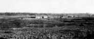
The earliest photo of Flushing Airport which has been located was a 1930 photo (courtesy of Mark Hess),
showing a few hangars along the edge of a grass airfield.
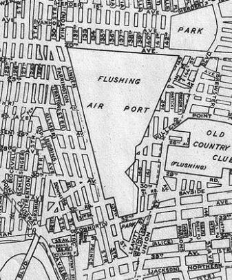
A 1930 Geographia Map of Queens depicted “Flushing Air Port: as a triangular property outline.
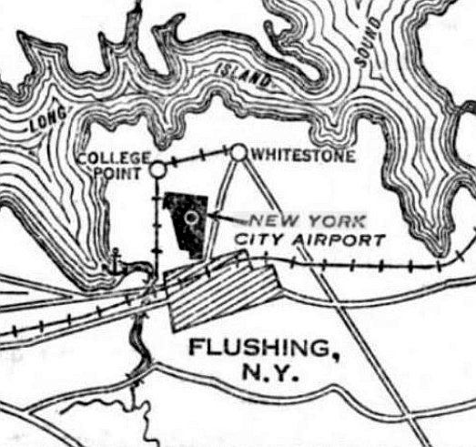
Flushing Airport was depicted on the 7/19/30 Commerce Department Airway Bulletin (courtesy of Mike Denja) under the odd name of “New York City Airport”.
This is the only document which has been located which used such a name for Flushing Airport.
The 7/19/30 Commerce Department Airway Bulletin (courtesy of Mike Denja) described the Flushing “New York City Airport”
as a commercial airport, owned & operated by New York City Airport Inc.
It was said to consist of a 305 acre irregularly-shaped clay field, within which were 4 runways, the longest measuring 3,000' southwest/northeast.
An airport circle marking was depicted in the center, and 1 building on the west side.
The earliest Sectional Chart depiction which has been located of Flushing Airport was on the August 1932 NY Sectional Chart.
Flushing Airport became the busiest airport in New York City for a time.
But when North Beach Airport (soon to be renamed LaGuardia Field) opened (at some point between 1935-37),
it quickly took business away from the older & smaller Flushing Airport.
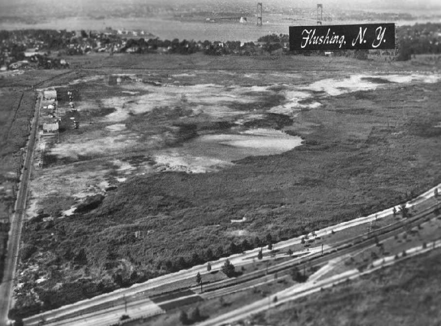
A circa 1930s aerial view looking north at Flushing Airport, with hangars & several monoplanes & biplanes visible.
Photo courtesy of The Cradle of Aviation Museum, Garden City, Long Island via Leo Polaski
"These photographs do not belong to me, they belong to the respective Museums.
ALL permission to use these photographs in publications MUST be obtained from the Museums,
I ONLY have permission to post here as long as no profit is obtained by me."
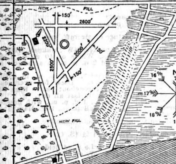
The Airport Directory Company's 1937 Airports Directory (courtesy of Bob Rambo) described Flushing-New York Airport
as having a total of 4 clay runways, with the longest being a 3,000' northeast/southwest strip.
The hangar was described as having "New York City Airport" painted on the roof.
The 1938 Aviation Facilities in NY State (courtesy of Bob Parmerter) described Flushing Airport as having 4 clay runways, with the longest measuring 3,000' northeast/southwest, and 3 hangars.
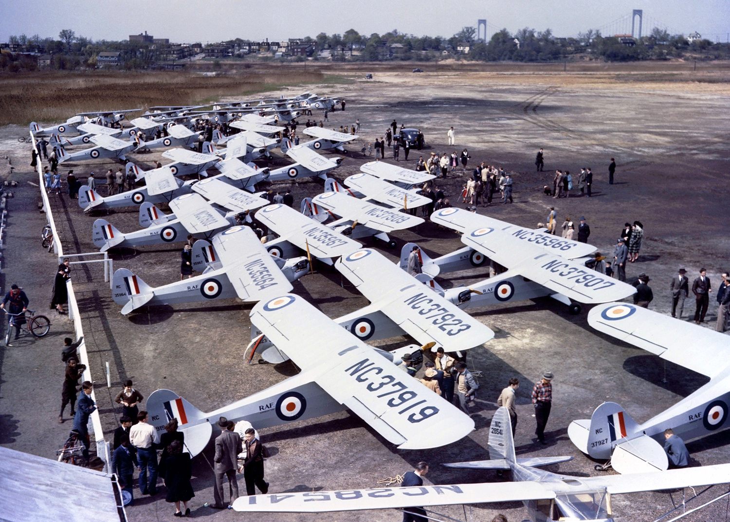
An April 1941 photo by Hans Groenhoff of Piper J-3L-65 Cubs in Royal Air Force markings at Flushing Airport, with the Whitestone Bridge in the background.
In 1941 Piper donated one Cub, NC1776, to raise money for the RAF Benevolent Fund. Piper dealers then ordered another 50 J-3s, each named after a US state in small print on the nose.
The so-called 'Flitfires' are seen here at Flushing Airport for a fundraising event following a formation flight from Lock Haven.
The aircraft subsequently went to the respective dealers & never actually trained RAF pilots in a coherent manner.
Readable tail numbers are NC37927, NC37919, NC37923, NC37907, NC35966, NC35964, NC35967, NC37909, NC37924, NC37922, NC37903, and NC37916.
NC28541 in the foreground is a Luscombe.
According to the CAP Major Peter Turecek, Flushing Airport was used by the Civil Air Patrol during the early days of WW2 to operate target towing & tracking missions.
Two CAP pilots were killed in 1943 during tow target & tracking exercises from Flushing: Captain Gordon Pyle & 2nd Lt Roy Paite.
A circa 1942-45 aerial view looking north at Flushing Airport from the 1945 AAF Airfield Directory (courtesy of Scott Murdock)
depicted the field as an open grass area.
The 1945 AAF Airfield Directory (courtesy of Scott Murdock) described Flushing Airport as a 300 acre irregularly-shaped property
within which was a bare all-way landing area, with the longest dimension being 3,150' north/south.
The field was said to have three 80' x 60' metal hangars, and to be privately owned & operated.
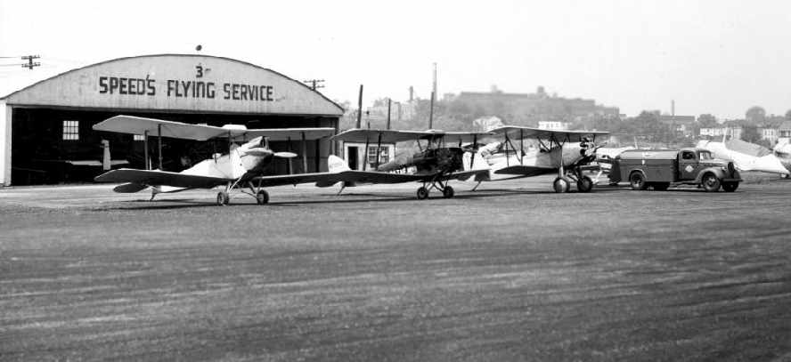
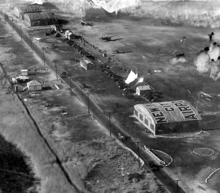
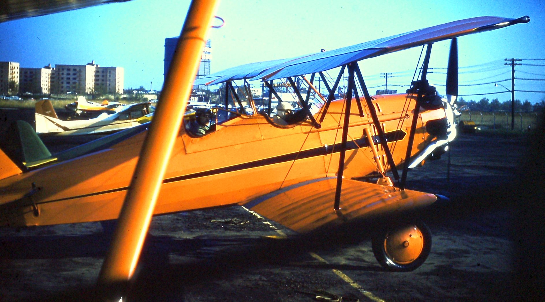
A circa 1940s photo looking west at several biplanes & a T-6 in front of the Speed's Flying Service hangar at Flushing Airport.
Photo courtesy of The Cradle of Aviation Museum, Garden City, Long Island via Leo Polaski
"These photographs do not belong to me, they belong to the respective Museums.
ALL permission to use these photographs in publications MUST be obtained from the Museums,
I ONLY have permission to post here as long as no profit is obtained by me."
A circa 1940s photo looking north at the Flushing Airport hangars.
A 1946 aerial view looking north at Flushing Airport, with the hangars along the left side (courtesy of Dan MacPherson).
Anthony Hanzlick, the manager of Speed's Flying Service at Flushing Airport, works on an aircraft in 1946
(courtesy of Dan MacPherson).
An article in the 1/46 issue of Flying Magazine (courtesy of Dan MacPherson)
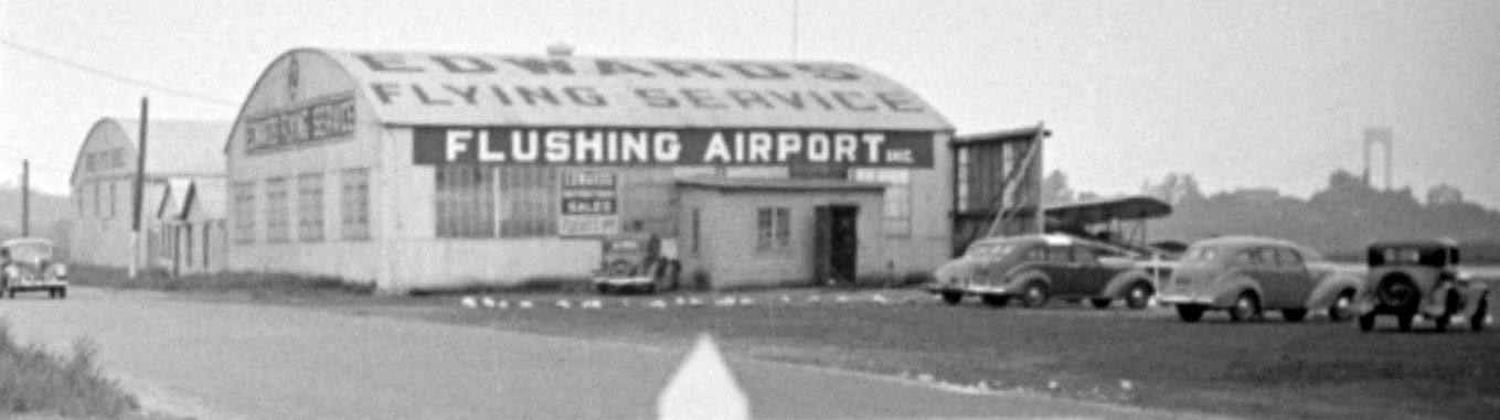
said that the operators at Flushing Airport were Speed's Flying Service & Edwards Flying Service.
It said that "Despite rough conditions of field, 18 planes are based there."
Flushing Airport, as depicted on the August 1946 NY Terminal Aeronautical Chart (courtesy of Tim Zukas).
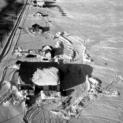
A snowy 1947 aerial view looking north at the row of hangars & buildings at Flushing Airport (courtesy of Mark Hess),
with only a few aircraft visible in the background.
A late 1940s aerial view looking north at Flushing Airport, with the hangars along the left side, and a large number of aircraft.
Photo courtesy of The Cradle of Aviation Museum, Garden City, Long Island via Leo Polaski
"These photographs do not belong to me, they belong to the respective Museums.
ALL permission to use these photographs in publications MUST be obtained from the Museums,
I ONLY have permission to post here as long as no profit is obtained by me."
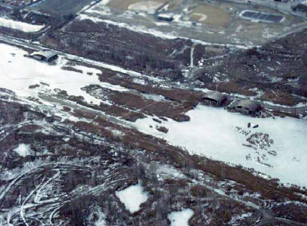
The 1947 USGS topo map depicted 2 remarkable details of Flushing Airport:
it is the only depiction to be located which showed a road bisecting the field from west to east (not seen in any other depictions of Flushing Airport, earlier or later),
and it also depicted the majority of the property as marsh, which was quite realistic.
Jerry Borshard recalled, “Flushing Airport... As a boy I spent many hours at the airport,
mostly in a wood-framed building which housed the office & waiting room of Edwards Flying Service.
My father, Jerry Borshard (Sr), was a part-time instructor at Edwards Flying Service during the late 1940s until 1952.
One of the aircraft based at Flushing was a 'Bamboo Bomber' twin Cessna, painted dark silver or gray with an eagle (possibly silver, gold, or white) painted on its nose.
Dad once arranged to lease that plane & fly me, Mom, and my younger sister to visit friends (or possible future business associates) in New Hampshire for an afternoon.”
Jerry continued, “The remarkable thing I remember about Speed's hangar is that he stored multiple (at least 10, it seemed) yellow Piper Cubs inside
by stacking them tails-up in a row against one another, noses all on the floor.
I always enjoyed seeing the Skywriters as we rounded the curve at the end of the airport.
Dad, who had been a flight instructor during the war & knew those SNJs intimately,
was baffled how revenue from writing ads in the sky could profitably sustain fueling those those gas-guzzling greenhouse-canopied planes.
Yes, those (and others, like the Mustang) could be had very cheap after the war, but few could afford the cost of actually flying them, let alone maintaining them.”
Jerry continued, “Dad was utterly passionate about flying - once absorbed, little else caught his attention.
On one occasion he was out instructing & evidently forgot to provide me with a quarter to get a hot dog & a soda from the luncheonette
(hot dogs then were 15 cents, hamburgers 25 cents, sodas 10 cents).
Mr. Edwards noticed the hungry look on my face, asked if I had had any lunch, muttered something about Dad's preoccupation,
then gave me half of the sandwich his wife had made him - chicken on white bread spread with chunks of butter, and a thermos-top cup of lemonade.
I was grateful for his kindness in sharing what Mrs. Edwards had prepared.”
Ed Daley recalled, “Flushing Airport... I took my first flight in a J-3 with Speed Hanzlik in 1951.
I have fond memories of flights in the J-3 & once in a brand-new TriPacer.
I recall the smell of asphalt & burned rubber that pervaded the area around the airport. Any time I smell that again, a wave of nostalgia washes over me.”
A 1951 aerial view depicted Flushing Airport as having an unpaved landing area,
with several hangars & several light aircraft along the west side of the field.
Andrea Edwards Anthony reported, "My father, George William Edwards,
was the owner & manager [of Edwards Flying Service].
He & Speed Hanszlick competed for many years; in fact it was felt Speed was an unfair competitor for a number of reasons.
After many years my father & mother purchased Davis Field in Bayport, NY."
Bob Mooney recalled, “When I moved to Mitchell Gardens, the Co-Op directly west of the airport, I was 13 years of age.
Intrigued by the airport, I used to walk to the airport where after a few weeks of hanging around, Speed’s wife engaged me in conversation.
Speed took me under his wing & introduced me to Al DiBello, his chief instructor & Johnny the main mechanic.
Then I met Bob Garrity when he had leased Edwards Flying Service using an Aeronca 7AC & his Stinson Station Wagon.
I would keep Bob’s place clean, answer phones & run after food for the great folks who frequented Bob’s business.
One was Johnny Smith, a well-known jazz guitarist & pilot.
Bob started to give me flight training every Friday after which we would drive to NYC,
where he would meet his friend Bonnie, do his Radio show, Birdland then it was off to Birdland. Bob’s show followed Alan Freed.
RCA Victor located in Camden, NJ installed the radio equipment in the Stinson so that Bob could give his traffic report to his first client Radio WINS 10 10 on your radio dial.
Fred Collins, then the voice of NBC would come to the airport. Bob would have me fly the Stinson while he did his traffic report.”
Bob continued, “When I first visited Flushing, Speed had just had the runway running somewhat North & South, black-topped mixed with stones.
The NYC PD would base their Bell 47A at the airport during the day. They loved the Italian food the brothers served.
Al DiBello & the Chief Pilot for the NY Daily News & flew his DH Beaver into Flushing almost every week day.
There was one airport so-called ‘Bum’ by the name of Harry who carried a stuffed small bear with him all of the time.
Yes, Speed would give Bob a hard time when he rode around the airport in his Ford Station Wagon, however, Speed was really a nice guy.”
Bob continued, “Paul Mantz based his B-26 at Flushing while he filmed 'This is Cinerama' [1952].
He flew the aircraft under all of the bridges on the East River which was the opening scene for this first all-dimension movie.
Andy Stennis had 9 SNJs or AT6s he SKY TYPED with.
Andy taught me how to fly the AT6 when I was just 16 years of age.
That was a real thrill believe me & yes, the people from Mitchell Gardens always complained about the noise the AT6s made on base leg
and the oil that was deposited from the big radial engines we would clear before landing.
Tony & his brother Al ran the restaurant with their nephew Johnny. Great meatball sandwiches & other homemade foods.
I left the area when I joined the military in 1958 & never looked back until I became a pilot flying Connie’s.
On my first trip into La Garbage I could not believe the old Flushing airport.
It almost brought tears to my eyes thinking about all of the great people who frequented the airport.”
A 1954 aerial view depicted Flushing Airport as having an unpaved landing area,
with several hangars & dozens of light aircraft along the west side of the field.
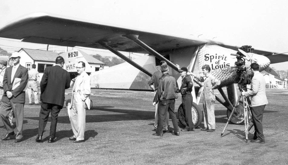
An undated photo of a Ryan NYP (one of several Spirit of St. Louis replicas?) at Flushing Airport.
A July 1956 photo by John Givre of an unidentified biplane at Flushing Airport's engine run-up area.
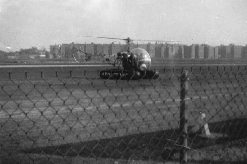
A September 1956 photo by John Givre of a Bell 47 helicopter at Flushing Airport. The pontoon is marked “Police NYC”.
A September 1956 photo by John Givre looking east at an Aeronca 11AC Chief at Flushing Airport,
with the Linden Hill apartment complex stretching for several blocks in the background.
A September 1956 photo by John Givre of a Stinson 108 at Flushing Airport.
John recalled, “All my own photos were shot with a little plastic Kodak box camera using 640 film.
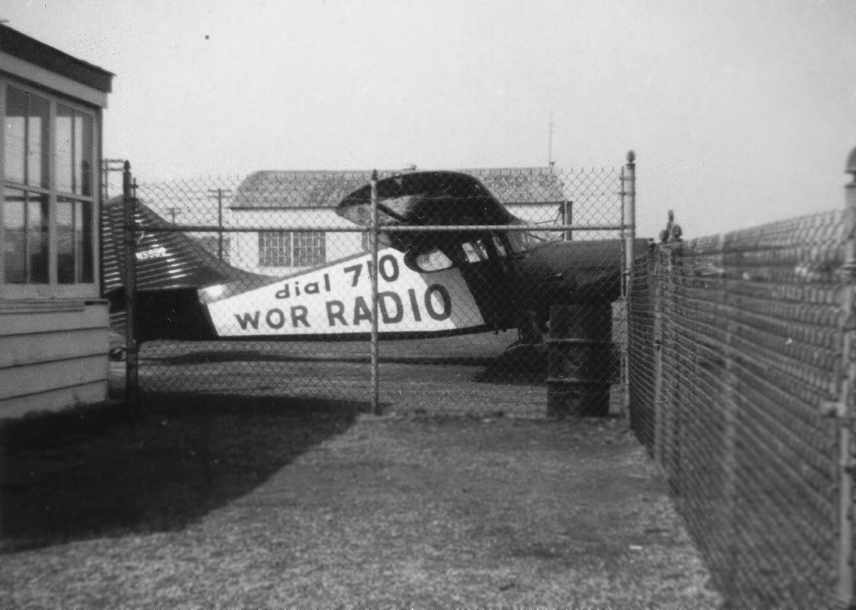
In 1956 this Stinson 108 was flown by an old New York radio station, WOR-AM.
It was parked right next to the airport's luncheonette.”
Joe Amoroso recalled, “Regarding the blue WOR Stinson 108 at Flushing Airport...
I have flown many hours in this airplane alongside of Bob Garrity, disc jockey of the 'Birdland' show & traffic reporter who was also my flight instructor at Edwards Flying Service.
Bob was the very first traffic report pilot that I know of.
He would let me pilot the airplane while he discussed traffic conditions on the ground for WOR radio.
He was one of the kindest & most dedicated pilots I have ever known.
Bob soloed me in an Aeronca 7AC when I was just 17 in 1956.”
Bob Mooney recalled, “There were 3 De Havilland Moths based at Flushing & 2 Ryan aircraft while they filmed the movie ‘The Spirit of St. Louis’ [1957].”
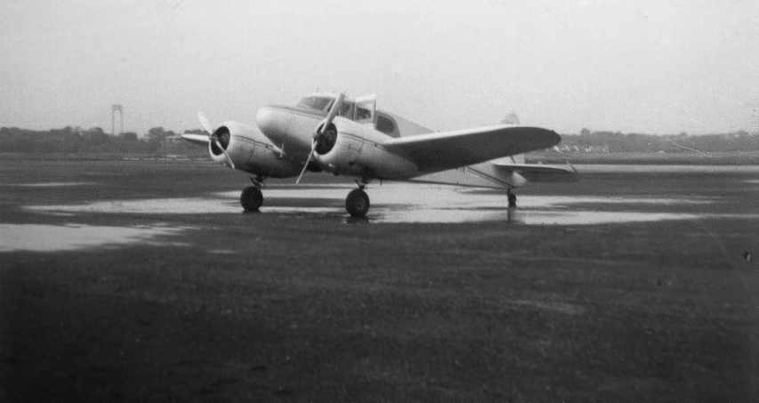
A June 1958 photo by John Givre of “a handsome Cessna T-50” Bobcat at Flushing Airport.
John observed, “Not bad for a 10-year-old with a box camera!
You can see the Whitestone Bridge in the left background.”
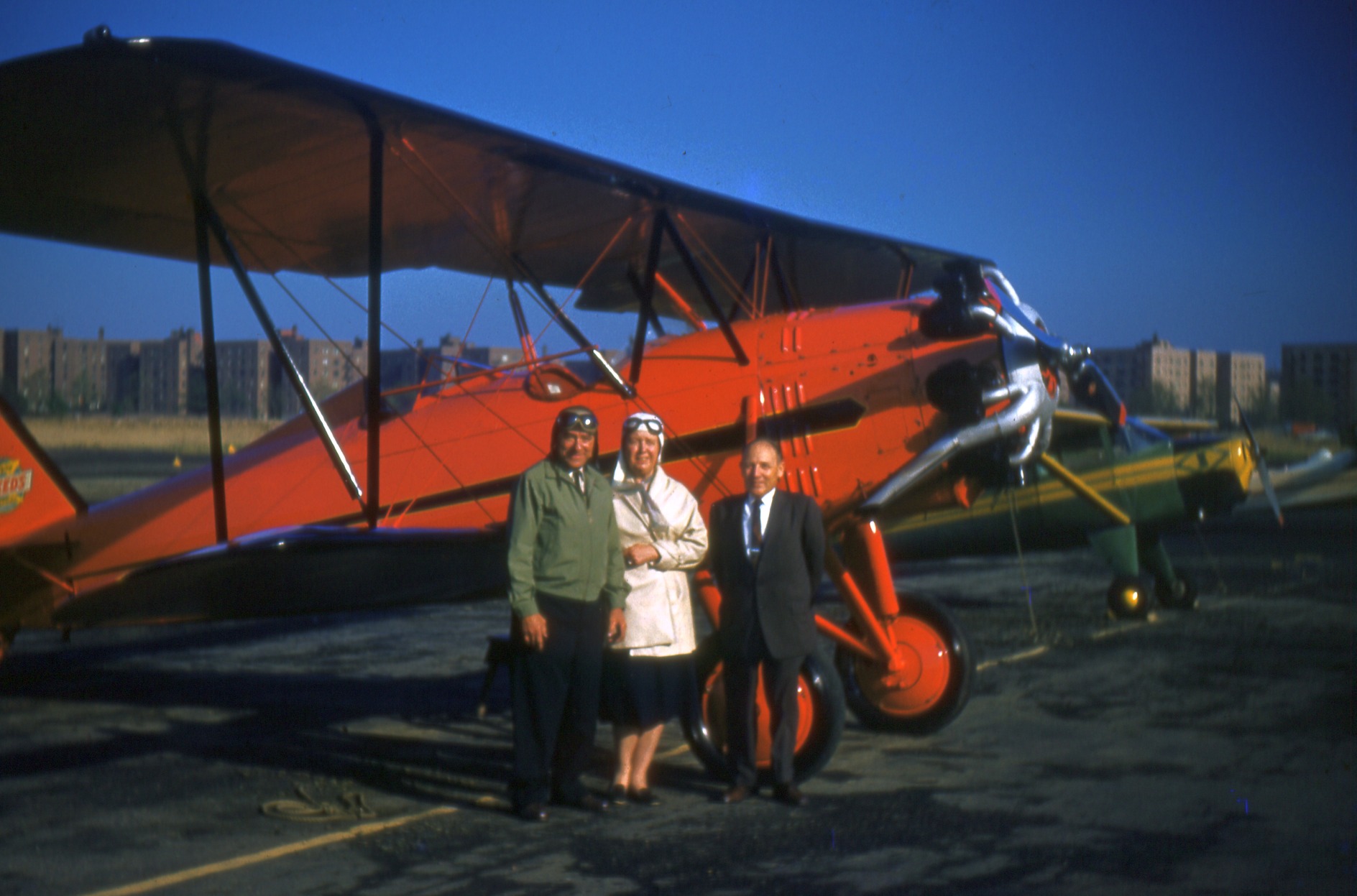
A circa mid-1950s photo (from the Walter Winicki collection, courtesy of Bob Mott) of Anthony “Speed” & Wilhelmina Hanzlik next to their Stearman C3-R Business Speedster at Flushing Airport.
A circa mid-1950s photo (from the Walter Winicki collection, courtesy of Bob Mott) of Anthony “Speed” & Wilhelmina Hanzlik, Speed’s nephew John Harabes, and Pete Brucia (founder of the Antique Airplane Club of Greater NY)
in front of the Hanzliks' Stearman C3-R Business Speedster at Flushing Airport.
A circa mid-1950s photo (from the Walter Winicki collection, courtesy of Bob Mott) of the Hanzliks' Stearman C3-R Business Speedster at Flushing Airport.
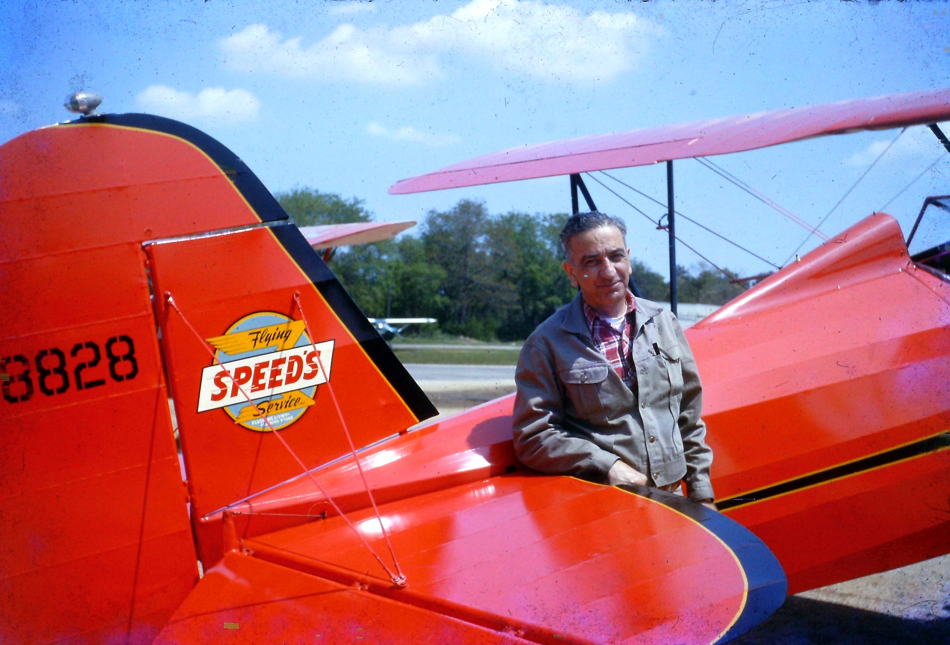
A circa mid-1950s photo (from the Walter Winicki collection, courtesy of Bob Mott) of Pete Brucia & the Hanzliks' Stearman C3-R Business Speedster at Flushing Airport.
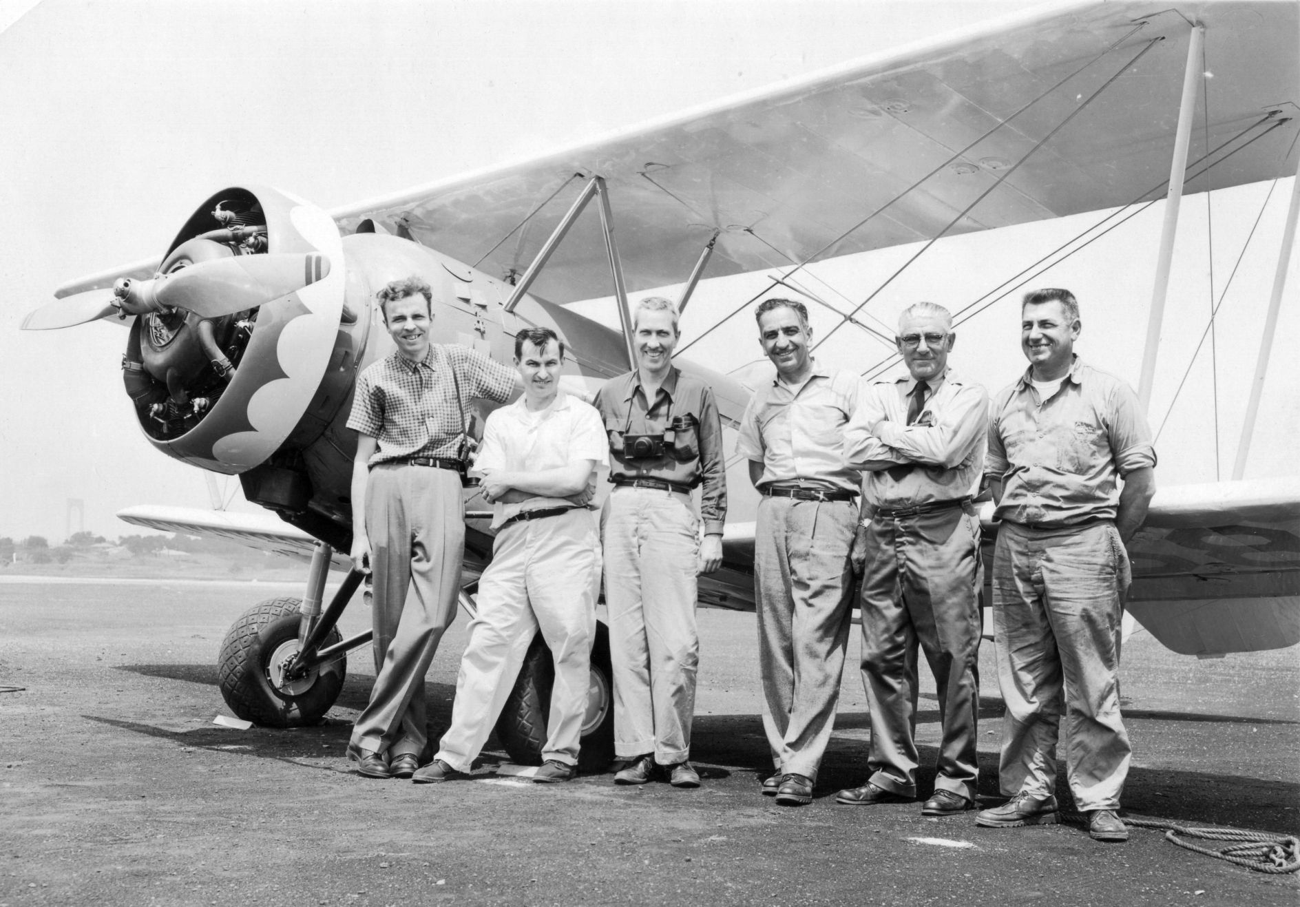
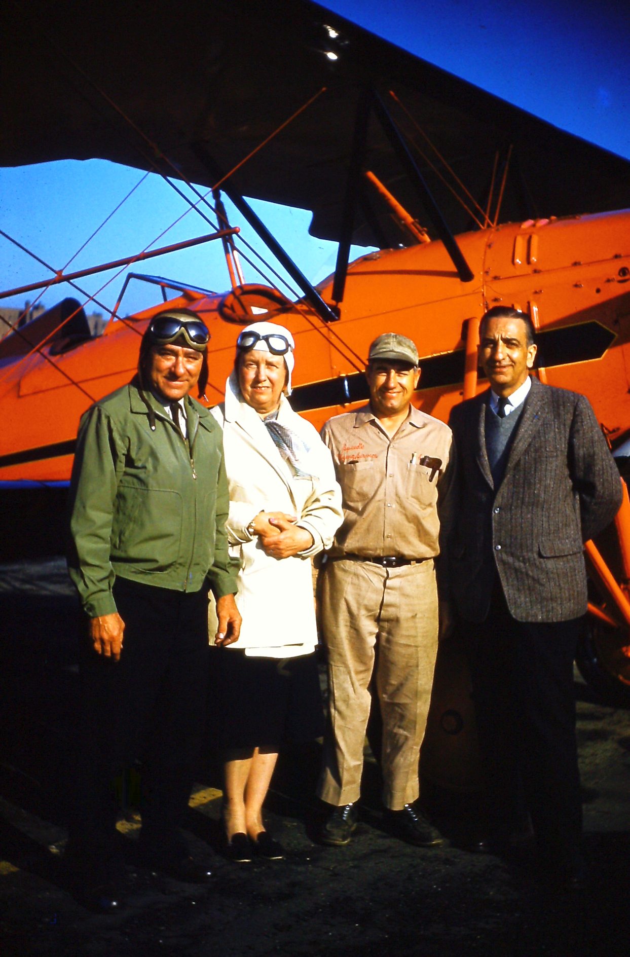
A 1959 photo (from the Walter Winicki collection, courtesy of Bob Mott) of a group in front of Pete Brucia’s 1930 PA-7S Pitcarin Sport Mailwing at Flushing Airport:
Richard Gudaitis, Walter Winicki, Duncan Morrison, Pete Brucia, Speed, and John Harabes.
Bob Mott recalled, “They were all members of the Antique Airplane Association & founders of the Antique Airplane Club of Greater NY, a chapter of the AAA formed in 1963.”
The July 1960 NY Sectional Chart depicted Flushing Airport as having 2 paved runways, with the longest being 3,200'.
A 1960 photo of a Piper Cub on the Flushing Airport ramp.
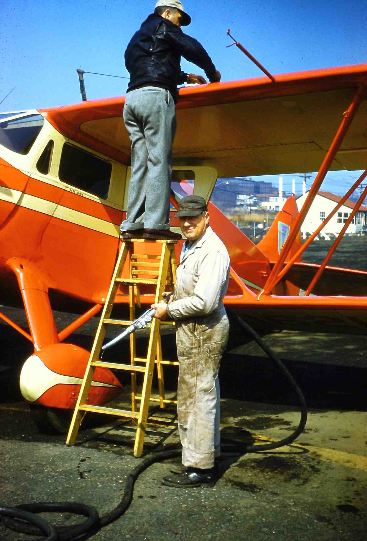
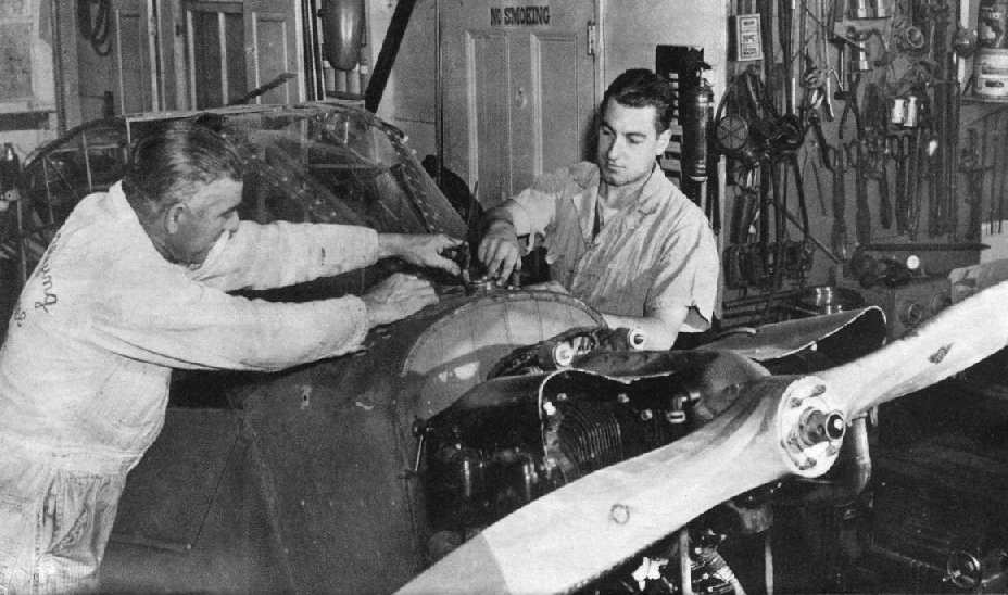
A circa 1960 photo by Walter Winicki (courtesy of Robert Mott) of Speed Hanzlik & his nephew & mechanic John Harabes fueling a beautiful Waco DQC-6 at Flushing Airport.
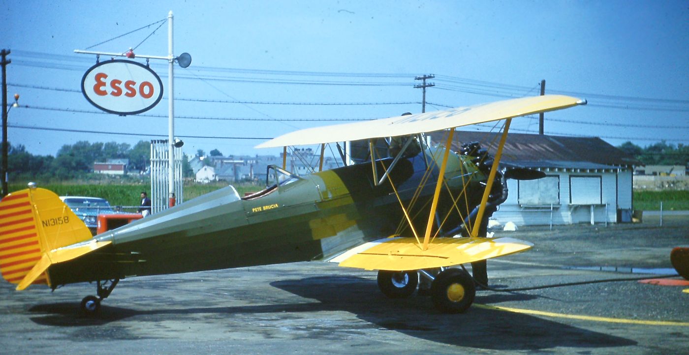
A 1960 photo by Walter Winicki (courtesy of Robert Mott) of Pete Brucia fueling up his Pitcarin Mailwing at Flushing Airport.
Robert Mott recalled, “Pete was the founder of the Antique Airplane Club of Greater NY& an early warbird collector.”
Flushing Airport had apparently gained a paved runway at some point between 1954-62,
as the 1962 AOPA Airport Directory described Flushing as having a single 2,950' paved runway,
and listed the operators as Speed's Flying Service & Stinis Air Service.
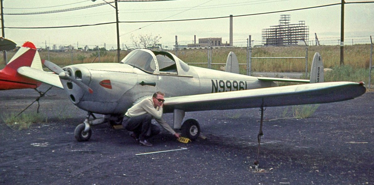
A 1964 photo of an Erco Ercoupe 415C at Flushing Airport.
A 1964 photo of a Piper PA-18-150 Super Cub in front of a hangar at Flushing Airport.
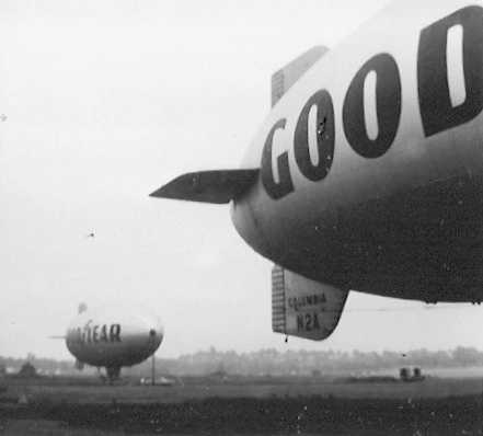
A 1964 photo (courtesy of Alan “AirshipAl” Gross) of 2 Goodyear blimps at Flushing Airport.
Goodyear blimps used the Flushing Airport regularly from the mid 1960s to the mid 1970s.
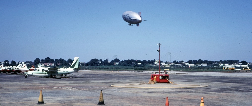
A circa 1960s photo of a Goodyear blimp departing Flushing Airport, with its mooring mast visible in the foreground.
A 1965 photo of a Goodyear blimp being moored at Flushing Airport.
Flushing was described on the 1965 NY Sectional Chart (courtesy of John Voss) as having 2 runways, with the longest being a 3,300' asphalt strip.
However, the remarks included, "NE/SW runway closed."
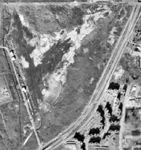
A 2/23/66 USGS aerial photo depicted Flushing Airport as having 2 runways & several dozen light aircraft parked along the hangars on the west side.
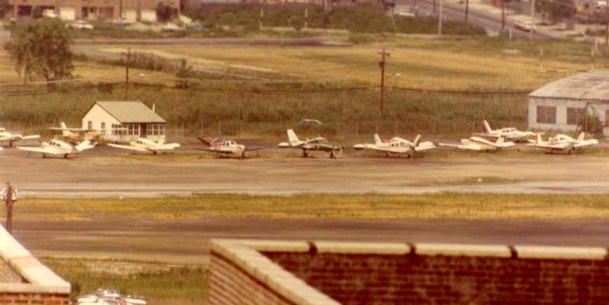
A 1970s view looking northwest at the planes on the Flushing Airport ramp (courtesy of Joe Walcez, via Andrew Baffi).
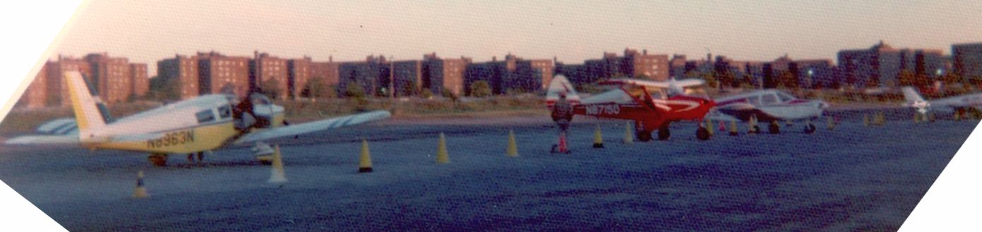
A circa 1970s view of several Pipers on the Flushing Airport ramp.
A 12/1/71 “Proposed Redevelopment of Flushing Airport” depicted 2 runways each with a parallel taxiway, but that proposed redevelopment never occurred
Andrew Baffi recalled, “I am an airline pilot today but it all started for me when my parents used to take me to Flushing Airport to watch the airplanes in the 1970s.
We also used to go to the decrepit Adventurer’s Inn across the street.
It was a great place for sure. I can still conjure up the smell of the gravel in my memory.
It was a great place for me & holds many, many special memories.”
An undated photo of Joe West in front of a Piper.
A 4/16/73 Tribune article (courtesy of Andrew Baffi) described how Flushing Airport operator Anthony “Speed” Hanzlik
was selling his operation to Joe West.
A 1970s view of a Cessna 310 & a North American SNJ Texan on the Flushing Airport ramp (courtesy of Joe Walcez, via Andrew Baffi).
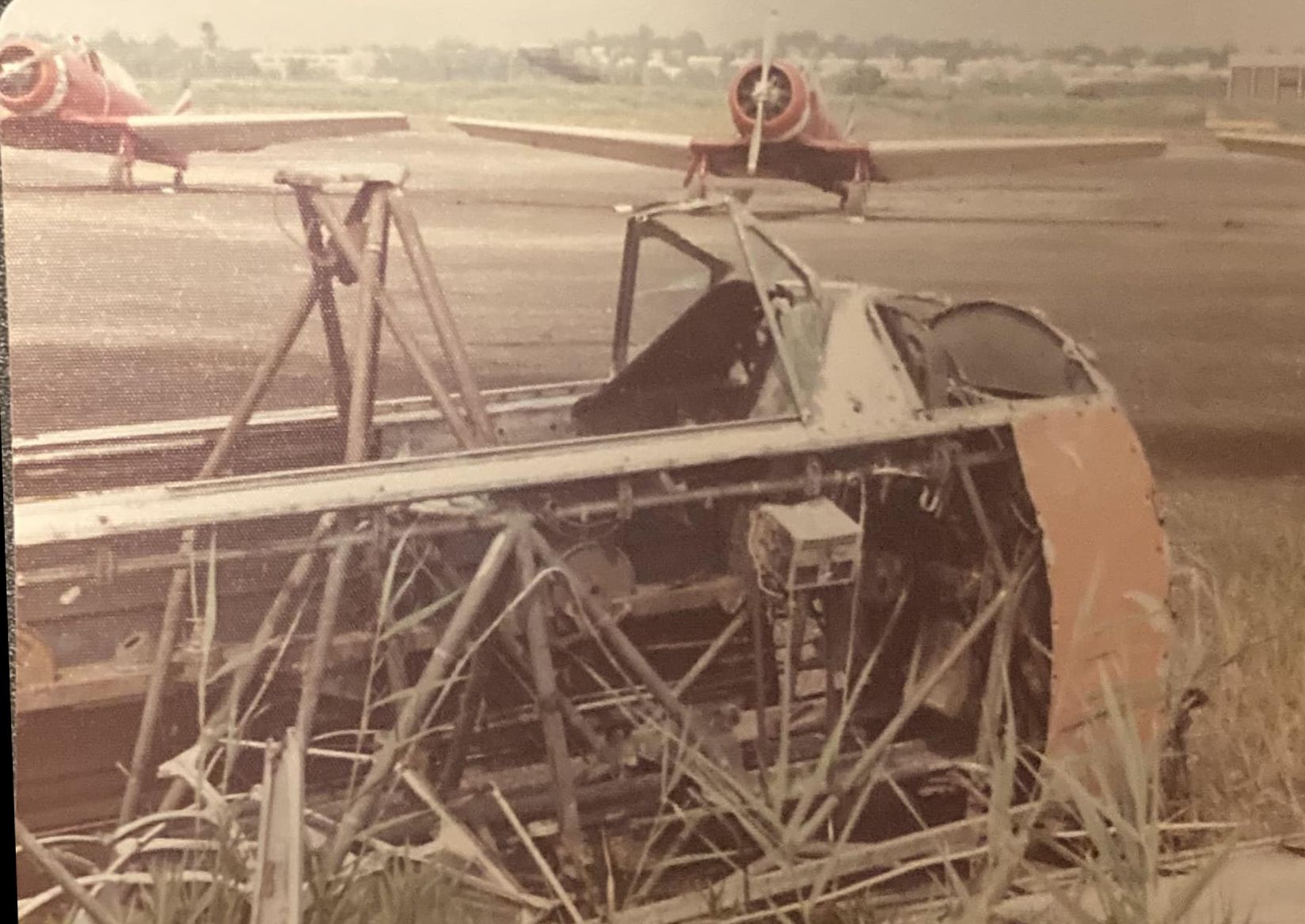
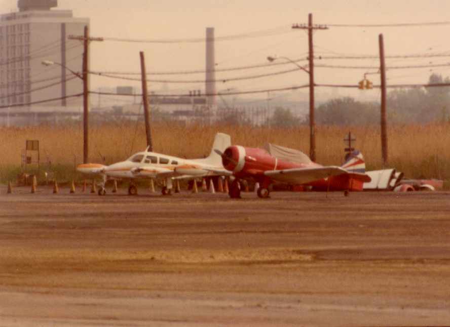
A circa 1970s photo at Flushing Airport of possibly a Fairchild PT wreck, with 3 SNJs of the Skytypers in the background.
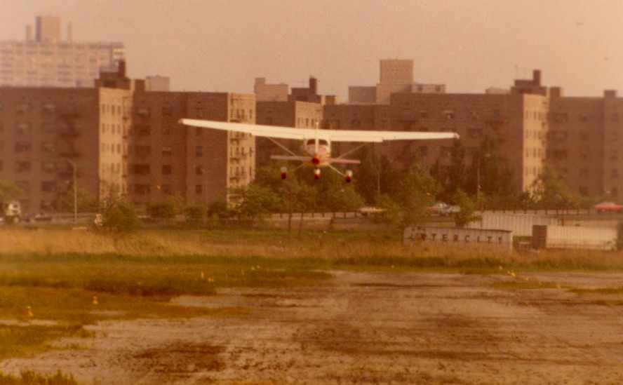
A 1976 photo of a Cessna departing from Flushing Airport (courtesy of Joe Walcez, via Andrew Baffi).
Note the poor condition of the runway pavement, not to mention the multi-story buildings directly in the departure path.
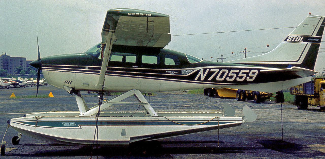
A 6/17/76 photo of a Cessna 206F Stationair amphibious floatplane at Flushing Airport.
Flushing Airport was still depicted as an active airfield on the 1979 NY TCA chart (courtesy of Bill Suffa).
It was depicted as having a single 2,600' paved north/south runway.
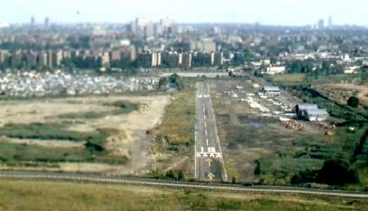
A 1980 aerial view by Alan “AirshipAl” Gross looking south from final approach to Flushing's Runway 18,
showing numerous planes parked along the west side of the field.
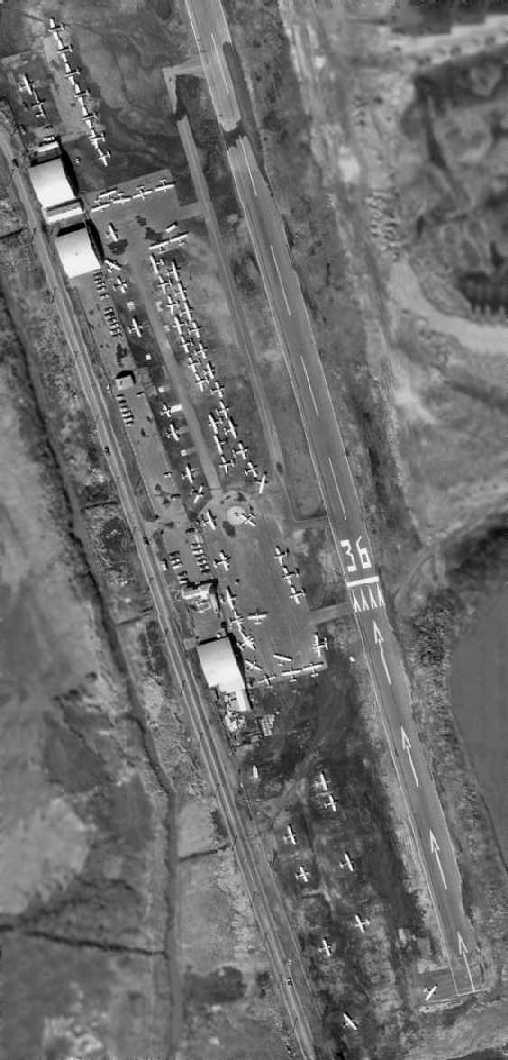
A 1980 aerial photo depicted an amazing number of aircraft at Flushing Airport, notably including the 5 SNJs of the Skytypers at the very top.
The large number of aircraft on the field showed that Flushing Airport served a valuable role right up to the very end.
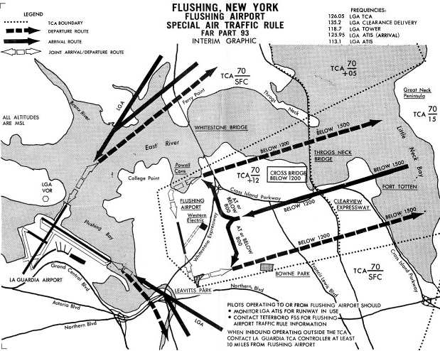
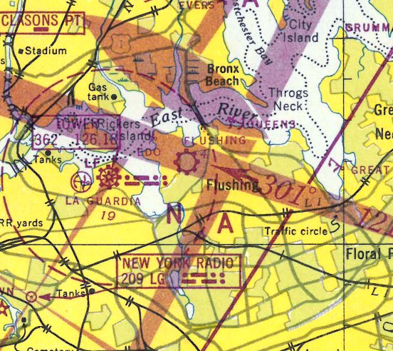
A 1980 FAA diagram of special air traffic rules for Flushing Airport,
due to its proximity to La Guardia Airport (courtesy of Gary Agranat).
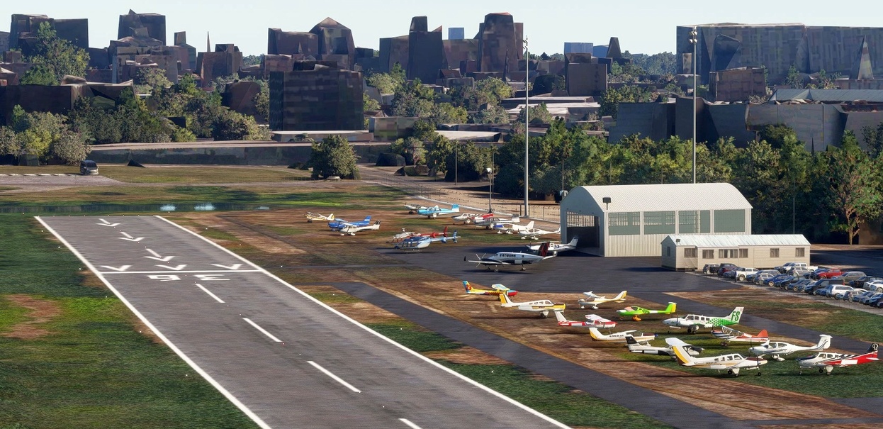
A flight simulation scenery depiction looking southwest at the runway, aircraft, and hangar at Flushing Airport.
The last photo which has been located showing aircraft at Flushing Airport was a May 1981 photo by Steve Rocketto
of a very rare military surplus Lockheed YO-3A covert surveillance aircraft, sitting partially disassembled, lacking a propeller & rudder.
Steve recalled, “I have no idea why the YO-3 was there. My guess is someone purchased it to rebuild.
One of the Skytyper SNJ-2 aircraft is also visible”, behind the YO-3A.
By the time of the 1982 AOPA Airport Directory (courtesy of Ed Drury),
Runway 18/36 had been shortened to 2,630', and the operator was listed as Sunrise Aviation.
Andrew Baffi recalled, “I worked there in 1982… it was limited use & I worked for a helicopter company called Spectrum Helicopters.
There were only about 3 airplanes there in 1982: Cessna 172, a Mooney and I can’t remember the 3rd one.
I remember Bianca Jagger being flown from Flushing to Montauk.
She got out of a limo & went straight to a single-engine Cessna… I guess the alimony from Mick didn’t come to much.”
As the neighborhood around Flushing Airport was gradually built up,
neighborhood pressure continued to grow to close the airport, and it eventually was closed in 1984.
Rich Peabody recalled, "I was frequently at the site of Flushing Airport after its closure.
There were several aircraft there for 2 or 3 years, being slowly vandalized.
The flooding mentioned seemed to be tidal, as the runway appeared to dip in the center, probably to below sea level?"
Even though Flushing Airport had evidently been closed already for 3 years, it was still depicted as an active airfield on the 1987 NY Terminal Aeronautical Chart (courtesy of Gwen Shafer).
It was depicted as having a single 2,800' paved north/south runway.
Flushing Airport was depicted as closed on the December 1993 NY Terminal Aeronautical Chart (courtesy of Ron Plante).
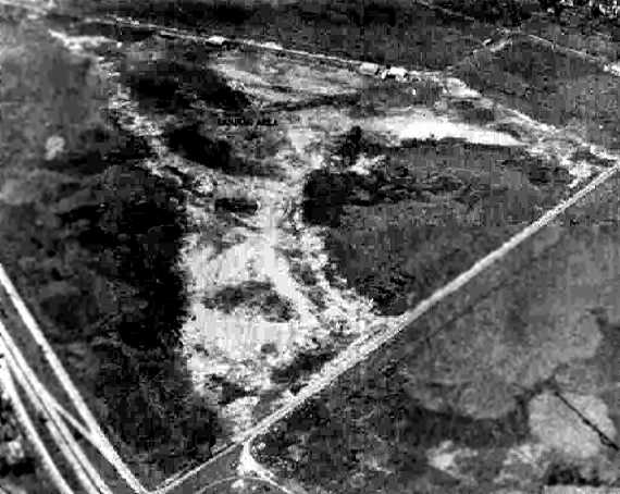
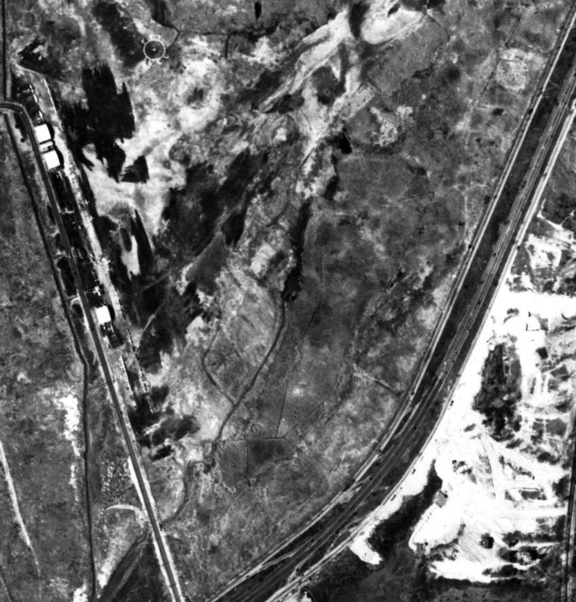
A 1994 aerial view looking northeast showed the majority of the Flushing Airport runway to have been flooded.
The 1995 USGS topo map still depicted Flushing Airport as having 2 unpaved runways, and 2 small buildings along the west side.
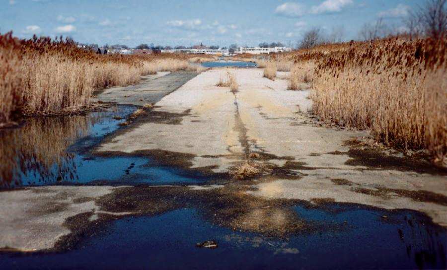
A 1997 view looking north along the abandoned runway at Flushing Airport, by Jonathan Westerling.
A circa 2000 aerial view, showing the remaining (southern) half of the Flushing Airport runway which is not yet covered by standing water.
The 2 remaining hangars at Flushing Airport, 2001.
Exterior of the Speed's Flying Service hangar, 2001.
Exterior of the other remaining hangar at Flushing Airport, 2001.
Strangely, although Flushing Airport has been closed for years (and has been depicted as an abandoned airfield on flying charts),
it was still listed in 2001 in the FAA Airport/Facility Directory, although with the note "Airport closed indefinitely; redevelopment in progress."
Yet runway 18/36 is still listed as an active runway, at 2,800 ft long, "asphalt, in good condition".
Its present owner is listed as "Economic Development Corp, NY, NY".
There was apparently a plan to reopen Flushing Airport as a general aviation airport, but apparently that plan has not come to fruition.
It would seem that present-day flying operations at the site would be extremely difficult,
due to the presence of intense flying traffic overhead, headed to La Guardia only 1 mile away.
The airport manager has recently said that the airport will probably never reopen.
He said that it was built on top of a swamp about 75 years ago & it has slowly subsided back into it.
He said that it is currently wetlands & it might be possible to turn it into an industrial complex.
Charles Gallo reported, “The reason the airport was listed as 'temporarily closed'
was that the folks in the Mitchell Gardens Apartment complex realized that if Flushing Airport was fully taken off the books,
it’s airspace would revert back to LGA airport airspace,
and instead of the SNJs of the Skytypers flying over their buildings (the main complaint which really got Flushing airport closed)
they would have had 727s flying over their buildings.
As is typical, the real problem is someone built right near the airport (in this case, the end of Runway 18)
and then complained when they had to deal with airplanes.
Now I know the sound of a big radial engine is probably music to your ears (it is to mine),
but the folks in those buildings didn’t love the fact that on every nice spring through fall day,
having 5 SNJs taking off at full power (to clear the 6-story buildings).”
A group has proposed reopening Flushing Airport as a blimp port.
An observer who recently flew over Flushing Airport reports: "The runway is under water & the asphalt looks broken up.
It truly is a shame because the airport could have been a great general aviation airport 2 miles from LGA & 5 from Manhattan.
It's a sad ending to what could have been a great general aviation airport."
Ed Drury reported in 2003 that "I'm told the Economic Development Department of the city owns Flushing Airport.
I also believe the NY State DEC controls the 'wetlands' portion.
As 'wetlands' it requires years to get a permit to do anything with it. It may just stay that way.
You are not even allowed to clean up a wetland, without a state permit, even if you own it.
Big brother stuff. I landed there once or twice many years ago, but I barely remember it."
A 2003 photo by Andrew Nobody of the rear of one of Flushing Airport's remaining hangars.
Andrew Nobody visited Flushing Airport in December 2003, and noted that a new gravel road had been recently laid,
running from Linden Place to the abandoned hangars.
Unfortunately, this road was constructed so as to bring in demolition equipment,
which was reportedly scheduled to demolish the remaining structures in early 2004,
so that the site of the former airport could be occupied by a new production plant
(possibly related to the huge new NY Times printing plant which had recently been constructed adjacent to the airport).
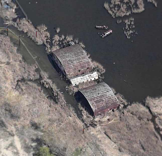
What a sad photo – a circa 2005 aerial view looking north at the northern 2 hangars which remained standing.
Note the 2 trucks, submerged in the water northeast of the hangars.
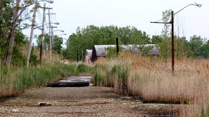
A 5/21/06 photo looking north from Linden Place at the 2 remaining hangars at Flushing Airport.
A 7/5/07 aerial view looking north at the site of Flushing Airport, showing the flooded runway, and the 3 remaining hangars.
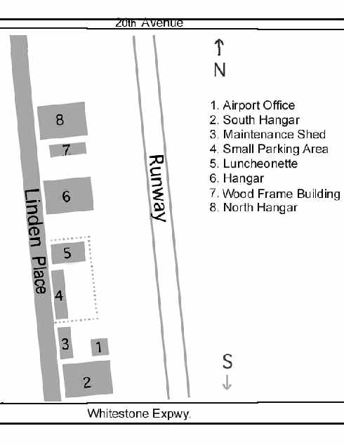
A 2007 diagram by John Givre of Flushing Airport.
According to John, “This is what I recall from my childhood visits: 1. The airport office was Speed Hanzlick's lair.
Only mechanics & fliers ever ventured into the office - visitors were not usually allowed past the parking lot / restaurant area.
2. The south hangar is no longer standing. It may have been torn down when the airport closed.
It was the same type of structure as the 2 remaining hangars.
3. This maintenance shed had 2 bays, and can be seen on the right in photo (9).
4. The parking lot was immediately off of Linden Place, a small 2-lane asphalt road parallel to the runway.
The lot was gravel, with several creosoted logs laid end to end for visitors to front into.
Only 8 or 10 cars could actually park there. The lot & restaurant were surrounded by a cyclone fence.
Most of my photos were taken from this parking lot area, or from just in front of it.
5. A small wood frame luncheonette with counter service.
In 1956 (and even before that according to my Mom) the lunch special, as advertised on a painted sign outside, was always spaghetti & meatballs for 25 cents.
6. Large hangar, one of 2 still standing on the site.
7. Another wood frame structure, maybe a 2nd office? 8. North hangar, still on the site.”
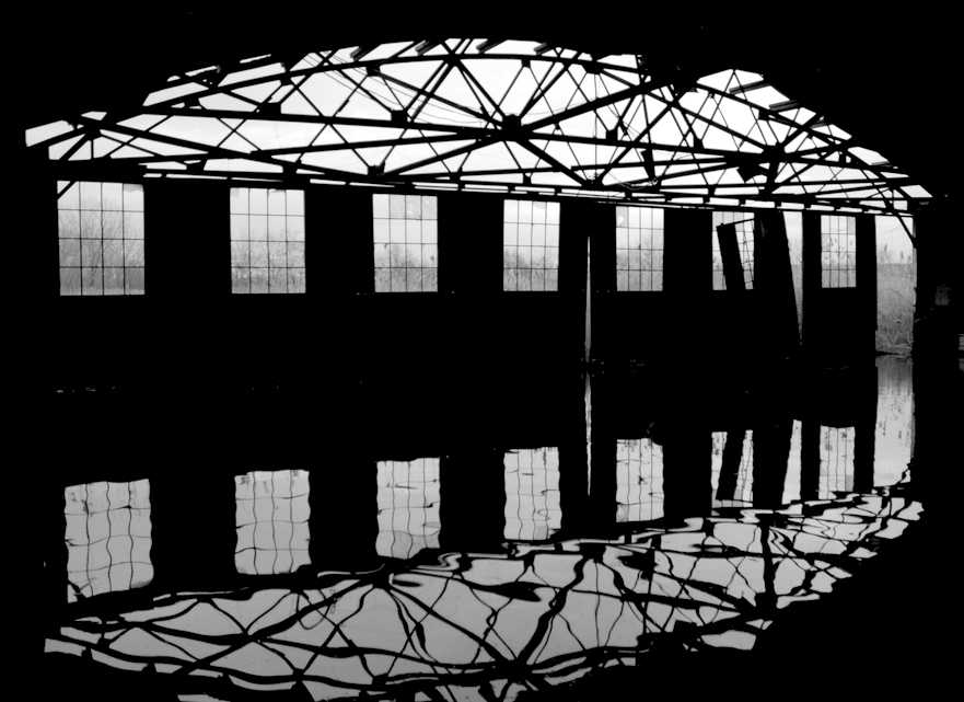
A beautiful 2008 photo looking out from the interior of a flooded Flushing Airport hangar.
A 4/1/08 aerial view still showed the hangars remaining standing.
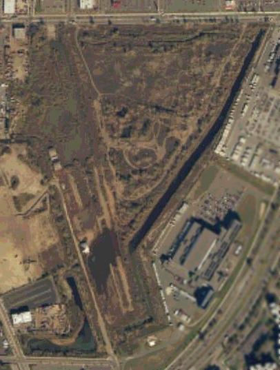
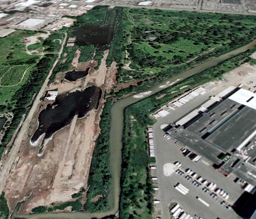
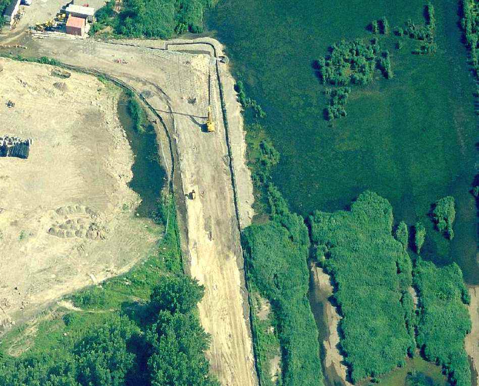
Reportedly in 2008, all 3 former hangars at the site of Flushing Airport have been removed, pending redevelopment of the site.
Indeed a 5/4/09 aerial view showed that all of the hangars had been removed, with the ground scraped clean,
erasing the last prominent trace of this historic urban airport.
A circa 2008-2010 aerial view of the site of Flushing Airport, showing the former location of the hangars.
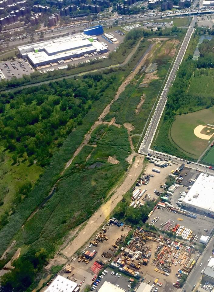
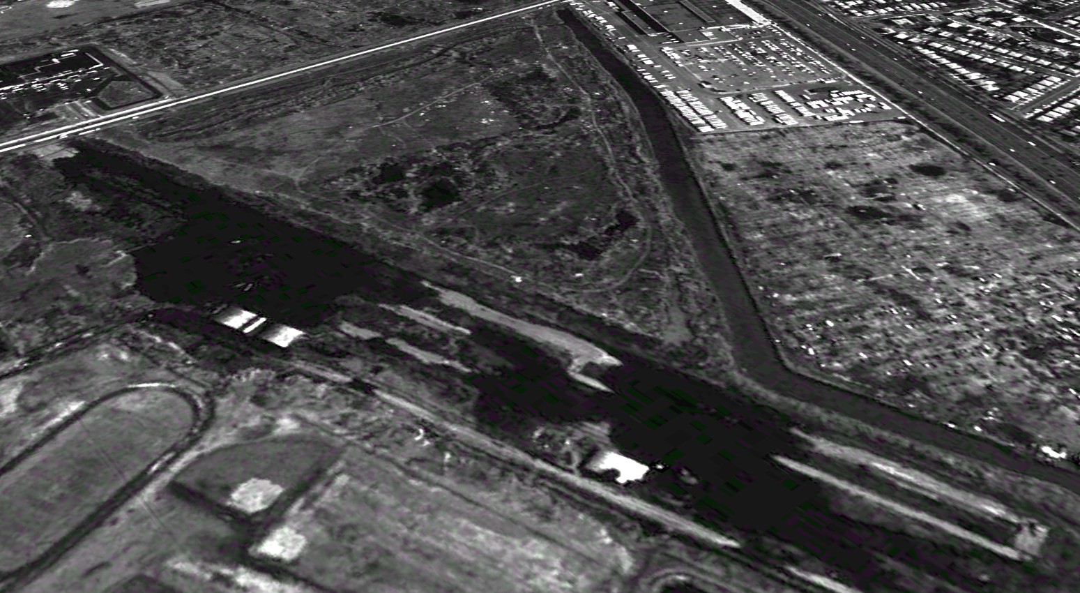
A sad 2016 aerial view looking south at the remains of Flushing Airport's runway.
A November 2019 photo looking northeast from Linden Place at the site of Flushing Airport, now just an empty field.
A 2023 aerial view looking northeast showed that all traces of Flushing Airport had been scraped away, with the property outline being the only remaining recognizable trace.
See also:
http://www.queenstribune.com/archives/featurearchive/feature2000/0831/feature_story.html
http://www.forgotten-ny.com/STREET%20SCENES/FLUSHING%20AIRPORT/flush.html
________________________________________________
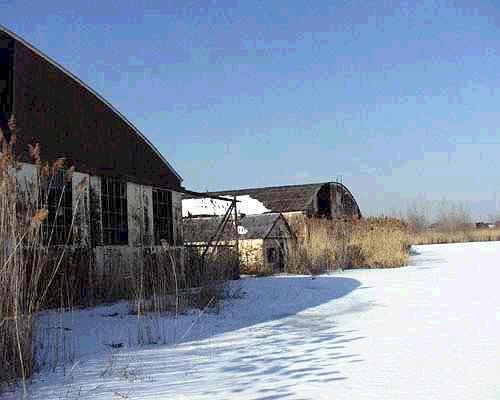
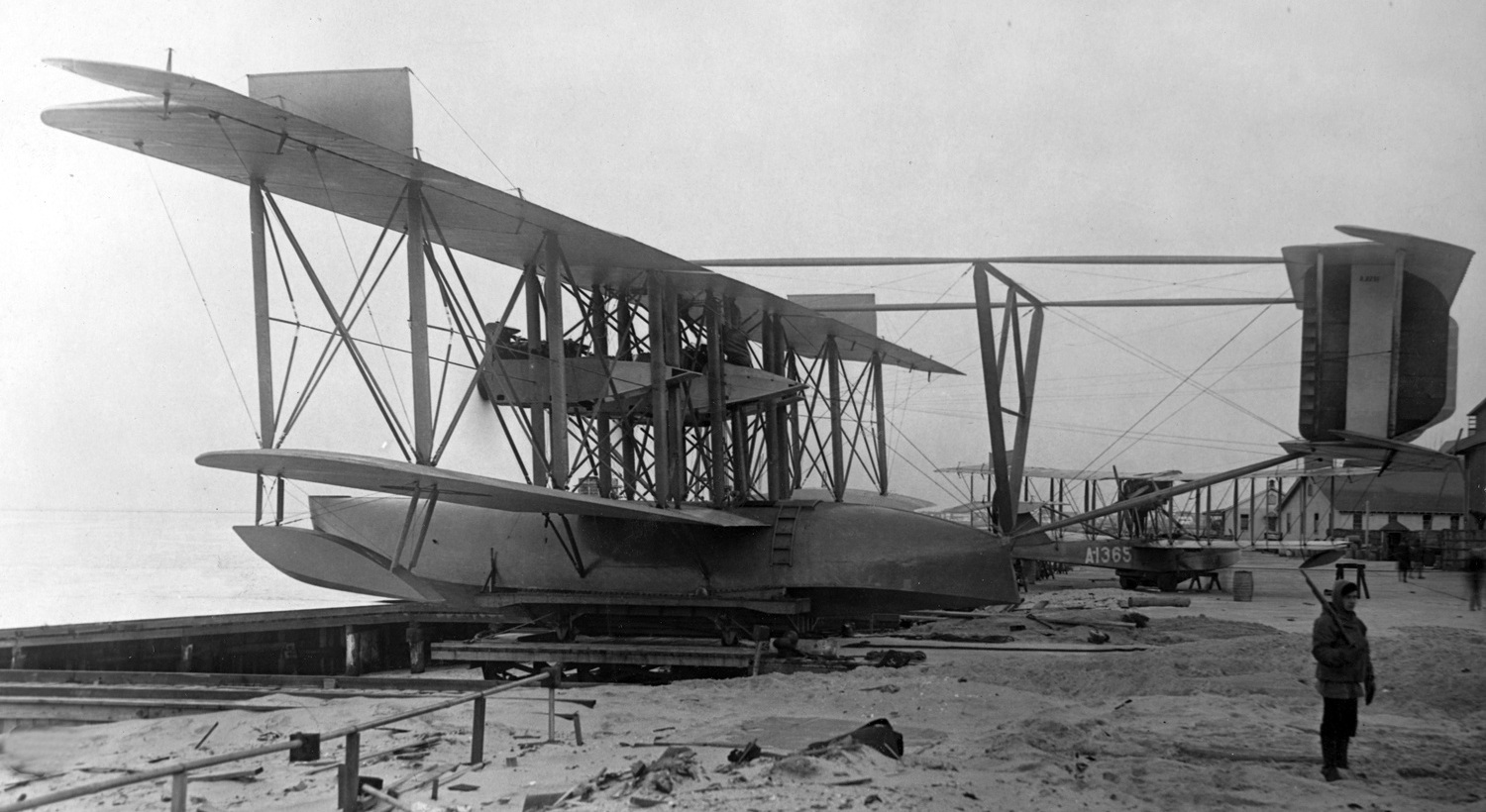
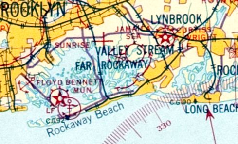
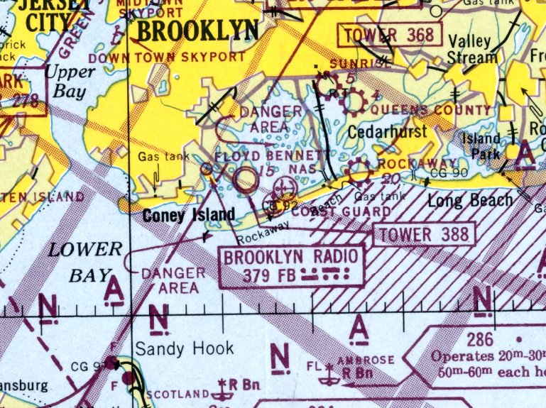
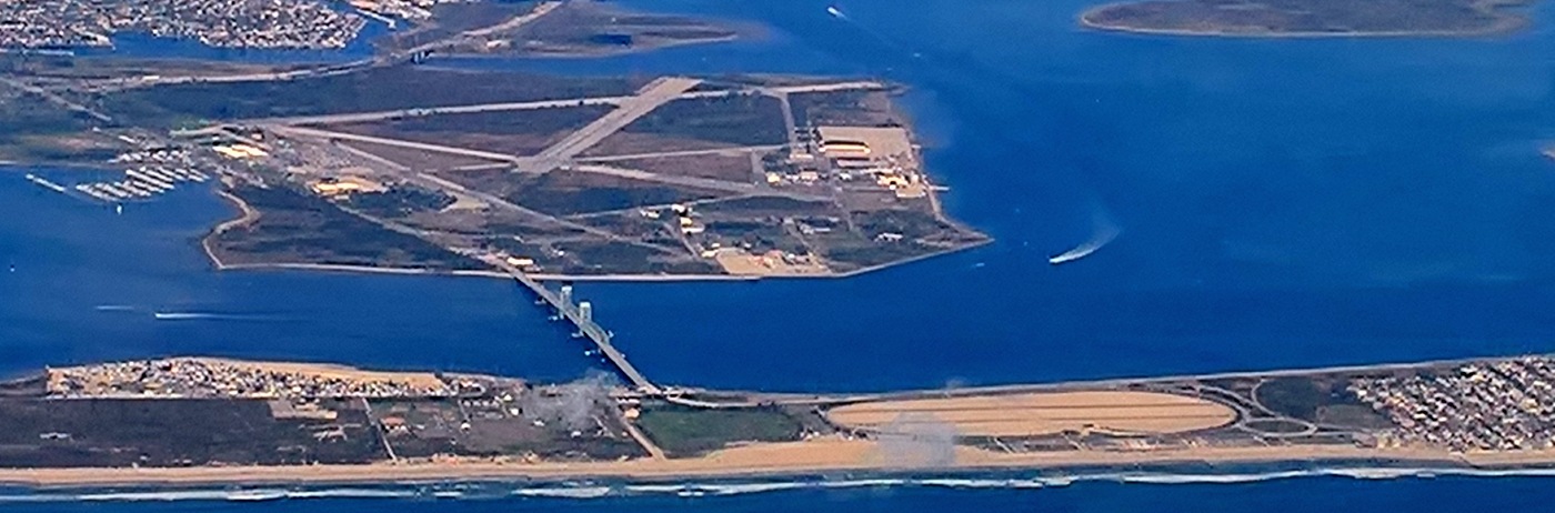
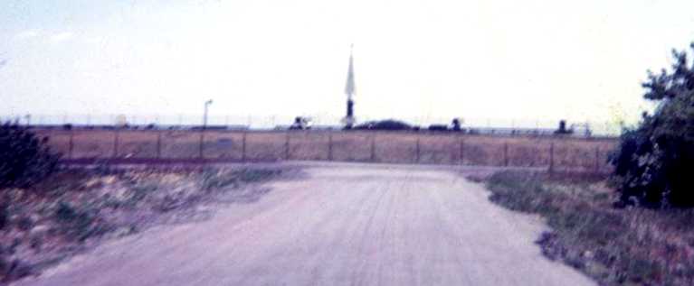
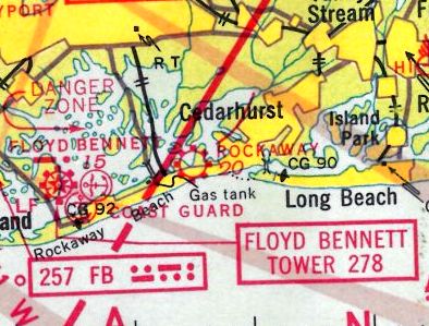
Rockaway Naval Air Station (WW1-era location), Rockaway, NY
40.57, -73.87 (Southwest of Kennedy Airport)
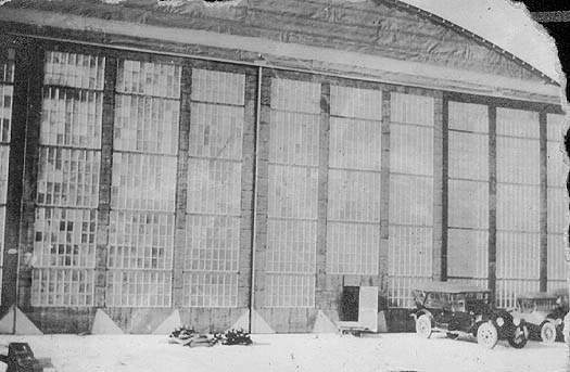
A 1918 photo of the Rockaway seaplane hangar.
This airfield is located on a narrow peninsula in between the Atlantic Ocean & Jamaica Bay, a mile southeast of Floyd Bennett NAS,
Fort Tilden is located immediately adjacent to the west.
Rockaway was one of the Navy's original Naval Air Stations.
Operational from 1917-30, it was staffed with as few as a handful of men to as many as a maximum of 1,285 men.
Over 80 buildings & several large hangars were constructed.
Fort Tilden's battery of four 12 inch mortars were also located inside the boundaries of the 96 acre NAS Rockaway.
Rockaway was used as a base for floatplanes, dirigibles, free balloon, and kite balloons.
It was also used as an advanced training facility for Navy aviators.
The base had its origin in 1917, when the City of New York granted the Navy a permit to occupy the property.
A contract covering the establishment of patrol stations on Long Island
located at Montauk, Rockaway & Bay Shore was let in the same year.
A 1918 photo (from the National Archives) of Curtiss NC-1 flying boat A2291 at NAS Rockaway.
In 1918 a collision of 2 HS-2L Flying Boats (A-1273 & A-1175) resulted in the deaths of 3 persons at Rockaway.
The HS-2L was a biplane flying boat with a single pusher propeller Liberty 330 horsepower engine.
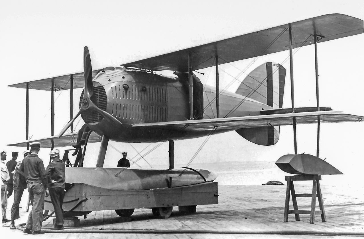
A 1918 photo of the sole Curtiss HA-1 2-seat floatplane biplane fighter at NAS Rockaway.
At the end of WW1, there were 24 seaplanes & 2 dirigibles stationed at Rockaway NAS, as well as 1,200 Enlisted men & 105 Officers.
In 1918 the NC-1 took off from Rockaway with 51 persons aboard, establishing a new world record for persons carried in flight.
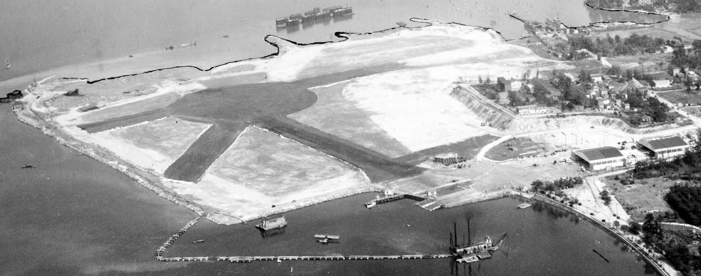
A circa 1919 US Navy aerial view looking east at Rockaway NAS (courtesy of Richard Porcelli), showing several flying boats moored offshore, and the dirigible hangar.
A circa 1919 photo of a Curtiss H-16 flying boat at NAS Rockaway (courtesy of Richard Porcelli).
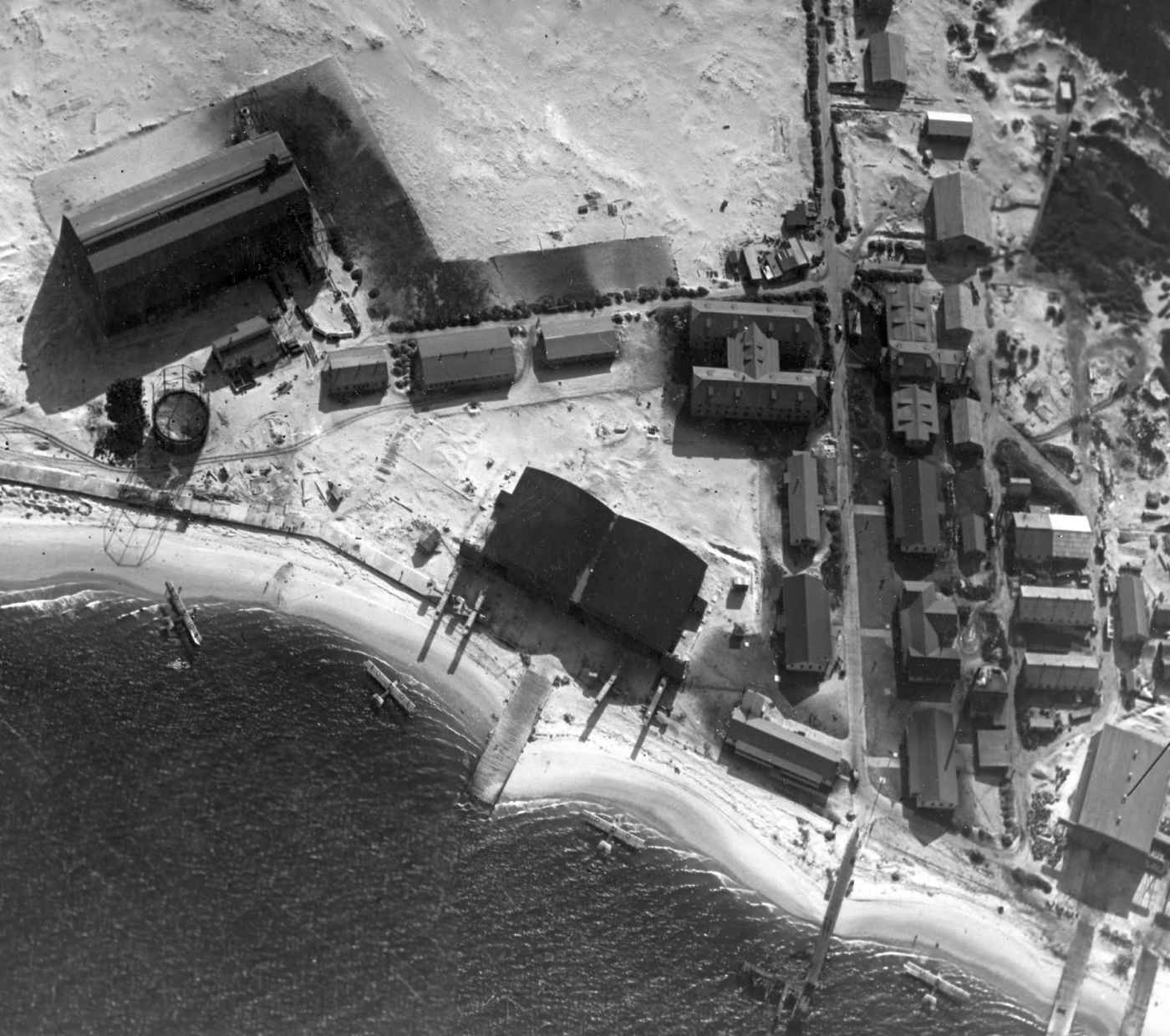
A circa 1919 aerial view looking south at NAS Rockaway NAS (courtesy of Richard Porcelli), showing several flying boats in the water near the hangars.
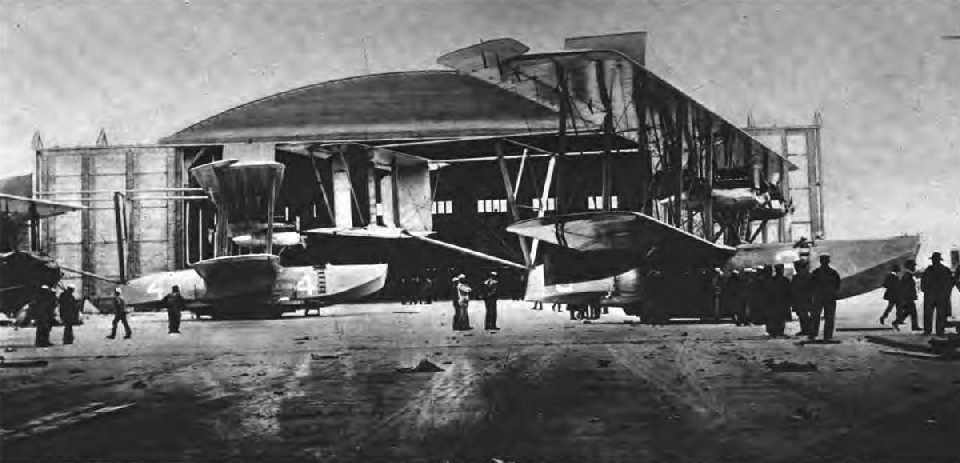
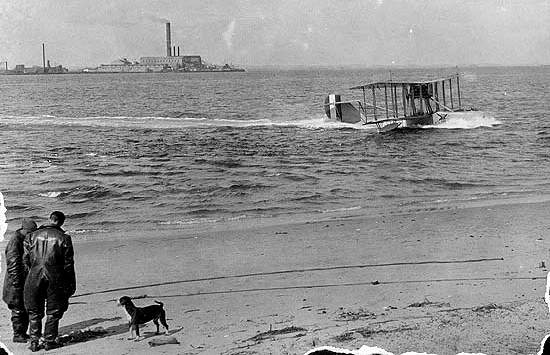
A 1919 photo of Curtiss flying boats NC-3 & NC-4 in front of a Rockaway hangar.
In 1919, three Curtiss flying boats departed Rockaway to begin the 1st trans-Atlantic oceanic crossing.
After it's historic flight, the NC-4 was put on display in the summer of 1919.
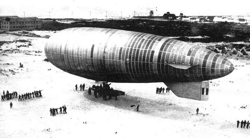
A 1919 photo of an airship being hauled out for a flight at NAS Rockaway.
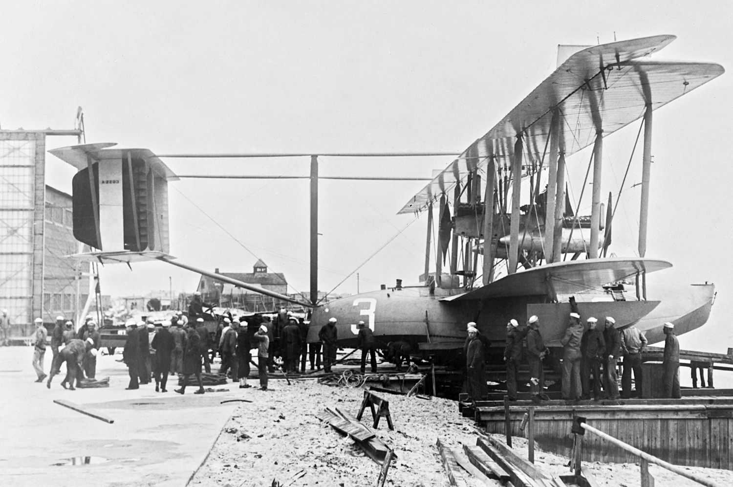
A 5/1/19-5/8/19 photo of Navy Curtiss NC-3 A2293 being prepared at NAS Rockaway for the first attempted flight across the Atlantic, via the Azores.
Note the hangar visible in the background.
The complement of the station was reduced to 259 men in 1921.
In the same year, a hydrogen fire at Rockaway destroyed 3 airships.
A 1921 photo of the sole example of the unusual Curtiss Model 24 CT torpedo plane being tested at Rockaway NAS.
In 1921 the transfer of the Rockaway property back to the City of NY to construct Jacob Riis Park is discussed.
By the end of 1921, most air operations ceased at NAS Rockaway.
In 1922 the dirigible hangar (measuring 114' x 250' x 65') burned to the ground.
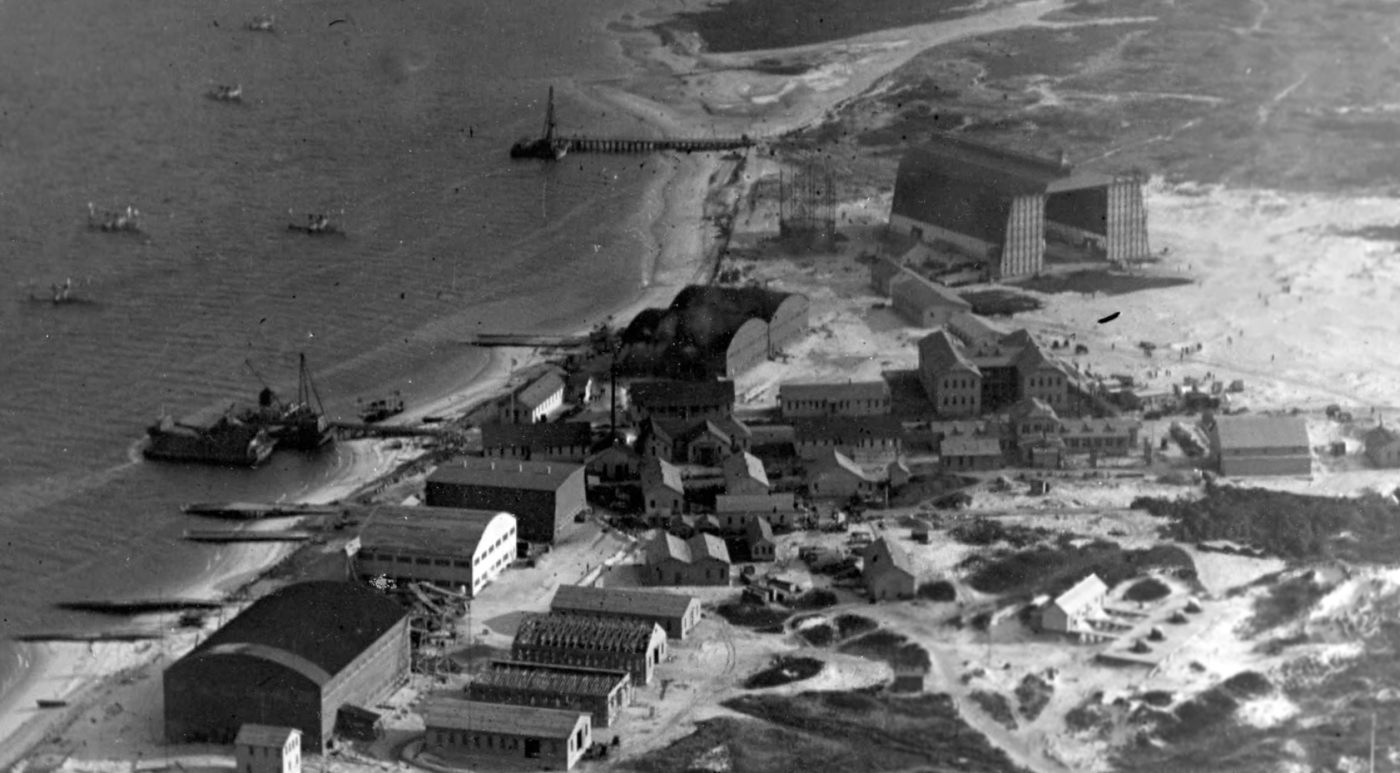
A 1924 aerial view of Rockaway (from the NYCityMap, courtesy of Chris Kennedy)
showed the seaplane hangars on the west end, and the site of the former dirigible hangar on the east end.
By 1927, the condition of the buildings at Rockaway were described as "very bad" in records from Fort Tilden.
An article entitled “Rockaway Squadrons Commended by Board”
appeared in the 9/15/28 issue of Aviation Magazine (courtesy of Chris Kennedy).
It described how “Squadrons VN-3RD3 was awarded 1st place
and VN-4RD3 was awarded 2nd place in the final standing of 24 aviation divisions throughout the country.”
It also said that “Plans are under way to make a two-way landing field large enough to accommodate any type of plane.”
The "Naval Reserve" seaplane base, as depicted on the 1930 "Rand McNally Standard Map of NJ With Air Trails" (courtesy of Chris Kennedy).
In 1930 the NAS property was transferred to the City of New York, and 42 of 51 structures remaining at Rockaway NAS were demolished.
A 1931 photo of a Vought O2U Corsair on floats at Rockaway.
The November 1931 NYC-Albany Air Navigation Map depicted a seaplane base at Rockaway.
Rockaway apparently continued to see some aviation use, as the August 1932 NY Sectional Chart depicted a seaplane base at this location.
The last aeronautical chart depiction which has been located of the Rockaway seaplane base was on the November 1942 NY Sectional Chart.
It depicted the "Coast Guard" seaplane base at this location.
The aviation use of the Rockaway seaplane base apparently came at an end at some point between 1942-43,
as no seaplane base was depicted at this location on the May 1943 NY Sectional Chart or subsequent charts.
The 1947 USGS topo map depicted Jacob Riis Park on the site of Rockaway NAS.
A 1951 aerial photo showed Jacob Riis Park had been built over the site of Rockaway NAS, leaving no trace of airbase remaining.
The National Park Service has placed an interpretive display on the mall area of Jacob Riis Park
and a plaque commemorating the 1st trans-Atlantic flight made by NAS Rockaway's NC Flying Boats in 1919.
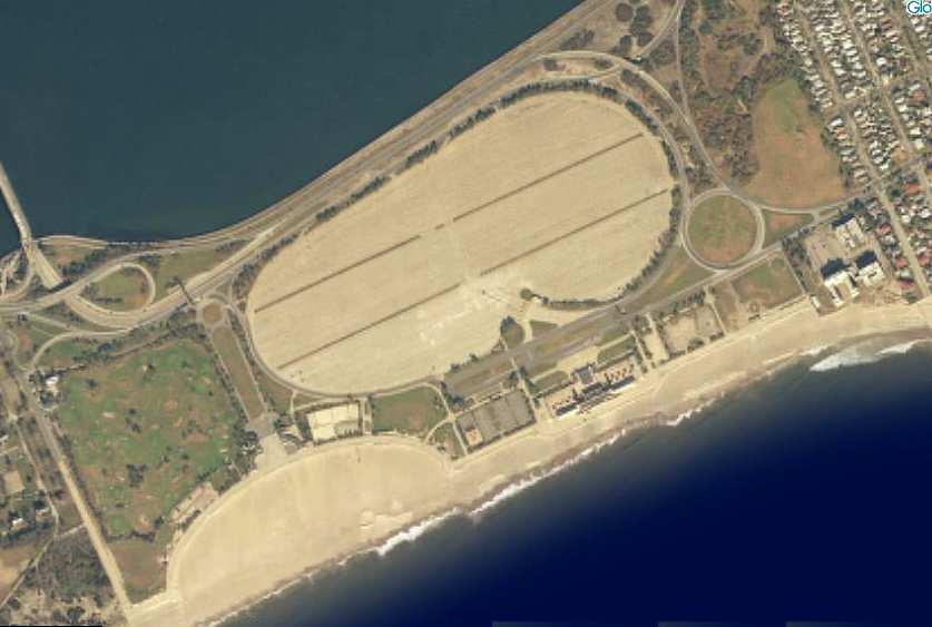
A circa 2000 aerial photo of the site of Rockaway NAS, now the Jacob Riis Park.
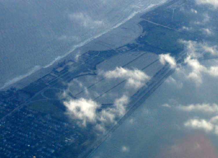
A 2005 aerial photo by Paul Freeman, taken from a Diamond Eclipse at 8,000 feet, looking southwest at the site of Rockaway NAS.
A 10/15/16 aerial view by Graeme Smith looking north at the site of Rockaway NAS, with Floyd Bennett Field also visible in the background.
See also: http://www.geocities.com/fort_tilden/rnas.html
____________________________________________________
Fort Tilden Blimp Field, Rockaway, NY
40.56, -73.88 (Southwest of Kennedy Airport)
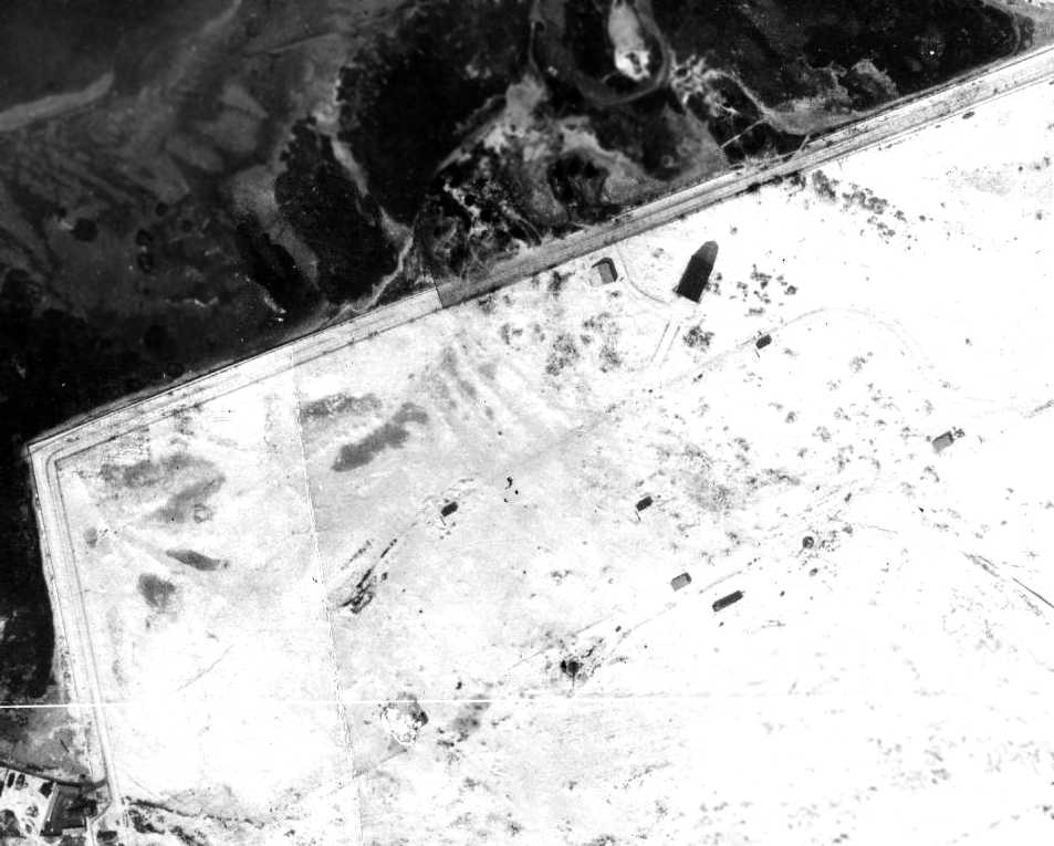
The Fort Tilden blimp hangar & field, as depicted on a 1924 aerial view (from the NYCityMap, courtesy of Chris Kennedy).
Fort Tilden was the home of a blimp hangar which was designed to house Type C airships.
The hangar was located on the North side of the post, along Rockaway Beach Boulevard.
A Gas Generator House & an incinerator were also located near the hangar.
The Class C Airship were non-rigid airships.
They measured 192' in length, with a 42' diameter, and having a gas volume of 181,000 cubic feet.
They were powered by two 125 HP Hispano-Suize engines, had a crew of 4, and a maximum speed of 10 MPH.
A total of 10 Class C airships were built by Goodyear-Goodrich,
intended to be used for coastal patrol in the Atlantic waters near the entrance to New York's harbor during World War I.
On 12/12/17, in a test to determine the feasibility of carrying fighter aircraft on dirigibles,
the airship C-1 lifted an Army JN-4 aircraft in a wide spiral climb to 2,500' over Fort Tilden
and at that height released it for a free-flight back to base.
The airship was piloted by Lieutenant George Crompton, (Naval Aviator #100), Dirigible Officer at NAS Rockaway,
and the plane by Lieutenant A.W. Redfield, USA, commanding the 52nd Aero Squadron based at Mineola (Long Island).
This was the first test of a "parasitic aircraft" and although it was a successful test, the idea was not considered to be practical.
It has not been determined if the Fort Tilden hangar was actually used for the storage of blimps,
as the adjacent NAS Rockaway had a larger hangar & landing field.
The earliest depiction which has been located of the Fort Tilden blimp field was a 1924 aerial view (from the NYCityMap, courtesy of Chris Kennedy).
It appeared to show a large open flying field with the hangar & a smaller building along the north side.
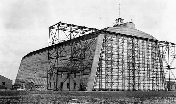
An undated photo of the Fort Tilden blimp hangar, showing the massive door support structure.
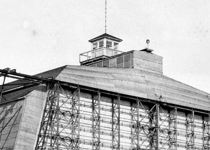
An undated photo of showing the control tower on top of the Fort Tilden blimp hangar.
A 1938 aerial photo depicted the hangar with the name "FORT TILDEN" painted on the roof,
and railroad tracks were visible entering the building.
The Fort Tilden hangar was used as a storage building for locomotives until it was torn down sometime after WW2.
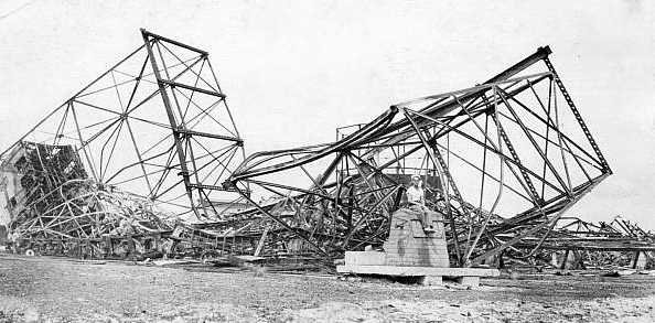
An undated photo showing the wreckage of the Fort Tilden blimp hangar in the course of its demolition.
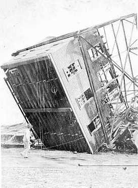
An undated photo showing the upturned building which sat adjacent to the Fort Tilden blimp hangar, in the course of its demolition.
A 1951 aerial view of the foundation of the Fort Tilden blimp hangar (top-center) (from the NYCityMap).
The Fort Tilden property had another significant phase with an aviation role,
as in 1954 the Army situated the Nike-Ajax surface-to-air missile battery NY-49 on the property,
one of several batteries which ringed New York City during the early days of the Cold War.
NY-49 featured a 4-magazine configuration, as a double Nike battery, with a total of 40 Nike-Ajax missiles.
In 1959 the Fort Tilden battery became the 2nd in the nation to be upgraded to deploy to the 2nd-generation Nike Hercules missile,
with a total of 24 Nike-Hercules missiles.
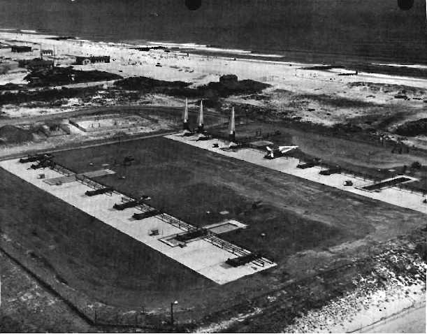
A 1959 aerial view looking southeast at several Nike Hercules missiles raised on their launchers at Fort Tilden.
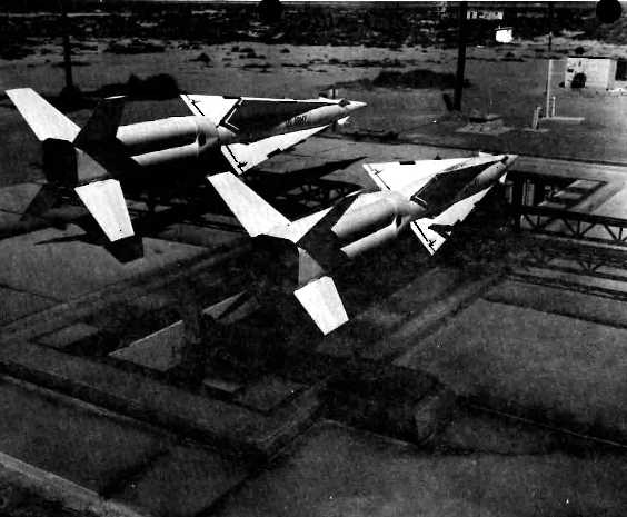
A 1959 photo of 2 Nike Hercules missiles at Fort Tilden, showing their massive quadruple solid rocket boosters.
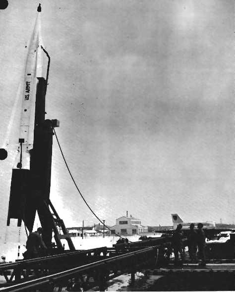
An 11/23/63 photo of a Nike Hercules missile raised to alert status at Fort Tilden, the day after President John F. Kennedy was assassinated.
A 1967 photo of a Nike Hercules missile raised on its launcher at Fort Tilden.
The Fort Tilden Nike battery was deactivated in 1974, as part of the scaling-back of Cold War air defenses.
As of 2000, a 150' x 60' concrete hangar foundation & the steel rails which once guided the rollers of the large hangar doors
were still clearly visible on the north side of Fort Tilden near Rockaway Beach Boulevard.
The area was used to store wood chips from cut-down trees until they were used on the trails in the park.
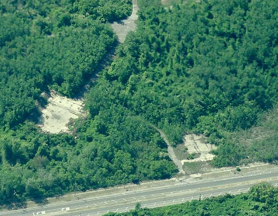
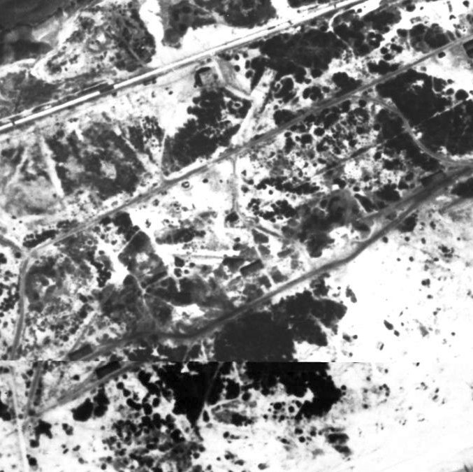
A circa 2007 aerial view looking south at the concrete foundation of the Fort Tilden blimp hangar.
A circa 2007 aerial view looking north at the concrete foundation of the Fort Tilden Nike missile launchers.
____________________________________________________
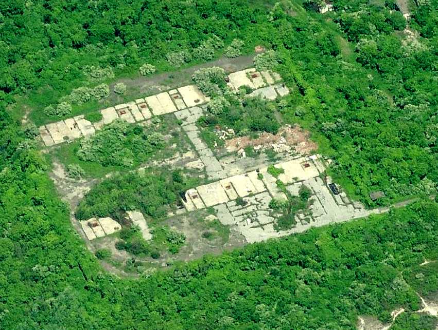
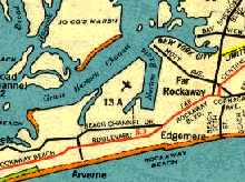
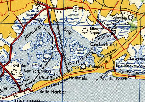
Rockaway Airport / Edgemere NOLF, Edgemere, NY
40.6, -73.78 (South of Kennedy Airport)
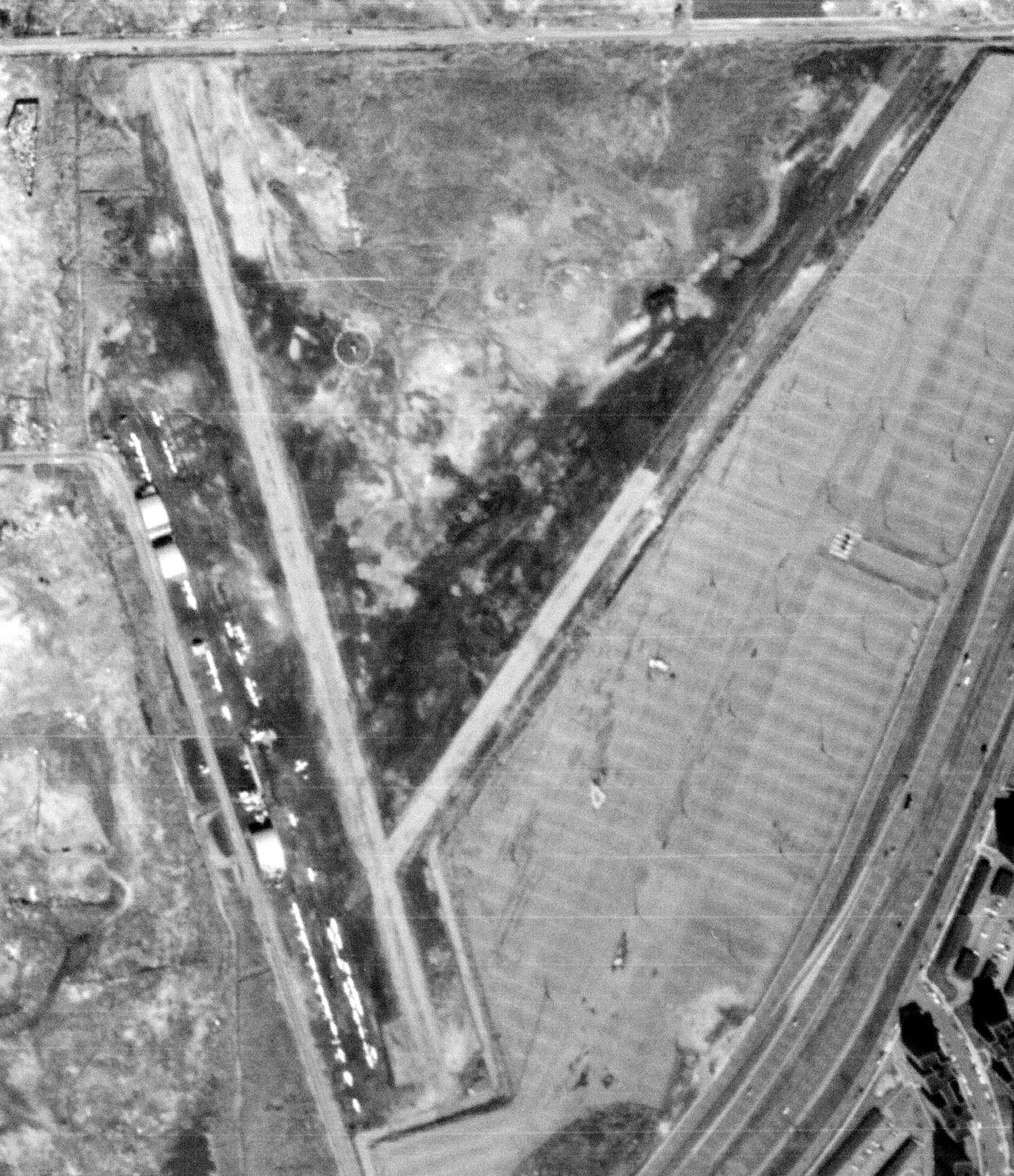
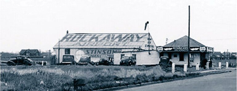
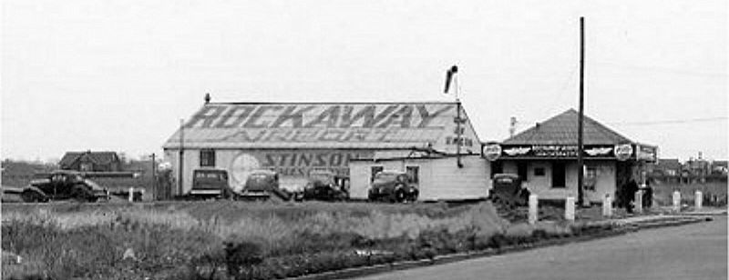
A circa 1939-42 aerial view looking north at the Rockaway Airport (courtesy of Jack Gordon).
According to the August 1938 issue of the Chamber of Commerce of the Rockaways' Rockaway Review (courtesy of Michael Azzollini),
an airport for the Rockaways was first proposed by the Chamber of Commerce
in a letter sent to the Secretary of War & the Secretary of the Navy.
It was pointed out that the Rockaways presented one of the best locations for the defense of New York City.
The property which was proposed was 240 acres located between Beach 47th Street & Beach 58th Street,
and it represented the only remaining open parcel of land in the Rockaways.
The property was previously known as the Verdam Estates,
and was owned mostly by the NY City Waterfront Company.
Rockaway Airport was not yet depicted on the June 1939 NY Sectional Chart.
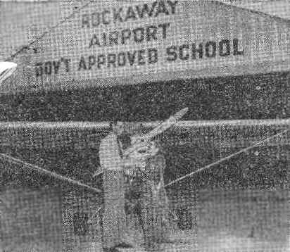
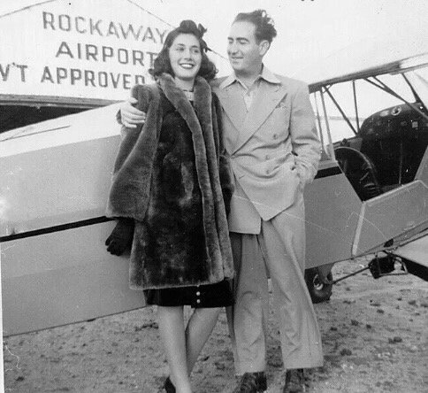
A circa 1939-42 photo (courtesy of Jack Gordon), entitled "Teacher wins commercial flying license at Rockaway Airport", depicted Katherine Lynch & her instructor, Jack Gordon.
The caption described Gordon as "one of the youngest qualified flight instructors in the country."
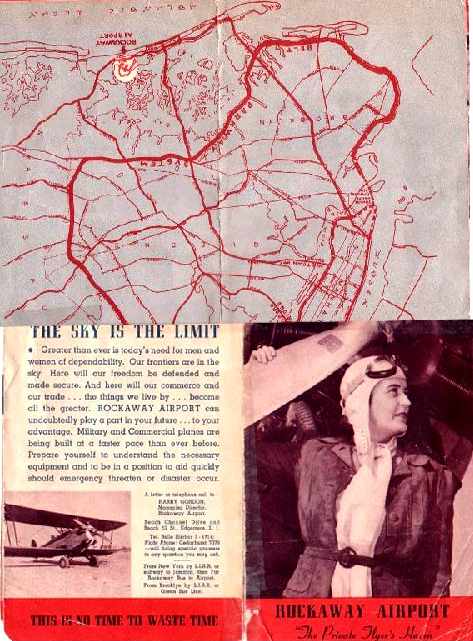
A circa 1939-42 brochure for Rockaway Airport (courtesy of Jack Gordon).
"The lady on the cover of the brochure, Kay Lynch, was a student of mine, and ultimately became a flight instructor as well."
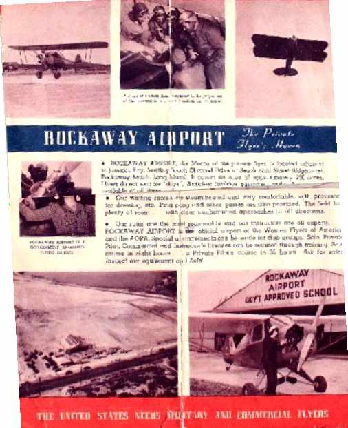
A circa 1939-42 brochure for Rockaway Airport (courtesy of Jack Gordon).
According to the June 1941 issue of the Chamber of Commerce of the Rockaways' Rockaway Review (courtesy of Michael Azzollini),
the Rockaway Airport was founded in May 1940 by Harry Gordon,
on 80 acres at the intersection of Beach Channel Drive & Beach 52nd Street.
Harry Gordon purchased a former oil burner assembly building from a Rockaway Beach firm & relocated it to the airport, becoming the airport's hangar.
Rockaway Airport initially had 2 planes, but within less than a year had grown to a complement of 7 aircraft.
Gordon was described as conducting flight training at the Rockaway Airport through which he hoped to contribute to the national defense.
Jack Gordon recalled, "My father, Harry Gordon, was the originator & operator of the Rockaway Airport.
I was then 17 or 18 years old, and the chief instructor for 'Gordon Air Services'.
The earliest aeronautical chart depiction which has been located of Rockaway Airport
was on the March 1940 NY Sectional Chart (courtesy of Tim Zukas), which depicted "Rockaway" as a commercial airport.
A 1941 photo of Ann Gordon in front of a Luscombe Silvaire at Rockaway Airport (courtesy of Jack Gordon).
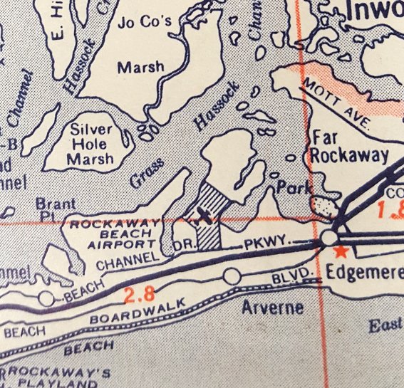
Rockaway Airport, as depicted on a 1941 street map.
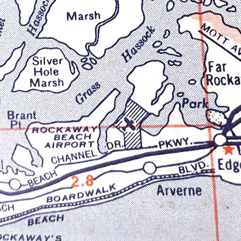
Rockaway Airport was depicted as an irregularly-shaped property outline on a circa 1940s street map.
The September/October 1941 issue of the Chamber of Commerce of the Rockaways' Rockaway Review (courtesy of Michael Azzollini)
reported that the Rockaway Airport consisted of over 200 acres, so it may have been expanded at some point since its founding.
Both Army & Navy officials had inspected the airport, and the Navy had proven successful in landing a seaplane in the adjacent Jamaica Bay & taxiing to the airfield.
The hangar had recently been expanded, and the airport's complement of aircraft was up to a total of 8.
Bob Livingston recalled, “Rockaway Airport... in 1941 I learned to fly there. Jack Gordon was my instructor. Kay also instructed me.
I soloed in an Aeronca Papoose with a 60 HP radial engine. We used the original runway of Idlewild (now JFK) to practice lining up for stalls & spins.”
Jack Gordon & three passengers were injured in a forced landing of a Waco biplane in early 1942 when it suffered a loss of power after departure from Rockaway Airport,
as described in an article in the Rockaway Journal (courtesy of Jack Gordon).
The plane was brought down in a marsh a block away from the airport.
An article in the 8/4/42 issue of the Rockaway Journal (courtesy of Jack Gordon) described how the Army had issued orders closing all privately operated airfields
within a radius of 200 miles of the coastline "for the duration" of the war.
This resulted in the closure (as a civilian airport) of Rockaway Airport on 8/3/42.
Jack Gordon recalled, "We then flew all of our aircraft to Livingston Manor Airport, in the Catskill Mountains."
Harry Gordon had originally established the airfield at Livingston Manor in 1938.
This was not the end of the Rockaway airfield, though, as it was taken over by the military for the remainder of the Second World War.
The 1943 NY Sectional Chart (according to Chris Kennedy) depicted "Rockaway" as an auxiliary airfield, but there was no indication of any military use of the field.
A 1944 Directory of Airfields (according to John Voss) listed an "OLF Edgemere" as being located at this location (40-36-00/73-47-15).
It described the airfield as having a 3,200' runway. It was apparently used during WW2 as a satellite airfield by aircraft operating from nearby Floyd Bennett NAS.
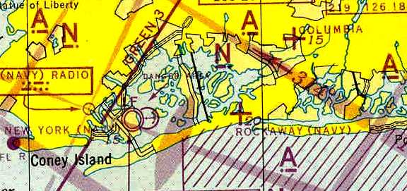
The 1945 NY Sectional Chart (courtesy of Robert Brown) labeled this field as "Rockaway (Navy)".
That is somewhat confusing, as the WW1-era Rockaway NAS was located several miles to the west, due south of Floyd Bennett NAS.
After the end of WW2, Rockaway returned to use as a civilian airport.
Jack Gordon recalled, "It was not reopened again until 1945 or 1946 when it was taken over by a fiend named Joe Alta."
Richard Herbst recalled, “I lived about 3 blocks from the airport & with a father & uncle just returned from wartime flying duty,
spent much of my time trying to persuade Joe Alta that my father would appear 'at any minute' to rent one of his Cubs.
The love affair with the little airplanes lasted although I only got to fly once.
The field... was rolled cinder recovered from the LiLco plant in Far Rockaway.
But from my vantage point, always on the ground, I could not picture the airport layout
other than the usual pattern was to take off south towards the Boardwalk,
turn east a block from the beach & continue on final over Beach 59th Street.”
Leo Diamond recalled about Rockaway, "I learned to fly the Piper J3 there in about 1946-48.
It was then adjacent to a landfill that made landings/takeoffs an adventure... pigeons by the hundreds [over] the landfill."
An article entitled "Helicopter Experiment Judged a Success" was carried in the
February 1947 issue of the Chamber of Commerce of the Rockaways' Rockaway Review (courtesy of Michael Azzollini)
It described how a helicopter had landed at the Rockaway Airport on 1/6/47 with a delivery of air mail.
The April 1947 issue of the Chamber of Commerce of the Rockaways' Rockaway Review (courtesy of Michael Azzollini)
described how Second World War veterans had returned to become instructors at the Rockaway Airport, to pass on their love of flying.
Vern Baisden recalled, “I soloed at Rockaway Airport in September 1948 in a Piper J3 C-65.”
A circa 1940s photo (courtesy of Jim Supple) of an unidentified couple & a Piper L-3 Cub in front of the Rockaway Airport hangar.
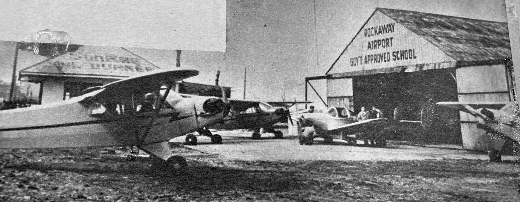
A circa 1940s photo (courtesy of Ed Das) of a several Piper L-3 Cubs & an Ercoupe in front of the Rockaway Airport hangar.
A circa 1940s photo of the Rockaway Airport hangar & office building.
Rockaway Airport, as depicted on the 1947 USGS topo map.
"Rockaway" was depicted as a civil airport on the 1950 NY Sectional Chart (courtesy of Mike Keefe).
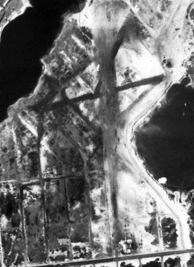
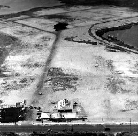
A 1951 aerial photo depicted Rockaway Airport as having several unpaved runways, with a hangar & several light aircraft on the south end.
Richard Herbst recalled, “There were, in the early 1950s at least 20 aircraft tied down & more hangared.”
Elliot Spiro recalled, “As a kid growing up in Far Rockaway I was often drawn to the airport. My dad even got me to take my 1st airplane rides there.
In the early 1950s a school, MS198 Benjamin Cardozo Middle School, was built on Far Rockaway Boulevard & 56th street.
I remember thinking as this building was going up that the airport would not last very long as a lot of the air traffic passed over the school.
I think that this may have caused the demise of Rockaway Airport.”
A circa 1953 photo of a hangar & office building at Rockaway Airport.
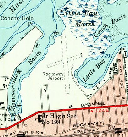
The 1954 USGS topo map depicted Rockaway Airport as having 2 unpaved runways & 2 small buildings on the south side.

The last aerial photo which has been located showing the Rockaway Airport while open was a 1954 aerial view.
It depicted the field as having a hangar at the south end, with a dozen light aircraft parked around it, and several unpaved runways on the northern end.
A 1955 street map (courtesy of Steve Boggess) depicted “Rockaway Beach Airport” as an irregularly-shaped property outline.
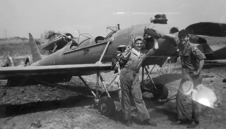
A 1956 photo (courtesy of Jordan Kraly) of a Ryan PT-22 at Rockaway Airport.

A 1956 photo (courtesy of Jordan Kraly) of a Navion at Rockaway Airport.
Jordan Kraly recalled, “I worked at Rockaway in 1957-58. I was an aspiring pilot & became a lineboy to help pay for lessons.
It was a wonderful place & guys would just come around to hang out. Rockaway was a government-approved flight school.
They accepted the G.I. Bill & had a real Link Trainer for instrument instruction. Joe Alta was still there till it closed because of the apartments.
I later joined the USAF & became a fighter pilot flying F-100 Super Sabres.”

The last aeronautical chart depiction which has been located of Rockaway Airport was on the July 1957 NY Sectional Chart.
Its Aerodromes table described Rockaway as having 4 runways, with the longest being a 2,705' cinder strip.
But note Rockaway's uncomfortable proximity to “New York International” Airport (eventually known as JFK), which undoubtedly hastened the little airport's closure.
Rockaway Airport was no longer depicted on the 1957 USGS topo map or the January 1958 NY Sectional Chart, so it was presumably closed by that point.
Richard Herbst recalled that 2 years after the construction of Benjamin Cardozo Junior High,
“Peninsula General Hospital went up adjacent to the already condemned land the airport was on.”
Charles Friedman recalled, “As a child growing up in Rockaway Beach,
my parents used to drive us to the airport, to park nearby to see the airplanes taking off & landing at this airport.
The airport closed by 1959, as it's demolition was done to replace it with a NY City housing project.
My mother went to work for the New York City Housing Authority in 1959,
and she was transferred to this housing project to help rent all of the apartments in this sprawling 24-building complex,
which replaced the Rockaway Airport in Edgemere.
The housing project was rented beginning in 1960.”
No airfield (or abandoned airfield) was depicted in Rockaway on the 1960 NY Sectional Chart (courtesy of Mike Keefe).
A 1966 aerial photo showed that the southern portion of the former Rockaway Airport had been covered with an apartment development.
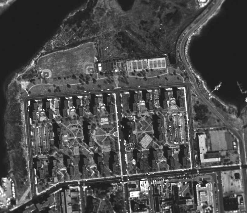
A 1994 USGS aerial photo showed the southern portion of the Rockaway Airport site had been covered with an apartment development, and not a trace appeared to remain of the airfield.
The northern edge of the site was occupied by the Rockaway Community Park.
The site of Rockaway Airport is located northeast of the intersection of Beach Channel Drive & Beach 54th Street.
____________________________________________________
Or if you prefer to contact me directly concerning a contribution (for a mailing address to send a check),
please contact me at: paulandterryfreeman@gmail.com
If you enjoy this web site, please support it with a financial contribution.
____________________________________________________
This site covers airfields in all 50 states.
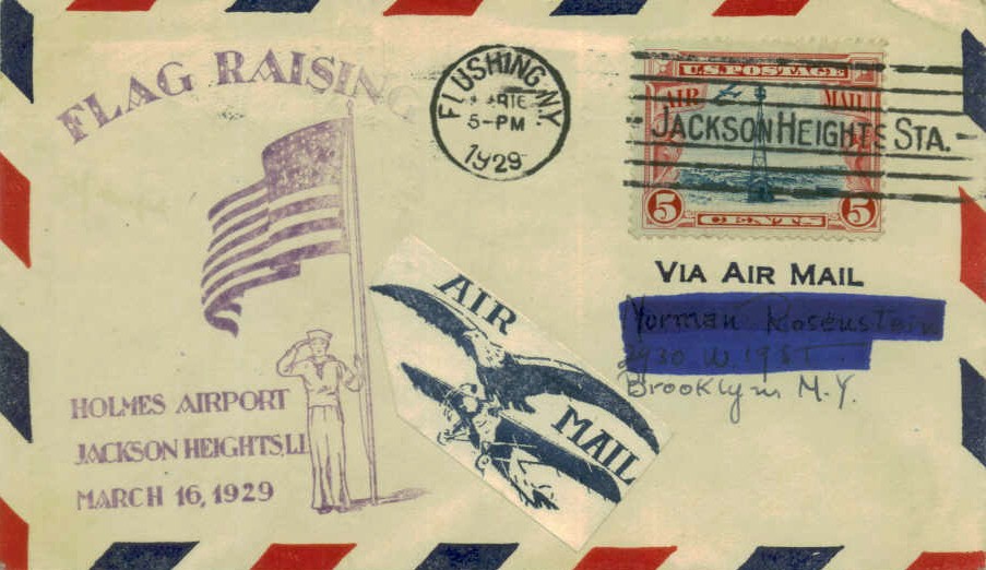