Abandoned & Little-Known Airfields:
© 2002, © 2026 by Paul Freeman. Revised 1/25/26.
This site covers airfields in all 50 states: Click here for the site's main menu.
____________________________________________________
Please consider a financial contribution to support the continued growth & operation of this site.
Aeromarine Factory Airfield / Keyport Airport (revised 10/2/23) - Belford Airfield (revised 5/5/23) - Hadley Field (revised 1/25/26)
North Brunswick Airport (revised 6/27/22) - Standard Aircraft Company Factory Airfield / Bayway Airfield (revised 12/7/14)
Walling Airport (revised 6/7/19) - Westfield Airport (revised 3/11/24) - Woodbridge Airport / Shinn-Woodbridge Airport (revised 8/5/17)
____________________________________________________
Standard Aircraft Company Factory Airfield / Bayway Airfield, Bayway, NJ
40.644, -74.214 (West of New York, NY)
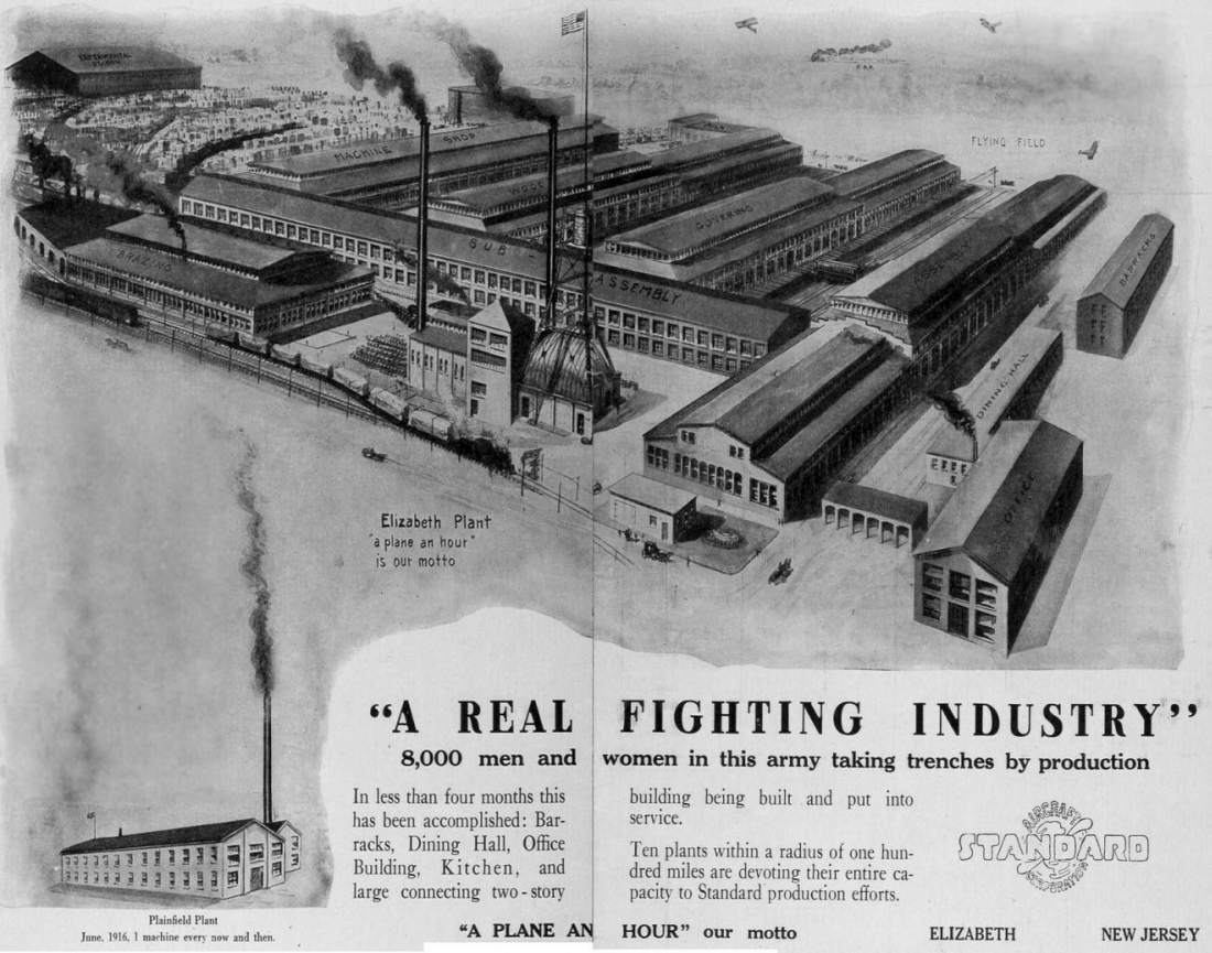
An image courtesy of Fred Cassel, which Fred observes is “an ad that Standard Aircraft ran in 1917
that used the exaggerated bird's eye view that was originally issued as a postcard of the Stephenson Trolley Works.
The image was re-labeled as the complex looked when Standard was in operation, including the label of Flying Field just beyond the buildings.”
According to Fred Cassel, “The complex was built in 1895 to build wooden trolleys for the Stephenson Trolley Works company.
As trolleys transitioned from wood to steel, the facility quickly became outdated,but became ideal for the woodworking-based aero industry.
Standard Aircraft purchased the plant with basically the entire skilled workforce,
created the airfield out back & overnight became one of the 4 largest aircraft manufacturers in the nation.
When it was operated by Stephenson Trolley & then Standard Aircraft,
it was a classic late 1800's red-brick industrial complex composed of numerous long narrow individual buildings.
In 1917 while prospects were still quite high, they built a huge assembly building solely for the final assembly of the massive 100' wingspan H-P O/400 bomber.
The airstrip was just to the northwest of the buildings.
Standard Aircraft built some rather large planes at this facility in the 1917-18 timeframe,
including the American-built versions of the early British bomber, the Handley-Page O/400, as well as countless other small early biplanes.”
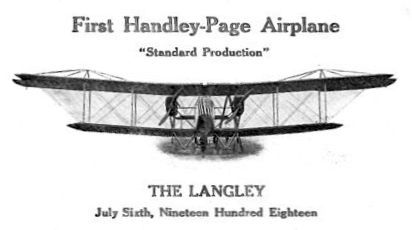
A commemoration of The Langley, the first Handley-Page airplane from the “Standard Production” on 7/6/18.
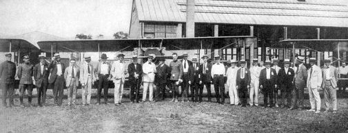
An 8/16/18 photo of a group in front of biplanes at the Standard Aircraft factory.

A circa 1918-19 photo of a single-engine Standard biplane in front of the factory.
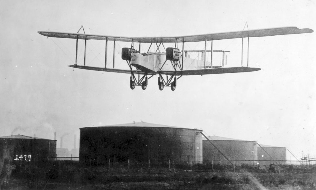
A 1918-19 photo of a massive Handley-Page O/400 approaching the Bayway Airfield, over the adjacent Standard Oil tanks.
Acording to Wikipedia, Standard Aircraft supplied the Sloan H as the Standard H-2 & H-3 to the Army,
and the float-equipped H-4H to the Navy, after the Sloan company was reorganised as the Standard Aircraft Company.
A more significant type was the Standard J series trainer, similar to the Curtiss JN-4,
which began with the SJ prototype, followed by the production J-1 (or SJ-1), of which some 800 were built.
They were badly hampered by the choice of engine, and attempts to cure the problems with subsequent designs were not successful.
Only handfuls of JRs & JR-1Bs were built; some were also purchased by the Post Office.
Standard's last type was the E-1. Intended as a fighter, 100 served as advanced trainers,
about half with a provision for fitting machine guns, as the M-Defense.
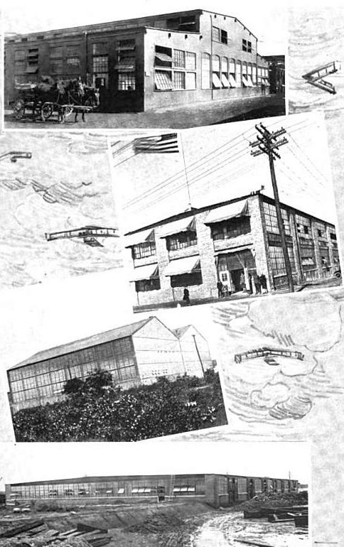
A 1919 photo of the Standard Aircraft Bayway factory buildings.
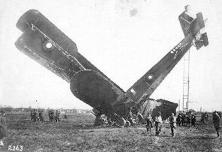
A 7/10/19 photo of a massive Handley-Page O/400 which crashed after takeoff from the Bayway Airfield.
Fred Cassel reported of the Standard Aircraft factory, “It didn't last long & they went under shortly after the war ended, as did the government's funding.”
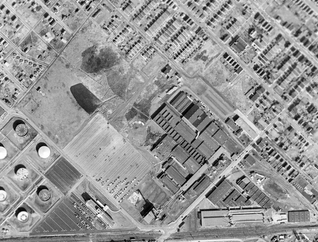
A 2/27/54 aerial view showed the Standard Aircraft factory buildings remained, with the clearing to the northwest (presumably the airfield) also remaining largely clear.
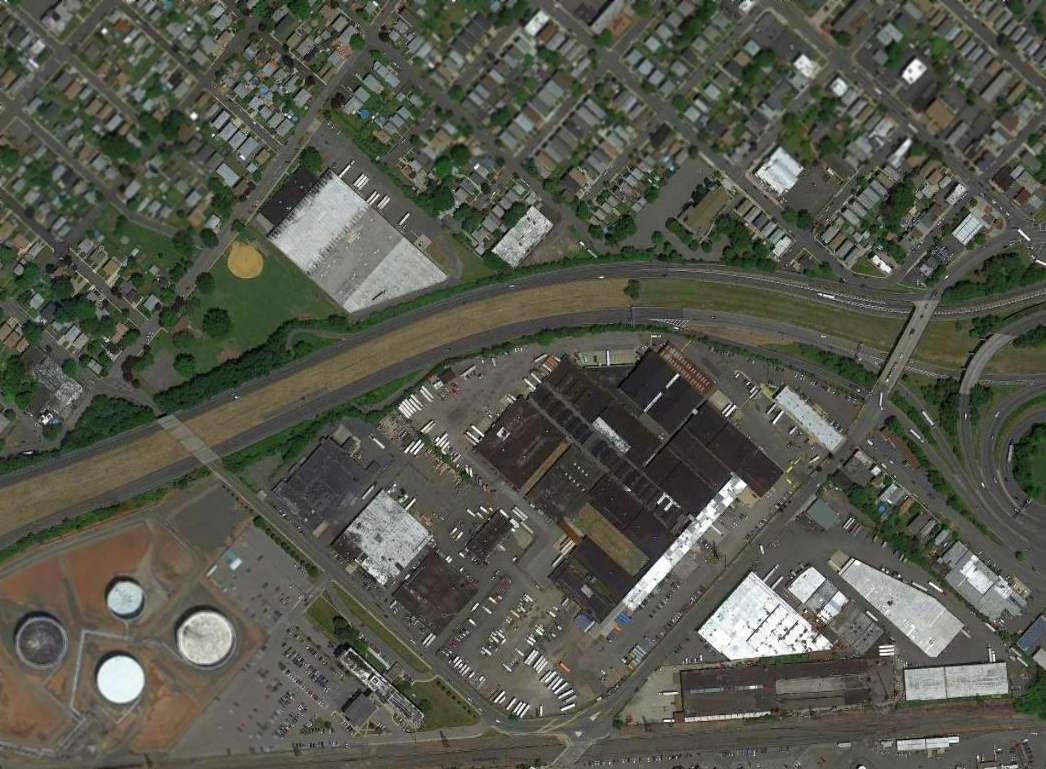
A 2010 aerial view showed the Standard Aircraft factory buildings remained, but Interstate 278 cuts through the area of the former airfield.
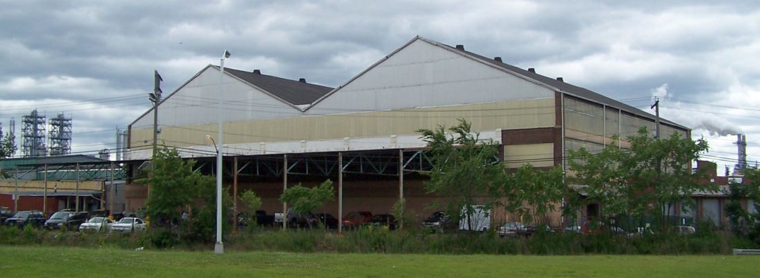
A 1/16/12 photo by Fred Cassel of the Standard Aircraft “double-truss main assembly building”,
the same building as shown in the 1919 photo above, showing it “as it looked when first built in 1917.”
Fred Cassel reported in 2014, “Remarkably, most of this complex has survived to this day, while its former history has been long forgotten.
Today, all of the buildings have been combined into one massive large warehouse complex,
but [aerial photos] clearly show the rooflines of the original structures.
The 1917 H-P O/400 assembly building is still a stand-alone building with a distinct double-truss roof.
Millions of cars pass right by this building every day on their way from NJ into Staten Island, completely unaware of the history of these buildings.
The airstrip has been replaced by Route 278 as it leads to the Goethals Bridge.
We are soon approaching the 100th anniversary of the beginning of this ambitious, if short-lived, company
and I am hoping to publish a modest book about the company's history & it's manufacturing plant also located here in Linden.
Part of my goal is to have marker added to the buildings commemorating their aviation history.”
Fred requests that anyone having more information about the Standard facility email him.
The site of the Standard Aircraft factory airfield is located west of the intersection of Interstate 278 & Brunswick Avenue.
Thanks to Fred Cassel for pointing out this airfield.
____________________________________________________
Woodbridge Airport / Shinn-Woodbridge Airport, Woodbridge, NJ
40.576, -74.333 (West of New York, NY)
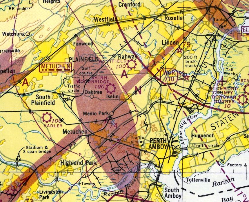
Shinn-Woodbridge Airport, as depicted on the August 1946 NY Terminal Aeronautical Chart (courtesy of Tim Zukas).
Nothing but open land was depicted at this location on a 1940 aerial photo.
Shinn-Woodbridge Airport was evidently established at some point between 1945-46 (like hundreds of other small airports in the post-WW2 general aviation boom),
as it was not yet depicted on the January 1945 NY Sectional Chart (courtesy of Ron Plante).
The earliest aeronautical chart depiction which has been located of Shinn-Woodbridge Airport was on the August 1946 NY Terminal Aeronautical Chart (courtesy of Tim Zukas).
It depicted Shinn-Woodbridge as a commercial airport.
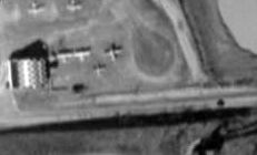
The earliest photo which has been located of Woodbridge Airport was a 1947 aerial photo.
It depicted 2 paved runways in an “X” shape, with a single hangar & 11 light planes on the south side.
The Garden State Parkway was under construction directly adjacent to the east side of the airport.
Strangely, the 1947 USGS topo map didn't depict Woodbridge Airport at all.
George Manser recalled of Woodbridge Airport, “It was located on Oak Tree Road in what is now Iselin, part of Woodbridge Township.
The northern border was New Dover Road, the west side Wood Avenue & east side was absorbed by the Garden State Parkway.
It was south of Westfield Airport about 1 or 2 miles. It had an administration building & paved runways.”
The July 1949 NY Sectional Chart (courtesy of Ron Plante) depicted Woodbridge as having a 2,100' paved runway.
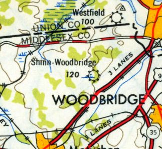
The 1949 USGS topo map depicted “Shinn-Woodbridge” as a commercial/municipal airport.
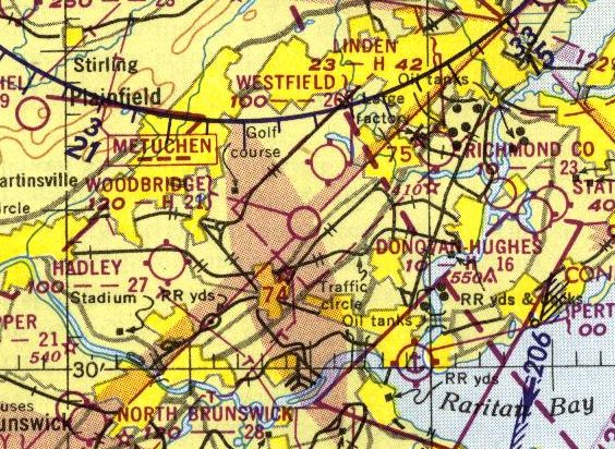
The last aeronautical chart depiction which has been located of Woodbridge Airport was on the 1950 NY Sectional Chart (courtesy of Mike Keefe).
It depicted Woodbridge as having a 2,100' paved runway.
Woodbridge Airport was evidently closed at some point between 1950-53, lasting no more than 8 years,
as it was no longer depicted on the 1953 NY Terminal Aeronautical Chart (courtesy of Tim Zukas),
and a 1954 aerial photo showed the site covered with housing, with no trace remaining of the little airport.
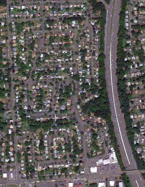
A 6/17/10 aerial photo showed no trace remaining of Woodbridge Airport.
George Manser reported in 2013, “There is a Shop Rite Market located in the same area as the administration building.”
Thanks to George Manser for pointing out this airfield.
____________________________________________________
40.428, -74.188 (South of New York, NY)
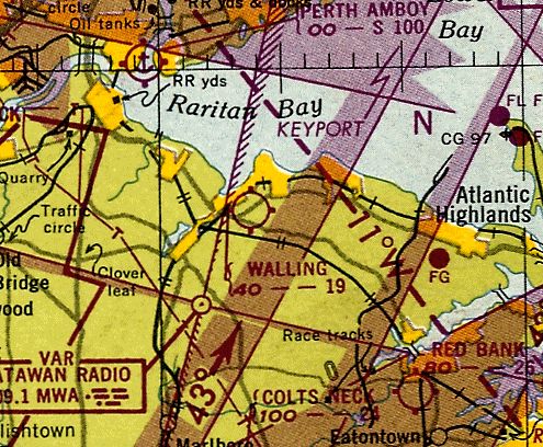
Walling Airport, as depicted on the July 1949 NY Sectional Chart (courtesy of Ron Plante).
“Walling Airport was established by Daniel & James Walling approximately 1934”, according to “Aberdeen NJ Life” (courtesy of Dick Lewis).
.
However, Walling Airport did not yet appear to be depicted on a 1940 aerial photo.
Neil Cressman reported, “My Father's Uncle Richard Cressman... was a member of the Civil Air Patrol that flew out of Wallings in WW2.
His name is listed in the registry.”
However Walling airport was still not depicted on the January 1945 NY Sectional Chart (courtesy of Ron Plante).
Richard Cressman reported, “After the war, locals would meet at the airfield on Sundays after church, Get fish & chips from Keyport Fishery, and pay $5 to get a ride out to the Statue of Liberty & back.
The field doubled as a cow pasture, and at times they would have to chase the cows off the filed so the plane could land.
I believe the pilots were Richard Cressman, Delrosso, and Bud Fendwick.”
The earliest depiction which has been located of Walling Airport was on a 1947 aerial photo.
It depicted the field as having 2 perpendicular grass runways, with 3 single-engine aircraft parked near some small buildings on the north side.
Walling Airport was not yet depicted on the 1947 USGS topo map.
Dick Lewis recalled, “Walling's Airport... As a teenager in the 1940s, I assisted passengers for a sight-seeing operation using a 'Standard' biplane.
The aircraft had a 4-seat front cockpit & my 'pay' was filling the occasional empty seat.”
The earliest aeronautical chart depiction which has been located of Walling Airport was on the July 1949 NY Sectional Chart (courtesy of Ron Plante).
It depicted Walling as having a 1,900' unpaved runway.

A circa late 1940s/1950s photo (courtesy of Dick Lewis) showing several single-engine aircraft (including a Navion) parked near a hangar painted with “Walling Keyport”.
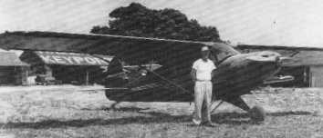
A circa 1950s photo of Richard Cressman in front of a Piper Cub, with the “Walling Keyport” hangar in the background.

A 4/24/53 USGS aerial photo depicted a few buildings that had been added at some point between 1947-53.
A total of 3 single-engine aircraft were visible on the field.
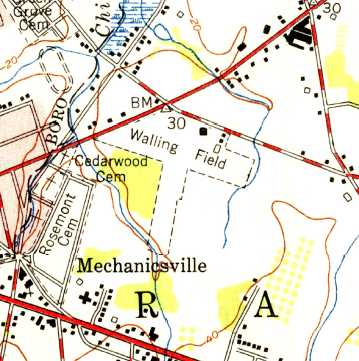
The 1954 USGS topo map depicted Walling Field as having 2 unpaved runways, with several buildings along the northeast side.
An article entitled “Plane just borrowed” in the 7/12/54 Schenectady Gazette
reported that a man stole a plane from Walling Airport & flew it to nearby Red Bank Airport.
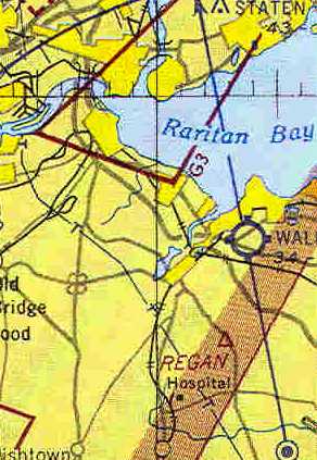
The last depiction which has been located of Walling Airport
was on a truncated portion of 1955 NY Sectional Chart (courtesy of Chris Kennedy).
It depicted Walling as having a 1,900' unpaved runway.
Walling Airport was evidently closed (for reasons unknown) at some point between 1955-57,
as the airport was no longer depicted on the 1957 NY Sectional Chart,
but its memory was commemorated by an aeronautical intersection, “Walling”, over the airport site.
A 1957 aerial photo showed the airport's demise compared to the 1953 photo:
new houses covered the southern half of the airport site,
and the northern half had been scraped clean, for new construction.
A 1963 photo showed that houses & a shopping center had covered the site of Walling Airport,
with no trace remaining.
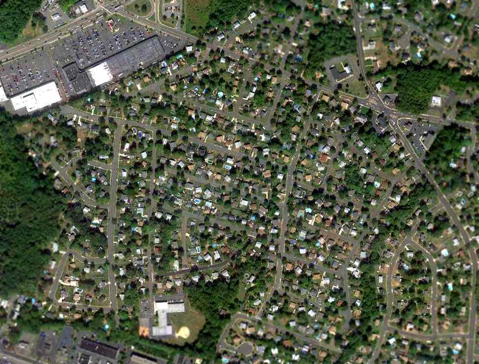
A 9/21/10 aerial view showed no trace remaining of Walling Airport.
As of 2011, the shopping center on the site of Walling Airport continues to be known as Airport Plaza.
The site of Walling Airport is located southeast of the intersection of Route 36 & Middle Road.
____________________________________________________
Hadley Field, South Plainfield, NJ
40.556, -74.43 (Southwest of New York, NY)
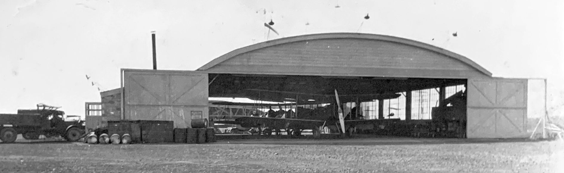
A 3/15/25 photo by Fred Hensel captioned “Airplane hangar near Stelton NJ”, which appears to be the Hadley Field hangar (courtesy of Eric Williamson).
As Post Office plans for inaugurating night airmail progressed,
it became apparent that New York's Hazlehurst Field, often blanketed in fog & smoke, proved sadly inadequate.
What was needed was an area allowing clear approach from all directions & the establishment of improved terminal facilities.
Officials set out locating the ideal location; in short order they found one, not in New York but in neighboring New Jersey.
On 11/1/24, John Hadley leased to the Post Office 77 acres of level ground 5 miles from New Brunswick, NJ, for a new landing field to be called Hadley Field.
Immediately, preparations began, land was cleared, radio masts erected,
boundary lights installed, and provisions established for floodlights & revolving beacons.
So rapid was the construction that by December 15 daytime transcontinental operations shifted from Hazlehurst to Hadley.
The earliest photo which has been located of Hadley Field was a 3/15/25 photo by Fred Hensel captioned “Airplane hangar near Stelton NJ”, which appears to be the Hadley Field hangar (courtesy of Eric Williamson).
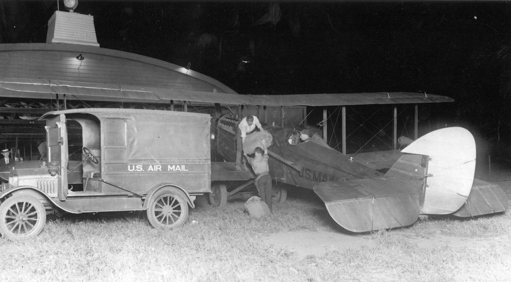
A 1925 photo of postal employees loading an Airmail deHavilland in front of a Hadley Field hangar at night.
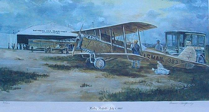
A painting of airmail operations at Hadley Field in 1925 (courtesy of Ed Drury).
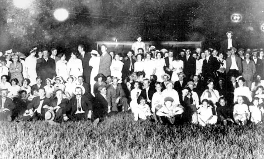
A 7/1/25 photo of the crowd gathered at Hadley Field to witness the first transcontinental night airmail flight.
On the night of 7/1/25, 500,000,000-candlepower arc floodlights swept the field for nearly a mile in half a circle.
A powerful searchlight stood on top of a hangar revolving six times a minute.
All was in readiness for the inaugural night flight for which more than 15,000 people had turned out
to watch Dean Smith & J.D. Hill lift into a moonlit sky on their way to Cleveland.
As described by Dean Smith in "By the Seat of My Pants", after the goodbyes & handshakes trouble awaited him:
"...I climbed in the DH-4. The newsreel cameras were grinding. I ran up the engine & roared down the field.
As I was still climbing, not yet a hundred feet high, the engine suddenly revved down as though the throttle had been pulled back.
Praise be, I managed to make a full one-eighty turn & straighten out, floating back in over the fence, the engine not quite dead.
Examination disclosed that a pin connection in the throttle rod had broken,
and the butterfly valve in the carburetor had consequently slipped back.
That 1st night the rod was quickly repaired, and I took off toward Bellefonte with little total delay."
Smith's problems were far from over. Engine failure forced him down again near Kylertown, PA.
Dropping his parachute flare, he landed in a small emergency field.
Two hours later he left for Cleveland in another plane but ran out of gas 15 minutes short of Cleveland & crashed landed,
unhurt but upside down with crumpled wings in a farmer's vineyard.
"Hmm," the farmer said looking at the crash, "Do you always land this way?"
J.D. Hill had better luck than Smith, his mail got through, and the 1st inaugural flight out of Hadley Field was deemed a success.
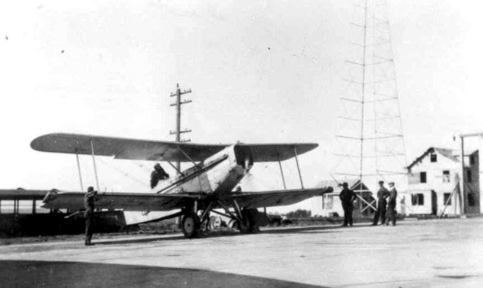
A circa 1925-28 photo of a Douglas M1-M4 airmail biplane, preparing to depart from Hadley Field.
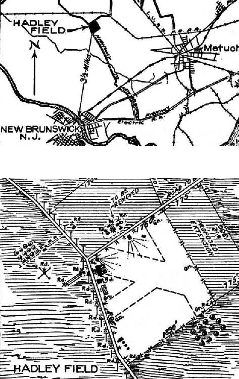
The location & layout of Hadley Field, as depicted on the 1927 Commerce Department Airway Bulletin (courtesy of David Brooks).
It described Hadley as a 141 acre rectangular sod field having 3 runways.
A single hangar was depicted on the northwest side.
David observed, “Of interest on the Hadley field are 2 floodlights & they used lines radiating out for them.”
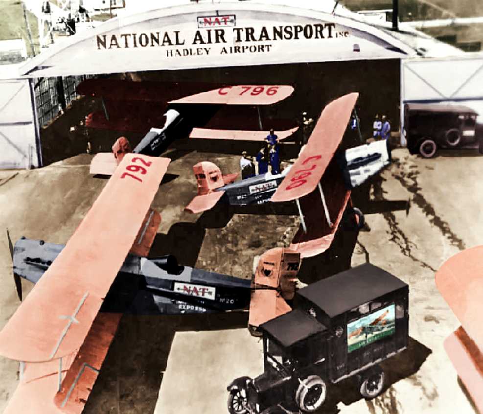
A 1927 photo of "The scene at Hadley Field, as 4 airlines & Railway Express Agency
began the 1st express & mail flights coast-to-coast" (courtesy of Karen Sindt, colorized by Joe Orth).
According to a Smithsonian Air & Space article (courtesy of Joseph du Pont), WW1 ace Arthur Brooks “in 1928 was hired by Bell Telephone Laboratories.
He spent the next few decades working as a scientist, engineer and chief pilot for the company at Hadley Field.
There, Brooks & his staff conducted pioneering research on ground-to-air radiotelephone communications & electronic aviation navigation equipment.
During much of this period, he piloted a Fairchild FC2-W Wasp and a Ford Tri-Motor that operated as flying laboratories for the team's communications research.”

A pre-1929 photo of an unidentified airmail biplane in front of a hangar at Hadley Field.
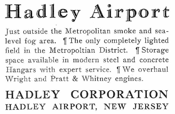
An advertisement for Hadley Airport from the 9/15/28 issue of Aviation Magazine (courtesy of Chris Kennedy).
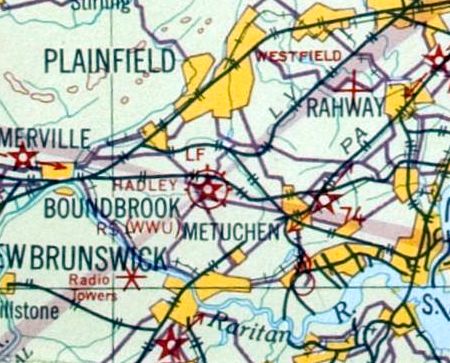
The earliest aeronautical chart depiction which has been located of Hadley Field
was on the November 1931 NYC-Albany Air Navigation Map.
A 1931 aerial view depicted Hadley Field as a square-shaped grass field, with 2 hangars along the west side of the field.
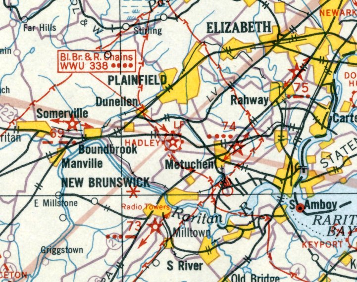
The earliest Sectional Chart depiction which has been located of Hadley Field was on the August 1932 NY Sectional Chart.
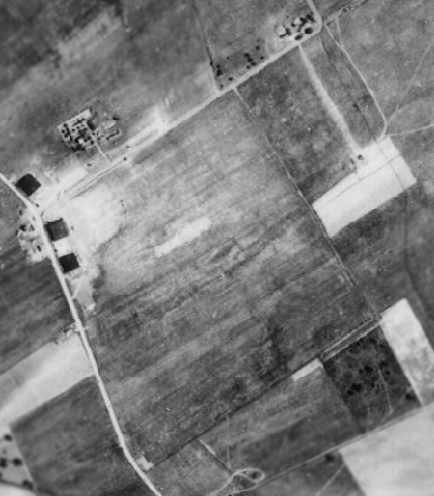
A circa early 1930s aerial view depicted Hadley Field as a square-shaped grass field,
with 2 hangars along the west side of the field.

The 1934 U.S. Navy Aviation Chart (courtesy of Chris Kennedy)
depicted Hadley Field s consisting of a roughly square-shaped field.
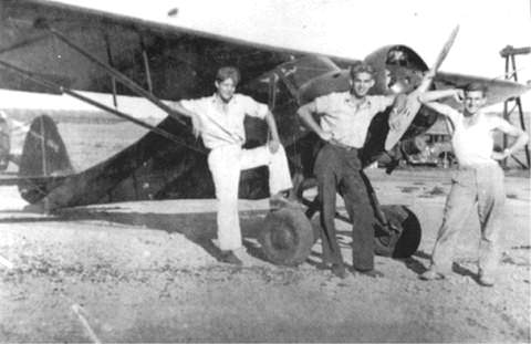
A circa 1934 photo of the Allen brothers & a friend, posing in front of an unidentified aircraft at Hadley Field.

An aerial view looking northwest at Hadley Field, from the Airport Directory Company's 1937 Airports Directory (courtesy of Bob Rambo).
The directory listed Hadley Field under the name of "New Brunswick", without referring to the actual name of the airfield, inexplicably.
It described the field as consisting of a 1,900' sod square, and pictured 2 hangars along the southwest corner of the field.
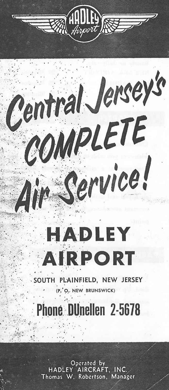
A crica 1930s brochure for Hadley Airport (courtesy of Khadi Madama).
Khadi
Madama recalled, “My father, Anthony [Madama] had served as a
photographer on location between 1939 & up until WW2
filming almost all of the Civil Air Patrol maneuvers that occurred at Hadley Airport.”
A 1940 aerial view depicted Hadley Field as a square-shaped grass field,
with 2 hangars along the west side of the field.
Several light aircraft were visible around the hangars.
Jacqueline Beusse recalled, “My mother won a contest at Hadley Airport when I was 4.
She was always interested in aviation. Her prize was a flight in an open-cockpit aircraft.
My father held onto my hand with my brother holding his other hand.
I remember the plane in the air. But not much more.
Much later I was told the pilot of the plane my mother was a passenger in was a stunt pilot and also carried mail for US Mail Service.
I do not think there was any tower in 1940.”
The 1944 US Army/Navy Directory of Airfields (courtesy of Ken Mercer)
described Hadley Field as having a 2,700' unpaved runway.
The remarks said, "Restricted to Civil Air Patrol" (most likely a temporary measure during WW2).
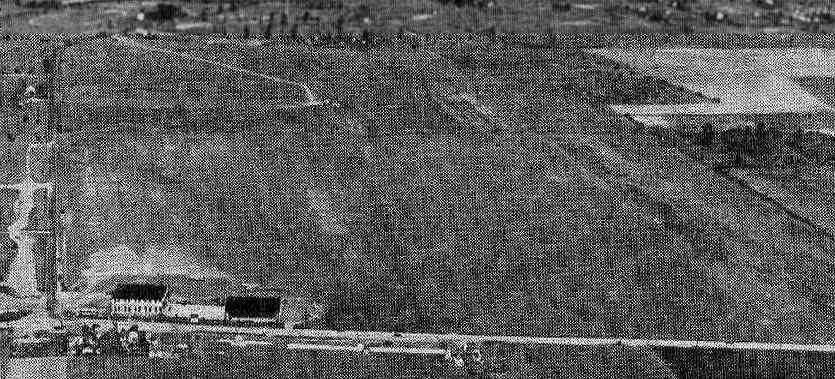
An aerial view of Hadley Field from the Haire Publishing Company's 1945 Airport Directory (courtesy of Chris Kennedy).
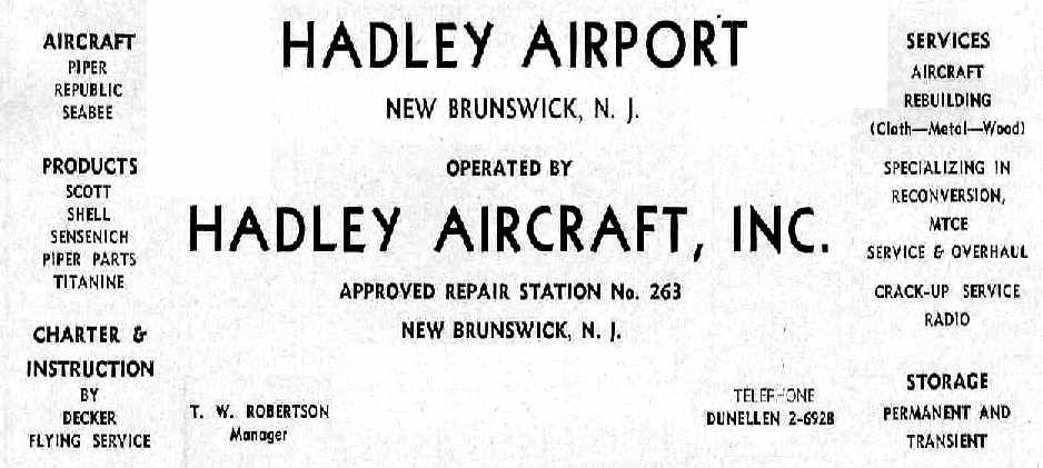
An advertisement for Hadley Field from the Haire Publishing Company's 1945 Airport Directory (courtesy of Chris Kennedy).
According to the History of South Plainfield, "Bendix Aviation experimental planes & helicopters were tested at Hadley Airport."

A 6/30/45-11/30/45 photo of the sole prototype of the Bendix Model K coaxial helicopter, seen undergoing flight testing at Hadley Field.
It was flown initially unshrouded, then eventually with an enclosure to support development of the bigger Model J.
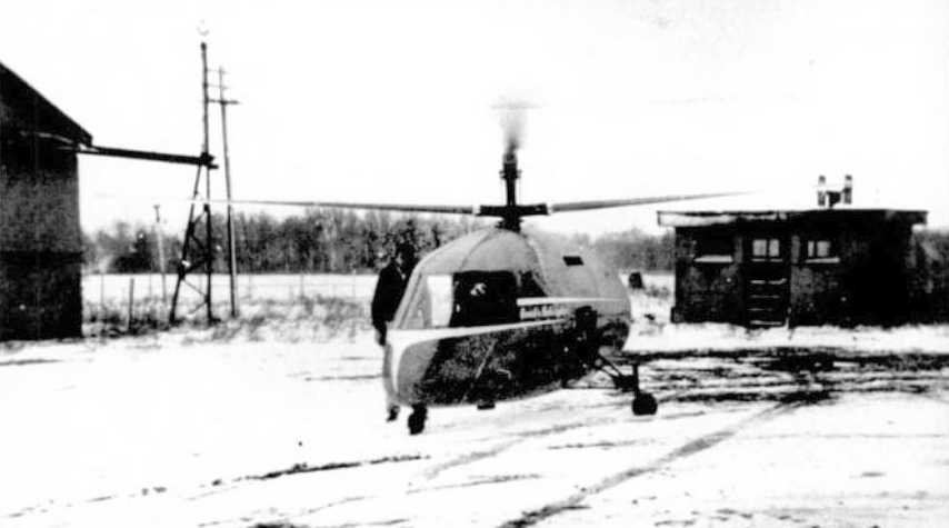
An undated view of a rare Bendix Model J helicopter (c/n 2), seen undergoing flight testing at a snowy Hadley Field.
The Bendix J had an unusual coaxial counterrotating rotor configuration.
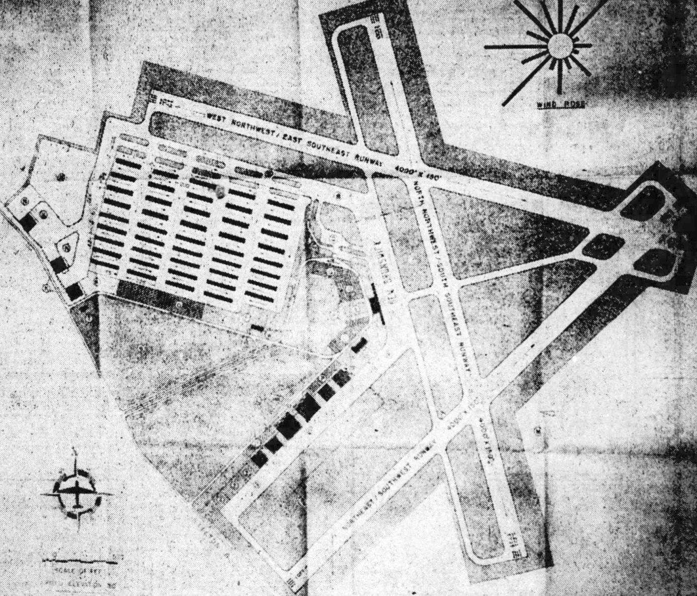
A “Proposed development of Hadley Airport” from the 7/5/46 New Brunswick Home News.
The elaborate layout featured 3 runways & a huge array of hangars, which apparently never came to fruition.
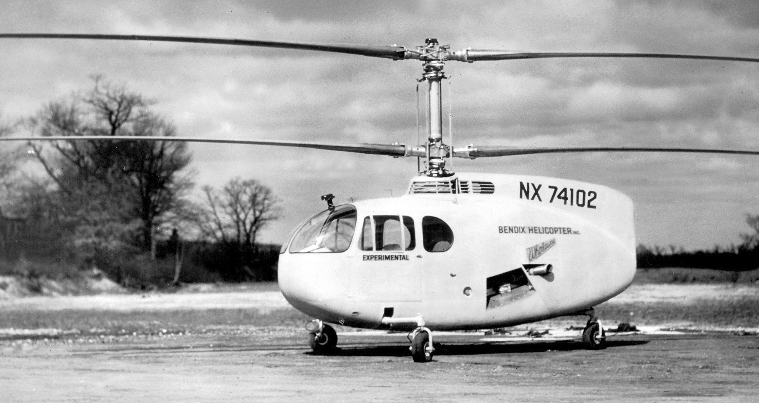
A circa 1946-47 photo of a rare Bendix Model J helicopter (c/n 2) at Hadley Field.
Khadi Madama recalled, “My mother, Grace Madama, was a student pilot in 1946 at Hadley Airport, which historically was also a flight training center.
She loved when the plane flew upside down & other exciting maneuvers.
Grace took her lessons at Hadley Airport, because of the connection she & my father had with the Civil Air Patrol
and was also instrumental in the 'Canteen' that was located on site to feed all of the civilian volunteers.
Unfortunately, Grace was not able to complete her training because she became pregnant with me & believe me, I never heard the end of it!”
The August 1946 NY Terminal Aeronautical Chart (courtesy of Tim Zukas) depicted Hadley as a commercial airport.
A 1947 aerial view showed that Hadley Field had gained 2 asphalt runways at some point between 1940-47.
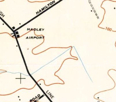
The 1947 USGS topo map depicted Hadley Airport as an open field with several small buildings on the west side.
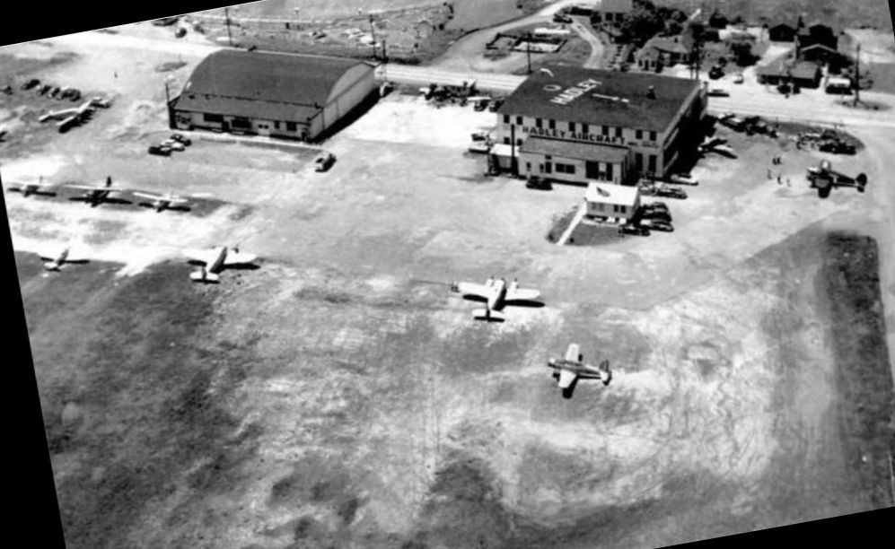
A circa 1950-58 aerial view looking southwest at Hadley Field's hangars, located along Stelton Road.
A total of 10 aircraft were visible, including 2 Cessna Bobcat twins & a surplus Vultee Valiant in the foreground.
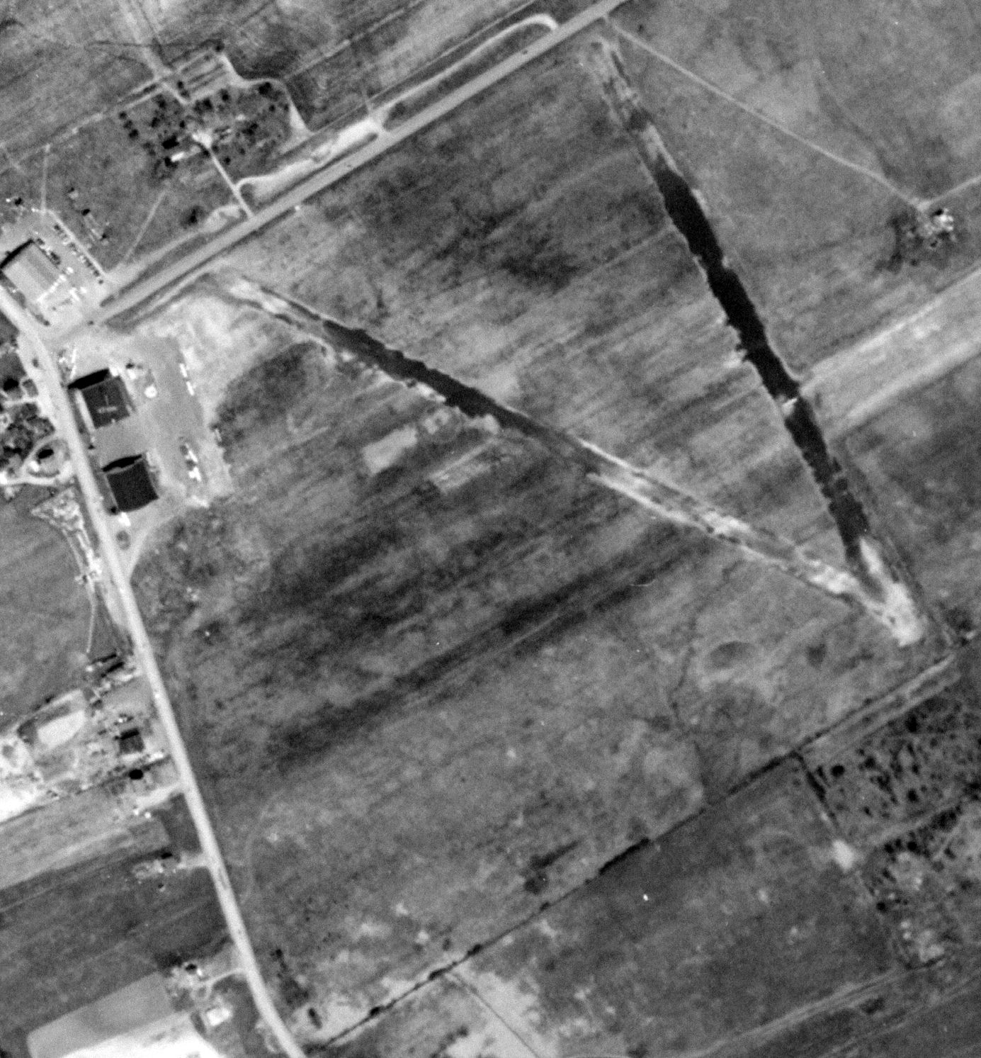
A 4/24/53 USGS aerial view depicted 4 aircraft parked around the Hadley Field hangars.

A photo of 11-year-old Wayne Hansen & a puppy in the cockpit of a plane during a Cub Scout outing to Hadley Field, published in the 5/24/54 Newark Star Ledger.
Wayne recalled, “In spite of the newspaper caption, the puppy was not mine. I remember someone saying 'Put the puppy on the boy's lap, it will make a great picture.'”
Ed Wolf recalled, “Hadley Airport... that's where I learned how to fly in 1955.
After getting my license, I owned 3 different airplanes which I kept there.
A PT-19 which I kept hangared, an Aeronca 7AC & a Cessna 140 which were tied down on the field.
The field was operated by 'Robbie' Robertson, who I understand was a legend in his own right.”
Michael Robertson reported, “I am the grandson of Thomas Robertson who operated Hadley Airfield.
My father, Michael C. Robertson (youngest son of my grandfather) along with my uncles always share fond memories of growing up around Hadley & flying planes.”
Khadi Madama recalled, “I loved driving out to Hadley Airport into the mid-1950s with my father, Anthony Madama, which we did every weekend.
The sight of all of the planes & stepping into the hangars is still with me today. It was exhilarating.”
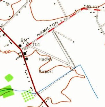
The 1955 USGS topo map depicted Hadley Field as having 2 paved runways & 3 buildings on the west side of the field.
A 1956 aerial view depicted a significant increase in the number of aircraft visible at Hadley Field – 14.
A 1957 aerial view depicted 15 aircraft visible at Hadley Field.
Mel Haynes Sr. recalled, "I grew up in Edison & took flying lessons at Hadley as did my father.
I soloed there, got my private there & was a line boy & shop monkey there for a few years."
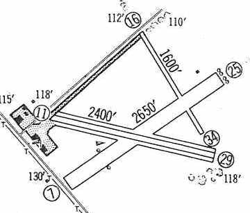
The 1960 Jeppesen Airway Manual (courtesy of Chris Kennedy)
depicted Hadley Field as having 3 unpaved runways (with the longest being the 2,650' Runway 7/25),
as well as a ramp on the west side of the field with several buildings.
Chuck Heller recalled, “I used to go to Hadley with my dad to watch the planes in the very early 1960s.”
A 1963 aerial view of Hadley Field showed 23 aircraft on the field.
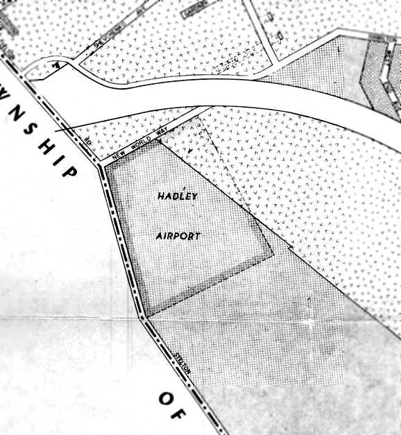
A 1966 Zoning Map of South Plainfield depicted Hadley Airport as having a rectangular outline.
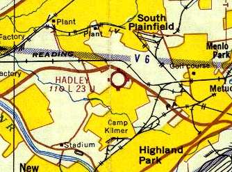
The 1967 NY Local Aeronautical Chart (courtesy of Mike Keefe) described Hadley as having 3 turf runways, with the longest being 2,345'.
Heber MacWilliams recalled, “I learned to fly at Hadley Airport in 1967.
My fist lesson was 3/31/67, with instructor Richard Beck, in Aeronca 7AC N83219.
I started flying with Ed Cashin on my 5th lesson & continued with him for the rest of my training. We were a good 'fit'.
One day he took me up for a loop in one of the Champs. It's the only time I've been upside down in an airplane.
My first solo was 6/21/67, with instructor Ed Cashin, in Aeronca 7AC N83219.
At Hadley I flew the following Aeronca 7AC aircraft: N83219, N84528, N84394, N83045.
I flew the following Aeronca 7EC aircraft: N8550E & N9857Y, and a C172 N9854T.
The charge for one hour of dual flight instruction at Hadley in 1967 was $15: $10 for the plane & $5 for the instructor. Those were the days.”
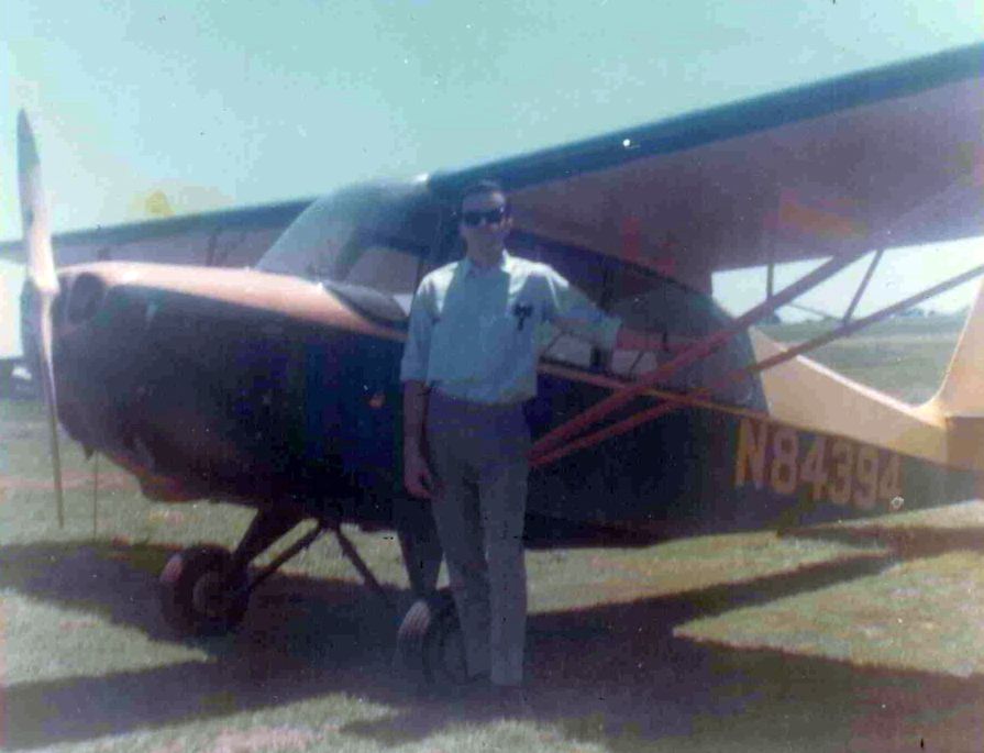
A Summer 1967 photo of Heber MacWilliams “at Hadley with one of the Aeronca 7AC Champs I learned to fly in.”
Mel Haynes Sr. recalled, "When they reenacted the airmail flight around 1967 or 1968 I propped the Jenny & made the papers.
I really enjoyed working there & knew many of the locals & legends, Tom Robertson in particular."

Two 1968 aerial views of Hadley Field by Mac Mayercik.
Mac recalled, “I learned to fly there & had a Champ in 1967-68, before moving it to Somerset Hills, also [now] gone.”

The last airport directory listing which has been located of Hadley Field was in the 1968 Flight Guide (courtesy of Robert Levittan).
It depicted Hadley as having 3 unpaved runways, with the longest being the 2,345' Runway 7/25, and with a ramp with 3 buildings on the west side.
Heber MacWilliams recalled, “My last Flight from Hadley was 8/29/68, in Aeronca 7AC N84394, 2 months before Hadley was closed.”
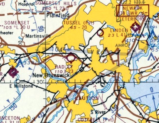
The last aeronautical chart depiction which has been located of Hadley Field was on the October 1968 NY Sectional Chart.
It depicrted Hadley as having a 2,300' unpaved runway.
According to Peter Maefield's 1972 Wings Club of NYC speech (courtesy of Dave Kanzeg),
“Hadley was finally closed on 11/1/68”, after 44 years in operation.
According to Tom Beamer, "After it closed there was a big auction (unfortunately I didn't attend).
Among the items auctioned were parts from mailplanes of the 1920s."
In a 1996 report by the New Jersey General Aviation Study Commission's Subcommittee on Airport Closings,
reasons were given for the closing of 13 New Jersey general aviation airports.
According to the report, "Hadley Airport would have needed a costly upgrade in order to survive.
The community was opposed to preservation of the airport
and the land was sold to a developer, who erected a shopping center, industrial park, and hotel."
Hadley Field was no longer depicted on the April 1969 NY Sectional Chart.
A 1969 aerial view showed that a new road had been cut through the center of Hadley Field.
The 2 runways were still recognizable, but both hangars had been removed.
A 1970 aerial view showed that portions of the 2 runways were still recognizable.
A 1972 aerial view showed that Hadley Field had been covered with new construction, with not a trace remaining of the airport.
According to Douglas Wright, "The name lives on, at least,
immortalized in the name of the shopping mall that covers part of the site."
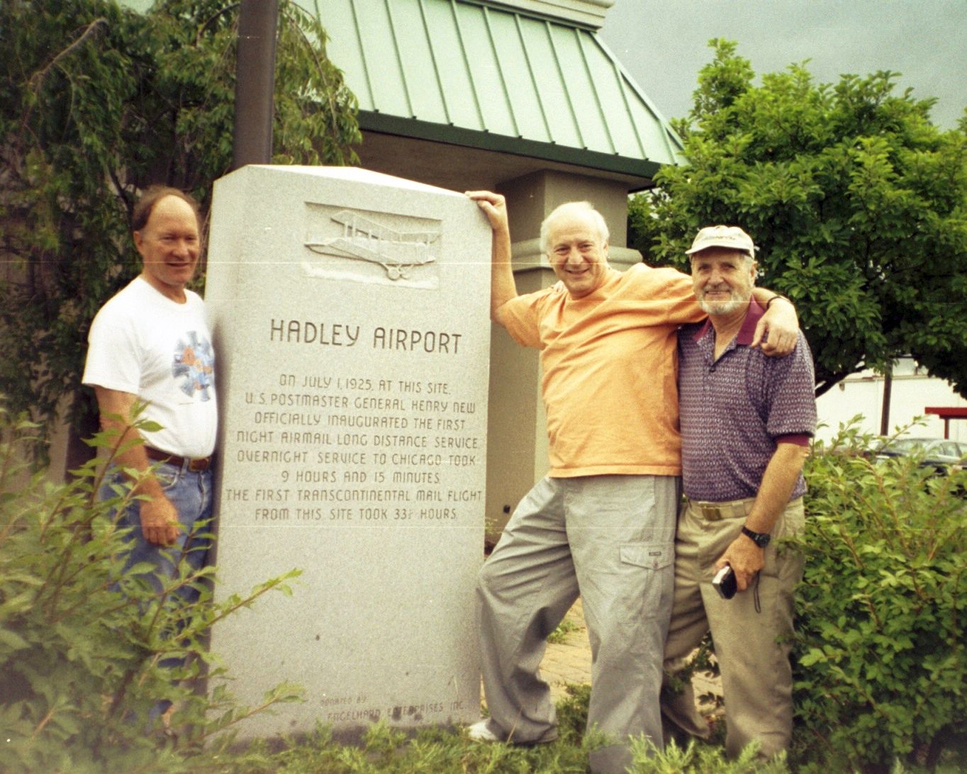
A 2001 of Bill Leavens, Captain Barry Schiff, and Michael Stoddard with the engraved stone memorial which sits at the site of Hadley Airport (courtesy of Joseph DuPont).
Peter Angelou reported in 2005, “Both of the hangars that were located at Hadley were sold & moved to Blairstown Airport where they were both erected...
only one was completed... the other having only the framework erected.
It still is sitting there today... 'bare boned'.”
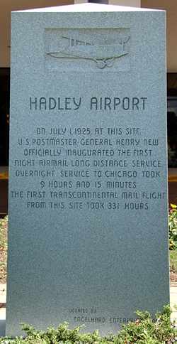
A 2007 photo by Jack McKillop of an engraved stone memorial which sits at the site of Hadley Airport.
Jack reported in 2007, “Part of the old airport is now a Holiday Inn.”
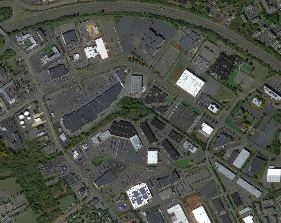
A 2014 aerial photo showed not trace remaining of Hadley Field.
The site of Hadley Field is located at the intersection of Route 529 & Hadley Road (appropriately enough).
See also: http://www.airmailpioneers.org/history/HadleyField.htm
…………………………………………………………..
In 1955 Hadley Field gained an unusual neighbor - an Army Nike surface-to-air missile battery.
South Plainfield Battery NY-65 was a 2-magazine Nike missile battery,
first manned by Regular Army units & later by the NJ Army National Guard.
The Integrated Fire Control Site for the Nike battery was located east of Durham Avenue
The Launch Site was located at the intersection of Hadley Road & Durham Avenue, close to the southern edge of Hadley Field.
The South Plainfield battery was originally equipped with 20 first-generation Nike Ajax missiles.
The earliest photo which has been located of the South Plainfield Nike battery was a 1956 aerial view.
NY-65 was chosen as one of a subset of Nike batteries to be upgraded
to the significantly more capable 2nd-generation Nike Hercules missile, the first of which arrived at the NY-65 Battery in 1961.
Battery NY-65 was eventually equipped with 12 Nike Hercules missiles.
The last photo which has been located showing the battery was a 1970 aerial view.
The South Plainfield Nike battery remained operational until 1971.
A 1972 aerial view showed the above-ground portion of the missile launchers had been removed, but the site otherwise remained intact.
A 1979 aerial view showed the launch site was still relatively intact, but used for parking.
All remains of the Nike missile site were subsequently obliterated (just like the historic Hadley Field).
A 1987 aerial view showed that a shopping plaza had covered the launch site at some point between 1979-87.
____________________________________________________
North Brunswick Airport, North Brunswick, NJ
40.468, -74.486 (Southwest of New York, NY)
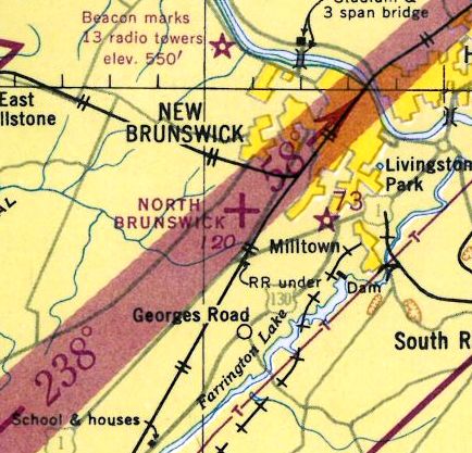
North Brunswick Airport, as depicted on the August 1946 NY Terminal Aeronautical Chart (courtesy of Tim Zukas).
The North Brunswick Airport was evidently established at some point between 1945-47,
as no airfield was depicted at this location on a 1940 aerial photo nor on the 1945 NY Sectional Chart.
According to Joseph Novelli, “The property located at 1202 Airport Road... I obtained deeds for the property
and learned that Aeromotive Corporation purchased the lot (which was probably part of a larger lot) in 1945.”
The earliest aeronautical chart depiction of North Brunswick Airport which has been located
was on the August 1946 NY Terminal Aeronautical Chart (courtesy of Tim Zukas).
It depicted North Brunswick as an auxiliary airfield.
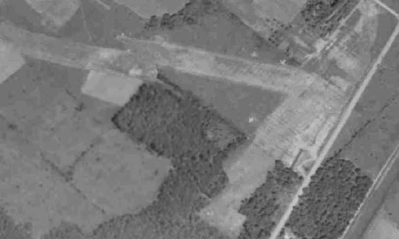
The earliest photo of North Brunswick Airport which has been located was a 1947 aerial view.
It depicted North Brunswick as having 2 grass runways, oriented northwest/southeast & northeast/southwest.
A total of 6 light aircraft were visible on the east side of the field, along with a long hangar building.
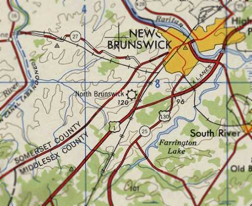
North Brunswick Airport, as depicted on the 1947 USGS topo map.
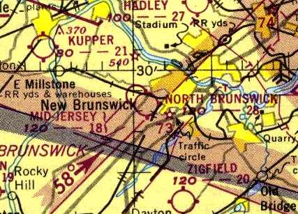
The 1950 NY Sectional Chart (courtesy of Mike Keefe) depicted North Brunswick as having a 2,800' unpaved runway.
Gus Kuhlman recalled, “North Brunswick had an airport for quite a while.
Off Jersey Avenue there's a road called Airport Road; it's industrial [now].
That was an airport - it ran from Jersey Avenue up to Route 27.
A friend of mine had an airplane there that we used to fly.
One time when I was the police commissioner, we got a call about an airplane wreck in the woods south of that.
We went down there, and it was the son of the fellow who owned the airport.
He had gotten his solo license, and he was out practicing. That was a very active airport at the time.”
Gorge Fisch recalled, “In 1952 we moved to North Brunswick. I use to ride my bike to North Brunswick Airport & watch the planes takeoff & land.
The best time was at 3:30 PM weekdays. A DC-3/C-47 would land & deliver the daily airmail as well as other cargo.
What made this so incredible to watch was the way they had to bring the plane in to land. The runway was short for a plane this size.
They also had to clear the live wires of the Pennsylvania Railroad. The used a technique called 'crabbing', a way to slow the plane down but still maintain power.
The pilots would make their approach, sliding the plane in sideways. Once they cleared the PRR electric wires, they would straighten-out, power back & touchdown.
Their takeoffs were equally challenging. They would get as close to the end of the runway as possible, set brakes, go to full flaps, go to full power & then release the brakes.
They would clear the PRR powerlines & off they were.
I actually got to watch a Ford Tri-Motor land there once. It appeared to be much more manageable on that short field.”
A 1953 aerial photo depicted 11 light aircraft on the east side of North Brunswick Airport.
A 3rd much longer northwest/southeast runway had been added at some point between 1947-53,
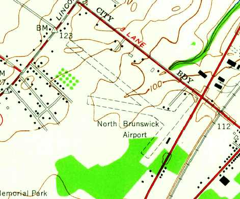
The 1954 USGS topo map depicted North Brunswick as having 3 unpaved runways & a few small buildings.
Arthur Stoller recalled, “In the summer of 1955 I began flying & training for my private license at the North Brunswick airport using the GI Bill.
My instructor was Art Rooney, a fine instructor & a great guy.
The airport was owned by a gentleman named Walt Gingrich.
He had a daughter Barbara (who I used to tutor in her high school physics), and a son named Bruce.
They had 3 yellow Aeronca Champs 7A2 that were used for training, and for giving people local rides.
According to my log book, the numbers of these Aeronca's were: 83219, 3418E, and 1840E.
Ground school was held in their small office building. It cost $6/hour (including fuel) to rent a plane solo.
Since the GI Bill covered 2/3 of the cost, it cost me $2 per hour to fly.”
Arthur continued,. “Walt's son Bruce was 15 years old & was bought up around the airport, and was taking flying lessons for years.
There were 3 instances where he was written up in the New Brunswick newspaper, The Daily Home News.
The first time, was when he had his first solo on his 16th birthday.
He soloed a twin-engine plane, and was written up as the youngest multi-engine pilot in the country.
The second time was when another plane was attempting to land,
but one landing gear deployed, but the other would not come down.
Bruce stood on the back of a pick-up truck which was driven along the runway,
and he held up the wing until the aircraft had lost most of its speed.”
A 1956 aerial view showed that North Brunswick Airport had gained a 2nd row of T-hangars, and a total of 8 light aircraft were visible on the field.
A 1957 aerial view depicted North Brunswick Airport in a similar manner.
Karol Franzyshen recalled, “I started flying out of North Brunswick Airport on 3/8/58.
My instructor was Ethel Shaffer; she & her husband were co-owners of the airport.
Her husband was a WW2 pilot & she was a WW2 ferry pilot ferrying fighters & bombers to Europe.
I started 3/8/58 solo checked by Walt Surgriala #32810 on 12/28/58. Total time to solo 13 hours at $6/hour for a total of $87.”
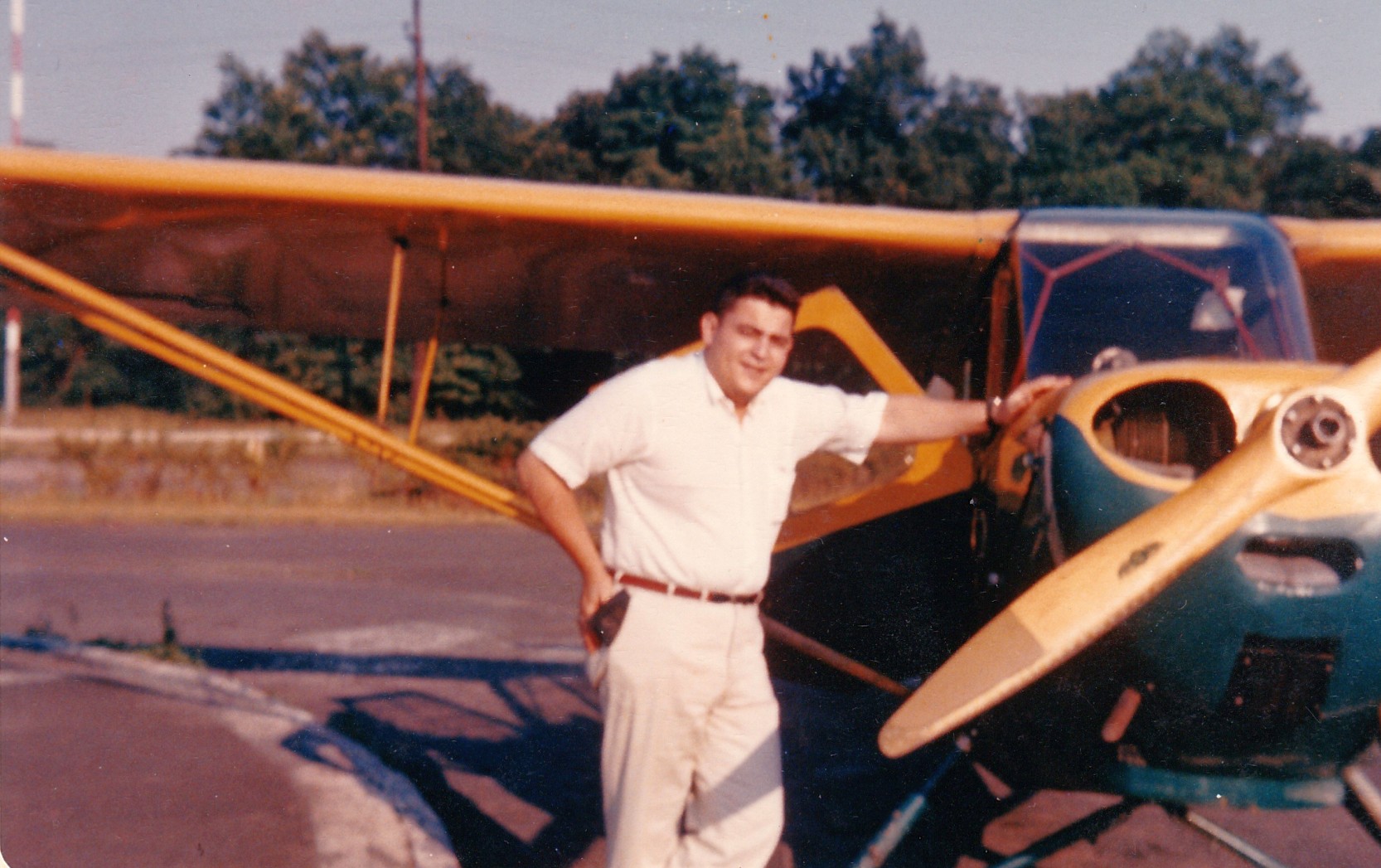
A circa 1960-63 photo of Henry Gurshman with one of the rental Aeronca Champs at North Brunswick Airport.
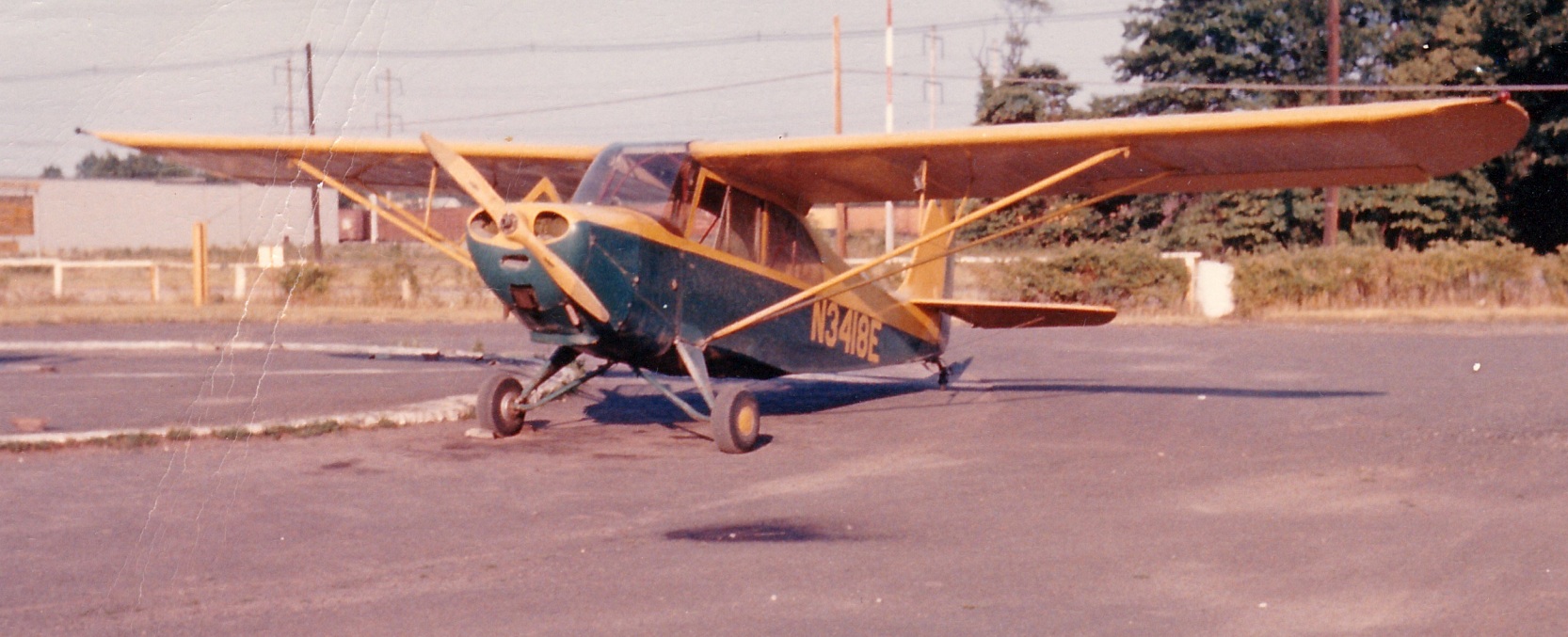
A circa 1960-63 photo (courtesy of Henry Gurshman) of one of the rental Aeronca Champs at North Brunswick Airport.
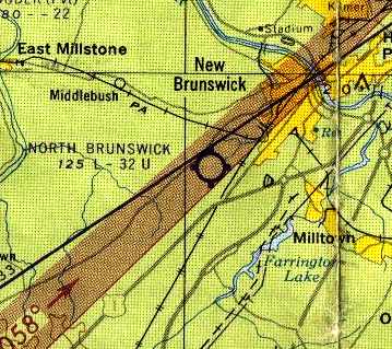
The 1962 NY Local Aeronautical Chart (courtesy of Mike Keefe) depicted North Brunswick as having a 3,200' unpaved runway.
The 1962 AOPA Airport Directory described North Brunswick as having 3 sod runways, with the longest being the 3,400' Runway 14/32.
The field was described as offering major repairs, hangars, tiedowns, charter, and fuel, and the operator was listed as Aeromotive Corporation.
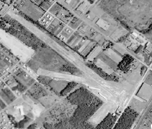
The last photo which has been located of the North Brunswick Airport was a 1963 aerial view.
It showed that North Brunswick had gained a 3rd set of T-hangars, west of the runway intersection, at some point between 1957-63.
Only 4 light aircraft were visible parked outdoors at the field.
Arthur Stoller recalled, “After the airport had been there for many years,
someone built a housing development just beyond the far end of the runway.
Pretty soon calls were coming in to complain about the noise when planes took off.
I could never understand why anyone would buy a house at the end of a runway, and then be surprised to hear aircraft noise.
At any rate, we were asked to dog-leg off to the right as soon as we had enough altitude.”

The last depiction which has been located of North Brunswick Airport was on the 1965 NY Sectional Chart.
It depicted the field as having a 3,200' unpaved runway.
In a 1996 report by the New Jersey General Aviation Study Commission's Subcommittee on Airport Closings,
reasons were given for the closing of 13 New Jersey general aviation airports.
According to the report, "In the case of North Brunswick Airport,
the end of G.I. Bill training caused the downturn of development off the end of the runway & contributed to the decision to sell.
North Brunswick Airport was another case where encroachment contributed to an airport's closing.”
According to Joseph Novelli, deeds for the property located at 1202 Airport Road showed that Aeromotive Corporation sold the lot in 1965.
North Brunswick Airport was evidently closed at some point between 1965-66,
as it was no longer depicted on the March 1966 NY Sectional Chart or the 1969 USGS topo map.
A 1969 aerial photo showed that 2 large industrial buildings had been built over the eastern portion of the North Brunswick Airport site,
and housing developments covered the western portion.
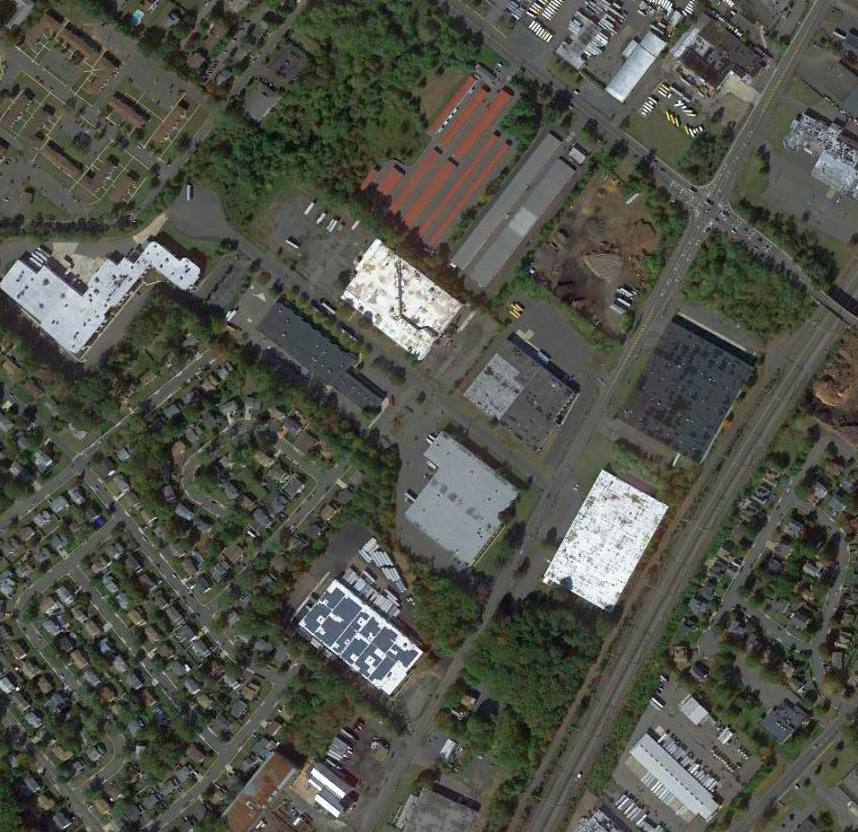
A 2014 aerial view showed no trace remaining of North Brunswick Airport.
The site of North Brunswick Airport is located at 1200 Airport Road, appropriately enough.
Thanks to Neal Dillman for pointing out this airfield.
____________________________________________________
40.61, -74.319 (West of New York, NY)
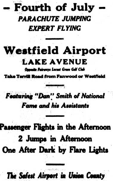
A July 1928 advertisement for a parachute jumping exhibition at Westfield Airport (courtesy of Mark Hess).
According to a talk given by former Mayor Garland Boothe at a meeting of the Westfield Historical Society,
E.R. Crow, the owner of the former Westfield Ford agency on North Avenue,
helped select the site for the airport during the summer of 1928.
He served as the Westfield Airport Corporation’s 1st president while Alan Bruce Conlin served as the airport’s lawyer.
Westfield debuted its airport on 10/21/28 (although some newspaper clippings indicate the airport opened on 3/31/29).
The airport was located on what was previously farmland.
An 11/23/55 article (courtesy of Mark Hess) observed, “The field started out in 1928 with predictions of big success.”
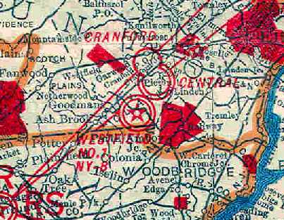
The earliest depiction of the Westfield Airport which has been located
was on the 1930 Rand-McNally Air Trails Map (courtesy of Chris Kennedy).
It depicted as Intermediate Field #1 along the NY-B Airway (New York to Baltimore?).
The field's operator was listed as the Atlantic Air Service, and it was described as having 3 runways,
with the longest being the 2,500' northeast/southwest strip.
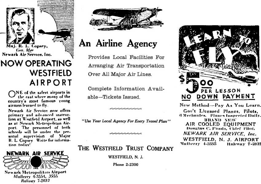
Three 1931 advertisements for Newark Air Service & The Westfield Trust Company, operating from Westfield Airport (courtesy of Mark Hess).
A third anniversary dinner was held for the airport in 1931 at the Echo Lake Country Club, attended by State Senator Arthur Pierson.
Garland Boothe explained that Westfield Airport was fairly large,
with 3 runways, the longest of which was 2,700' (and eventually located parallel to the Garden State Parkway).
The facility also had 2 hangars located across the Clark Township & Union County line in Woodbridge.
"The airport was typical of the day, grass strips, biplanes & loud authoritative piston engines", according to Garland.
There was no air traffic control at the airport. The main runway was located behind Madison Hill Road in Clark.
Garland explained that the 1st pilot to land a plane at the airport was the late Cap Smith, a Westfield realtor.
Smith landed periodically at the Westfield Airport.
The earliest aeronautical chart depiction which has been located of Westfield Airport
was on the November 1931 NYC-Albany Air Navigation Map.
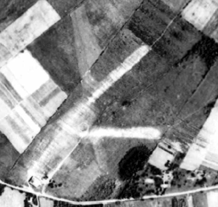
A 1931 aerial view depicted Westfield Airport as having 3 unpaved runways, with a hangar on the southwest corner of the field.
A circular airport marking was visible near the runway intersection.
According to Garland Boothe, Cap Smith landed at the Westfield Airport in May of 1938
to pick up some letters as part of a celebration to mark the 20th anniversary of air mail.
Bob Buck, formerly of Trinity Place & who used to fly a glider at the airport with a friend,
set an altitude record out of Westfield Airport of over 15,000' while using oxygen.
This flight almost became a tragic one, however, when the pilot could not find his way down through storm clouds.
Buck finally found a hole in the clouds over Summit & returned home with a realization that flying that day,
which had been against the advice of others at the airport, had not been such a good idea.
Westfield Airport hosted parachute jumps (one of which resulted in a fatality), air races & aerobatics as well as rides.
A big air meet was held in June of 1931, co-sponsored by the Westfield real estate board,
which included warbirds & planes from World War I.
Westfield Airport was not yet depicted on the August 1932 NY Sectional Chart.
The Airport Directory Company's 1933 Airport Directory (courtesy of Chris Kennedy)
described Westfield as having 3 runways, with the longest being 1,800'.
A hangar was said to have "Westfield" painted on the roof.
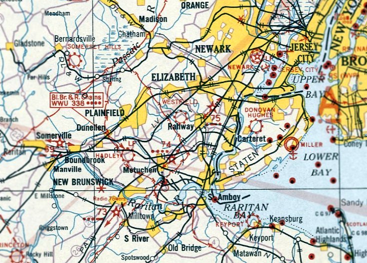
The April 1933 NY Sectional Chart depicted Westfield Airport as a commercial/municipal field.
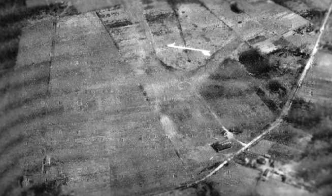
An aerial view looking east at Westfield Airport
from the Airport Directory Company's 1937 Airport Directory (courtesy of Bob Rambo).
The directory described Westfield as having 3 sod runways,
with the longest being the 2,600' northeast/southwest strip.
A single hangar on the southwest side of the field was said to have "Westfield" painted on the roof.
A 1940 aerial view depicted the hangar at the southern end of the field, but there were no aircraft visible outside.
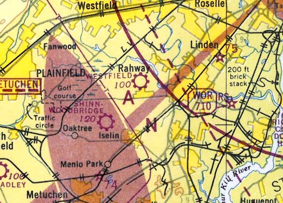
The 1946 NY Terminal Aeronautical Chart (courtesy of Tim Zukas) depicted Westfield as a commercial/municipal airport.
A 1947 aerial view depicted a total of 23 light aircraft parked at Westfield Airport.
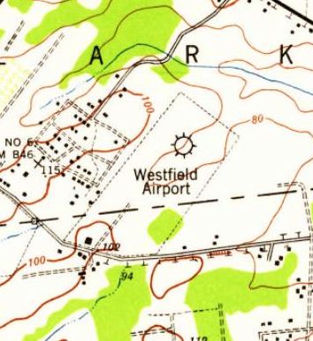
The 1947 USGS topo map depicted Westfield Airport as a rectangular clearing with a single building on the southwest side.
Carl Frank recalled, “The hangar & operations 'shack' were in Colonia (Woodbridge).
I only recall 2 runways. The runways were in Clark.
The east/west runway was clipped to permit the Parkway roadway to cleave its was through New Jersey. That was in 1947-48.
The dividing line between Middlesex County & Union County was at the south edge of the east/west runway.
This runway was then to be called the 'Short Runway'.
The airport was forever noted as the Westfield Airport. Truly it should be called Westfield's Airport.”
George Manser recalled, “In July 1952, I was a passenger in an aircraft that crashed on the farm across from the airport.
I recovered from my injuries & took an aircraft solo up on my 16th birthday, 11/13/53.”
An 11/23/55 article (courtesy of Mark Hess) observed:
“Operations began running into different obstacles which eventually resulted in the field's demise.
In 1952 an attempt was made by resident groups of Clark, Colonia, Westfield, Rahway and Scotch Plains to have the field closed because of alleged stunt flying by pilots.
The airport management was cleared of the charges by state aeronautical experts, but was forced to change its flight patterns thereafter.”
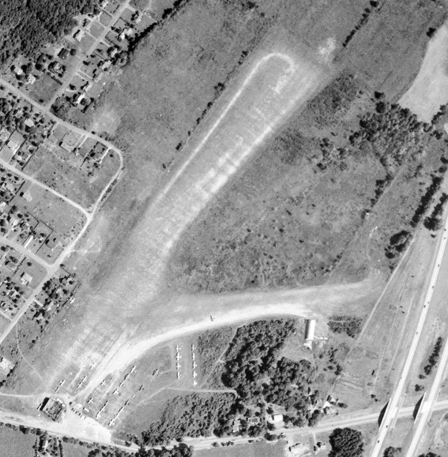
A 9/2/54 USGS aerial view depicted Westfield Airport perhaps at its zenith of popularity, with over 33 light aircraft parked on the southwest side.
An 11/23/55 article (courtesy of Mark Hess) observed: “Litigation suits brought the ownership of the airport to courts,
which resulted in the property being purchased by a building concern a year ago.”
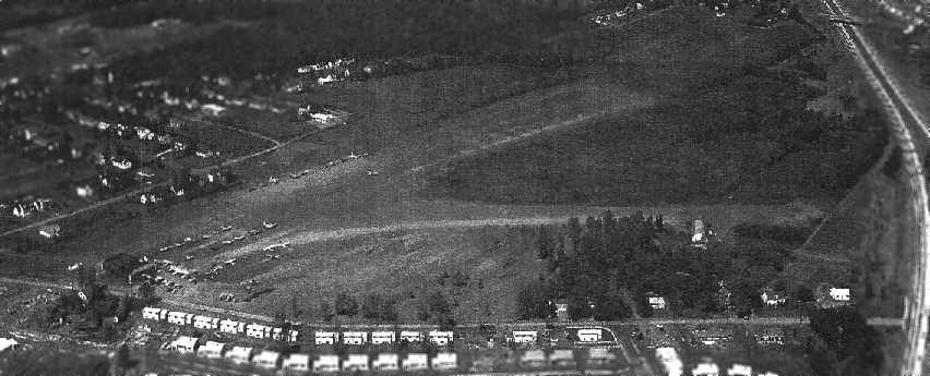
A 1955 aerial view looking north at Westfield Airport (by Carl Frank, courtesy of George Manser)
showed the field to have 2 grass runways, oriented east/west & northeast/southwest.
Note the Garden State Parkway bordering the field to the east,
and the numerous houses which had started to surround the field (and would be the ultimate cause of its demise).
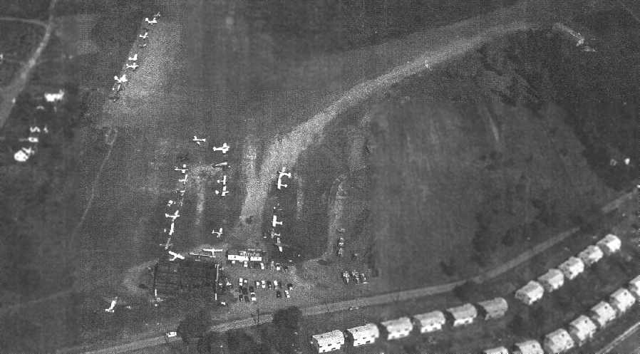
A 1955 aerial view looking northeast at Westfield Airport (by Carl Frank, courtesy of George Manser).
A single dark hangar was located at the southwest corner of the field, along with an office building which had “Westfield” painted on the roof.
Another Quonset-hut type building is visible at the right side of the photo.
A total of over 30 light aircraft were visible parked at the field.
George Manser recalled, “My last flights at Westfield Airport
were during my leave time from the Air Force in the Summer of 1955.
There were many pilots that learned to fly at this airport who went on to bigger & better things in aviation.
Many careers started at Westfield Airport, covering the entire gamut of aviation.”
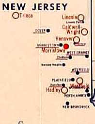
The last depiction of the Westfield Airport which has been located
was on a 1955 NY State Department of Commerce map of airports.
An 11/23/55 article entitled “Westfield Airport To Close Sunday” (courtesy of Mark Hess) observed:
“After 27 years of operation, the Westfield Airport will close its operations Sunday.
Rick Decker, airport operator, stated he has already transferred most of his activities to Somerset Hill Airport, Basking Ridge.
The builder, Sommer Brothers Construction Co., plans to construct 93 homes on the site, most of which are reported already sold.”
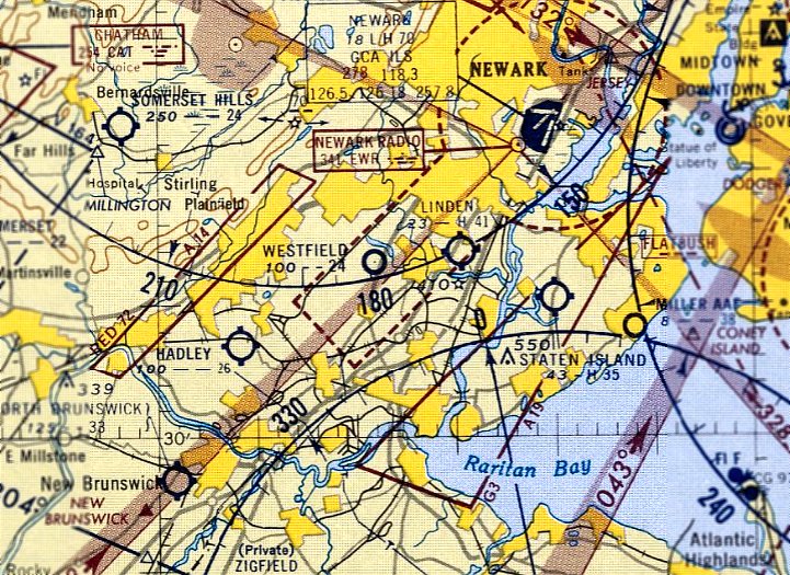
The last aeronautical chart depiction which has been located of Westfield Airport was on the June 1956 NY Sectional Chart.
It depicted Westfield as having a 2,400' unpaved runway.
The 1956 USGS topo map no longer depicted Westfield Airport,
but instead showed the newly-built Garden State Parkway cutting through the eastern portion of the former property.
Westfield Airport was no longer depicted on the January 1957 NY Sectional Chart.
A 1957 aerial view showed that houses had covered the southern portion of the former Westfield Airport,
but the northern portion of the primary runway was still clear.
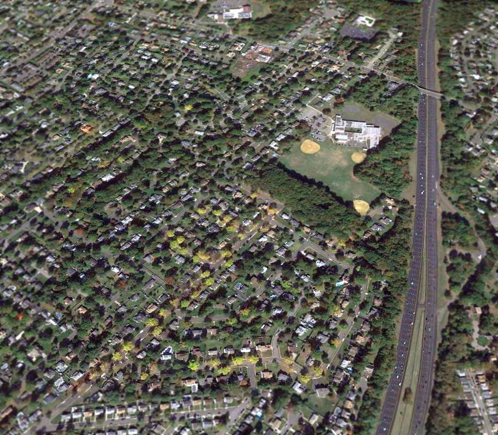
A 2014 aerial view looking north showed no trace appears to remain of Westfield Airport.
The site of Westfield Airport is located northwest of the intersection of the Garden State Parkway & Lake Avenue.
The site of the east/west runway is now Dorset Drive, and the site of the northeast/southwest runway is now Jupiter Street.
Thanks to Kris Fink (whose grandfather worked at Westfield Airport) for pointing out this airfield.
____________________________________________________
40.426, -74.078 (South of New York, NY)
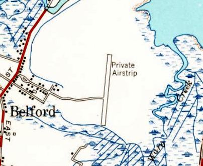
The 1954 USGS topo map depicted Belford simply as "Private Airstrip".
This airfield originally belonged to the J. Howard Smith Fish Factory in Port Monmouth across the Belford Creek
(according to Belford resident Harry Nolan, via John Gorto).
The J. Howard Smith Fish company had a plant there for processing Menhaden,
and they used aircraft to spot schools of fish for the boats.
The Belford Airfield was evidently established at some point between 1947-53,
as a 1947 aerial photo showed an empty field with no sign of aviation facilities,
and no airfield was depicted on the 1949 USGS topo map
or the 1953 NY Terminal Aeronautical Chart (courtesy of Tim Zukas).
The earliest depiction which has been located of the Belford Airfield was a 1953 aerial view.
It depicted Belford as having a single paved north/south runway.
The 1954 USGS topo map depicted Belford as a single north/south runway, labeled simply as "Private Airstrip".
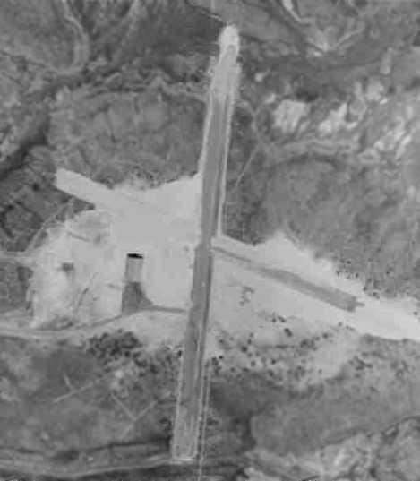
A 1957 aerial view depicted the Belford Airfield as having a single paved north/south runway,
with the crosswind runway apparently under construction.
A hangar had been added at some point between 1953-57 southwest of the runway intersection.
A 1963 aerial view showed that construction had been completed on the paved crosswind runway.
No airfield at this site could be located in either the 1962 or 1982 AOPA Airport Directories.
The airfield wasn't depicted at all on Sectional Charts from 1958, 1965, or 1975,
the 1969 USGS topo map, or the 1979 NY TCA chart (courtesy of Bill Suffa).
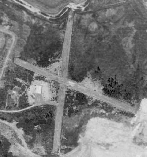
A 1970 aerial view showed the Belford runways.
According to Tom Beamer, “The building was a hangar, I remember it active/open in the 1970s."
A 1979 aerial view showed the 2 runways remaining clear, but both were painted with closed-runway “X” symbols.
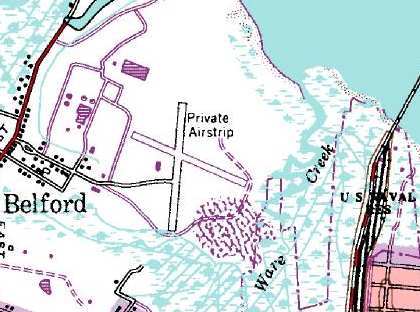
The airfield was depicted on the 1981 USGS topo map, labeled simply as"Private Airstrip".
It depicted the field as having two 1,700' runways, oriented north/south & northwest/southeast.
The Belford Airfield was still depicted on the 1986 USGS topo map.
The Belford Airfield was evidently closed at some point before 1995,
as the 1995 USGS aerial view showed piles of mulch on portions of both runways.
According to Gus Fraser, "Students at Linden use it [the Belford Airfield] to practice off-field landings (down to 500ft)."
Tom Beamer reported in 2003, "Belford is now a municipal mulching operation.”
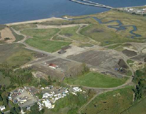
A 2003 aerial view by Rich Galiano, looking northeast at the Belford Airport.
William Angus reported in 2005, “Belford Airfield is owned by Monmouth County
and leased to the Middletown Department of Public Works for $1/year (or some such minimal figure).
Officials were gracious enough to allow me to visit the site & document the operations.
Part of the property is a landfill (now closed). The metal hangar remains but looks like hell.
I spoke with one employee who showed me the interior
and pointed out pipes that led to bathroom facilities for a small apartment for pilots.
I commented the holes in the walls looked like bullet holes,
to which he responded 'There certainly are bullet holes! I know because I put them there as a kid!'
Apparently many of the pilots & their families were hunters.”
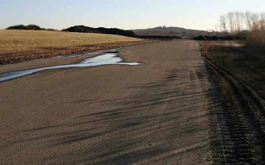
A January 2006 photo by Rich Galiano, “Looking roughly south down the main runway
at the huge piles of leaf compost that give the site a very distinctive pungent odor.
Both runways were clear, with the compost off to the sides, and the asphalt mostly intact.
There are no traces of numbers or X's.”
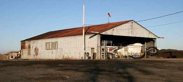
A January 2006 photo by Rich Galiano of “the hangar, full of earth-moving equipment.
I was very surprised to see a wind sock still up on the roof after all the years & hurricanes. What are those things made of?”
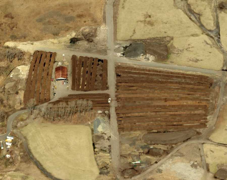
A circa 2006 aerial view looking north at the Belford Airport, showing the 2 runways & the hangar.
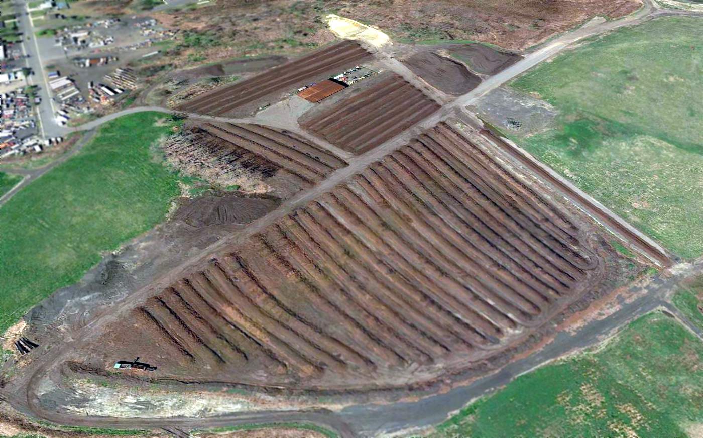
A 2016 aerial view looking northwest at the site of Belford Airfield showed that the remains of both paved runways still existed,
along with a single hangar, southwest of the runway intersection.
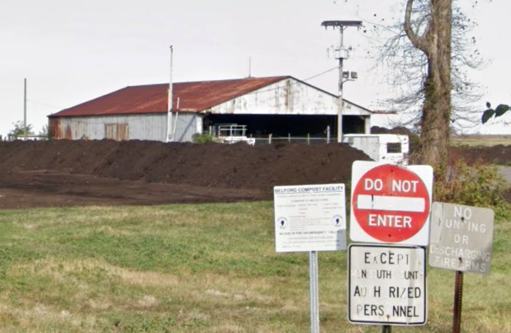
A2019 photo looking northeast at the former Belford Airfield hangar, with the site now designated the Belford Compost Facility.
The Belford Airfield is located at the eastern terminus of Centre Avenue, just east of the town of Belford.
Thanks to Gus Fraser for pointing out this airfield.
____________________________________________________
Aeromarine Factory Airfield / Keyport Airport, Keyport, NJ
40.445, -74.188 (Southwest of New York, NY)
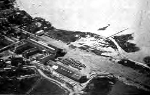
The Aeromarine Airfield, as depicted on an undated aerial view looking northwest
from the 1921 Eytinge's Flying Guide (courtesy of Alex Sheppard).
New York businessman Inglis Uppercu founded the Aeromarine Plane & Motor Company in New Jersey in 1914.
Initially the Boland Aeroplane Company, Uppercu renamed the firm Aeromarine
when Boland died in a crash & his widow sold Uppercu control.
The facilities of the Aeromarine Plane & Motor Company were constructed in 1917 on the east side of Keyport.
The site eventually consisted of several large factory buildings.
An unpaved runway ran in between the factory buildings & the coast, oriented northeast/southwest.
Very quickly the company began developing useful purposes for its Aeromarine Model 40 Flying Boat.
Focusing on mail delivery, these aviation innovators successfully delivered mail to a ship at sea in 1919.
Aeromarine manufactured landplanes, flying boats, engines, and propellers.
Aeromarine employed 900 employees at peak of the First World War.
They produced 200 39-A/39-B aircraft for the USN beginning in 1917,
converted Curtiss /Navy F-5lL & HS-2L flying boats into airliners, built 25 Martin MB-2s as NBS-1s in 1921-22,
designed & built a number of other landplane & flying boats models in small quantities,
and in 1923 built the 1st all-metal flying boat in the US.
Aeromarine's Inglis Uppercu was also credited with invention of the inertial starter.
Aeromarine Airways Inc, began operations in 1919 between NYC & Atlantic City.
They also operated between Key West & Cuba, NYC & Havana, and Cleveland & Detroit, all in Curtiss Flying boats.
The earliest depiction which has been located of the Aeromarine Airfield
was an undated aerial view from the 1921 Eytinge's Flying Guide (courtesy of Alex Sheppard).
It depicted the field as having a single unpaved east/west runway, with factory buildings on the southwest side.
The directory described the “Aeromarine Plane & Motor Company” field
as being 1,800' x 600', with letters on the roof, and indicated the field also had a seaplane station.
Aeromarine Airways ceased operations in 1923.
The Aeromarine-Klemm Corporation began operations in 1928, license building the German Klemm.
The Upper-Burnelli Aircraft Corporation began operations in 1929.
Uppercu was Vincent Burnelli’s backer in his development of lifting body aircraft,
that culminated in the Burnelli CBY-3 Loadmaster built in Canada.
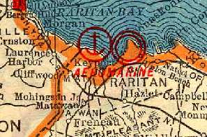
The 1930 "Rand McNally Standard Map of New Jersey With Air Trails" (courtesy of Chris Kennedy)
described the Aeromarine Airport as being operated by the Aeromarine Klemm Corporation.
The field was described as having a single 1,000' northeast/southwest runway. It also depicted the adjacent seaplane base.
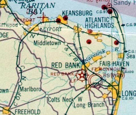
The earliest aeronautical chart depiction which has been located of Keyport Airport was on the November 1931 NYC-Albany Air Navigation Map.
The Aeromarine-Klemm Corporation ceased operations in 1932.
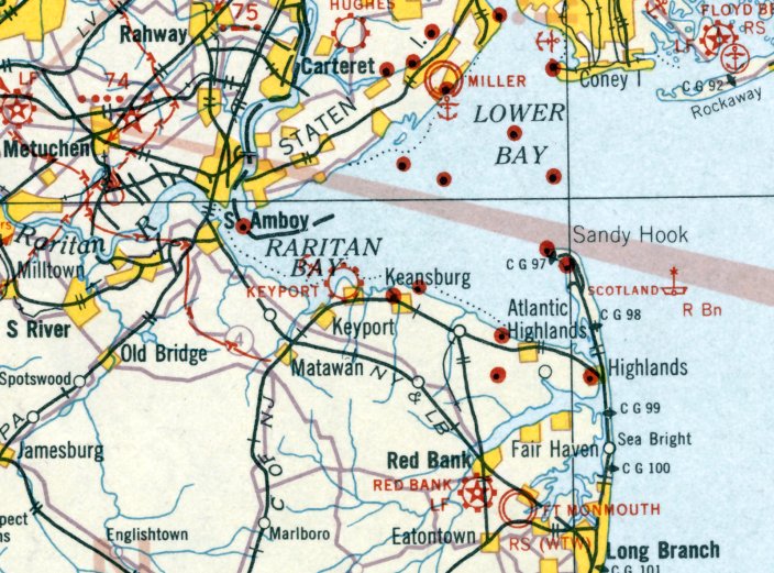
The earliest Sectional Chart depiction which has been located of Keyport Airport was on the August 1932 NY Sectional Chart.
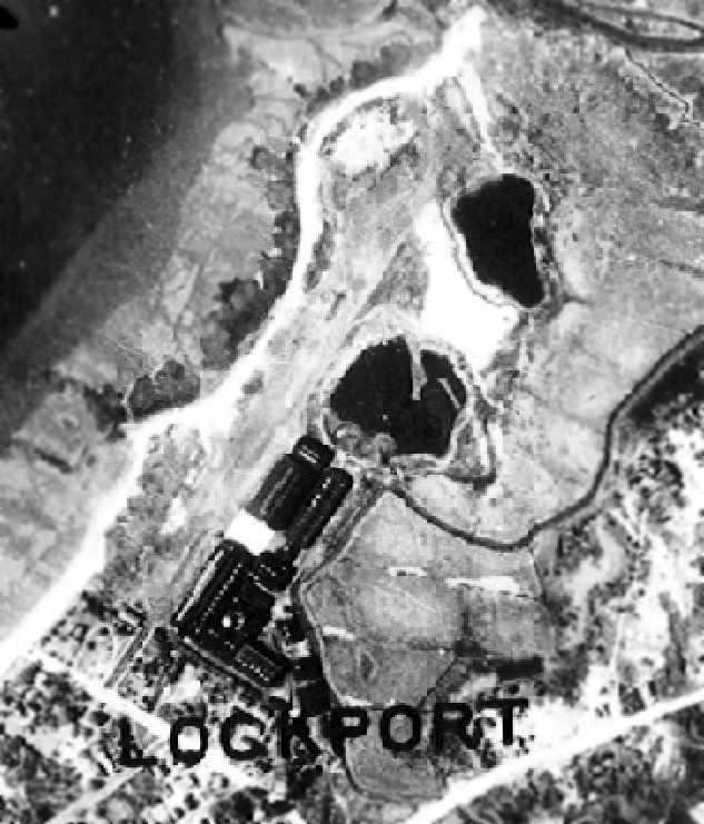
A circa early 1930s aerial view depicted the Aeromarine factory buildings,
along with the single unpaved runway along the coastline.
The Upper-Burnelli Aircraft Corporation ceased operations in 1934.
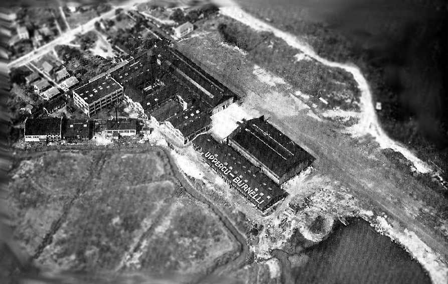
An undated aerial photo looking northwest at the Aeromarine Uppercu-Burnelli factory (courtesy of Tom Beamer).
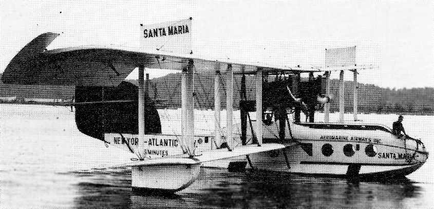
An undated view of F-5L converted by Aeromarine (courtesy of Tom Beamer).
The 1934 Department of Commerce Airport Directory (according to Chris Kennedy)
described Aeromarine Field as having 2 sod runways oriented in an "L" shape,
with the longest being an 1,800' northeast/southwest strip.
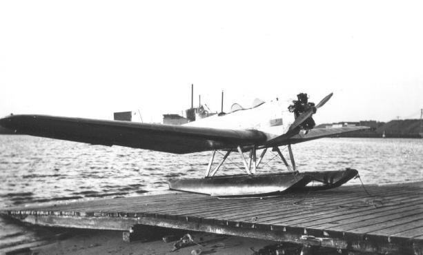
A 1935 photo of an Aeromarine ALK-26A floatplane (courtesy of Tom Beamer).
The exact date of the end of operations at the Aeromarine Keyport site is unknown,
but Tom Beamer said, "I've seen 1937 listed as the end of operations."
However, the Aeromarine airfield was still listed among active airfields
in the Airport Directory Company's 1938 Airport Directory (according to Chris Kennedy).
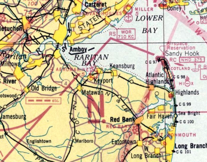
Aeromarine was still depicted as an active commercial airfield & seaplane base on the April 1938 NY Sectional Chart.
Candee Preston recalled that her father, Rhea Preston, learned to fly from Keyport Airport, “and which his friends flew out of.”
The Aeromarine airfield was evidently closed at some point in 1938,
as no airfield or seaplane facility was depicted at the location of Aeromarine on the November 1938 NY Sectional Chart.
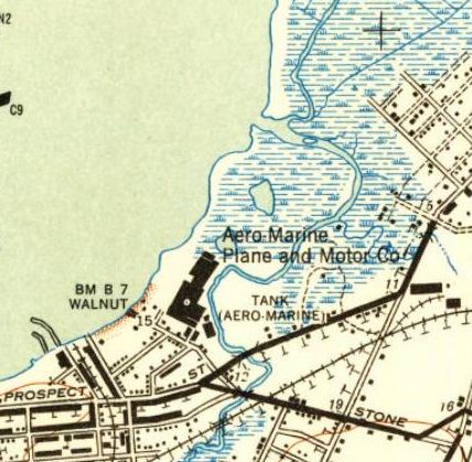
The 1947 USGS topo map depicted the “Aero Marine Plane & Motor Co”.
According to Robert Giannetti (President of Infern-O-Therm Corporation),
the former main Aeromarine factory building has been the location of the Infern-O-Therm Corporation since 1966.
Today the Aeromarine site is known as Keyport Aeromarine Industrial Park.
The Keyport Yacht Club had plans in 1997 for a modest portion of one building
to be dedicated as a museum to the Aeromarine Plane & Motor Company.
Tom Beamer reported in 2003, "The site is still intact but terribly rundown.
The buildings were in use by a variety of concerns when I visited a few years ago.
Erosion along the waterfront has reclaimed a portion of the runway."
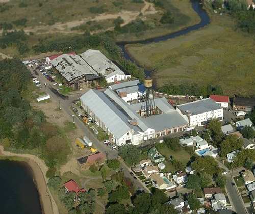
A 2003 aerial view by Rich Galiano, looking northeast at the former Aeromarine factory buildings.
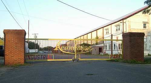
A 2003 photo by Rich Galiano of the wrought iron gate to the "Aeromarine Industrial Park".
"The wrought-iron gate looks nice, but is obviously of modern construction. Normally it is left open; I closed it for the photo."
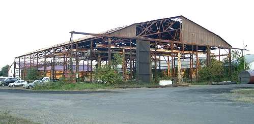
A 2003 photo by Rich Galiano. Rich observed, "The big hangar is little more than a skeleton. It is used to store construction equipment."
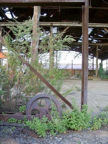
A 2003 photo by Rich Galiano, "Looking inside the hangar, past one of the door rollers."
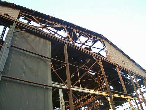
A 2003 photo by Rich Galiano, "Looking up through the rotted wooden roof."

A 2003 photo by Rich Galiano. Rich observed, "The main factory building, opposite the hangar, with traces of full-width door rollers evident."
William Angus reported in 2005, “Aeromarine Airfield is in worse shape then was depicted in the 2003 photos.
According to the local business that is run there, the hangar is slated for tear-down within the next few weeks.
The entire facility is slated for demolition by year's end.
Local opposition seems to have been unable to stop the planned demolition & building of McMansions.”
However, Robert Giannetti (President of Infern-O-Therm Corporation) reported in 2007,
“Infern-O-Therm Corporation is a manufacturer of industrial heating equipment for the asphalt & concrete producing industry.
We have been in the main factory building at Aeromarine since 1966.
The Areomarine complex is not slated to be torn down & is to remain as an industrial complex for years to come.
Most building have new roofs & windows.
The old hangar in the back of the complex is having work done to it as I write this, restoring it to as new condition.
There are over 10 business operating from the complex with approximately 100 employees.”
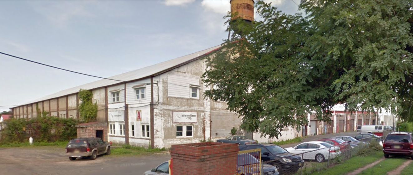
A 2013 photo looking east at the former Aeromarine factory building.
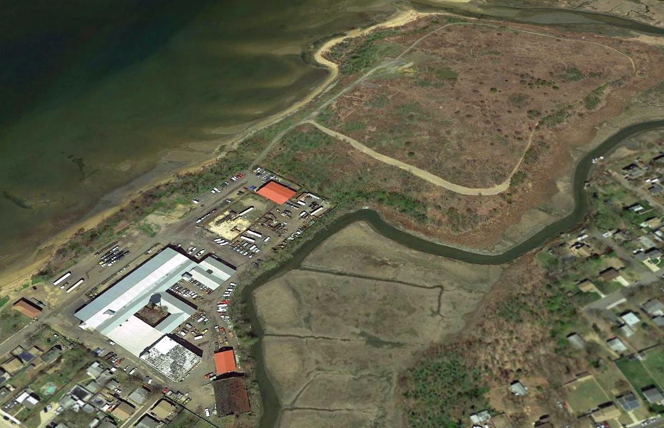
A 2016 aerial view looking north showed the former Aeromarine factory buildings still standing.
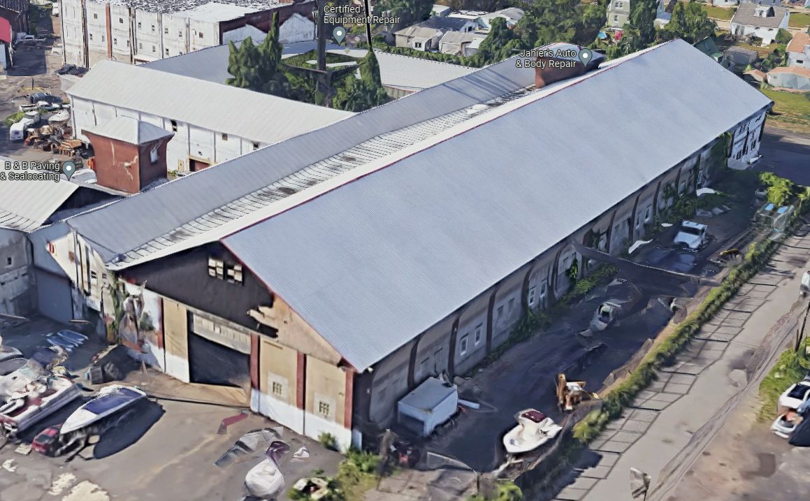
A 2023 3-D aerial image looking south at the former Aeromarine factory building.
The Aeromarine Factory site is located at the end of Locust Street, northeast of Walnut Street.
____________________________________________________
Or if you prefer to contact me directly concerning a contribution (for a mailing address to send a check),
please contact me at: paulandterryfreeman@gmail.com
If you enjoy this web site, please support it with a financial contribution.
____________________________________________________
This site covers airfields in all 50 states.