Abandoned & Little-Known Airfields:
Northeastern New Jersey
© 2002, © 2026 by Paul Freeman. Revised 8/26/26.
This site covers airfields in all 50 states: Click here for the site's main menu.
____________________________________________________
Please consider a financial contribution to support the continued growth & operation of this site.
Arcola Airport (added 9/22/20) - East Hanover Airport / Hanover Airport (revised 6/12/26)
Murchio Field / Passaic County Airport / Murchio Airport (revised 7/23/22) - North Jersey Airport / Nelson Airport (added 8/26/26) - Ramapo Valley Airport (revised 10/9/22)
- Totowa-Wayne Airport (revised 10/2/23) - Towaco Airport / Montville Airport (revised 12/30/22)
____________________________________________________
North Jersey Airport / Nelson Airport, Franklin Lakes, NJ
41, -74.233 (Northwest of New York, NY)
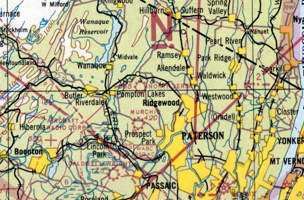
North Jersey Airport, as depicted on the November 1938 NY Sectional Chart.
As described in a 4/14/13 patch.com article (courtesy of Mike McCollough), “In the late 1920s Don Nelson came to Franklin Lakes & purchased a large tract of land. He cleared the land & set up his airport.
It was smaller than the ones in the area but soon grew in fame. Soon local flyers were storing & flying their planes from there. This started the success of the enterprise.
As the profits increased Don Nelson expanded his operation. He purchased two new aircraft.
One was a Challenger; the other was a Waco Biplane. Both were inspected by the government & were used to give rides to the local population on Sundays.
The flights were over the local area to view the sights. The airfield also offered courses in flying, mechanics and general ground school.
The ground school course consisted of meteorology, navigation & aircraft engines. A number of local men & boys took advantage of the classes.”
The article continued, “During its operation many notables visited the airfield. One notable was Capt. Smyles O’Timmings. He was a 1-armed, 1-legged aeronautical expert.
He flew into Franklin Lakes to visit his friend H.E. Merchant, the chief pilot & head instructor at the airport.
During his visit Capt. O’Timmings made a parachute jump over the field. He landed in the center of the field.”
A 1931 aerial photo did not show any recognizable element of the North Jersey / Nelson Airport.
North Jersey Airport was not yet depicted on the 1937 NY Sectional Chart.
The earliest depiction which has been located of North Jersey Airport was on the November 1938 NY Sectional Chart.
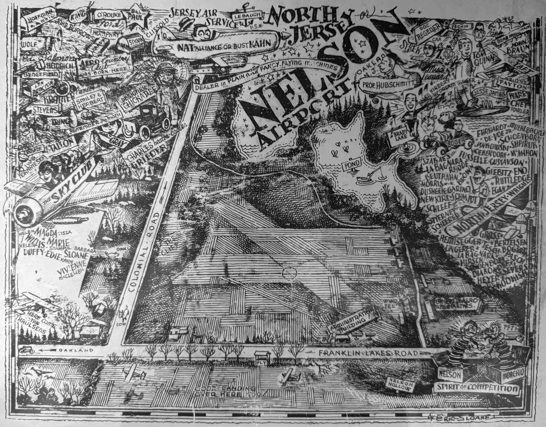
An elaborate drawing of North Jersey / Nelson Airport (courtesy of Mike McCollough) showed the field to have several runways, an airport circle marking in the center, and an administration building along the south side.
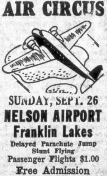
A circa 1930s advertisement for the Nelson Airport Air Circus.
As described in a 4/14/13 patch.com article (courtesy of Mike McCollough), “One of the big events held at the air field was the Air Circus. Several well-known stunt pilots would arrive & put on a thrill show.
This along with motor cycle races & stunt show filled the day. Despite all of this many local residents were not happy with the operation.
Late in 1938 a petition was brought before the Town Council. It was signed by 40 residents & called for the closing of the airport.
They stated that it was a lowing the land values because of the noise & traffic.
A motion was made that the petition be placed in file & the Amusement License of the New Jersey Air service, now the operators of the field, be revoked as a nuisance.
As the matter was looked into the town fathers found out that they could do nothing about the airport because the town obtained no revenue from the operation.
The only thing they could do was to force the operators to renew the license each year.”
The article continued, “But it was not all events & happy landings at the airport. Death did come. Such is the case of Johnny Hubschmidt.
He was a 30 year old pilot from Teaneck. He was visiting friends at the airport when he decided to go flying. He borrowed a plane from Miss. Anna Syrek & took off.
He was in the air only a few minutes when the tip of the right wing came off & the plane crashed. He died of his injuries.”
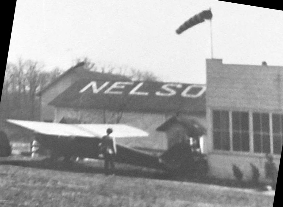
A circa 1930s photo of a Piper Cub in front of a hangar which had “Nelson” marked on its roof.
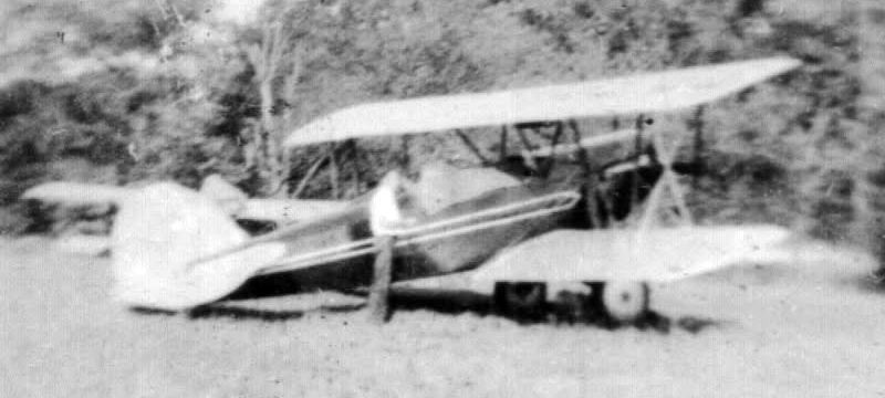
A circa 1930s photo of a Waco Model 10 biplane at Nelson Airport.
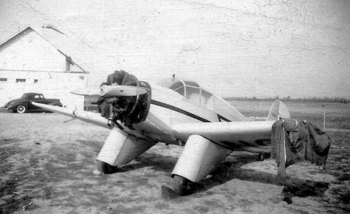
A circa 1930s photo of an Aeronca C70 at Nelson Airport, after losing part of its left wing to a collision with a car.
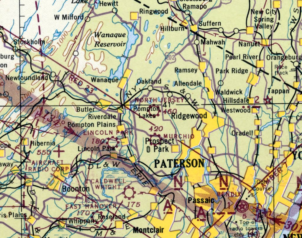
The last depiction which has been located of North Jersey Airport was on the May 1943 NY Sectional Chart.
North Jersey Airport was closed at some point between 1943-44, as it was no longer depicted on the May 1944 NY Sectional Chart.
As described in a 4/14/13 patch.com article (courtesy of Mike McCollough), “The airport closed because of World War II. But this did not stop the airport from serving the national defense.
The residents of Franklin Lakes Road woke one morning to find that the trees along the road were cut back without their permission.
An investigation was started. It turned out that the trees were cut to allow the movement of the airport buildings to Haledon.
This was done so they could be used as barracks for the anti-aircraft soldiers stationed here to defend Paterson. Thus ended the life of the Frankin Lakes airport.”
A 1953 aerial photo did not show any recognizable element of the North Jersey / Nelson Airport.
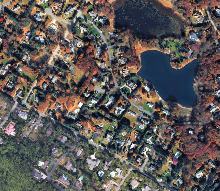
A 2019 aerial view showed no trace remaining of Arcola Airport.
Thanks to Mike McCollough for pointing out this airfield.
____________________________________________________
40.916, -74.084 (West of New York, NY)
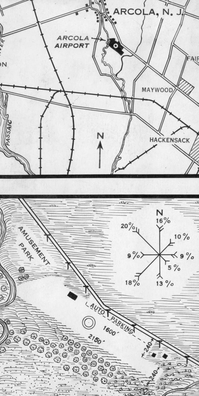
Arcola Airport, as depicted on a 7/10/29 Commerce Department Airway Bulletin (courtesy of Lee Corbin).
The date of construction of this early general aviation airport has not been determined.
The earliest depiction which has been located of Arcola Airport was on a 7/10/29 Commerce Department Airway Bulletin (courtesy of Lee Corbin).
It described Arcola as a commercial airport, owned by Maria Ditmars, and operated under lease by F.H. Trautwein.
It was said to consist of a 30 acre irregularly-shaped property, having 2 sandy runways, measuring 2,150' northwest/southeast & 1,600'.
Arcola Airport's operator F.H. Trautwein had earlier (as of January 1928) had an American Eagle A-1 (NC1797, c/n 57) registered.
In 1928 American Ealge Aircraft was making aircraft at Arcola, according to a February 1928 Aero Digest Magazine article (according to Tim Barbosa).
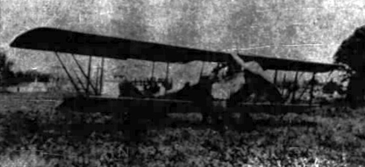
The earliest photo which has been located of Arcola Airport was a circa 1920s photo of an unidentified biplane from the 2/16/64 Ridgewood Sunday News (courtesy of Lee Corbin).
An advertisement for Arcola Airport in the 10/16/30 Ridgewood Herald News (courtesy of Lee Corbin) offered passenger flights & sightseeing tours.
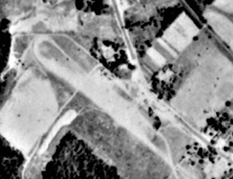
The earliest aerial photo which has been located of Arcola Airport was a 1930 aerial view (courtesy of Lee Corbin).
It depicted Arcola Airport as having an unpaved northwest/southeast runway.
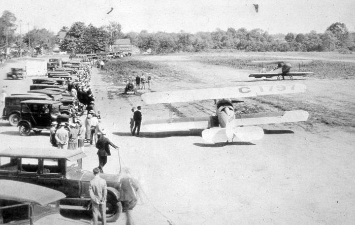
A circa 1930s photo looking southeast at Arcola Airport (courtesy of Lee Corbin) depicted a line of spectators looking at 2 biplanes.
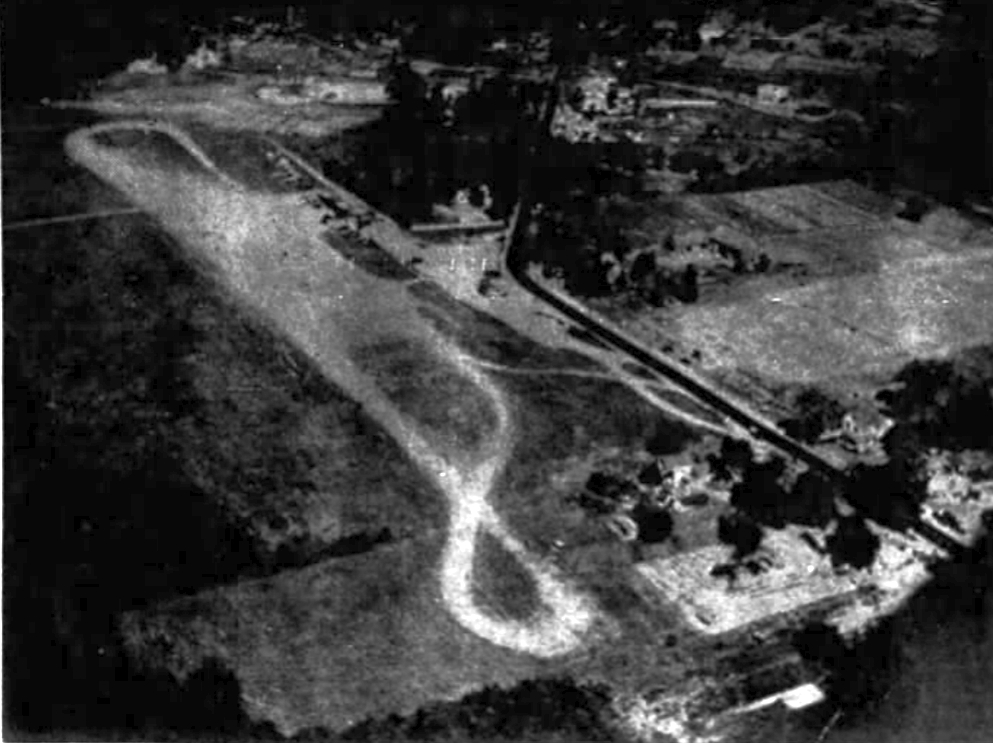
A circa 1930s aerial view looking northwest (courtesy of Lee Corbin) depicted Arcola Airport as having an unpaved northwest/southeast runway.

The only aeronautical chart depiction which has been located of Arcola Airport was on the March 1932 NY Sectional Chart.
Arcola Airport was evidently closed (for reasons unknown) at some point between 1932-33,
as it was no longer depicted on the April 1933 NY Sectional Chart, or the 1934 USGS topo map.
A 1954 aerial photo showed the site of Arcola Airport had been covered by houses & streets.
Yet another of thousands of American grassroots airports swallowed by suburban housing construction.
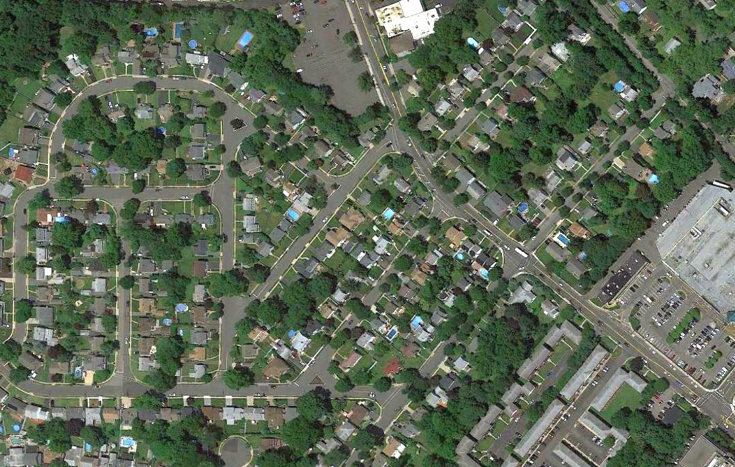
A 2019 aerial view showed no trace remaining of Arcola Airport.
Thanks to Lee Corbin for pointing out this airfield.
____________________________________________________
Ramapo Valley Airport (1st location), Mahwah, NJ
41.102, -74.162 (Northwest of New York, NY)
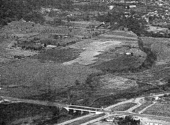
A 1946 aerial view looking north showing Ramapo Valley Airport under construction (the light colored area in the center).
Ramapo Valley Airport was not yet depicted on the August 1946 NY Terminal Aeronautical Chart (courtesy of Tim Zukas).
The earliest depiction which has been located of the Ramapo Valley Airport
was a 1946 aerial view showing the airport still under construction.
According to Dick Greene, "Ramapo Valley Airport was owned & built by my late father-in-law, Fred L. Wehran."
Wehran had previously owned & developed the Teterboro Air Terminal, from 1939-48.
According to Adam Raines, Ramapo Valley Airport began operating in 1946.
Adam reported, “Billy Beard... [had] a short tenure operating the Ramapo Valley Airport in Mahwah.
The one in Mahwah was owned by Fred Wehran, the owner of Teterboro airport.
Fred lived near this land & felt it would be well suited as a feeder airport for Teterboro.”
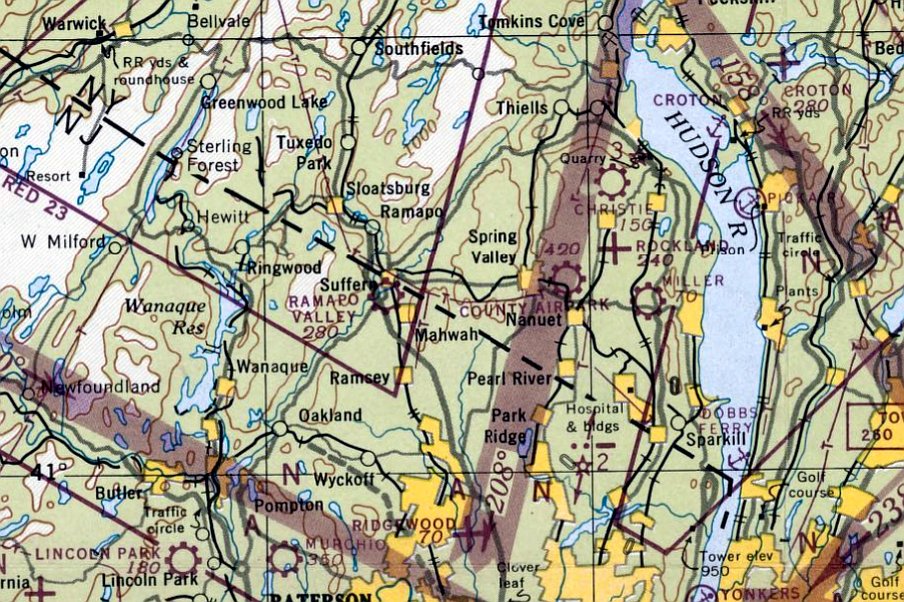
The earliest aeronautical chart depiction which has been located of Ramapo Valley Airport was on the January 1947 NY Sectional Chart.
It depicted Ramapo Valley as a commercial/municipal airport.
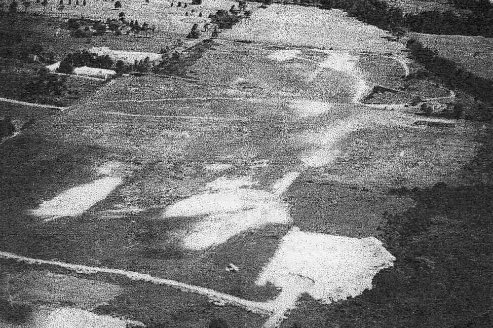
A circa 1940s aerial view looking north at Ramapo Valley Airport, with a single Piper Cub in the foreground,
next to the sand & gravel pit from which material was drawn to fill holes in the remainder of the airfield.
The 1949 NY Sectional Chart (courtesy of Chris Kennedy) depicted Ramapo Valley as a commercial airport with an 1,800' unpaved runway.
Bill Lanning recalled of Ramapo Valley Airport, "I grew up in the area & can remember it well.
State Highway 17 is in its approximate same position as it is now.
There was a road that made its way between what is now a propane gas business & a service station.
The grass strip was on one side of the road & the Hovenkamp Golf Course was on the other."
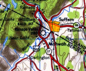
Ramapo Valley Airport, as depicted on the 1950 USGS topo map.
The earliest photo of the Ramapo Valley Airport in NJ which has been located was a 1952 aerial view.
It depicted Ramapo Valley as having a single unpaved northeast/southwest runway,
with a dozen light aircraft visible parked on the east side of the field.
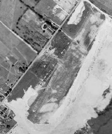
The last photo which has been located showing Ramapo Valley Airport was a 1953 aerial view.
It depicted Ramapo Valley as having a single unpaved northeast/southwest runway,
with a total of 10 light aircraft visible parked on the west side of the field.
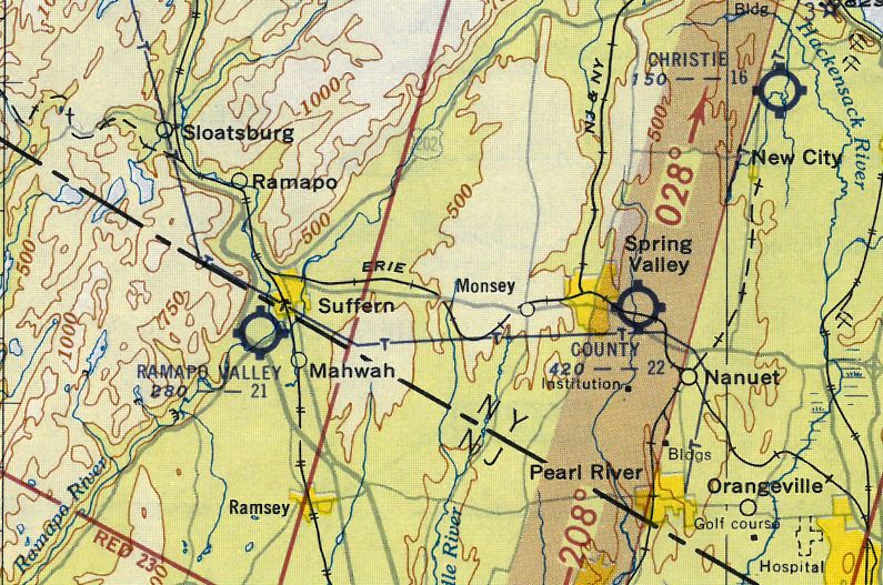
Ramapo Valley Airport was still depicted as an active airfield in its NJ location
on the 1953 NY Terminal Aeronautical Chart (courtesy of Tim Zukas), with a 2,100' unpaved runway.
Ramapo Valley Airport was still depicted on the 1953 USGS topo map.
Ramapo Valley Airport was evidently closed at some point in 1953,
as it was no longer depicted on the July 1953 NY Sectional Chart.
Nearby resident Bill Lanning recalled that the airport "ceased to exist when the Ford Motor Company purchased the land
and converted it into what was the largest auto-making plant under one roof."
The Ford Motor Company Mahwah assembly plant was the largest motor vehicle assembly plant in the United States at the time.
It produced the Edsel, Ford Galaxie, Ford LTD, Ford Granada, Ford Fairmont, Mercury Monarch, Mercury Zephyr, and Lincoln Versailles.
The 1955 USGS topo map depicted the automobile factory at the location of the Ramapo Valley Airport.
At some point between 1955-57, another airport named Ramapo Valley Airport
was established just a few miles to the east in Spring Valley, NY.
However, the Ramapo Valley Airport in NY had no relation to the Ramapo Valley Airport in NJ - other than using the same name.
A 1965 aerial view showed the factory covering the site, with no trace remaining of NJ's Ramapo Valley Airport.
The Ford factory built on the site of Ramapo Valley Airport was closed in 1980.
Bill Lanning recalled that after the Ford factory was closed, “The property was vacant for a year or two & a 27-story office / Sheraton hotel was built in its place."
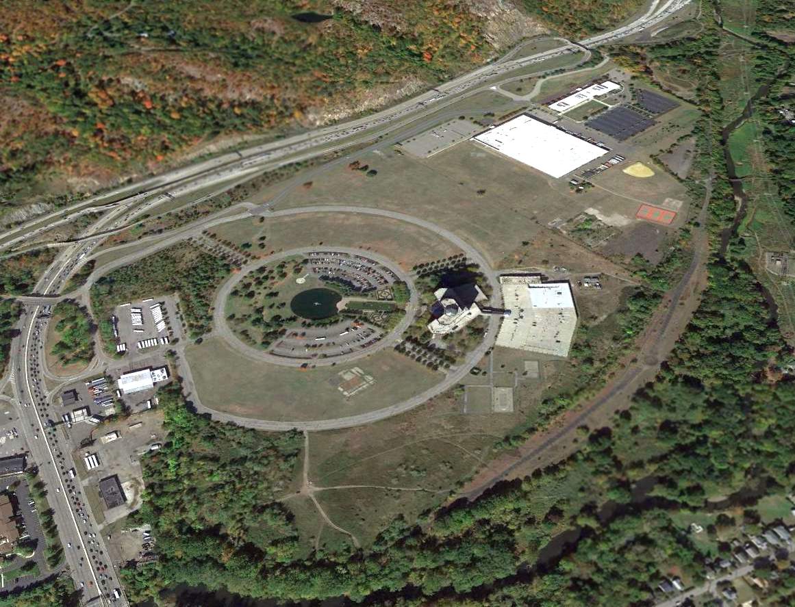
A 2014 aerial view looking northwest showed the Sheraton hotel complex covering the site of Ramapo Valley Airport.
The site of Ramapo Valley Airport is located east of the intersection of Route 287 & Route 17.
____________________________________________________
Towaco Airport / Montville Airpark, Towaco, NJ
40.932, -74.338 (Northeast of Morristown Municipal Airport, NJ)
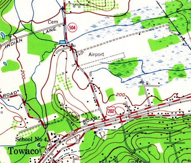
Towaco Airport, as generically depicted on the 1955 USGS topo map.
This general aviation airport was evidently established at some point between 1947-56,
as it was not yet depicted on the 1946 NY Terminal Aeronautical Chart (courtesy of Tim Zukas)
or the 1947 USGS topo map.
Edward Adams recalled, “Towaco Airport... I grew up in Towaco, born there in 1947, and remember the planes taking off overhead from a very young age.
The grass dogleg strip was there all of my adolescent years, and the owners were a man name Frank Reiser from Paterson, and a Barry Hoffman from Spring Valley, NY.”
The earliest depiction which has been located of the Towaco Airport was on the 1955 USGS topo map.
It depicted a single unpaved northeast/southwest runway, generically labeled “Airport”.
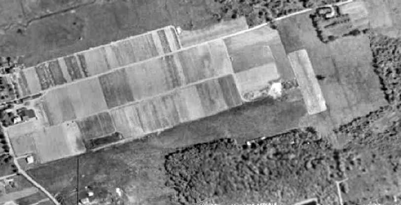
The earliest photo which has been located of the Towaco Airport was a 1957 aerial view.
It depicted Towaco as having a single grass northeast/southwest runway.
A small barn was located on the southeast side of the runway, but no aircraft were visible on the field.
Towaco was not yet depicted on the January 1958 NY Sectional Chart.

The earliest aeronautical chart depiction of the Towaco Airport which has been located was on the July 1958 NY Sectional Chart.
It depicted Towaco as having a mere 1,900' unpaved runway.
Edward Adams recalled, “Towaco Airport... My older brother worked there doing odd jobs, working off flight time learning to fly.
I experienced my first flight there in a J3 around 1958/59.”
Brian DeLuca recalled, “When I was living there, it was a dirt strip, but it did have grass where the airplane tires didn’t wear it out.”
Forrest Smith recalled, “I remember only 2 or 3 planes there when I was growing up... one being a Stinson.”
The 1962 AOPA Airport Directory described Towaco as having a single 2,700' sod runway.
A 1963 aerial view depicted 3 single-engine aircraft next to the barn on the southeast side of Towaco Airport's runway.
The 1964 USGS topo map continued to label the runway simply as “Airport”.
The 1965 NY Sectional Chart (courtesy of John Voss) described Towaco Airport as having a single 3,000' turf runway.
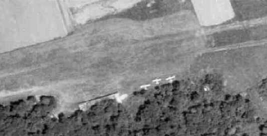
A closeup from a 1966 aerial view, showing 3 single-engine aircraft next to the barn on the southeast side of Towaco Airport's runway.

The 1968 Flight Guide (courtesy of Robert Levittan) depicted Towaco as having a single 2,600' unpaved Runway 9/27,
with a few small buildings on the south side.
The 1969 NY Sectional Chart (according to Chris Kennedy) described Towaco as having a single 2,600' turf runway.
In a 1970 aerial view, the Towaco Airport was still intact, but there were no aircraft visible on the field.
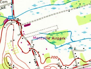
The airport was evidently renamed at some point between 1969-70, as the 1970 USGS topo map labeled the runway as “Montville Airpark”.
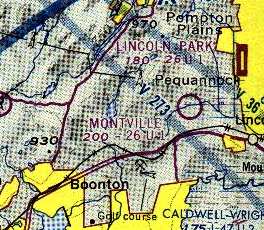
The only aeronautical chart depiction which has been located of Montville Airport
was on the 1975 NY Local Aeronautical Chart (courtesy of Mike Keefe).
Montville Airpark was apparently closed (for reasons unknown) at some point between 1975-79,
as it was no longer depicted at all (not even as an abandoned airfield) on the 1979 NY TCA chart (courtesy of Bill Suffa).
It was still labeled "Montville Airpark" on the 1981 USGS topo map.
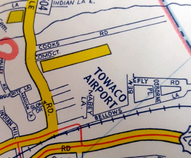
A 1983 street map (courtesy of Steven Boggess) depicted the Towaco Airport as having a northeast/southwest runway.
It was labeled "Mountville Airpark" on the 1986 USGS topo map, but it the airport was evidently already closed by that point.
A 1987 aerial view showed that a building had been built over the southwestern portion of the runway at some point between 1970-87.
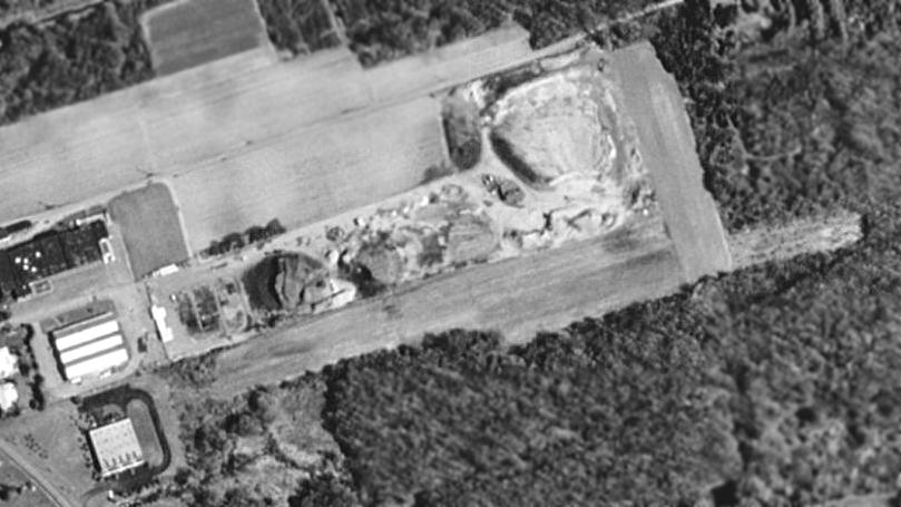
As seen in the 1995 USGS aerial photo, the site of Towaco Airport was covered by Dan Como's construction contracting site.
The airfield remains consisted of a 2,000' grass runway & a shorter crosswind grass runway.
Aaron Gould reported in 2003 that "the Towaco Airport, if my bearings are correct, is still visible as an open field.
It is on private property however & is relatively unremarkable. There are no artifacts of any sort that I could spot."
Forrest Smith visited the Towaco Airport site in 2005.
He reported, “They used to have a wind sock at the top of the old barn there, but it is gone. The barn is still there though.”
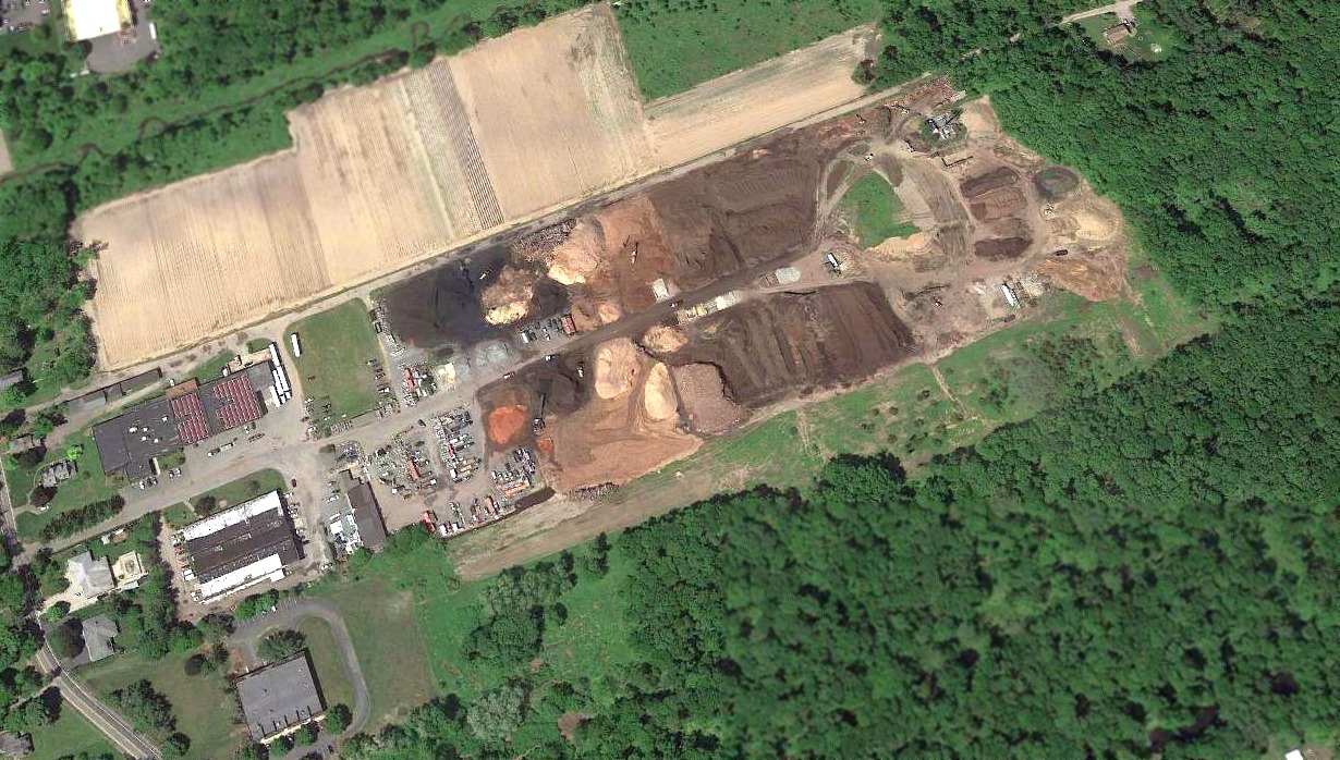
A 2018 aerial view looking north of the site of Towaco Airport.
Brian DeLuca reported in 2018, “The old airport site is now Como’s Topsoil & Mulch business.”
The Towaco Airport is located on the east side of Jacksonville Road, only 1.5 miles southwest of the present-day Lincoln Park Airport.
Thanks to Aaron Gould for pointing out this airfield.
____________________________________________________
Murchio Field / Passaic County Airport / Murchio Airport, Paterson, NJ
40.957, -74.237 (West of New York, NY)
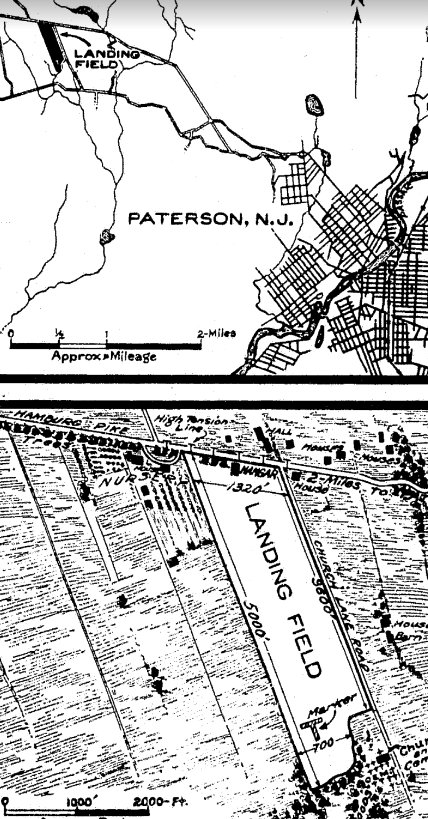
Murchio Field, as depicted on the 1925 Air Service Airway Bulletin (courtesy of Luke Calamita).
The date of construction of Murchio Airport has not been determined.
The earliest depiction which has been located of Murchio Field was on the 1925 Air Service Airway Bulletin (courtesy of Luke Calamita).
It depicted Murchio Field as a rectangular clearing measuring 5,000' along the northwest/southeast axis,
and described it as a private emergency field operated by Thomas Murchio, with a hangar for 1 plane on the north side.
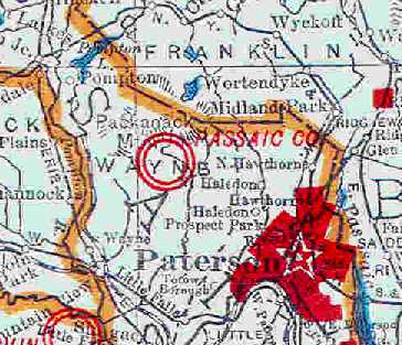
The 1930 Rand McNally "Map of NJ with Air Trails" (courtesy of Chris Kennedy)
described the "Passaic County Airport (Murchio Field)" as being operated by the County,
and described it as consisting of a rectangular field, measuring 5,000' north/south by 1,320' east/west.
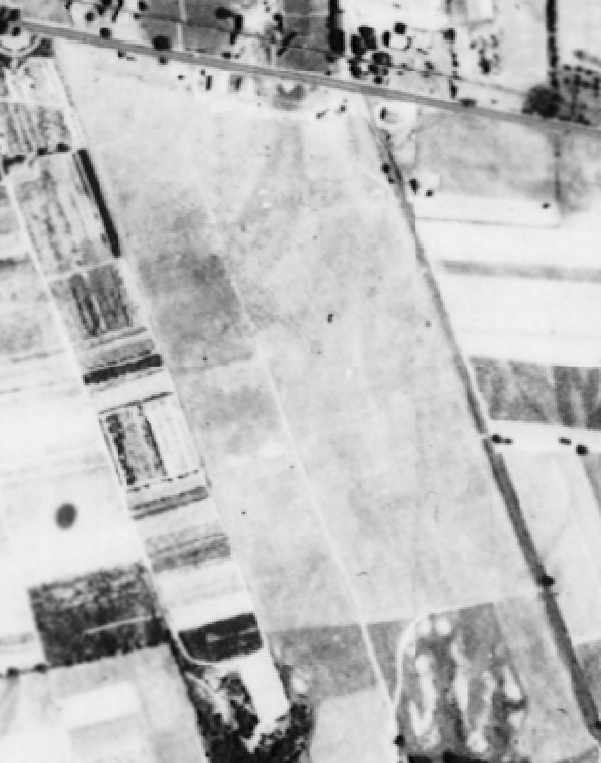
A 1931 aerial view depicted Murchio Airport as consisting of an open grass field,
oriented northwest/southeast, with a few small buildings along the north side of the field.
The earliest aeronautical chart depiction which has been located of Murchio Airport was on the August 1932 NY Sectional Chart.
The Airport Directory Company's 1937 Airport Directory (courtesy of Bob Rambo) described Murchio as a commercial airport,
consisting of a 2,600' x 1,000' rectangular sod field.
A hangar was said to have "Paterson" painted on the roof.
George Frost recalled, “I recall when I was very young, maybe about 5, being taken out to Muchios Airport to see the Curtis Condor
that was flown by Clarence Chamberlin sometime in the 1930s.”
According to the book "Wayne Township" by Cathy Tobin, crowds gathered on Sundays at Murchio’s Airport in the 1930s
to watch Bill Rhode (known as the "Smiling Daredevil") jump out of airplanes & parachute to the ground.
In 1938, Rhode jumped with 5 parachutes & set a record that he still holds.
Stan Varner recalled, "I often flew night-time 'Civil Air Patrols' 1943-44 out of Murchio's flying a 'Cub Coupe'.
It was not much of an airport then - no lights.
There was a little church located just off the southeast corner of the airport.
I remember Mr. Murchio as being older & handicapped. His daughter often helped out.
I remember they had an instructor named Bill Winterbottom.
There was also a Paterson policeman named Fred Petersen who often moonlighted there as an instructor.
There were 4 or 5 other Wright Aero engineers who rented Murchio's planes in 1943-45 to get in some flying time."
The April 1944 US Army/Navy Directory of Airfields (courtesy of Ken Mercer)
described Murchio Airport as having a 3,200' unpaved runway,
but the remarks said "Restricted to CAP [Civil Air Patrol]."
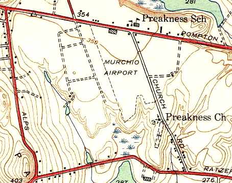
The most detailed depiction of Murchio Airport which has been located was on the 1944 USGS topo map.
It depicted the field as roughly rectangular in shape,
with the longest dimension running north-northwest/south-southeast, parallel to Church Road.
A single building (a hangar?) was depicted along the north side of the field.
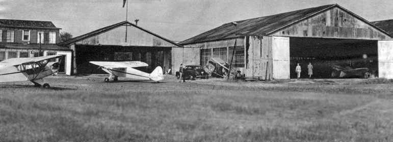
A photo of 2 Piper Cubs in front of the hangars at Murchio Airport, from a January 1946 magazine article (courtesy of Dan MacPherson).
The field was described as consisting of 92 acres, with 3 metal hangars & a combination flight office & restaurant.
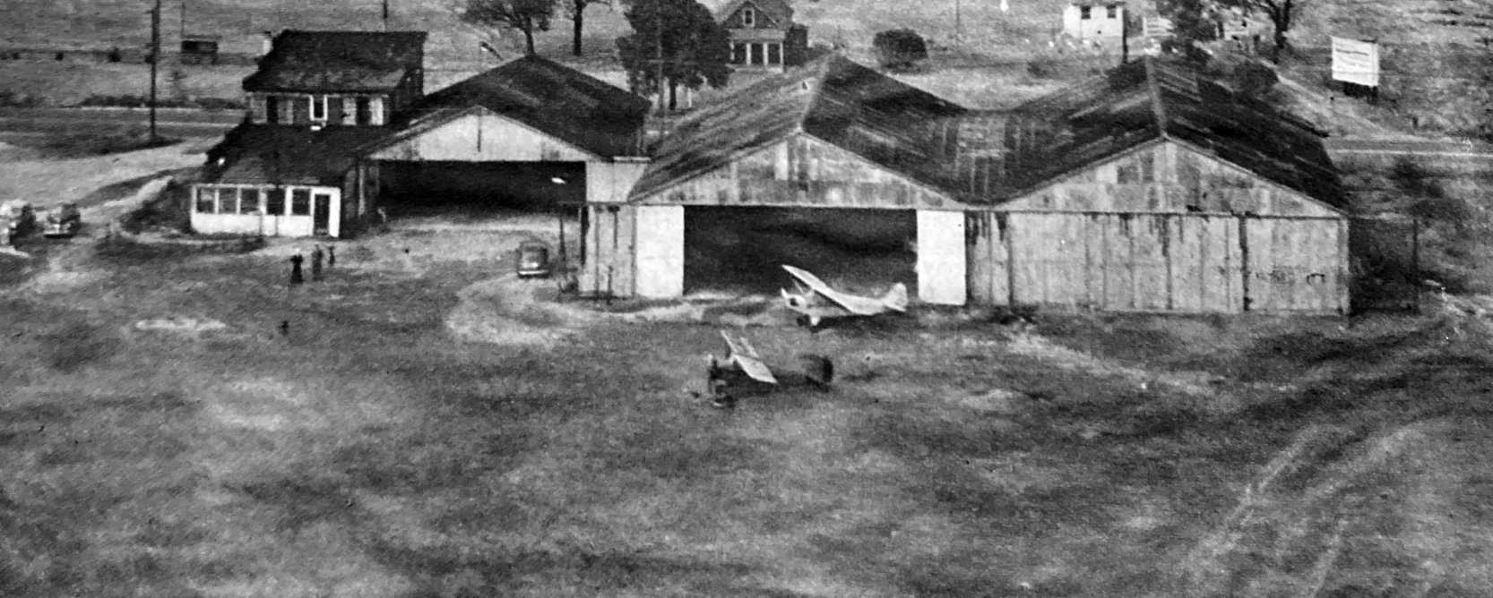
An aerial view of the hangars at Murchio Airport from a January 1946 magazine article (courtesy of Ed Das).
Valerie Bornstein recalled, “Murchio's Airport... My Uncle John Syrek operated or leased the airport in the late 1940s.
My mother & aunt worked in the office. His son, my cousin Danny Syrek may have operated the airport or another nearby for a while.”
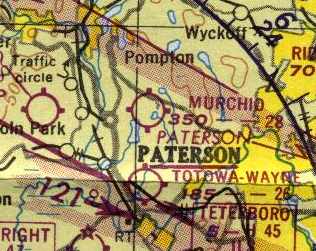
The 1950 NY Sectional Chart (courtesy of Mike Keefe) depicted Murchio Airport as having a 2,800' unpaved runway.
Alan Fischer recalled, “My father Albert Fischer was a B-24 pilot in WWII.
After coming home he was tired of flying. He got a job driving a truck for the Little Falls Laundry.
However he began instructing at Murchio's to earn some extra money as well as taking out some of the pay in flight time.
I was no more than 5 years old - 1951 when he would take me flying.
I would sit in the front of a Piper cub - so very proud & watch as Pop spun the prop.
He also took our family up in a Stinson.
He would let me 'fly' which got my mother & sister in the back seat feeling queezy to say the least.
I do recall a row of trees as well as the Church steeple at the airfield.
No one ever took a picture of us there probably because my parents couldn't afford a camera.”
Janet Nottingham recalled, “I went to school directly across the street (known as The Paterson-Hamburg Turnpike) from the airport.
There was a plane that crashed after takeoff.
It went down just after passing over the school & killed the pilot & passenger. This was in the early 1950s.
The airport closed shortly thereafter & became a housing development.
I remember the building across the street from the school with the airplane on it as being a restaurant.”
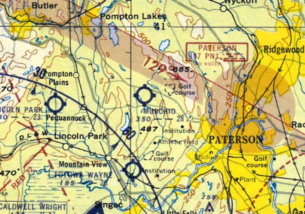
The 1953 NY Terminal Aeronautical Chart (courtesy of Tim Zukas) depicted Murchio Airport as having a 2,800' unpaved runway.
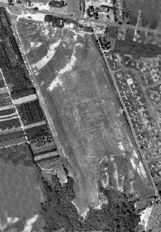
The last photo which has been located showing the Murchio Airport was a 1953 aerial view.
The field was evidently well-utilized right up to the end,
as a total of 25 aircraft were visible parked around the periphery of the northwest end of the field.
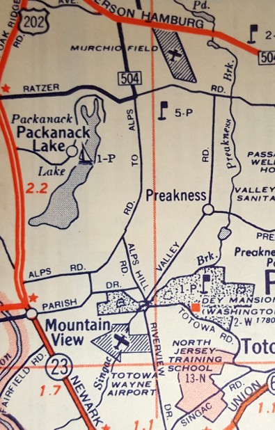
A 1955 street map (courtesy of Steven Boggess) depicted Murchio Field.
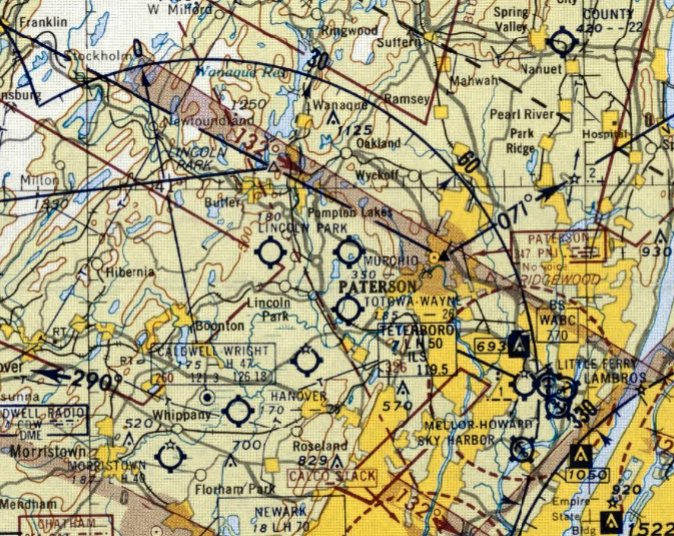
The last aeronautical chart depiction which has been located of Murchio Airport was on the July 1955 NY Sectional Chart.
It depicted Murchio Airport as having a 2,800' unpaved runway.
Murchio Airport was evidently closed at some point between 1955-56,
as it was no longer depicted on the January 1956 NY Sectional Chart.
In a 1996 report by the New Jersey General Aviation Study Commission's Subcommittee on Airport Closings,
reasons were given for the closing of 13 New Jersey general aviation airports.
According to the report, "Murchio Airport closed when the owner/operator died & his survivors had no interest in the airport."
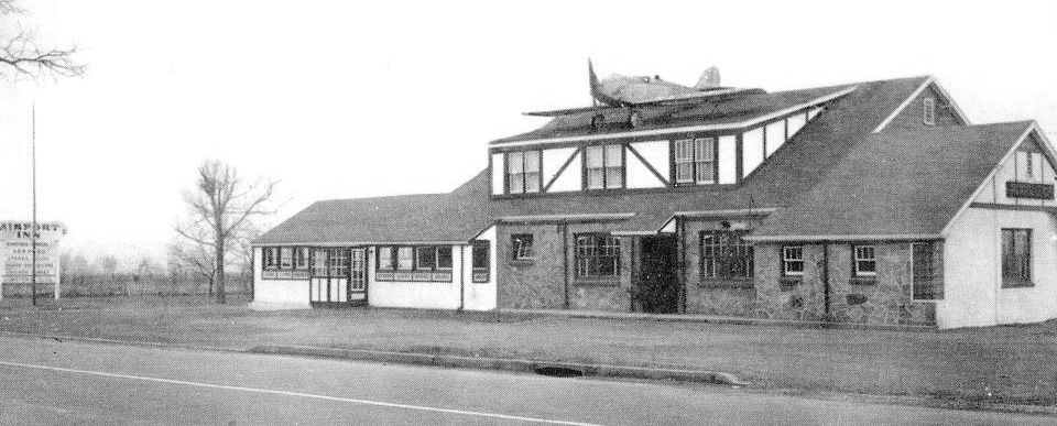
An undated photo of the Airport Inn (courtesy of Pete Milano), with an unidentified low-wing monoplane on its roof,
located at the northeast corner of Hamburg Turnpike & Church Lane, across the street from the site of Murchio Airport.
A 1966 aerial view showed that the property had been covered by housing & a shopping center,
with not a trace remaining of Murchio Airport.
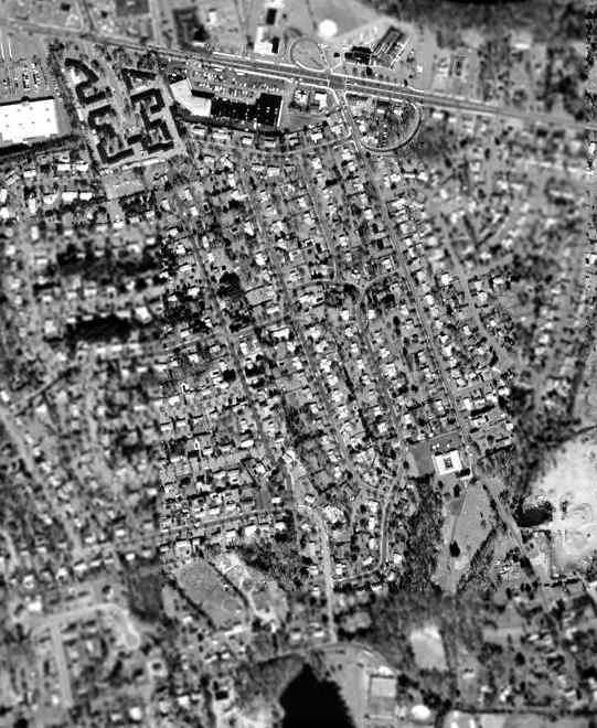
The 1995 USGS aerial photo of the site of Murchio Airport shows that it has been covered by housing & a shopping center,
and not a trace appeared to remain of the airport.
Ken Hopkins reported in 2004 of the former Murchio Airport,
"It is now the site of a Mobile gas station & the T-Bowl shopping center, and of course, houses along Church Lane.
On the other side of Church Lane on the Hamburg Turnpike, there was a building that had an airplane on its roof.
That building is now a bank."
The site of Murchio Airport is located southwest of the intersection of Church Lane & Hamburg Turnpike.
____________________________________________________
Totowa-Wayne Airport, Paterson, NJ
40.909, -74.247 (West of New York, NY)
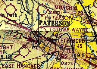
Totowa-Wayne Airport, as depicted on the 1950 NY Sectional Chart (courtesy of Mike Keefe).
This general aviation airport was evidently constructed at some point between 1949-50,
as it was not depicted on a 1931 aerial photo nor on the 1949 NY Sectional Chart (according to Chris Kennedy).
The earliest reference to Totowa-Wayne Airport which has been located
was on the 1950 NY Sectional Chart (courtesy of Mike Keefe),
which described the field as having a 2,600' unpaved runway.
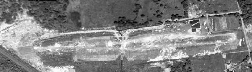
The earliest photo that has been located of Totowa-Wayne Airport was a 1953 aerial view.
It depicted the field as having a single unpaved east/west runway,
with a single hangar on the northeast side, around which were parked 9 light aircraft.
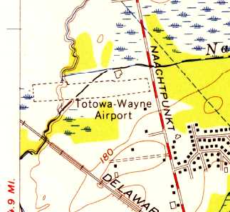
The 1955 USGS topo map depicted Totowa-Wayne Airport as having a single unpaved east/west runway.
A 1955 street map (courtesy of Steven Boggess) depicted Totowa-Wayne Airport.
Totowa-Wayne was depicted as a commercial airport on the 1958 NY Sectional Chart (courtesy of Norman Freed),
with a singe 2,850' hard-surfaced runway.
John De Nicola recalled, "Although I started flying at Teterboro,
I moved to Totowa-Wayne on advice of Pete Kenny because Teterboro was already getting crowded.
Pete Kenny was the aircraft mechanic who maintained Arthur Godfrey's planes.
Pete himself was a colorful character but that's another story.
The 1st entry in my log book for Totowa-Wayne was dated 10/19/56."
John continued, "You mention the length of the runway as 2,850'.
That's correct because I remember my instructor mentioning that to me.
About one third of the runway at each end was hard-surfaced.
The center third was more like a gravel road. Hard, but a lot of loose gravel."
"The owners & operators of Totowa-Wayne Airport were Jacob Brain & Jacob Brain, cousins.
One was generally known as Jack Brain. The other was generally known as Jake Brain.
Jack was the flight instructor, although they had other instructors,
and did all the flying part of the business.
His cousin, Jake, was more concerned with running the office & the repair shop.
As a side note, Jack was an FAA flight examiner & gave me my flight test when I finally got my private ticket."
Totowa-Wayne was also "locally known as Brain Field" (according to Dick Greene).
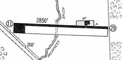
The 1960 Jeppesen Airway Manual (courtesy of Chris Kennedy) depicted Totowa-Wayne as having a single 2,850' paved Runway 11/29,
with a ramp on the northeast side with a single hangar, and another ramp on the southwest end of the runway.
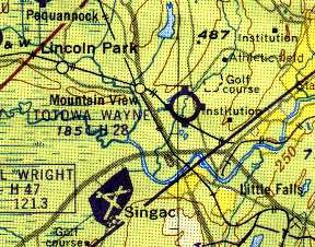
Totowa-Wayne Airport, as depicted on the 1961 NY Local Aeronautical Chart (courtesy of Mike Keefe).
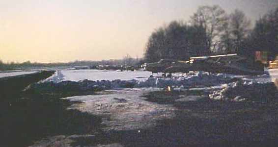
A December 1961 photo of Totowa-Wayne Airport by Wayne Hansen,
looking west from the hangar along the taxiway north of the runway.
Wayne Hansen recalled, “Growing up in Montclair, NJ,
I took my 1st flight instruction in June 1961 at Totowa-Wayne about 10 days after high school graduation.
I soloed the end of the summer in the early straight-tail Cessna 150s they used for training.
I remember Jack Brain & his wife who ran the airport, and the 2 or 3 instructors I had,
and have log book entries for all of them.”
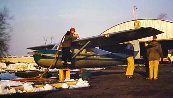
A December 1961 photo by Wayne Hansen looking northeast at Totowa Wayne Airport,
of a lineman fueling N5739E, a 1959 Cessna 150 'Straight Tail', s/n 17239.
Wayne remarked that this was “one of 4 early Cessna 150's that the airport had for flight training & rental.”
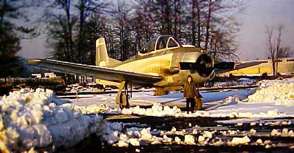
A December 1961 photo by Wayne Hansen of David Hansen in front of a T-28 Trojan at Totowa-Wayne Airport.
The 1962 AOPA Airport Directory described Totowa-Wayne Airport as having a single 3,000' asphalt Runway 9/27,
and listed the operator as Jack Brain.
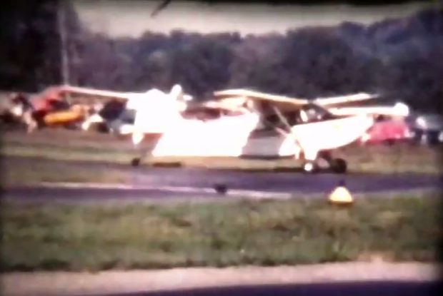
A still from a 1964 movie by Joe Walmach of a taildragger (model unidentified) taxiing at Totowa-Wayne Airport.
The Aerodromes table on the 1965 NY Sectional Chart (courtesy of John Voss)
described Totowa-Wayne as having a single 2,850' asphalt runway.
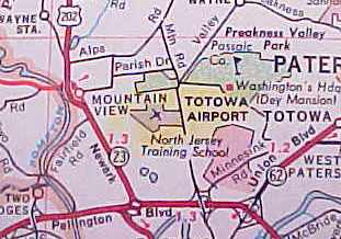
Totowa Wayne Airport, as depicted on a 1965 NJ road map (courtesy of Wayne Hansen).
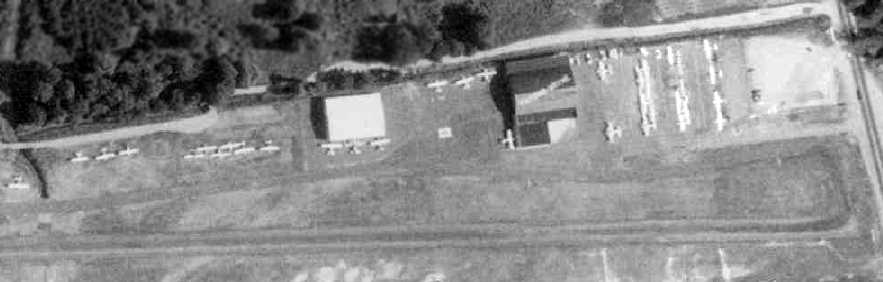
A closeup from a 1966 aerial view showed how well-utilized Totowa Wayne Airport was right up until the end,
with a total of over 32 aircraft visible parked outside.
Note the hangar with “Totowa Wayne” painted on the roof.
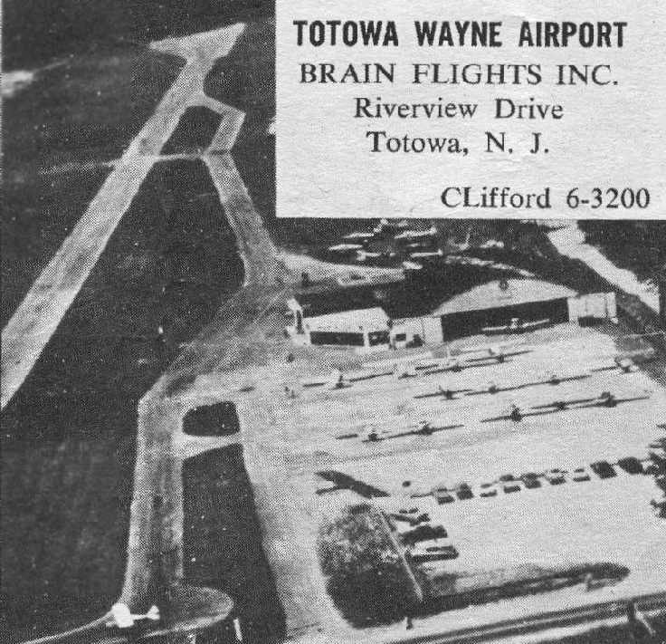
A circa 1960s aerial photo looking west at Totowa Wayne Airport, from an advertisement on a street map (courtesy of Mark Mastroieni.
It depicted the field as having a paved runway, a paved taxiway & ramp, and a single arched-roof hangar with attached office.
The operator was listed as Brain Flights Inc.
John De Nicola recalled, "Totowa-Wayne was partly in Totowa & partly in Wayne, hence the name Totowa-Wayne.
It was never quite clear to me where the line was that put the airport in the 2 townships.
However, from the conversations back then,
I surmised that the creek that cut across the middle of the runway was the boundary between the 2 towns.
In the picture [above] you will note the suggestions of a smudged line
cutting across the runway about halfway down at the 1st bend in the taxiway.
That was the creek.
On occasion when we got an unusually heavy rain & the creek overflowed leaving the area near the creek underwater.
That's the runway the taxiway & the tie-down area (which is behind the words "BRAIN" & "Riverview" in the picture).
Heavy steel structures shaped like an inverted U were used to span the creek, both the runway & taxiway.
This may explain the reason the middle of the runway was more like a dirt road.
It was easier to grade the runway so that when you rolled from the ground to the 'bridge' section
and then back to the hard ground there would be no bumps.
Every once in awhile they graded it to keep it fairly smooth."
Thomas Ploch recalled, "Totowa-Wayne Airport was on Riverview Drive near the Totowa Wayne border.
The threshold was very close to the road.”
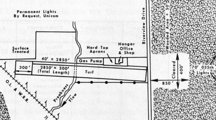
The 1966 Passaic County Master Plan (courtesy of Luke Calamita) depicted Totowa-Wayne Airport as having a single 2,850' paved turf east./west runway,
with a gas pump, hard top aprons, hangar, office, and shop her ramp on the northeast corner.
Frank Dalton recalled, “Totowa - Wayne Airport.. I took flight lessons there from 1966-68.”
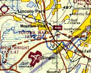
Totowa-Wayne was still depicted as an active airport on the 1967 NY Local Aeronautical Chart (courtesy of Mike Keefe),
and described as having a single 2,850' asphalt runway.
John De Nicola recalled, ""Totowa-Wayne Airport... I was still living in NJ when they started to sell off the assets of the airport
and remember going there one day to see the dismemberment of an airport."

The last airport directory listing which has been located of Totowa Wayne Airport was in the 1968 Flight Guide (courtesy of Robert Levittan).
It depicted Totowa Wayne as having a 2,850' paved Runway 10/28, and a ramp with 2 buildings on the northeast side.
Frank Dalton recalled, “Totowa - Wayne Airport.. I was supposed to take my Private [Pilot's License] check ride with Jack Brain but he was not available.
I rented the plane from Totowa - Wayne & flew to Caldwell for the check ride on 8/21/68.
My last logged flight at Totowa - Wayne was on 9/1/68.
I did not fly again until 11/29/68 & that was from Caldwell Airport - I would not have flown out of Caldwell if Totowa - Wayne was open.
So the airport definitely closed sometime between those dates; I think it was either the latter part of September or early October.”

A circa late 1960s/70s photo looking northwest at Totowa Wayne Airport, presumably after it had closed, being devoid of aircraft.
It showed the office still labeled Brain Flights, the hangar, and the threshold of Runway 28.
In a 1996 report by the New Jersey General Aviation Study Commission's Subcommittee on Airport Closings,
reasons were given for the closing of 13 New Jersey general aviation airports.
According to the report, "Totowa-Wayne Airport, which was one of the best & most profitable airport operations in the State,
was forced to close after the township doubled the taxes in 2 consecutive years.
The most often recommended suggestion for tax relief, eliminated taxes on public use portions of an airport such as runways & taxiways,
even if feasible, would not solve the problem.
Communities could still raise the rate on the taxable portion of the airport to drive the operator out of business,
as was done, for example, at Totowa-Wayne, a successful operation."
John De Nicola observed, "The issue of real estate taxes as the reason for closing is accurate.
Over the years we had numerous occasions to talk to Jack about many things.
I distinctly remember Jack telling us about the problems he was having with the local politicians
on more than one occasion & the tax issue.
But of course what really struck fear in my heart
was when he said that if they raise the taxes again he will have to close the airport."
Thomas Bowdler recalled, "I don't remember the exact year it was torn up but an industrial park was built on the site,
the main road of which paralleled the runway, perpendicular to Riverview Drive."
Totowa-Wayne was no longer depicted at all on the 1969 NY Sectional Chart (according to Chris Kennedy).
A 1970 aerial view showed that a large industrial building had been constructed over the eastern portion of the runway,
but the western half remained clear.
The smaller hangar had been removed at some point between 1966-70, but the larger hangar remained standing.
A 1979 aerial view showed that all traces of the airport had been removed at some point between 1970-79,
with several large industrial buildings having been built over the remainder of the former airport,
covering the western portion of the runway & the site of the main hangar.
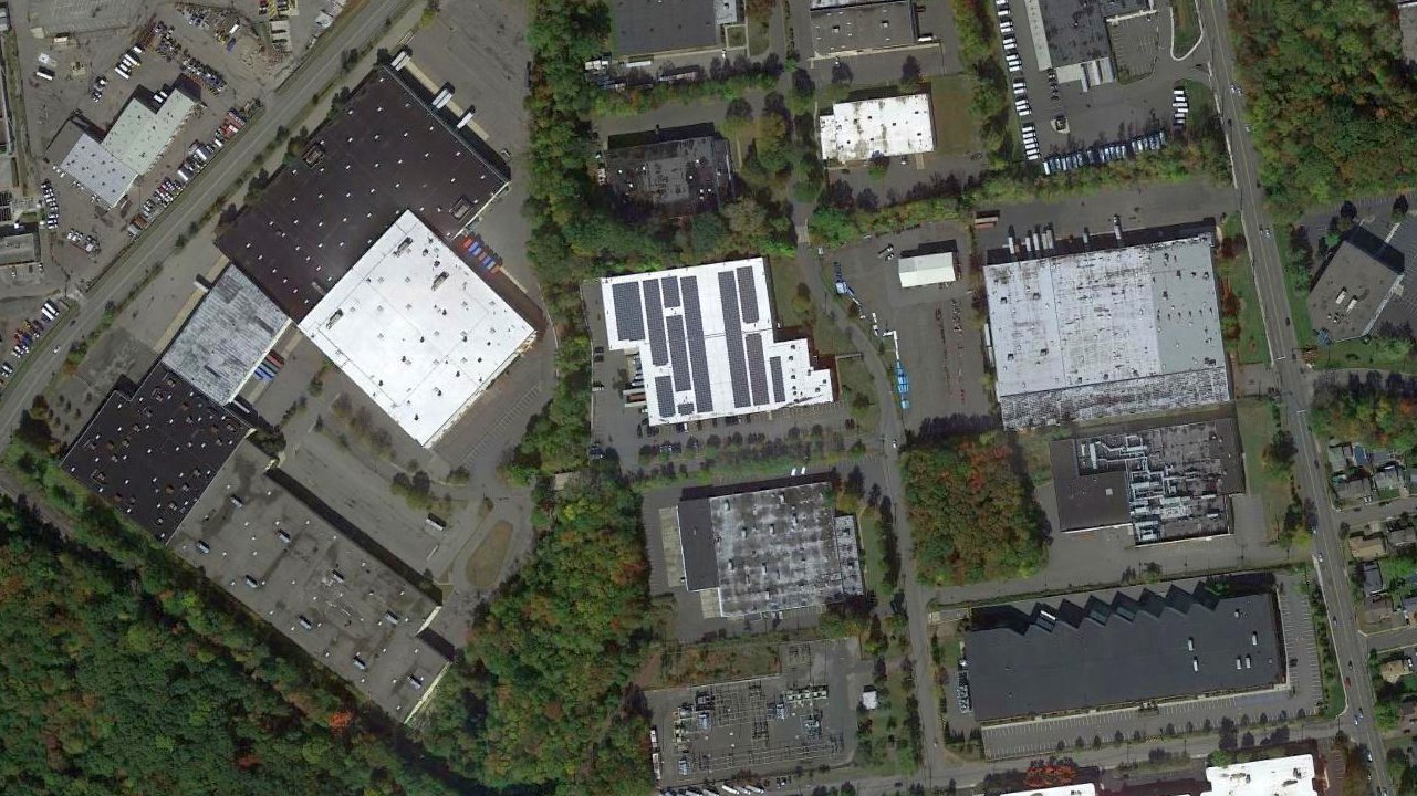
A 2014 aerial photo showed the site of the Totowa-Wayne Airport had been redeveloped as an industrial park,
and not a trace appears to remain of the airport.
According to Thomas Ploch,”Today Thomas's Muffins & Roche have buildings on the site."
Totowa-Wayne Airport was located near the intersection of Riverview Drive & Edison Drive.
____________________________________________________
East Hanover Airport / Hanover Airport (N58), Hanover, NJ
40.84, -74.345 (Northeast of Morristown Municipal Airport, NJ)
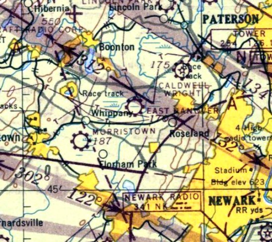
East Hanover Airport, as depicted on the July 1946 NY Sectional Chart.
East Hanover Airport was not yet depicted on the November 1945 NY Sectional Chart.
An article in the Daily Record reported that Gertrude Tannenbaum's father started the East Hanover Airport on his farm.
The earliest depiction which has been located of East Hanover Airport was on the July 1946 NY Sectional Chart.
According to David Schober, “My father.. He operated the airport [Hanover] when it opened after WWII for a couple years;
I would guess between 1946-49.
Tom Oram was actually one of my dad's students, and I think he took over after my dad went to work elsewhere.
It was during that time frame that the runway was changed from grass/mud to gravel.”
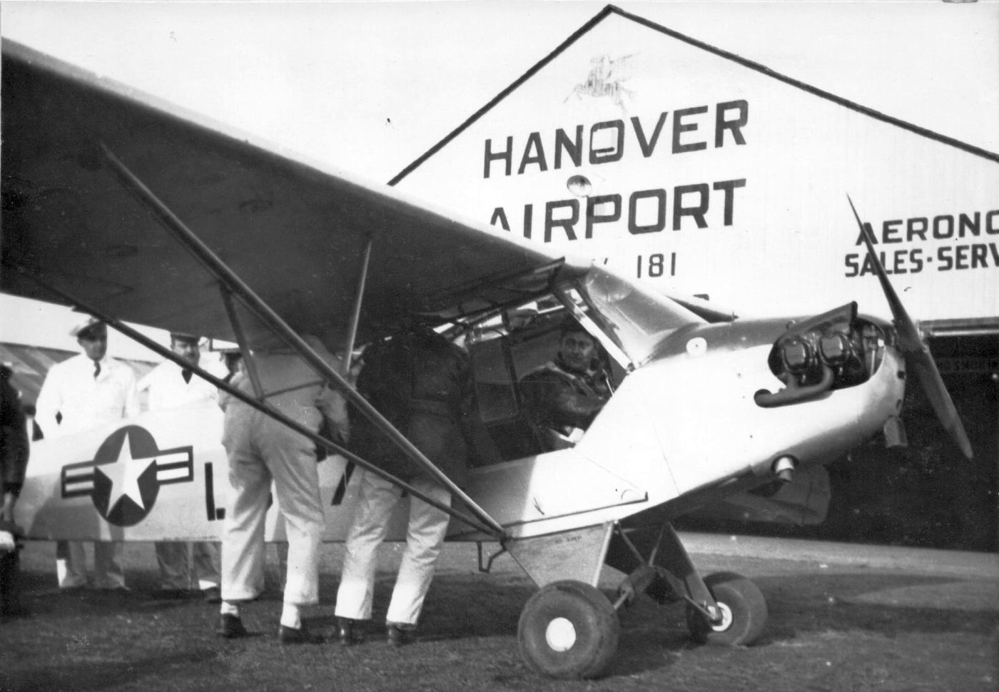
A 1946-49 photo by Don Reid (courtesy of Bruce Reid) of a Civil Air Patrol rescue/evacuation practice with a Piper L-4 Cub in front of a Hanover Airport hangar.
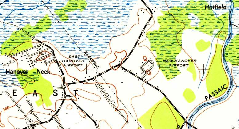
The 1947 USGS topo map depicted both an “East Hanover Airport” & a “New Hanover Airport” to the east.
According to Andrew Smith, “The 'New Hanover Airport' appearing on charts:
Crosswinds at the old airport could challenge the best flyers. A better runway layout was why the new spot was considered.
It's not clear why it was never developed.”
The 1949 NY Sectional Chart (according to Chris Kennedy) depicted East Hanover Airport as having a 2,000' unpaved runway.
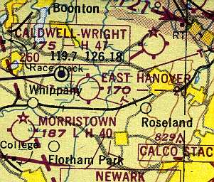
The 1950 NY Sectional Chart (courtesy of Mike Keefe) depicted East Hanover Airport as having a 2,000' unpaved runway.
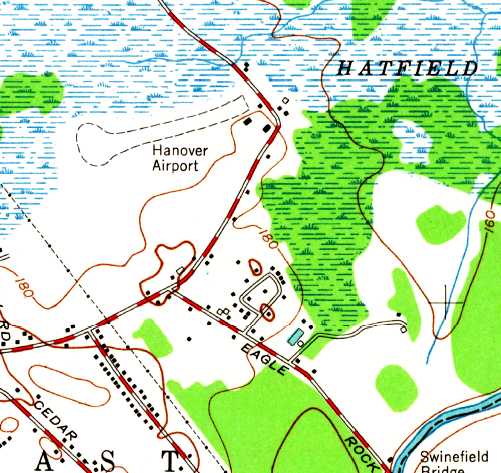
The 1954 USGS topo map depicted the “Hanover Airport” as having a single unpaved northeast/southwest runway,
with a few small buildings on the east side.
The “New Hanover Airport” to the east was no longer depicted.
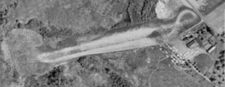
The earliest photo which has been located of Hanover Airport was a 1957 aerial view.
It depicted the field as having a single unpaved northeast/southwest runway.
A hangar & other small buildings sat at the east end of the field, around which were visible 27 light aircraft.
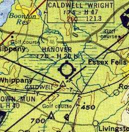
Hanover Airport was depicted on the 1958 NY Sectional Chart (courtesy of Norman Freed)
as having a single 2,500' turf & bare runway.
The runway at Hanover had been paved at some point between 1958-61,
as the 1961 NY Local Aeronautical Chart (courtesy of Mike Keefe) described the field as having a single 2,000' asphalt runway.
Ronald McCormack recalled, “I made my 1st solo flight from Hanover in a Piper Supercub in 1961.
My instructor was Claud Brown.
He was a former crop duster & he had a terribly deformed leg sustained in a crop dusting accident.”
The 1962 AOPA Airport Directory described Hanover as having a single 2,000' paved runway, and listed the operator as Thomas Oram.
A 1963 aerial view depicted Hanover's newly paved runway.
Skip Degan recalled, “My 1st flight lesson was 6/17/64, with Bill Rhode CFI. I soloed a Luscombe at Hanover on 7/28/64, 8 hours with Mr. Rhode's sign-off.
I was a member of the Icarus Flying Club. I think Mr. Rhode had well over 20,000 instructor hours at that time.
Hanover was a real neat place for a kid into aviation. It had a restaurant that was second-to-none.
It had hundreds of airplane models hanging from the ceiling & a small lunch counter.
Tom Oram's daughter & son-in-law worked at the place.
I remember there being a hangar full of great airplanes, including a Staggerwing, among others.
Down the tie-down line was Ernie White's T-6, which I had the pleasure of riding in on a short hop to Cherry Ridge in PA.”
Thomas Oram owned & operated the Hanover Airport for over 20 years.
He had a life long love for flying & was licensed to operate of both fixed wing aircraft & helicopters.
He received recognition & many awards for his assistance in rescue work,
hunting fugitives from the law & surveying traffic snarls, including a Gold PBA award for his service when he went up in his helicopter in pursuit of bank robbers.
He brought joy to kids by flying Santa in a helicopter to a number of shopping centers during the holidays
& landing with Batman & Robin at White Meadow Lake.
Tom Gilbertson recalled, “My father, John Gilbertson was a TWA Flight Engineer
and in the early 1960s the pilots' union demanded that flight engineers obtain their commercial pilot's license with instrument rating.
Once he had his license he went looking for an airplane.
In December of 1964 he found a Taylorcraft for sale at Hanover Airport.
He bought the airplane from Jack Lenehan.
My father, brother Jack & I had the Taylorcraft based at Hanover from 1964-70.”
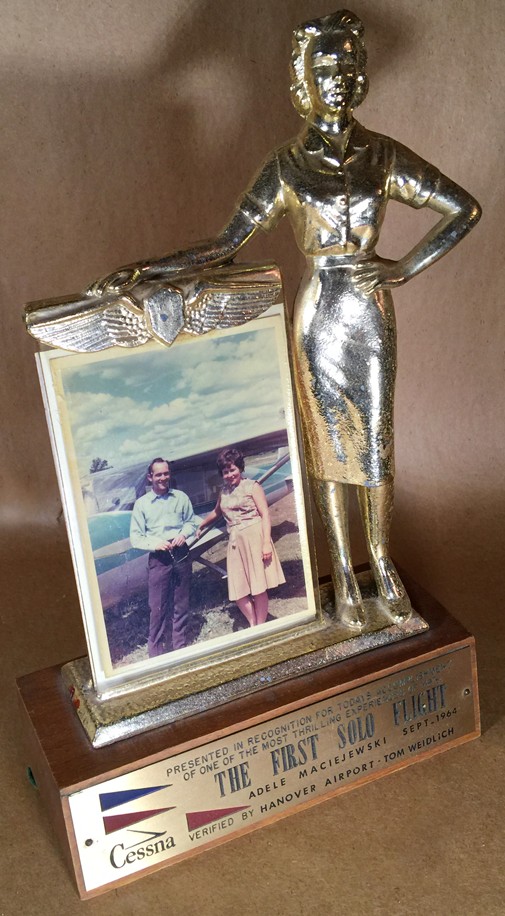
A photo by Sandee Weiner of a trophy sent by Cessna to her mother, Adele Maciejewski to commemorate her September 1964 first solo flight from Hanover Airport, instructed by Tom Weidlich.
Sandee Weiner recalled, “My mom & father both flew out of Hanover Airport.”
A still from a circa 1964-65 movie (courtesy of Sandee Weiner) of Sandee's father (Stanley Maciejewski) on rollout after landing her 1946 Ercoupe at East Hanover Airport.
A still from a circa 1964-65 movie by Stanley Maciejewski (courtesy of Sandee Weiner) of Sandee's mother (Adele Maciejewski)
and Hanover instructor Tom Weidlich performing a touch & go in a Cessna at East Hanover Airport.
A still from a circa 1964-65 movie (courtesy of Sandee Weiner) of a Cessna T-50 twin at East Hanover Airport.
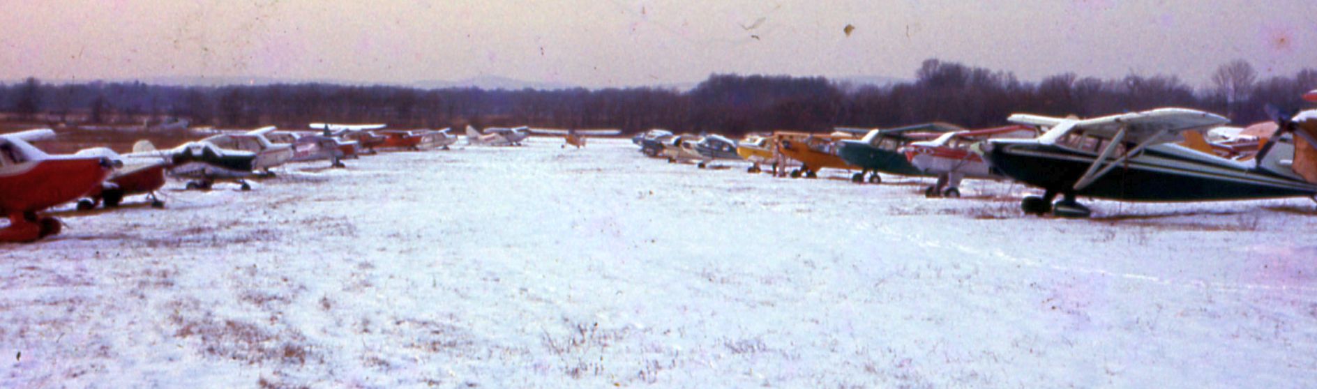
A 1960s photo (courtesy of Philip Kineyko - www.FlyinPhilsPhotos.com) of a variety of light general aviation aircraft at a snowy Hanover Airport.
Phillip reported the picture was taken by his father, “when he & his brother used to fly into East Hanover Airport (or the Boneyard as they used to like to call it) in their 1946 Fairchild 24R.”

A 1960s photo (courtesy of Philip Kineyko - www.FlyinPhilsPhotos.com) of a beautiful sunset over Hanover Airport's snowy runway.
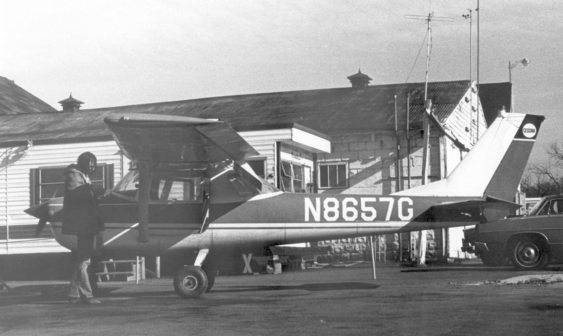
A circa 1965 photo by Bernie Earls (courtesy of Mike Jacoby) of “John Robbins who was my neighbor at the time doing preflight checks. He is the person who encouraged me to take flying lessons.”
John is standing in front of brand-new 1965 Cessna 150F N8657G at Hanover Airport.
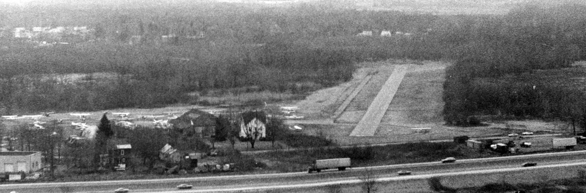
A circa 1965 aerial view by Bernie Earls (courtesy of Mike Jacoby) looking west from approach to Hanover Airport, with I-280 in the foreground.
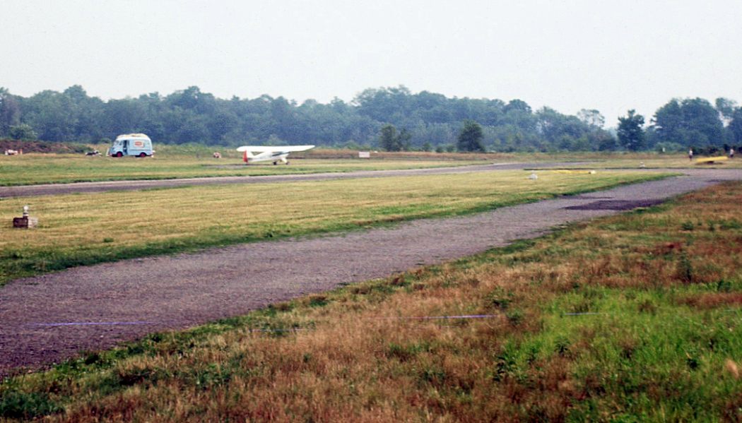
An August 1965 photo by Tom Gilbertson at Hanover Airport “taken from the west end of the taxiway towards the approach end of Runway 27.
You can see a blue hot dog truck on Ridgedale Avenue. He sold a lot of hot dogs on the weekends! People would be all over the place to watch the airplanes.”
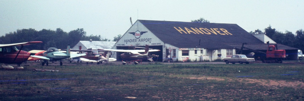
An August 1965 photo by Tom Gilbertson of the Hanover Airport hangar.
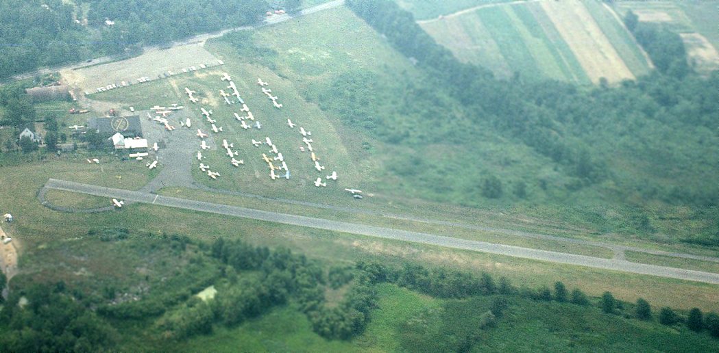
An August 1965 aerial view by Tom Gilbertson looking south at Hanover Airport.
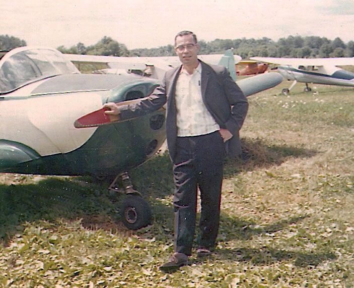
A 1965 photo by Ellie Maciejewski of Stanley Maciejewski in front of their 1946 Ercoupe at Hanover Airport (courtesy of Sandee Weiner).
Sandee Weiner, their daughter, recalled, “My father re-fabric'ed the 1946 Ercoupe himself, and painted it a nice red & white.
He even drove it to our house along Ridgedale Avenue - after taking the wings off!”
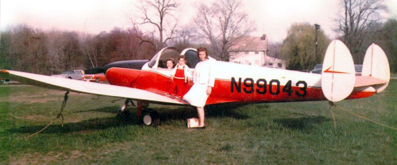
A 1965 photo by Stanley Maciejewski of Ellie Maciejewski, her daughter Sandee standing on the wing,
and Sandee's sister in the cockpit of their Ercoupe at Hanover Airport (courtesy of Sandee Weiner).
Sandee Weiner, their daughter, recalled, “ Although both my parents had their pilot’s licenses, we never actually all flew together - neither did my Mom & Dad - they only went up alone.
My mom said that when I was little, she would 'tie' me to the hangar ... basically a rope tied to my baby walker.
She said I would sit there all day, bouncing up & down watching her do touch-n-go's!”
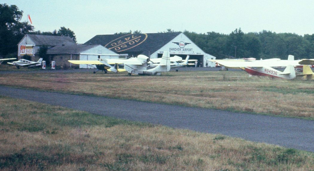
A 7/30/66 photo by Tom Gilbertson of planes parked in front of the Hanover Airport hangar, including a Republic SeaBee amphibian.
Tom Gilbertson recalled, “My father taught me some basics but since he was not an instructor I flew with Bill Rhode who was an incredible pilot & instructor.
Anyone who remembers Hanover will remember Bill. I made my first solo in the Taylorcraft on 6/23/67 at 16 years old.
My brother Jack also learned to fly in it & went on to an airline career with Allegheny Airlines/USAir.
Hanover was an extremely friendly place. We made a lot of friends there.
Even when the weather was not good we would go to the airport & socialize at the lunch counter that was run by Helen, Tom Oram's first wife.
Along with all of the airplanes I also remember a 1956 Ford Country Squire
that had been put out to pasture in the weeds alongside the maintenance hangar by the Runway 27 approach end.
It had 'Fly Hanover Airport' in big letters on both sides.”
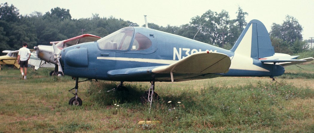
An August 1967 photo by Tom Gilbertson at Hanover Airport of “an odd duck - a Culver Cadet.”
Andrew Smith recalled, “My activity at Hanover Airport ranged from 1967 (at age 11) to about 1983.
With the exception of Linden, Hanover was the non-tower NJ field located the nearest to all the NY/NJ metro airports.
It was characterized by no fence & a much more casual management style than the airports at Lincoln Park, Basking Ridge, or Somerset.
Even though Hanover hosted tens of thousands of flights including many students, I never heard of any tragic crashes at Hanover.
People from many different backgrounds drove from as far as an hour or more away to enjoy the activity at Hanover Airport.
These included enthusiasts, photographers, and families with picnics.
The pilots & airplane owners included businessmen, salesmen, machinists, welders, equipment operators,
engineers, airline pilots, a mysterious college professor, and one local veterinarian (my father).
Sadly, only a few women graced the field regularly, mostly as student pilots or managing the office or the lunch counter.
The instructors, Fixed-Base Operator, and the pilots & owners at Hanover were mostly friendly & welcoming, making it an attractive place to base your plane, spend the day, or learn to fly.
A few were very generous 'mentors' long before the word became popular.”
Andrew continued, “Flight students receiving instruction included a few veterans taking advantage of the G.I. Bill (for their commercial licenses).
Certified Flight Instructors at Hanover included Warren Loveless, Tommy Allen, Ronald Hill, Walter Castle, (flight examiner) Rolf Nelson, and aviation historian & author Bill Rhode.
Rhode was a veteran AAF B-17 crew member. Bill Gallagher was Hanover's superb IA mechanic. Gallagher was a veteran AAF P-51 crew chief.
Tom & Helen Oram operated the airport through the 1960s.
Hanover may have been the most colorful when operated by Jack Callo & Ray Castro from about 1971-74.
They were dealers for Lake Amphibian & McCulloch Autogiro.”
Andrew continued, “A few of the aircraft owners included Bill Eberhardt, Al & Mark Henderson, Mike Hebert, Dave Harmon, Ed Stuyvesant,
Ed & Steve Shinn, Doc & Andy Smith, Jim Hagesty, Don Rhode, Barry Landry, Fred Morris, Mike Hegarty, Bill English,
Jim Singleton, Bill Waldron, Rees Sweeny, Bob Blanchard, and Arnold DuBarry.
Andrew continued, “From 1967-83 Hanover had quire an assortment of lightplanes based at the field.
These included Aero Commander Lark, Aeronca Champs & Chiefs, Bellanca Cruisair & Viking,
Beechcraft Staggerwing C-17L, Bell 47G, Benson Gyrocopter, Boeing Stearman PT-17, Cessna 140, 150, 170B, 172, 175,
Champion Citabria & Decathalon, Commonwealth, Culver Cadet, Ercoupe, Fairchild PT-26, Fairchild 24W,
Kreider-Reisner biplane, Interstate S1B1/L-6, Lake LA-4, Luscombe Silvaire, Mustang II homebuilt, McCulloch J-2 Autogiro,
Mooney Mite & M21, North American AT-6 & T-28, Piper J-3, PA12, PA-15, PA-22, PA-28, Cherokee 6-300, Comanche,
Apache, Aztec. Porterfield, Republic SeaBee, Ryan Navion, Shinn, Smith Miniplane homebuilt, Stinson 105 & 108 Voyager & SR10 Reliant, and Taylorcraft.
Occasional visitors included a Howard DGA-15P, Consolidated Vultee L-13A, and a CAP or Army Guard Cessna T-41 & L-19 Bird Dog & a De Havilland L-20 Beaver.
Like many small airports, 20% of the aircraft did 95% of the flying; a few sat dormant for years.”
Bill Fusselmman recalled, “Hanover Airport... During the time period 1967-69, I was a newly-minted Commercial Pilot, 26 years old.
Tom Oram gave me a job flying 'Sky Rides' on weekends in one of his Cessna 172s.
I probably have logged well over 1,000 takeoffs & landings at Hanover Airport flying those sky rides taking people up on weekends for an 18 minute flight.
Tom complained that he was losing money if I took more than 18 minutes!
When I got my Certified Flight Instructor rating, I became an instructor also in addition to doing the sky rides, instructing in Tom's Cessna 150s & 172s, circa 1968.
I did a few pilot checkouts for ICARUS Flying Club members in addition to my regular flight instructor duties for Tom.
Tom also took me for a few evening rides in his helicopter when we closed up for the day.
I remember when Tom & Helen Oram's daughter, Jill, married a young guy named Billy, about 1968.”
The 1968 Flight Guide (courtesy of Robert Levittan) depicted Hanover Airport
as having a 2,000' paved Runway 9/27, and a ramp & several buildings on the southeast side.
David Schober recalled, “Hanover Airport... I learned to fly there in 1969 with my father as my flight instructor.”
A 1970 aerial view depicted the main hangar at Hanover, and over 60 light aircraft visible parked on the field.
According to Mac Lewis (who learned to fly at Hanover in 1972), the locals referred to it as "Hangover International", as it was a very loose operation.
There was a power line fairly close to the southwest runway end. This led to developing skill at a high approach & slipping to final for landing.
David Schober recalled, “There were 2 hangars there up through 1973.”
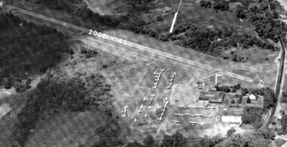
An undated aerial view looking northwest from the 1973 NJ Airport Directory depicted Hanover Airport as having a paved Runway 9/27, 2 hangars on the southeast side, and dozens of light aircraft.
Hanover's main hangar burned down in 1973, according to an article that appeared in the Newark Star-Ledger in 2000.
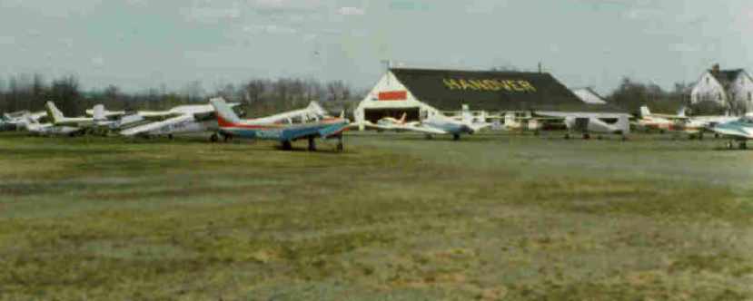
An April 1975 photo by Tom Gilbertson of a large number of aircraft in front of the hangar at Hanover.
According to David Schober, this picture “is of the smaller hangar that was used for maintenance.
The larger hangar was a fair amount larger with a Quonset-type roof.
It was located adjacent to the one in the picture, a little to the right & closer to the camera.”
The 1975 NY Local Aeronautical Chart (courtesy of Mike Keefe) depicted Hanover Airport as having a 2,000' paved runway.
In spite of Hanover having such a short runway, Richard Krentz recalled, "I landed a DC-3 at that place when it was active.
I think we did that around 1975. Landing the DC-3 at Hanover was a piece of cake, but, getting out of there was another story.
Luckily the tree line was shallow on the departure end, however, getting over the power lines a short distance from there was another story.
We were a gutted ship with not too much fuel aboard.
At full power from the stop, rotation was started at about 1,000' or so & a slow climb was initiated.
As we approached the wires we made a shallow turn to parallel the wires & the rest was history as we climbed out.
Needless to say that noise abatement was an issue for a few days after that."
Erika Eick recalled, "At Hanover, I took lessons with the Civil Air Patrol in a beat-up Cessna 150, around the mid-1970s."
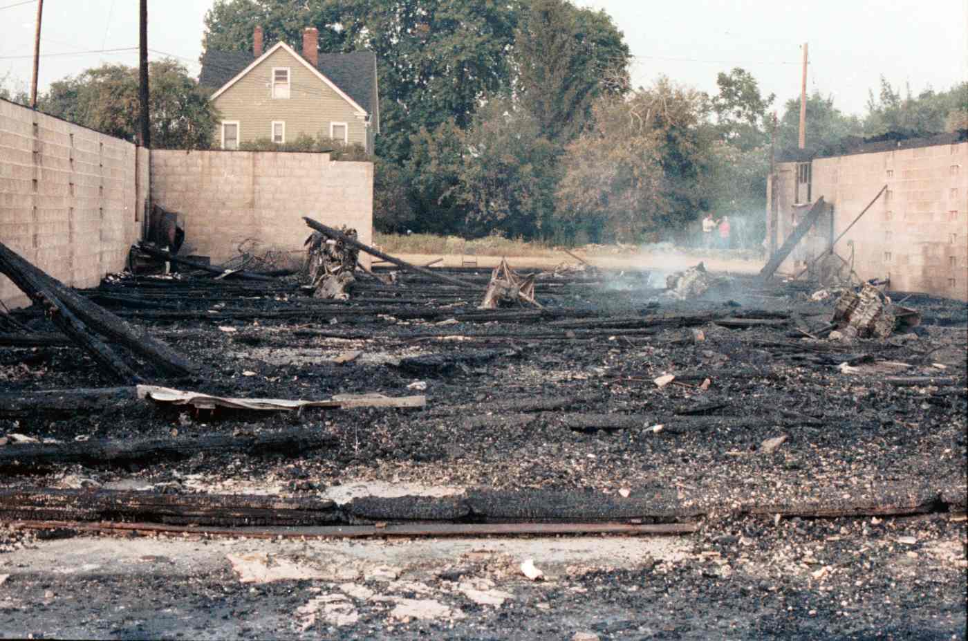
A circa 1976 photo by Neal Lanetti of the still-smoking remains of the Hanover Airport hangar.
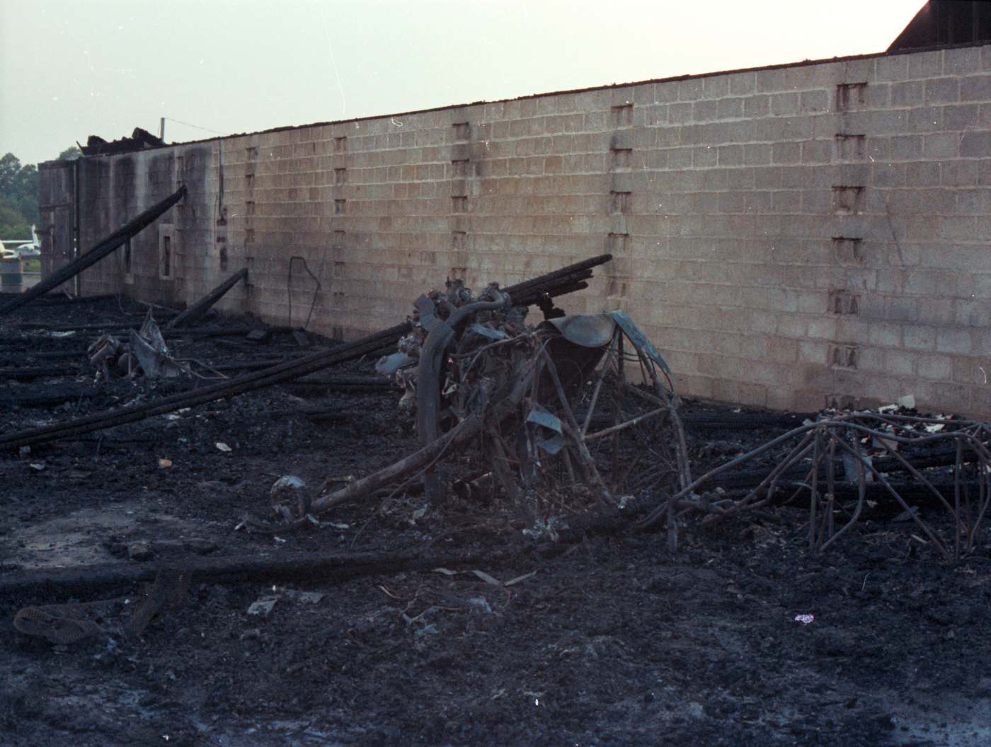
A circa 1976 photo by Neal Lanetti of the remains of the Hanover Airport hangar after the fire.
Neal noted, “This is what's left of the tubular frame of a biplane (Stearman?) complete with radial engine.”
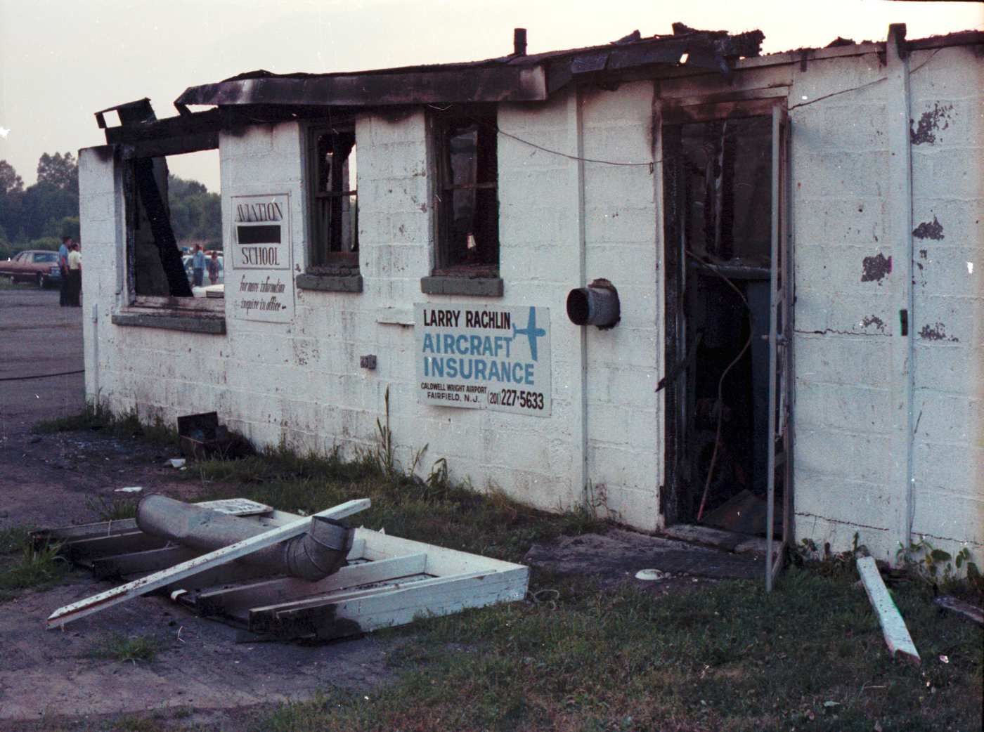
A circa 1976 photo by Neal Lanetti of the remains of the Hanover Airport hangar after the fire, ironically showing an insurance sign on the hangar wall.
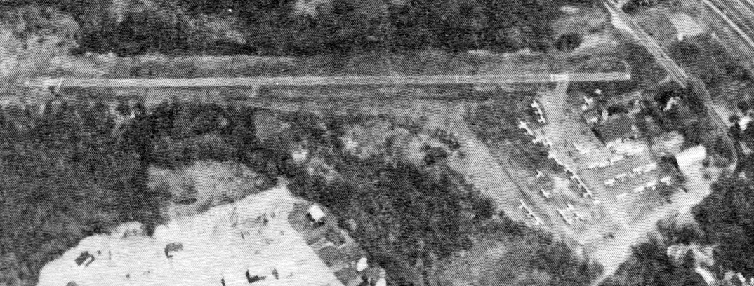
An undated aerial view looking north from the 1979 NJ Airport Directory depicted East Hanover Airport as having a 1,960' asphalt Runway 9/27,
with a large number of light aircraft parked on the ramp on the southeast side.
The manager was listed as Paul Gac, and the Fixed Base Operator as Salgo Aviation.
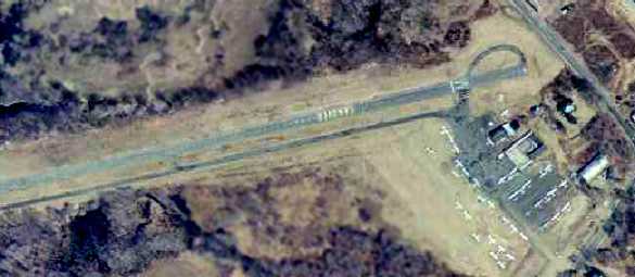
A 1979 aerial view depicted the remains of Hanover's main hangar (which had burned down several years before).
The airport was still very well-utilized, with a total of 40 light aircraft visible parked outside.
Hanover was still depicted as an active airfield on the 1979 NY TCA chart (courtesy of Bill Suffa).
It was shown as having a single 2,000' paved east/west runway.
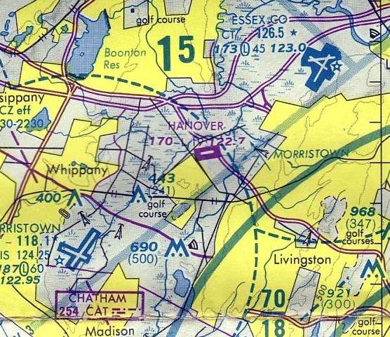
The last aeronautical chart depiction which has been located of Hanover Airport
was on the June 1982 NY Terminal Aeronautical Chart (courtesy of Mitchell Hymowitz).
Hanover's depicted runway length had decreased to a mere 1,900'.
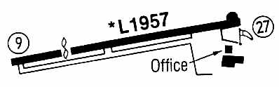
The 1983 Flight Guide (courtesy of Chris Kennedy) depicted Hanover as having a single 1,957' paved Runway 9/27,
with a parallel taxiway on the south side leading to a ramp on the southwest corner of the field with an office & one other building (a hangar?).
This airport's history started to come to an end in 1984.
According to an article by Joe Malinconico in the 10/8/85 issue of The Daily Record, Anthony Pugliese bought the land in 1984 from Ethel Steppel & Gertrude Tannenbaum.
Pugliese planned to build a 217,000 square foot office complex on the 53-acre site.
However, the land was zoned residential at the time & a variance would have been required to build an office complex on the site.
Pugliese apparently sent the township a letter stating his intentions to construct low-income housing on the site if his bid for an office complex was refused.
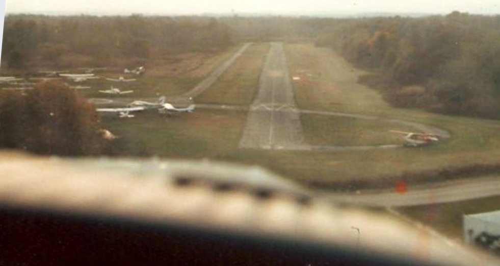
The last photo that has been located showing Hanover Airport while it was still open was a 1985 aerial view (courtesy of George Schaefer).
George reported, the “picture was taken from inside my plane by Patricia Farnsworth in the right seat as we were landing at Hanover shortly before it closed about 1985.
The aircraft was Piper Cherokee 140, N9743W. I miss the old place!”
One of the airport's licenses, issued by the FAA, had expired at the end of August, 1985, and the new owner, Pugliese, refused to apply for renewal.
He announced the airport's closure.
According to Udo Ottenfield, who had managed the airport for about 6 years, all planes at the airport would be removed by Friday, October 11.
Ottenfield claimed that the airport had been losing money to the tune of $10,000-$15,000 / year.
At its closing, the airport was the home of Eagle Flying Services, a flying school, as well as aircraft salespeople & mechanics.
There were also plane rentals available at the airport. It was usually home to about 75 small aircraft.
In a 1996 report by the New Jersey General Aviation Study Commission's Subcommittee on Airport Closings,
reasons were given for the closing of 13 New Jersey general aviation airports.
According to the report, Hanover Airport closed because it was rundown, mismanaged, and not producing enough revenue to carry itself,
and its absentee owners were not interested in owning a facility which provided no return.
Although it had already been closed, Hanover was still depicted as an airfield on the 1986 USGS topo map.
A 1987 aerial view depicted the empty ramps of the closed airport.
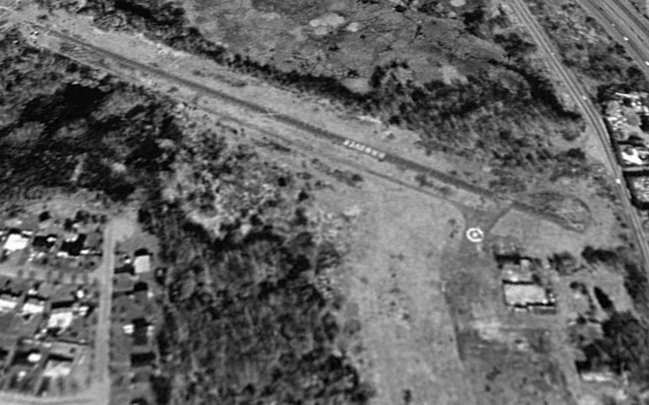
A 995 USGS aerial view looking northwest at the abandoned Hanover Airport.
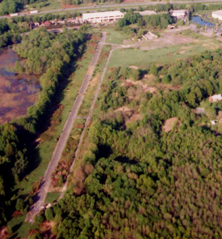
A 1996 aerial view looking east at the remains of Hanover Airport by Philip Kineyko.

A 2001 photo of the overgrown remains of the runway at Hanover Airport (© 2001 by Bill Treloar, used by permission).
The airfield consists of a single 2,000' paved runway, a parallel taxiway, a small paved ramp, and a Quonset hut style hangar & a few buildings, which still stand.
The runway has become overgrown & has painted "X" closed runway markings, but also still has "Hanover" painted on its midsection.
In general, none of the airport facilities have been removed. Part of the airfield property is used by a local industry for parking.
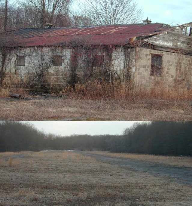
Two circa 2001-2002 photos of the hangar & runway at Hanover (courtesy of Skip Degan).
Aaron Gould reported in 2003 that "the runway is slowly becoming unusable for anything but the most dire aviation emergencies.
I recently drove out onto the field & found there to be several potholes which pushed my suspension to the limits.
I'd hate to feel them in a 172 at 40kts."
A web site for a local realtor states, "There is much interest in (and controversy over) rezoning this piece of real estate."
Aaron Gould reported in 2004, "I observed a survey crew on the runway taking measurements & my heart jumped at the possibilities,
but alas... to no avail."
According to material gathered by Bill Treloar, on 3/8/04, the Township Council passed an ordinance changing the zoning of the 52-acre airport from "residential" to "park".
The township had been in purchasing negotiations with the owners for several years,
and planned to designate the area for "passive recreation" and to serve as a recharge area for the Whippany River.
Apparently, the township was also considering smoothing out the sharp bend in Ridgedale Avenue at the corner of the airport.
A $2 million bond was approved in 2003 to buy the airport, with the help of some Green Acres funding.
Despite that, the township was not in possession of the property in 2004,
and was still in active negotiations with the owner, Richard Ullman.
William Angus reported in 2005, “East Hanover is owned privately but the property is being sold to the town
which will convert it to parkland or green acres, open spaces, something along those lines.
The landing strip is still there as is the hangar which is in very bad shape. It is unclear if either will remain once it is converted to parkland.”
Mark Krefting reported in 2005, “I just flew over the old Hanover field a couple of months ago & was amazed how intact, at least from the air, it looked.
The runway was visible, untouched, with the letters 'Hanover' clearly visible from the air.”
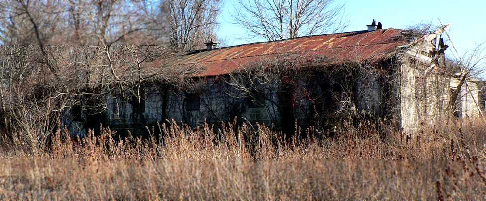
A December 2006 photo by Daniel Berek of the Hanover hangar, with the “Hanover” lettering still visible on the roof.
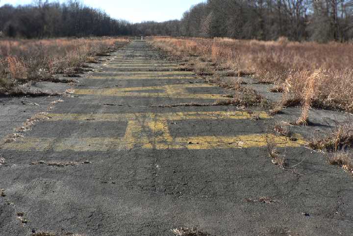
A December 2006 photo by Daniel Berek looking west along Hanover's former Runway 27, with the “Hanover” lettering still visible.
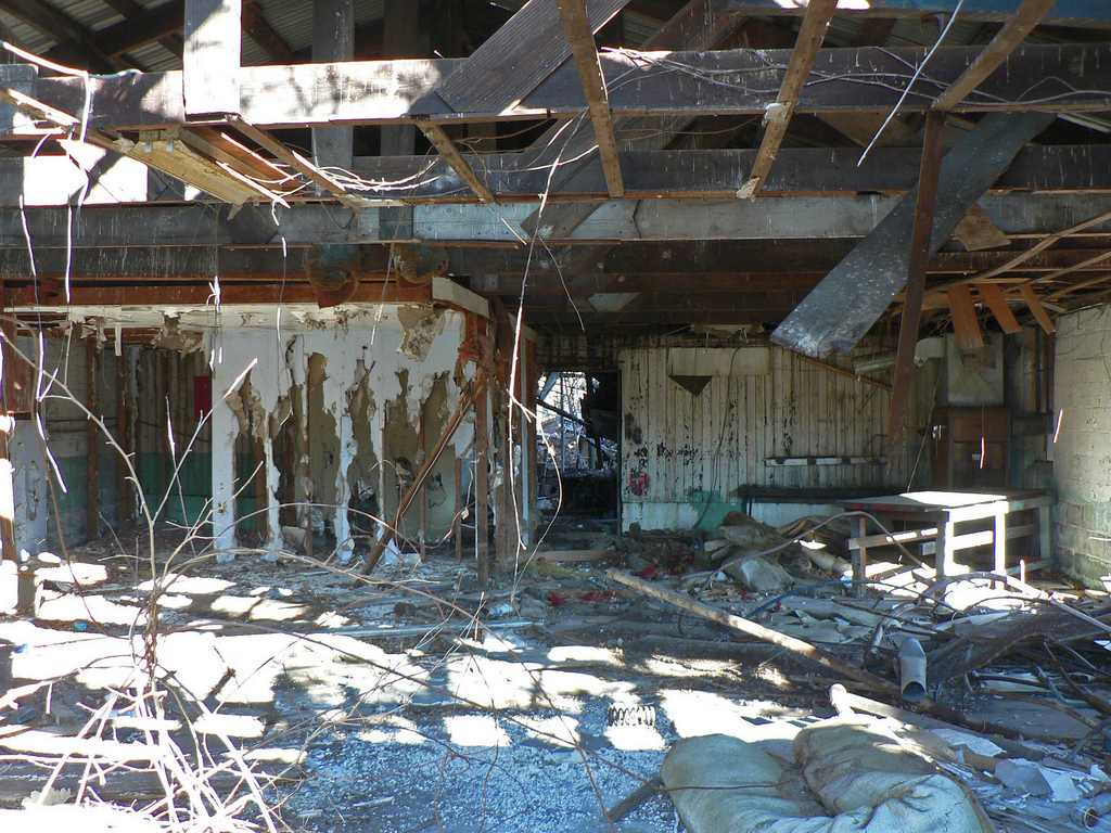
A 12/10/06 photo by Daniel Berek, “Inside the main terminal of what was once a thriving general-aviation airport.”
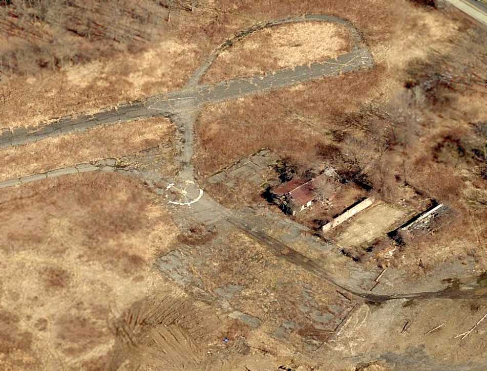
A circa 2006-2010 aerial view looking north at the remains of Hanover Airport,
including the runway, taxiways, ramp, and remains of 2 hangars.
Bill Fusselman recalled, “I lost track of the Oram's & Hanover Airport, returning in 2009 to find it gone. That was a sad day!”
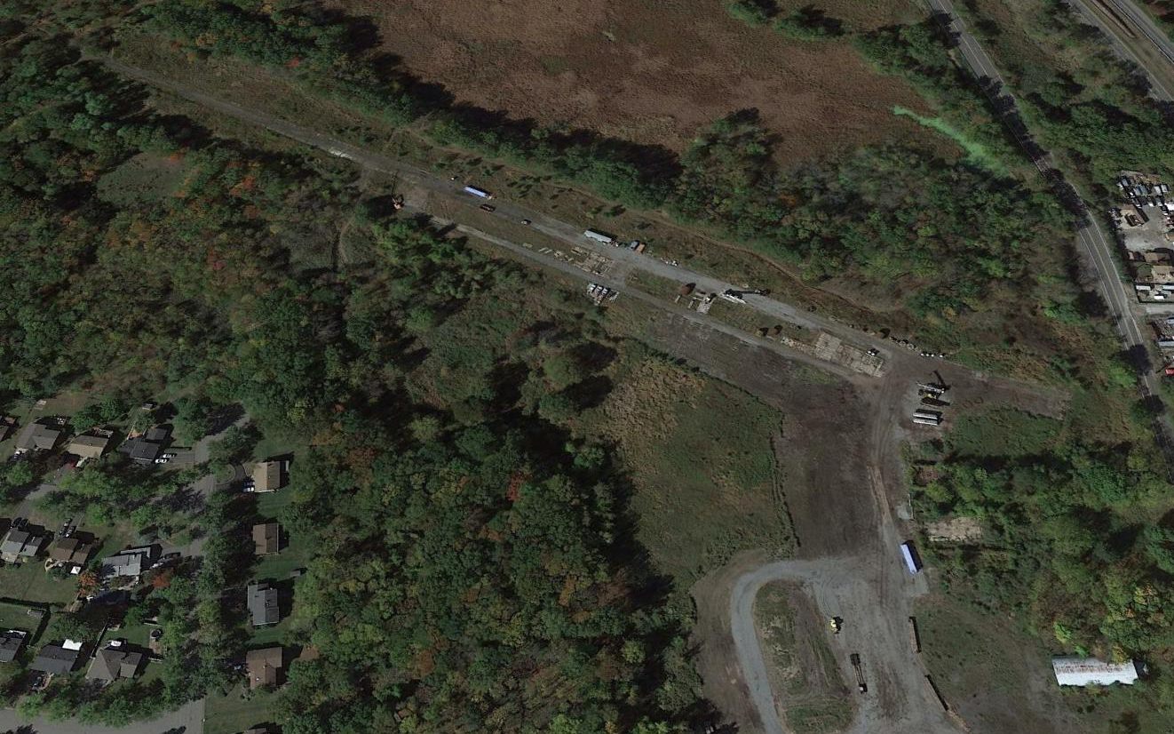
A 2014 aerial view looking northwest at the sad remains of Hanover Airport.

A 2/8/17 photo by Steven Boggess looking southwest along the remains of East Hanover's runway.
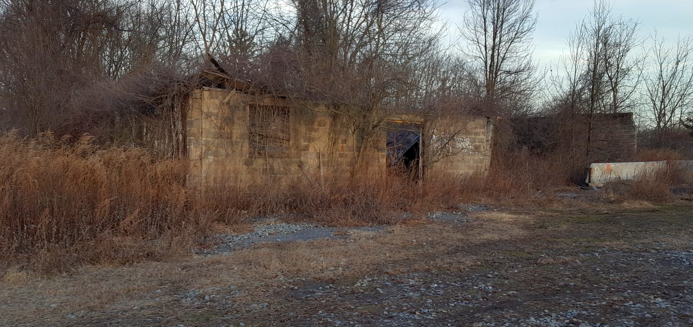
A 2/8/17 photo by Steven Boggess looking north at the remains of an East Hanover Airport building.
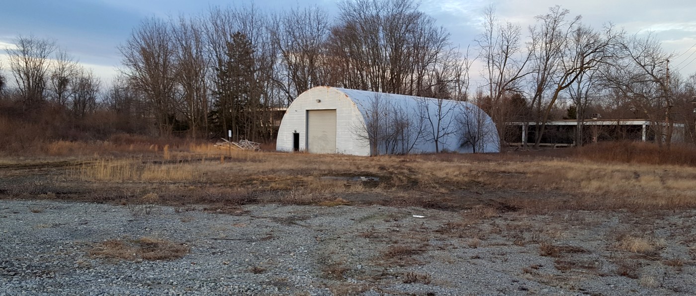
A 2/8/17 photo by Steven Boggess looking northwest at a Quonset hut apparently added after the closure of East Hanover Airport.
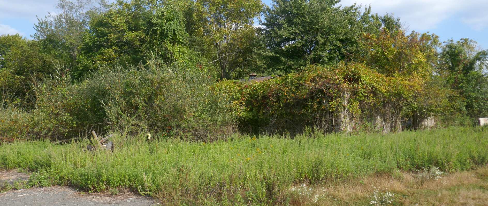
A 2019 photo by Michael LaRose of a former East Hanover Airport building. Michael reported, the “runway & taxiways [were] completely overgrown.”
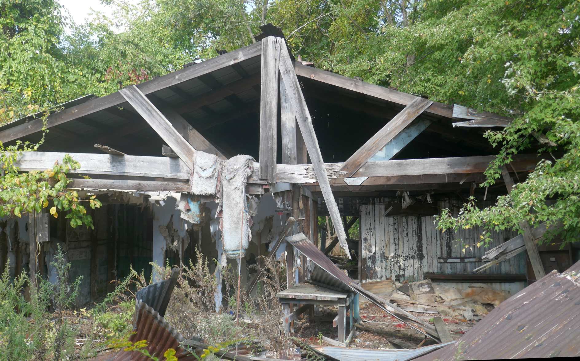
A 2019 photo by Michael LaRose of the interior of a former East Hanover Airport building.
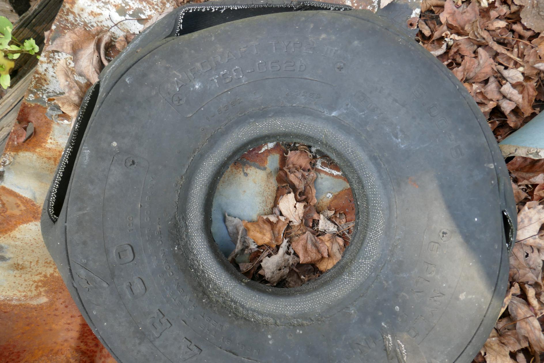
Sad proof that an airport was once here: a 2019 photo by Michael LaRose of one of several aircraft tires left to rot at the East Hanover Airport site.
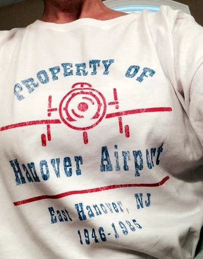
A T-shirt created by Sandee Weiner to commemorate Hanover Airport.
The site of Hanover Airport is located adjacent to the south side of Interstate 280, west of Ridgedale Ave.
Thanks to Aaron Gould for pointing out this airfield,
and to James G. for providing further historical background.
____________________________________________________
Or if you prefer to contact me directly concerning a contribution (for a mailing address to send a check),
please contact me at: paulandterryfreeman@gmail.com
If you enjoy this web site, please support it with a financial contribution.
____________________________________________________
This site covers airfields in all 50 states.