Abandoned & Little-Known Airfields:
Florida: Eastern Pensacola area
© 2002, © 2025 by Paul Freeman. Revised 10/31/25.
This site covers airfields in all 50 states: Click here for the site's main menu.
____________________________________________________
Please consider a financial contribution to support the continued growth & operation of this site.
Bagdad NOLF (revised 9/21/18) - Ellyson Field NAAS (revised 10/31/25) - Holley Field / NOLF 07623 (revised 11/1/19)
____________________________________________________
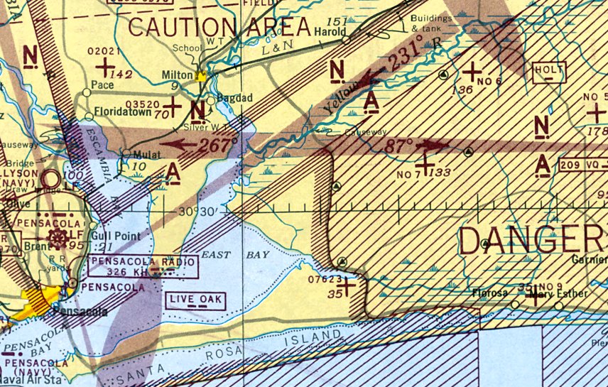
Holley Field / Naval Outer Landing Field 07623 / Holley Naval Outer Landing Field (NKI), Navarre, FL
30.427, -86.895 (East of Pensacola, FL)
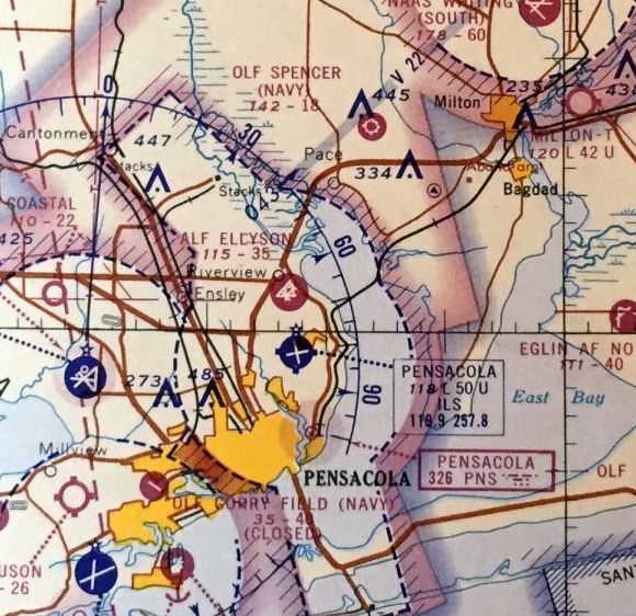
NOLF 07623, as depicted on the January 1944 Mobile Sectional Chart.
Holley NOLF was not yet depicted on the June 1942 Mobile Sectional Chart.
Brian Rehwinkel reported, “Holley OLF (originally Navarre OLF #07923) was acquired during WWII as part of an effort to take advantage of the airspace east of Pensacola.
For several years, the Navy had been using airfields such as Spencer OLF, Pace OLF, and Milton Airport,
but the airspace around Pensacola was very crowed during WWII.
So the Navy added airfields in Baldwin County, AL to the west & Santa Rosa County to the east.
The Navy built Whiting Field NAAS & added other outlying fields such as Bagdad, Santa Rosa, Choctaw, and Holley OLF.”
Brian continued, “The addition of Holley OLF & Santa Rosa OLF also helped the Navy establish their claim to some of the airspace east of Pensacola.
The Navy & the Army didn’t always see eye to eye regarding this airspace.
When the Navy & Army divided up aviation training space in Florida (Arnold-Towers Agreement),
the Navy pushed hard to make sure they were not squeezed too much by the Army.
Because there was designated Army airspace on each side of Pensacola (Mobile to the west & the Army Proving Ground to the east),
the Navy wanted to make sure they were able to spread their wings to the east.
Holley OLF was representative of this effort.
The building of Holley OLF was used later as a justification for the Navy’s continued use of Choctaw OLF.
When the Army asked the Navy to leave the field (even though the field was constructed by the Navy)
the Navy told the Army that the field was built within airspace already designated for Navy training,
and that the Navy already had two other training fields (Santa Rosa & Holley) east of that field.”
Brian continued, “Holley OLF was established to be used as a gunnery field & was planned to be used for over-water gunnery training.
A sister gunnery field, CanaI OLF was built a few months before Holley OLF.
Holley was acquired & opened as a gunnery field in late Spring of 1943.
The field consisted of 640 acres & 3 paved runways (all 3,600’ long).”
The earliest depiction which has been located of Holley Field was on the January 1944 Mobile Sectional Chart.
It depicted NOLF 07623 as an auxiliary airfield.
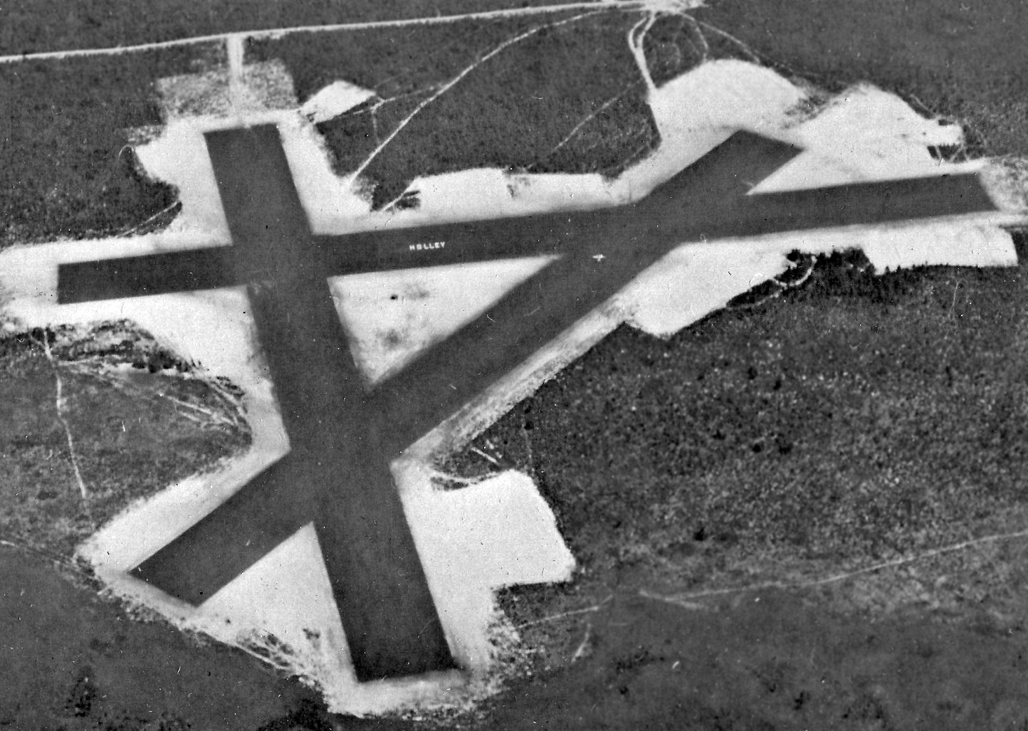
The earliest photo which has been located of Holley Field was a 6/1/44 U.S. Navy aerial view (courtesy of Brian Rehwinkel).
It depicted Holley Field as having 3 asphalt runways, with the airfield's name painted on the east/west runway.
A single aircraft was visible on the northeast/southwest strip.
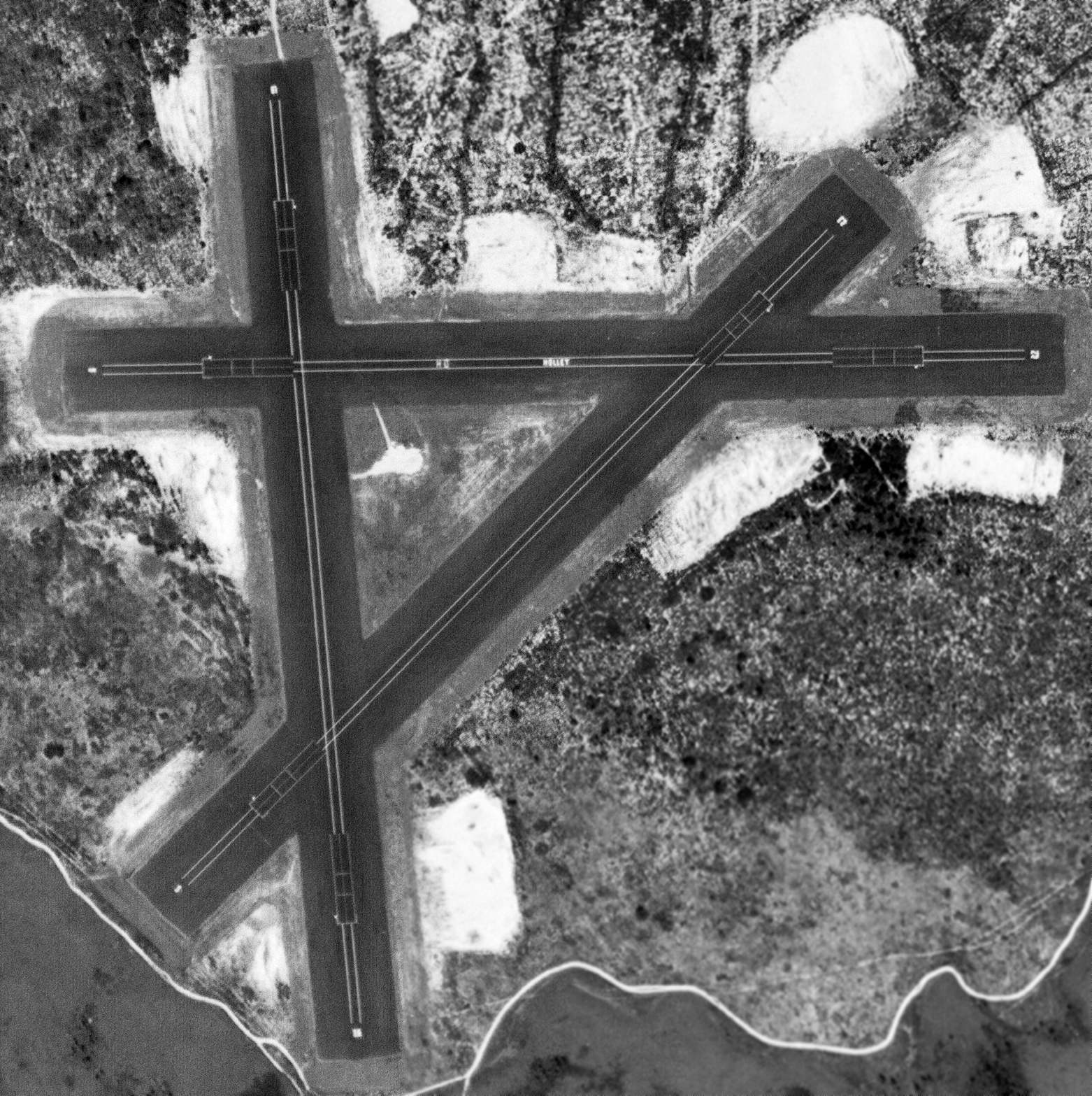
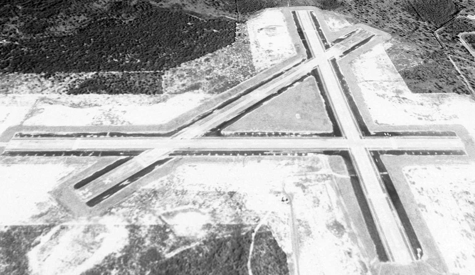
A 10/22/55 USGS aerial view depicted Holley Field as having 3 asphalt runways, with the airfield's name painted on the east/west strip.
The February 1966 Mobile Sectional Chart depicted “OLF Holly (Navy)” as having 3 paved runways, the longest being 3,600'.
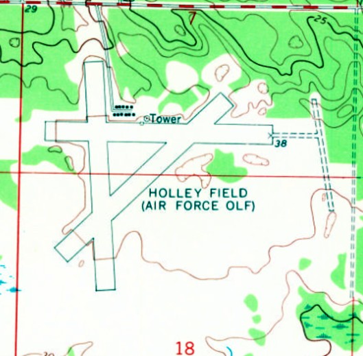
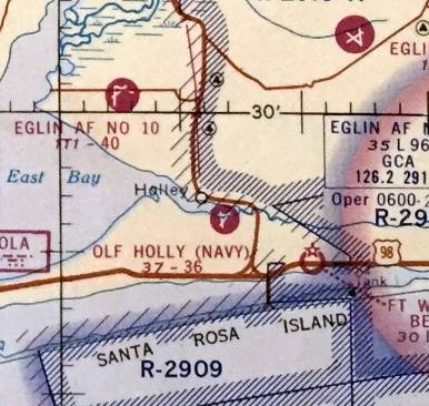
Holley Field evidently was used by the Air Force for some period, as it was labeled “Holley Field (Air Force OLF)” on the 1970 USGS topo map.
It was still labeled “Holley Field (Air Force OLF)” on the 1987 USGS topo map.
A 1994 USGS aerial view looking south depicted Holley Field as having 3 paved runways.
The last aeronautical chart depiction which has been located of Holley Field
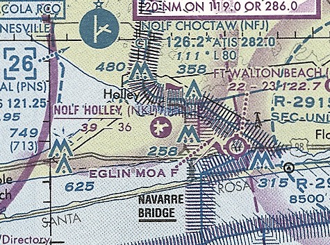
was on the June 1999 New Orleans Sectional Chart (courtesy of Ron Plante).
It depicted “NOLF Holly)” as having 3 paved runways, the longest being 3,600'.
According to Brian Rehwinkel, “The field was used pretty regularly until the Navy began their transition from the T-34C to the T-6 Texan II.
The T-6 requires longer runways than the 3,600' runways at Holley.
In addition, the residential development had completely surrounded the airfield, making expansion of the runways impractical.
This ultimately determined the fate of this field’s aviation future.”
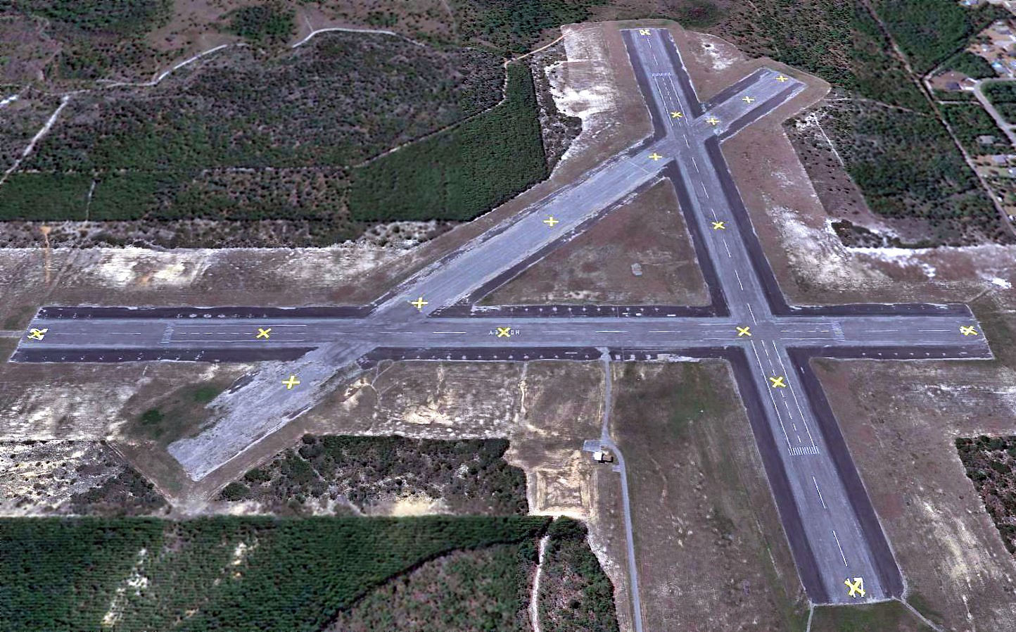
A 2013 aerial view looking south depicted all 3 of Holley Field's runways had been painted with yellow closed-runway “X” symbols.
Brian Rehwinkel reported in 2017, “The Navy stopped using Holley for aviation training several years ago, but didn’t dispose of the property.
Instead, Holly OLF will be a solar farm & will provide energy.
I believe the Navy signed a 30 or 40 year agreement with Gulf Power to use Holley OLF.
So, the field will go on…just not as an airfield.”
As of 2017, Holley Field was depicted as an abandoned airfield on aeronautical charts.
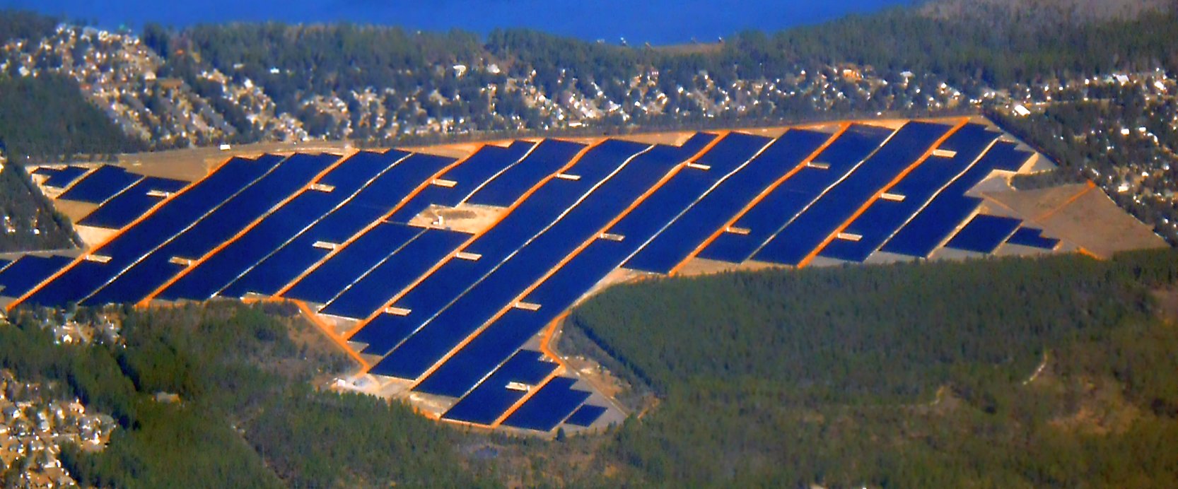
A 1/25/18 aerial view by Alex Price looking north at the site of Holley Field, now covered by solar panels.
Alex Price remarked, “Perhaps a solar farm isn't a bad fate for an abandoned airfield – it preserves the pavement & keeps the land from turning into houses.
In a pinch, if the panels are moved, the airfield could be restored with relative ease.”
Holley Field is located southwest of the intersection of East Bay Boulevard & Holley NOLF Airfield, appropriately enough.
____________________________________________________
Ellyson Field Naval Auxiliary Air Station, Pensacola, FL
30.52, -87.2 (North of Pensacola Airport, FL)
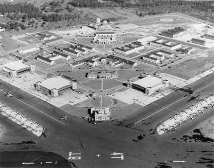
A 10/24/41 US Navy aerial view looking south at Ellyson Field (from the National Archives, courtesy of Brian Rehwinkel).
Ellyson Field was first proposed in 1940 as an outlying landing field
to support Navy flight training operations in the Pensacola area.
The Navy purchased farmland in 1940 to construct the base, initially designated Base Field 01913 (Site 3),
to serve as an auxiliary field for Chevalier Field.
The new ALF was to be equipped with a hangar & repair unit.
Ellyson Field was not yet depicted on the June 1940 Mobile Sectional Chart.
As the war intensified, it was decided to make Site 3 into a larger field similar to Saufley & Corry Fields
to assist in the planned increased flight training.
Construction on the expanded facility began in 1941,
officially named Ellyson Field in honor of CDR Theodore "Spuds" Ellyson, the Navy’s first aviator.
Completed at a cost of slightly over $1.7 million, the new field consisted of six taxiways & runways,
three hangars, administrative & operations buildings, barracks & a mess hall.
On the morning of 10/1/41, 5 divisions of aircraft from VN2D8 (Basic Training Squadron)
flew in a huge V of division Vs from Chevalier Field to their new home at Ellyson.
By 11:00, dedication ceremonies for the new field were completed, and training flights began that same afternoon.
The earliest depiction which has been located of Ellyson Field was a 10/24/41 US Navy aerial view (from the National Archives, courtesy of Brian Rehwinkel).
Brian Rehwinkel observed, it “shows the earliest configuration of this field.
The geometry of these early fields is fascinating... this early design looked similar to the design used at some of the NAS Corpus Christi fields (as an example, Field # 41).”
The earliest aeronautical chart depiction which has been located of Ellyson Field was on the June 1942 Mobile Sectional Chart.
A 1943 aerial view looking northwest at the control tower, hangars, and large numbers of VN-2 Vultee SNV Valiants on the Ellyson Field ramp.
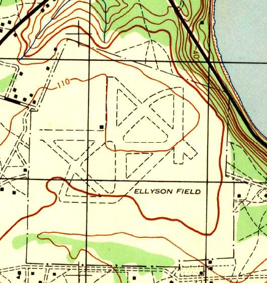
The 1944 USGS topo map of Ellyson Field depicted an airfield layout somewhat different compared to aerial photos from the same period,
particularly lacking the 2 large circular paved mats.
A WW2-era aerial view looking west at Ellyson Field (National Archives photo).
As built during WW2, Ellyson had a 2-field layout: East & West fields,
with a total of 10 asphalt runways (the largest only 3,750').
VN-2A became Ellyson’s only training squadron during WW2
and conducted intermediate basic training there until it was disestablished in 1945.
At the time war was declared, VN-2’s old Vought SU, O3Us & SBU biplanes
were being replaced by the landplane version of the Vought OS2U-3 Kingfisher
and Vultee SNV-1/-2 Valiant, more commonly known as the "Vibrator".
The Kingfisher, used for formation training, was replaced by the SNV by fall 1942.
At its peak, VN-2A operated almost 250 SNVs,
which were used to conduct 4 weeks & 36 hours of familiarization, formation & night flying in single-engine monoplanes
before the cadets, enlisted & officer students moved on to specialized intermediate courses in the SNJ, PBY, SNB & OS2U.
Ellyson Field was designated an NAAS in 1943,
and in 1945 Pensacola’s Intermediate Instructor School with its SNJs, N2Ss, SNVs & N3Ns moved its operations to Ellyson.
At the same time, a Gunnery Instruction Unit was based at Ellyson using SNJs for its fixed-gunnery curriculum.
By 1945 the SNJ began to replace the SNV,
and by the end of the war the Vibrators had disappeared from Ellyson & the Training Command.
In November 1945, with primary & basic training moving to Corpus Christi,
the field was placed in a reduced status & used for trainer storage until it was deactivated & eventually disestablished in 1947.
During the next 3 years, portions of the field were released for civilian use.
Occupying the facilities at Ellyson was a school for handicapped children & a training center for the Brooklyn Dodgers baseball club.
In the course of the Korean War build up, a significant expansion of the helicopter flight training program was required.
With this in mind, the Navy decided to reactivate Ellyson Field as a training base
and move its helicopter pilot training from HU-2 at NAS Lakehurst to the Pensacola area
where training activities were more easily controlled.
In addition, there was land nearby available for expansion.
ALF Ellyson & Helicopter Training Unit One (HTU-1) were officially established together in 1950.
All training flights except for some advanced instruction were initially conducted within the field boundaries.
Since the mid-1950s training was also conducted
at several outlying auxiliary fields that included Spencer & Sites 4, 6 & 8.
"Pinwheel" or "Whirlybird" students, as they were known then,
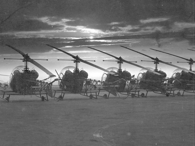
began their pre-solo & intermediate stages in the Bell HTL-4 & Hiller HTE-1/-2 trainers,
and went on to fly the service-type Sikorsky HO3S-1 & Piasecki HUP-2 in the advanced stage.
The HTEs were removed from Ellyson by late 1952.
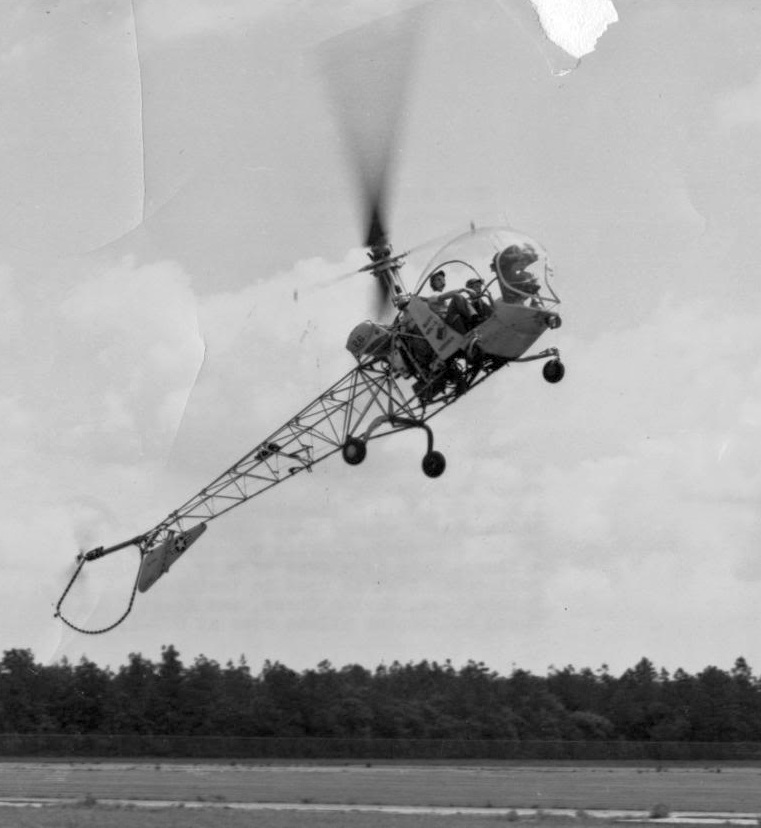
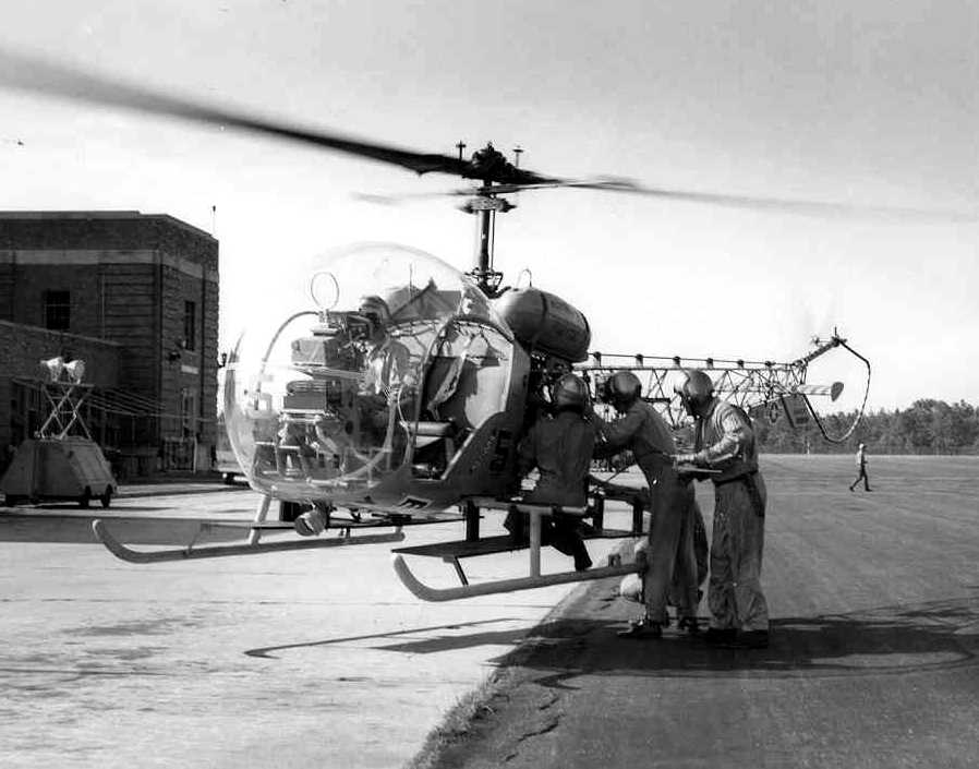
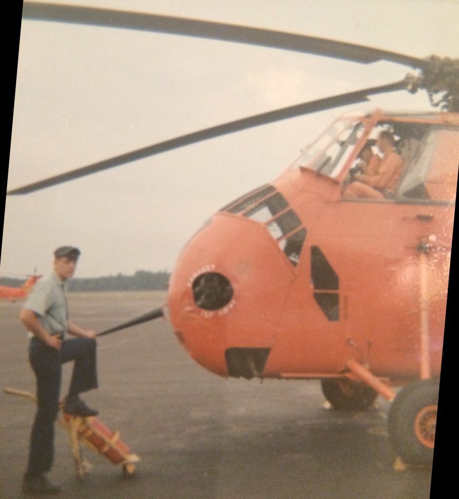
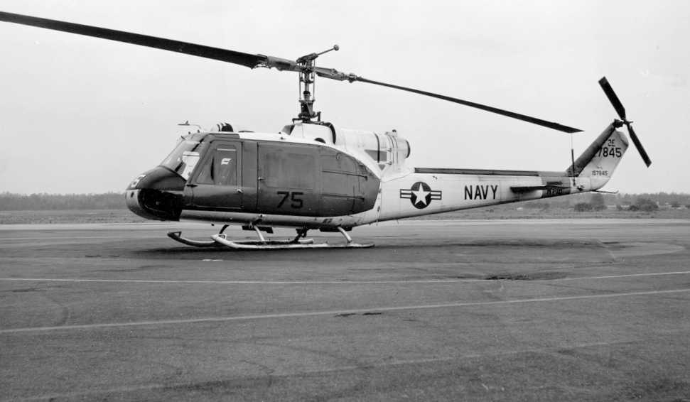
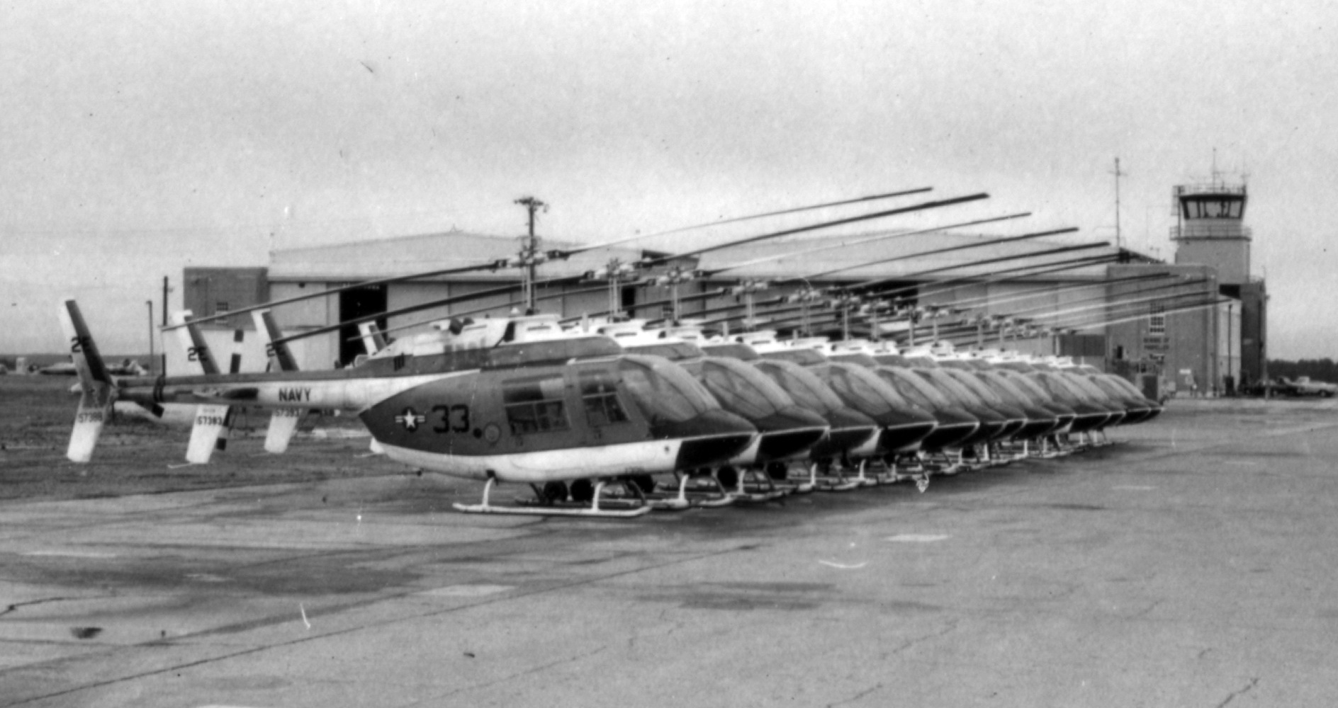
An undated photo of a Navy Bell HTL helicopter of Helicopter Training Unit One
doing what appears to be a practice autorotation at Ellyson Field (courtesy of Dallam Oliver-Lee).
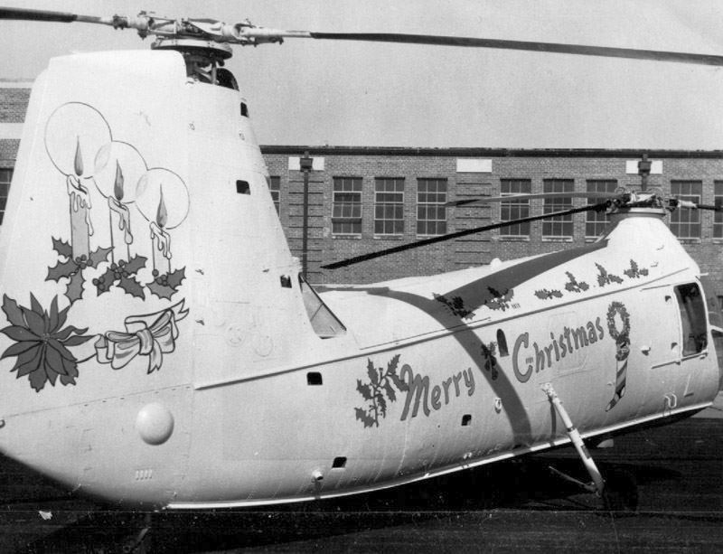
A 1950s photo of a Piasecki HUP Retriever decorated for the holidays in front of a Ellyson Field hangar (courtesy of Dallam Oliver-Lee).
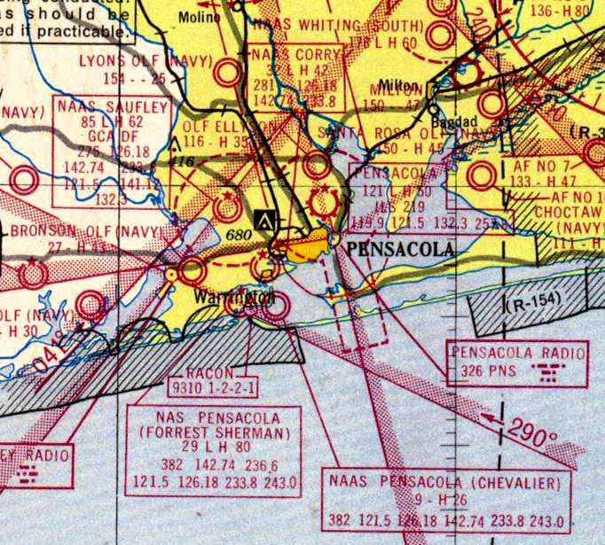
A 1956 aeronautical chart (courtesy of Dallam Oliver-Lee) depicted OLF Ellyson
(among a dizzying array of Pensacola-area airfields) as having a 3,500' paved runway.
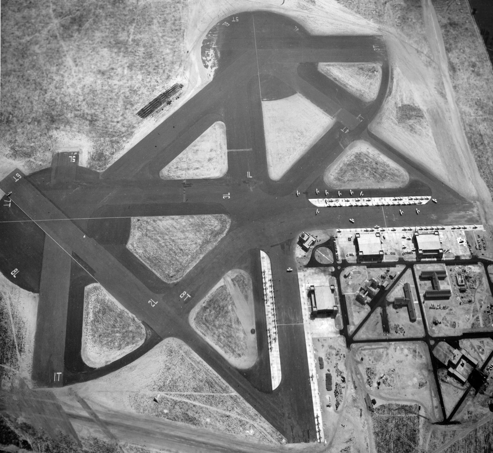
A 10/22/56 USGS aerial view depicted OLF Ellyson ALF strangely devoid of almost all aircraft, with only 1 fixed-wing single-engine aircraft visible on the ramp north of the control tower.
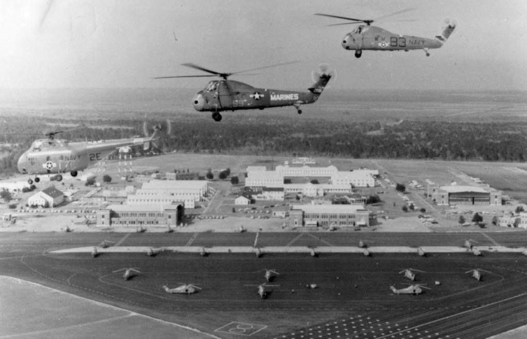
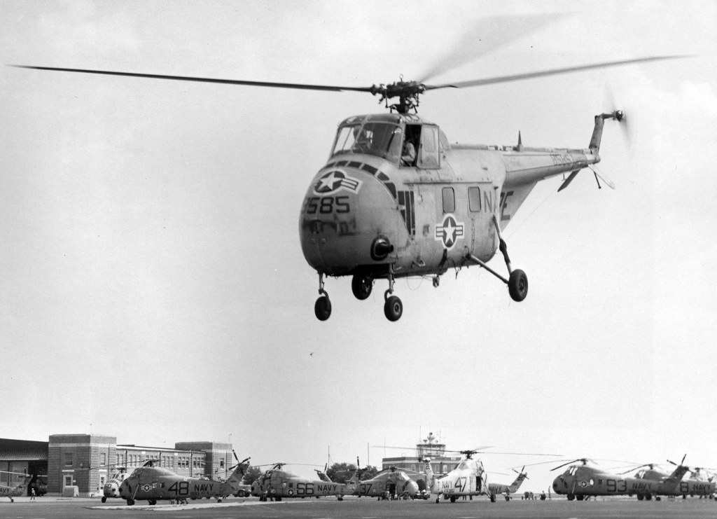
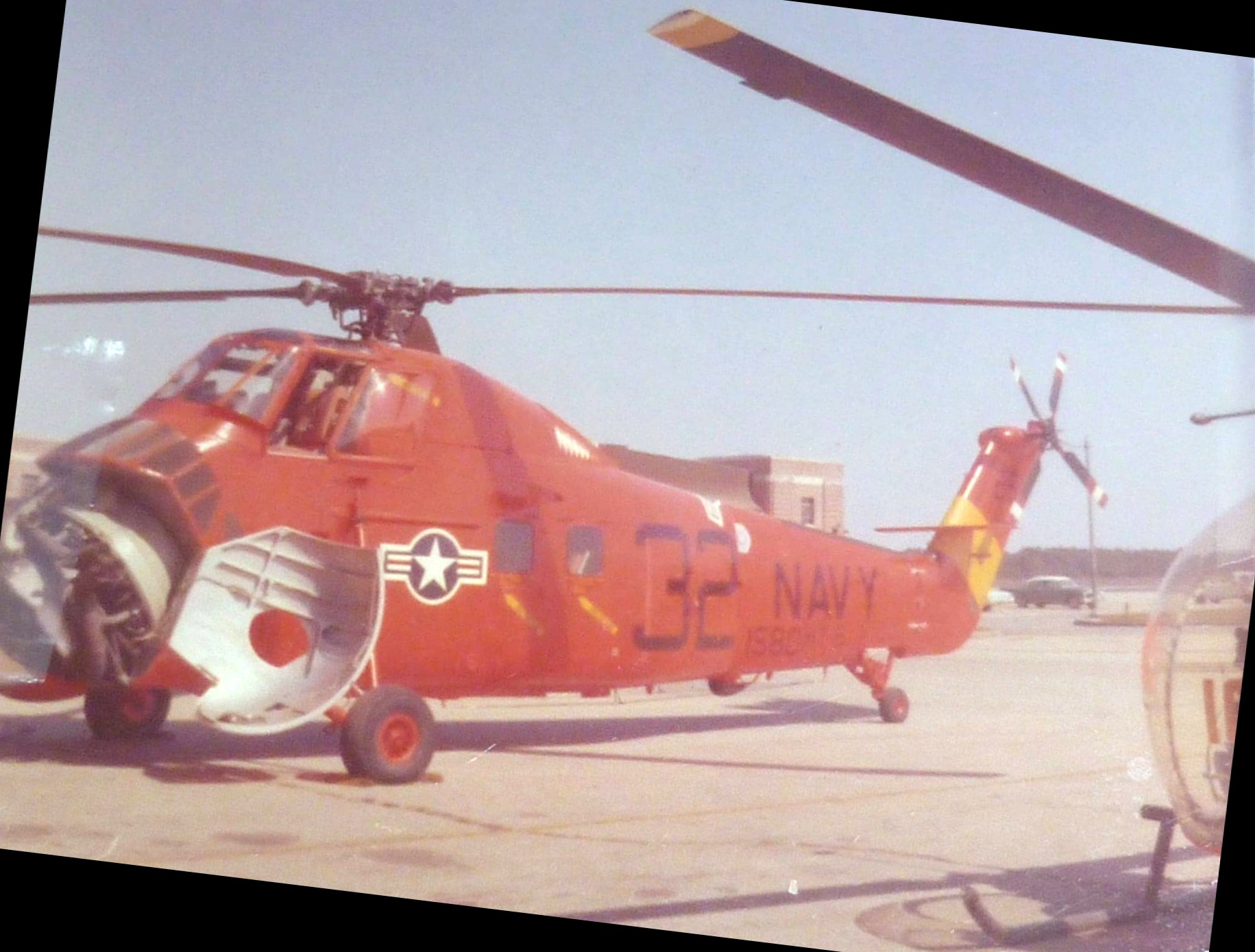
A circa late 1950s aerial view of a formation of a Navy Sikorsky H-19 Chickasaw & 2 Sikorsky HUS-1 Seahorse helicopters (one each in Marines & Navy markings)
overflying Ellyson Field (courtesy of Dallam Oliver-Lee).
The Sikorsky HO4S replaced the HO3S as an advanced trainer at Ellyson in mid-1957.
In the late 1950s the helicopter came into its own with the with the widespread
The jet-powered helicopters that quickly followed increased the community’s versatility & effectiveness.
Following on the heels of the technological advances was the Vietnam War,
which increased the need for helicopter pilots as well as the HT-8 training load.
The 1960 Jeppesen Airway Manual (courtesy of Chris Kennedy)
depicted "Ellyson ALF" as having a total of 8 paved runways, with the longest being the 3,550' Runway 4L/22R.
A Bell HTL-6 pictured during its unofficial endurance flight during which it remained airborne for 72 hours & 2 minutes at Ellyson Field between June 5-8, 1961.
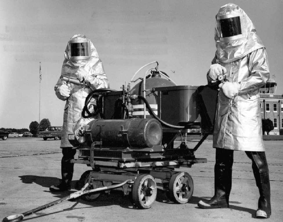
A 1962 photo (courtesy of Walt Eggers), originally captioned “Testing relatively new firefighting gear”, with Ellyson's control tower visible at right.
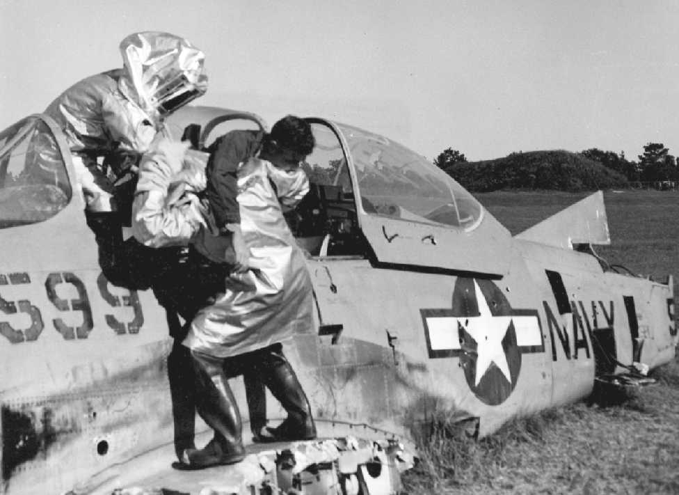
A circa 1962 photo (courtesy of Walt Eggers), originally captioned “Dry runs at drill area”, showing Ellyson's firefighters practicing on a wrecked T-28 Trojan.
Walt Eggers recalled, “Ellyson Field... I was stationed there 1964-68 & enjoyed the area & my time there very much, it’s kind of sad to see it the way it is today.
I was in Crash/Fire/Rescue at the time.”
In mid-1963 helo training was increased from 60 to 80 hours,
with the extra 20 hours devoted to night & instrument training in the Sikorsky UH-34D/G Seabat/Seahorse,
the new advanced trainer.
In 1963, NASA requested that HT-8 provide a 2-week familiarization course
in the Bell TH-13 for 14 of its 15 original astronauts.
The training also provided Lunar Excursion Module simulation used in the Project Apollo lunar landing program.
This training continued throughout the 1960s for NASA support personnel & additional astronauts.
A Sikorsky SH-34G Seabat hovers over the main gate of Ellyson Field in 1964.
A 9/24/64 photo of the last Sikorsky UH-19F helicopter departing Ellyson Field (from the Emil Buehler Library at the NNAM, via Maureen Keillor).
"ALF Ellyson (Navy)" was depicted as an active airfield on the 1964 Mobile Sectional Chart (courtesy of John Voss).
The airfield was described as having a total of eight asphalt runways, with the longest being 3,550'.
The remarks said, "ALF to Pensacola NAS. Extensive helicopter training."
A 10/28/65 aerial photo of Ellyson Field (courtesy of the FL DOR via Brian Rehwinkel).
Several dozen helicopters are visible on the western side of the field, which still retained its WW2-era layout.
The February 1966 Mobile Sectional Chart (courtesy of David Stevenson)
depicted “ALF Ellyson” as having multiple paved runways, the longest being 3,500'.
A 1966 photo of 5 Bell TH-13 training helicopters at Ellyson Field (from the Emil Buehler Library at the NNAM, via Maureen Keillor).
A 1966 photo of Robert Huston with a Sikorsky H-34 Seabat at Ellyson Field.
Robert recalled, “I was stationed there from 5/66-9/68.”
A circa 1960s photo of a Sikorsky H-34 Seabat in front of an Ellyson Field hangar.
As a result of the increasing importance of helicopter aviation within the Navy & the accelerating activity at the installation,
Ellyson was redesignated a Naval Auxiliary Air Station in 1967, and then a full Naval Air Station in 1968.
Striving to establish an all-jet helicopter training program by mid-1970,
HT-8’s piston-powered Bell primary trainers were replaced by the turboshaft-powered Bell TH-57A Sea Ranger by 1969.
The UH-34 advanced trainer gave way to the Bell TH-1L Huey beginning in 1969.
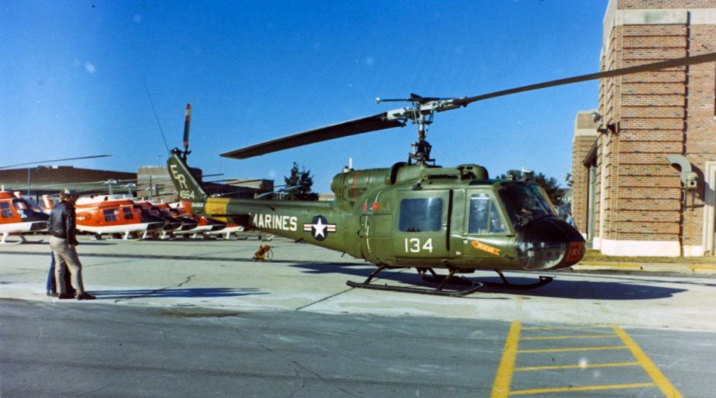
A circa 1969-73 photo of a row of TH-57s & a Marine UH-1 next to the Ellyson Field hangars (courtesy of Dallam Oliver-Lee).
“NAS Ellyson” was still depicted on the 1970 USGS topo map.
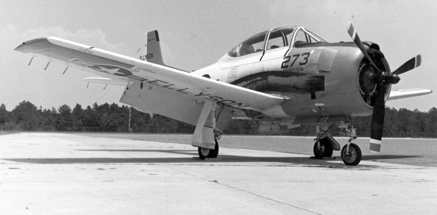
The last photo which has been located showing a fixed-wing aircraft at Ellyson Field was a 9/3/70 photo (from the National Museum of Naval Aviation)
of a T-28B Trojan (note the “Ellyson” painted on the bottom of its wing).
A circa 1971 photo of a Bell TH-1L from HT-18 at Ellyson Field.
The photographer noted, “These Hueys were used as advanced trainers for helicopter pilots in HT-8 & HT-18.”
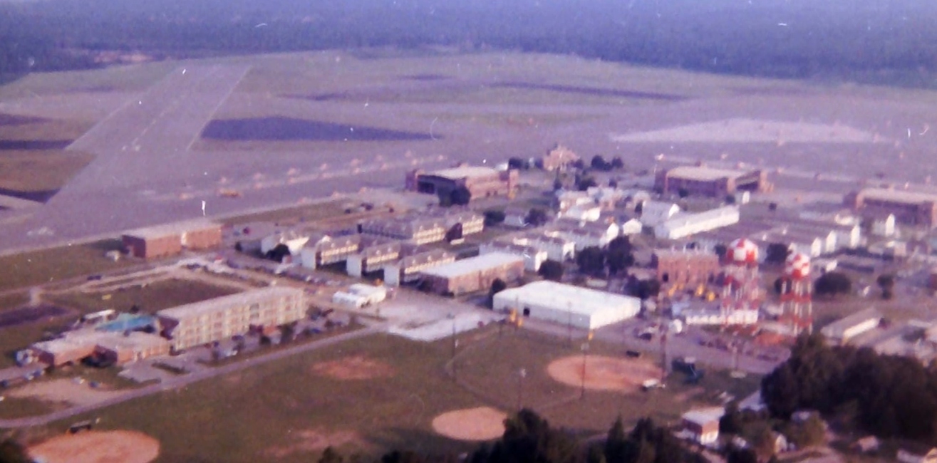
A circa 1972 aerial view looking southeast at Ellyson Field.
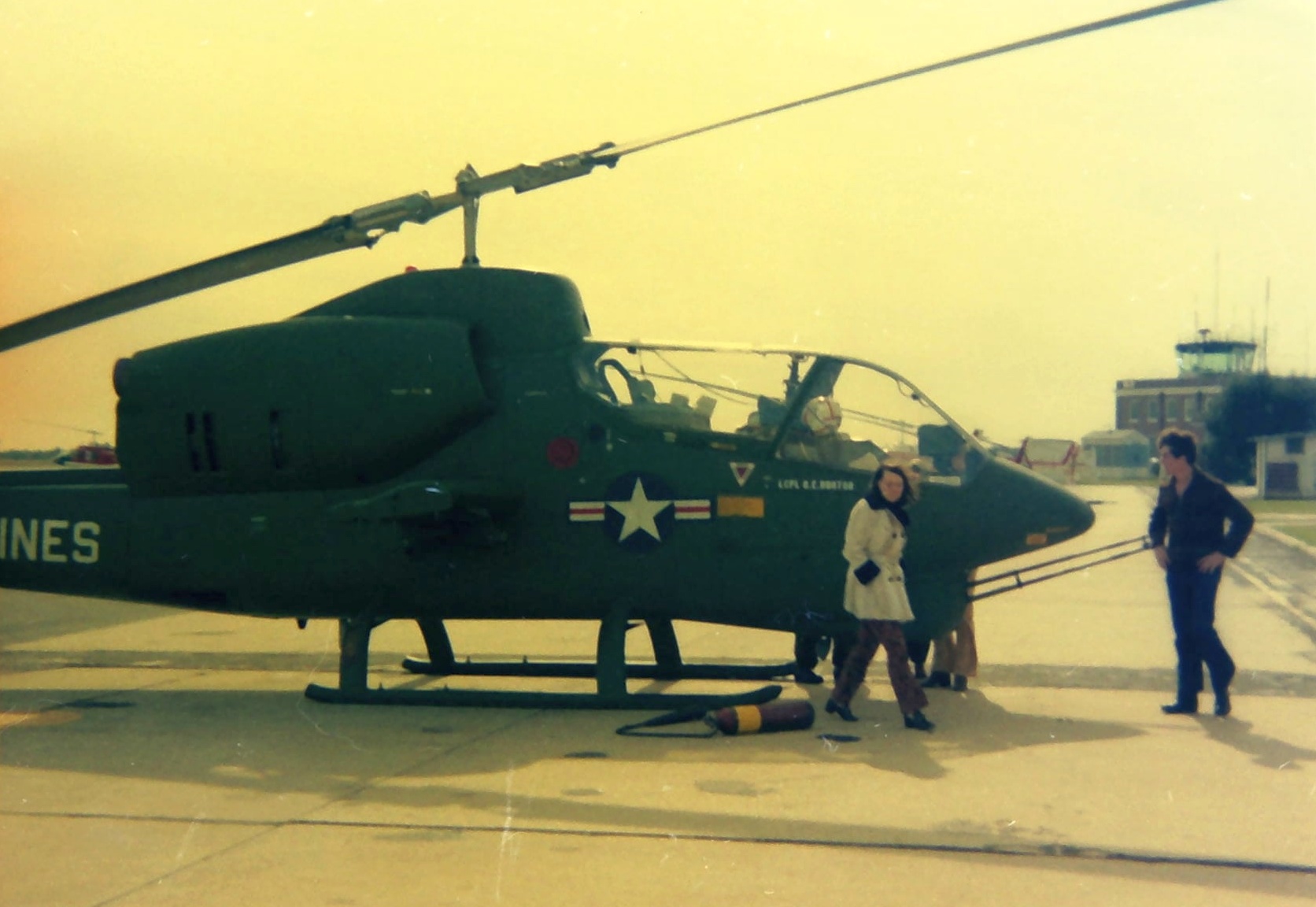
A circa 1972 photo of a Bell AH-1J SeaCobra with the Ellyson Field control tower in the background.
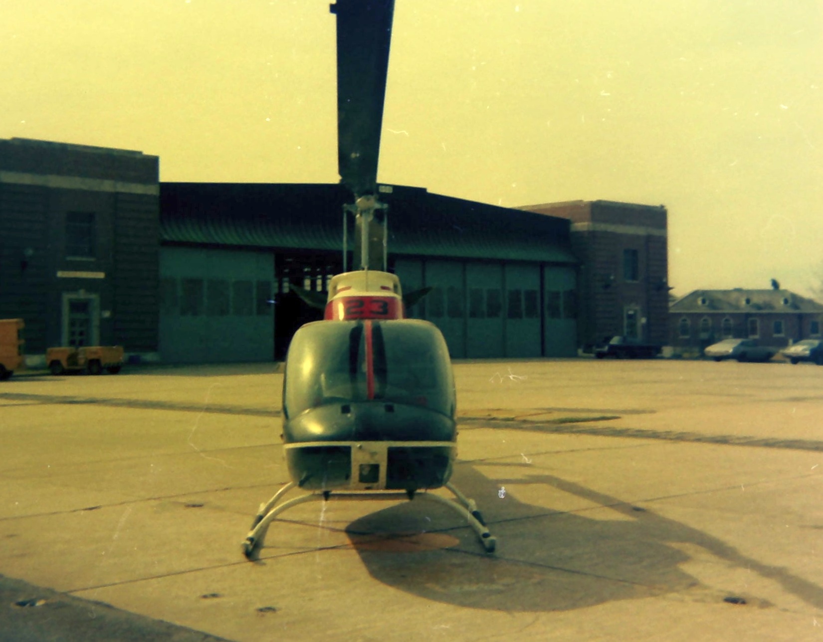
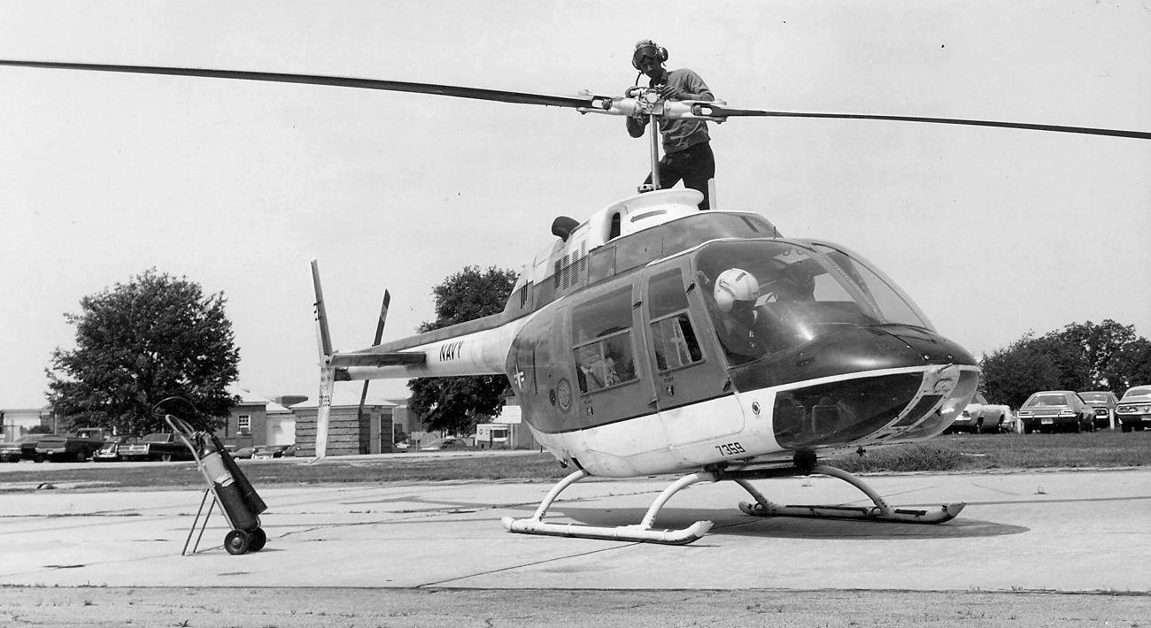
A circa 1972 photo of a Bell TH-57 JetRanger in front of an Ellyson Field hangar.
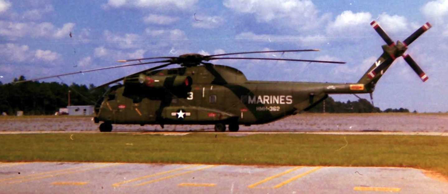
A circa 1970s photo of a Sikorsky CH-53A or 53D at Ellyson Field.
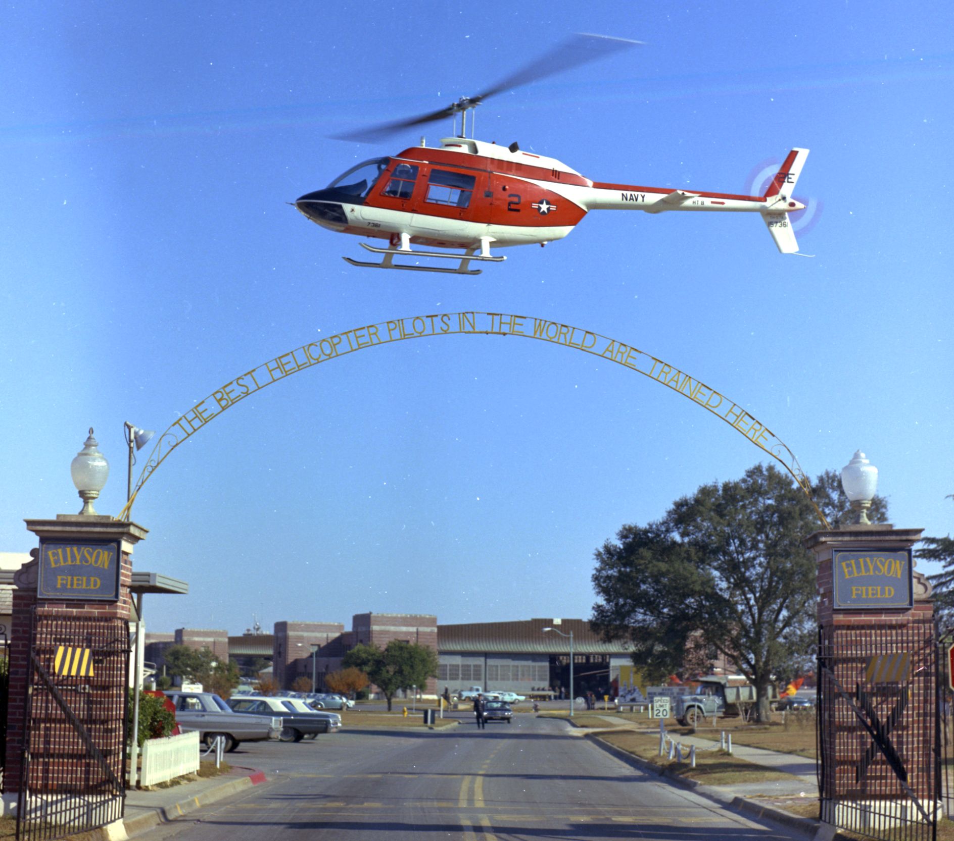
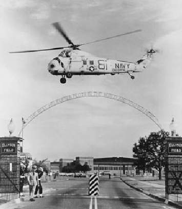
An October 1972 USN photo of a Bell TH-57 JetRanger over Ellyson Field's main gate.
Due to constant conflict with Pensacola’s civilian airport traffic pattern & the reorganization of the Training Command in 1972,
it was decided to close Ellyson & move helicopter training in 1973 to NAS Whiting Field.
A 4/30/73 photo (from the National Museum of Naval Aviation) of a plane captain inspecting the rotor of a Bell TH-57A Sea Ranger of Helicopter Training Squadron 8 at Ellyson Field.
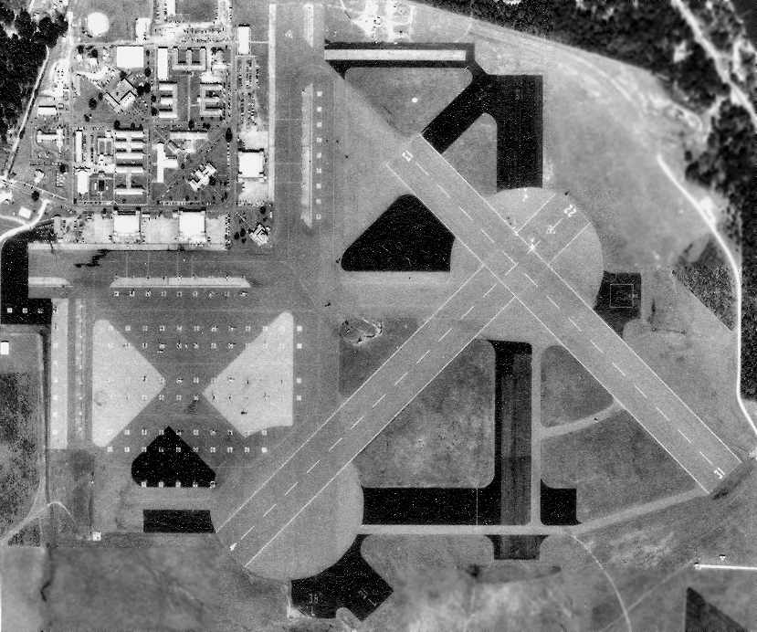
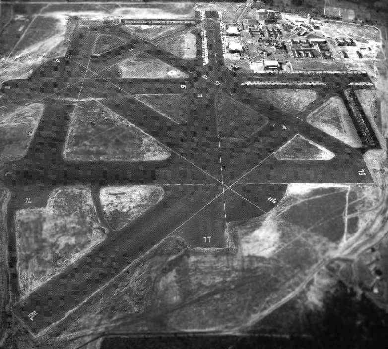
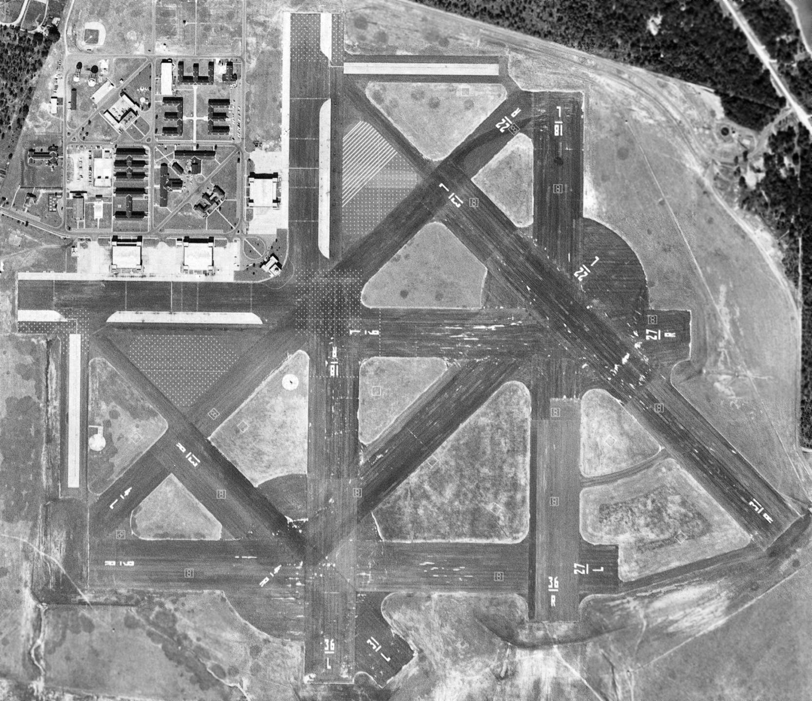
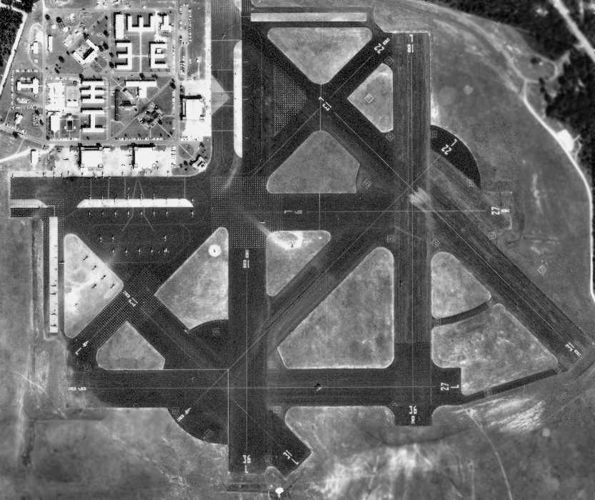
A 10/22/73 aerial photo of Ellyson by Mark Hurd Aerial Surveys (courtesy of Brian Rehwinkel),
taken only 2 months before helicopter flight operations were ended at Ellyson.
Note how the runways had been modified for helicopter training.
Flight operations ceased at NAS Ellyson Field on 12/28/73,
and soon afterward the base was declared a non-aviation activity & claimed by the Naval Education & Training Program Development Center.
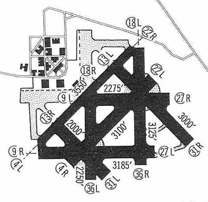
NAS Ellyson was still depicted as an active airfield on the January 1976 New Orleans Sectional Chart (courtesy of Chris Kennedy), and was described as having a 3,100' hard-surface runway.
Following the Naval Education & Training Program Development Center’s move to Saufley Field in 1979, Ellyson was declared excess & the gates were permanently closed.
Three runways at Ellyson were depicted on the 1981 USGS topo map but the base was labeled as “Landing Field (Abandoned)”.
NAS Ellyson was no longer depicted on the December 1983 New Orleans Sectional Chart.
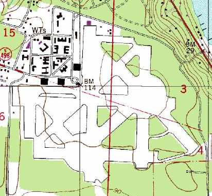
Ellyson's numerous runways were still depicted on the 1987 USGS topo map,
but the field was not labeled at all.
As of the 1990s, the site of the former NAS Ellyson Field was being reused as an industrial park,
in which several of the original buildings still stood, including the 3 hangars,
the academic training building, the dispensary, and the BOQ.
The former tower & operations building were being used
as the headquarters for the 417th Signal Battalion of the Florida National Guard.
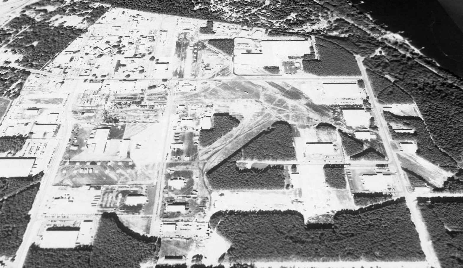
A 1994 USGS aerial view looking north showed the Ellyson Field property had been progressively redeveloped,
but outlines of several former runways were still recognizable.
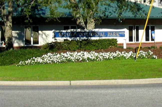
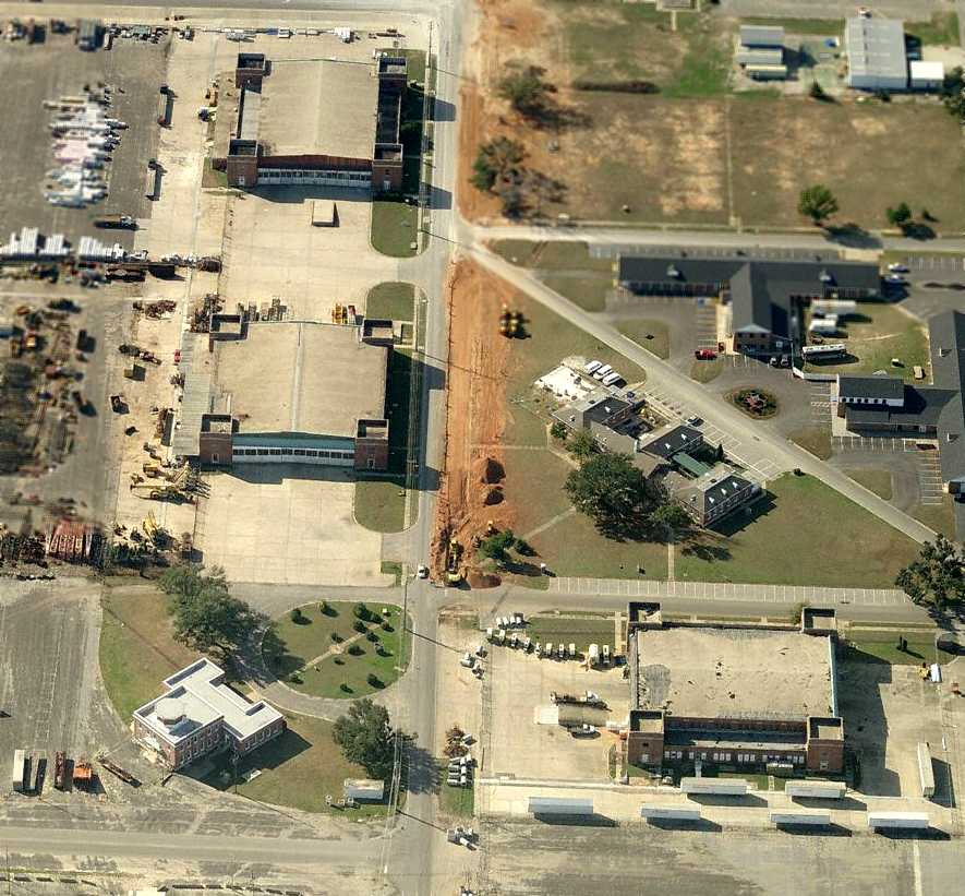
A January 2006 photo by Paul Freeman looking northeast at the sign at the southwestern entrance to the “Ellyson Industrial Park”.
Paul Freeman visited the site of Ellyson Field in 2006, now the “Ellyson Industrial Park”.
A significant number of airfield buildings still remain standing & in very good condition,
including 3 large hangars, the control tower / operations building,
and several other buildings on the northwest corner of the site.
The buildings are reused by a variety of industrial businesses.
A network of roads now criss-cross the former runways,
with numerous industrial buildings having been built over the former airfield.
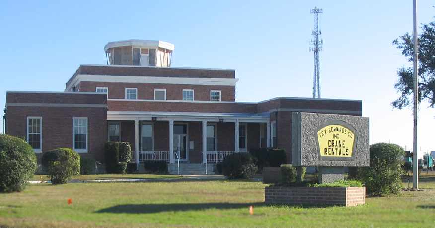
A January 2006 photo by Paul Freeman looking southeast at entrance of the former Ellyson control tower & operations building,
with a sign indicating it is reused by the “Tex Edwards Company Inc., Crane Rentals”.
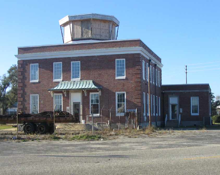
A January 2006 photo by Paul Freeman looking northwest at the front of the former Ellyson control tower & operations building.
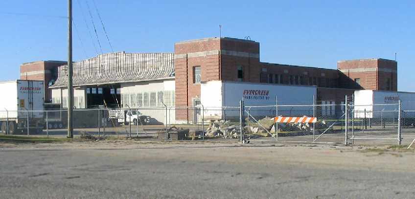
A January 2006 photo by Paul Freeman looking northwest at the hangar just north of the control tower.
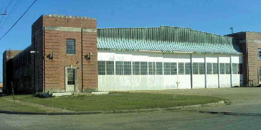
A January 2006 photo by Paul Freeman looking southeast at the hangar just west of the control tower.
A circa 2007 aerial view looking west at Ellyson's control tower & 3 hangars which remain standing.
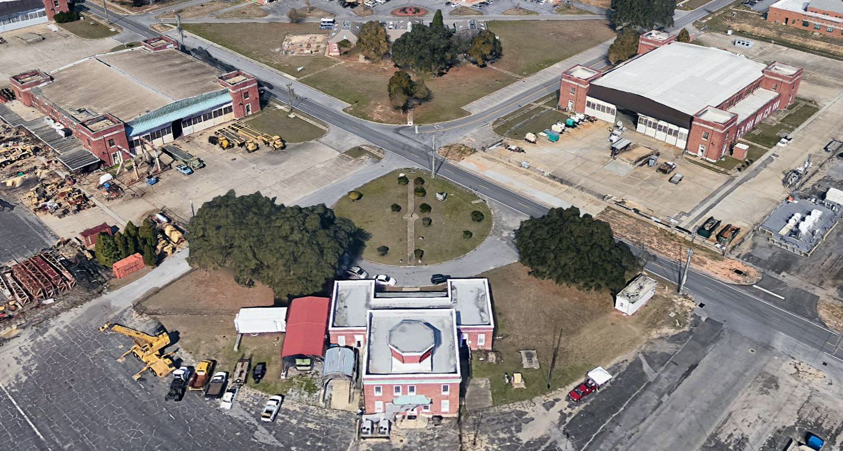
A circa 2015-18 3-D aerial image looking northwest at Ellyson's control tower & hangars.
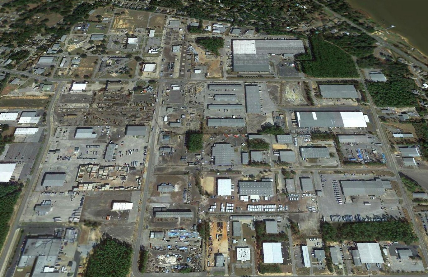
A 2017 aerial view looking north showed all traces of Ellyson Field's runways had been erased, with the only remains being the former hangars at top-left.
See also: http://www.pafw.com/ellyson.htm
____________________________________________________
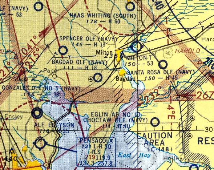
Bagdad Naval Outer Landing Field, Bagdad, FL
30.58, -87.08 (Southwest of Whiting Field NAS, FL)
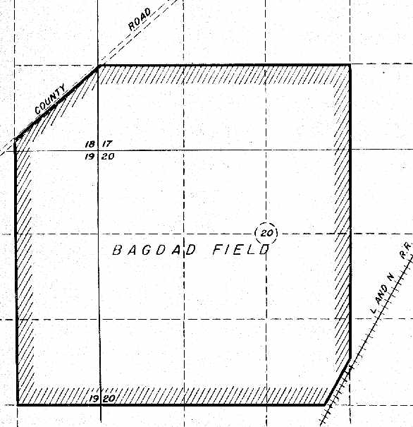
A 5/1/43 Navy plat of "Bagdad Field" (courtesy of Brian Rehwinkel).
Nothing was yet depicted at the site of Bagdad Field on a 11/3/40 USDA aerial photo (courtesy of Dallam Oliver-Lee).
Much of the following information about Bagdad Field was submitted by Brian Rehwinkel.
Bagdad Outlying Field (also known as Field # 3520) was constructed in 1943/1944
to help handle the expansion of Pensacola's Naval Air Training Center.
With the opening of Whiting Field NAAS in 1943,
more training fields were needed for the eastern side of the greater Pensacola area.
Bagdad OLF was one of several new fields built east of Pensacola (Santa Rosa OLF, Choctaw OLF, and Holley OLF)
in the latter part of the Second World War.
According to Navy records, 614 acres of land for the field was acquired in 1943 for $3,400.
In late 1943 & early 1944, the Navy invested $347,136 in improvements to the field, which included eight 1,800' X 200' runways.
Bagdad was used for the remainder of the war as an outlying field for Ellyson Field NAAS.
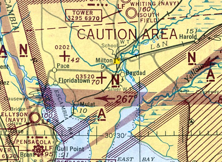
The earliest aeronautical chart depiction which has been located of Bagdad NOLF was on the January 1944 Mobile Sectional Chart,
which depicted NOLF 03520 as an auxiliary airfield.
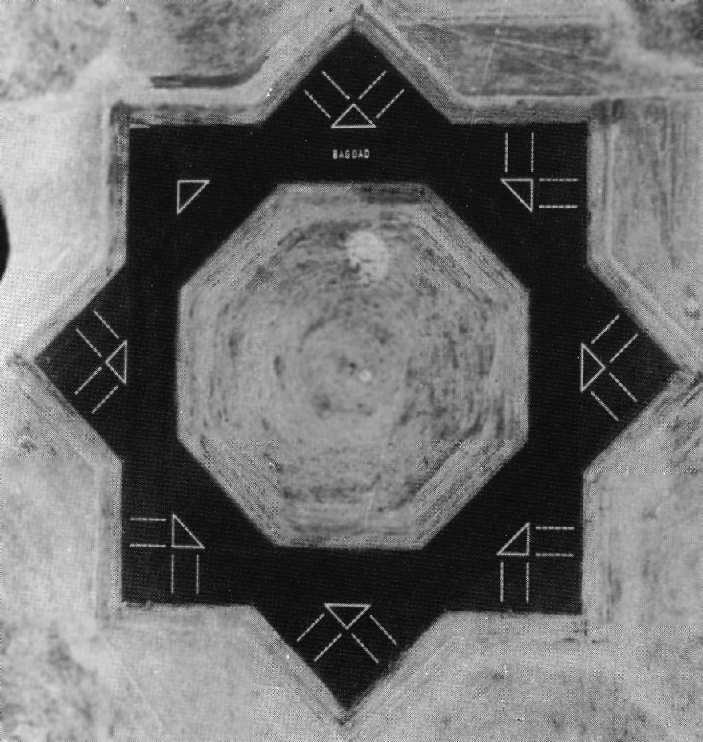
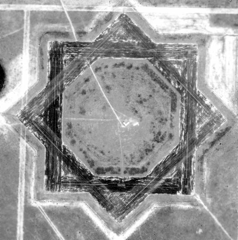
As can be seen in a WW2-era view of Bagdad NOLF (National Archives photo),
Bagdad's airfield consisted of a complex of eight 1,500' asphalt runways,
evenly spaced around the compass.
It would appear to be the perfect runway layout for unpredictable winds -
never a crosswind landing!
After the war ended, Bagdad was initially declared surplus by the Navy in May 1946;
however, the Navy quickly reversed course & withdrew the request to surplus the field.
The Navy made use of the field for several years after the war.
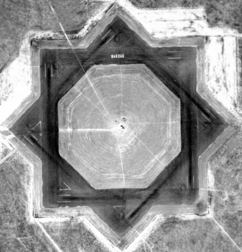
A 1/9/49 USDA aerial photo of Bagdad NOLF (from the FL DOT, courtesy of Brian Rehwinkel).
The last aeronautical chart depiction which has been located of Bagdad NOLF was on the February 1955 Mobile Sectional Chart.
It depicted "Bagdad OLF (Navy)" as having an 1,800' paved runway.
The Navy eventually reported the field as excess (for disposal) to the Department of General Services in July 1959,
and the property was sold in 1960 for $128,400 “to various private parties”
according to a 4/3/72 NAS Pensacola Installation Survey Report (courtesy of Maureen Keillor).
Bagdad NOLF was depicted as an abandoned airport on the March 1960 Mobile Sectional Chart.
The field was evidently never reused for civilian aviation.
In the March 1961 aerial photo of Bagdad NOLF (from the FL DOT, courtesy of Brian Rehwinkel),
it was still marked "Bagdad" (although this marking had been moved from the northern runway to the southern runway).
The runways were also noticeably deteriorated, compared to the 1949 aerial photo.
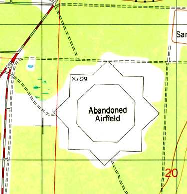
The 8 former runways of Bagdad NOLF were still depicted as "Abandoned Airfield" on the 1978 USGS topo map.
The last photo which has been located showed Bagdad NOLF remaining completely intact was a 2/2/81 aerial view (courtesy of Dallam Oliver-Lee).
A 4/3/85 aerial view (courtesy of Dallam Oliver-Lee) showed that a structure had been built over the northwest corner of the airfield.
The 1987 USGS topo map depicted Bagdad NOLF in the same fashion as the 1978 topo.
A 1/23/94 aerial view (courtesy of Dallam Oliver-Lee) showed that a 2nd structure had been built over the northwest corner of the airfield.
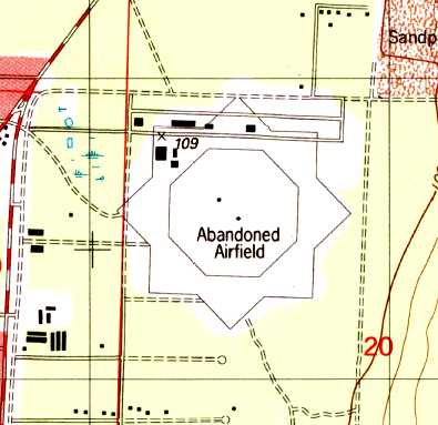
The 1994 USGS topo map still depicted the star-shaped runway layout, but a road & several buildings
had been added along the northern portion at some point between 1987-94.
In the 11/26/99 USGS aerial photo,
the western half of the site of Bagdad NOLF had been extensively built upon with new housing,
but the original runway pavement was still recognizable & clear on the eastern half of the former airfield.
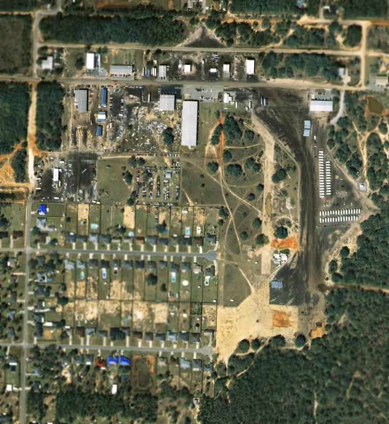
In a 2003 aerial photo the original runway layout was still recognizable on the eastern half of the former airfield,
but much of the former runway pavement was being used to park Federal Emergency Management Agency trailers,
which were being used to house those displaced by recent hurricane damage.
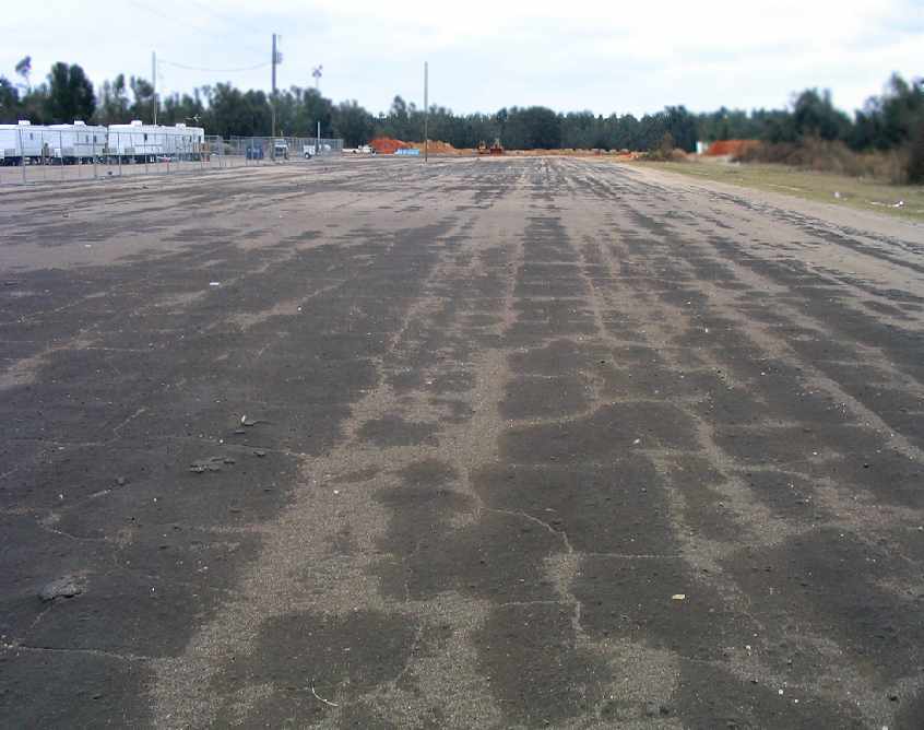
A January 2006 photo by Paul Freeman, looking south along the former western north/south runway at Bagdad.
Note the camp of Federal Emergency Management Agency trailers on the left.
The trailers occupy the northeastern portion of the the former western north/south runway.
The eastern half of the former airfield is unrecognizable as such,
being covered by a variety of streets, houses & buildings.
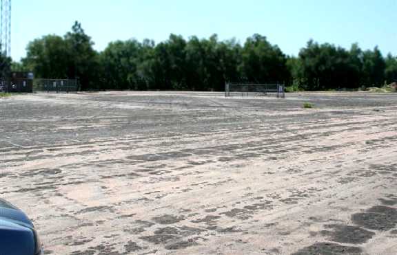
But the western half of the airfield remains largely intact,
with a significant portion of 4 asphalt runways remaining intact.
A 2008 photo by Dick Merrill of the remains of the Bagdad runway pavement.
Dick reported, “Bagdad has been turned into a 2nd-rate industrial park.
This photo was taken on the east side looking toward the eastern-most point of the star formed by the pavement.
Most of the original pavement is still there where not covered up by buildings or new roads.”
A 1/3/12 aerial photo (courtesy of Dallam Oliver-Lee) showed that the original runway layout was still barely recognizable at the edges,
but housing & commercial buildings covered most of the former runway pavement.
A 7/27/16 photo by Dallam Oliver-Lee looking northeast at the largest remaining portion of the Bagdad NOLF runway pavement, on the east side of the airfield site.
The site of Bagdad NOLF is located east of the intersection of Avalon Blvd & Mulat Rd.
The nearby Spencer NOLF has an identical runway layout.
Thanks to Scott Seaton, USN, for pointing out this airfield.
____________________________________________________
Or if you prefer to contact me directly concerning a contribution (for a mailing address to send a check),
please contact me at: paulandterryfreeman@gmail.com
If you enjoy this web site, please support it with a financial contribution.
____________________________________________________
This site covers airfields in all 50 states.