Abandoned & Little-Known Airfields:
Florida Keys area
© 2002, © 2025 by Paul Freeman. Revised 7/12/25.
This site covers airfields in all 50 states: Click here for the site's main menu.
____________________________________________________
Please consider a financial contribution to support the continued growth & operation of this site.
Ed Barry's Airstrip (revised 10/22/20) - Matecumbe Key Airport (revised 10/22/20) - Port Largo Airport (revised 7/2/22) - Trumbo Point Seaplane Base (revised 7/12/25)
____________________________________________________
Ed Barry's Airstrip, Big Pine Key, FL
24.696, -81.35 (Southwest of Miami, FL)
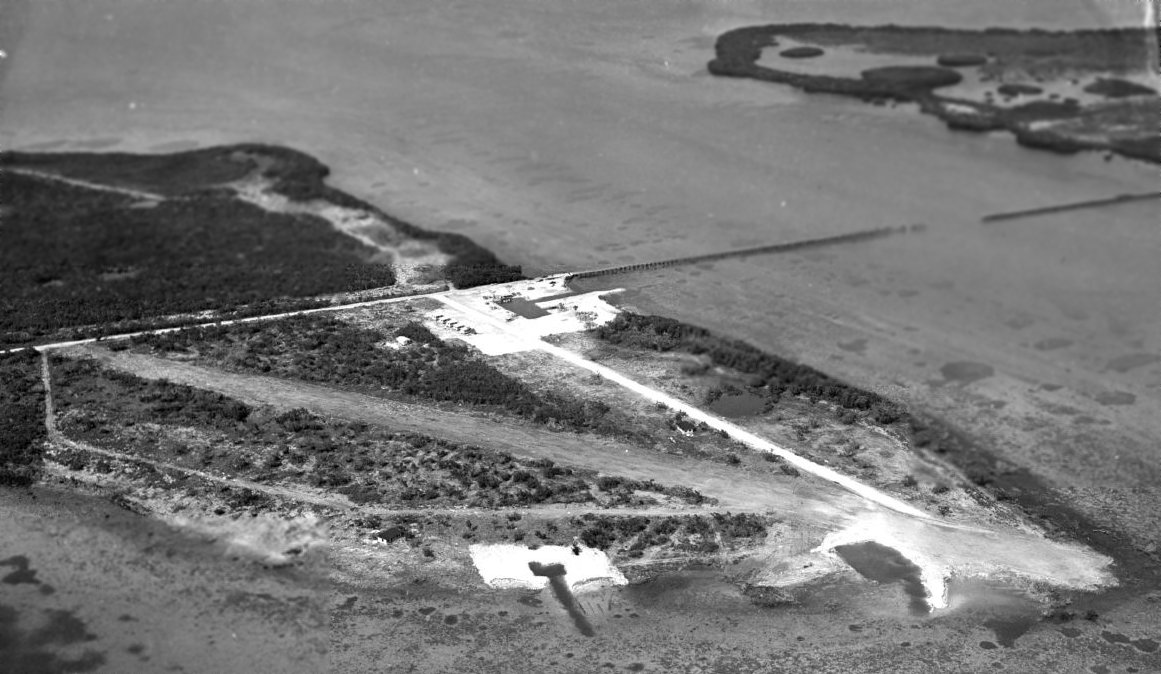
A September 1952 aerial view by Edwin Swift looking northeast at “Ed Barry's Airstrip & No-Name Fish Camp on Big Pine Key” (courtesy of Tony Daiuto).
Ed Barry's Airstrip was not yet depicted on the August 1952 Miami Sectional Chart.
According to The History of Big Pine Key, “In 1952 Ed Barry built a fishing camp at the west end of the charred remains of the bridge named Old Wooden Bridge Fishing Camp.”
The fish camp evidently included an airfield.
The earliest depiction which has been located of “Ed Barry's Airstrip” was a September 1952 aerial view by Edwin Swift (courtesy of Tony Daiuto),
which depicted a single unpaved northwest/southeast runway to the west of the “No-Name Fish Camp on Big Pine Key”.
Tony Daiuto recalled, “I remember [Ed Barry's airstrip] as a kid.”
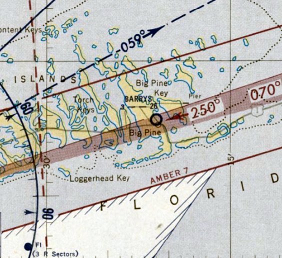
The only aeronautical chart depiction which has been located of Ed Barry's Airstrip was on the January 1953 Miami Sectional Chart.
It depicted Barrys as having a 2,600' unpaved runway.
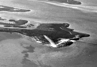
An April 1954 aerial view by Edwin Swift looking northwest at Ed Barry's Airstrip (courtesy of Tony Daiuto).
Ed Barry's Airstrip was evidently closed at some point between 1952-55,
as it was no longer depicted on the February 1955 Miami Sectional Chart.
A 1970 USGS aerial view showed canals & houses having been built on the Ed Barry's Airstrip site, with no trace remaining of the airfield.
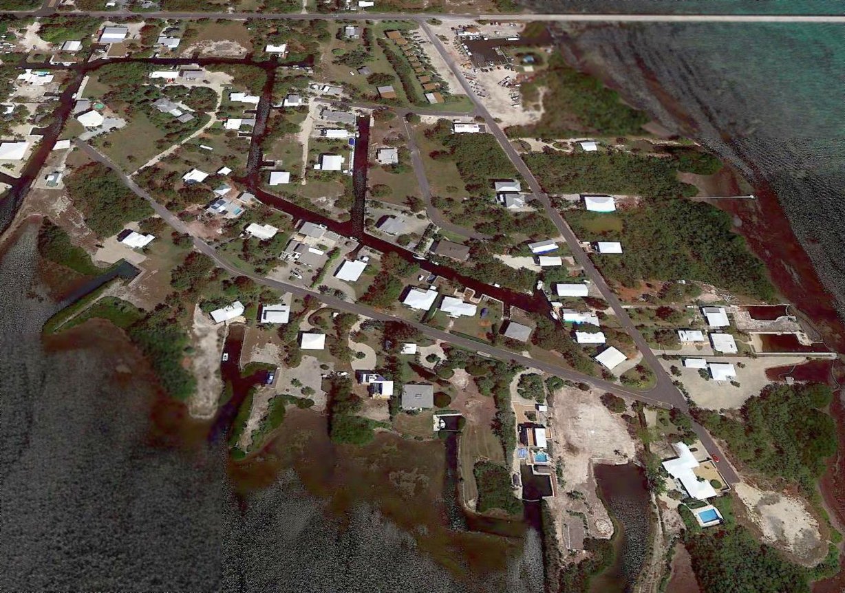
A 2017 aerial view looking north shows no trace remaining of Ed Barry's Airstrip, but the buildings of the No-Name Fish Camp seen in the 1952 photo still remain (at top-center of the photo).
Thanks to Tony Daiuto for pointing out this airfield.
____________________________________________________
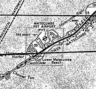
Matecumbe Key Airport, Lower Matecumbe Key, FL
24.86, -80.73 (Southwest of Miami, FL)
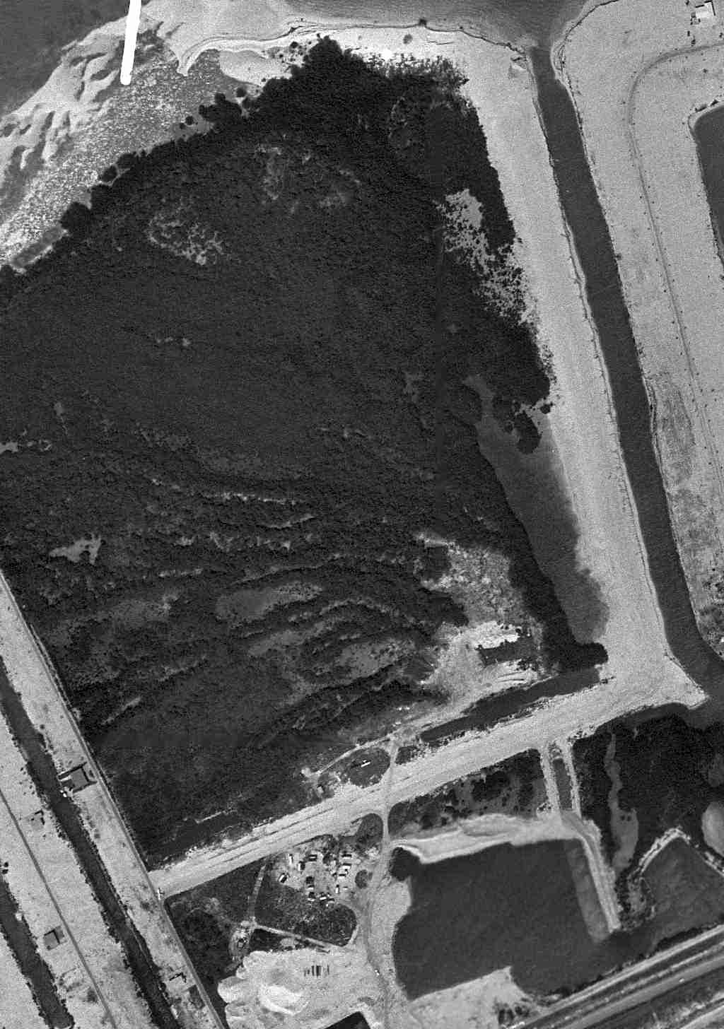
A 2/21/59 FL DOT aerial view of Matecumbe Key Airport (courtesy of David Henderson).
Matecumbe Key Airport was not yet depicted on the 1956 FL Aeronautical Chart (courtesy of Roger Connor).
According to David Henderson, “Jerry Wilkinson at the Florida Keys History Museum sent a notated photo of an airport I'd never heard of,
a private field on Lower Matecumbe near Islamorada.
I was stunned to see this because my grandparents lived in the Port Antiqua subdivision on this exact site for nearly 25 years
without any knowledge that it had once been an airport.
According to the Keys History Museum, the land had been owned by Alonzo Cothron who used the property to dredge & sell fill in the late 1950s.
The airport had 2 runways laid out in an L-shape.
The field appears to have been unpaved limestone gravel & sand fill typical of the area.”
The earliest photo which has been located of Matecumbe Key Airport was a 2/21/59 FL DOT aerial view (courtesy of David Henderson).
It depicted Matecumbe Key Airport as having 2 unpaved runways, with 3 single-engine planes visible parked on the field.
Matecumbe Key Airport was not yet depicted on the February 1960 Miami Sectional Chart.
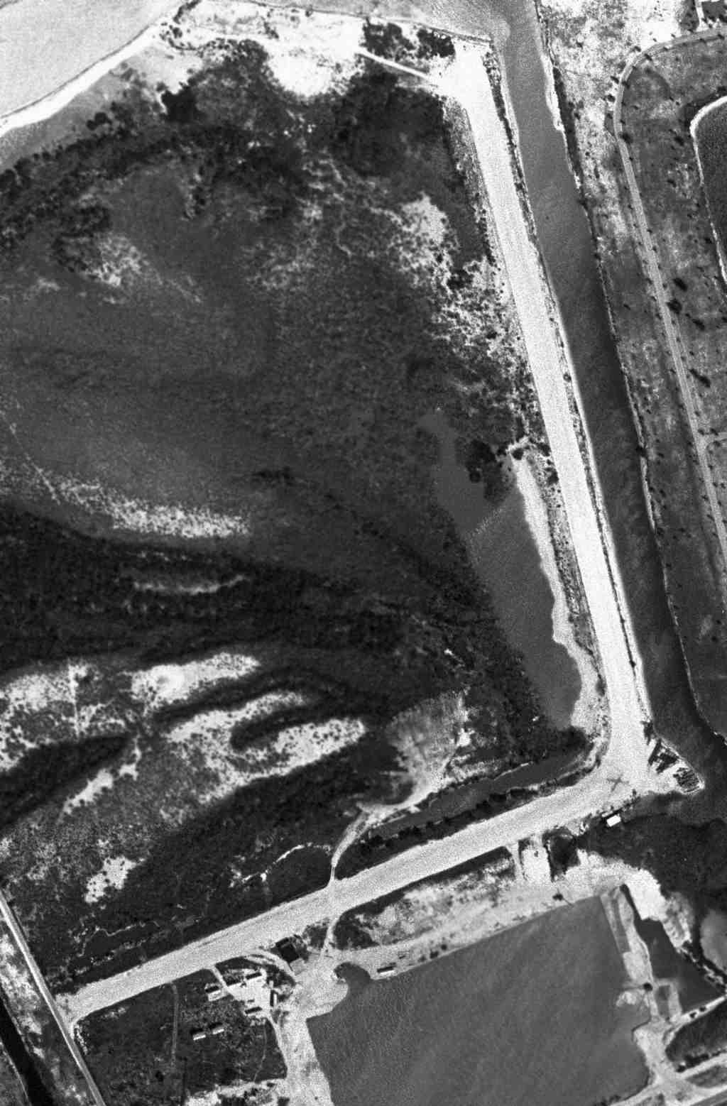
A 3/31/64 aerial view of Matecumbe Key Airport (courtesy of David Henderson).
David observed that closed-runway “X” symbols “have been placed on both ends on the east/west runway.”
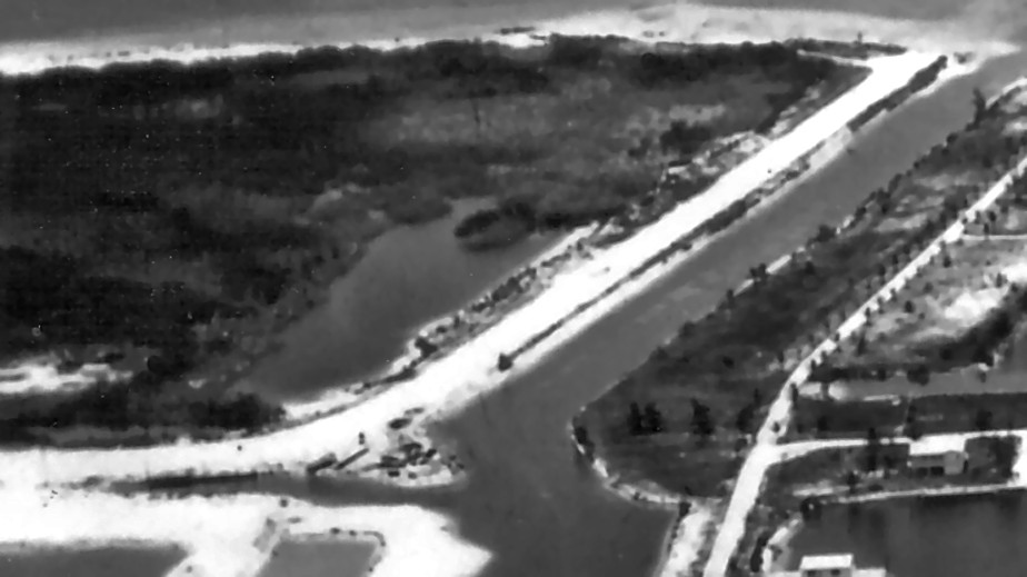
The last photo which has been located of Matecumbe Key Airport
was a circa 1964-70 aerial view looking northwest (courtesy of Loralea Carrera via Jerry Wilkinson).
The earliest aeronautical chart depiction which has been located of the Matecumbe Key Airport was on the April 1965 Miami Sectional Chart,
which depicted Matecumbe Key as a private airport having a 2,000' unpaved runway.
The earliest map depiction which has been located of the Matecumbe Key Airport was on a February 1966 DOT Monroe County highway map (courtesy of David Henderson),
which depicted Matecumbe Key as a private airport.
The last aeronautical chart depiction which has been located of the Matecumbe Key Airport was on the 1969 Miami Sectional Chart (courtesy of David Henderson),
which depicted Matecumbe Key as a private airport.
Matecumbe Key Airport was evidently closed at some point between 1969-71,
as it was no longer depicted on the 1971 Miami Sectional Chart or the 1971 USGS topo map.
According to David Henderson, “By 1971, construction had begun on the Port Antigua development & canals had been dredged across parts of the former runways.
The north/south runway later became Biscayne Boulevard & the east/west runway became El Capitan Drive.
Coincidentally, my grandfather taught me how to drive here (I was only 13!)
and I remember commenting that this road was perfectly straight & flat & just the right length for a small plane. Little did I know!”
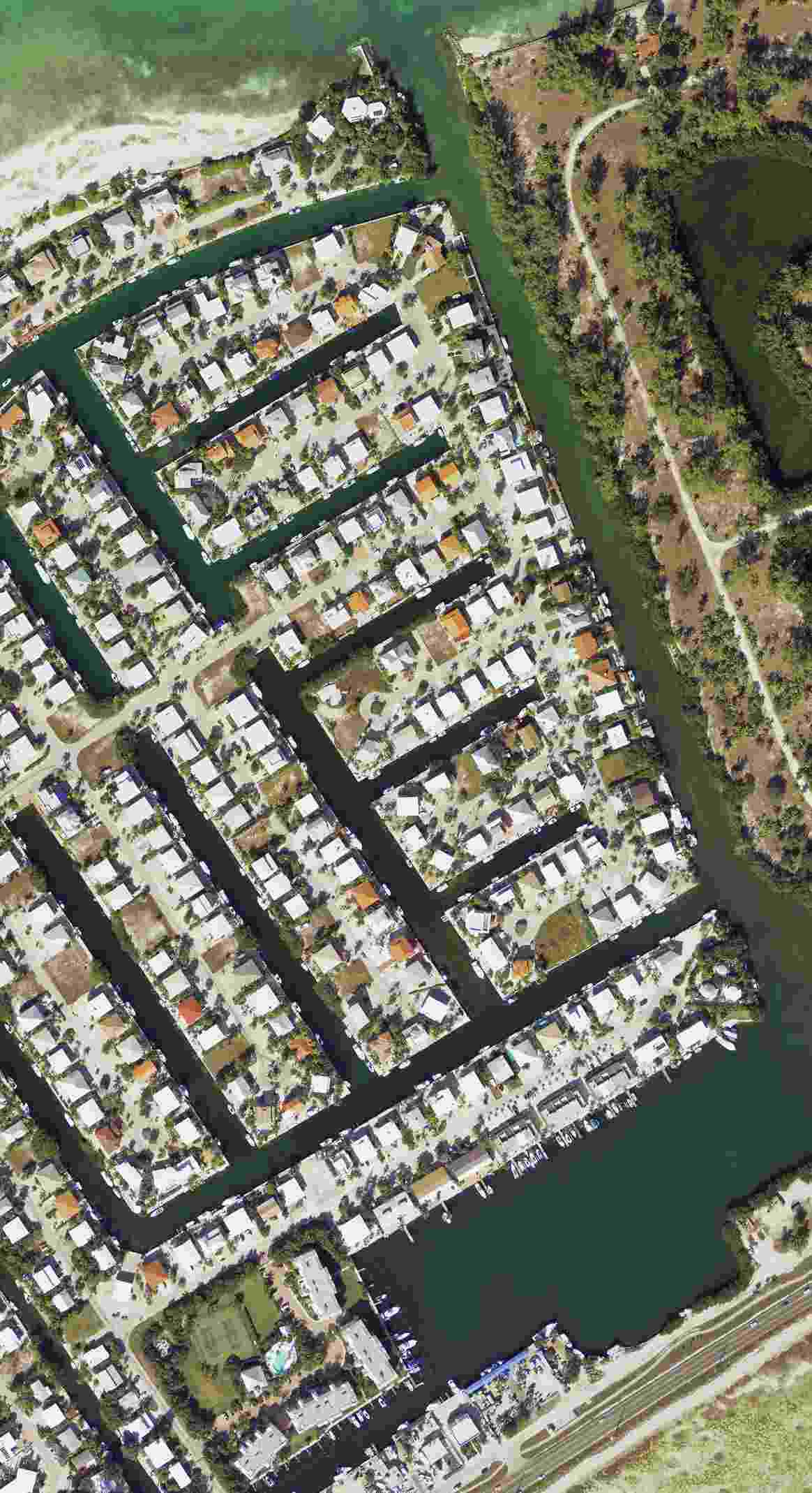
A 2012 aerial photo (courtesy of David Henderson) no trace remaining of Matecumbe Key Airport.
The site of Matecumbe Key Airport is located northeast of the intersection of El Capitan Drive & Gulfview Drive.
Thanks to David Henderson for pointing out this airfield.
____________________________________________________
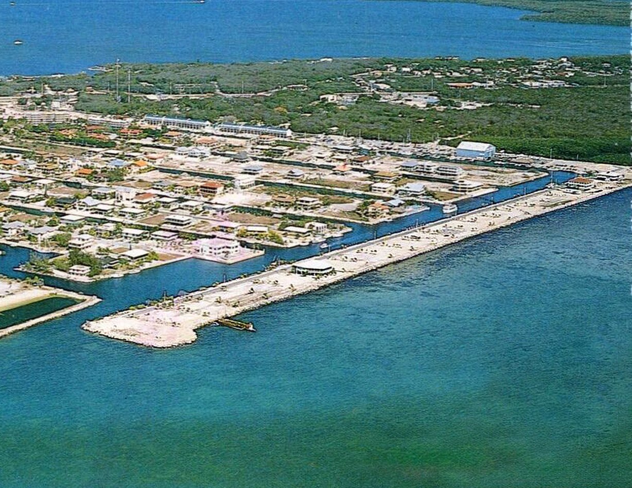
Port Largo Airport (KYL), Key Largo, FL
25.09, -80.43 (Southwest of Miami, FL)
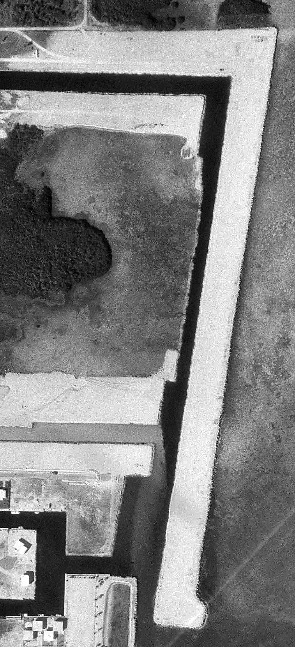
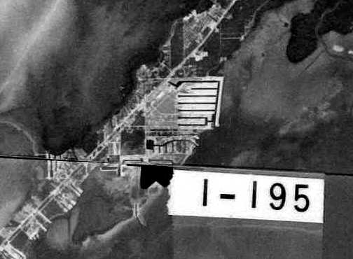
A 2/10/71 aerial view of Port Largo Airport, perhaps while it was still under construction (courtesy of David Henderson).
According to Sunshine Skies, “Port Largo Airport... dredged from the ocean floor,
was little more than a breakwater with a runway on top & operated for little more than a decade.
Despite its diminutive size, Port Largo enjoyed commercial commuter airline service & became the center of a nearly two decade legal battle.
The story of this unusual airport began in the late 1960s
with an undeveloped, submerged parcel of land owned by the State of FL on the Atlantic side of Key Largo.
The State sold the parcel to a developer who dredged the area & constructed a breakwater that was paved with a 2,300' landing strip.
It was agreed that the developer would eventually donate the property to Monroe County for use as a public airport.
Dredging began in 1968.”
The earliest photo which has been located of Port Largo Airport was a 1969 aerial view,
which depicted a single northeast/southwest runway directly along the Atlantic.
The 1970 USGS topo map depicted the land of the runway, but did not label it as an airport.
A 2/10/71 aerial photo (courtesy of David Henderson) depicted Port Largo Airport perhaps while it was still under construction,
but with a single light plane visible inland of the north runway end.
According to Sunshine Skies, “The airport was opened in 1972.”
Port Largo Airport was not yet depicted on the 1973 Miami Sectional Chart or the 1973 USGS topo map.
Port Largo Airport, as seen in a February 1973 USGS aerial photo.
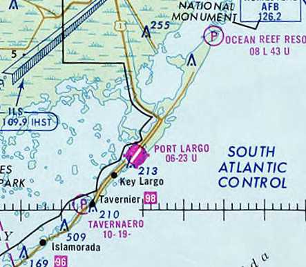
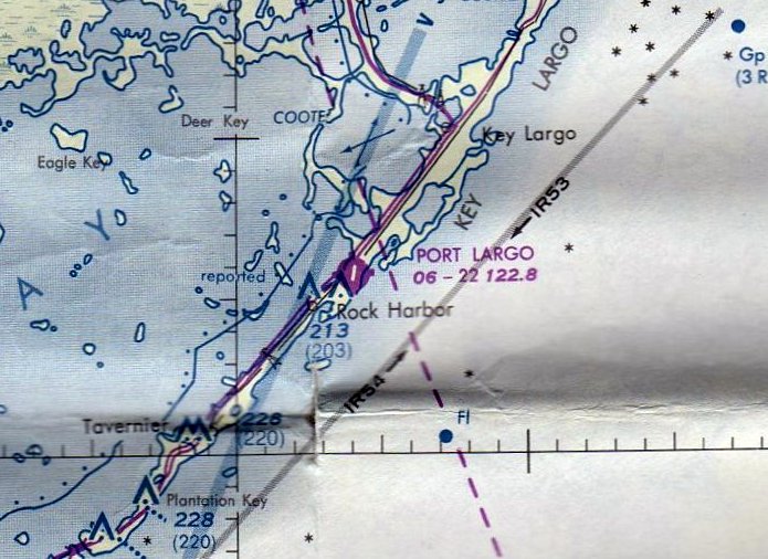
The earliest aeronautical chart depiction which has been located of the Port Largo Airport was on the February 1976 Miami Sectional Chart.
It depicted Port Largo as having a 2,300' paved northeast/southwest runway.
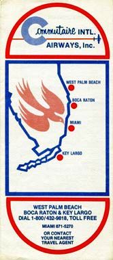
A 4/1/76 Commutaire International Airways timetable (courtesy of David Henderson).
According to David Henderson, “Commutaire International Airways served Key Largo in the mid-late 1970s.”

A still from the 1978 Beechcraft promotional film "People Machine" filmed at Port Largo Airport, facing east.
The last aeronautical chart depiction which has been located of the Port Largo Airport was on the September 1980 Miami Sectional Chart.
It depicted Port Largo as having a 2,300' paved northeast/southwest runway.
According to Sunshine Skies, “In the early 1980s there were 4 airports in the Florida Keys that received commercial airline service:
Key West, Marathon, Ocean Reef, and Port Largo.
Bahamas Caribbean Airlines operated nonstop flights between Port Largo & Miami International Airport
using 9-passenger Britten-Norman Islander equipment.
An excerpt from the 12/1/81 Official Airline Guide shows 2 daily flights & a one-way fare of $45.
Bahamas Caribbean later changed its name to Aero International & then Air South.”
According to Sunshine Skies, “In the early 1980s, the property was purchased by New Port Largo, Inc,
who intended to close the airport & build homes on the site.
Upon learning this, Monroe County commenced litigation to block the closure & gain legal control over the airport,
and even changed zoning laws in an attempt to block residential development.
Monroe County lost the battle in 1985 & the airport was permanently closed.”
The last photo which has been located of the Port Largo Airport was a 4/3/85 aerial view (courtesy of David Henderson),
showing 8 light aircraft parked on the northwest of the narrow sliver of airport land.
David remarked, “Hard to tell, but it looks like a BN-2 Islander, the type that was flown commercially into KYL, at top left.”
A circa late 1980s aerial view looking northwest (courtesy of David Henderson) showed no trace remaining of Port Largo Airport.
Port Largo Airport was no longer depicted on the 1989 Miami Sectional Chart.
A 1994 USGS aerial view showed houses built over the site of Port Largo Airport.
A 12/23/10 aerial photo showed houses covering the site of Port Largo Airport.
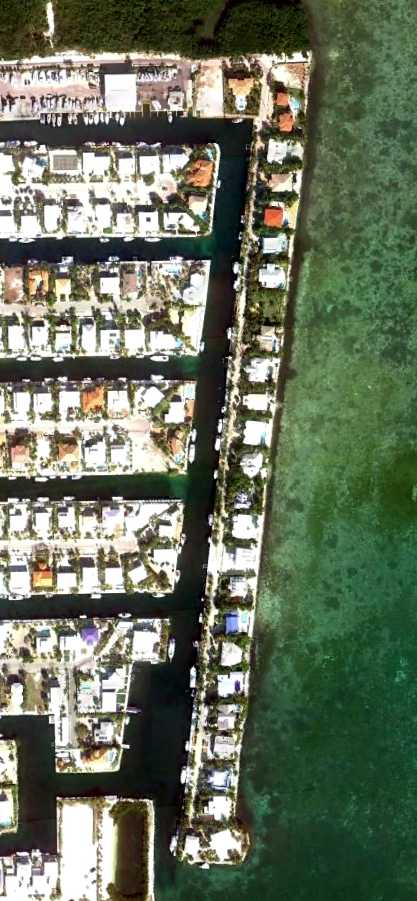
According to Sunshine Skies, “The strip of land that was once Port Largo Airport,
is now a street called Ocean Cay with high-density oceanfront property.
Many residents probably have no idea that a commercial airport once operated where their houses now stand.”
____________________________________________________
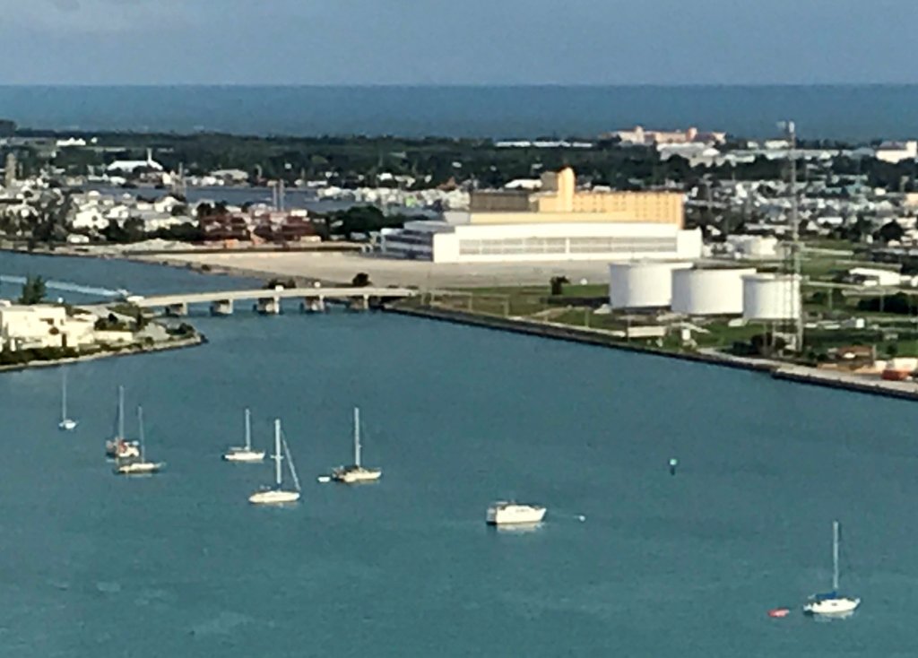
Trumbo Point Seaplane Base, Key West, FL
24.56, -81.79 (Southwest of Miami, FL)
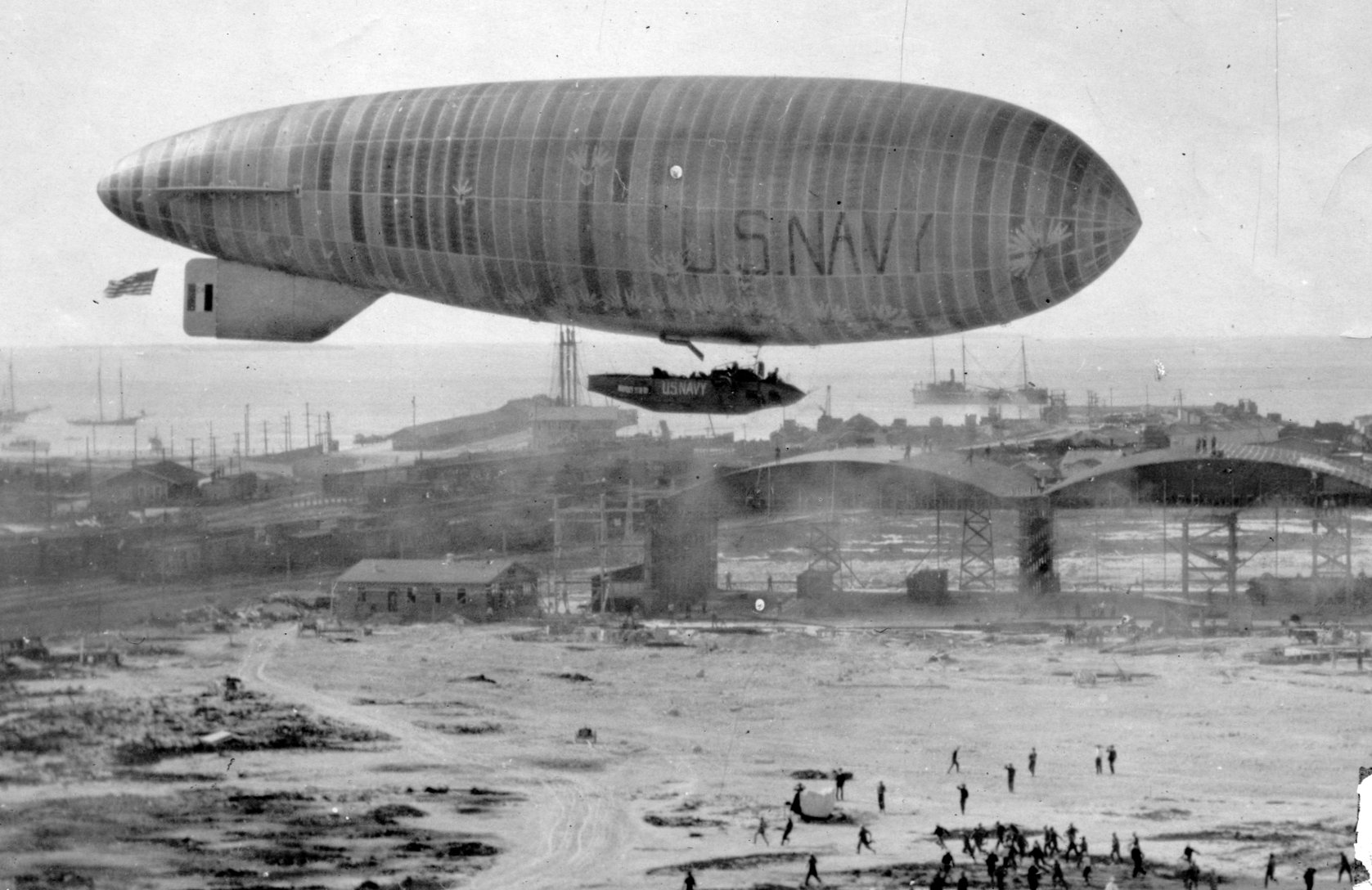
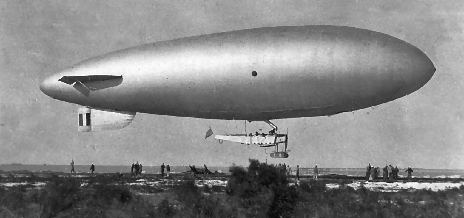
A circa 1917-19 photo of Navy C-1 blimp (BuNo. A4118) over several hangars at Trumbo Point (courtesy of Bill Grasha).
A Naval Air Station was first opened at Trumbo Point in 1917.
It hosted patrol flights & conducted preliminary flight training, with 18 seaplanes & 4 kite balloons.
The earliest depiction which has been located of the Trumbo Point Naval Air Station was a circa 1917-19 photo of Navy C-1 blimp (BuNo. A4118) over several hangars at Trumbo Point (courtesy of Bill Grasha).
A circa 1918-19 photo of a Navy B-class blimp at Trumbo Point.
Mark Lincoln noted, “Between January 1918 - July 1919 there were 3 B ships operated at Key West. They were B-2, B-3, and B-9.”
In 1919, the first flight to Havana (90 miles over water) departed from Trumbo Point.
In the same year, the station's blimp hangar was disassembled & moved to Opa-Locka.
The Navy reportedly closed Trumbo Point in 1920.
A circa 1923 aerial view depicted over a dozen seaplanes on the ramp & in the water at Trumbo Point.
No seaplane facility was depicted at Key West on the December 1935 Miami Sectional Chart(according to Chris Kennedy).
The earliest aeronautical chart depiction which has been located of the Key West seaplane base
was on the April 1937 Miami Sectional Chart (courtesy of Chris Kennedy).
Note that it depicted the seaplane base on the western side of the island (which is further to the west of all subsequent depictions).
This different location may have been erroneous.
As part of the pre-WW2 military buildup, the Navy began to reactivate Trumbo Point in 1939,
with a PBY Catalina flying boat squadron conducting neutrality patrols.
Trumbo Point was commissioned again as Naval Air Station Key West in 1940.
The May 1941 Miami Sectional Chart (courtesy of Chris Kennedy).
depicted the seaplane base on the northern side of the island, at Trumbo Point.
"Key West (Navy)" seaplane base, as depicted on the 1943 Miami Sectional Chart (courtesy of Chris Kennedy).
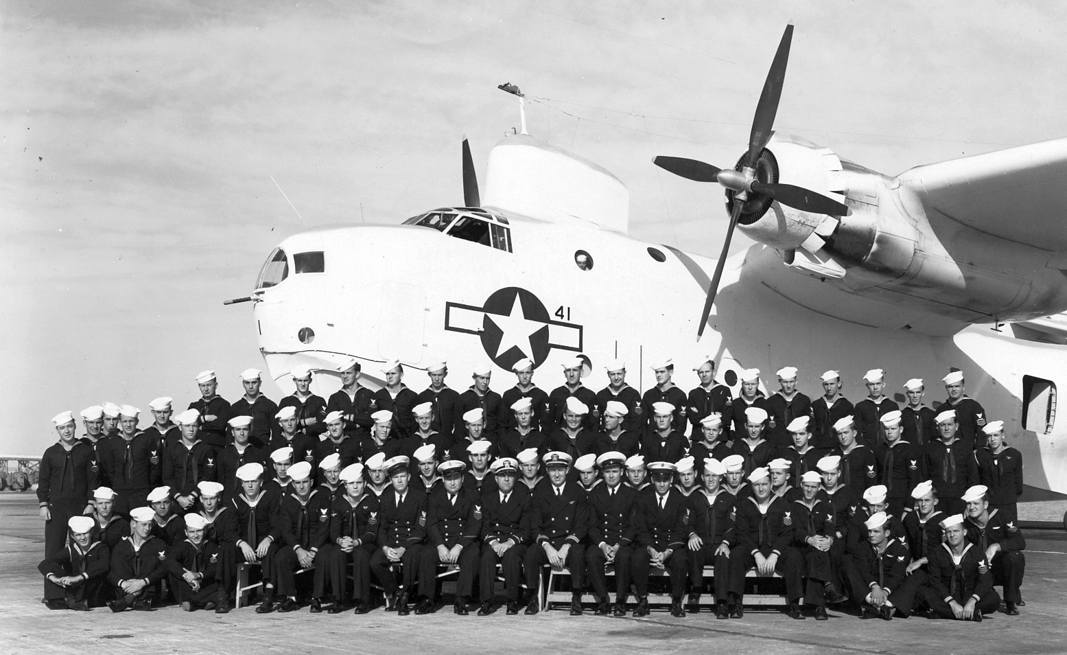
A WW2 photo of squadron members in front of a Martin PBM Mariner flying boat at Trumbo Point.
Aircraft based at Trumbo Point during WW2 included the OS2U Kingfisher, PBM Mariner, and J2F Duck.
The total complement at Trumbo Point during WW2 was a total of 2,614 personnel.
A WW2-era aerial view looking east at Trumbo Point (National Archives photo).

The last aeronautical chart depiction which has been located of the "NAS Key West" seaplane base was on the February 1960 Miami Sectional Chart.
Stuart Babins recalled, “Trumbo Point... I was engaged in seaplane operations there at least until January of 1961
at which time I was involved in Operation Springboard which was centered there at that time.
I was in one of the two P-5 squadrons based in Bermuda.
Operation Springboard was an annual series of events that occurred early each year in which Patrol Squadrons conducted antisubmarine exercises.”
According to Jim, “In 1961... my wife's father, Lcdr. John Black was Officer in Charge of the seaplane base.”
Seaplane operations at Trumbo Point were discontinued by 1965,
as the seaplane base was no longer depicted on the April 1965 Miami Sectional Chart.
The aviation facilities were then reused by Navy helicopter squadrons through the late 1960s.
Starting in 1977 the piers to the west of Trumbo Point became the home of the Navy's hydrofoil squadron PHMRON-2,
which operated the 6 ships of the PHM-1 Pegasus class.
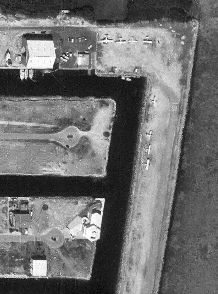
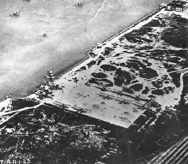
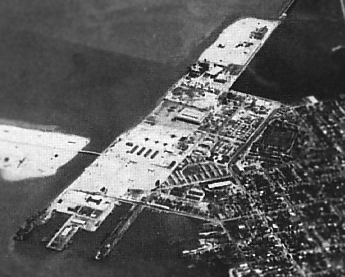
A circa 1980s aerial view looking southeast at the Trumbo Point seaplane ramp & hangar.
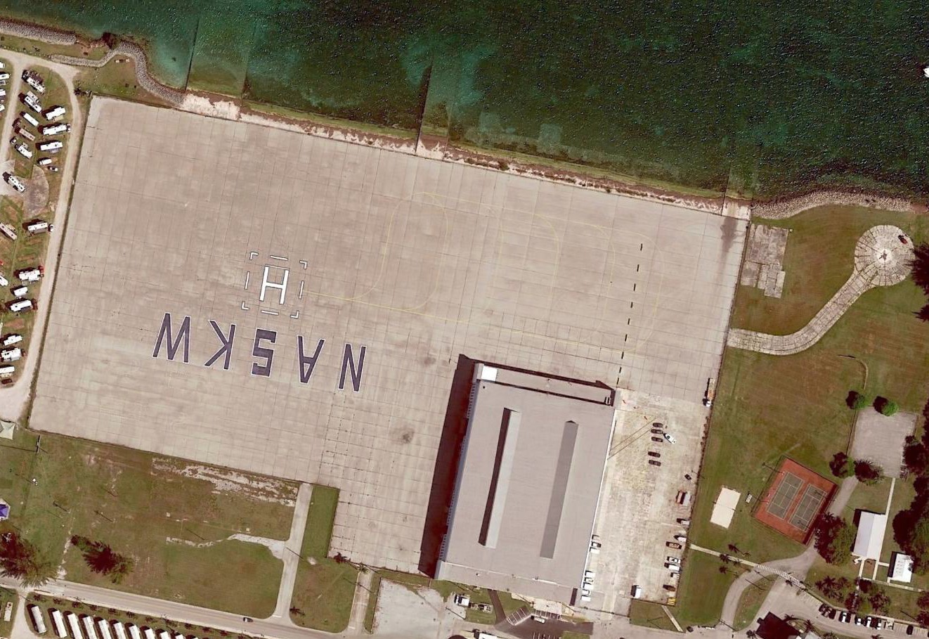
A 1994 USGS aerial photo showed 4 numbered helicopter landing spots painted on the edge of the seaplane ramp.
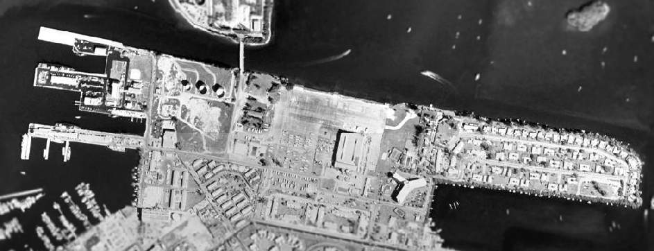
The 1999 USGS aerial photo showed that a cross helipad marking had been added to the northwest corner at the ramp at some point between 1994-99.
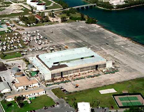
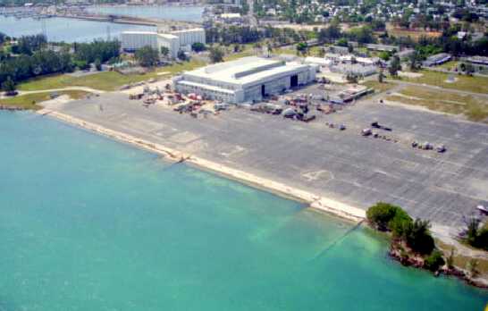
A 1999 aerial view looking west at the Trumbo Point seaplane hangar & apron.
A 2009 aerial photo showed that 2 helipad markings were still visible on the ramp.
A 12/28/10 aerial photo showed that the Trumbo Point ramp had been repaved (for what purpose?) at some point between 2009-2010.
A 3/18/17 aerial photo showed the Trumbo Point ramp & seaplane hangar remained in good condition.
Key West sustained major damage from Hurricane Irma in September 2017,
but it has not been determined whether this damage extended to the Trumbo Point facilities.
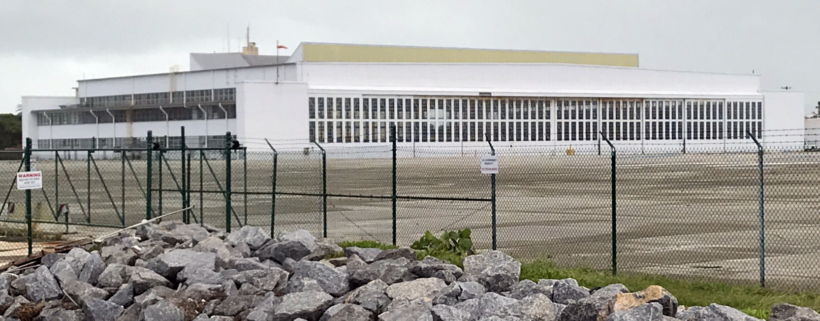
A 10/22/20 photo by Ron Plante looking southwest at the Trumbo Point seaplane hangar.
Ron reported, “The east hangar doors were partially open; it looks like the building is used for storage.
A SeaHawk landed near the seaplane ramps, stayed a few minutes, and then took off again.”
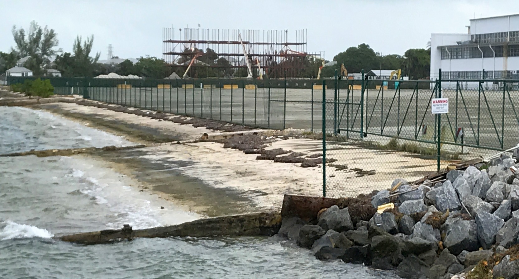
A 10/22/20 photo by Ron Plante looking southwest at a Trumbo Point seaplane ramp.
A 10/24/20 aerial view by Ron Plante looking southwest at the Trumbo Point seaplane hangar, taken from his Robinson R-44 helicopter flight.
See also: http://www.globalsecurity.org/military/facility/key_west.htm
____________________________________________________
Or if you prefer to contact me directly concerning a contribution (for a mailing address to send a check),
please contact me at: paulandterryfreeman@gmail.com
If you enjoy this web site, please support it with a financial contribution.
____________________________________________________
This site covers airfields in all 50 states.