
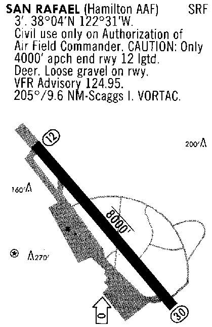
Abandoned & Little-Known Airfields:
California: San Rafael area
© 2002, © 2026 by Paul Freeman. Revised 6/13/26.
This site covers airfields in all 50 states: Click here for the site's main menu.
____________________________________________________
Please consider a financial contribution to support the continued growth & operation of this site.
For a 10th year, the CA pages of this website are sponsored by the California Pilots Association:
Hamilton Field / Hamilton AFB / Hamilton AAF (revised 6/13/26) - San Francisco Bay Airport (revised 3//25/25)
San Rafael Airport (original location) / Marin County Airport (original location) (revised 6/4/21)
____________________________________________________
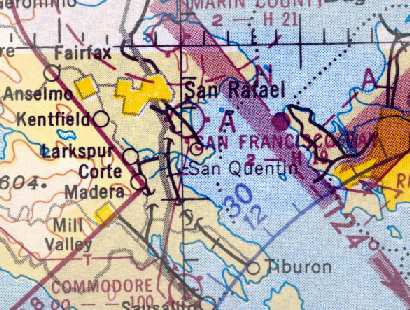
San Rafael Airport (original location) / Marin County Airport (original location), San Rafael, CA
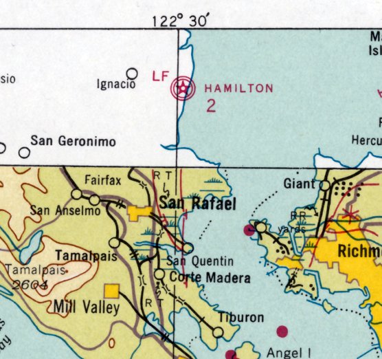
38.015, -122.515 (North of San Francisco, CA)
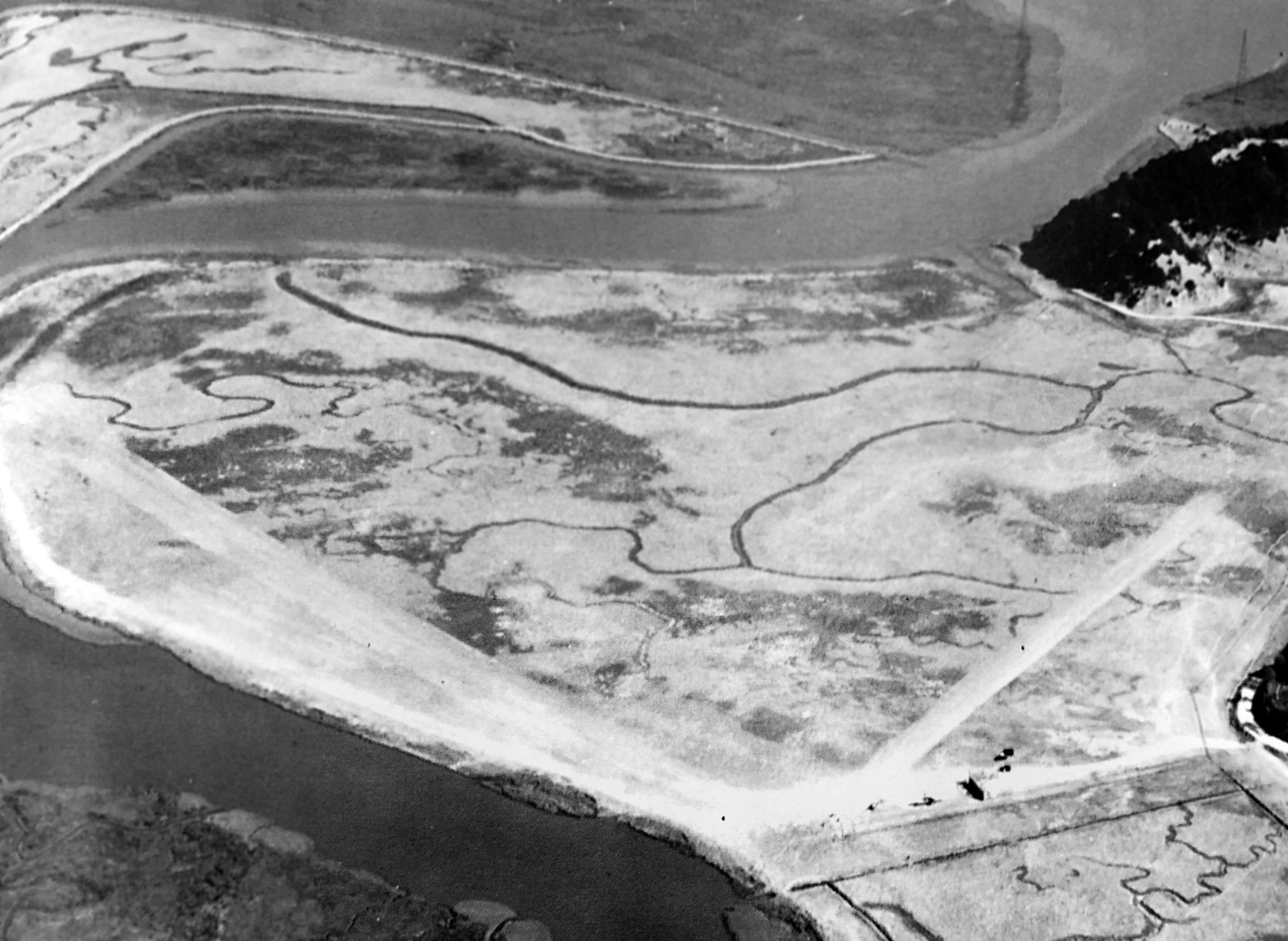
A 1927 aerial view looking north at the original San Rafael Airport.
The date of establishment of the original location of the San Rafael Airport / Marin County Airport has not been determined.
The earliest depiction which has been located of the original San Rafael Airport was a 1927 aerial view.
It depicted the field as having 2 unpaved runways, with a few small single-engine planes & a small building.
According to the book "Two Hours By Crow" by Howard & Judith Campbell (courtesy of Wings of History),
San Rafael Airport “started out as a 2,400' x 1,500' field, with bad ditches in the center, but easily visible.
A 1927 photo from the San Diego Aerospace Museum showed the well-worn strips that pilots used before runways were paved.
Harvey Morrill used to 'hop rides' in his brand-new Alexander Eaglerock Long Wing in 1928.”
The original San Rafael Airport / Marin County Airport was not yet depicted on the 1933/35/41 San Francisco Sectional Charts.
Leon Deslisle reported, “The old Marin County Airport was located in pickleweed marsh out in Santa Venetia.
The Army was flying out of there before Hamilton Field was officially opened in 1935.”

A 1936 photo (courtesy of Marc Salvisberg) of his 68 year old great-grandmother Rosa Inauen Rutz in front of a Fleet Model 2 at the original (Santa Venetia) location of the Marin County Airport.
According to Marc Salvisberg, “She flew often enough to have her own leather flying cap. The family lived a few miles up the road from the field.”
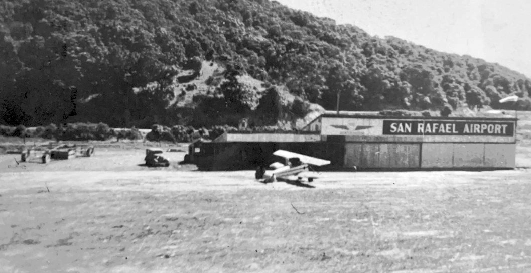
A circa 1930s photo (courtesy of Kevin Walsh) of a biplane in front of a hangar painted “San Rafael Airport”.
The book "Two Hours By Crow" by Howard & Judith Campbell (courtesy of Wings of History) reported of San Rafael Airport,
“Flying had dwindled to almost nothing by 1938 & the field closed formally in 1942 as the country went to war.”
The original San Rafael Airport / Marin County Airport was not yet listed among active airfields in the 1945 AAF Airfield Directory (courtesy of Scott Murdock),
nor depicted on the February 1946 San Francisco Sectional Chart.
The book "Two Hours By Crow" by Howard & Judith Campbell (courtesy of Wings of History) reported of San Rafael Airport,
“Reopening in 1946 saw a huge rush to handle the many student pilots with money from the G. I. Bill, and those worn
strips were paved as 2,000' northwest/southwest & 1,500' east/west runways.”
A 1946 aerial view depicted San Rafael Airport as having a single northeast/southwest unpaved runway,
with a small hangar & 4 light single-engine aircraft on the southwest side of the field.
The earliest aeronautical chart depiction which has been located of Marin County Airport was on the August 1946 San Francisco Sectional Chart.
It depicted Marin County Airport as a commercial/municipal airport.

A circa 1940s photo (courtesy of Marc Salvisberg) depicted 5 light aircraft in front of a hangar labeled “Marin County Airport”,
with hills visible immediately behind the hangar.
The 1948 San Francisco Local Aeronautical Chart (courtesy of Tim Zukas) depicted Marin County Airport as having a 2,400' unpaved runway.
A 1948 aerial view depicted at least 2 light aircraft on the south side of San Rafael Airport.
The book "Two Hours By Crow" by Howard & Judith Campbell (courtesy of Wings of History) reported of San Rafael Airport,
“Instructor Glen Wentz started a flying school in the late 1940s & then Harry Tollefson took over as manager / Fixed Base Operator, but residential development was pushing in.”
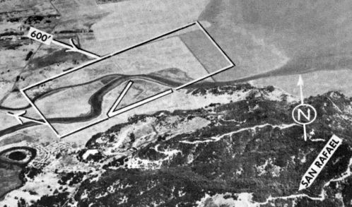
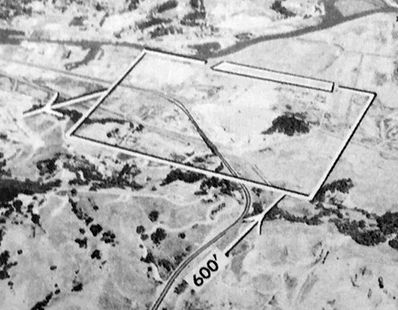
An undated aerial view looking north at “San Rafael – Marin County Airport” from the 1950 Air Photo Guide (courtesy of Kevin Walsh).
It described Marin County Airport as having a 2,450' paved runway & 2,000' turf Runway 18/36, and listed the manager as H.O. Tollefson.
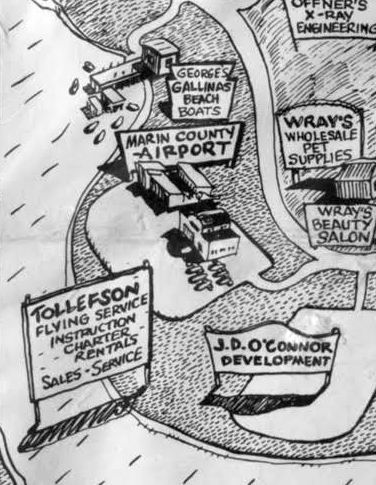
A 1951 cartoon-style map depicted Tollefson Flying Service at Marin County Airport (courtesy of Kevin Walsh).
The 1951 San Francisco Sectional Chart (courtesy of Jonathan Westerling) depicted Marin County Airport as having a 2,100' paved runway.
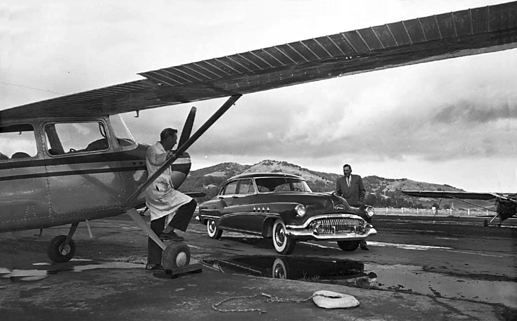
A 1951 photo depicted several Cessnas & a stylish 1951 Buick Roadmaster Sedan Model 72R at San Rafael Airport (courtesy of Marc Salvisberg).
The last aeronautical chart depiction which has been located of Marin County Airport was on the March 1952 San Francisco Sectional Chart.
It depicted Marin County Airport as a commercial/municipal airport.
Marin County Airport was evidently closed at some point in 1952,
as it was no longer depicted on the September 1952 San Francisco Sectional Chart.
A 1952 aerial view showed that Marin County Airport remained intact, including the runway, a long hangar, and an arch-roof hangar, but the field was completely devoid of aircraft,
possibly indicating it had closed already.
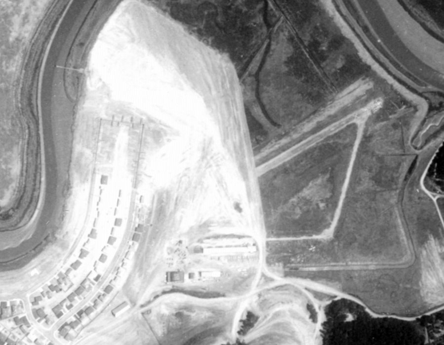
A 1953 aerial view (from the UCSB Library, courtesy of Jonathan Westerling) showed the western portion of the Marin County Airport site
having been covered with construction of a new housing development,
but the eastern portion of the runway & taxiway remained, along with several hangars.
A closed-runway “X” symbol was still visible on the runway.
Notably, one light single-engine aircraft appeared to remain on the field, just south of the remaining portion of taxiway.
Perhaps it was not airworthy when the airport was closed.
The 1955 USGS topo map did not depict San Rafael Airport, just an open space.
A 1958 aerial view depicted homes covering the site of the original San Rafael Airport.
A 1968 aerial view showed that another San Rafael Airport had opened less than a quarter-mile to the west, on the opposite side of the Gallinas Creek.
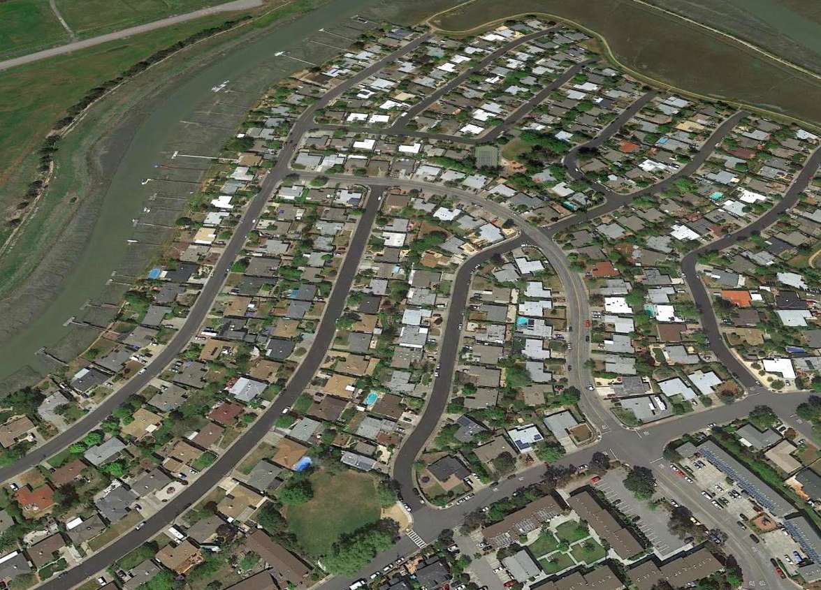
A 2015 aerial view looking north shows the site of the original San Rafael Airport covered by homes.
The runway of the replacement San Rafael Airport, located on the opposite side of the Gallinas Creek, is visible at top-left.
The site of the original San Rafael Airport is located at the intersection of Adrian Way & La Pasada Way.
Thanks to Marc Salvisberg for pointing out this airfield.
____________________________________________________
San Francisco Bay Airport, San Rafael, CA
37.965, -122.505 (North of San Francisco, CA)
The earliest depiction that has been located of the San Francisco Bay Airport was a 1946 aerial view (courtesy of Jonathan Westerling).
San Francisco Bay Airport was a little general aviation field that served the residents of San Rafael, the largest city in Marin County.
The date of establishment of San Francisco Bay Airport has not been determined.
The earliest reference to San Francisco Bay Airport came from the book "Two Hours By Crow" by Howard & Judith Campbell (courtesy of Wings of History),
which reported, “In 1930 this consisted of a grass field with very few amenities & it languished through the Depression.
Only the wealthy could afford to fly during those years.”
San Francisco Bay Airport was not listed among active airfields in the 1944 US Army/Navy Directory of Airfields (courtesy of Ken Mercer).
The earliest depiction which has been located of the San Francisco Bay Airport was a 1946 aerial view (courtesy of Jonathan Westerling).
It depicted the field as having a single northwest/southeast unpaved runway,
with several small buildings & at least 4 light aircraft on the south side of the field.
San Francisco Bay Airport still was not depicted on the February 1947 San Francisco Sectional Chart.
George Harper recalled of San Francisco Bay Airport, “I continued my flight training at this airport.
I started on 11/22/47. I received my private & commercial ratings. My instructors were R. F. Knapton & H. O. Talefson.
Note Talefson also in 1947 gave many check flights to Hamilton Field Air Force Pilots for their civilian pilot's licenses.
The aircraft we used for flight training were: Aeronca Champs & Chiefs, Piper J-3 Cubs, Super Cubs,
Super Cruisers, a Stinson Voyager, Taylor Craft, Stearman PT-17, a Vultee BT-13 and a Ryan PT-22. I got to fly them ALL!
On 2 occasions we flew over Larkspur, a nearby city, to release rose petals over their Rose Festival Parade.”
San Francisco Bay Airport was not yet depicted on the 1947 USGS topo map.
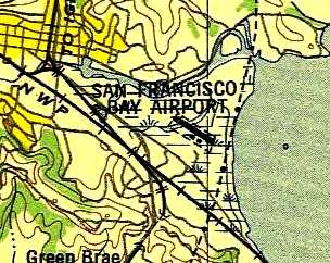
The earliest aeronautical chart depiction which has been located of San Francisco Bay Airport was on the August 1947 San Francisco Local Sectional Chart.
It depicted San Francisco Bay as a commercial/municipal airport.
The book "Two Hours By Crow" by Howard & Judith Campbell (courtesy of Wings of History) reported,
by 1948 San Francisco Bay Airport “was expanded to 2 paved runways with hangars & fuel & great hopes.
Prevailing winds would have made most landings in from the Bay & over marshland,
but takeoffs would have to be directly over the city with only a slight left turn to avoid Boyd Park Hill & then on over the city toward San Anselmo to the west.”
The 1948 San Francisco Local Aeronautical Chart (courtesy of Tim Zukas) depicted San Francisco Bay Airport as having a mere 1,900' unpaved runway.
A 1948 aerial view depicted at least 2 light aircraft on the south side of San Francisco Bay Airport.
The 1949 USAF Urban Area Chart depicted San Francisco Bay Airport as having a single northwest/southeast runway.
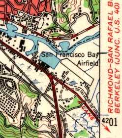
The 1950 USGS topo map depicted the San Francisco Bay Airfield as having a single northwest/southeast runway.
An undated aerial view looking north at San Francisco Bay Airport from the 1950 Air Photo Guide (courtesy of Kevin Walsh).
It described San Francisco Bay Airport as having a 1,800' paved east/west runway, and listed the manager as Charles Kleinclaus.
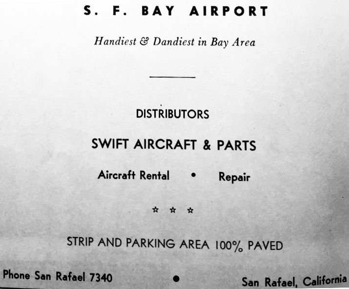
An advertisement for San Francisco Bay Airport from the 1950 Air Photo Guide (courtesy of Kevin Walsh).
San Francisco Bay Airport, as depicted on the 1951 San Francisco Sectional Chart (courtesy of Jonathan Westerling).
The 1951 San Francisco Sectional Chart (courtesy of Jonathan Westerling) described San Francisco Bay Airport as having a 1,900' paved runway.
A circa 1955-56 photo of Jack Kiehl & an instructor at San Francisco Bay Airport (courtesy of Michael Kiehl).
A circa 1955-56 photo of Jack Kiehl & a Piper Comanche at San Francisco Bay Airport (courtesy of Michael Kiehl).
Michael Kiehle reported, “My father Jack Kiehl trained with Bob Short.”

A circa 1955-56 photo of 2 men & an Aeronca at San Francisco Bay Airport (courtesy of Michael Kiehl).

A circa 1955-56 photo of Cessna N71270 & other light aircraft at San Francisco Bay Airport (courtesy of Michael Kiehl).
A circa 1955-56 photo of a Navion landing at San Francisco Bay Airport (courtesy of Michael Kiehl).
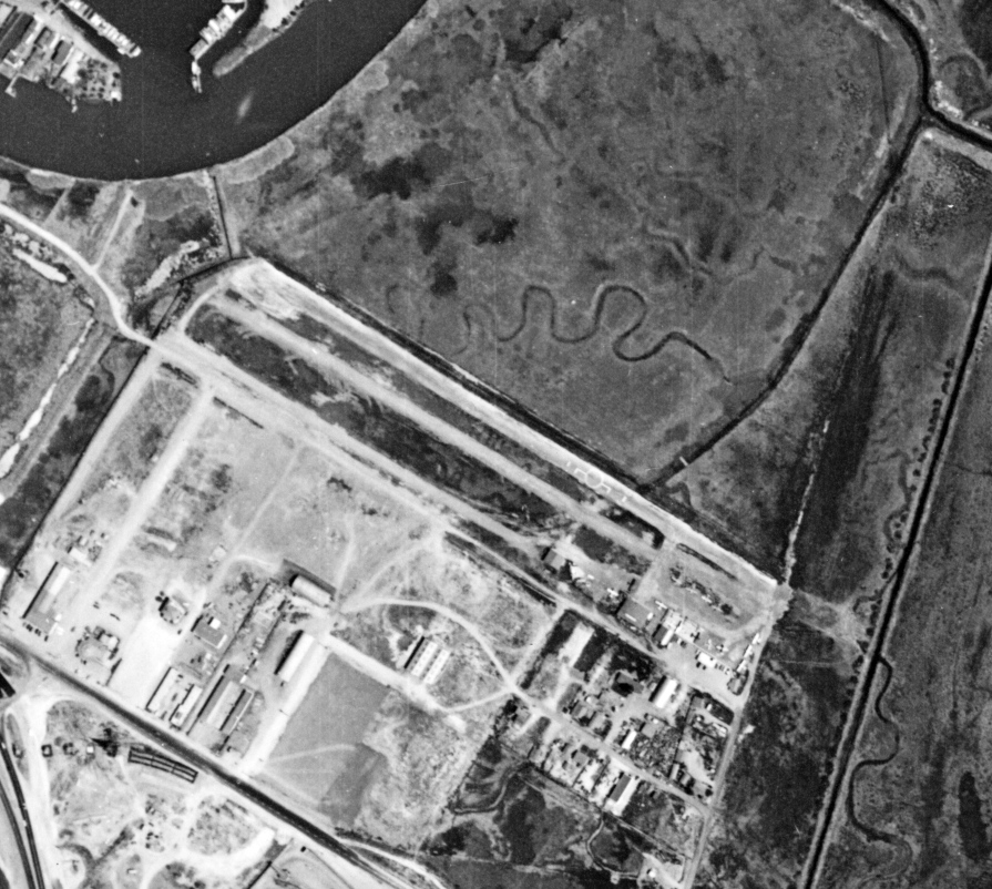
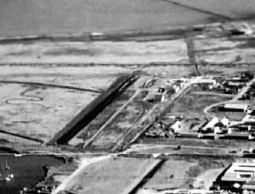
An 8/16/62 aerial view depicted San Francisco Bay Airport as having a single northwest/southeast runway with a parallel taxiway,
and several small hangars & a dozen light aircraft on the southeast side.
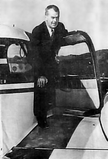
An undated photo, captioned "Frank Lynch of Sausalio emerges from the cockpit of his twin engine Piper Apache,
based at San Francisco Bay Airport" (photo by Bob Hax, courtesy of the Marin County Library, via Jonathan Westerling).
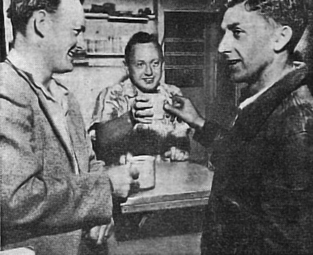
An undated photo of Bill Mulhern, proprietor of the San Francisco Bay Airport Cafe,
serving coffee to Pilot John Williford, left, and Jimmy Rusch, airport manager & maintenance specialist.
Photo: by Bob Hax, courtesy of the Marin County Library, via Jonathan Westerling.
According to Jonathan Westerling, San Francisco Bay Airport was owned by Jimmy Rusch.
It had full services along with a small café on the south east side of the airstrip.
Flight lessons were offered by a Mr. & Mrs. Bob Short, and several young pilots were trained there.
The airstrip served as home-base for several small businesses including an aerial photography firm
and an air-ambulance service which imported patients from Northern California
seeking the more advanced medical facilities of the bay area.
When filming the movie "Blood Alley", John Wayne based his Cessna at the San Francisco Bay Airport.
The 12/8/52 issue of the Marin Independent Journal (courtesy of Jonathan Westerling)
reported that a single-engine Cessna 195 en route to Detroit crashed into the canal adjacent to San Francisco Bay Airport.
Killed in the crash was Charles Kleinclaus Jr., part owner of the San Francisco Bay Airport.
A 1952 aerial view depicted 6 light aircraft on the south side of San Francisco Bay Airport.
The 1954 USGS topo map (courtesy of Kevin Walsh) depicted San Francisco Bay Airport at its heyday,
with 3 small buildings south of the east side of the runway.
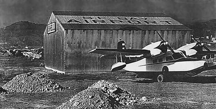
An undated photo of a nice Grumman G44 Widgeon in front of a hangar which had “S.F. Bay Airport” painted on the roof
(photo courtesy of the Marin County Library, via Jonathan Westerling).
A short article about San Francisco Bay Airport appeared in the 3/26/55 issue of Marin Magazine (thanks to Jocelyn Moss of the Marin Historical Society Library).
"The Airport is located at the end of Railroad Avenue which runs north from San Francisco Boulevard at California Park.
It is managed by Jimmy Rusch who also has charge of maintenance.
Rusch reports that right now, pleasure flyers outnumber business flyers who are also using the airport & their number is growing constantly.
Many flyers, however make an effort to combine business & pleasure, something that they wouldn't have time to do if they traveled by automobile."
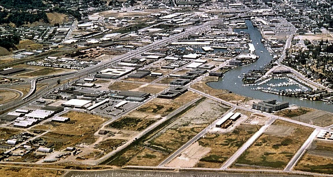
A circa 1950s aerial view looking east at San Francisco Bay Airport (courtesy of Steve Mahaley),
showing a single runway with several small hangars along the south side.
The photo was found in 2007 hanging along the wall in the San Rafael City Hall.

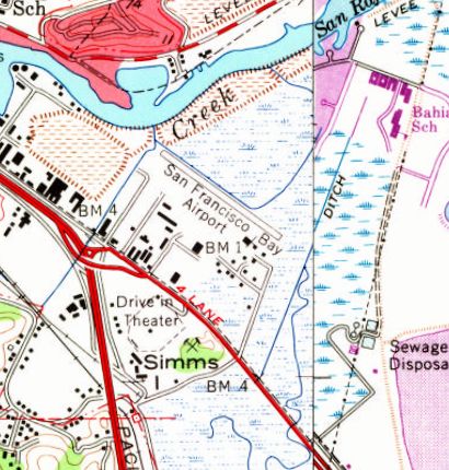
A street map from the mid 1950s, showing how streets had sprung up surrounding the little San Francisco Bay Airport (courtesy of Jonathan Westerling).
A 1958 aerial view depicted little San Francisco Bay Airport at the zenith of its popularity,
with a total of 17 light aircraft visible parked outside on the field.
The book "Two Hours By Crow" by Howard & Judith Campbell (courtesy of Wings of History) reported,
San Francisco Bay Airport “would close by 1958 & the entire area reverted to light industry & auto repair shops.”
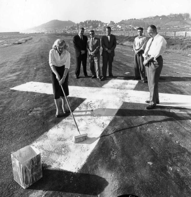
A May 1959 photo of a closed-runway “X” symbol being painted on the San Francisco Bay Airport's runway, upon the sad occasion of the airport's closure.
San Francisco Bay Airport was no longer depicted at all (not even as an abandoned airfield) on the April 1959 San Francisco Local Aeronautical Chart.
A 1961 aerial view looking northeast showed the remains of the San Francisco Bay Airport a year after its closure (courtesy of Marc Salvisberg).
A 1961 aerial view by Rudolf Barton looking at the site of the San Francisco Bay Aiport (courtesy of Kevin Walsh).
San Francisco Bay Airport, labeled "Aband arpt" on the May 1961 San Francisco Local Aeronautical Chart (courtesy of Tim Zukas).
Within a few years of its closing, the San Francisco Bay Airport property succumbed to an industrial development.
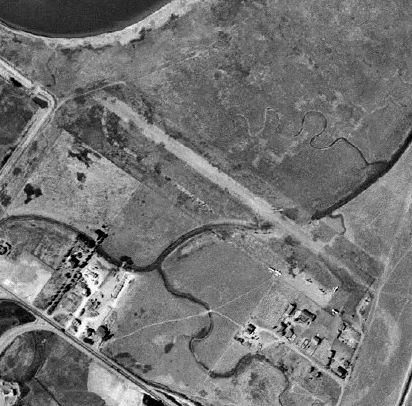
The 1966 USGS topo map continued to depict the San Francisco Bay Airport, even though it had been closed for 7 years by that point.
The 1969 USGS topo map depicted new streets covering the site of San Francisco Bay Airport.
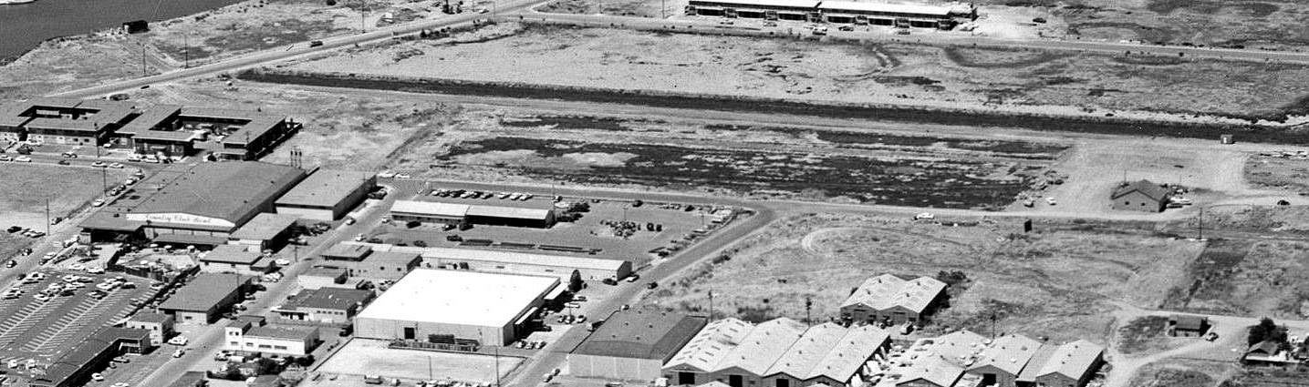
A 1968 aerial photo showed that development had covered the San Francisco Bay Airport site,
with not a trace remaining of the former airport.
An article entitled "Canal dredge reveals plane engine" by Jennifer Upshaw
in the 5/5/04 issue of the Marin Independent Journal (courtesy of Jonathan Westerling)
described how barge workers dredging private docks in the San Rafael Canal scooped up an airplane engine with its propeller still attached.
This most likely was the remains of a Cessna 195 which crashed in the canal adjacent to the San Francisco Bay Airport in 1952,
killing the airport owner.
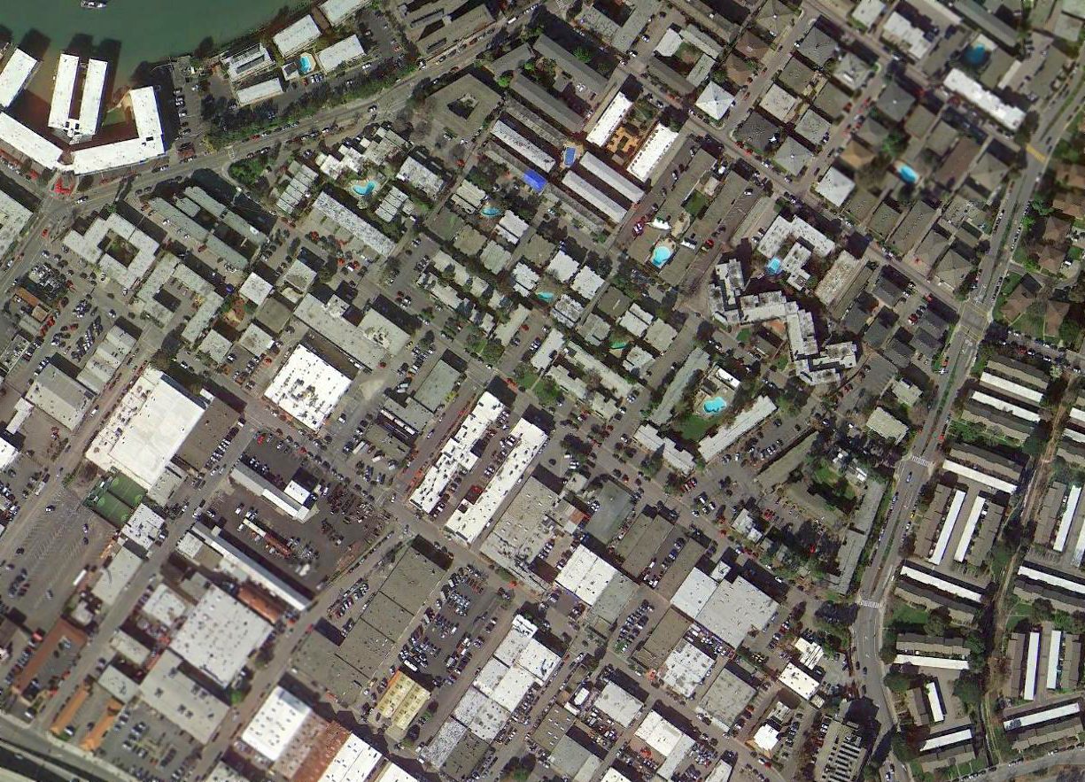
A 2018 aerial view shows not a trace appears to remain of San Francisco Bay Airport.
Thanks to Jonathan Westerling for pointing out this airfield.
____________________________________________________
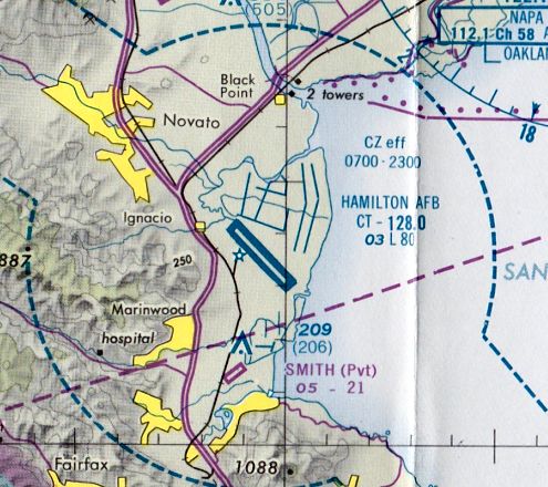
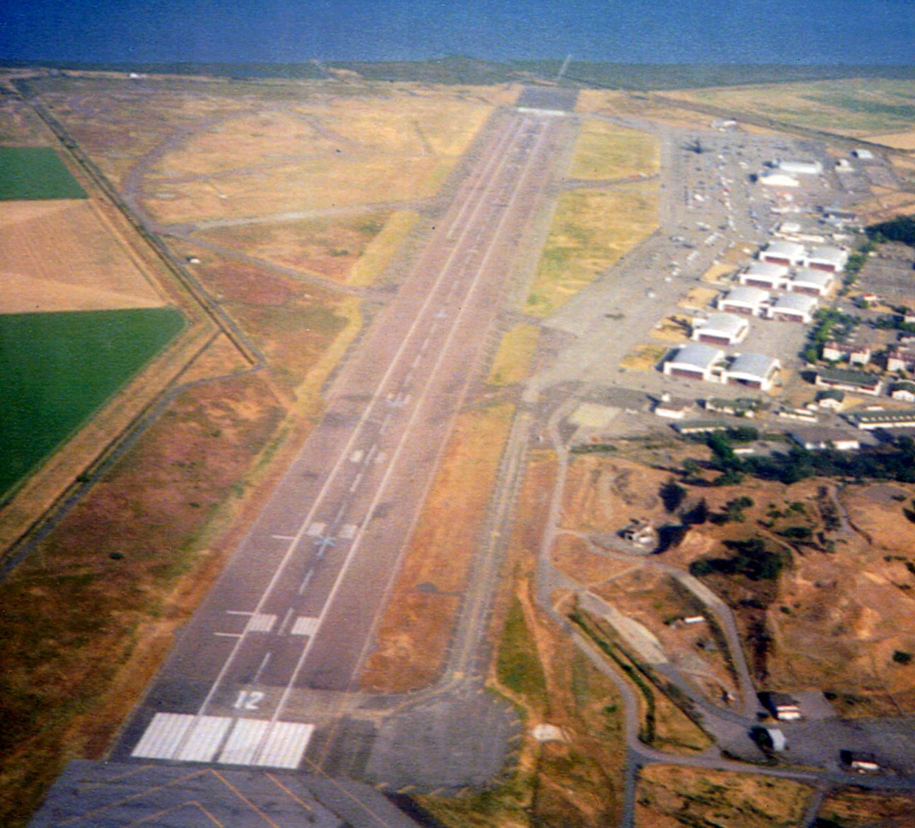
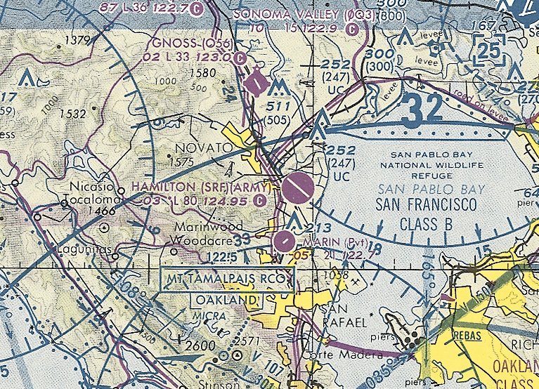
Hamilton Field / Hamilton AFB / Hamilton AAF (SRF), Novato, CA
38.055, -122.507 (North of San Francisco, CA)
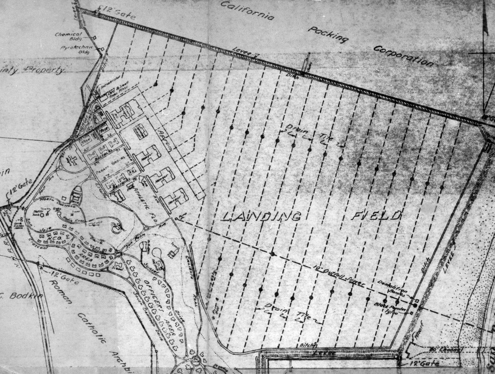
Hamilton Field, as depicted on a 3/12/32 War Department Plan (courtesy of Kevin Walsh).
This large military airfield was located along the northern shore of San Francisco Bay.
According to Leon Delisle, “My grandfather was on the lobbying committee to bring the Army to Marin County,”
Construction of this airfield began in 1932, with the airfield being originally designed to accommodate 4 bomb squadrons & their personnel.
It was named Hamilton Field in 1932.
The earliest depiction which has been located of Hamilton Field was a 3/12/32 War Department Plan (courtesy of Kevin Walsh).
It depicted 5 hangars & an apron on the west side of an irregularly-shaped landing field.
Captain John M. Davies' 70th Service Squadron arrived in December 1932 as the first squadron assigned to the base.
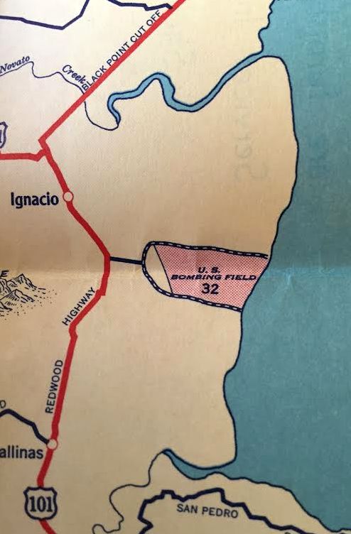
Hamilton Field was labeled as “U.S. Bombing Field” on a 1932 street map (courtesy of Kevin Walsh).
The earliest photo which has been located of Hamilton Field was a 1/13/33 aerial view looking north (courtesy of Kevin Walsh), showing hangars next to a broad unpaved landing field.
No airfield was yet depicted at the site of Hamilton AAF on the May 1933 San Francisco Sectional Chart.
A circa early 1930s view looking east from the hill looking at Hamilton Field's hangars under construction.
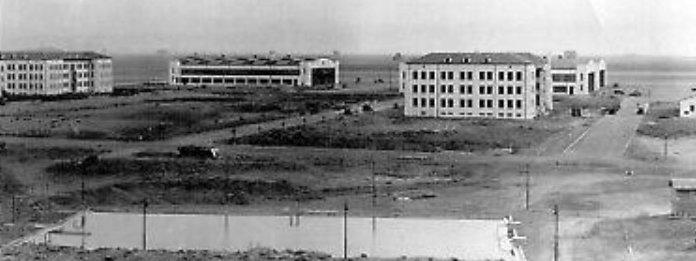
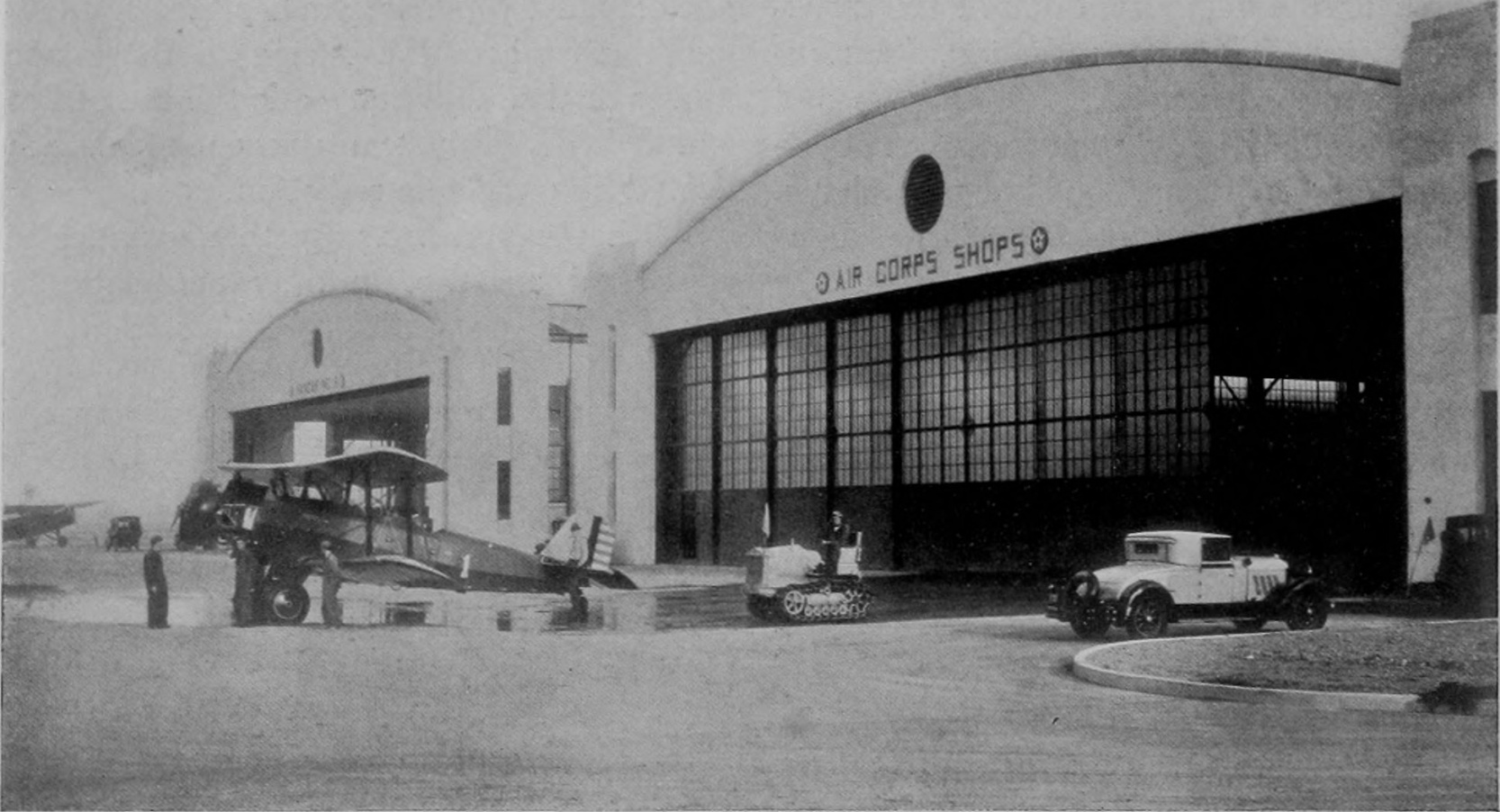
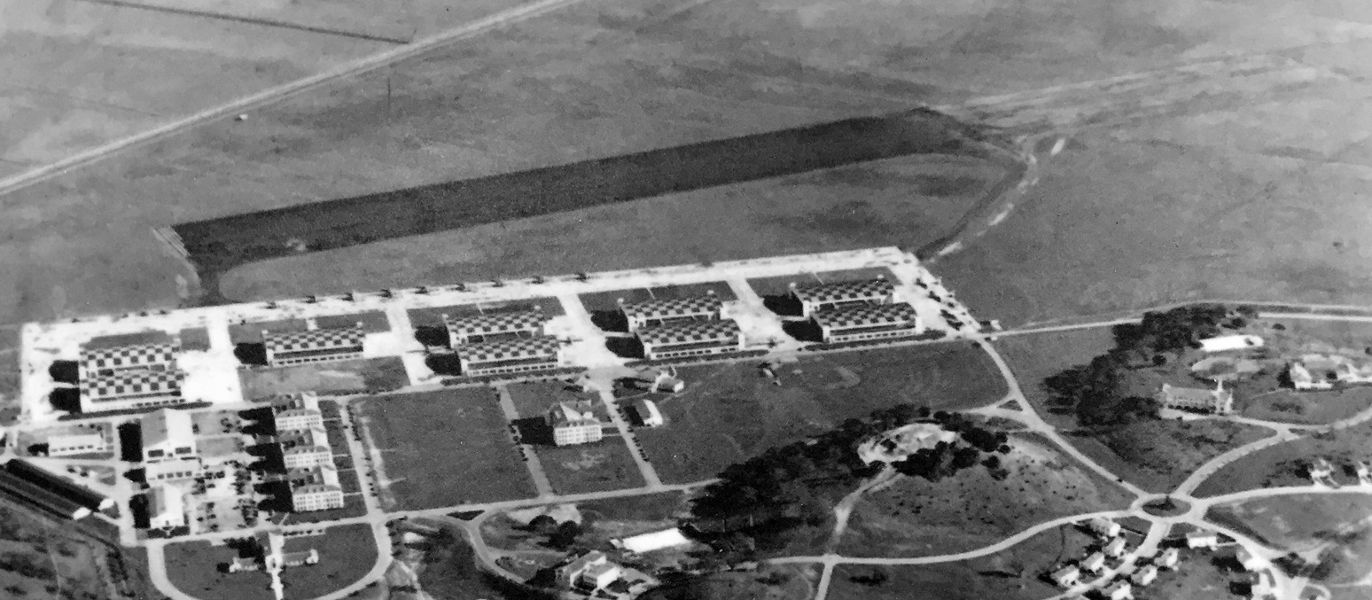
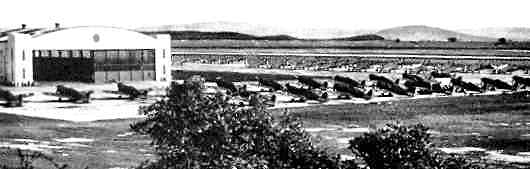
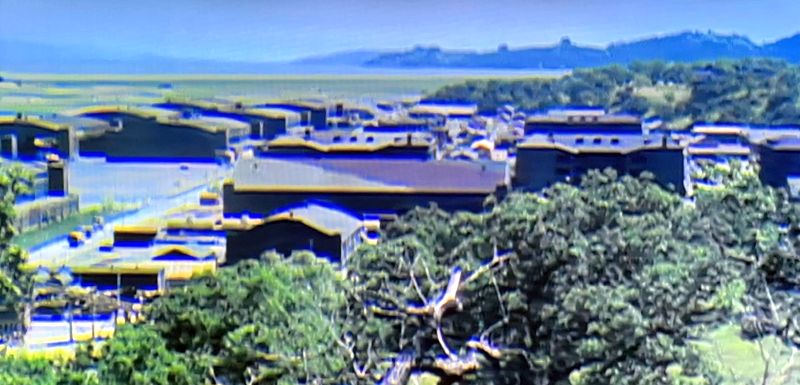
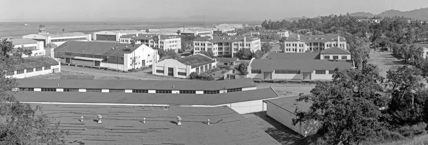
A circa early 1930s aerial view looking northwest at Hamilton Field showing the 9 large arch-roof hangars & other buildings to the west.
An undated photo from an 8/7/34 newspaper article (courtesy of Kevin Walsh) of 2 Army Boeing 95 2-seat biplanes in front of the new Hamilton Field hangars.
A 9/10/34 aerial view looking southeast at Hamilton Field depicted 9 large arch-roof hangars & many other buildings to the west.
A circa 1934 of the newly-constructed Hamilton Field hangars (courtesy of Kevin Walsh).
In 1934, the 7th Bombardment Group arrived to take station, having been transferred up from March Field.
The new base was designated that year as General Headquarters of the 1st Pursuit Wing.
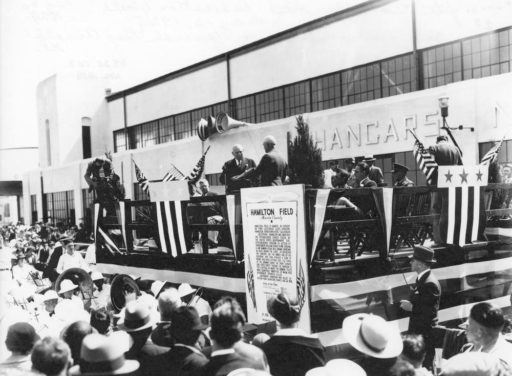
A 5/12/35 photo of Hamilton Field's Dedication (courtesy of Kevin Walsh), in which the field was ceremonially handed over by California Governor Merriam (left) to Brigadier General Henry 'Hap' Arnold (right).
Leon Delisle reported, “My grandfather was one of the Marin County VIPs up on the stage at the official base opening commemoration.
The first Base Commander was Col. Clarence Tinker USAAC. Clarence was mostly Cherokee.
He was very well liked & respected by all. A most capable leader. He was out there leading the way.
The Air Corps broke the racial barrier long before the edict in 1947-48.”
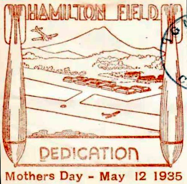
A postmark commemorating the 5/12/35 Hamilton Field Dedication (courtesy of Kevin Walsh).
A 1933-39 USAAC photo of the last of 4 Consolidated A-11 attack aircraft prototypes at Hamilton Field.
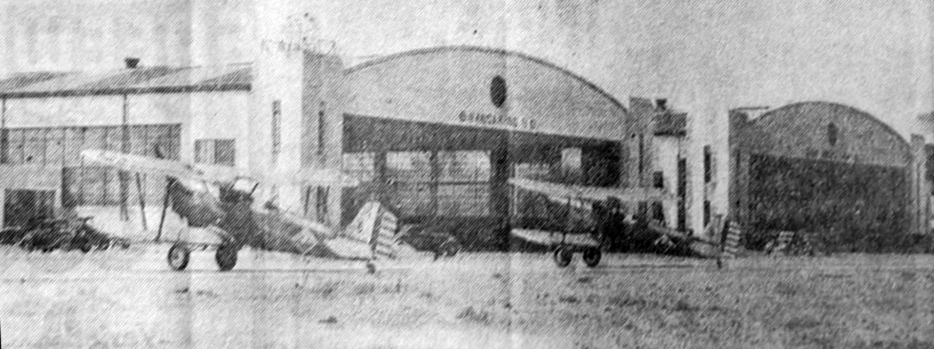
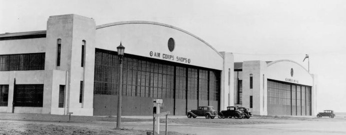
A circa 1930s photo of an Army Air Corps biplane (model unidentified) in front of the Hamilton Field “Air Corps Shops” hangars.
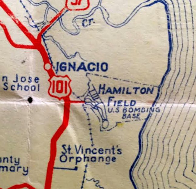
“Hamilton Field (U.S. Bombing Base)”, as depicted on a 1936 street map (courtesy of Kevin Walsh).
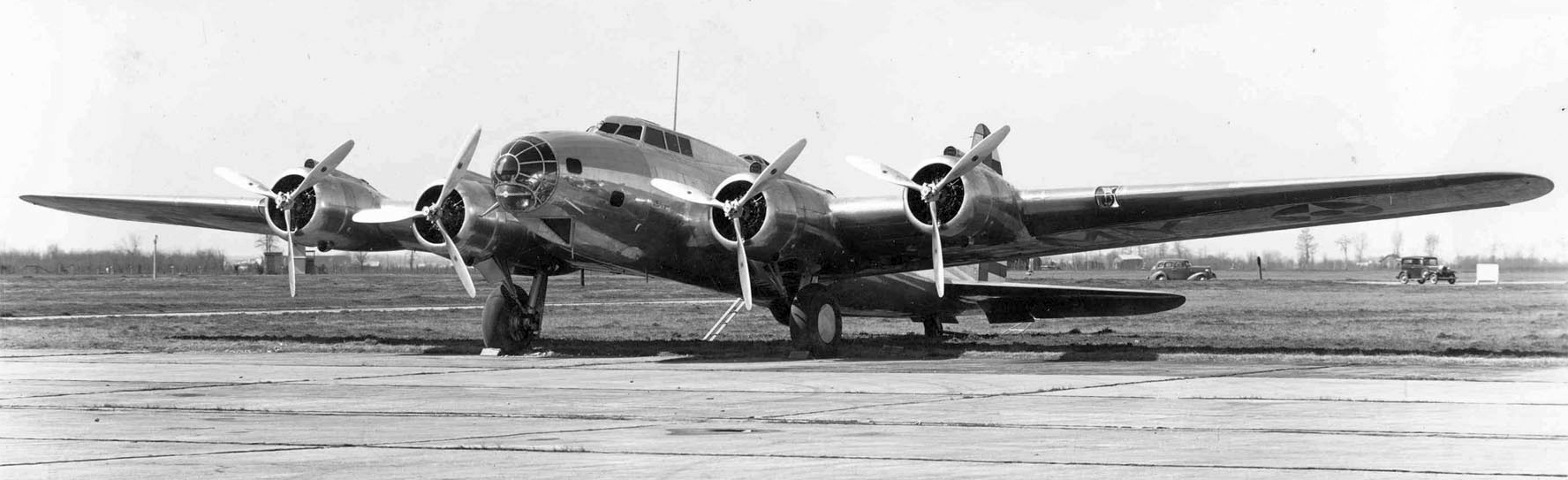
A 1936-39 USAAC photo of a Boeing Y1B-17 Flying Fortress at Hamilton Field.
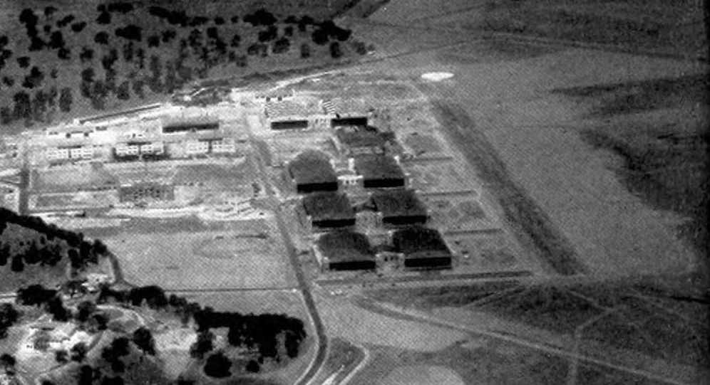
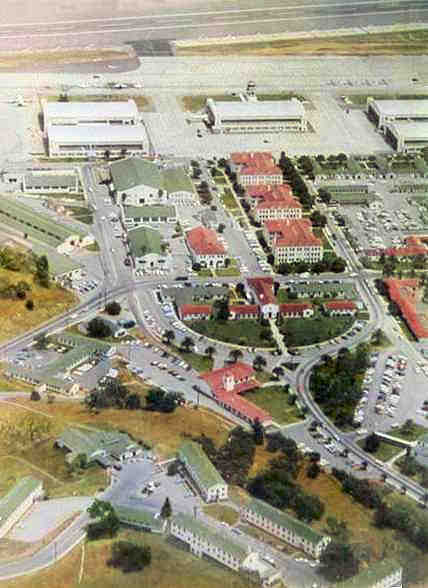
An undated aerial view in The Airport Directory Company's 1937 Airports Directory (courtesy of Bob Rambo) looking west at Hamilton Field.
It depicted 9 large hangars adjacent to the runway.
The directory described Hamilton Field as having a 3,500' landing mat running parallel to the hangars, as well as 2 shorter graded runways.
An undated U.S. Army photo from the 1937 Aeronautical Chamber of Commerce of America Aircraft Yearbook (courtesy of Kevin Walsh),
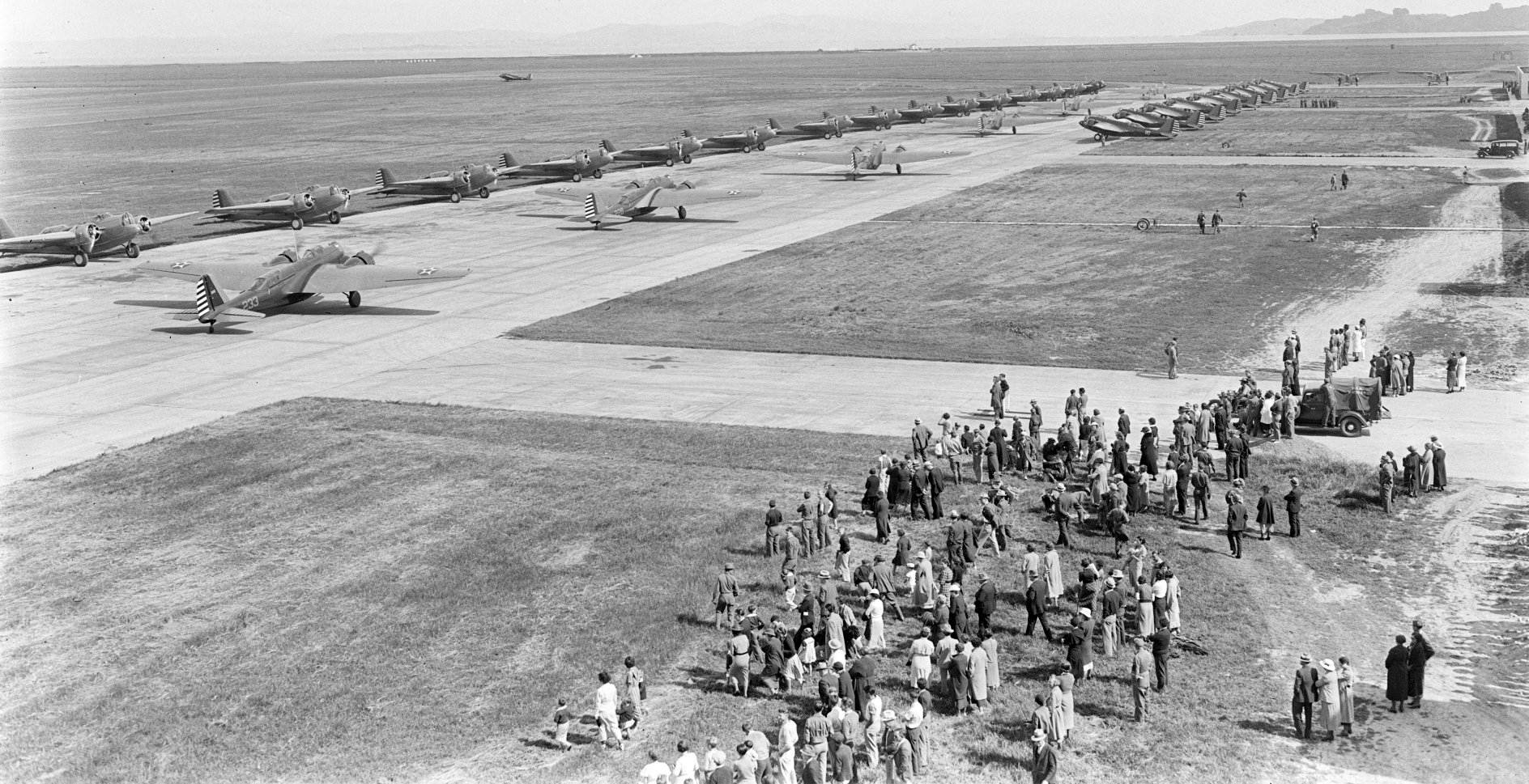
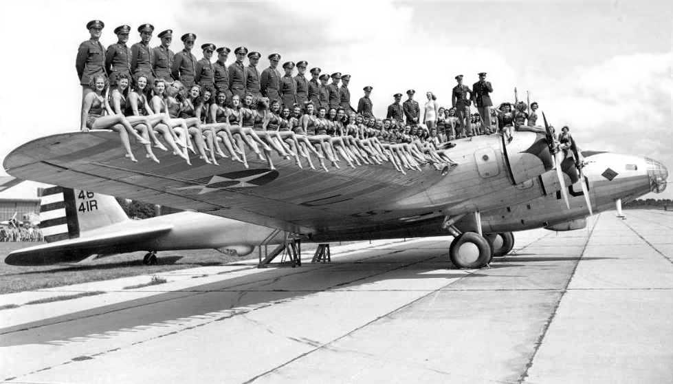
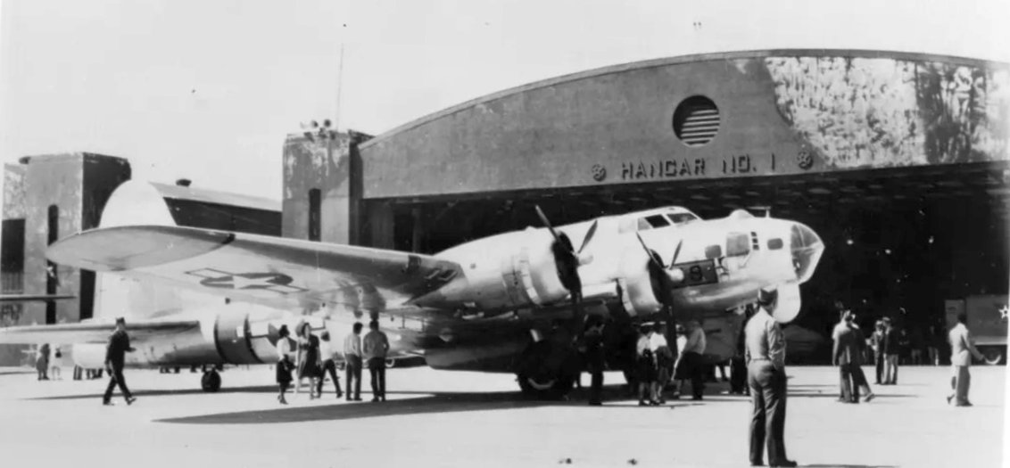
captioned “A great fleet of bombers: 35 Cyclone-powered Martin bombers & a Douglas amphibian in the Air Corps line up at Hamilton Field.”
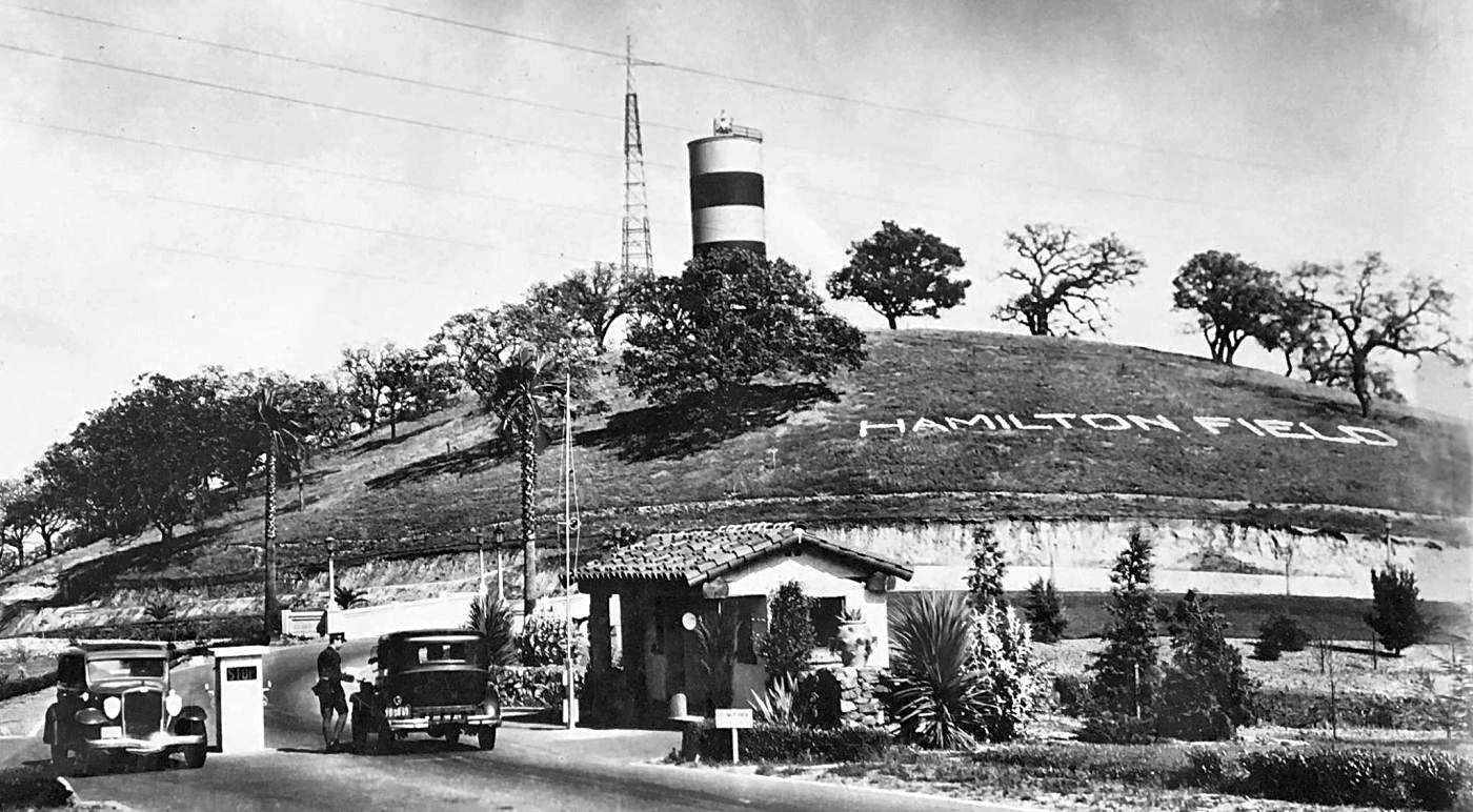
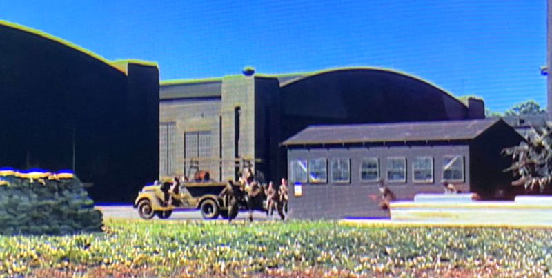
An undated photo of Hamilton Field's entrance gate from a 5/27/37 article (courtesy of Kevin Walsh).
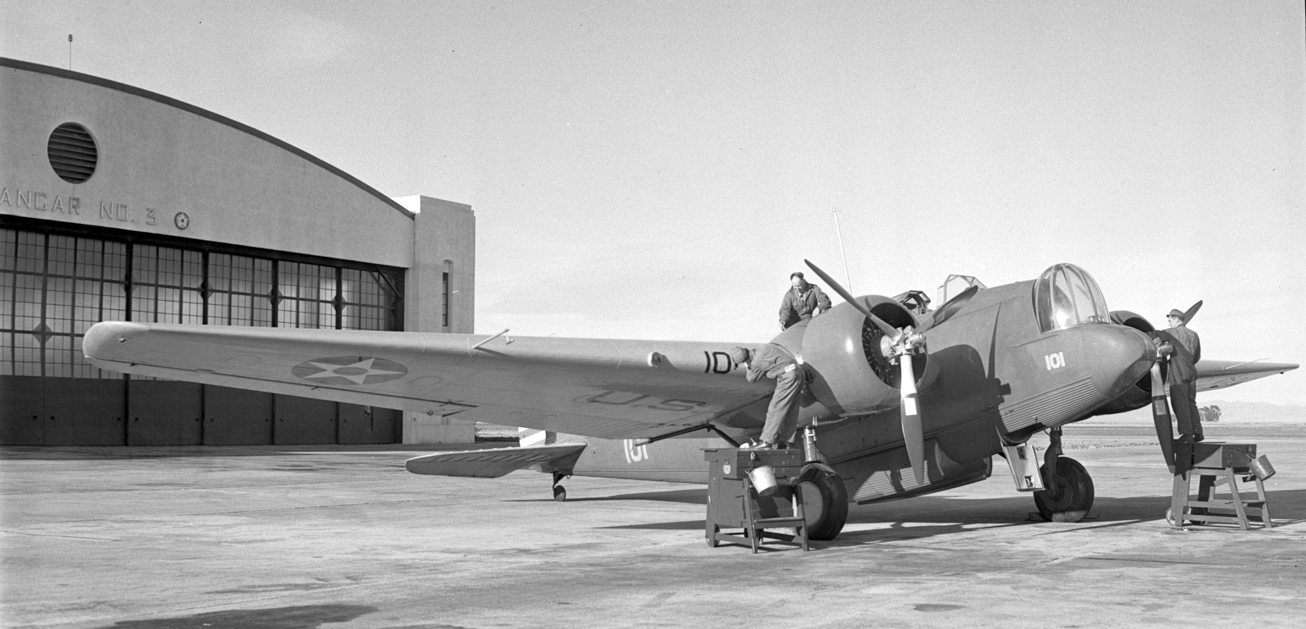
A 1939 photo by Jimmy Sayres of an Air Corps Martin B-10 bomber in front of Hamilton Field's Hangar #3 (courtesy of Kevin Walsh).
The earliest aeronautical chart depiction which has been located of Hamilton Field was on the October 1937 San Francisco Sectional Chart.
A circa 1937-40 promotional photo touting the size & strength of the sole prototype of the Boeing XB-15 bomber at Hamilton Field (courtesy of John Voss).
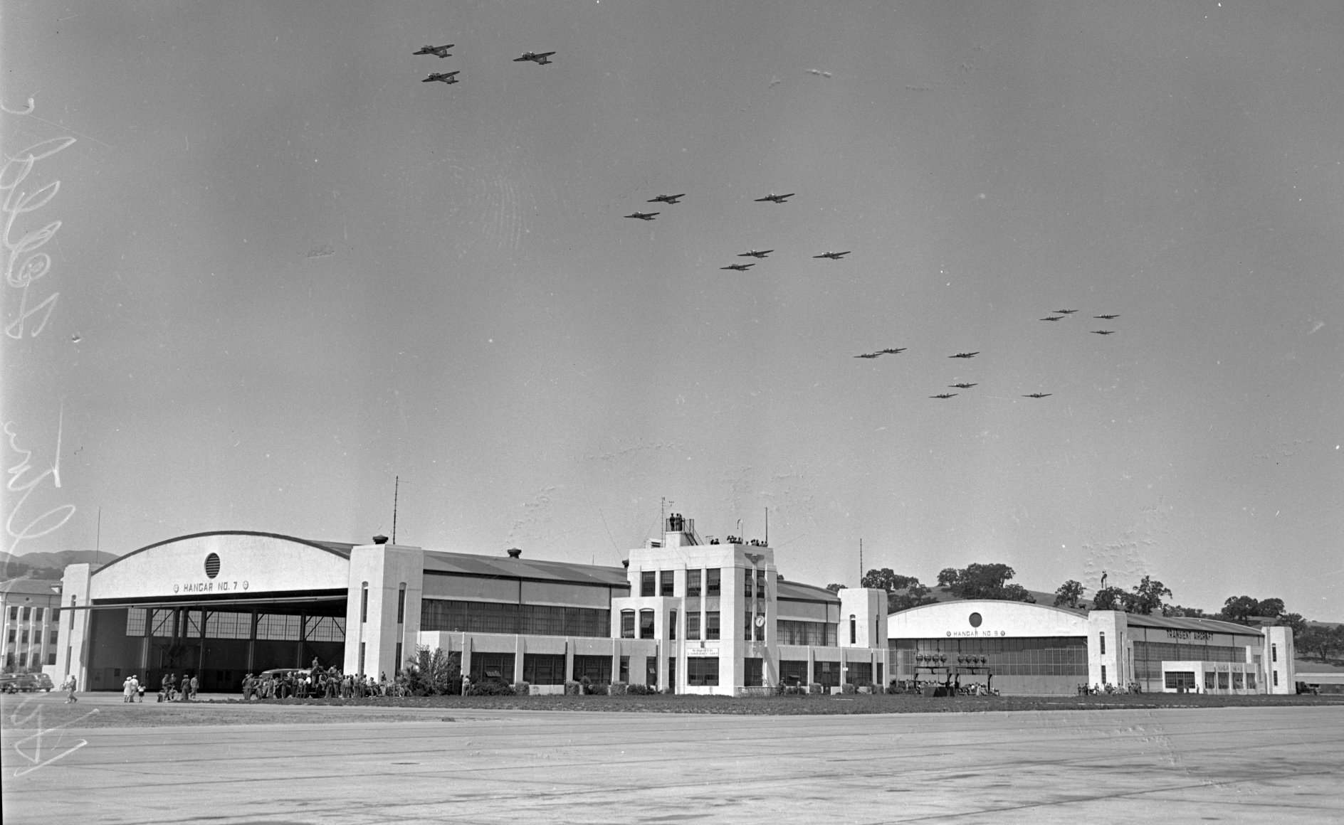
An 8/19/38 photo of Army bombers flying in formation over Hamilton Field's Hangar #7.
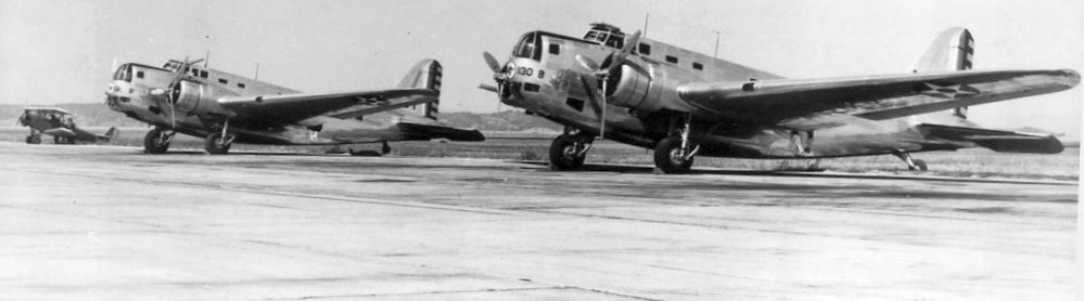
A circa 1939 photo of 2 Douglas B-18 Bolo bombers & an unidentified biplane at Hamilton Field.
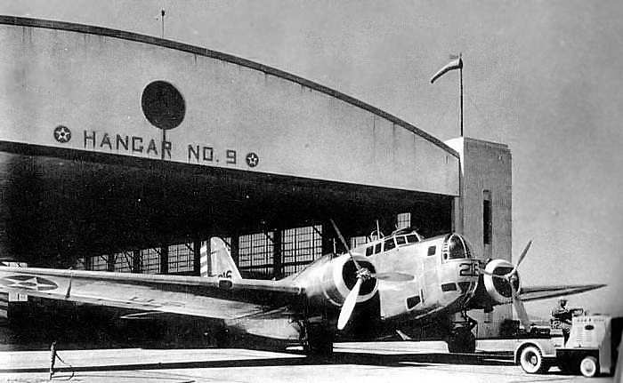
A 1939 photo of a Douglas B-18 Bolo bomber being towed from Hamilton's Hangar 9.
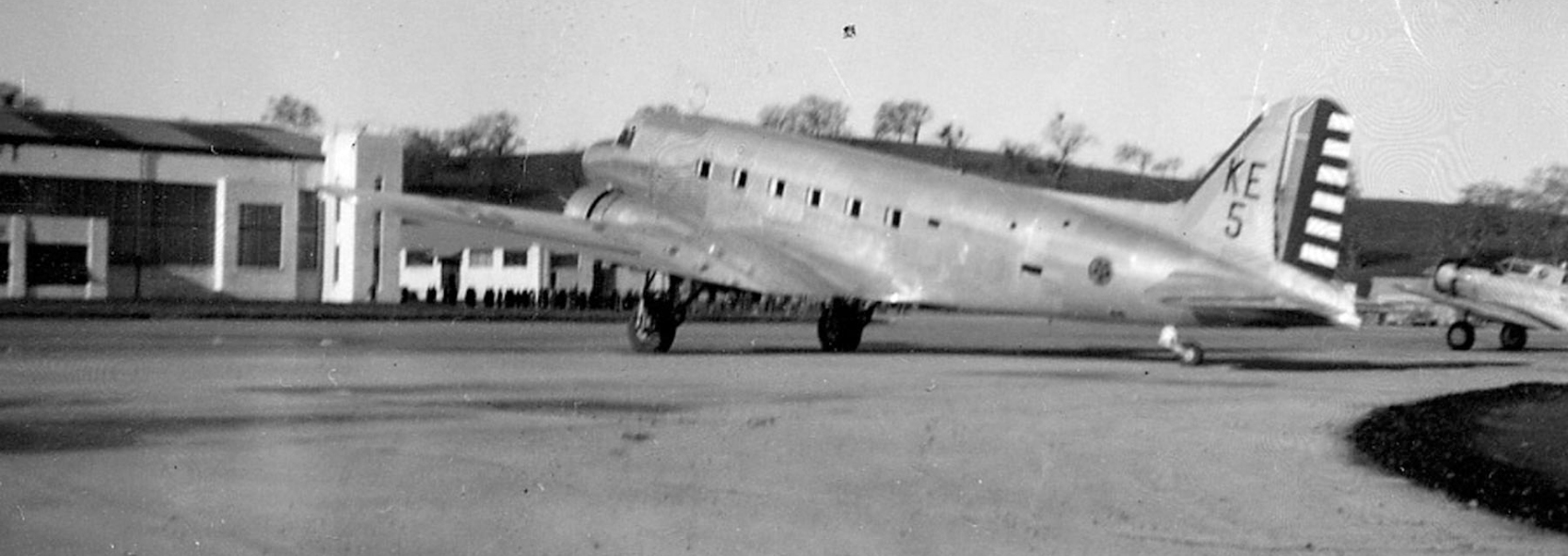
A 1940 USAAC photo of a rare Douglas C-39 at Hamilton Field.
The C-39 was a 16-seat passenger composite of DC-2 & DC-3 components, with a C-33 fuselage & wings & DC-3-type tail, center-section & landing gear.
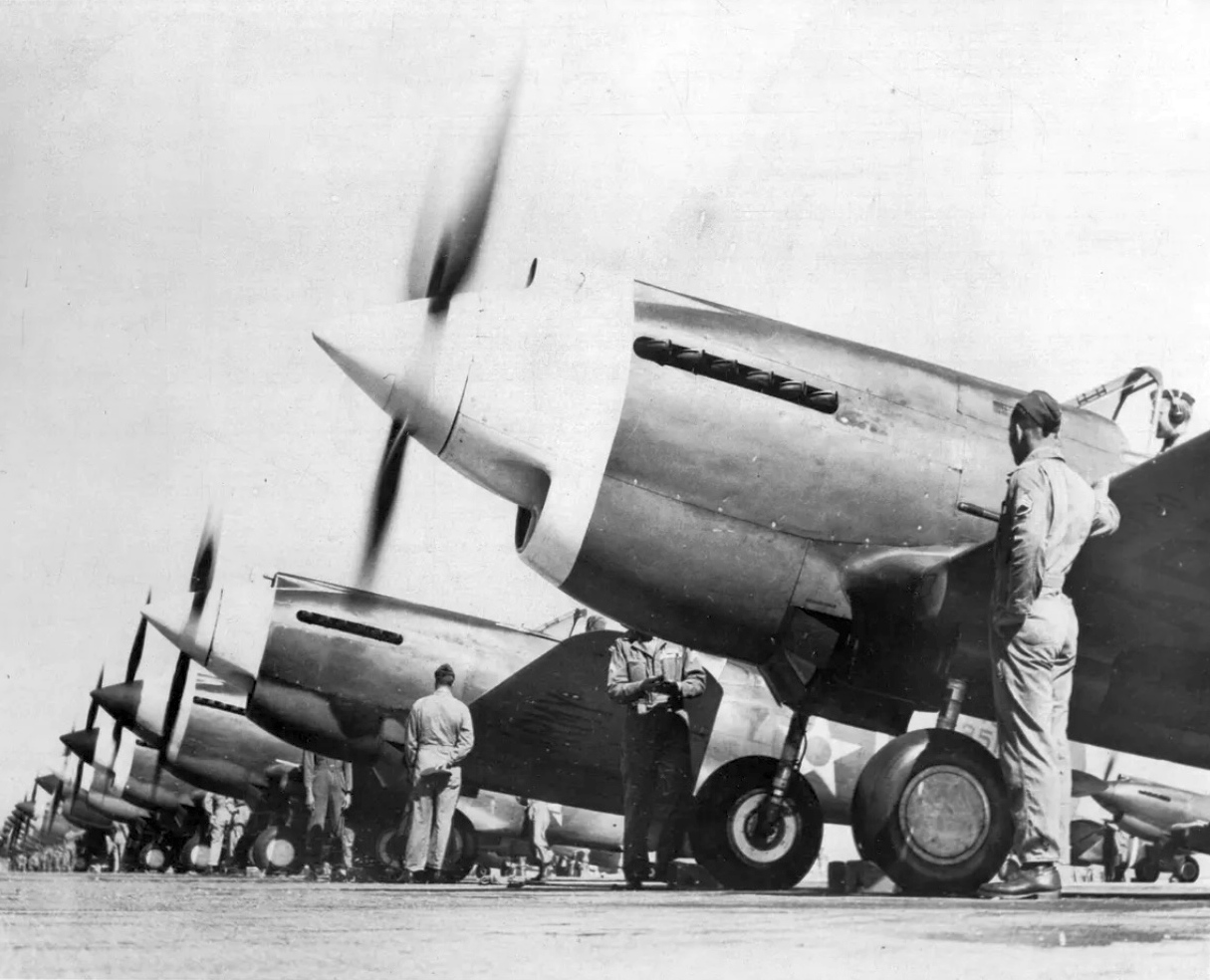
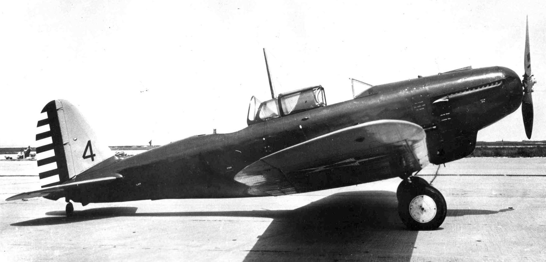
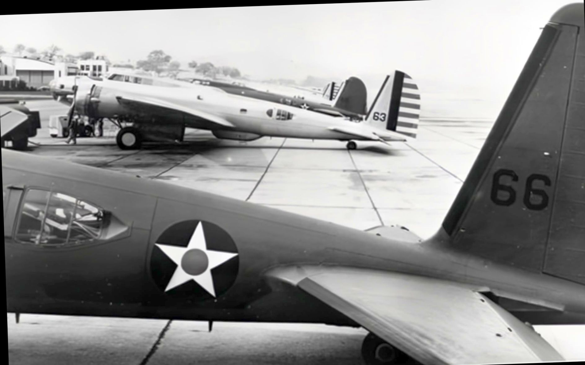
A 12/8/41 photo of Curtiss P-40 fighters of the 20th Pursuit Group at Hamilton Field (courtesy of Kevin Walsh).
A circa 1940 aerial view looking east at Hamilton Field (photographed in 2018 by Kevin Walsh from a display at Oakland Airport)
depicted multiple aircraft parked in front of the row of checkerboard-roofed hangars.
Hamilton Field was described in 1940 as "looking more like a modern residential suburb of Spanish California homes than the Army's Pursuit Base for northern California."
It had by that time received $5 million in development.
At that time the field housed the 45th Air Base Group, the 20th Pursuit Group (Fighter),
the 35th Pursuit Group (Interceptor), and the 82nd Observation Squadron, totaling over 4,000 officers & men.
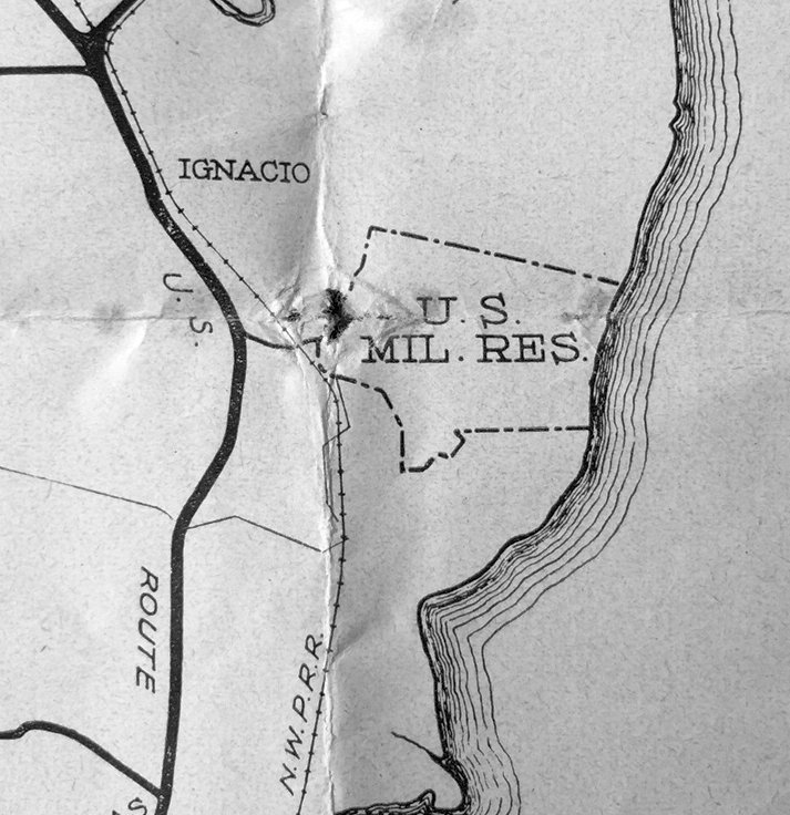
A 1941 Marin County map depiction of Hamilton Field, labeled simply as “U.S. Mil. Res.” (courtesy of Kevin Walsh).
Kevin Walsh noted, “In 1941 an access road ran from the Redwood Highway to the base, which lay entirely east of the railroad tracks.
This must represent the smaller base footprint of the time, when one crossed the tracks to reach the guard shack/gate at the base of the hill.
Later, of course, the base expanded all the way west to the highway & the railroad cut right through it.”
A circa 1941 photo looking east at Hamilton Field (photographed in 2018 by Kevin Walsh from a display at Oakland Airport)
of dozens of Curtiss P-40 fighters in front of a Hamilton hangar.
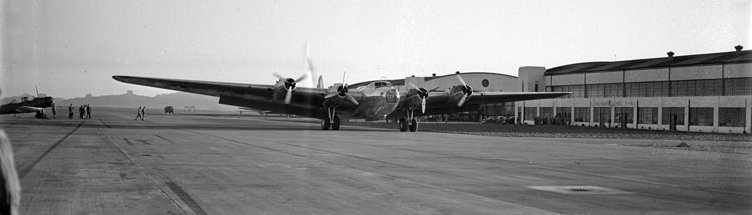
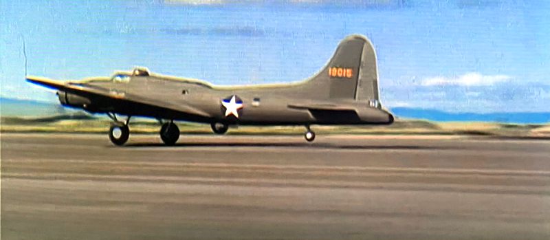
A May 1941 photo of early-model Boeing B-17C & 17D Flying Fortress bombers before departing Hamilton Field for Hawaii (courtesy of Kevin Walsh).
According to Leon Delisle, “My father enlisted at Hamilton Field in 1942.”
A still from the 1942 Warner Brothers film “Men of the Sky” of Hamilton Field's camouflaged hangars (courtesy of Kevin Walsh).
A still from the 1942 Warner Brothers film “Men of the Sky” of Hamilton Field's camouflaged hangars (courtesy of Kevin Walsh).
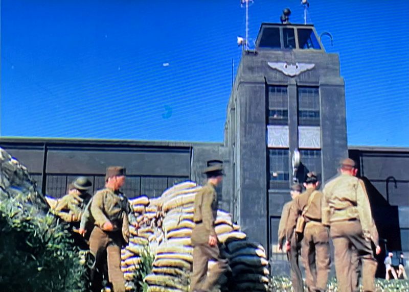
A still from the 1942 Warner Brothers film “Men of the Sky” of troops & sandbags in front of Hamilton Field's camouflaged control tower (courtesy of Kevin Walsh).
A still from the 1942 Warner Brothers film “Men of the Sky” of a Boeing B-17 Flying Fortress bomber taking off from Hamilton Field (courtesy of Kevin Walsh).
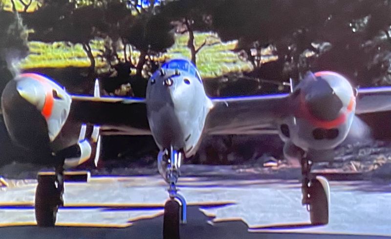
A still from the 1942 Warner Brothers film “Men of the Sky” of a Lockheed P-38 Lightning fighter parked within a Hamilton Field revetment (courtesy of Kevin Walsh).
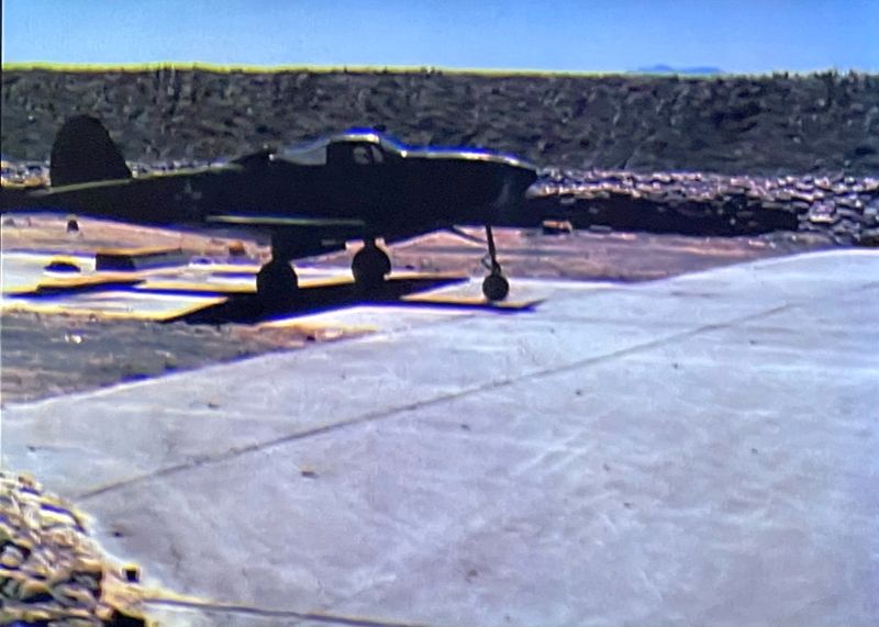
A still from the 1942 Warner Brothers film “Men of the Sky” of a Bell P-39 Airacobra fighter parked within a Hamilton Field revetment (courtesy of Kevin Walsh).
A still from the 1942 Warner Brothers film “Men of the Sky” of a Northrop A-17 Nomad attack aircraft parked within a Hamilton Field revetment (courtesy of Kevin Walsh).
A still from the 1942 Warner Brothers film “Men of the Sky” of an Army antiaircraft artillery crew at Hamilton Field (courtesy of Kevin Walsh).
During WW2, Hamilton Field was rapidly expanded to a wartime status,
with construction of additional barracks, mess halls, administration buildings,
warehouses, Link trainer buildings, schools, hospital & other structures.
A beautiful 1943 portrait of a Bell P-39 Airacobra at Hamilton Field (courtesy of National Air & Space Museum).
The original caption read, "Airacobra training at Hamilton Field, California, for the 357th Fighter Group
before shipping out to England to join the Eighth Air Force in July 1943.
Group CO Col. Edward S. Chickering's P-39 is being started by the ground crew the hard way -
with the hand crank to get the inertia starter going."
A 1943 photo of a 326th Fighter Group Bell P-39D Airacobra 42-8861 at Hamilton Field (courtesy of Kevin Walsh).
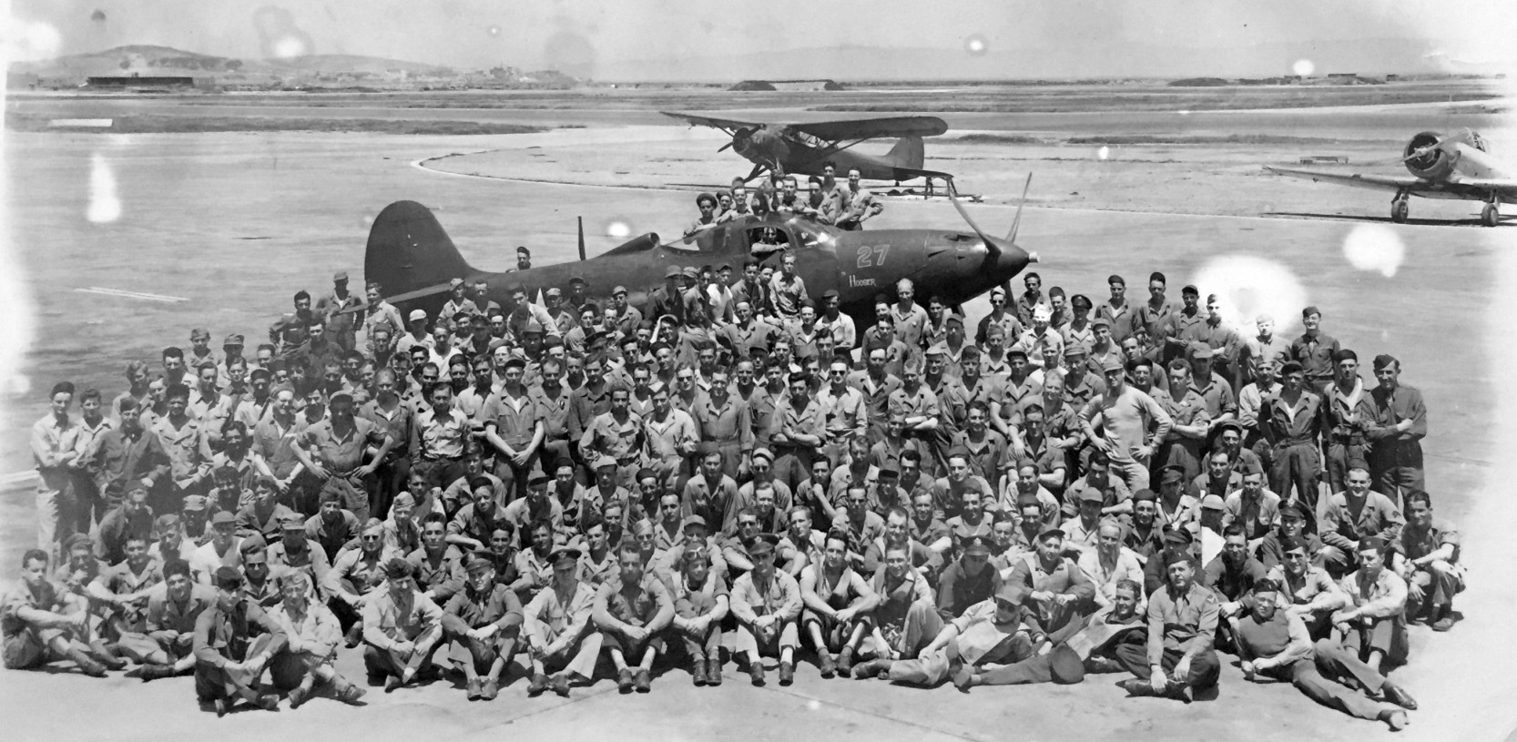
A WW2 photo of an unidentified group in front of a Bell P-39 Airacobra & 2 other Army planes at Hamilton Field (courtesy of Kevin Walsh).
The 4/1/44 US Army/Navy Directory of Airfields (courtesy of Ken Mercer) described Hamilton AAF as having an 8,000' hard-surfaced runway.
According to the 1945 Army Inventory List (courtesy of Rex Ricks), at that point Hamilton's property consisted of a total of 1,599 acres,
and it had auxiliary fields at Napa, Montague, & Willows.
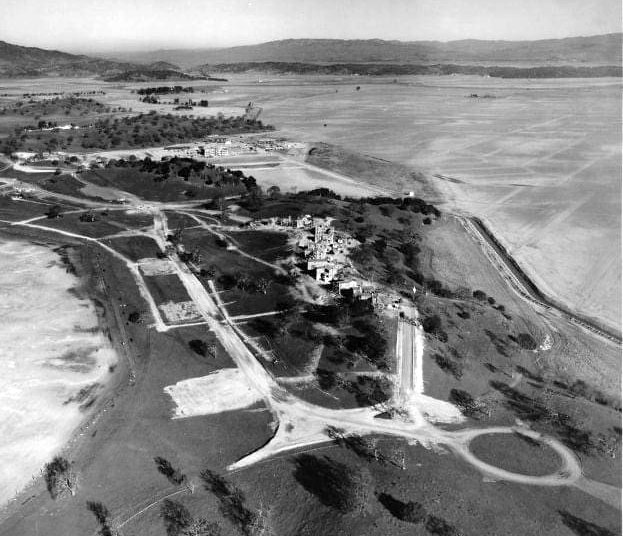
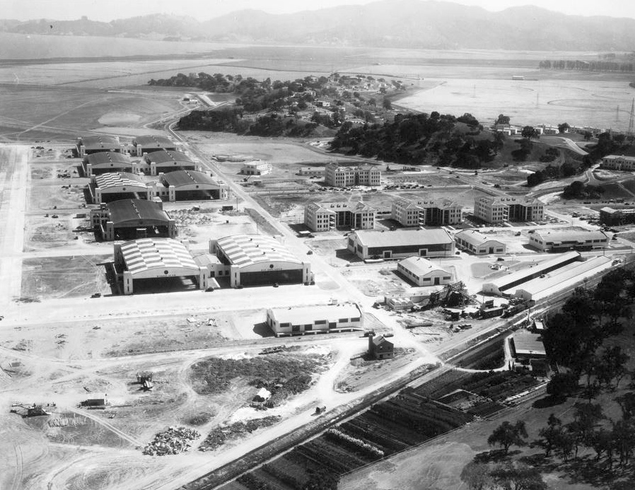
A 1945 aerial view looking west at Hamilton depicted the exponential growth which the base experienced during WWII.
Dozens of Douglas C-54 Skymaster transports lined the parking ramp with a few other types.
The area to the lower right of the runway was known as the "pea patch" and showed the parking dispersal hardstands for fighter planes.
These revetments were designed to allow fighters to survive an initial attack and launch to defend the base.
In later years the "pea patch" was where mechanics performed engine tests on afterburner-equipped jet interceptors.
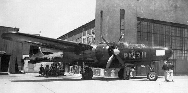
A mid/late-1940s photo of a Northrop P-61 Black Widow night fighter in front of a Hamilton Field hangar (courtesy of Kevin Walsh).
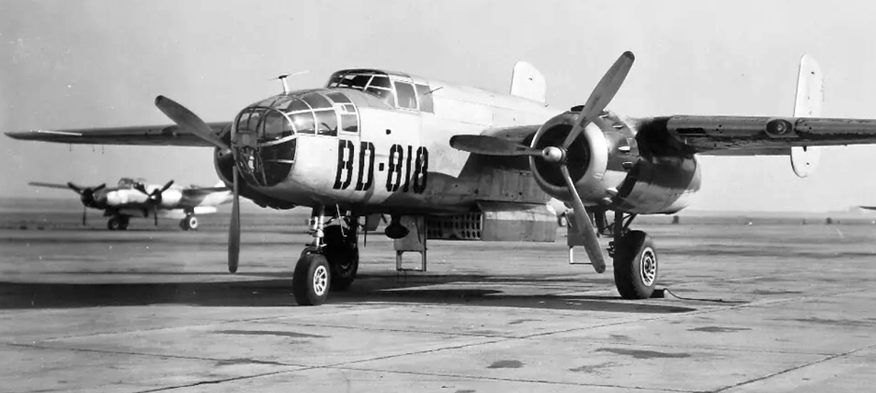
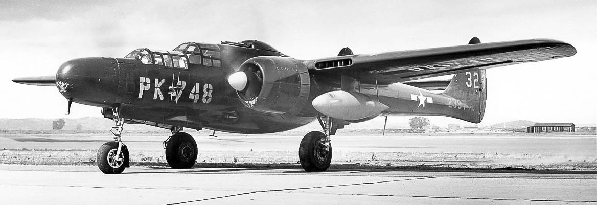
A mid/late-1940s photo of a North American B-25 Mitchel bomber at Hamilton Field (courtesy of Kevin Walsh), with an A-26 in the background.
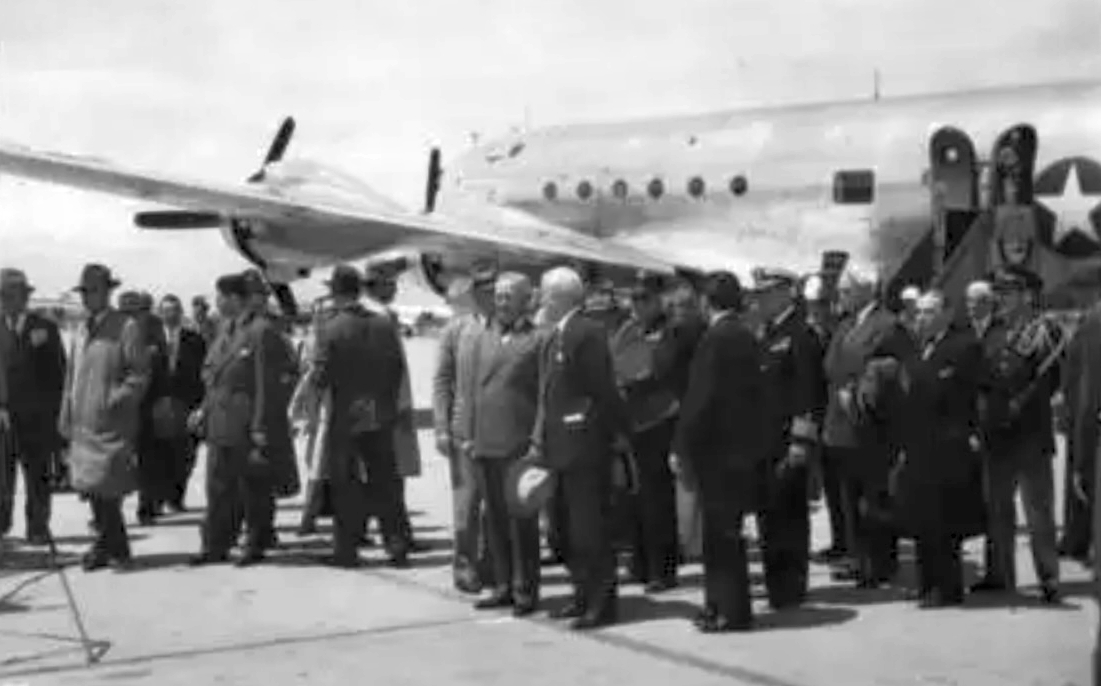
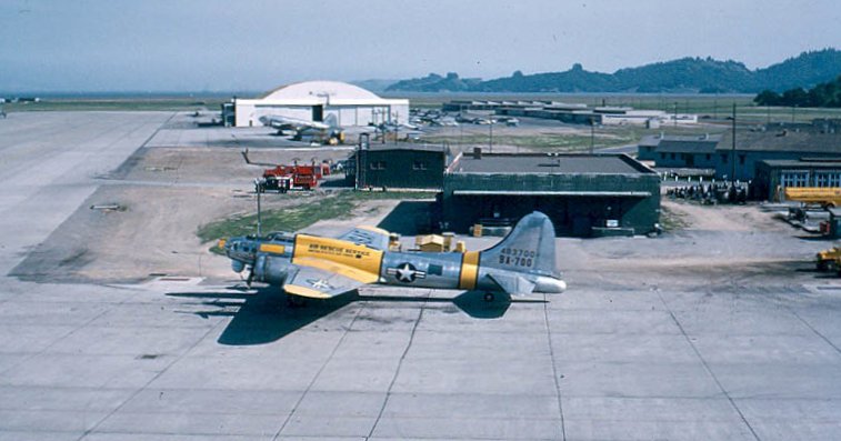
A 6/25/45 photo of President Harry Truman in front of a Douglas C-54 Skymaster at Hamilton Field (courtesy of Kevin Walsh).
Steven Pricer recalled, “My father, Lt. Col. Donald Pricer was the CO at Hamilton of the Search & Rescue outfit after the war.”
In the postwar era, Hamilton Field was reassigned to the Continental Air Forces in 1945.
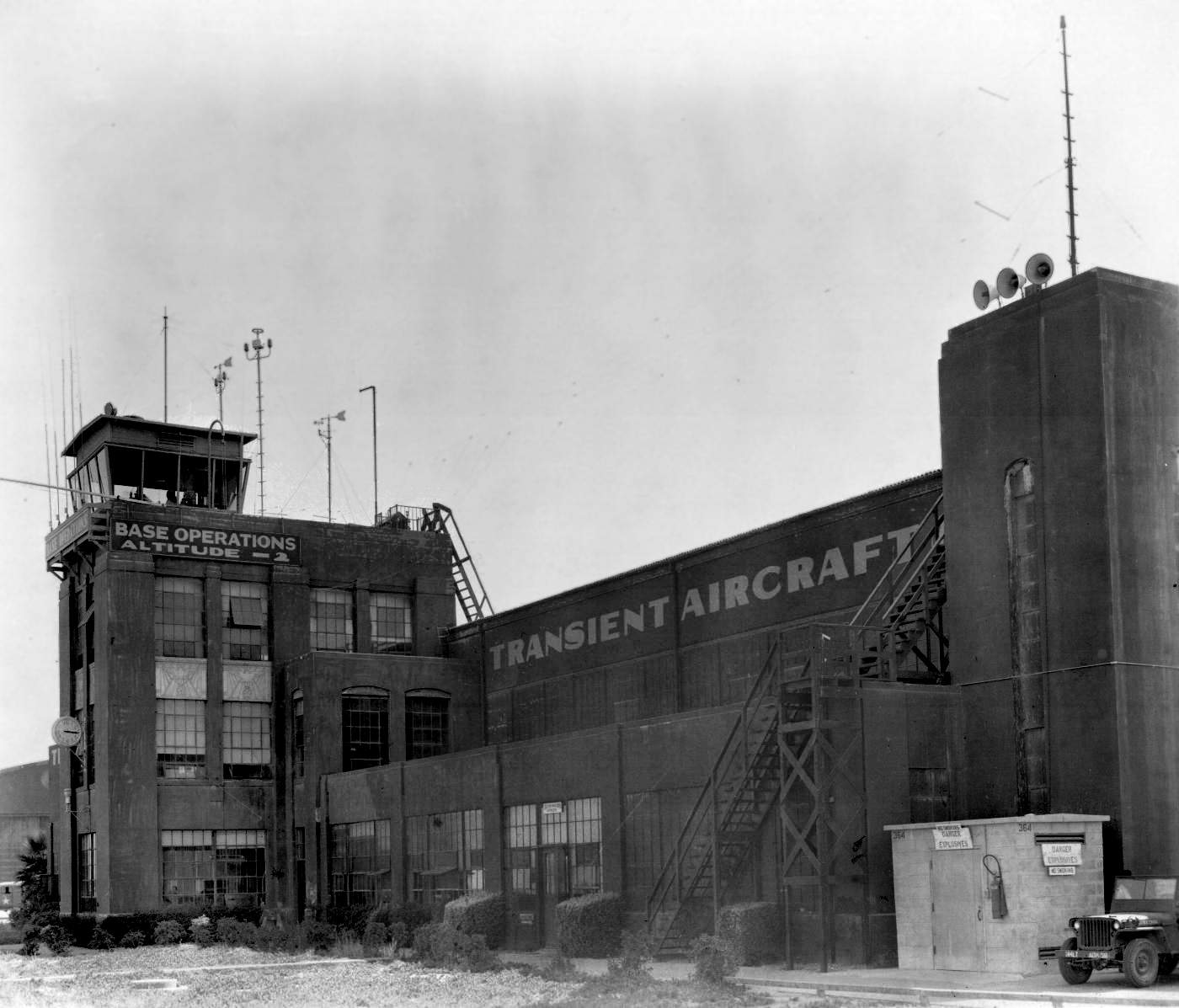
A circa 1946-49 photo by Don Reid (courtesy of Bruce Reid) of Hamilton Field's Base Operations & control tower attached to a hangar.
Note the legend indicating a field elevation of 2 feet below sea level.
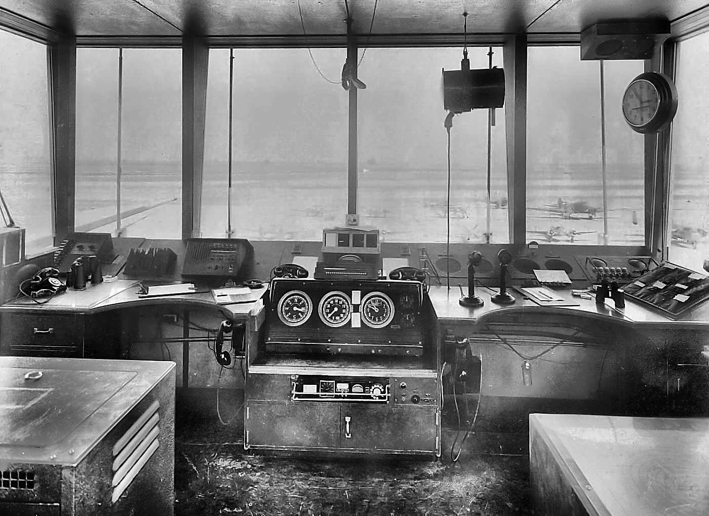
A circa 1946-49 photo by Don Reid (courtesy of Bruce Reid) of the interior of Hamilton Field's control tower.
Note the variety of aircraft outside on the ramp.
A circa 1940s photo (courtesy of Kevin Walsh) of a Boeing B-17 (possibly an SB-17G variant?) with an underslung lifeboat in front of Hamilton's Hangar #1.
The February 1948 San Francisco Local Aeronautical Chart (courtesy of Tim Zukas)
depicted Hamilton AFB as having a, 8,000' paved northwest/southeast runway.
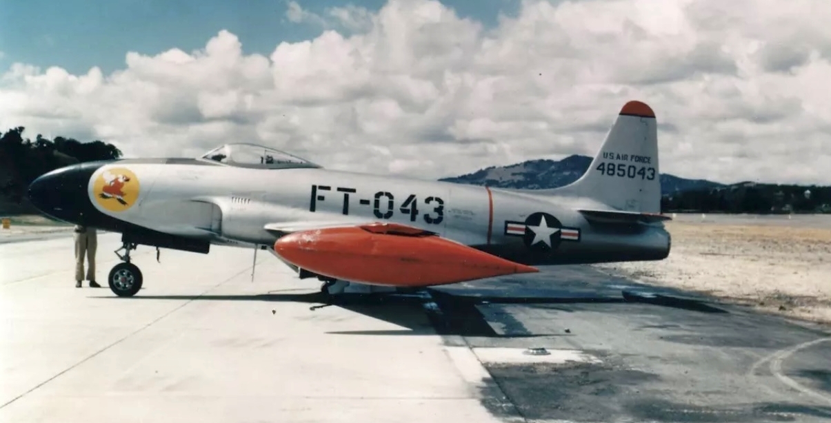
A May 1949 photo by Bill Larkins (courtesy of Kevin Walsh) of a Lockheed P-80A Shooting Star jet fighter on the Hamilton AFB ramp.
A 1949 photo by Bill Larkins looking south at a Boeing SB-17G of the Air Rescue Service at Hamilton Field.
The hangar in the background was used by the Air Force Reserve to operate C-46s & B-26s.
In the postwar era, Hamilton Air Force Base was modified to accommodate jet aircraft, and it was reassigned to the Air Defense Command in 1951.
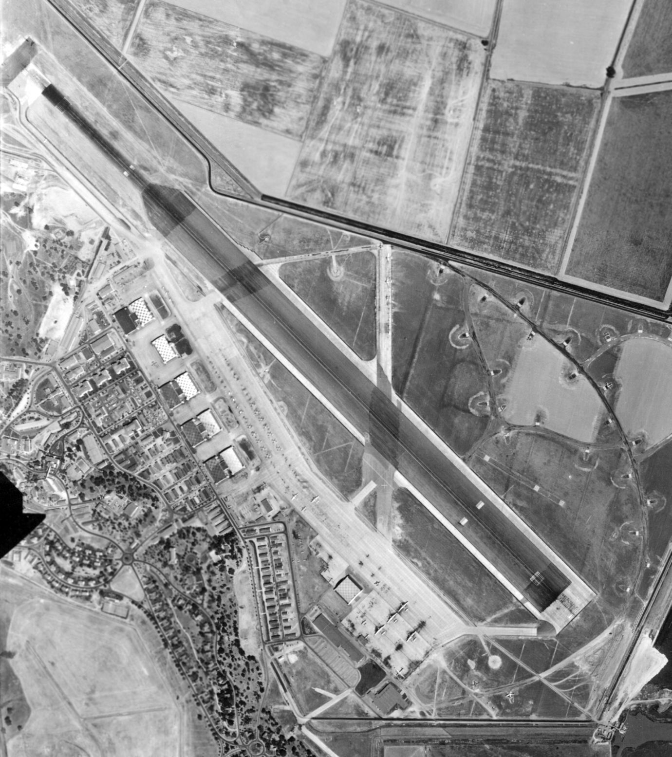
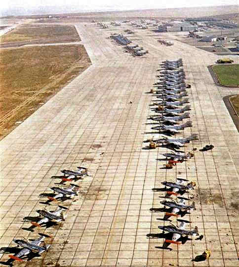
An amazing 8/16/52 aerial view (from the UCSB Library) depicted a large number of aircraft on the Hamilton AFB ramp.

A 1953 photo of 2 North American F-51 Mustangs on alert in front of Hamilton Field's control tower & a hangar (courtesy of Leon Delisle).
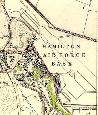
Hamilton AFB, as depicted on the 1954 USGS topo map.
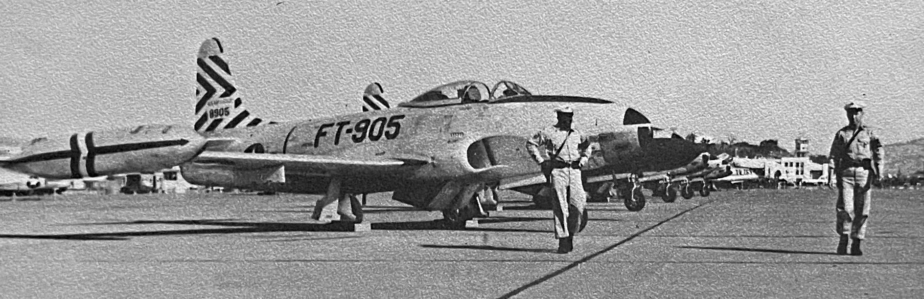
A 1954 photo of 2 armed MPs in front of Lockheed F-80 Shooting Stars on the Hamilton Field ramp (courtesy of Kevin Walsh).
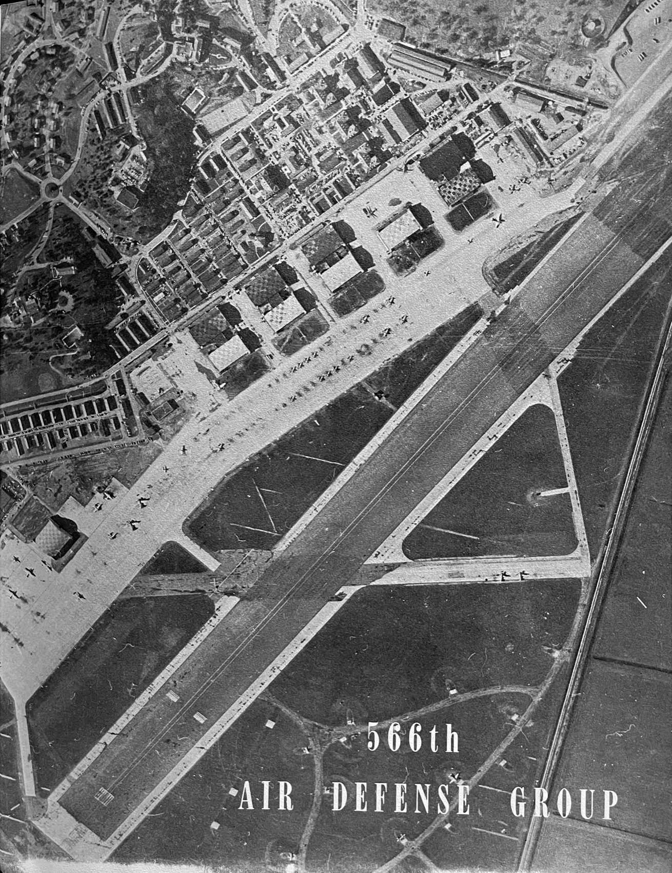
An undated aerial view of a busy Hamilton Field from a 1954 publication of the 566th Air Defense Group (courtesy of Kevin Walsh).
Richard Bickel recalled, “Hamilton AFB... I was an Air Traffic Control Radar technician there working on the ASR & PAR systems from 1956-58.
I witnessed the only emergency landing of a U-2 aircraft at that base during graveyard shift, in late 1958.
I had just finished a tune-up on the AN/FPN-16 PAR radar 100' from the edge of the runway.
I stepped out onto the top landing & was surprised to see a long slender 2-wheel glider floating down onto the runway, turning right onto the grass parking with one wing high in the air!”
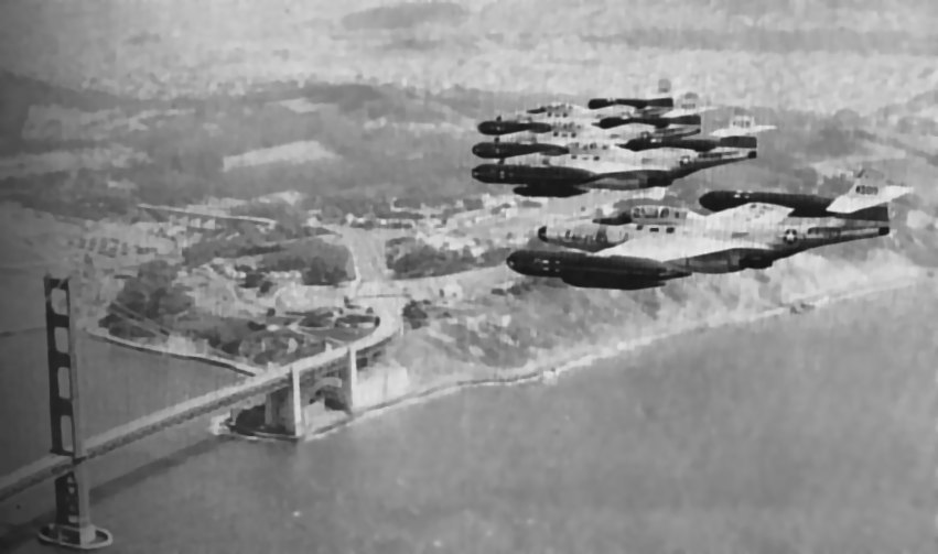
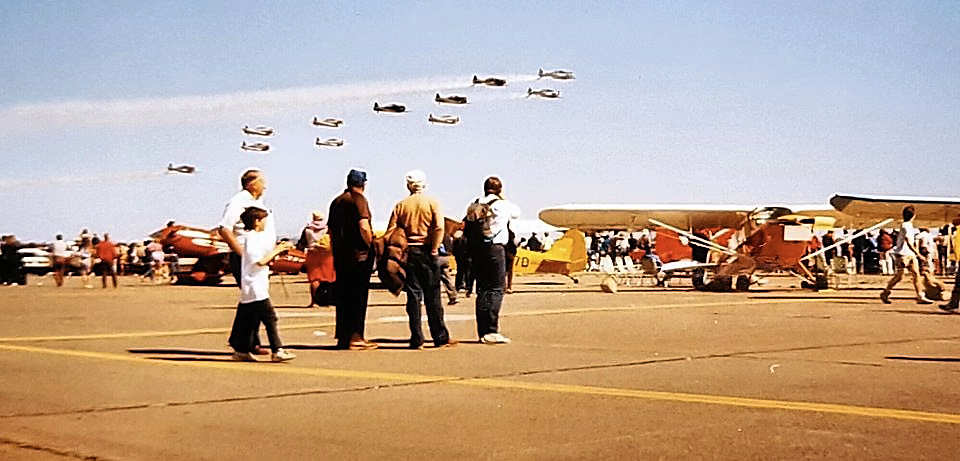
A formation of F-89 Scorpions over the Golden Gate, from the 1958 Hamilton AFB Directory & Guide (courtesy of Jonathan Westerling).
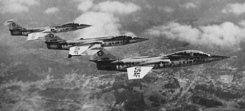
A trio of Hamilton's F-104 Starfighters (two F-104As & a 2-seat B-model) over Marin County,
from the 1958 Hamilton AFB Directory & Guide (courtesy of Jonathan Westerling).

A circa 1950s photo of an F-104 Starfighter inside an alert shed at Hamilton (courtesy of Bill Eaton).
In 1959 Hamilton's runway was upgraded to accommodate F-101 & F-104 fighter operations.
The April 1959 San Francisco Local Aeronautical Chart (courtesy of Paul Columbus)
depicted Hamilton AFB as having a single 8,000' paved northwest/southeast runway.
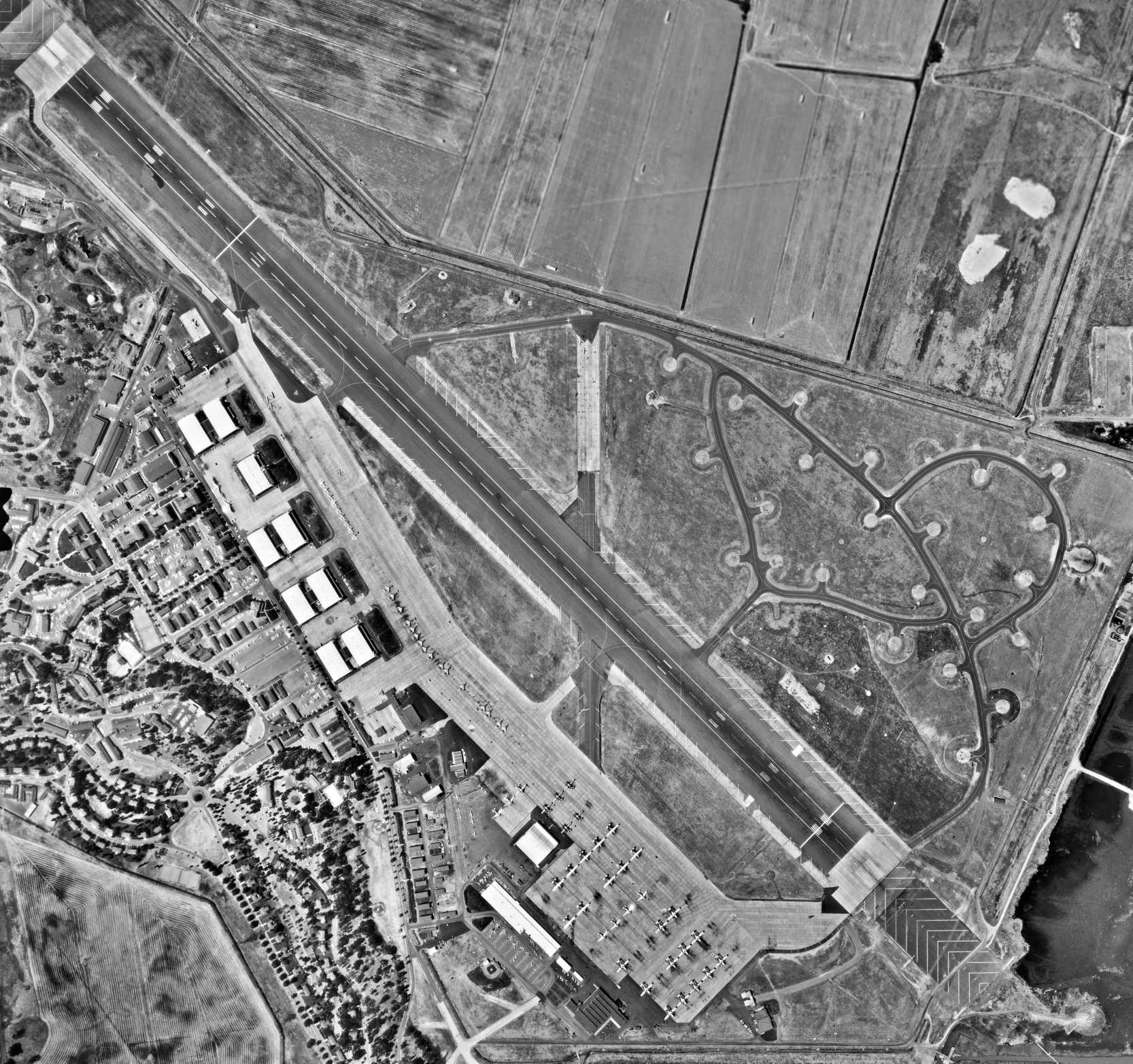
A 1961 aerial view looking southeast along Hamilton's massive ramp, showing T-33 T-Birds & F-101 Voodoos galore.
In 1961, Hamilton's 83rd & 84th Fighter-Interceptor Squadrons were both equipped with the McDonnell F-101B Voodoo.
In the foreground are 8 Lockheed T-33 Shooting Star proficiency trainers, also known as "T-Birds",
used by staff officers to use in their spare time to remain on flight status & thus get their flight pay.
A 1964 photo by Ben Brown (courtesy of Bill Eaton) of a Douglas A3 Skywarrior, probably from NAS Alameda, just after arrival at Hamilton for the May 1964 open house.
In the words of Bill Eaton, "It is parked abeam either Hangar 3 or 5. Note the checkerboard on the roof of the hangar - very 1930s.
The crew has placed their helmets ('bone domes') atop the canopy.
One gust of wind and they'd roll off & go 'crunch' on the ramp.
But it's May & there was probably little or no wind on such a gorgeous Spring morning in the Bay Area.
Think of how fun it was to fly up the Bay from Alameda in your A3 at maybe 1000 feet
on such a beautiful morning, then make a low pass down runway 30 at Hamilton,
pitch up, land, and taxi in while people ran over to take a picture.
Then your wife & kids drive up from Alameda in the 1963 Ford Country Squire & spend the day at the airshow with Dad -
in his flight suit looking like Steve Canyon."
A circa 1960s photo of USAF F-101B Voodoo interceptors in front of a Hamilton hangar.
A circa 1960s aerial view looking north at a wide variety of USAF aircraft on the Hamilton ramp.

An undated photo of a crew boarding their McDonnell F-101B Voodoo on the cover of the 1964 Hamilton AFB Directory (courtesy of Kevin Walsh).
An undated aerial view looking east at Hamilton from the 1964 Hamilton AFB Directory (courtesy of Kevin Walsh).
A 7/2/65 USGS aerial view (from the UCSB Library) depicted a large number of aircraft on the Hamilton AFB ramp.
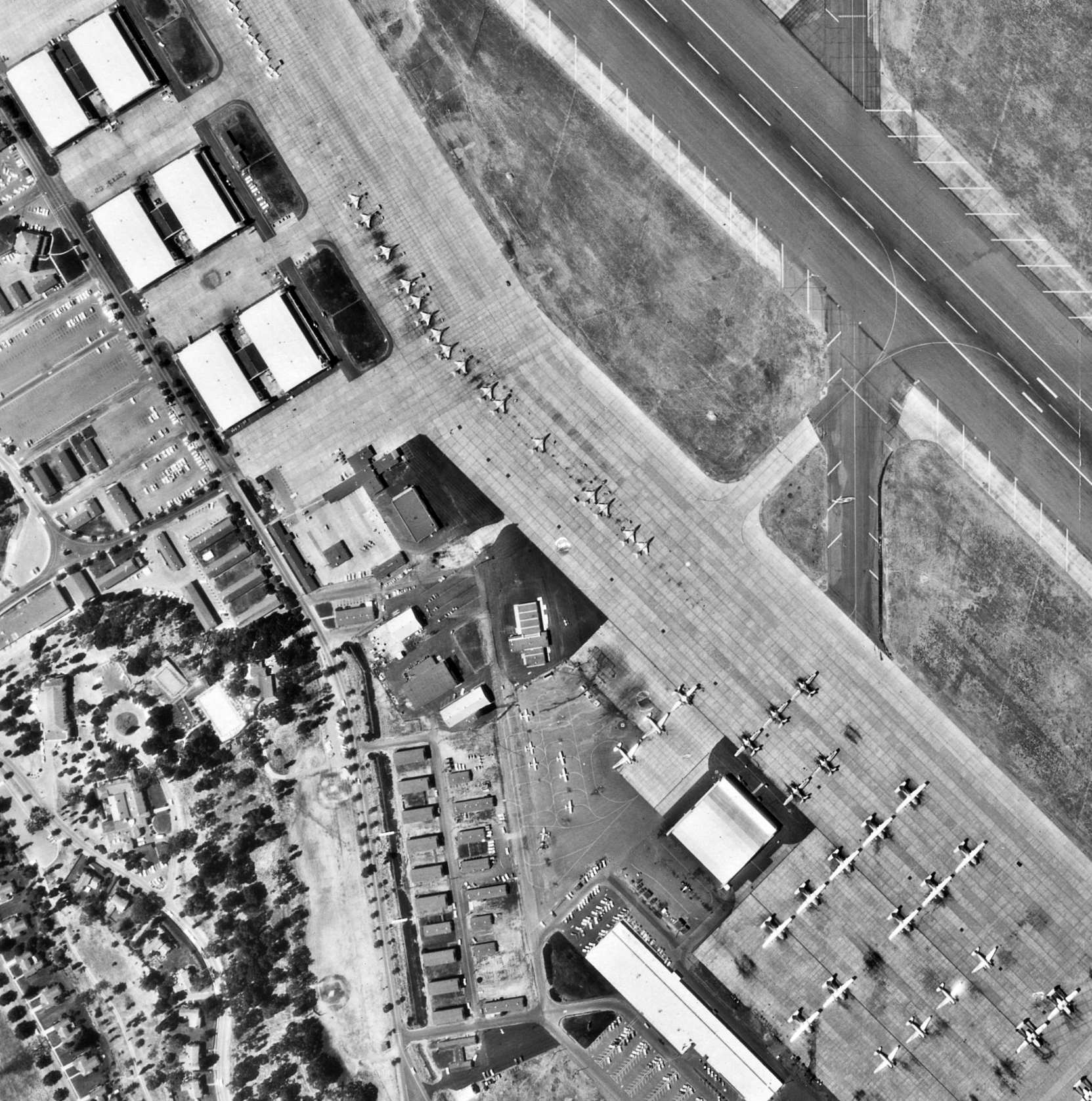
A closeup from the 7/2/65 USGS aerial view (from the UCSB Library) showing F-101 Voodoos & other aircraft on the Hamilton AFB ramp.
In 1966 Hamilton's 349th Military Air Wing converted from the C-119 to the C-124,
and shortly thereafter a large Air Force Reserve C-124 maintenance hangar was built on the southeast end of the ramp.
A 1966 aerial view looking northeast towards Hamilton's control tower (courtesy of Rex Ricks).
A VC-121A Constellation was parked on the left/west side of Hangar 7.
The Transient Aircraft line on the ramp side of Hangar 9 at upper left had visible 2 T-38 Talon trainers, a T-33 trainer, and an F-102 interceptor.
At far left were 2 C-47s & a C-131 transport.
At far right on the ramp were several T-33s belonging to Hamilton's 78th Fighter Wing.
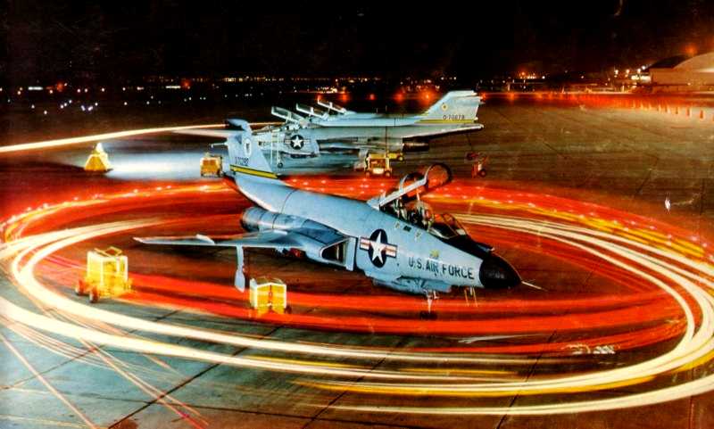
A 1967 time-lapse photo of USAF maintenance vans circling an 84th FIS F-101B Voodoo interceptor at Hamilton.
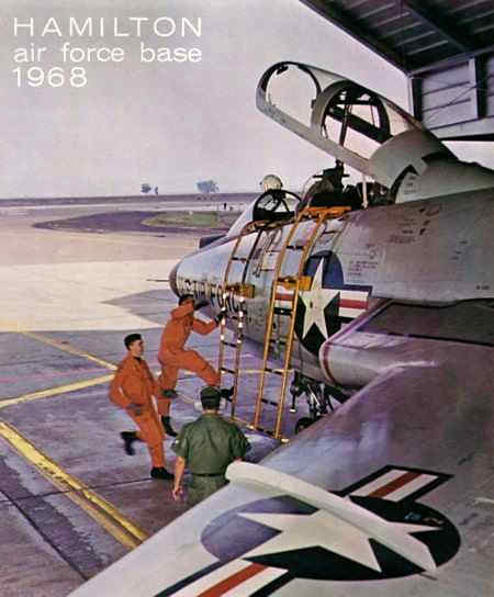
The cover of Hamilton's 1968 base yearbook (courtesy of Bill Eaton),
showing an F-101 Voodoo crew performing a scramble from their alert shed at Hamilton.
Hamilton was reassigned to the Aerospace Defense Command in 1968.
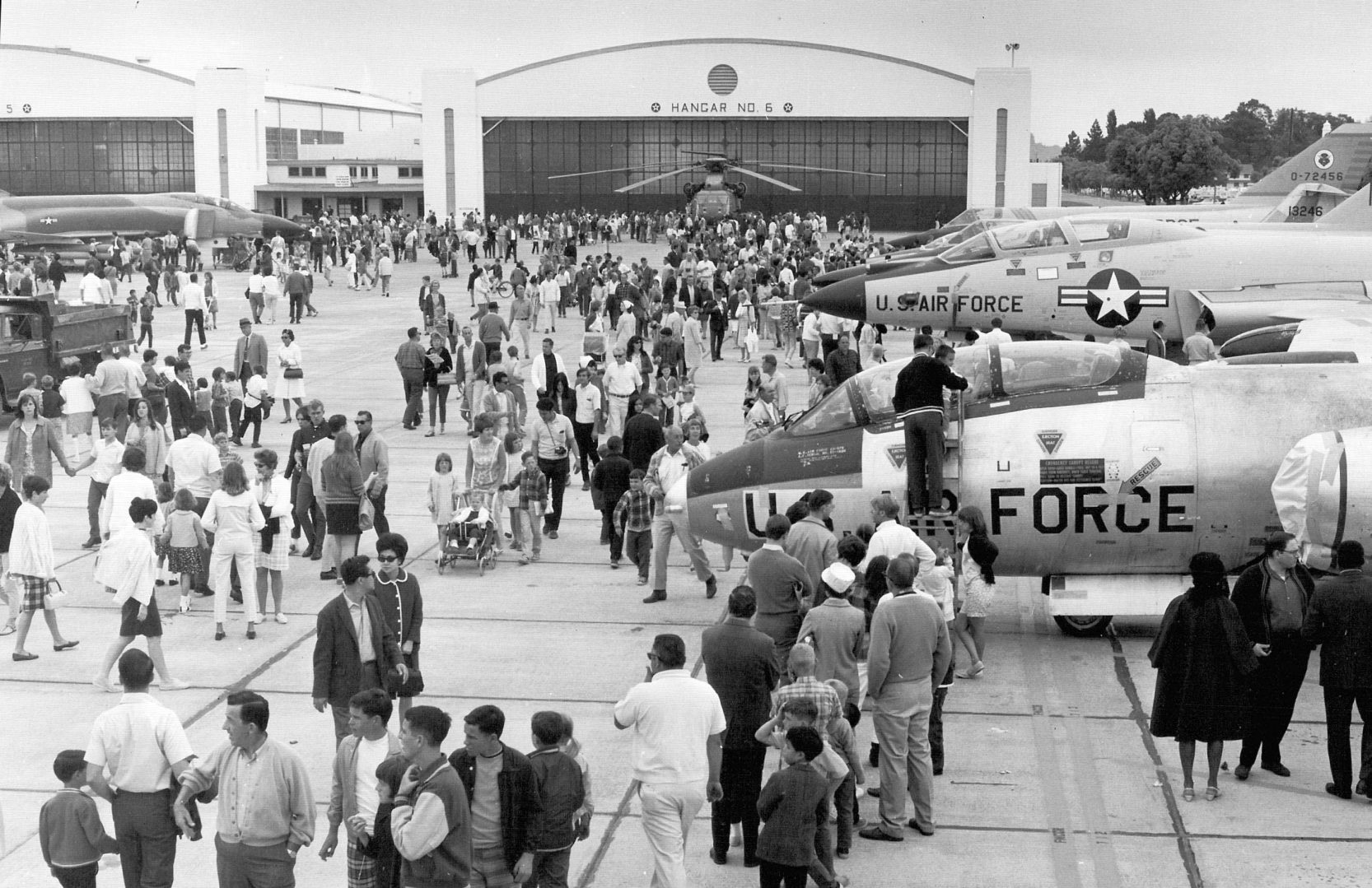
A 1960s photo of a Martin B-57 Canberra & other aircraft at a public display in front of Hamilton AFB's Hangar 6.
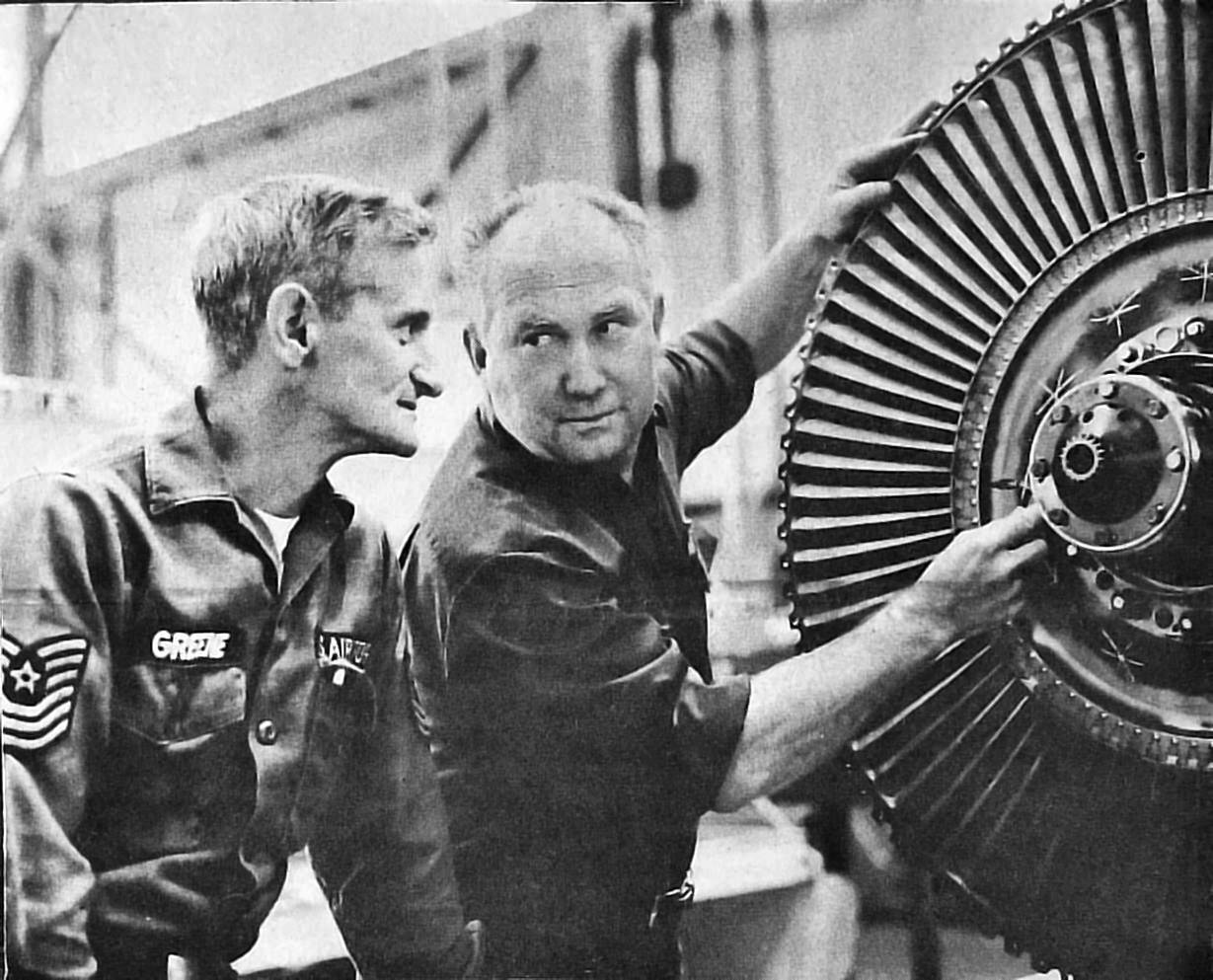
A photo from the 8/22/69 Hamilton Intercept (courtesy of Kevin Walsh) of Hamilton Field engine mechanic Clayton Walsh (right)
and Msgt. Thomas Greene, supervisor of J-75 section, checking the installation of a #3 turbine wheel of a Convair F-106 Delta Dart engine.
Kevin Walsh recalled that his father was an “Engine Mechanic, making the transition from props to jets, naturally.
He also subbed for a few months at the test cell circa 1968, and I always thought that was a rather cool place.
When his 1950 Chevy was getting tired, circa 1960, he bought the Base's Red Cross' surplus 1956 Chevy!
Unfortunately it was then painted all in black, which made it feel like an oven during those summer trips across the central valley up to Tahoe.
And he'd bring home the odd asbestos tile or batting to cover the garden shed with... It's a wonder i'm alive!”
A circa 1970 aerial view looking northwest at Hamilton Field from final approach to Runway 30.
Ray recalled, “I was assigned to Hamilton AFB from 1970-1975 as a Reservist.
We had C-124s at first then C-130s, in the 349th Aerial Port Squadron.”
A 1971 photo of a pretty Convair F-106A Delta Dart & its reflection on a wet Hamilton AFB ramp.
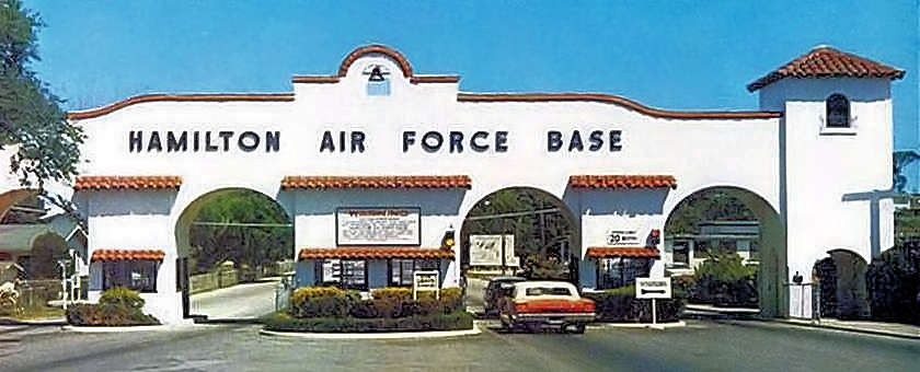
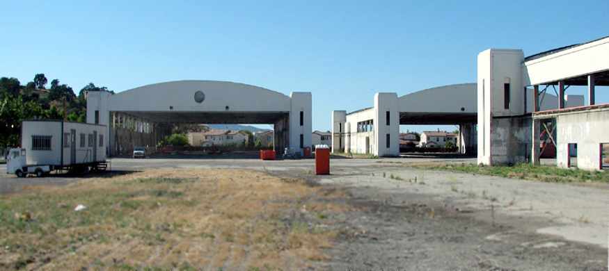
A circa 1970 photo of the beautiful Hamilton AFB gate (courtesy of Kevin Walsh).
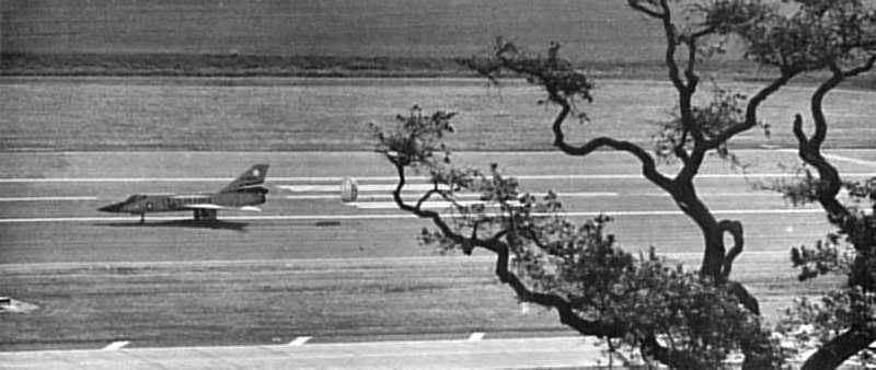
A 1972 photo of an 84th Fighter-Interceptor Squadron Convair F-106A Delta Dart, slowing to taxi speed on Hamilton's Runway 30 with the help of a drag chute.
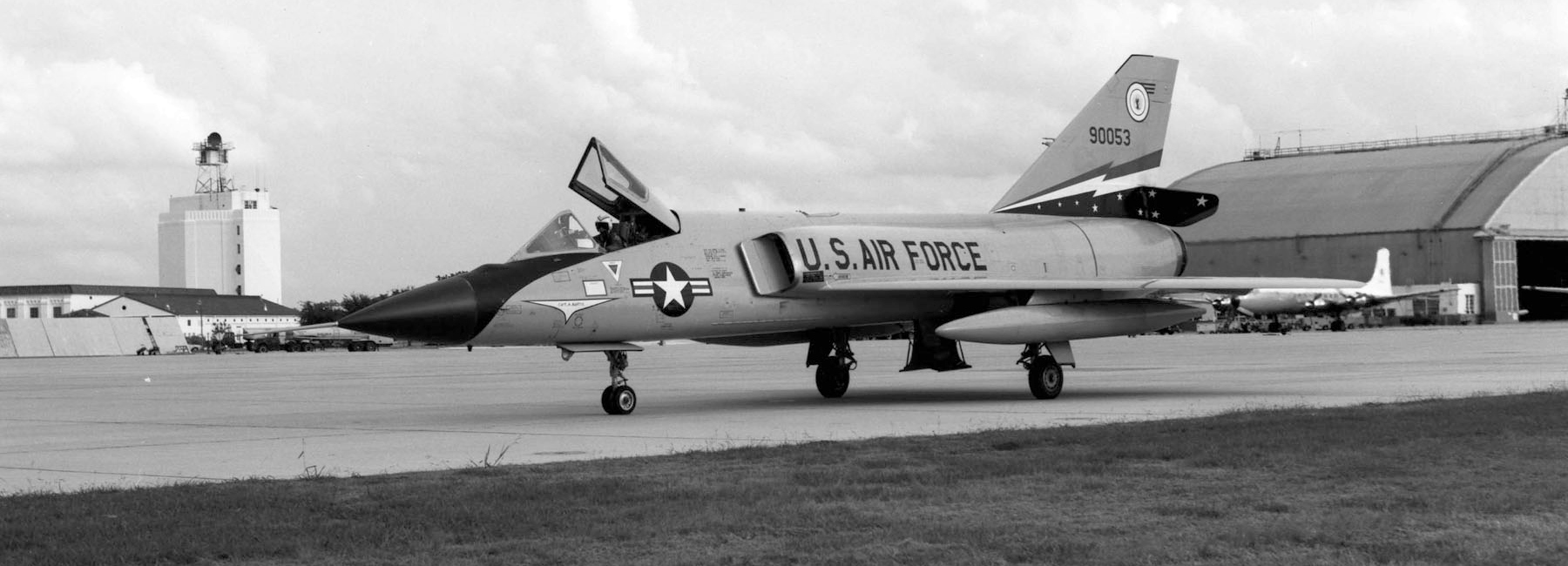
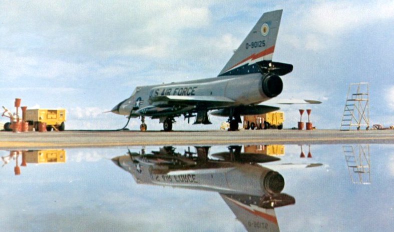
An October 1972 USAF photo of a Convair F-106A-110-CO Delta Dart (S/N 59-0053) of the 84th Fighter Interceptor Squadron, Hamilton AFB.
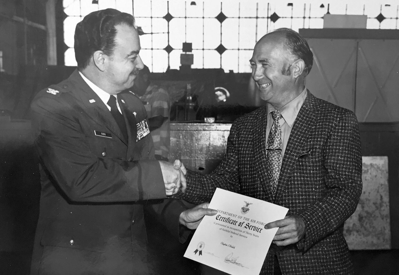
A 1972 photo (courtesy of Kevin Walsh) at Hamilton Field.
Kevin noted the picture is of “My father, Clayton Walsh, at age 50, getting his 30-year award in the very hangar in which he worked most of those years!”
In September 1973 the F-106s of Hamilton's sole remaining squadron, 84th Fighter Interceptor Squadron, relocated to Castle AFB,
thus bringing to an end a glorious era in Marin County history.
Hamilton was reassigned to the Air Force Reserve in 1973.
Carl Kangas recalled, “My old squadron, the 336th TAS, was the last flying squadron (C-130s) at Hamilton.”
Hamilton Air Force Base was decommissioned in 1974.
The airfield was transferred to the Army as Hamilton Army Airfield,
the housing to the Navy & a 411-acre parcel to the General Services Administration (GSA) for public sale.
The Pacific Strike Team of the Coast Guard occupied 2 of the historic hangars.

A 1975 aerial view looking southeast at Hamilton, showing only a few aircraft still visible on the ramp (courtesy of Kevin Walsh).
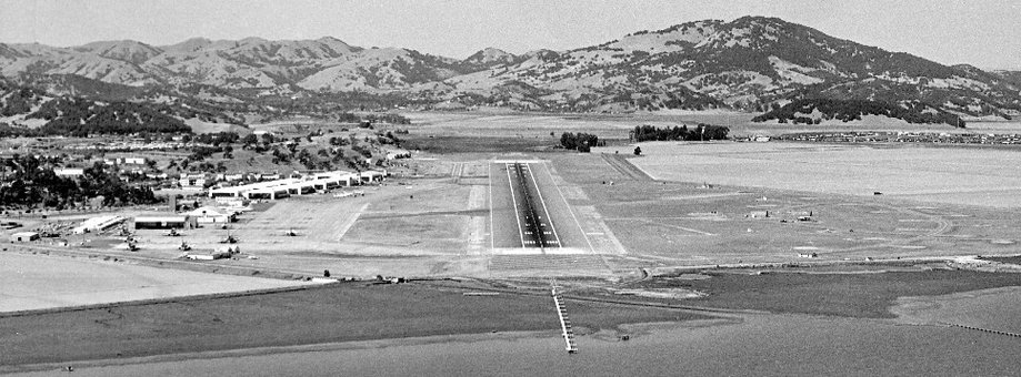
The 1975 San Francisco Terminal Aeronautical Chart depicted Hamilton AFB as having a single 8,000' paved northwest/southeast runway.
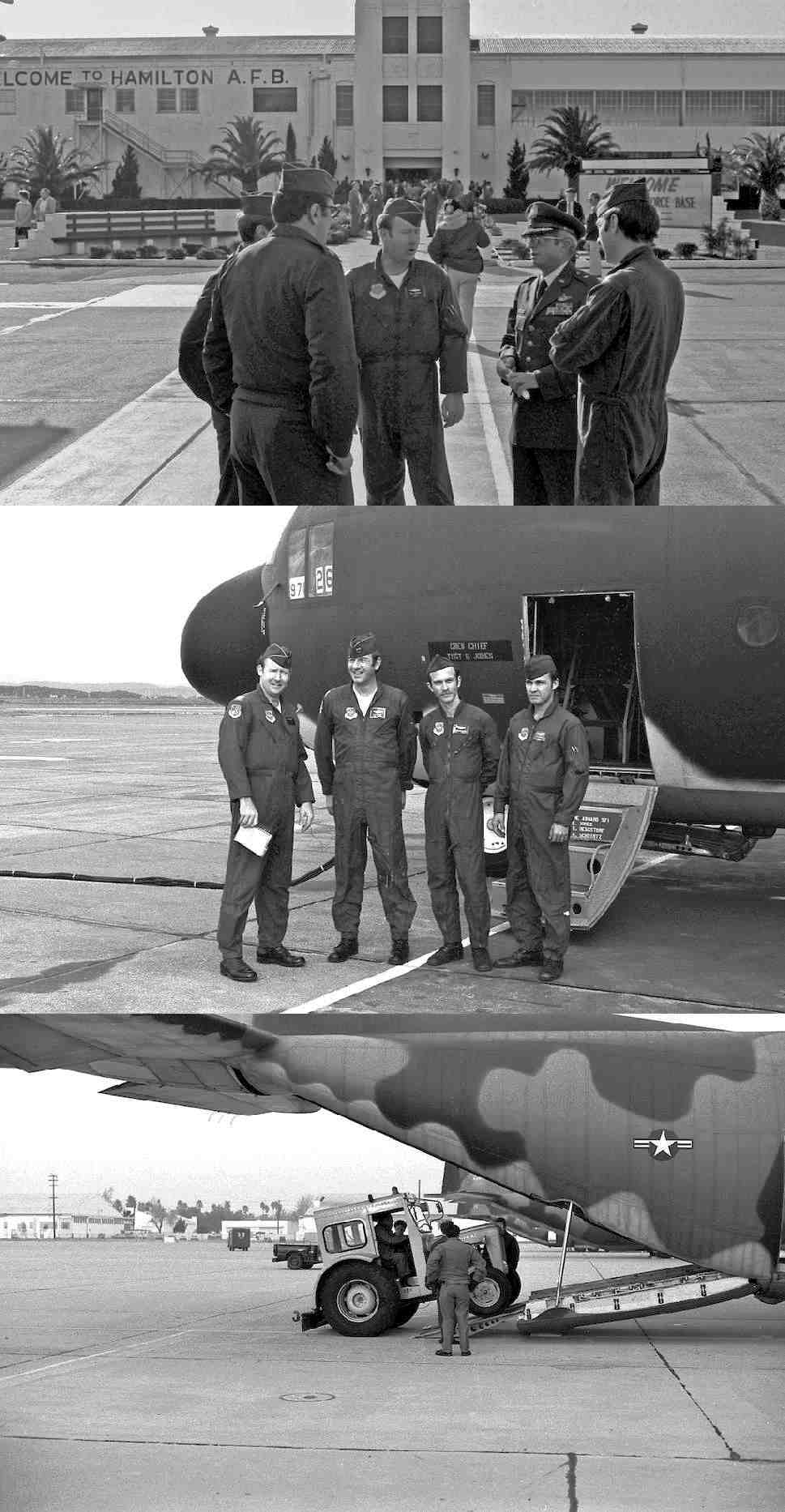
A series of 3 photos (courtesy of Carl Kangas) of the last Air Force flight from Hamilton on 1/9/76, by a 336th TAS C-130 Hercules.
Carl reported the 1st photo shows “the briefing in front of base operations.
Left to right: Unidentified, Lt. Col. W. Craig (squadron commander), Capt. Bob Shepherd (aircraft commander), Capt. L. Reisinger (co-pilot).”
The 2nd photo shows “the crew of 61-971: Left to right: Capt. B. Shepherd (AC), Capt. L. Reisinger (CP) , Load Master [unverified], Sgt. C. Kangas (FE).”
The 3rd photo shows “the heavy tractor being loaded to be flown to March AFB.
After take off Bob Shepherd came around for a low pass for the cameras & pulled up to about a 50 degree angle.
All the while I am hoping the load master did a good job of chaining down that tractor.
When Hamilton was slated for closure, the squadron was moved to March AFB.
This was the last load of squadron equipment that we flew down.”
The 1980 USGS topo map depicted Hamilton's massive airfield, but did not label it at all, strangely.
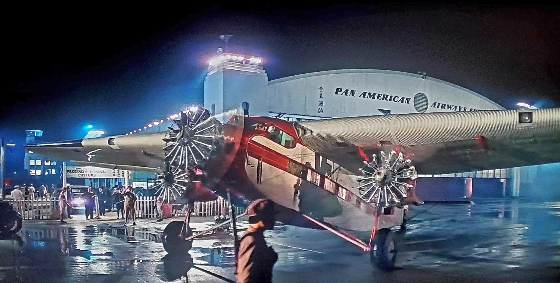
A 1980 photo of a Ford TriMotor filmed at Hamilton Field for the movie “Raiders of the Lost Ark”,
in front of a hangar painted “Pan American Airways” for the production.
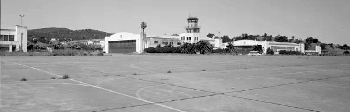
A circa 1980s photo of Hamilton Field's hangars & control tower (courtesy of Kevin Walsh).
A 411-acre Hamilton parcel was sold by the General Services Administration in 1985.
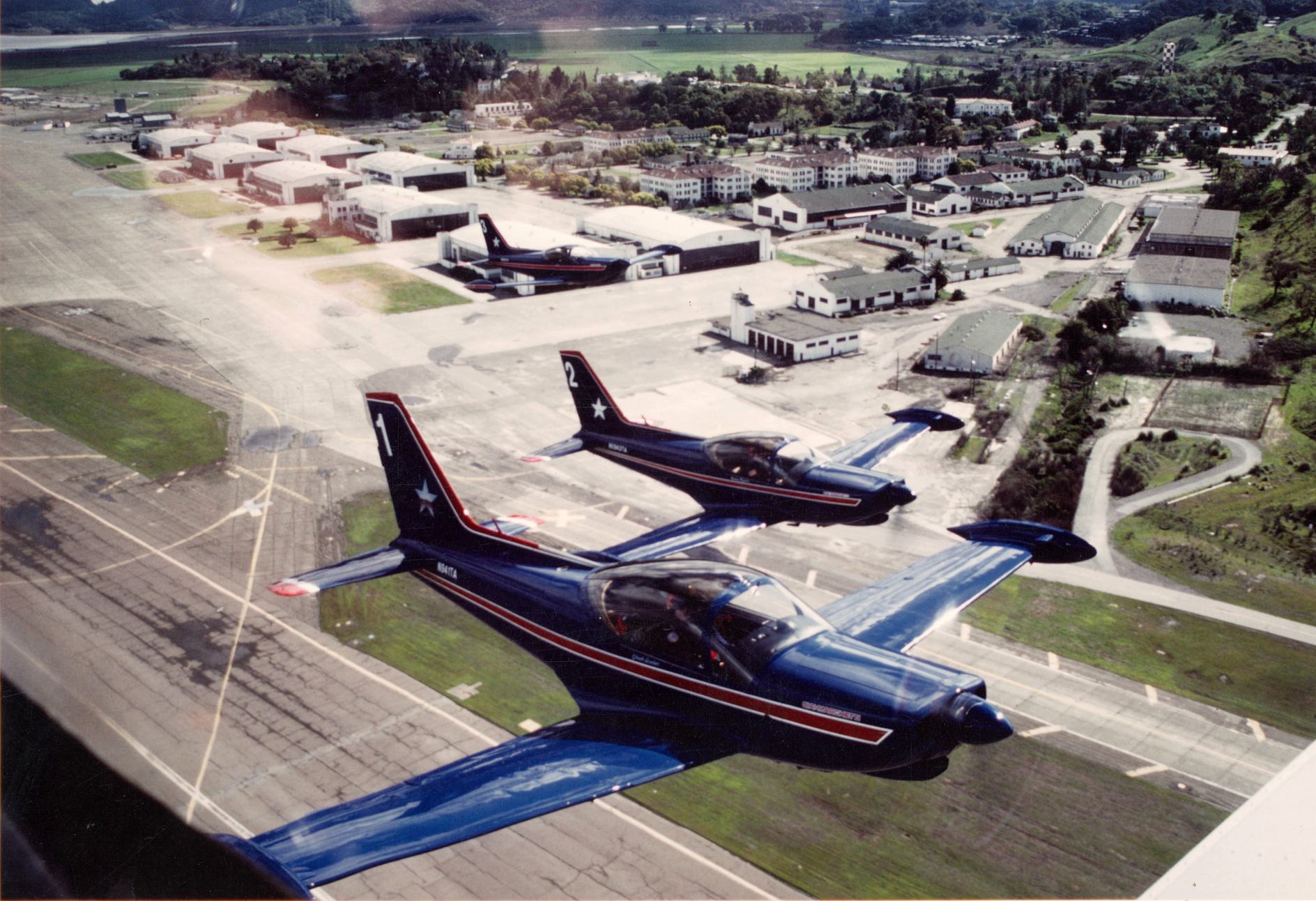
A February 1987 aerial view of Team America taking off from Hamilton Field (courtesy of Leon Delisle).
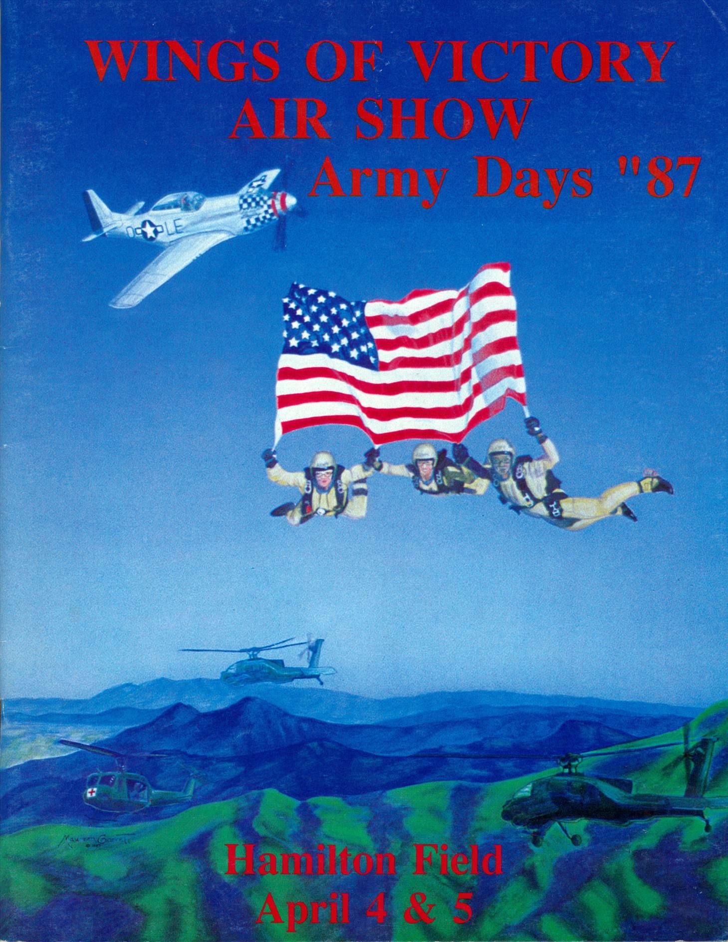
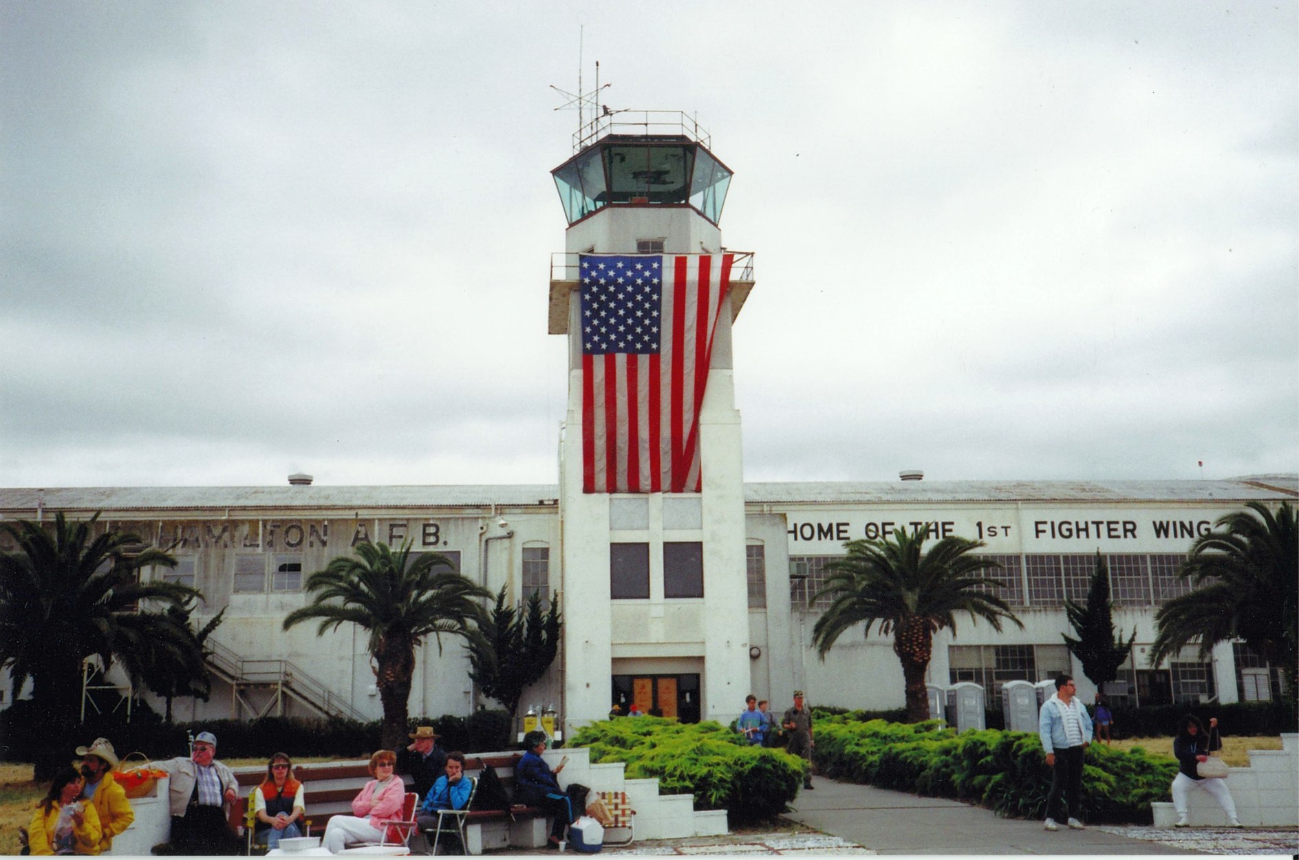
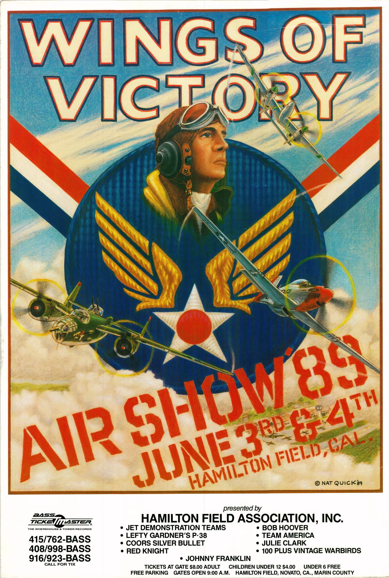
The program for Hamilton Field's 1987 Wings Of Victory Air Show (courtesy of Leon Delisle).
Leon Delisle recalled, “In the 1980s I founded & directed the "Wings of Victory" airshows at Hamilton Field.”
The last photo which has been located showing aircraft at Hamilton AFB was a 1987 photo of the Wings of Victory Airshow (courtesy of Kevin Walsh).

The Hamilton airfield evidently saw very little use in its last days,
as a 6/22/87 LANDSAT photo showed Hamilton's huge ramps completely devoid of even a single aircraft.
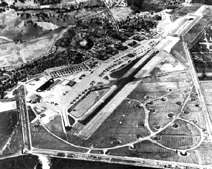
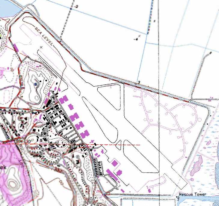
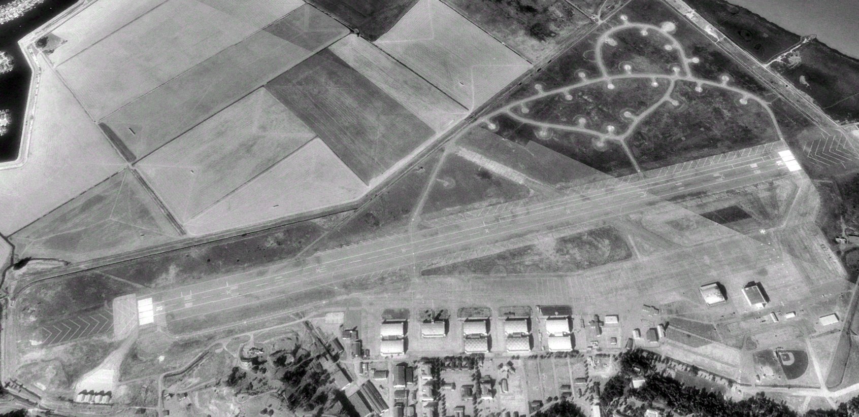
A 1988 airport diagram of Hamilton, its last year of operation.
The 1988 Base Realignment & Closure (BRAC) closed the Hamilton airfield.
Extensive aviation facilities remained, including a wide 8,000' long runway,
a smaller crosswind runway, numerous dispersal parking pads, extensive ramp areas, and 9 large hangars.
Controversy over future civilian use had developed between those supporting
its adaptation into a major civilian airport, those bitterly opposed to its continued use as an airfield at all,
and those holding varying intermediate degrees of opinion.
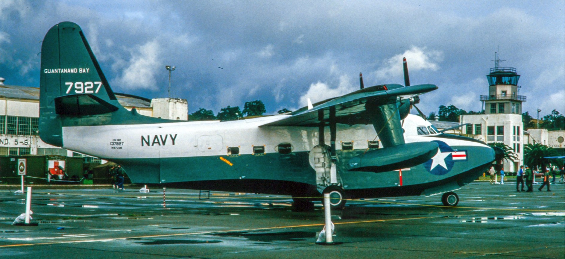
A circa 1980s Grumman HU-16C Albatross in front of Hamilton Field's control tower (courtesy of Leon Delisle).
A circa 1980s aerial view looking east at Hamilton Field (courtesy of Leon Delisle).
A circa 1980s photo looking southwest at Hamilton Field's control tower (courtesy of Leon Delisle).
Leon Delisle recalled, “The tower area was cleaned up & restored by our airshow cadre of volunteers. For a short time we brought it back to life for one more time."
The program for Hamilton Field's 1989 Wings Of Victory Air Show (courtesy of Leon Delisle).
Tim Tyler visited Hamilton Field in 1990. "Back then, many of the old buildings were intact,
including a large number of decrepit looking wooden barracks apparently left over from the WW2 era.
That area was marked as 'Off Limits' and probably scheduled for demolition.
The airfield was looking pretty rough, but there were some Army/National Guard UH-1s on the ramp.
It was still somewhat of a military installation back then,
but mostly used to provide housing for the military service members
assigned to various active military installations (mostly Navy) that were still active in the Bay Area then."
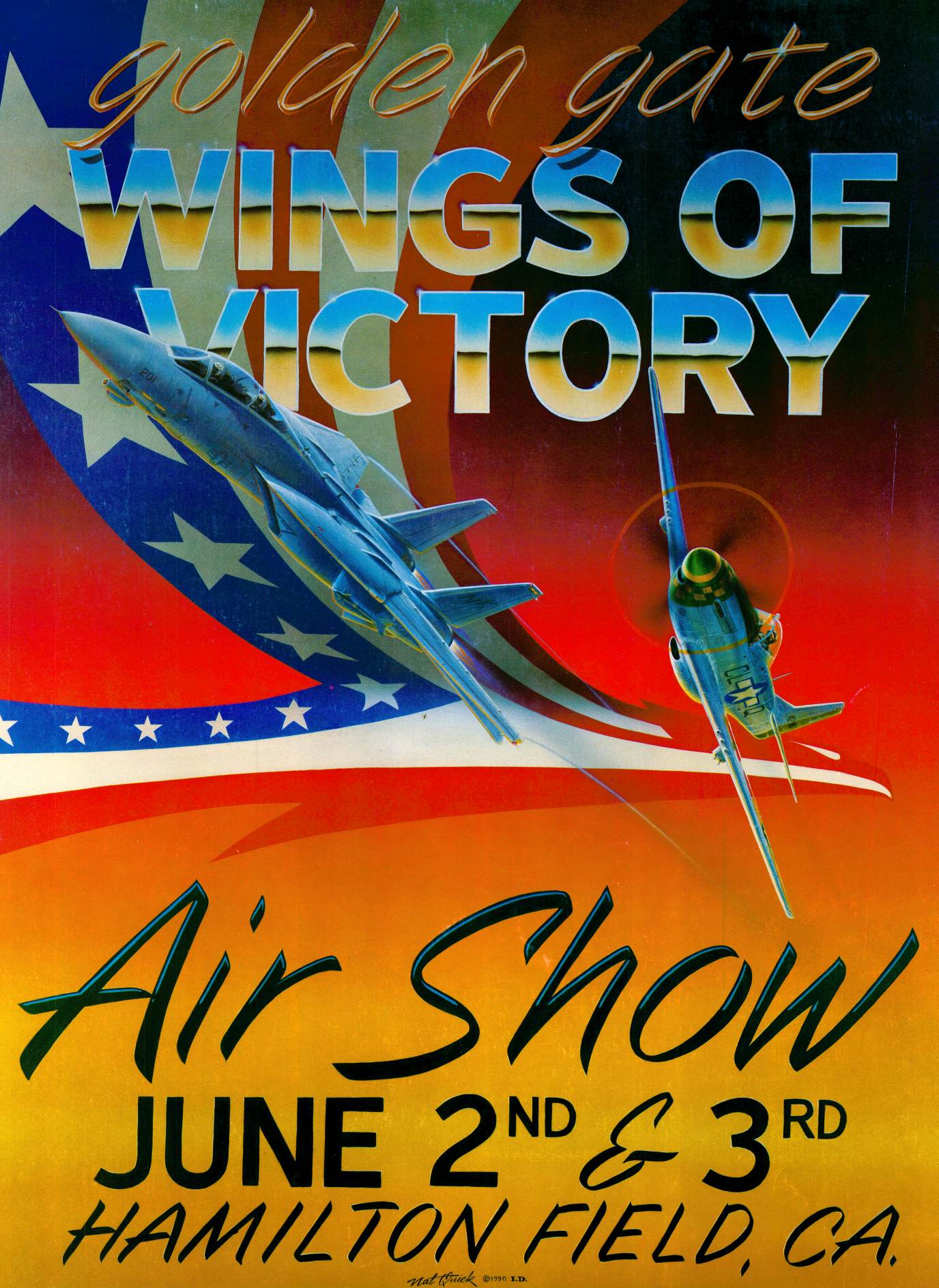
The program for Hamilton Field's 1990 Wings Of Victory Air Show (courtesy of Leon Delisle).
The last photo which has been located showing the massive Hamilton airfield still intact was a 7/9/93 USGS aerial view looking northeast.
Although the field remained intact, no aircraft were visible. Note the multiple WW2-era fighter dispersal pads east of the runway.
The last aeronautical chart which has been located showing the Hamilton airfield still operational was on the October 1993 San Francisco Sectional Chart (courtesy of Ron Plante).
It depicted Hamilton as an Army Airfield with a single 8,000' paved runway.
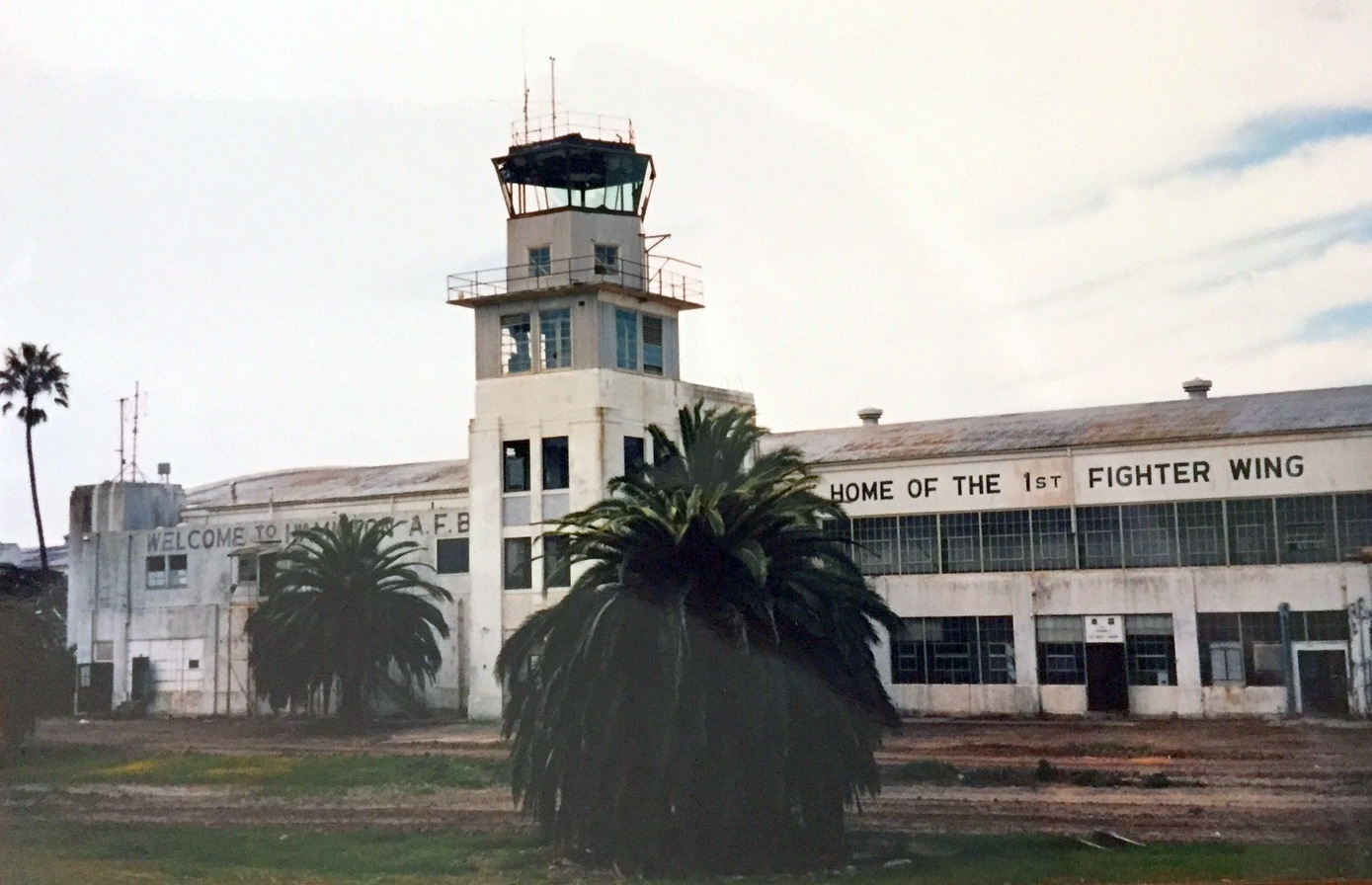
A 1993-95 view looking east at the Hamilton Field hangars, control tower, and other buildings (courtesy of Kevin Walsh).
A 1997 photo of Hamilton Field's control tower by Kevin Walsh, who recalled, “In 1997 I attended a rummage sale at Hamilton AFB, in one of the very hangars where my dad worked.”
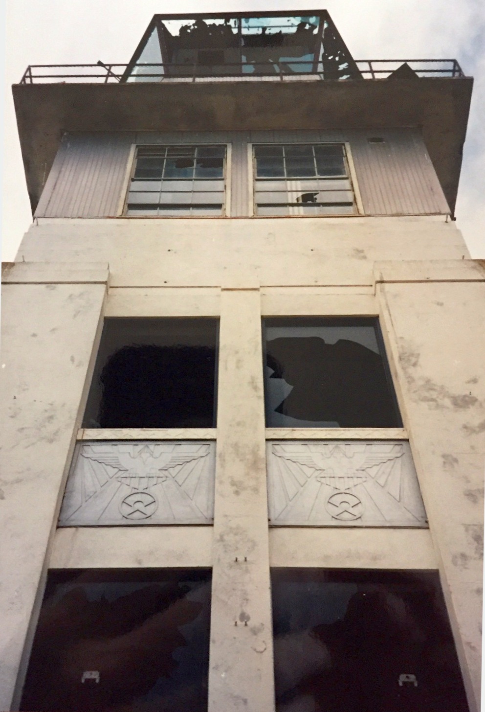
A 1997 photo by Kevin Walsh looking up at Hamilton Field's deteriorating abandoned control tower.
A 1997 photo by Kevin Walsh from Hamilton Field's control tower looking down on its rows of hangars.
Kevin reported on whether anything prevented access to the control tower: “Nothing at all! No locks or closed doors...
There were still a few blank paper forms lying about, too.”
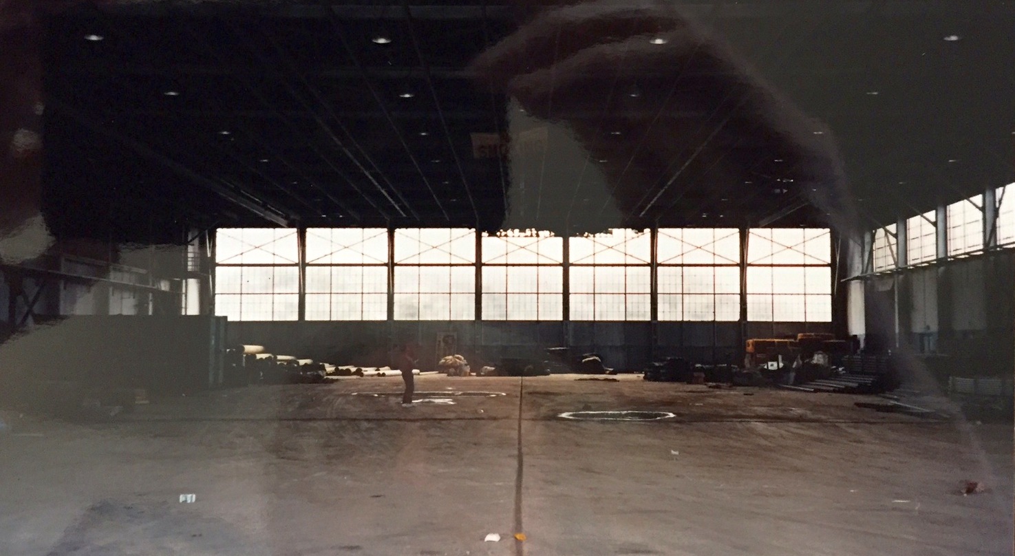
A 1997 photo by Kevin Walsh of the interior of an abandoned Hamilton Field hangar.
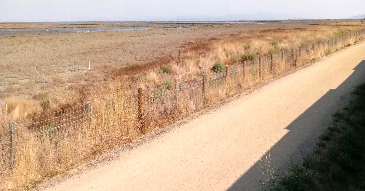
A 1997 photo by Kevin Walsh looking southwest at Hamilton Field, “from the then-newly-built levee, looking at the old runway before it was flooded.”
A circa late 1990s aerial view looking northeast at Hamilton's hangars, ramp & runway.
In the late 1990s, the Hamilton Field property was redeveloped by the local government,
with all of the aviation facilities to be removed.
Given the extent of the aviation infrastructure at this base (which was all paid for by the taxpayers),
it is a shame to see it completely destroyed.
Hamilton AAF was depicted as an abandoned airfield on the September 1997 San Francisco Sectional Chart (courtesy of Ron Plante).
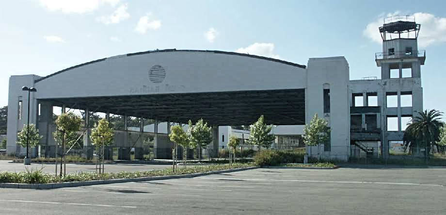
A 2002 photo by Tim Tyler of the line of hangars which remain standing at Hamilton Field.

A 2002 photo by Tim Tyler of a sign for Hamilton Landing.
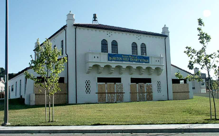
A 2002 photo by Tim Tyler of the "Future Home of the Hamilton Field History Museum".
Tim observed, “I came out to the old Hamilton AFB to see how much it'd changed since I last visited it in 1990.
Twelve years later, the base had changed a lot. First of all, it's no longer a base.
Many structures have been removed & replaced with a housing subdivision known as Hamilton Landing (nice pun)."
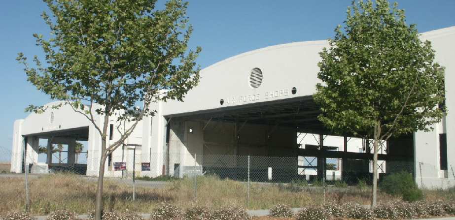
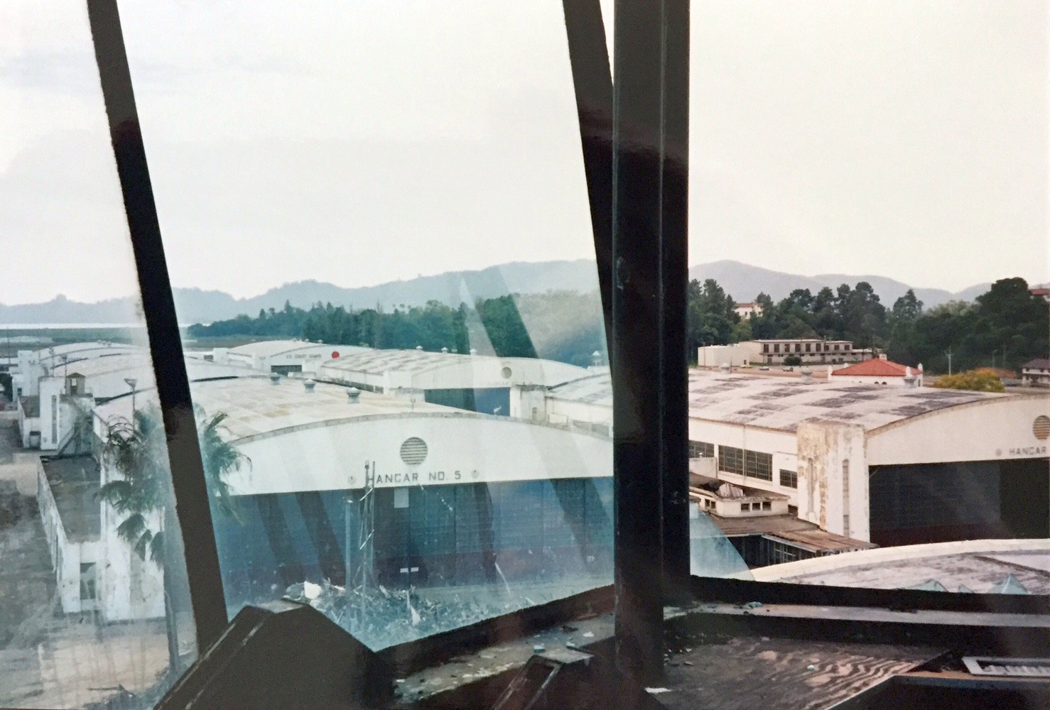
A 2002 photo by Tim Tyler of hangars which remain standing at Hamilton Field.
The hangar on the right has a legend entitled "Air Force Shops".
A 2002 photo by Tim Tyler of Hamilton's Hangars 5 & 6, which have been renovated.
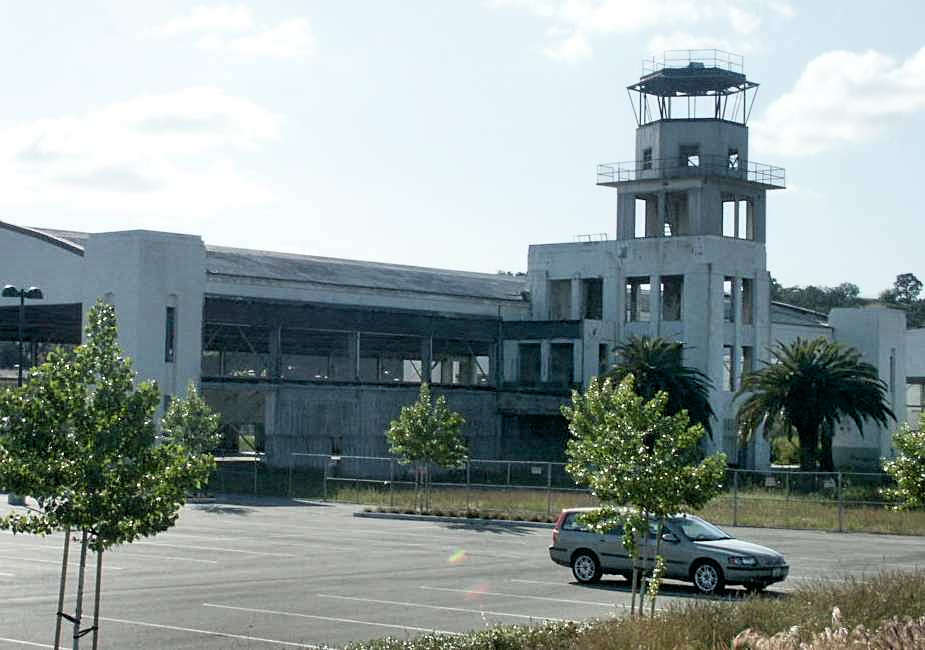
A 2002 photo by Tim Tyler of the gutted remains of Hamilton's control tower.
A 2002 photo by Tim Tyler of the remains of a hangar & the control tower at Hamilton Field.
Tim remarked, “The historic old main hangars were somewhat intact.
Some are now offices, using the shell of the original hangar but completely rebuilt inside,
and others as of my April 2002 visit were empty shells.
Several other old AAF/AFB buildings were intact, and either awaiting destruction, or renovation."
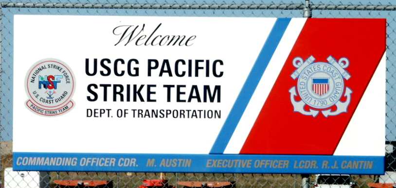
A 2002 photo by Tim Tyler of the sign at the Coast Guard installation which remains at Hamilton Field.
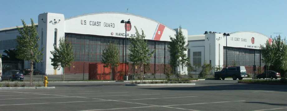
A 2002 photo by Tim Tyler of Coast Guard hangars at Hamilton Field.
Tim observed, “The USCG still has their Pacific Coast Strike Team there,
set up as a quick-response group to deploy to major oil spills or other maritime environmental hazards,
but unlike in the past, the team now can't just have some USCG HC-130s land at the field,
pull up to the CG area & pick up personnel & equipment to transport them to the incident scene."
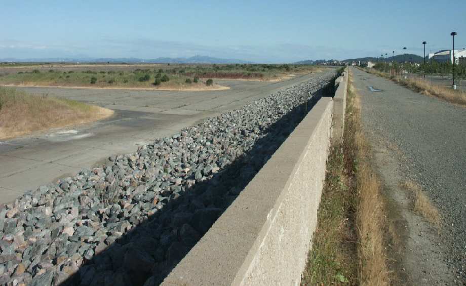
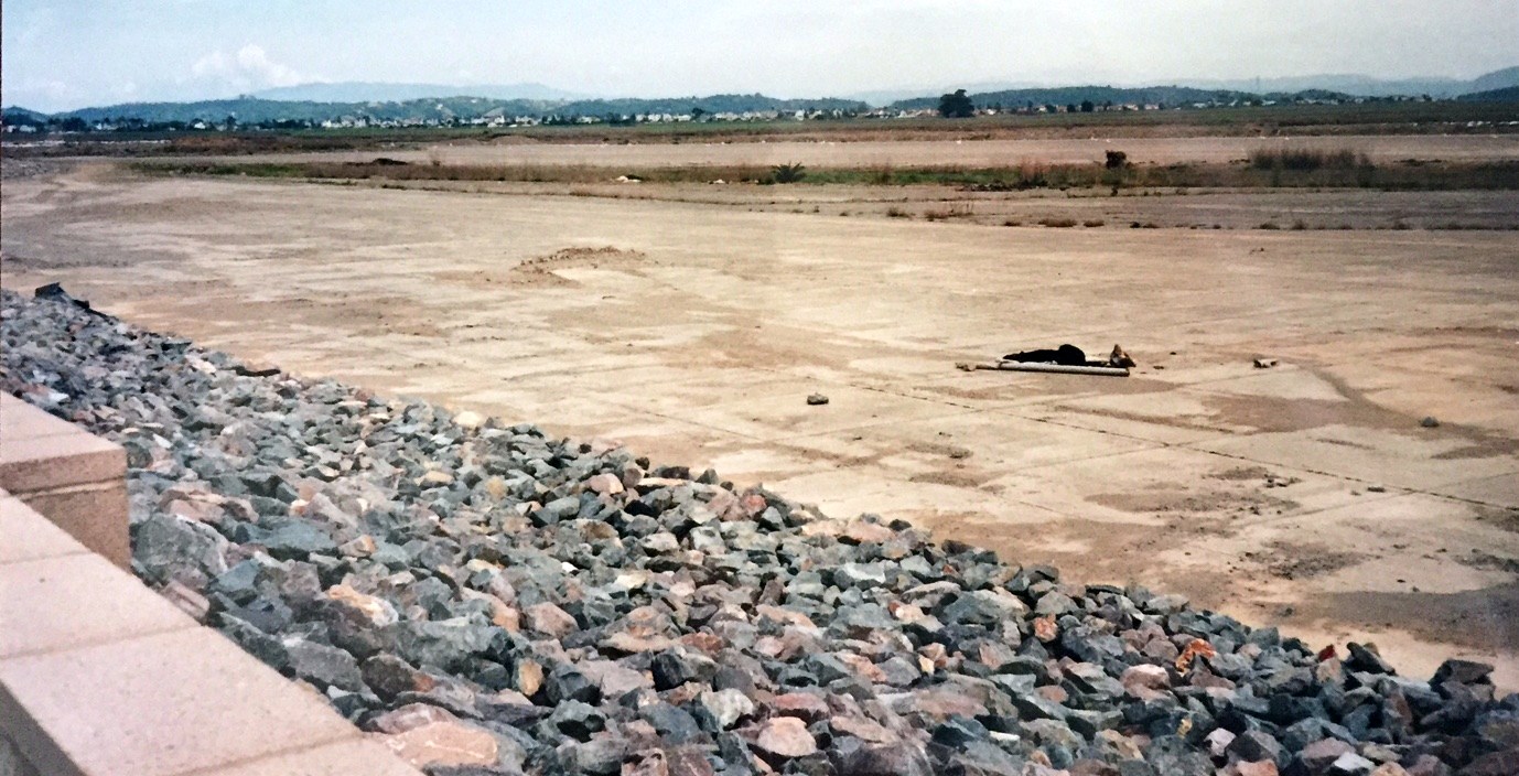
A 2002 photo by Tim Tyler of the dike which has been constructed along the former airfield area of Hamilton Field.
Tim observed, “The ramp area & runways seemed to be somewhat intact,
though I understand the plan was to flood the area & turn it into a marsh."
Tim Tyler reported again in 2003 of a later visit to Hamilton:
"I went up to the old Hamilton AFB, parked my car by some of the hangars,
hoisted my bike over the seawall thing,
and then merrily rode my bike along the old ramp/runway/taxiway & hardstand areas,
checking out various old buildings & facilities located along the runway area.
It looks like they've got a lot of work to go before they ever just flood the whole area."
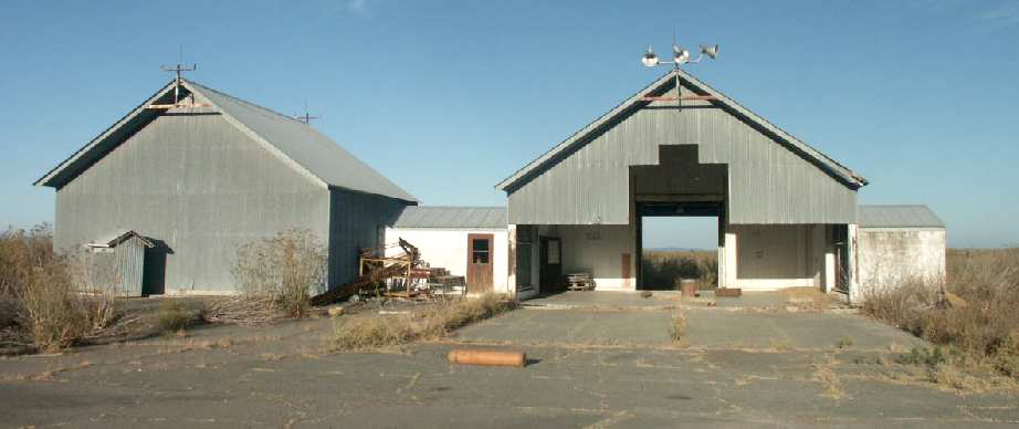
A 2003 photo by Tim Tyler, of what presumably was an MA-1 fire control system calibration barn,
located adjacent to the south side of Hamilton's runway.
Tim observed, "The first one is a sheet-metal hangar, attached to a small cinderblock building
and then a sheet-metal shed on the other side of it.
The hangar's aircraft door faced to the West, not to the East, which is the direction of the runway.
Interestingly, I estimate the hangar aircraft door width only being about 40' or 50'
which makes me think of an F-104, although the hangar wasn't long enough to fit an entire aircraft inside.
Some old stenciling read '84th FIS MA-1/ASQ-25 Scheduled Maint. W/C 14322.'"
The AN/ASQ-25 was the 'Airborne Weapon Control System' used by F-101, F-102, and F-106 aircraft.
The 84th FIS seems to have been at Hamilton from the late 1940s until 1973, when it moved to Castle AFB.
Tim observed, "I believe the small metal hangar & support building I came across at Hamilton
was the MA-1 (Fire Control System) Calibration Barn.
It would have been isolated from the alert hangars in order to not interfere with their MA-1s,
which might have been kept in standby mode while the aircraft were on alert."
Tim continued, "There were several old carbon dioxide 300cf bottles
inside the old hangar & small cinderblock building which connected the hangar
(based on the hangar door, complete with center notch for a vertical stabilator) with the shed/workshop type building.
There were a couple static discharge ground connections built into the concrete flooring,
at least one had a date of 'Sept 88' stenciled on it, though there is a good chance the date is (19)68 instead of (19)88."
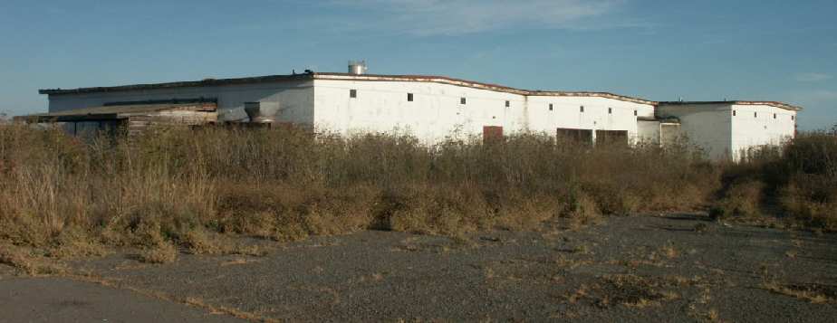
A 2003 photo by Tim Tyler, of the exterior of a concrete blockhouse located adjacent to the south side of Hamilton's runway.

A 2003 photo by Tim Tyler, of the interior of a concrete blockhouse located adjacent to the south side of Hamilton's runway.
Tim observed, “Just 10 or 15 yards to the southeast of [the hangar on the south side of the runway]
was a fairly large, single story concrete blockhouse,
which had an air conditioning/water chiller/power room on the end, and several large, open rooms inside.
Though long-abandoned & with lots of graffiti inside, everything but the old AC/chiller room on the end was still secured.
I don't know what this structure was used for, but it's the only thing I saw which may fit the basic 'signature'
of being an old ADC/NORAD Operations type building."
Richard Vedas (stationed at Hamilton from 1960-65) reported in 2003,
"the large concrete block house on the south end of the runway…
This was the Armament & Electronics building which housed the Radar, Com Nav, Data Link, and Instrument shops in the 1960s.
The F-101s used the MG-13 fire control radar, F-102s were equipped with the MG-10 weapons system while the F-106s were MA1 systems.
All were built by Hughes Aircraft.
MG-10 & 13 systems were almost identical, while the MA1 system was more advanced.
The radar mockup windows faced to the east where we used radio antennas on the east side of the bay for targets.
The small building looks like a F-106 nose dock used for system calibration.
We did calibrations on the F-101s in the hangars."
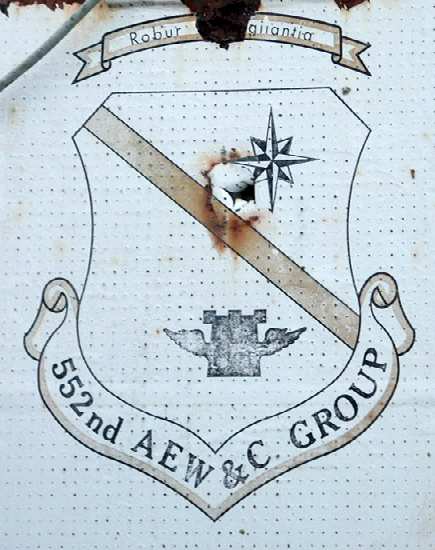
A 2003 photo by Tim Tyler of an emblem at Hamilton Field.
Tim reported, "The operations building, Building 30, had a 552nd AEW&C GROUP emblem on the exterior door. The 552nd was classified as a Group only between 1974-76."
A January 2006 aerial view by Ian Carisi looking northwest along the remains of Hamilton's massive runway, showing the unusual layout of the airfield.
Also note the hundreds of new houses which have been constructed right up to the hangars.
A 2006 photo by Scott Murdock of several gutted former Hamilton hangars.
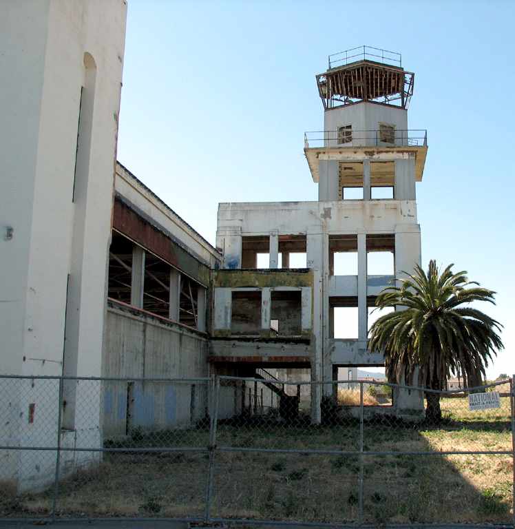
A 2006 photo by Scott Murdock of the gutted former Hamilton control tower.
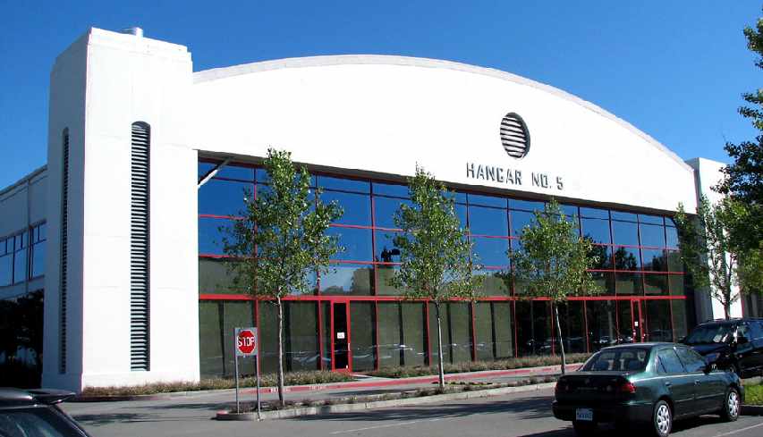
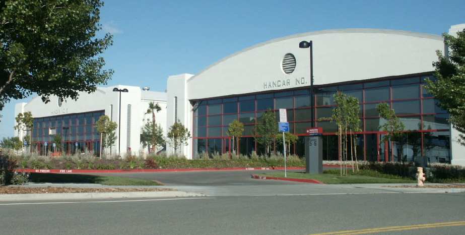
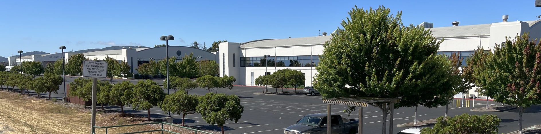
A 2006 photo by Scott Murdock of the fully-restored Hamilton Hangar #5.
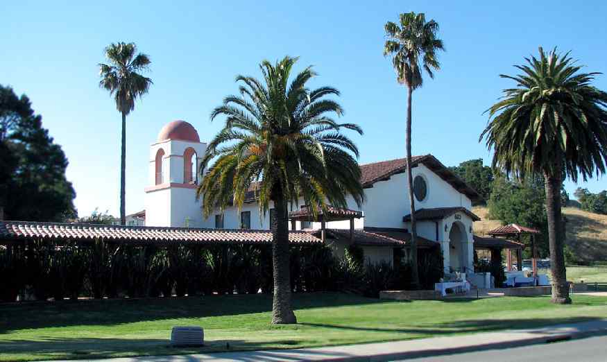
A 2006 photo by Scott Murdock of the beautifully maintained former Hamilton Protestant Chapel.
According to Brent Peircy, “To my knowledge it is one of the few original buildings that remained operational & didn't fall into disrepair.
I lived on the base from 1966-68 & we attended that Chapel, and when I visited again in the summer of 1990,
the Chapel was still operational & in fine condition unlike most other buildings on the base which were in terrible condition.”
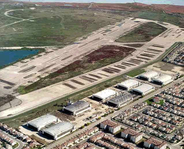
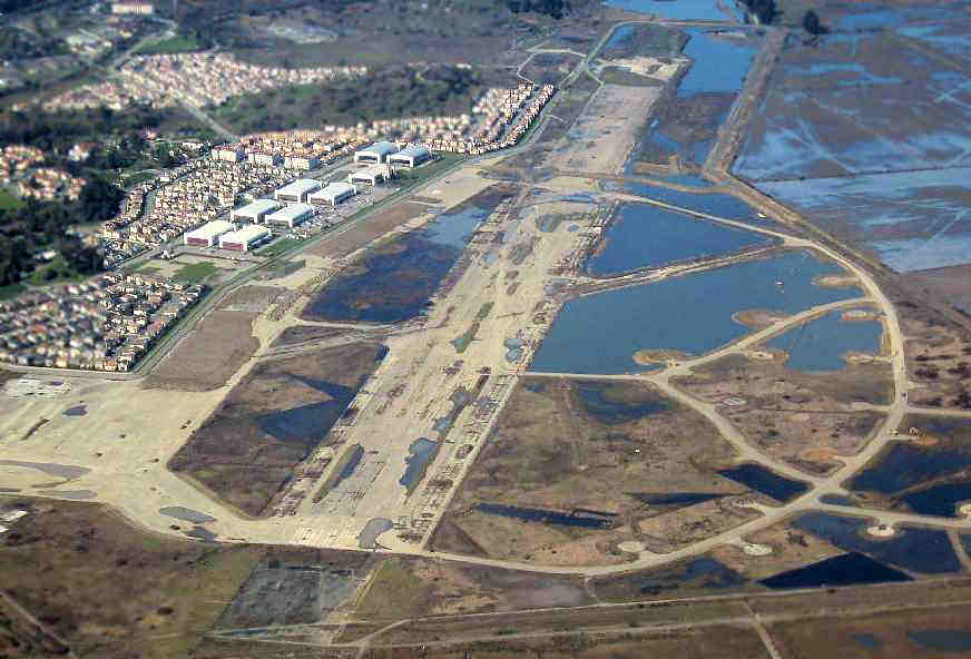
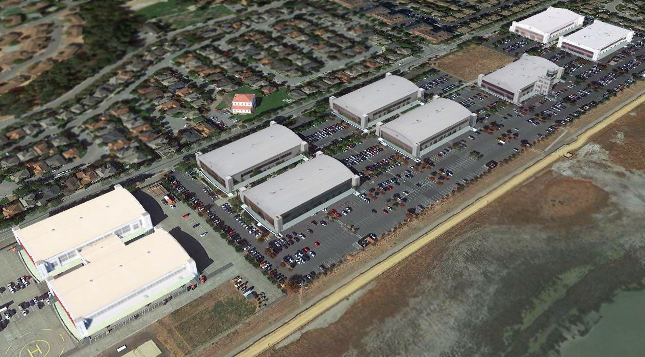
A February 2007 aerial view by Ian Carisi looking north at the redevelopment of Hamilton. Nine hangars still stand.
The middle of the runway has been flooded, but significant portions remain on either end, as well as numerous dispersal pads.
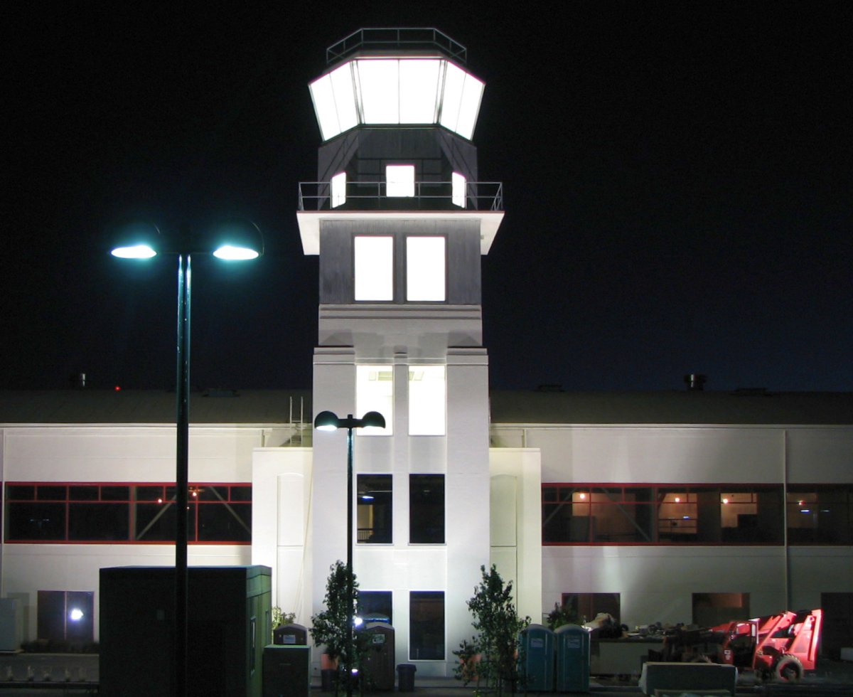
A circa 2008 photo of the restored Hamilton Field control tower.
A 2012 photo by Carl Kangas of the logo for the Hamilton Field History Museum, located in the former Hamilton Field Fire Station.
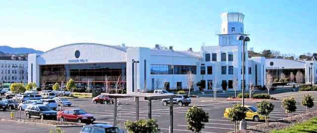
A 2012 photo by Carl Kangas of the restored Hamilton Field hangars & control tower.
Carl Kangas reported, “All the old hangars have been renovated & converted into a business park;
by the number of cars in the parking lots it looks like business is thriving. The tower has been restored.”
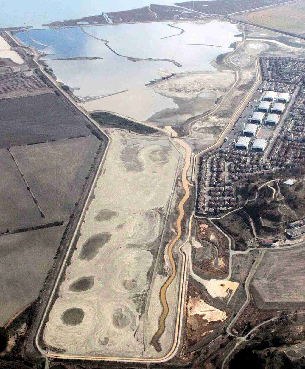
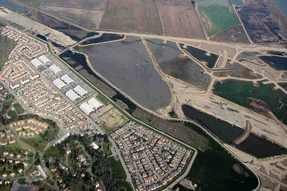
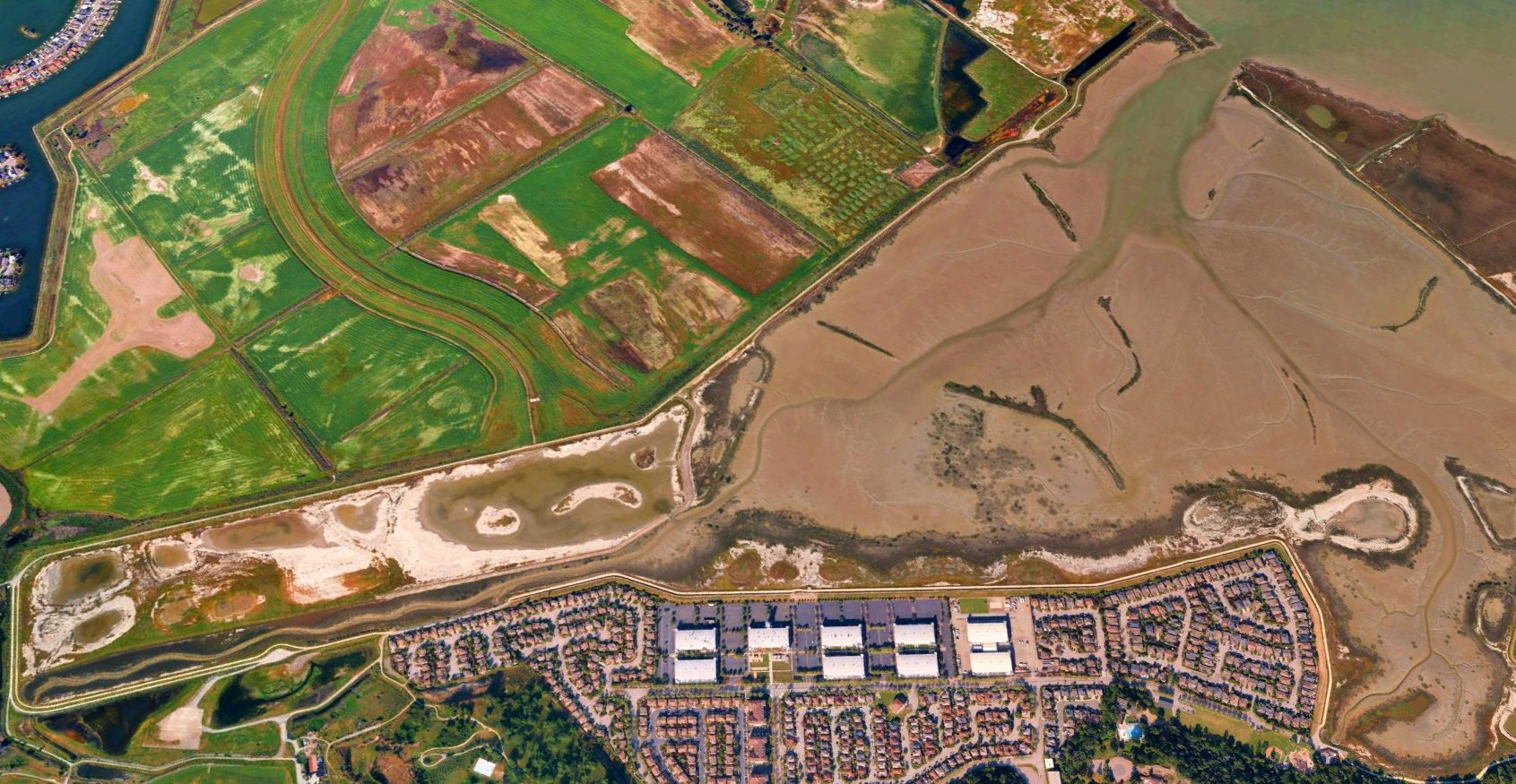
A 1/2/14 aerial view by Ian Carisi looking at the site of Hamilton Field. Amazing to see such a massive airfield completely removed.
Ironically, in April 2014 dikes were intentionally breached to let large portions of the Hamilton Field site be flooded, to restore wetlands from the previous century.

A 4/13/15 aerial view by Dallam Oliver-Lee looking southeast at the site of Hamilton Field,
with most of the airfield area now intentionally flooded, but the row of hangars remaining along the right side.
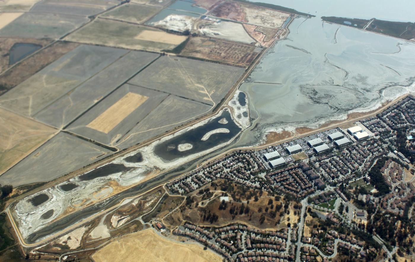
A 7/26/16 aerial view by Ian Carisi looking east at the site of Hamilton Field,
with most of the airfield area now intentionally flooded, but the row of hangars remaining along the right side.
Many millions of dollars of aviation infrastructure, paid-for by the taxpayers, now intentionally destroyed.
A 10/18/17 photo by Rex Ricks looking northwest along the former Hamilton AFB hangars & ramp area.
Rex observed, “Today as I visited the former Hamilton Field, I thought about the massive fires that recently hit Wine Country in Northern California.
If Hamilton Field was still an airport, instead of a swamp, aerial tankers could have scooped up water from the adjacent San Pablo Bay to put out the fires.
I will forever wonder, 'How many additional lives and homes could have been saved if only Hamilton Field was still active?'
Instead the Novato NIMBY Nabobs led by then Marin County Supervisor & eventual California Senator Barbara Boxer thwarted any efforts for aviation reuse in the 1970s.
Not only did Boxer join the swamp in DC, she also turned a federally taxpayer funded air base into a federally taxpayer funded swamp. What a colossal waste of millions of our tax dollars.”
A 10/18/17 photo by Rex Ricks looking east at the former Hamilton AFB runway, now flooded.
A 2018 3-D depiction of the former hangars at the site of Hamilton AFB.
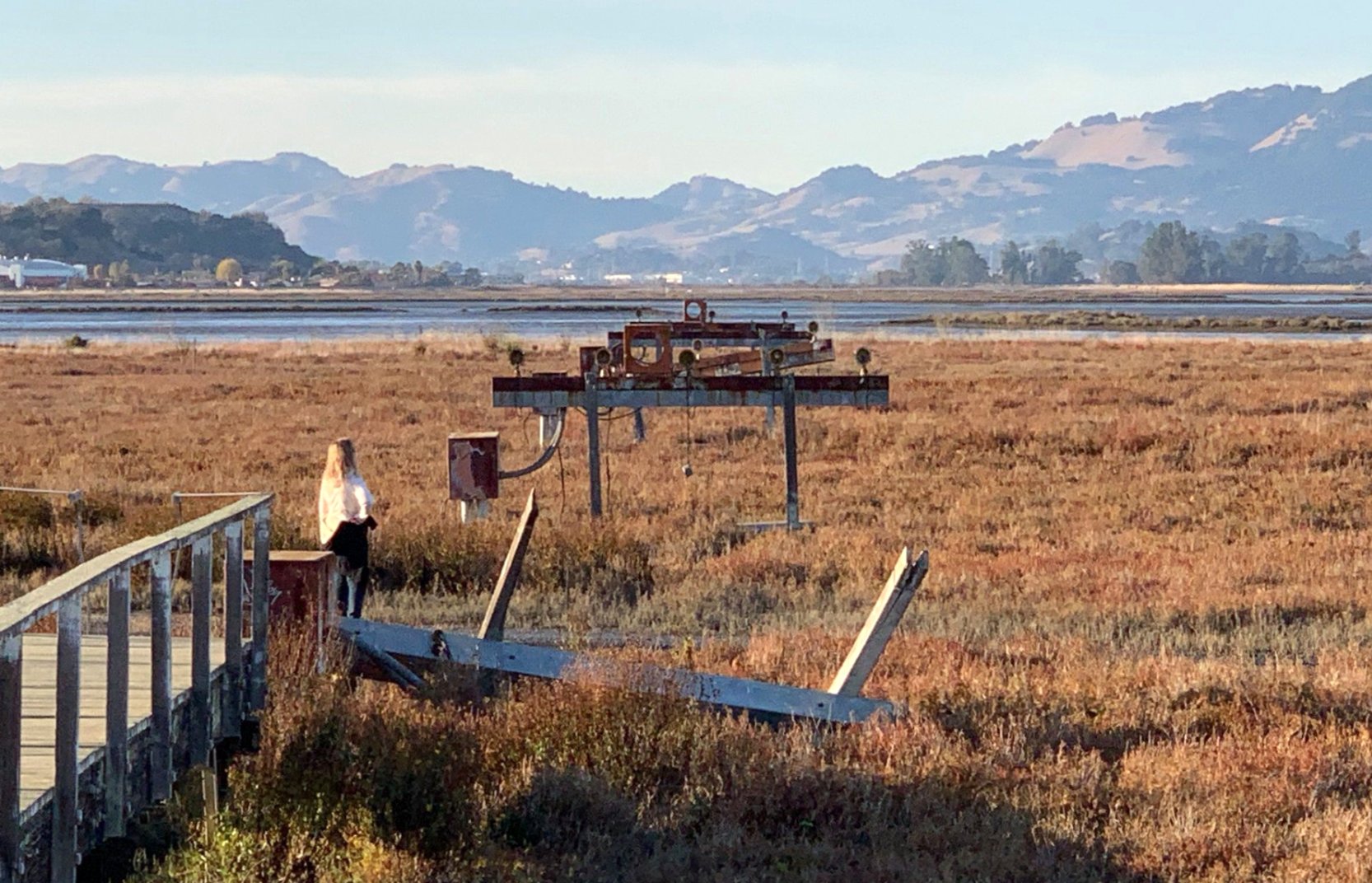
A 2019 (or before) photo looking northwest at the remains of the approach lights at the end of the former Hamilton AFB runway, now flooded, with a hangar visible in the background at left.
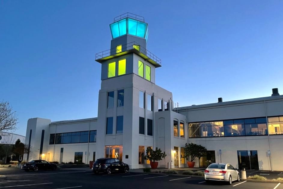
A March 2022 photo (courtesy of Ken Mercer) looking northwest at the restored Hamilton AFB control tower, illuminated in the Ukrainian colors as a show of support.
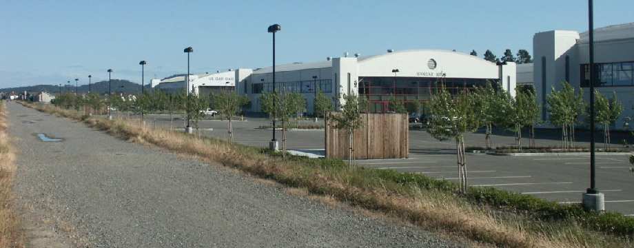
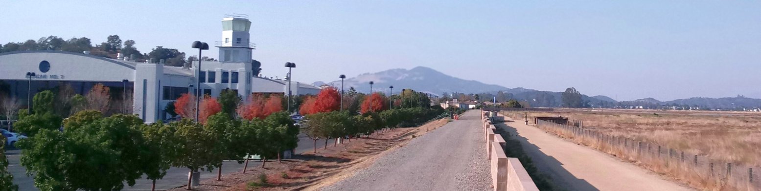
A 7/8/23 photo by Paul Freeman looking south at the row of restored Hamilton AFB hangars.
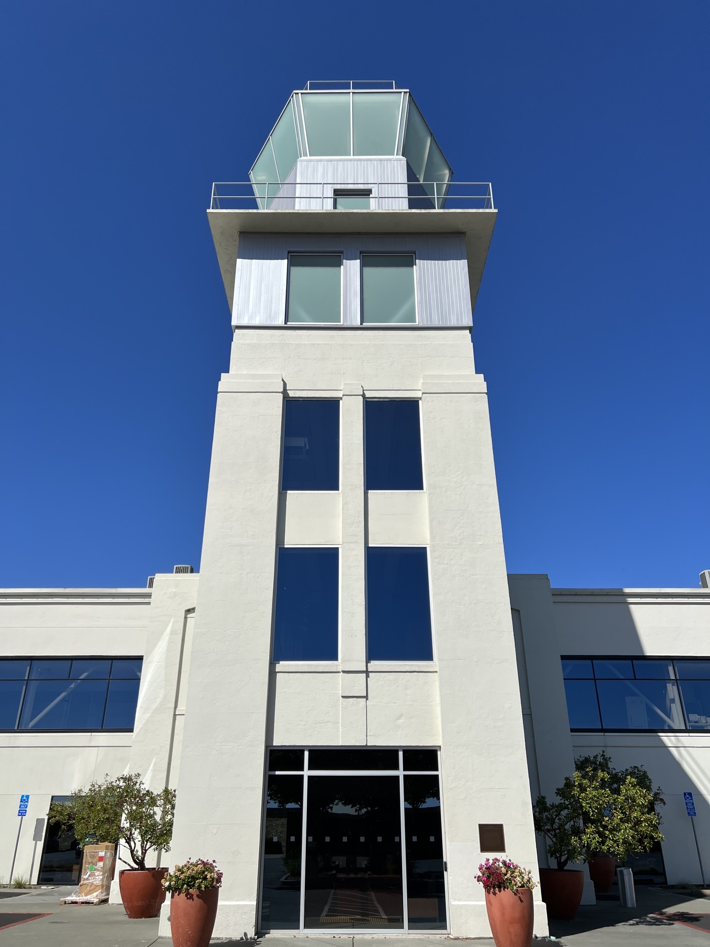
A 7/8/23 photo by Paul Freeman looking southwest at the restored Hamilton AFB control tower.
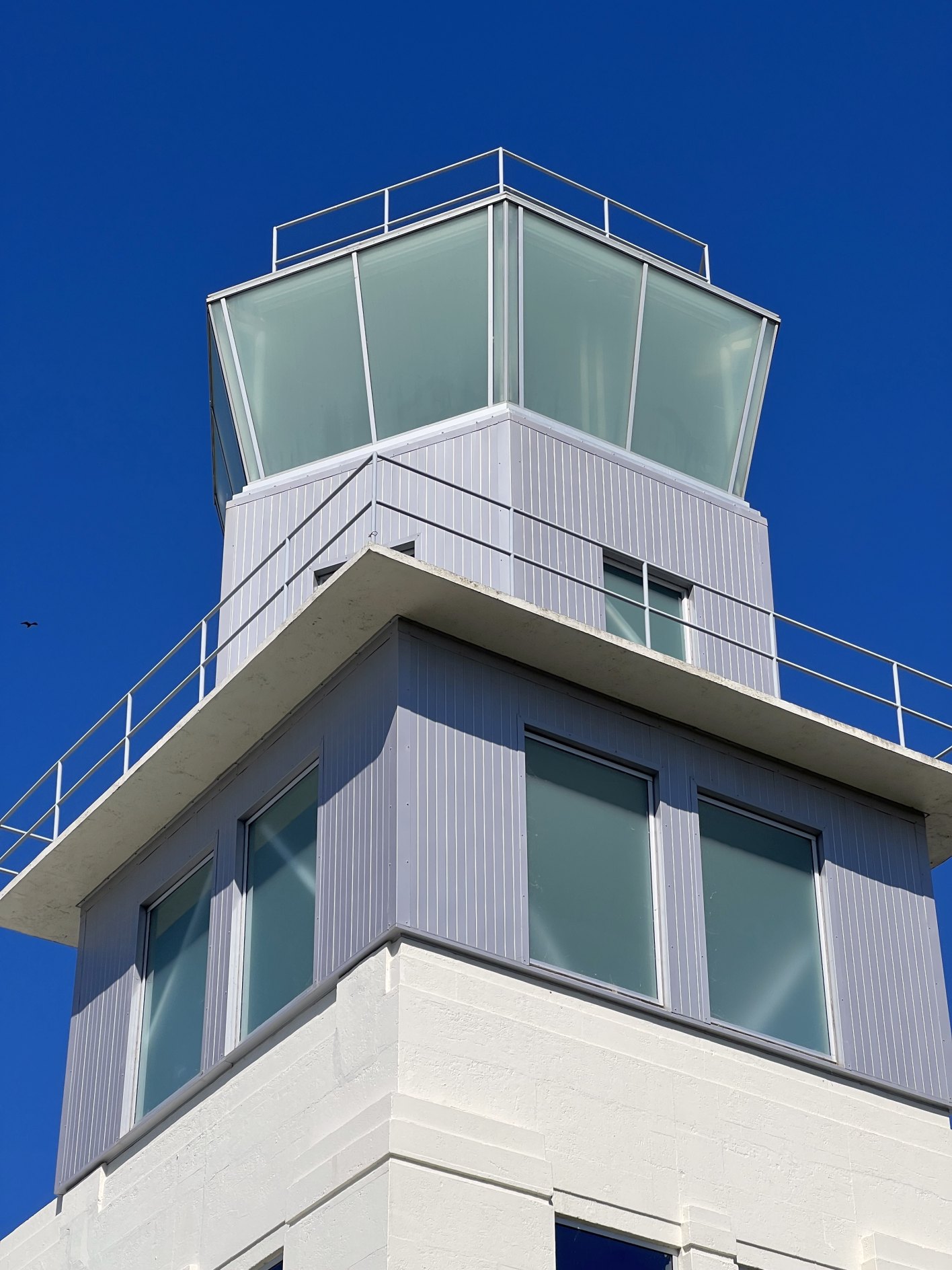
A 7/8/23 photo by Paul Freeman looking west at the restored Hamilton AFB control tower cab.
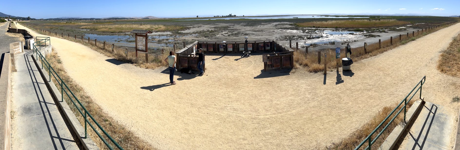
A 7/8/23 photo by Paul Freeman looking north at the former Hamilton AFB runway area, now flooded.
A 2024 aerial view looking northeast at the former Hamilton AFB, with the former runway area having been completely intentionally flooded.
____________________________________________________
____________________________________________________
This site covers airfields in all 50 states.