
Abandoned & Little-Known Airfields:
California: Northern Fresno area
© 2002, © 2021 by Paul Freeman. Revised 11/9/21.
This site covers airfields in all 50 states: Click here for the site's main menu.
____________________________________________________
Please consider a financial contribution to support the continued growth & operation of this site.
For a 10th year, the CA pages of this website are sponsored by the California Pilots Association:
Belmont Field (revised 11/9/21) - Cannon Field (revised 11/1/21) - Coyote Flats Airport (revised 5/11/18)
Fresno Country Club Airfield / Furlong Field (revised 2/12/21) - Wishon Airport (revised 12/3/16)
____________________________________________________
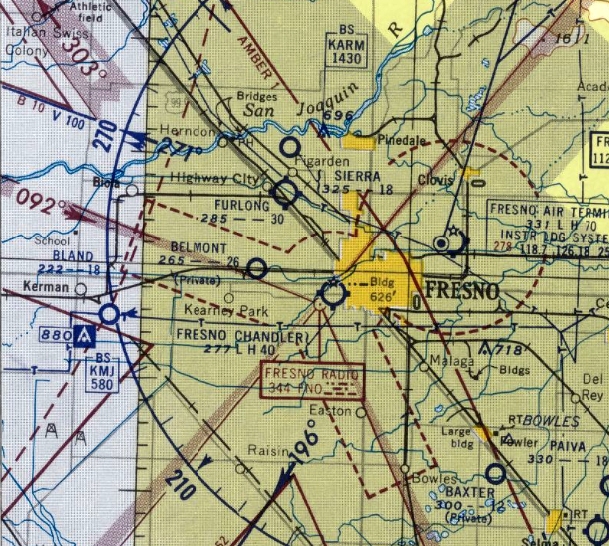
36.777, -119.778 (North of Downtown Fresno, CA)
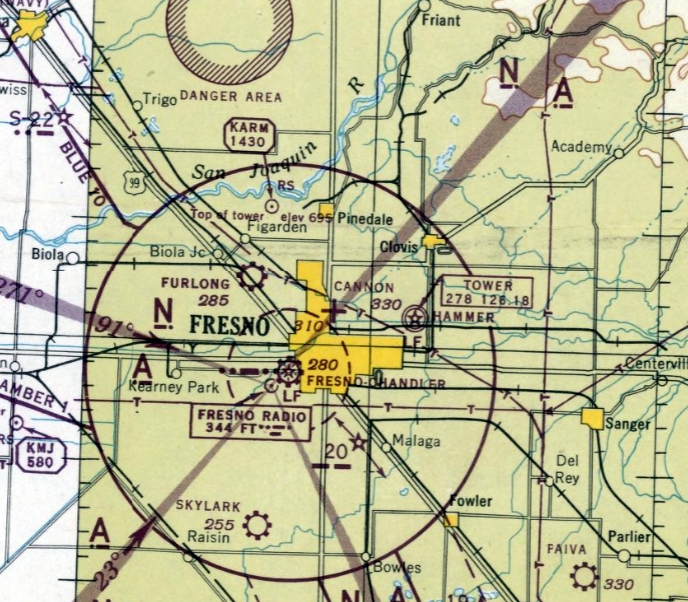
Cannon Field, as depicted on the September 1945 Mt. Whitney Sectional Chart.
This small airport on the north side of Fresno was evidently established at some point between 1944-45,
as it was not yet depicted on a 1937 aerial photo or the August 1944 Mt. Whitney Sectional Chart,
nor depicted among active airfields in the 1945 AAF Airfield Directory (courtesy of Scott Murdock).
The earliest depiction which has been located of Cannon Field was on the September 1945 Mt. Whitney Sectional Chart.
It depicted Cannon Field as an auxiliary airfield.
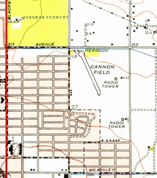
The earliest topo map depiction of Cannon Field which has been located was on the 1946 USGS topo map.
It depicted Cannon Field as having a single northwest/southeast runway, with 2 small buildings on the northwest side.
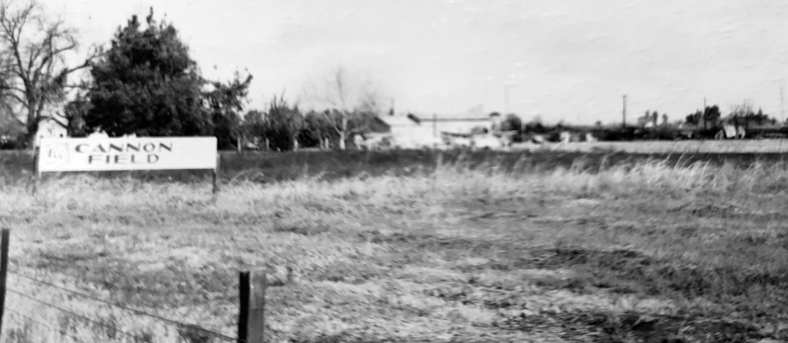
The only photo which has been located of Cannon Field was an undated photo of the airport sign & a possible hangar in the background (courtesy of Richard East).
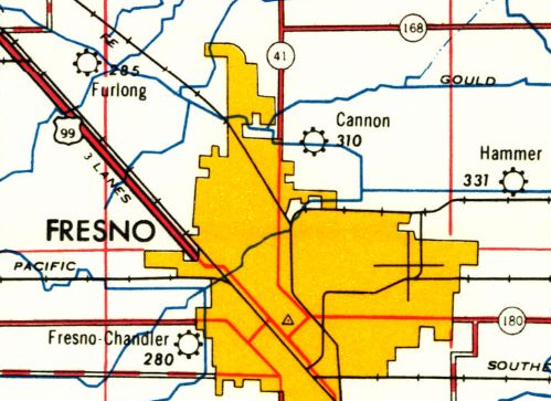
The last aeronautical chart depiction which has been located of Cannon Field was on the February 1947 Mt. Whitney Sectional Chart.
It depicted Cannon as having a mere 1,900' unpaved runway.
Cannon Field was evidently closed at some point between 1947-48, having lasted no more than 4 years,
as it was no longer depicted on the February 1948 Mt. Whitney Sectional Chart.
A 1955 street map (courtesy of Kevin Walsh) showed that the area of Cannon Field had been densely redeveloped.
A 1957 aerial view showed the area of Cannon Field had been densely redeveloped, with nary a trace remaining of the little airport.
Cannon Field was still depicted on the 1960 USGS topo map, even though it had been built-over for at least 3 years by that point.
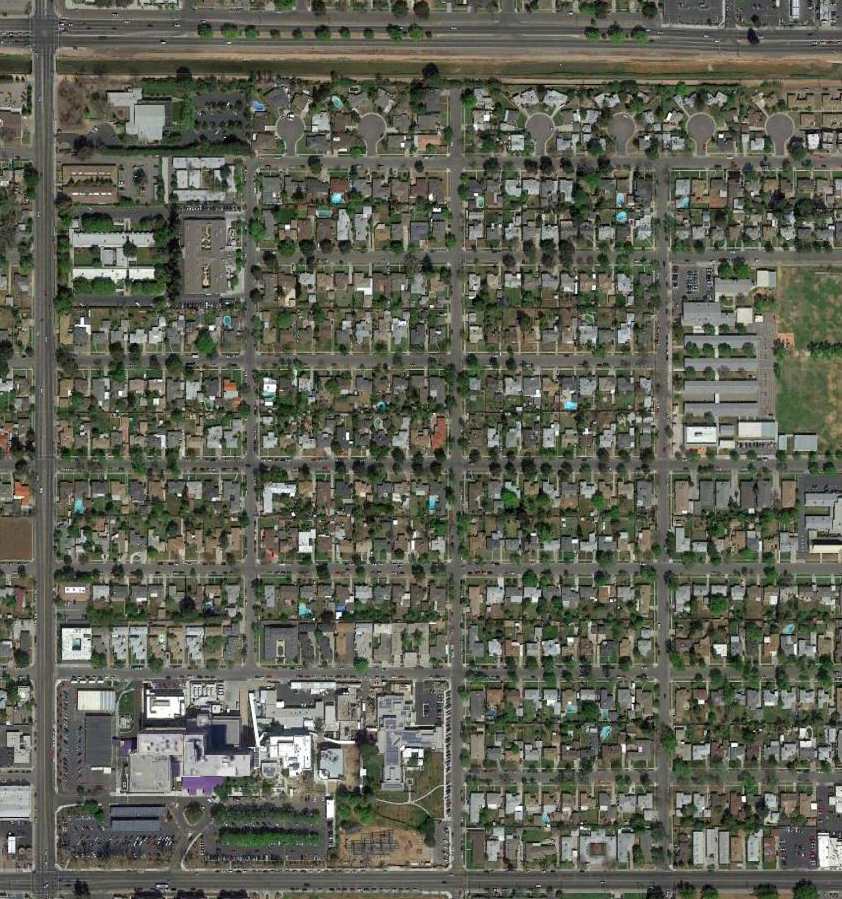
A 2015 aerial photo showed that the site of Cannon Field had no remaining trace of the airport.
The site of Cannon Field is located southeast of the intersection of Fresno Street & Shields Avenue.
Thanks to Kevin Walsh for pointing out this airfield.
____________________________________________________
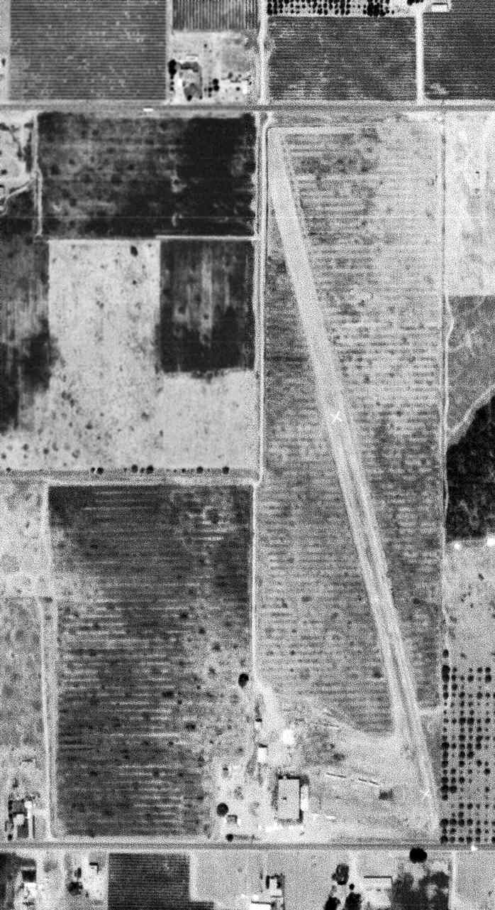
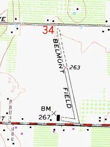
36.752, -119.888 (West of Fresno, CA)
Belmont Field, as depicted on a 4/24/46 USGS aerial photo (courtesy of Dallam Oliver-Lee).
This small airport on the northwest side of Fresno was evidently established at some point between 1945-46,
as it was not yet depicted on the February 1945 Regional Aeronautical Chart (courtesy of Kevin Walsh)
nor listed among active airfields in the 1945 AAF Airfield Directory (courtesy of Scott Murdock).
The earliest depiction of Belmont Field which has been located
was on a 4/24/46 USGS aerial photo (courtesy of Dallam Oliver-Lee).
It depicted Belmont as having 2 unpaved runways, with 6 single-engine aircraft parked around a hangar on the southwest side.
The 1946 USGS topo map depicted Belmont Field as having a northwest/southeast runway with a taxiway leading to a small building (a hangar?) on the southwest side.
It was labeled simply as “Airport”.
Tom Little recalled, “Belmont Field was where Carberry Crop Duster was located, since the late 1940s, the company my family flew for, for 30 years.”
Belmont Field was still not depicted on the March 1952 Mt. Whitney Sectional Chart.
The earliest aeronautical chart depiction which has been located of Belmont Field was on the September 1952 Mt. Whitney Sectional Chart.
It depicted Belmont Field as having a 2,600' unpaved runway.
The last aeronautical chart depiction which has been located of Belmont Field was on the March 1955 Mt. Whitney Sectional Chart.
It depicted Belmont Field as a private airfield having a 2,600' unpaved runway.
Belmont Field was no longer depicted on the September 1955 Mt. Whitney Sectional Chart.
Tom Little recalled, “Belmont Field was where I learned to fly in 1962 in a Piper J3 Cub.
We started a flying club there that year with 10 of us. We paid $10/month dues & $2.25/hour wet.
My dad was an instructor, so didn’t have to pay for dual [flight instruction], plus one of the members worked there as a mechanic,
so didn’t have to pay for maintenance labor. It was a good deal.
I have some pictures of the old stock Stearmans & Bull Stearmans that my dad flew there in the early 1960s before they transitioned into the Snow, and eventually to the Turbine Thrush.”
A 8/9/62 USGS aerial view (courtesy of Dallam Oliver-Lee) depicted what appeared to be 6 light single-engine aircraft parked on the south side of Belmont Field.
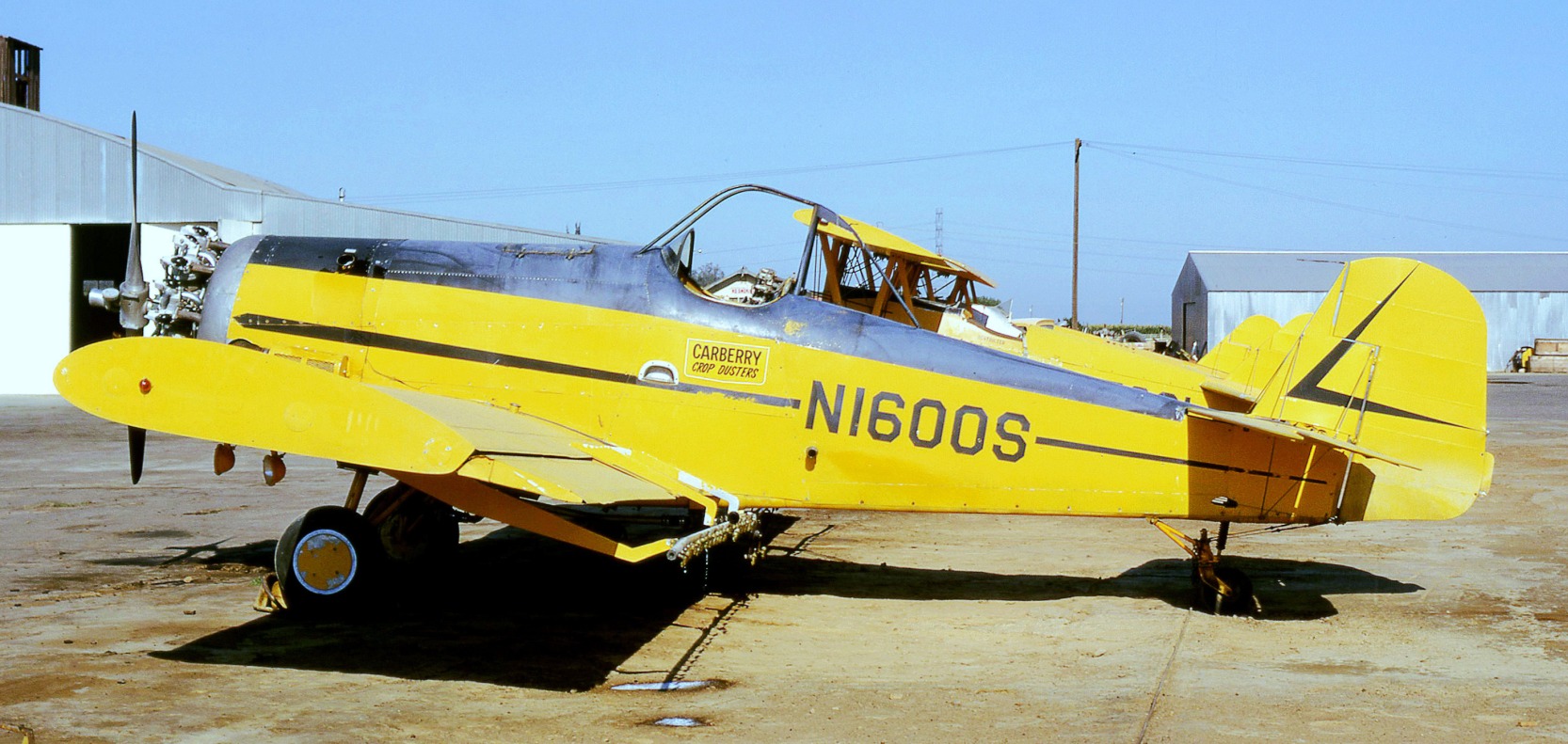
A July 1972 photo by Jay Sherlock of Carberry Crop Dusters Snow S2C N1600S at Belmont Field.
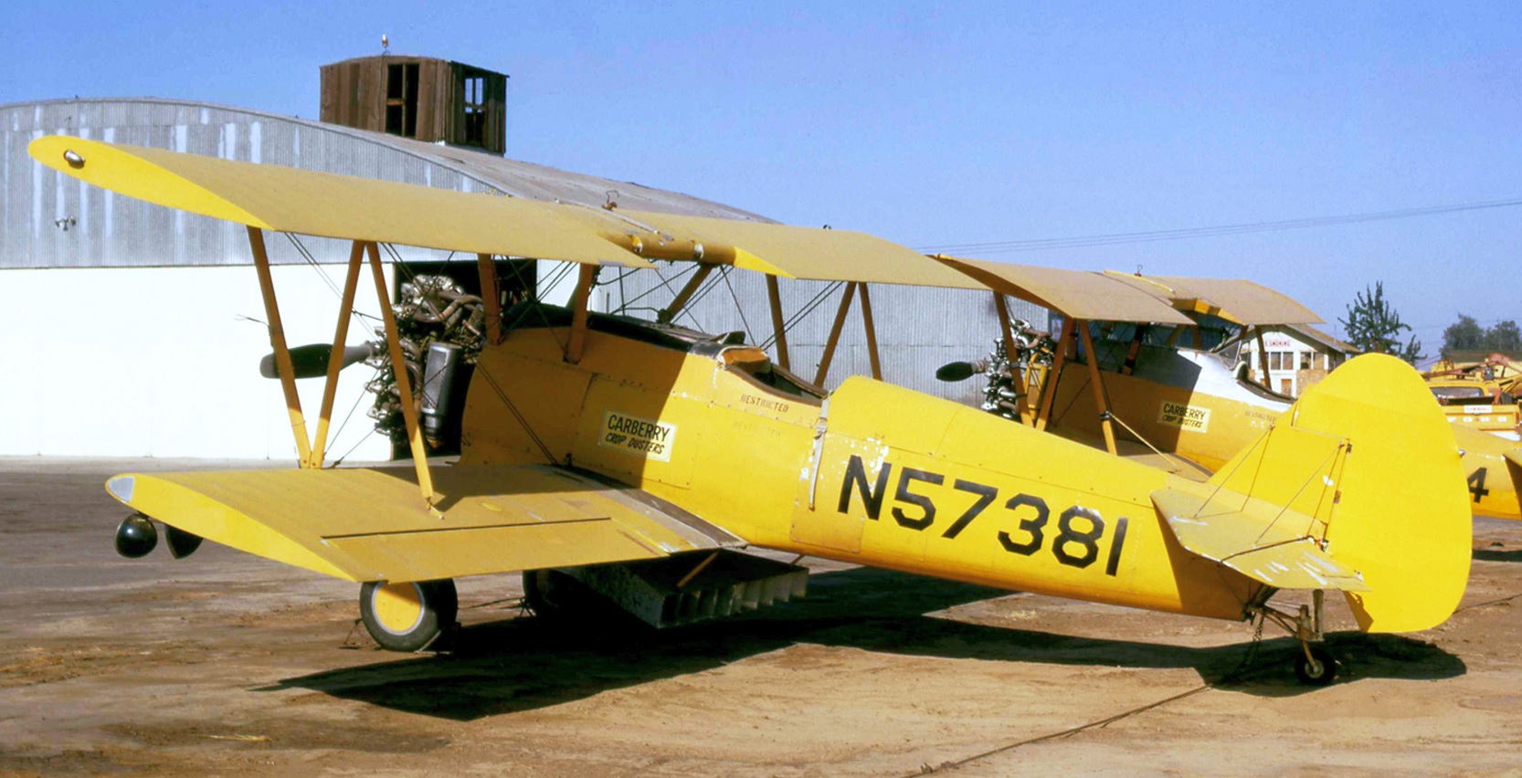
A July 1972 photo by Jay Sherlock of Carberry Crop Dusters PT-17 N57381 at Belmont Field.
Tom Little recalled, “Belmont Field... I finally started flying agricultural there in 1976.”
Terry Azamber recalled, “Belmont Airfield... I remember my dad taking me down there when I was a kid [circa 1970s].”
Belmont Field was not depicted at all on the April 1980 San Francisco Sectional Chart (courtesy of Mitchell Hymowitz).
The 1986 USGS topo map depicted Belmont Field as having a northwest/southeast runway with a taxiway leading to a small building (a hangar?) on the southwest side.
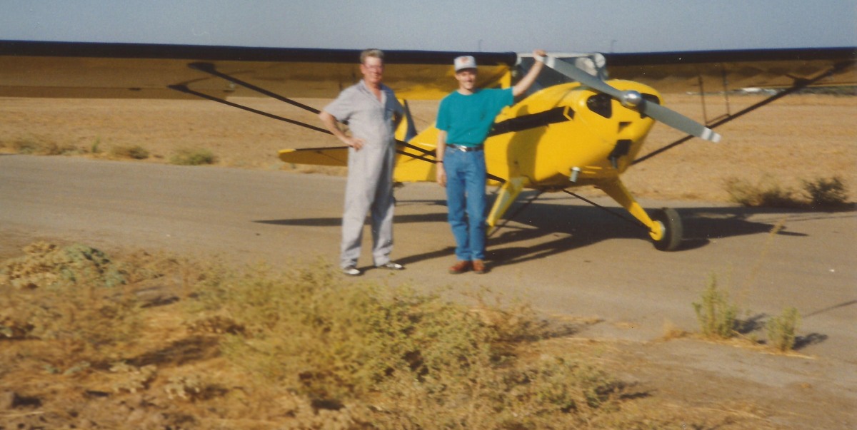
The last photo which has been located showing an aircraft at Belmont Field was an early Summer 1993 photo by Shele Fries of Chuck Miller & Marc Fries in front of Marc's 1946 Taylorcraft BC12D.
Marc recalled, “Chuck Miller worked at the airstrip for a cropduster.
He lived next to the airstrip, just west of the church in the lower left corner of [the previous] photo.
My wife & I had flown from Tulare that day to visit with Chuck & his wife, and had enjoyed root beer floats on his porch.
I believe I was the last pilot to fly into & take off from Belmont Field.
Later that summer, a pilot experiencing engine failure crashed his Ryan STA (N14987) there shortly after takeoff from Chandler Airport to the Southeast.
Shortly after that the family that owned the land tore out the runway.”
Belmont Field appeared to be abandoned in a 8/16/98 USGS aerial photo (courtesy of Dallam Oliver-Lee).
Only one runway was still recognizable, and the hangar had been removed at some point between 1962-98.
The faint outline of Belmont Field's primary runway was still recognizable in a 12/31/04 aerial photo (courtesy of Dallam Oliver-Lee).
The Belmont Field property had been scraped clean in a 4/27/06 aerial photo (courtesy of Dallam Oliver-Lee), erasing the last traces of the little airport.
A 8/26/12 aerial photo showed that the site of Belmont Field had been scraped clean, leaving no trace of the airport.
The site of Belmont Field is located northwest of the intersection of Belmont Avenue & North Cornelia Avenue.
____________________________________________________
Fresno Country Club Airfield / Furlong Field, Fresno, CA
36.806, -119.866 (Northwest of Fresno, CA)
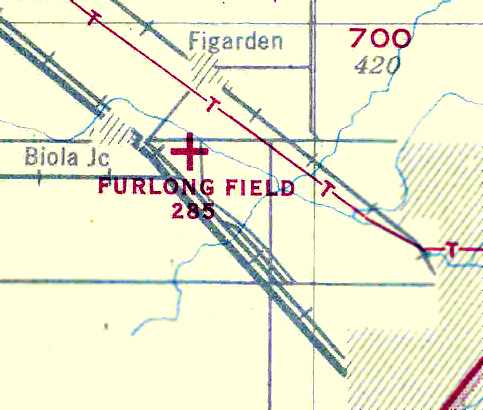
Fresno Country Club Airfield, as depicted on the June 1942 11M Regional Aeronautical Chart (courtesy of Chris Kennedy).
This small airport on the northwest side of Fresno was evidently established at some point between 1941-42,
as it was not yet depicted on the 1923 USGS topo map,
nor listed among active airfields in The Airport Directory Company's 1941 Airport Directory (according to Chris Kennedy)
nor depicted on the August 1941 Mt. Whitney Sectional Chart.
The earliest depiction which has been located of Fresno Country Club Airfield
was on the June 1942 11M Regional Aeronautical Chart (courtesy of Chris Kennedy).
It depicted “Fresno County Club” as a commercial airport.
Joyce (Furlong) Ayerza reported, “My father was Frank Furlong, owner/operator of Furlong Field.
When the war broke out, my folks had to move all the planes to El Paso TX
as they didn't want any aircraft to be sighted by the enemy on the west coast.”
It was still depicted as “Fresno Country Club” on the August 1943 Mt. Whitney Sectional Chart (according to Chris Kennedy).
The Haire Publishing Company's 1945 Airport Directory (courtesy of Chris Kennedy)
described the “Furlong Country Club Airport” as a “class 1” field, owned, operated, and managed by Frank Furlong.
It was said to have a single 2,400' northwest/southeast partially oiled runway, and a single 120' x 60' hangar.
Airline service was said to be provided by Transcontinental & Western, and United Airlines.
The 1945 USAAF Pilot's Handbook (courtesy of Chris Kennedy) depicted Furlong as an auxiliary airfield.
Joyce (Furlong) Ayerza recalled, “When the war was over, they [her parents] started a business on the airport called Central Air Services,
an all inclusive airport that provided flying lessons, repaired airplanes, housed or provided tie down space for private airplane owners
and was a refueling stop for people flying small airplanes between northern & southern California.
Thus, there were many more than 12 airplanes on the airport.
My Dad & Mom probably owned 12 airplanes to provide the flying lessons, but there were many more airplanes that were privately owned.
My Dad & Mom built a large flight office that had a Link Trainer used for teaching instrument-only flying techniques.
They also built a restaurant that would serve 9 people.
My Mom was famous for her hamburgers & one time served Dick Haymes & Rita Hayworth when they stopped in to refuel on a flight going up north.
She knew they were famous but didn't know who they were until my Dad came in & said, 'Do you know who you just served?'”
Joyce continued, “My Mom also had a private pilots license & would take me flying in the mornings before school to keep her license valid.
In those days you had to log so many hours to keep a license valid (that made it fun for me).
I can remember when she would go to the cafe at 7AM & prepare breakfast for the early bird pilots
then in the slow time of the day in the cafe she would go to the flight office & work on the books.
If Dad went to town she would have to run the cafe, office & gas airplanes all at the same time. She was a busy lady.”
Joyce continued, “Dad & Mom also provided flying lessons for the GIs after the war.
I can remember at one time when there were at least 4 or 5 flying instructors working for us.
My Dad did not have an instructor's license only a commercial license.
My Dad took many people up in an airplane for their first airplane ride.
He would never do any aerobatics during their first ride as he didn't want to scare them;
he wanted them to return & take flying lessons.
These things were all happening from about 1945-53.”
Joyce continued, “A couple of big cattle ranchers in the coastal range that lived in Fresno
would fly back & forth daily to their ranches with their private airplanes.”
The September 1949 Mt. Whitney World Aeronautical Chart depicted Furlong as having a 3,100' unpaved runway.
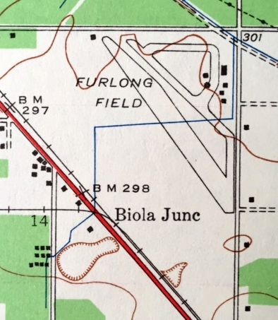
The 1946 USGS topo map (courtesy of Kevin Walsh) depicted Furlong Field as having a northwest/southeast runway with several taxiways & buildings on the northeast side.
Joyce (Furlong) Ayerza recalled, “In the early to mid-1950s things were pretty tough as the flying business soured due to the GI Bill for vets being discontinued.
People could not afford airplanes during these times.
It got so bad that my Mom went to work for Arden Farms Co to help out.
My Dad was trying to get some businesses to rent space on the property but couldn't get permits to even operate a paint shop
because of the political problems that were going on in the county planning office at the time.
It was also during these hard times that my dad remodeled the original large hangar,
one of about 4 or 5 on the property, into a chicken farm that housed chickens raised for fryers.
In one years time he lost $10,000 which at the time was a lot of money,
so he sold the equipment for what he could get out of it & discontinued the chicken business.
During that year the price of feed got higher than the price he could get for the chickens.”
Joyce (Furlong) Ayerza recalled, “Crop duster companies also operated out of the airport
that would provide spraying and dusting services for the westside farmers.
I can remember at least four: Brockman, Charley Treat, Marian Lawton, Snead, Fresno Helicopters & others through the years.
Harry Rogers of Rogers Helicopters first started as a mechanic for California Helicopters at our airport.
He then acquired his license to fly helicopters & started his own business;
in fact it was the last flying business to operate on the airport before my Mom sold the land in 1957 after my Dad died.
My Father died February 1957 & my Mom was not financially able to keep the airport going so she sold it.”
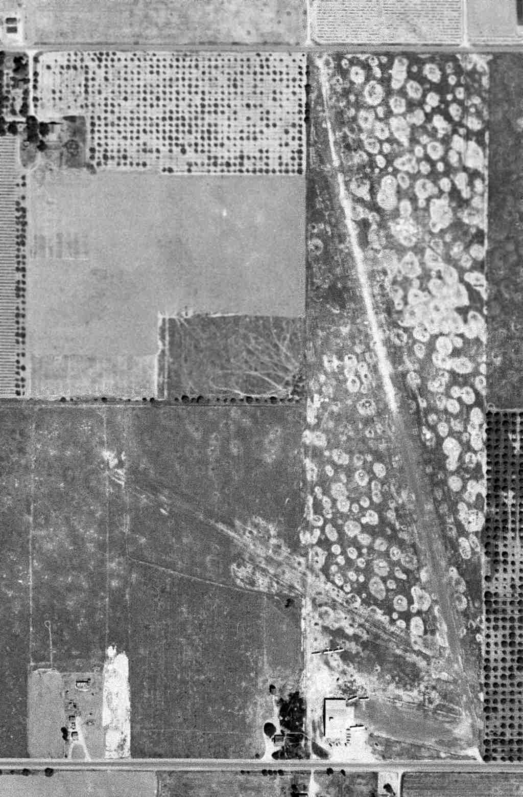
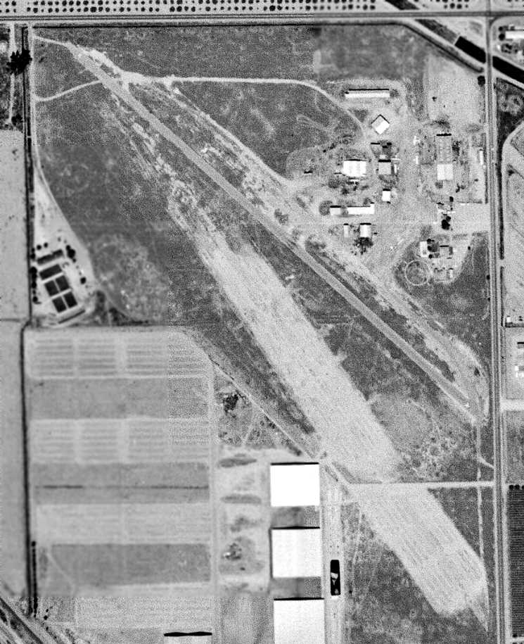
The earliest photo which has been located of Furlong Field was an 8/29/57 USGS aerial view.
It depicted Furlong as having a northwest/southeast paved runway, along with a longer unpaved runway to the south.
A dozen light single-engine aircraft were parked among several hangars & buildings on the northeast side.
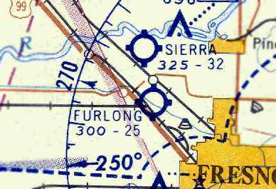
The last chart depiction which has been located of Furlong Field as an active airfield was on the March 1959 Mt. Whitney Sectional Chart (courtesy of Chris Kennedy).
The Aerodromes table on the chart described Furlong as having a 2,500' oiled runway.
Furlong Field was evidently closed at some point in 1959,
as it was no longer depicted on the September 1959 Mt. Whitney Sectional Chart,
nor was it listed among active airfields in the 1960 Jeppesen Airway Manual (according to Chris Kennedy).
However, Mike Wilkens reported, “I learned to fly at Furlong in a J-3 in the summer of 1961.
At the time, there were just a few old hangars left, which were so dilapidated they more resembled shelters.
There was the skeleton of an old Cessna Bobcat rotting in one of them.
My dad kept his Swift there for another couple of years, and he & a partner restored a Stinson 108-3 there in the mid-1960s.
The hangar was parallel to Shaw, and it seems there was another building along Brawley, perhaps a maint shop/hangar.
The hangars along Shaw are freshest in my mind, because that was where Dad's Swift was kept (they were actually T-shelters, not enclosed).
They started not far from the irrigation canal seen cutting across the corner of the property near the intersection.”
The last photo which has been located of Furlong Field was a 8/10/62 USGS aerial view.
It depicted Furlong as having a northwest/southeast paved runway with several taxiways & buildings, and at least 4 single-engine aircraft on the northeast side.
Interestingly, a longer & wider unpaved runway was also visible, apparently having been abandoned at some point.
Jim Shamp recalled, “I learned to fly out of Furlong in July 1963.
I flew there for about a month in an old 7AC Aeronca Champ that belonged to the Fresno State Flying Club.
The owners made everyone leave in the summer of 1963 due to liability issues & the plans to develop the property.
Furlong was a great airport, out in the country & fun to fly out of.
Claud Wood flew for Everet Snead & kept his airplane at Furlong. I always think of how close-knit aviation is.
I always remember Furlong Field. I drive by it on occasion & remember back then & what a great time it was to be flying.”
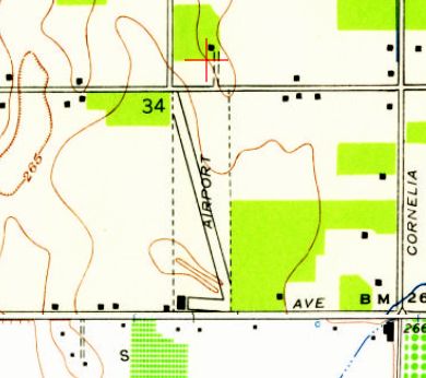
The 1965 USGS topo map still depicted Furlong Field,
with a single, very short northwest/southeast runway & a single building on the northeast side.
The 1979 USGS topo map still depicted “Furlong Field”, with a single northwest/southeast runway segment.
Furlong Field was no longer depicted at all on the April 1980 San Francisco Sectional Chart (courtesy of Mitchell Hymowitz).
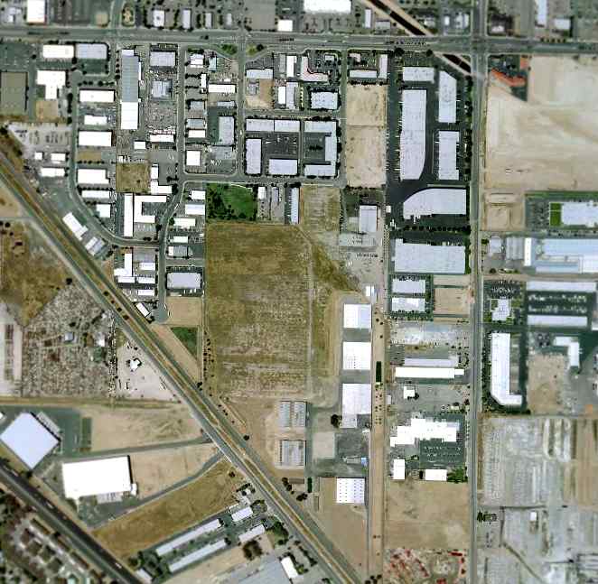
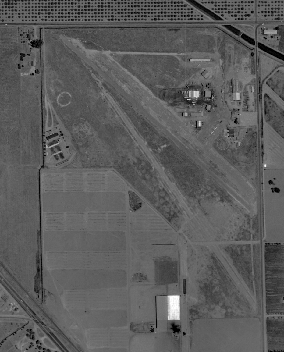
In the 2002 USGS aerial view of the site of Furlong Field, the slightest trace of the northwest/southeast runway alignment was still perceptible.
There did not appear to be any other remaining traces of the airport – the area had been built over.
A 3/24/16 aerial view by Dallam Oliver-Lee looking north at the site of Furlong Field.
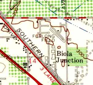
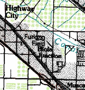
The site of Furlong Field is located southeast of the intersection of Shaw Avenue & North Brawley Avenue.
____________________________________________________
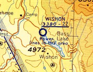
37.333, -119.58 (North of Fresno, CA)
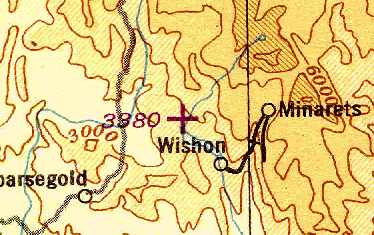
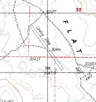
Wishon Airport, as depicted on the February 1945 11M Regional Aeronautical Chart (courtesy of Chris Kennedy).
This small airport on the northwest short of Bass Lake was evidently established at some point during 1944,
as it was not yet depicted on the August 1944 Mt. Whitney Sectional Chart
or listed in the April 1944 Army/Navy Directory of Airfields (courtesy of Ken Mercer).
The earliest reference to this airfield which has been located
was in the November 1944 Army/Navy Directory of Airfields (according to Chris Kennedy).
It was listed as “Wishon USFS”, so it was presumably established by the U.S. Forrest Service.
The earliest chart depiction which has been located of Wishon Field
was on a February 1945 11M Regional Aeronautical Chart (courtesy of Chris Kennedy).
Ney Grant recalled, “There used to be a Bass Lake Airport between Yosemite & Fresno,
right on the shores of Bass Lake outside the small town of Oakhurst.
It was called the Wishon airfield & I heard it was owned by PG&E.
There is higher terrain on one end so it was a one way strip or close to it.”
The September 1949 Mt. Whitney World Aeronautical Chart depicted Wishon as having a 2,200' unpaved runway.
The earliest photo which has been located of Wishon Airport was an 8/1/51 USGS aerial view, which depicted a single northwest/southeast unpaved runway.
The 1953 USGS topo map depicted a single northwest/southeast runway, labeled simply as “Landing Field”,
with 2 small buildings on the east side of the northern end of the runway.
The 1957-58 Aviation Week Airport & Business Flying Directory (courtesy of Chris Kennedy)
described Wishon Airport as a “limited” airfield with a single 2,200' unpaved runway.
The runway was noted to be “one-way”, with landings recommended to the north-northwest, and takeoffs to the south-southeast.
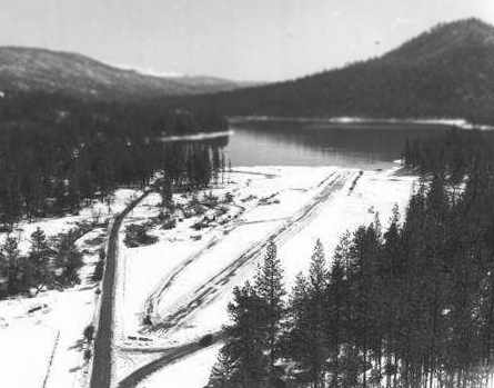
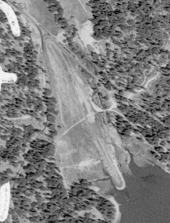
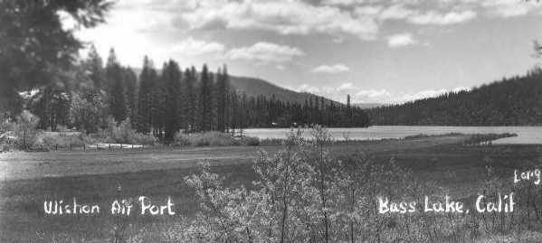
An undated aerial photo looking southwest at Wishon Airport, with Bass Lake in the background.
The airport was depicted as consisting of a single runway, along with a parallel taxiway.
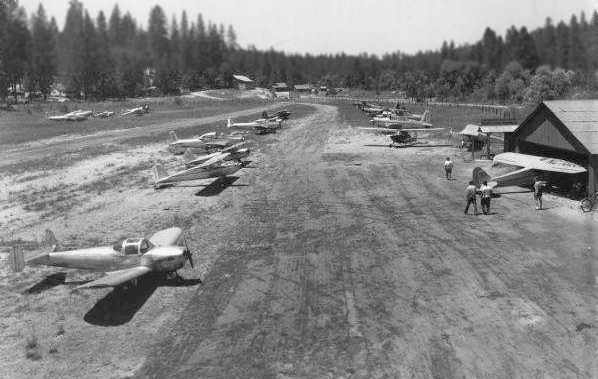
An undated (circa 1950s?) photo of an Ercoupe & other light planes at Wishon Airport.
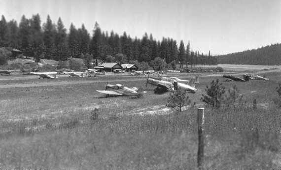
An undated (circa 1950s?) photo of a Vultee & other light aircraft at Wishon Airport.
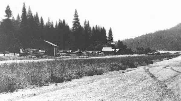
An undated (circa 1950s?) photo of some Cessnas & a few small buildings at Wishon Airport.
An undated (circa 1950s?) photo looking southwest along the Wishon Airport runway toward Bass Lake.
The last chart depiction which has been located of Wishon as an active airfield
was on the May 1957 Mt. Whitney Sectional Chart (according to Chris Kennedy).
The Aerodromes table on the chart described Wishon as having a single 2,200' bare runway.
According to Ney Grant, “A famous actress died taking off from there (I heard the plane couldn't outclimb the terrain & crashed into trees),
and I think it was shut down after that.”
Wishon Airport may have been officially closed at some point between 1957-59,
as it was no longer depicted at all on the March 1959 Mt. Whitney Sectional Chart (according to Chris Kennedy)
or subsequent aeronautical charts.
However, the 1960 Jeppesen Airway Manual (according to Chris Kennedy) continued to list Wishon Airport.
It described Wishon as having with a 2,200' hard-surfaced runway.
Furthermore, James Janssen recalled of Wishon Airport, “I flew in there many times during the 1960s.
To the best of my knowledge, it was open in 1967-69.
I flew in there with another pilot many times in the mid-1960s – probably 1963-65.
I then went back after I got my pilot's license in September 1966, for sure, it was a great place!
Back then, there was a restaurant & boat rental (the falls) on the left (looking down runway to the lake) & a campground on right.
A little store was in walking distance.
I really don't remember the date of last visit but it was probably around 1968-69. I could have been one of last to visit.
I do remember watching a Cessna crash in the lake on takeoff (one of my last visits), engine backfiring, and following the shore.
Just missed some swimmers. The pilot was unhurt, and I watched a tow truck pull it out of the water.
I talked to the pilot just before he took off, we were discussing the restaurant at the 'Falls', it was already gone,
and I will always remember his comment 'One thing they can't take away is the lake!'”
The 1980 USGS topo map still depicted a single 2,100' runway, but it was labeled simply as “Landing Strip”
(which typically means the airfield was no longer open by that point).
However, Keith Goodman recalled that the Wishon Airport was still in use at a later point:
“I visited Bass Lake many times in the early 1980s. My last visit & recollection of the airfield would be 1982-83.
I clearly remember seeing aircraft parked there & could hear arrivals/departures from the nearby campground.”
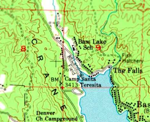
By the time of the 1990 USGS topo map, Wishon Airport was no longer depicted at all.
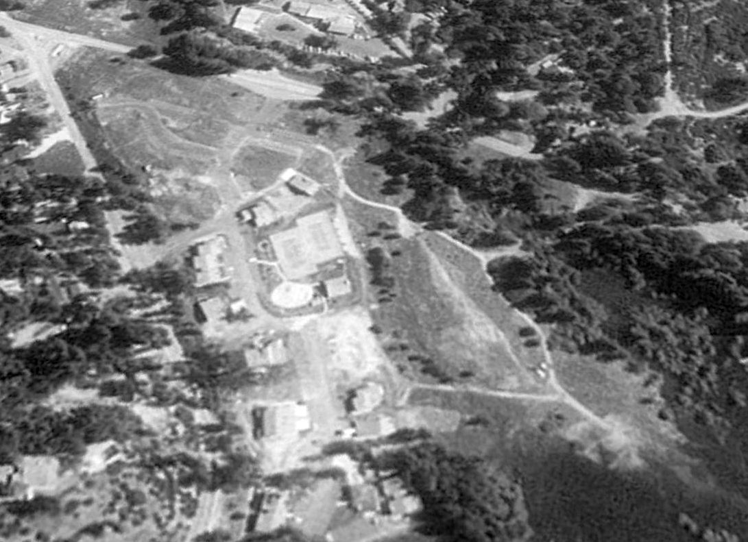
A 1993 USGS aerial view looking northeast showed the site of Wishon Airport had been redeveloped with houses,
and there did not appear to be any remaining trace of the airport.
Ney Grant reported in 2005, “There are condos/apartments there & I have never been able to see any signs.”
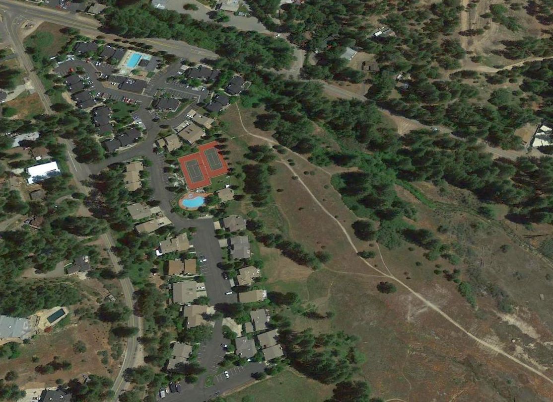
A 2014 aerial view looking northeast at the site of Wishon Airport showed the shore of Bass Lake, previously at the edge of the runway, had retreated further south due to California's drought.
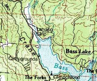
The site of Wishon Airport is located south of the intersection of North Shore Road & Road 222.
____________________________________________________
Coyote Flats Airport (04CA), Coyote Flats, CA
37.205, -118.478 (Northeast of Fresno, CA)
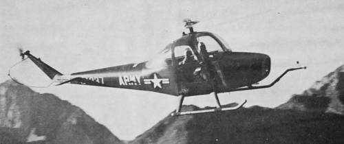
A 1958 photo of Cessna's prototype YH-41 helicopter during Army testing at Coyote Flats (courtesy of Jed Keck).
The Coyote Flats Airfield was not depicted on Mt. Whitney Sectional Charts from 1950/55/60/65/69, nor on the 1950 USGS topo map.
In 1958 the Army tested Cessna's prototype YH-41 helicopter at Coyote Flats (as depicted in a photo courtesy of Jed Keck).
This may have been before the runway was actually established.
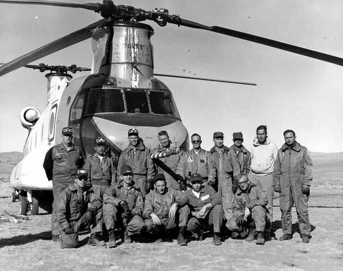
A 1965 photo of an Air Force evaluation crew in front of their CH-47, “Porky”, at Coyote Flats (courtesy of Jed Keck).
The Coyote Flats runway was reportedly built in 1968 by the Army High Altitude Test Center
as a facility to test the high altitude performance of helicopters & light airplanes.
It was also used in a similar capacity by the Marine Corps Mountain Warfare School in Bridgeport, CA.
During its lifetime, this little strip was the highest airfield in the United States, at 10,000’ elevation.
The location is extremely remote, being surrounded by glaciers that remain year-round.
According to Jed Keck, “Rumor is that they even operated a C-130 Hercules out of there but I have not seen the photo.”
Coyote Flats was depicted simply as "Landing Strip" on the 1978 USGS topo map.
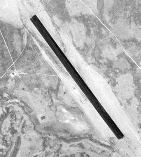
The earliest photo which has been located of the Coyote Flats Airport was on a 9/11/79 USGS aerial photo.
It depicted Coyote Flats as having an asphalt northwest/southeast runway, with a small building to the west.
Coyote Flats was not depicted at all (even as an abandoned airfield) on a 1987 aeronautical chart.
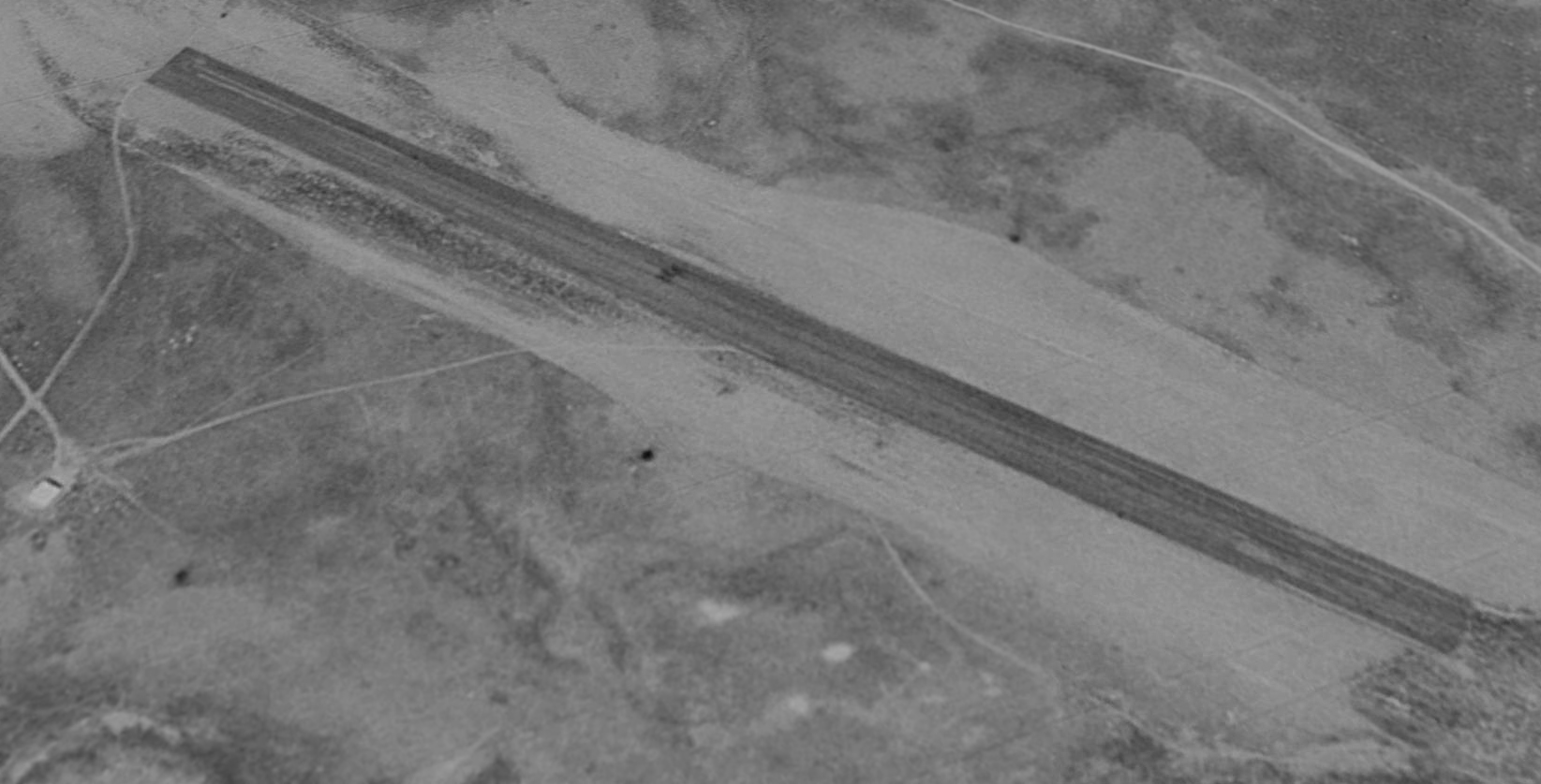
A 1987 USGS aerial view looking northeast showed the Coyote Flats airfield to have a single 3,000' runway, which was originally paved.
To the west of the runway was a small metal building (hangar or shed) & a windsock.
According to a 1994 environmental impact study of Edwards AFB,
Coyote Flats was listed among 18 off-base properties controlled by the Air Force Flight Test Center.
The Coyote Flats property was listed as a "Test Site", with 642 acres,
and was listed as being USAF property from 1965 to the time of the study (1994).
The 1994 USGS topo map depicted a single runway, labeled simply as “Landing Strip”.
Jed Keck recalled, “For 7 years I was a pilot for Southern California Edsion
and flew over or landed at Coyote Flats at least 50 times.
When I started with Edison in 1996 it was still on the Sectional Chart.”
The Coyote Flats airfield was evidently closed at some point between 1998-98,
as it was no longer depicted at all (even as an abandoned airfield) on a 1998 World Aeronautical Chart or the 2000 Sectional Chart.
Apparently, the property is now under the jurisdiction of the Forrest Service.
To discourage landings by civilian pilots,
the Forrest Service had apparently recently dug deep ruts into the runway & placed branches across it in an x-shaped pattern.
Like too many other backcountry airstrips, the Forest Service had torn this one up to prevent anyone from landing on it & closed it down.
This was apparently done to avoid the risk lawsuits if a crash should occur,
and because the state legislature doesn't want to spend the meager funds needed to keep it operational.
However, apparently the Coyote Flats airstrip has once again been visited by some backcountry pilots (with suitable skills & aircraft).
Jeff reported in 2003, "We visit Coyote Flats airstrip every year on our annual end of summer camping trip.
The buildings are all gone. Only the foundation of a camera observation point is left.
The ruts the Forest Service put in the strip are almost gone."
A pre-2005 aerial photo by J. Lawson of Coyote Flats.
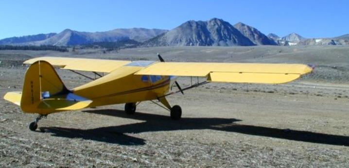
A pre-2005 photo by J. Lawson of a Taylorcraft at Coyote Flats.
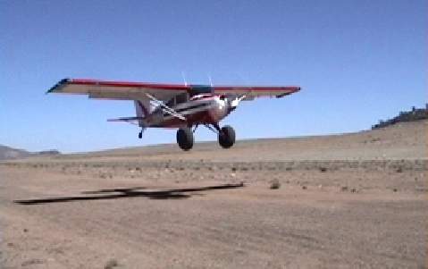
A pre-2005 photo by Jeff of a friend taking off from Coyote Flats. Note those huge tires!
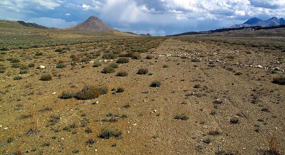
A 2015 photo by Walt Snyder looking along the Coyote Flats runway, showing the closed-runway “X” symbol made from white rocks.
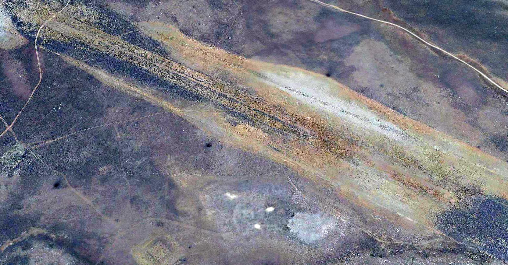
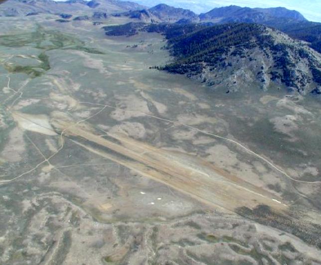
A 2016 aerial view looking northeast shows the Coyote Flats runway to remain intact though deteriorated.
Thanks to Skychick2 for pointing out this airfield.
See also: http://www.ridgecrest.ca.us/~jdlawson/coyote.htm
____________________________________________________
____________________________________________________
This site covers airfields in all 50 states.