Abandoned & Little-Known Airfields:
Central New York State
© 2002, © 2023 by Paul Freeman. Revised 11/26/23.
This site covers airfields in all 50 states: Click here for the site's main menu.
____________________________________________________
Please consider a financial contribution to support the continued growth & operation of this site.
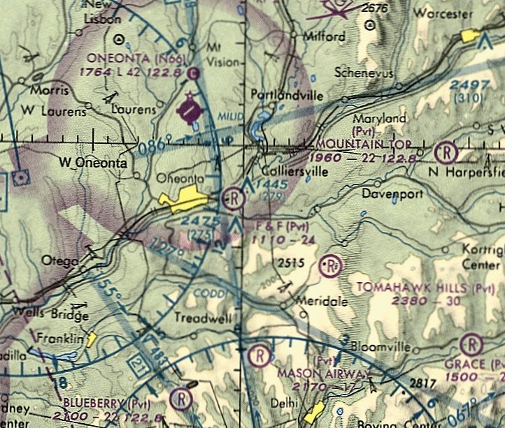
Auburn Airport (revised 1/17/21) - Bonnie Brae Airfield (added 9/6/22) - Canastota Airport (revised 1/17/21) - Cooperstown Airport (revised 1/17/21) - Downsville Airport (added 7/8/18) - F&F Air Park (revised 10/17/20)
Hayes Airport / Cicero Airpark / Michael Field (revised 4/14/18) - Ithaca Municipal Airport (revised 11/26/23) - Kamp Airport (revised 1/21/17) - Lakelawn Airport (revised 9/5/21)
Mangeot Field / Holly Brothers Airport / Reid Airport / Fulton Auxiliary Field / Fulton Airpark (revised 5/24/19) - Nedrow Airpark (revised 6/14/19)
Oneida Lake Airport & Seaplane Base (revised 10/17/20) - Syracuse Municipal Airport (revised 10/13/19) - Tioga Airport (revised 11/17/19) - Tri-County Airways Airport (revised 11/17/19)
____________________________________________________
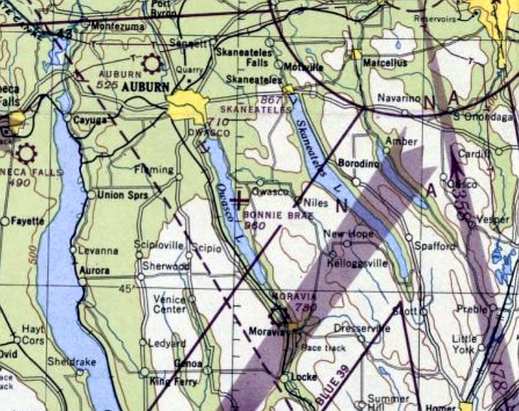
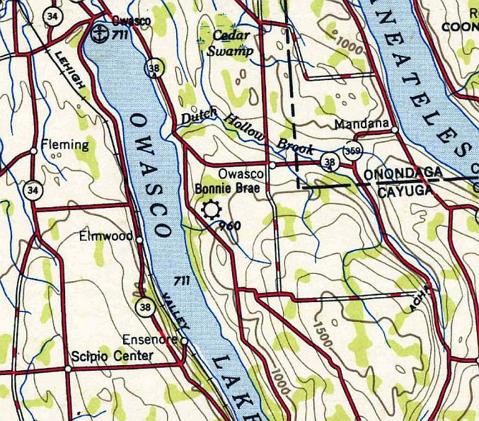
Bonnie Brae Airfield, Owasco, NY
42.838, -76.496 (Southwest of Albany, NY)
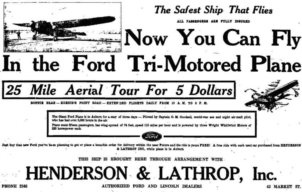
An advertisement for 25 Mile Aerial Tours from Bonnie Brae Airfield, from the 1930 Auburn Citizen (courtesy of Colleen Vasile)
Photo of the airport while in use has not been located.
According to the Town of Niles Comprhensive Plan (courtesy of Colleen Vasile),
“The Bonnie Brae Airfield was constructed in circa 1928 on the Philo Ramsey Farm, south of Keonig’s Point overlooking Owasco Lake in the northwest corner of the Town of Niles.
Bonnie Brae was one of the first airfields in Cayuga County.
Charles Lindbergh landed at Bonnie Brae Airfield in the late 1920s,
one of hundreds of stops on an America tour following his ground-breaking solo flight across the Atlantic Ocean in 1927.
Beginning in 1930, a 15 passenger Ford Tri-Motor plane powered by 3 Wright Whirlwind motors & a wingspan of 74' offered 25 mile aerial tours to the public for $5.”
The earliest reference which has been located of Bonnie Brae Airfield was a 1930 advertisement for 25 Mile Aerial Tours, from the 1930 Auburn Citizen (courtesy of Colleen Vasile).
Bonnie Brae Airfield was not yet depicted on the 1933 Albany Sectional Chart (or subsequent Albany Sectionals through 1945).
According to the Town of Niles Comprhensive Plan (courtesy of Colleen Vasile),
“The City of Auburn’s first airmail service began from Bonnie Brae Airfield in May 1938.
The earliest aeronautical chart depiction which has been located of Bonnie Brae Airfield was on the 1946 Albany Sectional Chart.
It depicted Bonnie Brae as an auxiliary airfield.
The earliest topo map depiction which has been located of Bonnie Brae Airfield was on the 1948 USGS topo map.
The last aeronautical chart depiction which has been located of Bonnie Brae Airfield was on the January 1950 Albany Sectional Chart.
It depicted Bonnie Brae as having a mere 1,700' unpaved runway.
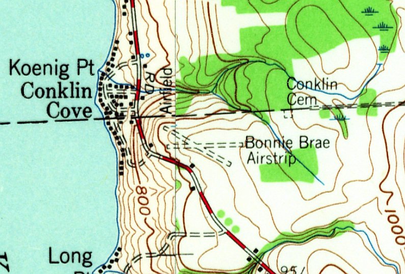
The 1955 USGS topo map depicted “Bonnie Brae Airstrip” as having 2 unpaved runways, with 2 small buildings along the southwest side.
Bonnie Brae Airfield was evidently closed (for reasons unknown) at some point between 1950-60,
as it was no longer depicted on the 1960 Albany Sectional Chart.
However, according to the Town of Niles Comprhensive Plan (courtesy of Colleen Vasile), “Bonnie Brae operated through the early 1960s.”
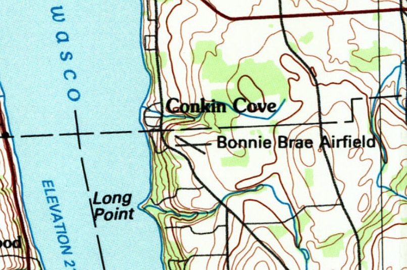
The 1985 USGS topo map still depicted “Bonnie Brae Airfield” as having 2 runways.
Colleen Vasile recalled, “Bonnie Brae Airstrip... I remember the one remaining building of this small airport, an abandoned small square building in the hedgerow, in the 1980s.
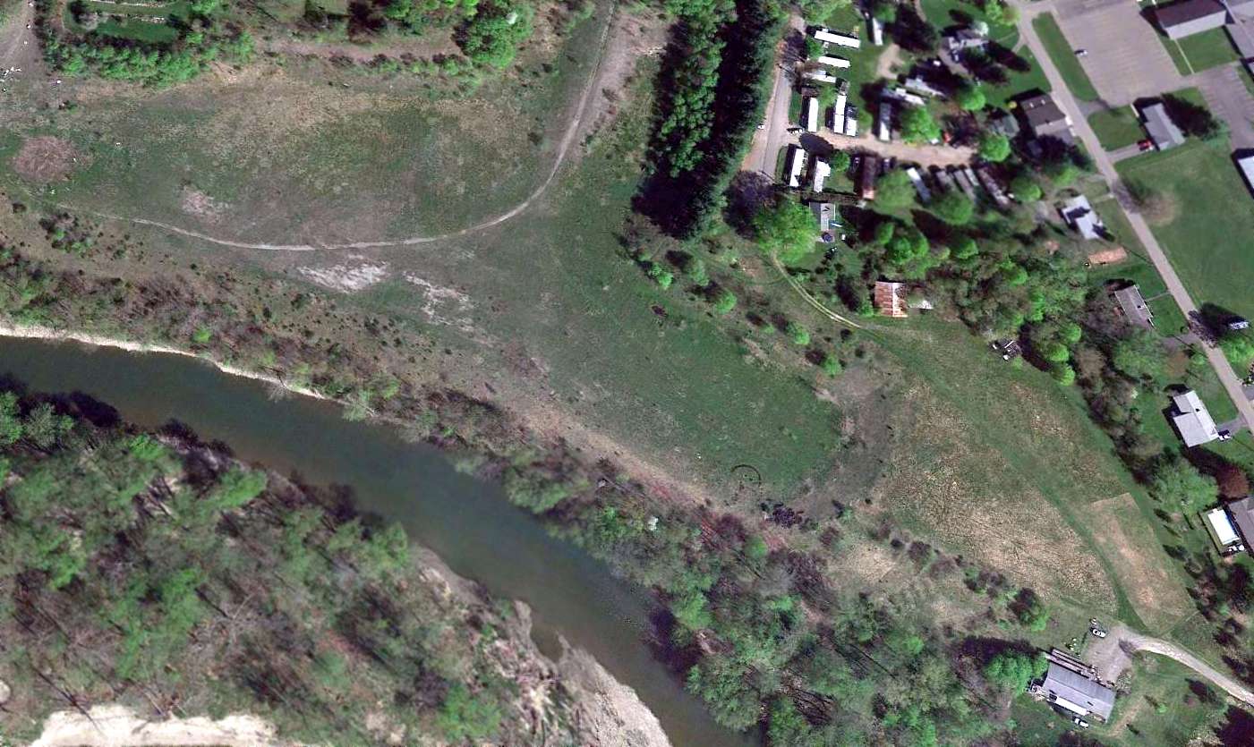
A 1995 aerial view showed the Bonnie Brae Airfield site to be under cultivation, with no trace remaining of the runways.
The former airport office building remained on the southwest side.
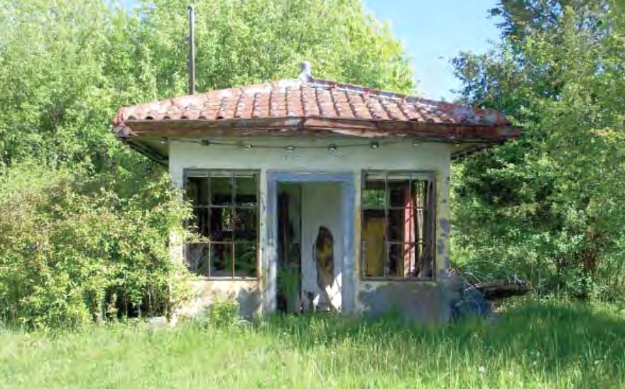
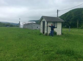
A 5/23/08 photo of the former Bonnie Brae Airfield office building (courtesy of Dick Coalson).
According to the January 2010 Town of Niles Comprhensive Plan (courtesy of Colleen Vasile), “A small building, once used as the Bonnie Brae Airfield office still exists on the site today.”
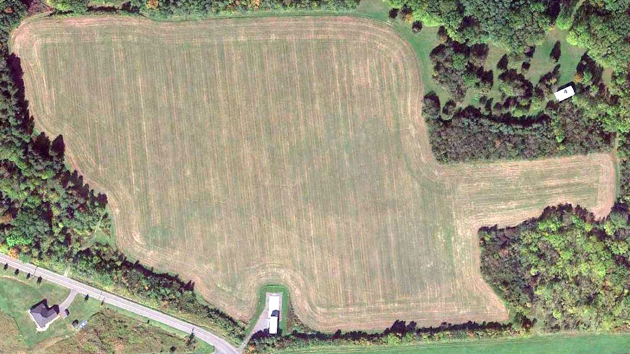
A 2019 aerial view showed the Bonnie Brae Airfield site to be under cultivation, with no trace remaining of the runways.
The former airfield office building on the southwest side had evidently been removed at some point between 2010-2019.
Colleen Vasile reported in 2022, “Today, no trace remains. There is nothing left. The barn [on the airfield site] is a modern building.”
Thanks to Colleen Vasile for pointing out this airport.
____________________________________________________
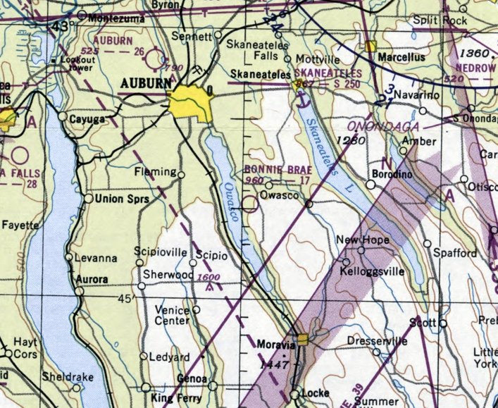
Lakelawn Airport, Skaneateles, NY
42.933,-76.444 (Southwest of Albany, NY)
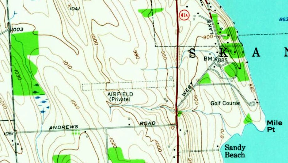
Lakelawn Airport was labeled “Airfield (Private)” on the 1955 USGS topo map.
Photo of the airport while in use has not been located.
Lakelawn Airport was not yet depicted on the 1949 USGS topo map.
According to “Aviation in Skaneateles” by Beth Battle, Town of Skaneateles Historian (courtesy of Clay Clary),
“Dwight Winkleman, known as the 'Flying Contractor', built a private airfield in the early 1950s north of the newly-built Kane Avenue,
on the former Frank Hares property known as Lakelawn.
His pilot, Clarence 'Bud' Kirley, a former Air Corps squadron commander with 53 combat missions in WW2,
flew the executive aircraft owned by the Winkleman Construction Company.”
The earliest depiction which has been located of Lakelawn Airport was on the 1955 USGS topo map.
It depicted a single unpaved east/west runway, labeled generically as “Airfield (Private)”, with 1 small building on the northeast corner.
According to “Skaneateles” (courtesy of Clay Clary), “Dwight Winkelman specialized in heavy construction - airports, highways, buildings.
As president of Winkelman Construction, Dwight enjoyed 16-hour work days, as long as they were in the field – he flew from job to job in his own airplane – and not behind a desk.
The Winkelmans re-named the Lone Oak property 'Lakelawn'. Winkelman’s airstrip was the Lakelawn Airport.
Dwight was a founder of the Skaneateles Polo Club & built the first polo field next to his airplane hangar on West Lake Road.”
Lakelawn Airport was not yet depicted on the 1968 Albany Sectional Chart.
The earliest aeronautical chart depiction which has been located of Lakelawn Airport was on the July 1969 Albany Sectional Chart.
It depicted Lakelawn as a private airfield having a single 3,500' paved east/west runway.
Note the close proximity of the Empire Aero Airport to the south.
According to “Aviation in Skaneateles” by Beth Battle, Town of Skaneateles Historian (courtesy of Clay Clary),
the Winkleman company's Twin Beech suffered a fatal crash on takeoff from their airfield on 4/6/72.
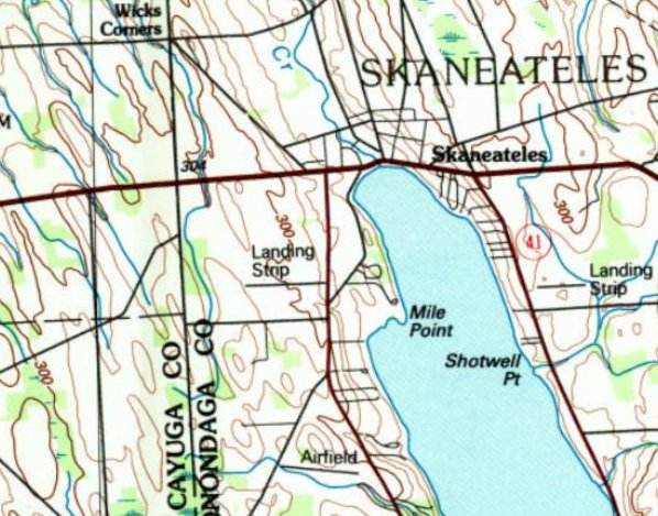
The 1992 USGS topo map depicted Lakelawn Airport as a single east/west runway, labeled generically as “Landing Strip”.
The last aeronautical chart depiction which has been located of Lakelawn Airport was on the June 1981 Albany Sectional Chart (courtesy of Ron Plante).
It depicted Lakelawn as a private airfield having a single 3,000' paved east/west runway.
According to “Aviation in Skaneateles” by Beth Battle, Town of Skaneateles Historian (courtesy of Clay Clary),
“After Dwight Winkleman's death in 1982, 54 acres of the land was sold to the Skaneateles Country Club”,
presumably spelling the end of Lakelawn Airport.
According to “Aviation in Skaneateles” by Beth Battle, Town of Skaneateles Historian (courtesy of Clay Clary),
“In 1991 the 4-bay hangar was the temporary home of the Skaneateles Country Club.”
Lakelawn Airport was no longer depicted on the December 1993 Albany Sectional Chart (courtesy of Ron Plante).
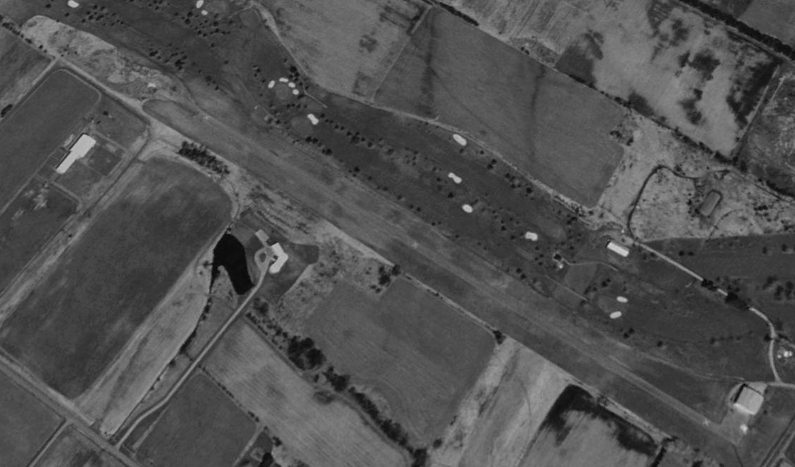
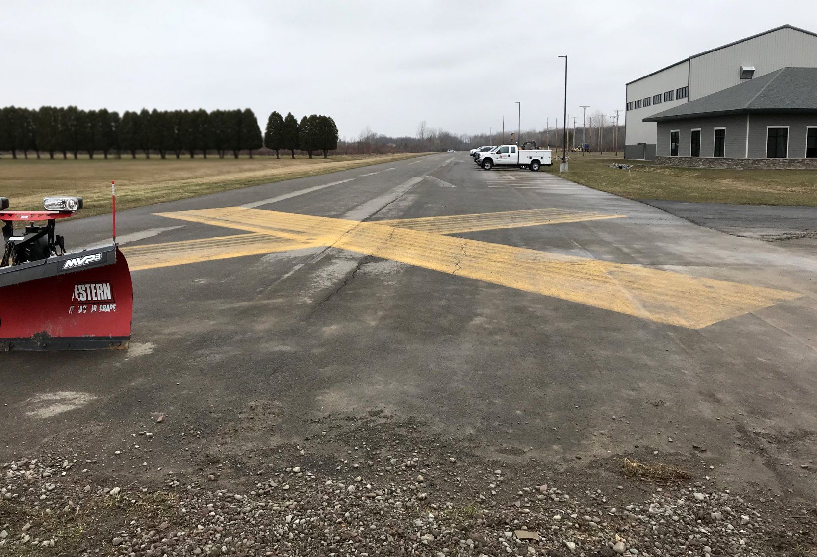
The earliest photo which has been located of Lakelawn Airport was a 1995 aerial view looking northwest.
It depicted Lakelawn as having a single paved east/west runway, with closed-runway “X” symbols painted on it, and a single small hangar on the northeast side.
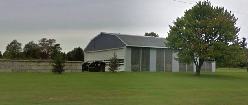
An October 2015 photo looking northwest at the former Lakelawn Airport hangar.
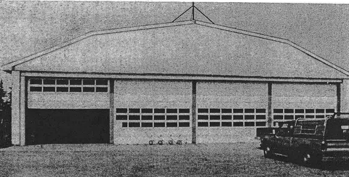
An undated photo of the former Lakelawn Airport hangar, from the 2016 report “Aviation in Skaneateles” by Beth Battle, Town of Skaneateles Historian (courtesy of Clay Clary).
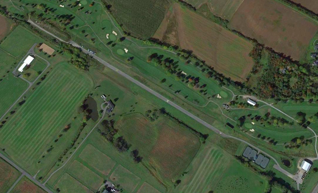
A 2019 aerial view looking northwest at the remains of Lakelawn Airport showed that the majority of the paved runway still existed, although tennis courts had been built along the southeastern portion.
The former hangar also remained on the northeast side.
A circa 2020 3-D aerial imagery looking northwest at the former Lakelawn Airport hangar & runway.
A 7/21/21 photo by Clay Clary looking northeast at the former Lakelawn Airport hangar.
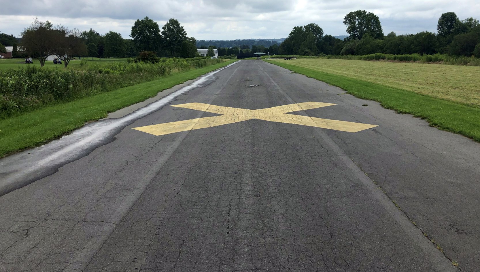
A 7/21/21 photo by Clay Clary looking east along the former Lakelawn Airport runway, intact but marked with a yellow closed-runway “X” symbol.
Thanks to Clay Clary for pointing out this airport.
____________________________________________________
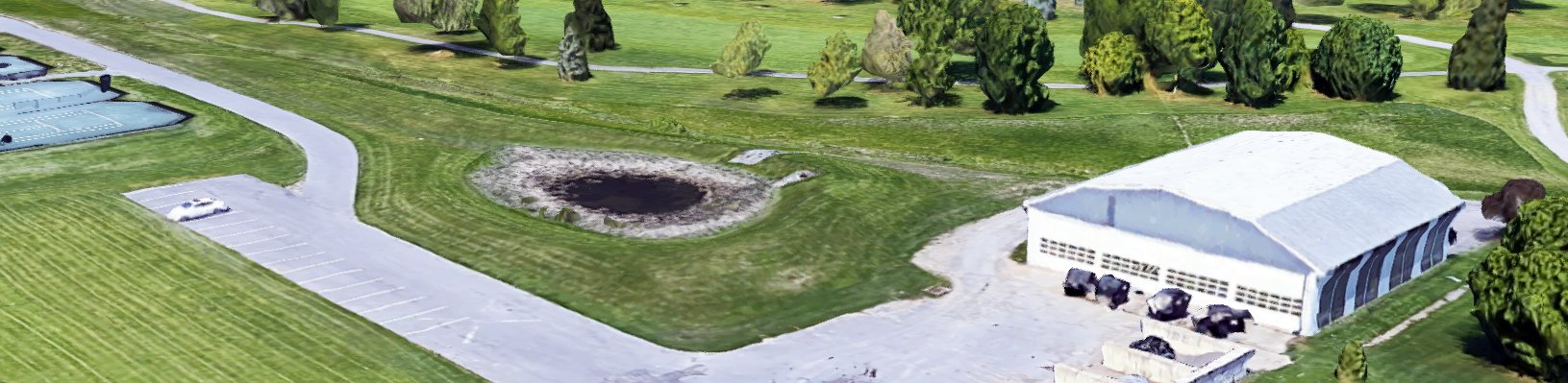
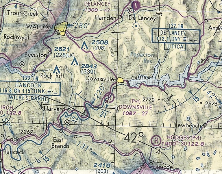
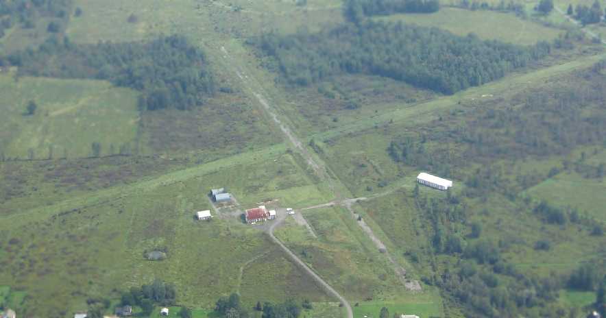
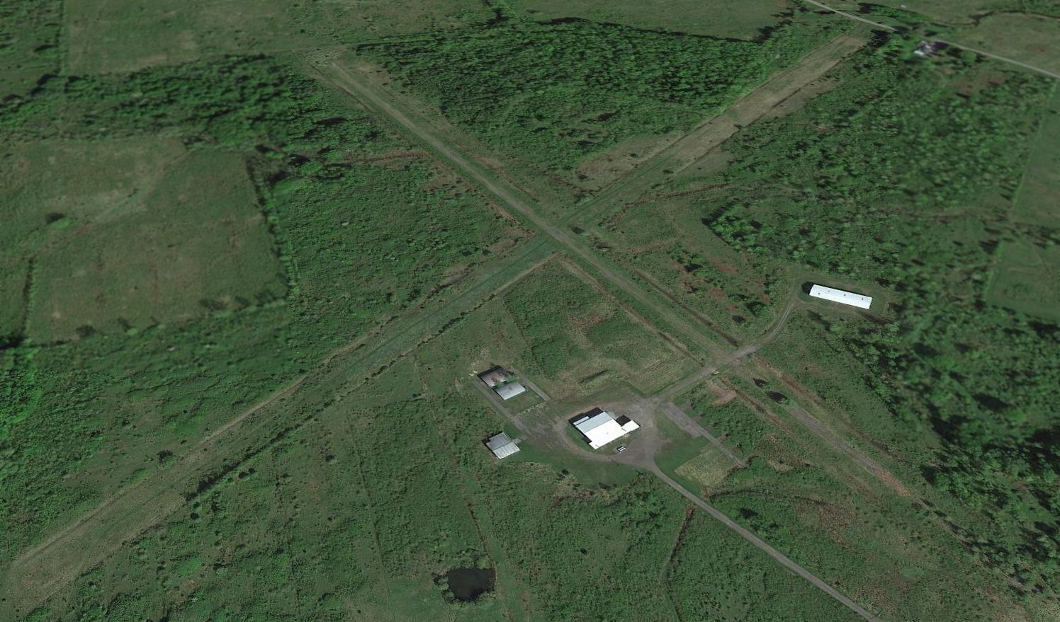
Downsville Airport, Downsville, NY
42.055, -75.013 (Southwest of Albany, NY)
Downsville Airport, as depicted on the January 1950 Albany Sectional Chart.
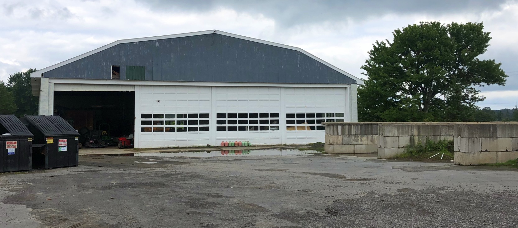
Photo of the airport while in use has not been located.
According to Paul Berge's 7/6/18 AvWeb article “Not Doing The Lindy Hop” (courtesy of Dave Slosson), Gary Klindt's grandfather opened Downsville Airport in 1947.
However, Downsville Airport was not yet depicted on the January 1948 Albany Sectional Chart.
The earliest depiction which has been located of Downsville Airport was on the January 1950 Albany Sectional Chart,
which depicted Downsville as having a 2,700' unpaved runway.
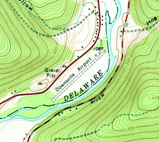
The 1965 USGS topo map depiction Downsville Airport as having a northeast/southwest unpaved runway, with a small building on the north side.
The last aeronautical chart depiction which has been located of Downsville Airport was on the June 1981 Albany Sectional Chart.
Downsville's status had evidently changed to a private airfield, and it was depicted as having a 2,700' unpaved runway.
Downsville Airport evidently closed at some point between 1971-93,
as it was no longer depicted on the December 1993 Albany Sectional Chart, or subsequent aeronautical charts.
However other sources indicate Downsville Airport may have continued to operate in an unofficial capacity.
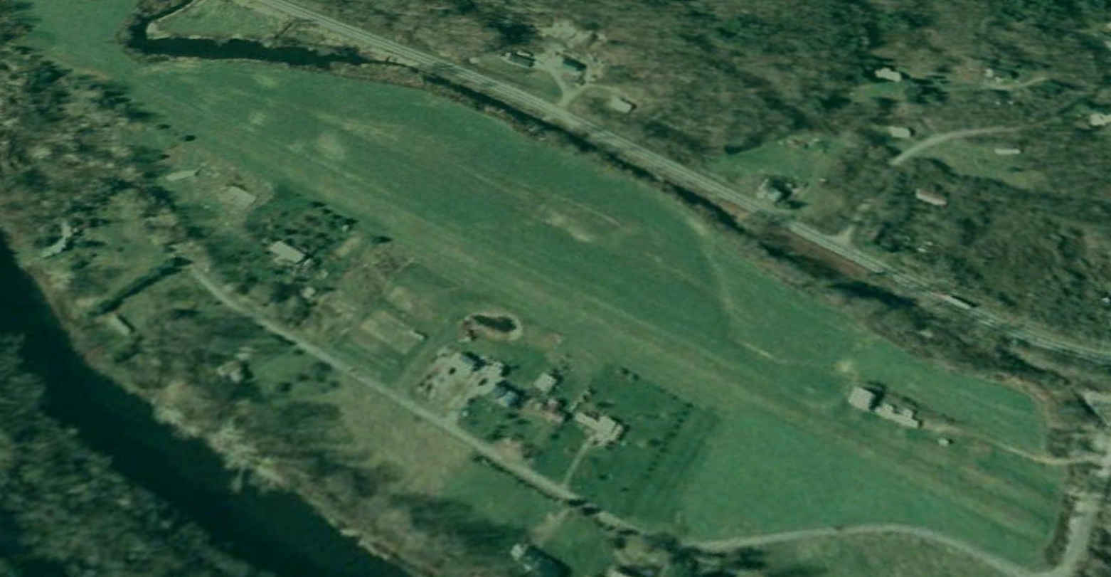
The earliest photo which has been located of Downsville Airport was a 2006 aerial view looking west.
It depicted Downsville northeast/southwest unpaved runway, with 3 small hangars & a even smaller building on the north side.
According to Paul Berge's 7/6/18 AvWeb article “Not Doing The Lindy Hop” (courtesy of Dave Slosson),
“Until it closed in 2016, three generations of Klindts learned to fly there [at Downsville Airport], Gary being the last.
America is dotted with the unmarked graves of dead air fields.
Klindt Field was dead but as yet unburied. Its grass runway was overgrown and staked with survey flags where solar panels would soon be installed in an effort to harvest the sun & tax credits.
We stepped from Gary’s pickup truck & walked through the tall grass, in the company of summer wind & birds.
A good mower could easily bring back the runway, and a can of LPS-3 on the hangar door hinges would have this old airfield back on the Sectional, where it would... Would what?
Yeah, grass runways are the backyard of my soul, but in the National Airspace scheme, it’s tough to sell romance to customers breathing kerosene & Wi-Fi. I want neither.
This dead airport was little different from hundreds of other memories I’ve explored.
A few empty hangars & a lone administration building little bigger than an outhouse were the only clues that for 70 years this had been a place where humans left the planet with arrogant impunity.
How I hate to see that arrogance die. Sure, there are thousands of airports with miles of paved runways, launching ambitions to heights above the tallest clouds.
But, these vanishing airfields with their weathered shacks & grass-stained lore draw me like that house fly to my Citabria. Pointless but irresistible.”
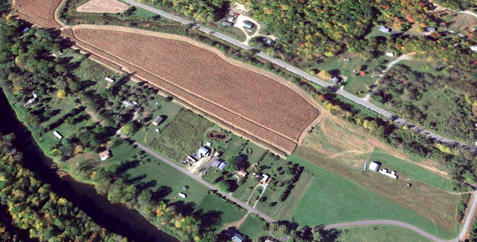
A 2016 aerial view looking west showed Downsville Airport's runway had mostly been planted with crops,
but the the 3 small hangars & other smaller building remained on the north side.
A 2018 photo of Paul Berge in front of the building & hangars at Downsville Airport.
The site of Downsville Airport is located west of Airport Road, appropriately enough.
Thanks to Dave Slosson for pointing out this airport.
____________________________________________________
Cooperstown Airport, Cooperstown, NY
42.714, -74.951 (West of Albany, NY)
Cooperstown Airport, as depicted on the May 1957 Albany Sectional Chart.
Photo of the airport while in use has not been located.
The original airport for the town of Cooperstown was located to the northwest of the town.
Cooperstown Airport was evidently established at some point between 1955-57,
as it was not yet depicted on the 1955 Albany Sectional Chart.
The earliest depiction which has been located of Cooperstown Airport was on the May 1957 Albany Sectional Chart,
which depicted Cooperstown as having a 2,500' unpaved runway.
Cooperstown Airport was not depicted at all on 1960/70/92 USGS topo maps.
Ian Barren recalled, “The old airport in Cooperstown... My father recalls flying into there in 1968-71.”
John King recalled, “The old Cooperstown Airport... It was still on the New York Sectional Chart in the early 1970s but I think it had been closed.”
The last aeronautical chart depiction which has been located of Cooperstown Airport was on the June 1973 NY Sectional Chart,
which depicted it as having a mere 1,400' unpaved runway.
Cooperstown Airport was definitely closed by 1979, as it was no longer depicted on the 1979 NY Sectional Chart.
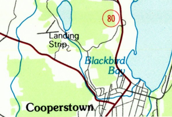
The 2 runways of Cooperstown Airport were still depicted on the 1985 USGS topo map, but it was labeled simply as “Landing Strip”,
which most likely indicates the airport was closed by that point.
The earliest photo which has been located of Cooperstown Airport was a 5/7/88 USGS aerial view.
It depicted 2 unpaved runways, with closed-runway “X” symbols visible on the northeast & east ends.
There were no buildings on the site, nor any indication recent aviation use.
A 1997 USGS aerial view (courtesy of Lee Corbin) depicted Cooperstown Airport as having 2 unpaved runways.
A building on the south side had apparently been added at some point between 1988-97, after the airport's closure.
A 2015 aerial view of the Cooperstown Airport site showed that the 2 unpaved runways were still recognizable though overgrown.
The site of Cooperstown Airport is located at the terminus of Old Airport Road, appropriately enough.
Thanks to Ian Baren & Lee Corbin for pointing out this airport.
____________________________________________________
42.453, -75.013 (Northeast of Binghamton, NY)
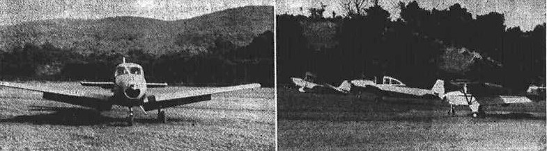
A pair of undated photos of a Navion & several other light single-engine planes from a 7/12/59 article announcing F&F Air Park's formal opening (courtesy of Todd Keator).
According to the Town of Oneonta, “In 1959 Elise Young & her husband Albert Fortin decided to try their hand at operating an airport.
They cleared acres of thorn apple trees & graded a runway 2,400' long.”
According to an article (courtesy of Todd Keator), F&F Air Park was formally opened on 7/12/59.
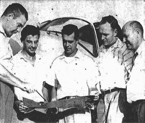
An undated photos of pilots from a 7/12/59 article announcing F&F Air Park's formal opening (courtesy of Todd Keator).
They are Fred Mann, Harold Felske, Albert Fortin, Gunnar Wahlberg, and George Tillapaugh.
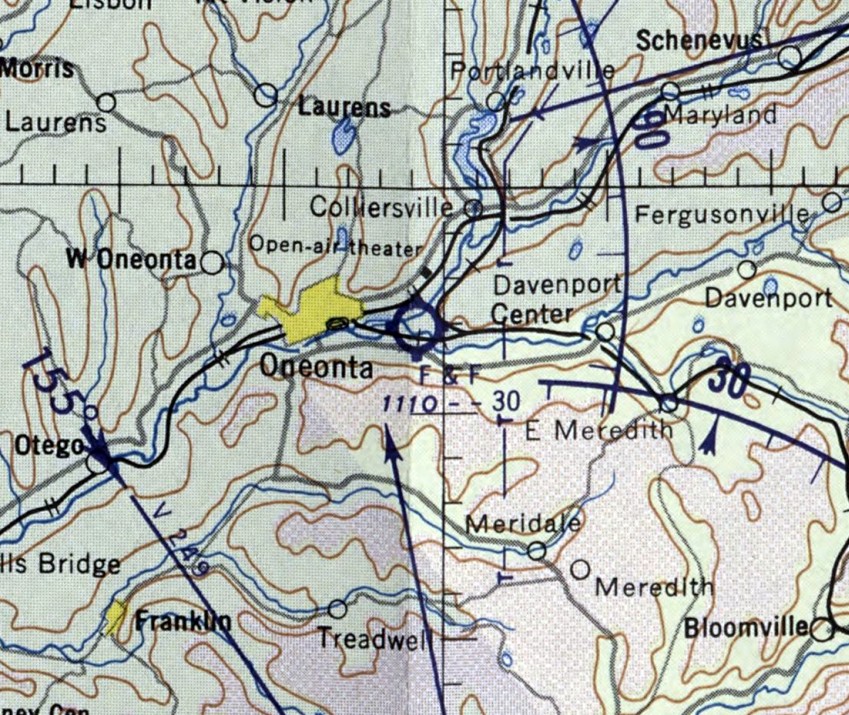
The earliest aeronautical chart depiction which has been located of F&F Airpark was on the May 1960 Albany Sectional Chart.
It depicted F&F as having a 3,000' unpaved runway.
According to the Town of Oneonta, “The airport thrived during the 1960s & 1970s, with several instructors training students,
and many local aircraft owners using the field for recreational flying, fly-in breakfasts and the like.
Governor Rockefeller once flew in to F&F Airpark in his Beech 18.”
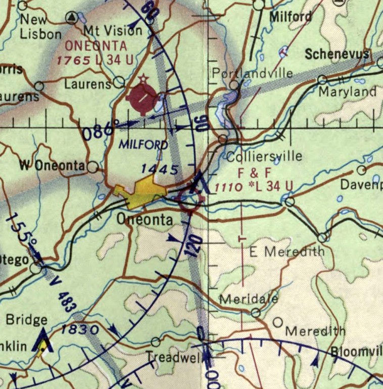
The February 1970 Albany Sectional Chart depicted F&F as having a 3,400' unpaved runway.
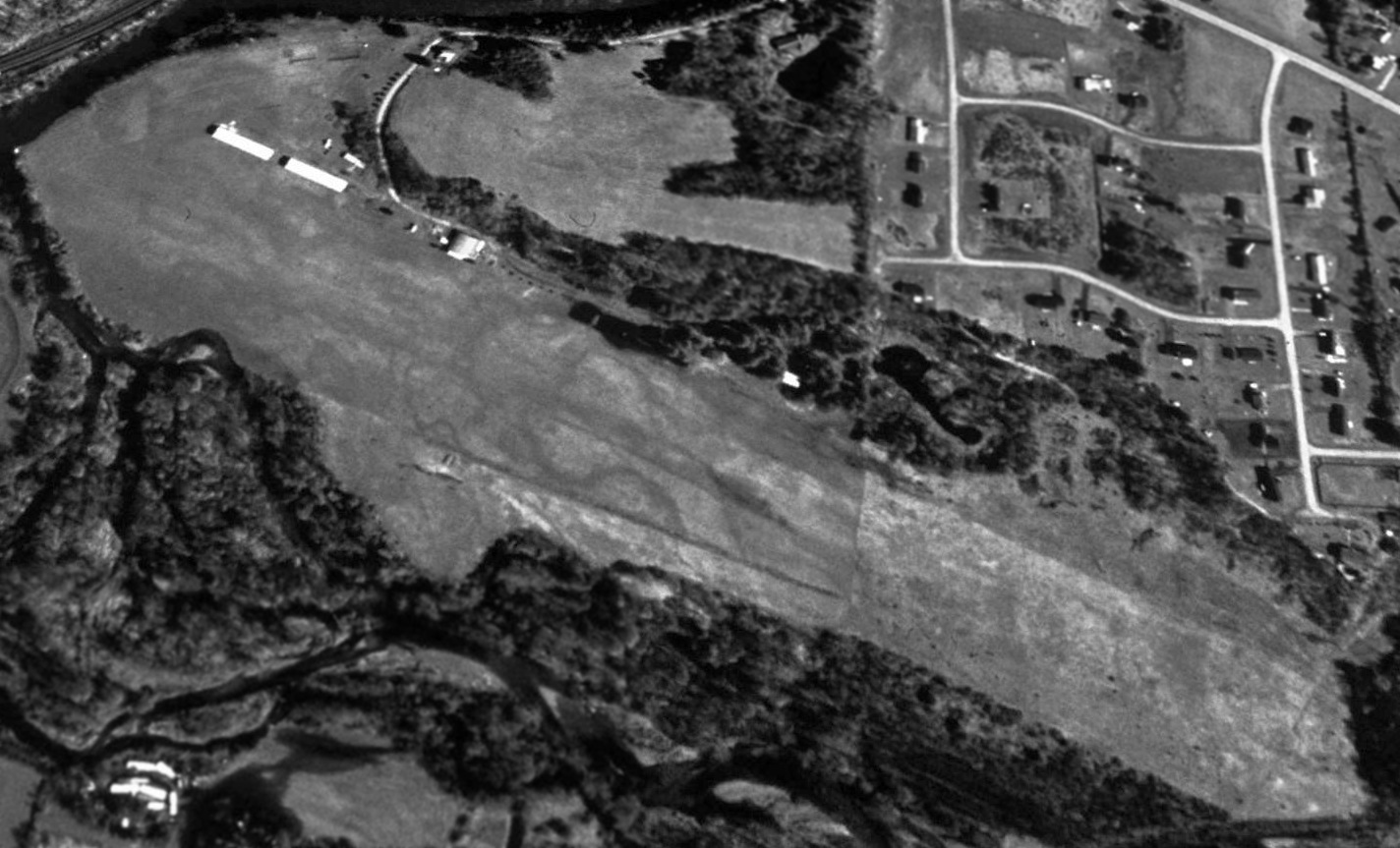
A 1998 USGS aerial view depicted F&F Air Park as having a single unpaved northwest/southeast runway, with several hangars on the north side.
There were no aircraft visible on the field.
According to the Town of Oneonta, “The Fortins operated the small airport to 2000.
In 2000, the Town purchased the airport & made it a town park.
The converted runway space features large, flat, open, grassy spaces, with pavilions, barbecues,
and former aircraft hangars used for skating in the winter & available for other activities in the summer months.”
F&F Airpark continued to be depicted on the May 2001 NY Sectional Chart (courtesy of Ron Plante),
even though it had been reported converted into a park the year before.
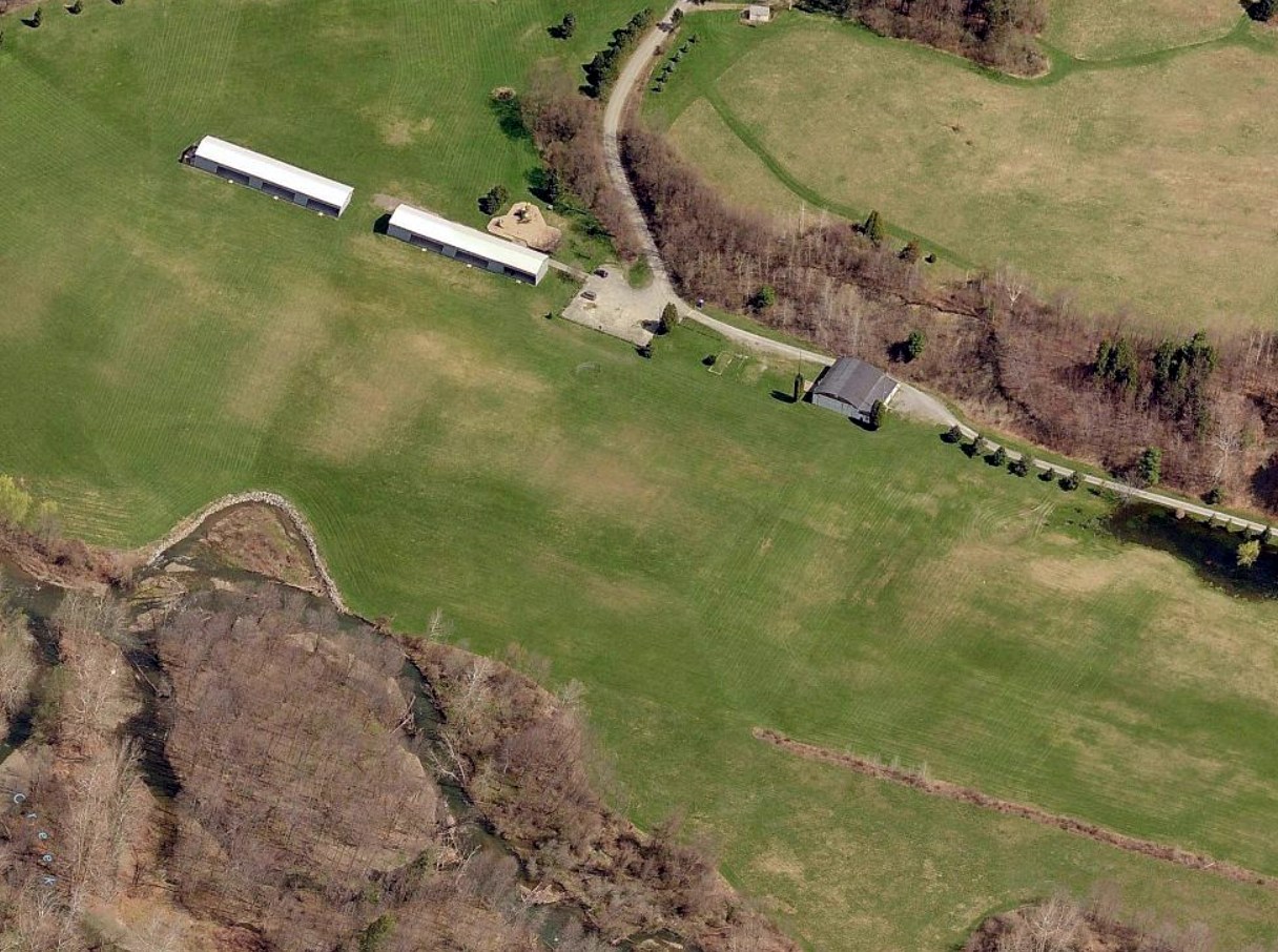
A circa 2012 aerial view looking north showed 3 hangars along the north side of F&F Air Park's grass runway.
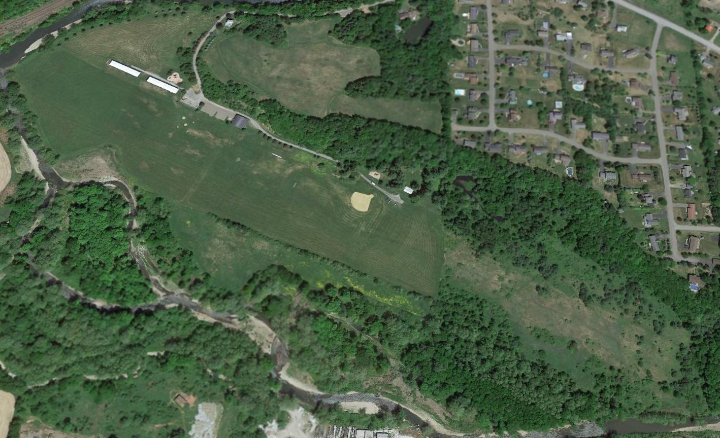
A 2015 aerial view showed F&F Air Park remained clear, but the southeast portion of the runway was overgrown.
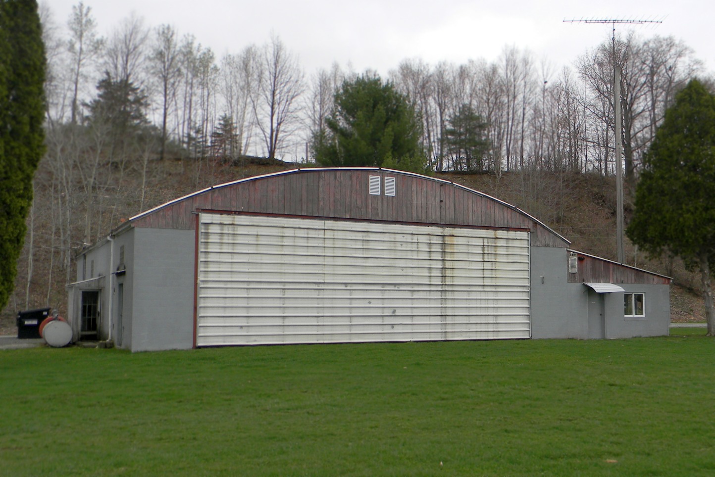
A 4/21/17 photo by Todd Keator looking northeast at the largest remaining hangar at the site of F&F Air Park showed it remained in fine condition.
A 4/21/17 photo by Todd Keator looking northwest at the 2 long remaining hangars at the site of F&F Air Park showed their doors had been removed, and they had been repurposed as picnic table shelters.
As of 2017, street maps label the site of F&F Air Park as Fortin Park, commemorating the airport's founders.
The site of F&F Air Park is located at the terminus of Youngs Road.
Thanks to Todd Keator for pointing out this airport.
____________________________________________________
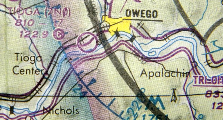
42.084, -76.304 (West of Binghamton, NY)
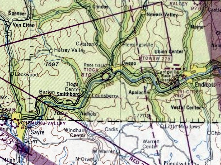
Tioga Airport, as depicted on the January 1948 Albany Sectional Chart.
Photo of the airfield in use has not been located.
This small general aviation airport was evidently established at some point between 1947-48,
as it was not yet depicted on the July 1947 Albany Sectional Chart.
Carol Spencer recalled, “I was born in 1947 & lived in the house at Tioga Airport (long before there was the trailer park in the back).
I took my first airplane ride when I was 4 months old. My father, Albert (Dick) Spencer, taught flying there until we moved in approximately 1953.
I can remember flying with my father, sometimes doing wingovers & all sorts of crazy stuff.
I know there were a couple of air shows there.”
The earliest depiction which has been located of Tioga Airport was on the January 1948 Albany Sectional Chart.
It depicted Tioga as a commercial/municipal airport.
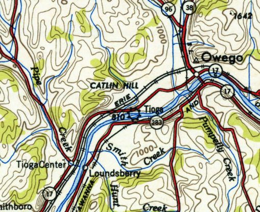
The 1950 USGS topo map depicted Tioga as a commercial/municipal airport.
The 1956 USGS topo map depicted Tioga Airport as having a single unpaved northeast/southwest runway,
with a few small buildings on the northeast side.
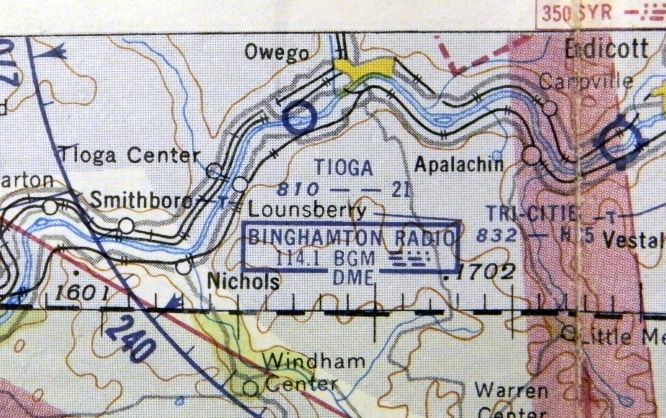
The January 1957 NY Sectional Chart (courtesy of Todd Keator) depicted Tioga Airport as having a 2,100' unpaved runway.
The last aeronautical chart depiction which has been located of Tioga Airport was on the May 1992 NY Sectional Chart (courtesy of Todd Keator).
The depicted runway length had decreased to a mere 1,700'.
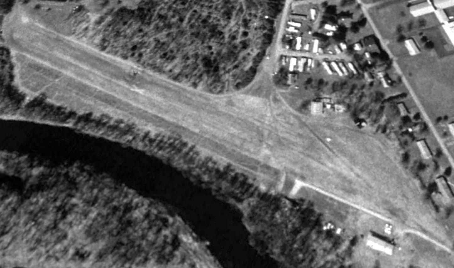
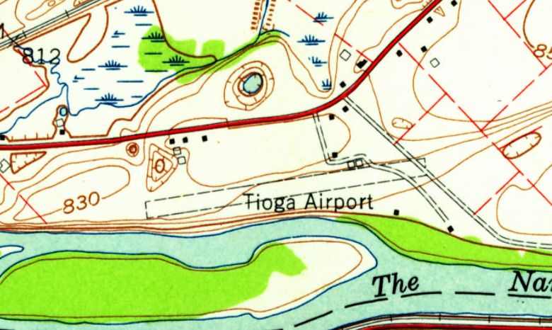
The earliest photo which has been located of Tioga Airport was a 1995 USGS aerial view looking northwest.
Tioga Airport may have been closed at some point between 1992-95,
as a closed-runway “X” symbol was visible along the runway midpoint, and no aircraft were visible on the field.
Tioga Airport was definitely closed by 1996, as it was no longer depicted on the May 1996 NY Sectional Chart (according to Todd Keator).
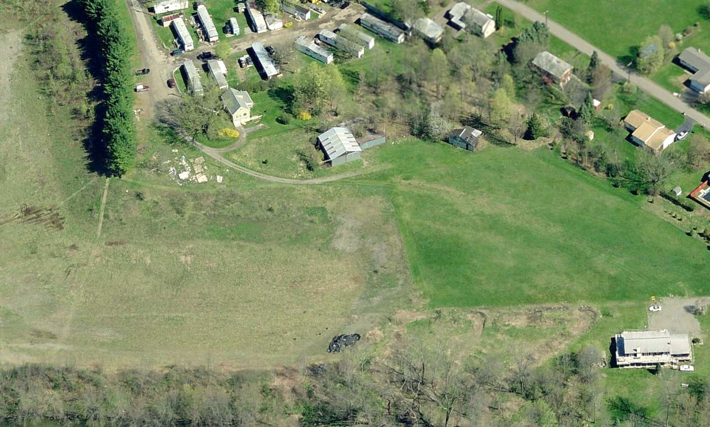
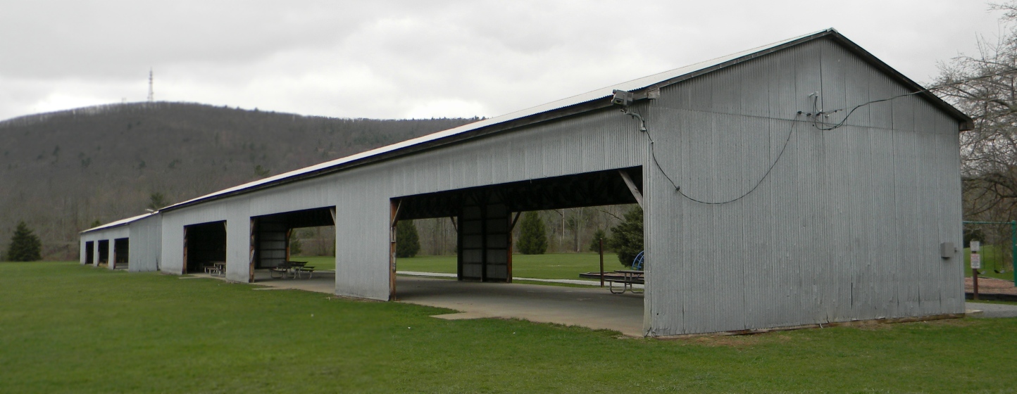
A circa 2010 aerial view looking north showed 2 hangars remaining on the northeast side of Tioga Airport's grass runway.
A 2013 aerial view looking northwest shows the former Tioga Airport runway remains intact, though no longer recognizable as a runway.
The 2 hangars remained standing on the northeast side.
The site of Tioga Airport is located at the southern terminus of Airways Road, appropriately enough.
Thanks to Todd Keator for pointing out this airport.
____________________________________________________
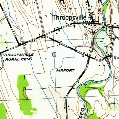
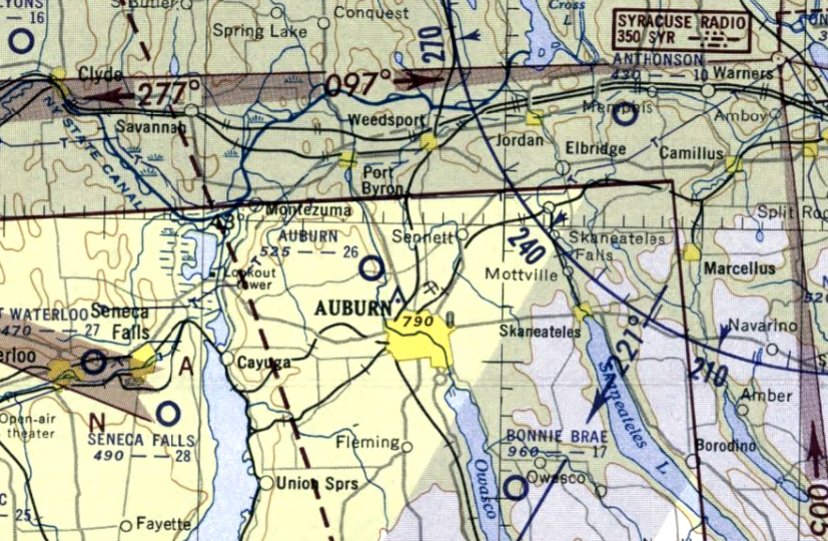
Auburn Airport, Throopsville, Fulton, NY
42.967, -76.608 (West of Syracuse, NY)
Auburn Airport, as depicted on the September 1942 Albany Sectional Chart.
No airfield was yet depicted at this location on the 1939 USGS topo map nor on the January 1940 Albany Sectional Chart.
According to the book “A Scrapbook History of the Auburn Aviation Company Inc. & the Auburn Airport at Throopsville 1941-52” by Robert Ingalls,
Auburn Airport began operations in 1941, operated by Auburn Aviation Company.
The earliest depiction which has been located of Auburn Airport was on the September 1942 Albany Sectional Chart.
It depicted Auburn as a commercial/municipal airport.
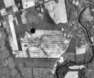
The earliest photo which has been located of Auburn Airport was a 10/3/42 aerial view in the 1945 AAF Airfield Directory (courtesy of Scott Murdock).
It depicted Auburn as having 3 unpaved runways.
The 1943 USGS topo map depicted Auburn Airport as an irregularly-shaped property outline
with one small building along the northeast side.
The 1945 AAF Airfield Directory (courtesy of Scott Murdock) described Auburn Airport
as a 128 acre irregularly-shaped property having 3 sod runways, the longest being a 2,750 west-northwest/east-southeast strip.
The field was said to have a single 78' x 68' wood & metal hangar, and to be owned & operated by private interests.
According to the book “A Scrapbook History of the Auburn Aviation Company Inc. & the Auburn Airport at Throopsville 1941-52” by Robert Ingalls,
Auburn Airport ceased operations in 1952.
The last aeronautical chart depiction which has been located of Auburn Airport was on the December 1952 Albany Sectional Chart.
It depicted Auburn as having a 2,600' unpaved runway.
The 1953 USGS topo map continued to label the site as “Airport”.
Auburn Airport was no longer depicted on the May 1953 Albany Sectional Chart or the 1955 USGS topo map.
A 5/6/57 USGS aerial photo depicted a clearing at the site of Auburn Airport, but nothing recognizable as an airport.
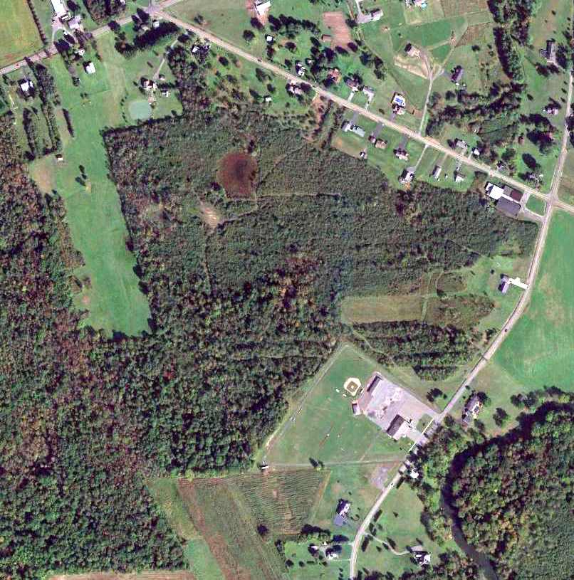
A 9/24/13 aerial view showed no trace remaining of Auburn Airport.
The site of Auburn Airport is located southwest of the intersection of Beech Tree Road & North Division Street.
Thanks to Robert Dunbar for pointing out this airport.
____________________________________________________
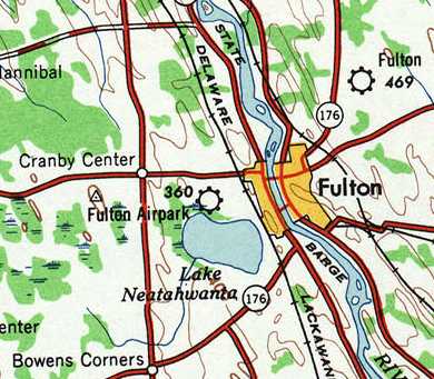
Mangeot Field / Holly Brothers Airport / Reid Airport / Fulton Auxiliary Field / Fulton Airpark, Fulton, NY
43.32, -76.44 (Northwest of Syracuse, NY)
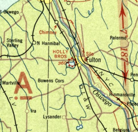
Holly Brothers Airport, as depicted on the June 1933 Albany Sectional Chart.
This property was originally located on the Mangeot Farm, which was the origin of the airport's original name, Mangeot Field.
The date of establishment of Mangeot Field has not been determined.
According to Mark Hess, “The airport was operating unofficially on Mangeot Farm, north of Phillips Street on State Route 3.”
According to a 1935 article (courtesy of Mark Hess), Holly Brothers Incorporated was formed early in 1930 by Leon & Henry Holly.
This corporation acquired what was then a meadow on the north side of Phillips street and proceeded to make a real airport of it.
The first airplane was bought to Fulton in August 1930, and the first hangar ever to erected in Fulton was constructed & housed the corporation's plane.
The earliest depiction which has been located of Holly Brothers Airport was on the June 1933 Albany Sectional Chart.
It depicted Holly Brothers Airport as a commercial/municipal airport.
According to a 1935 article (courtesy of Mark Hess), Leon Holly became the first Fulton resident to procure a commercial license.
His tragic death in an air crash on 5/6/34 put a stop to all air activities for some time.
In June 1934, the Fulton airport became a TERA project.
This was the result of continuous effort of the Fulton Kiwanis Club, which sponsored this as one of their projects.
Carl Worden & Dwight Murphy were in charge of TERA work at the airport.
According to Mark Hess, “This airport had a seaplane port on Lake Neatahwanta (end of Phillips Street towards the lake).
Official dedication of Holly Airport was 6/1/35.
It was used primarily for the 27th Division, Air Service Detachment, New York National Guard.
It was an Army Airfield for Coast Artillery practice of Fort Ontario in Oswego.
There was also a Civil Air Patrol Squadron & a Civilian Pilot Training Program based at [the] airport during WWII.”
The earliest photo which has been located of Reid Airport
was a 10/3/42 aerial view looking west in the 1945 AAF Airfield Directory (courtesy of Scott Murdock).
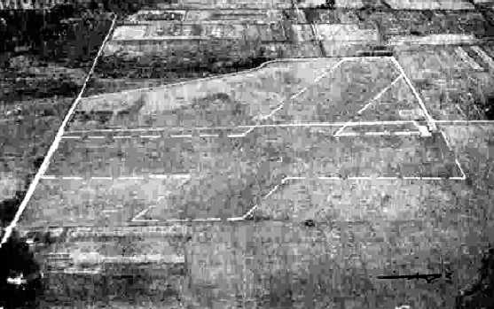
It depicted “Reid Airport (Fulton Auxiliary Field)” as having 2 unpaved runways.
Reid Airport was not yet depicted on the 1943 USGS topo map.
The 1945 AAF Airfield Directory (courtesy of Scott Murdock) described “Reid Airport (Fulton Auxiliary Field)”
as a 56 acre rectangular property having 2 sod runways, measuring 2,000' north/south & 1,800' northwest/southeast.
The field was said to have 3 hangars, the largest being a 75' x 55' wood & metal structure.
Fulton Airpark was described as being owned & operated by private interests.
At some point between 1945-47 the airport was evidently renamed Fulton Airpark,
as that is how it was depicted on the 1947 USGS topo map.
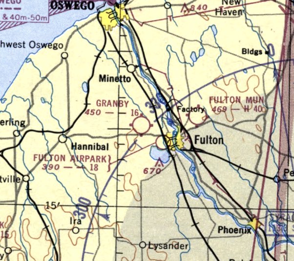
The last depiction which has been located of Fulton Airpark was on the January 1952 Albany Sectional Chart.
described Fulton Airpark as having an 1,800' unpaved runway.
According to Mark Hess, the Fulton Airpark ceased operation in 1952
(for reasons unknown, but presumably due to competition from the larger Fulton Municipal Airport on the east side of town).
Fulton Airpark was no longer depicted on the 1955 USGS topo map or the May 1955 Albany Sectional Chart.
By the time of a 1994 USGS aerial photo, the runways of Fulton Airpark were overgrown & no longer recognizable.
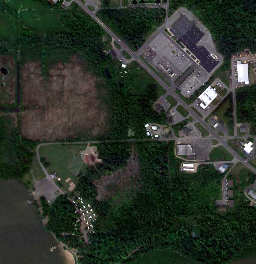
A 6/23/10 aerial view of the site of Fulton Airpark.
Mark Hess observed in 2011 that “The hangars were located where the big rectangle building (Pyramid Mall) & parking lot are located on State Route 3 (right side).”
The site of Fulton Airpark is located west of the intersection of Route 3 & Preston Street.
____________________________________________________
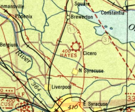
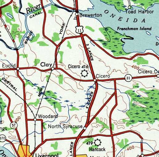
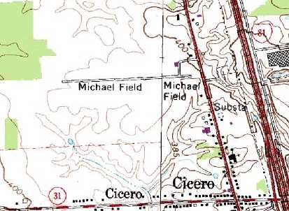
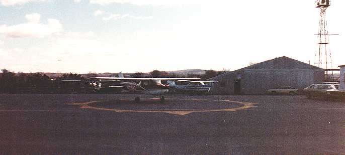
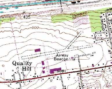
Hayes Airport / Cicero Airpark / Michael Field, Cicero, NY
43.18, -76.128 (North of Syracuse, NY)
Hayes Airport, as depicted on the June 1933 Albany Sectional Chart.
Hayes Airport was reportedly established in 1929.
This was the first name of the airport on Route 11, 3/4 mile north of the Four Corners.
The earliest depiction which has been located of Hayes Airport was on the June 1933 Albany Sectional Chart.
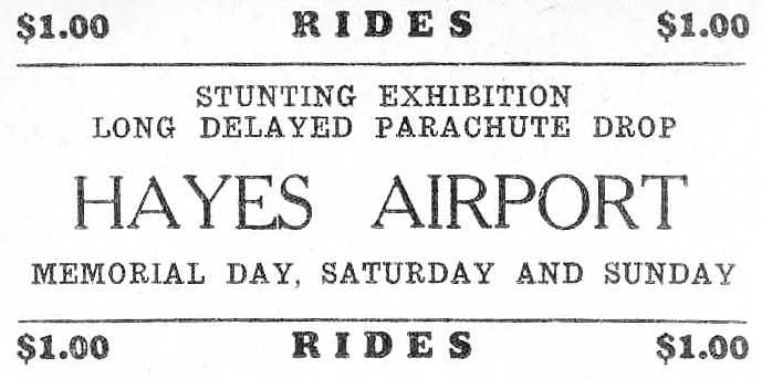
A circa 1930s advertisement for Hayes Airport.
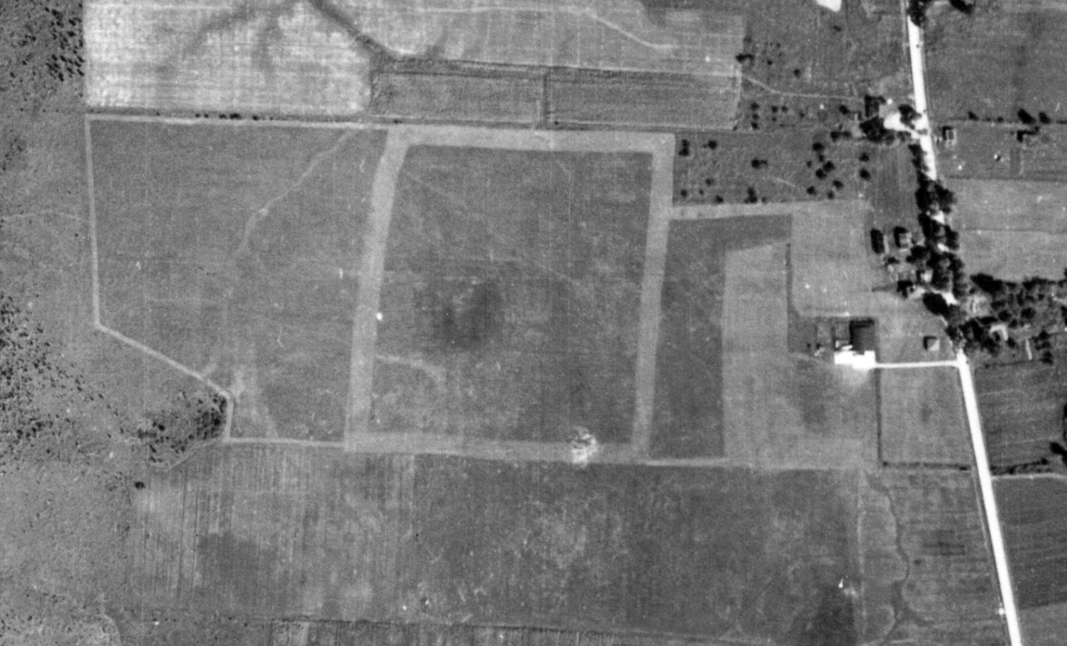
The earliest photo which has been located of Hayes Airport was a 9/6/38 aerial view.
It depicted Hayes Airport as having a grass landing area, with a hangar (& possibly 2 light single-engine aircraft) on the east side.
Hayes Airport was evidently closed (for reasons unknown) at some point between 1933-40,
as it was not depicted at all on the January 1940 Sectional Chart.
At some point between 1940-45 the airport was evidently reopened under the name of Cicero Airport,
as that is how it was depicted on the May 1945 Albany Sectional Chart.
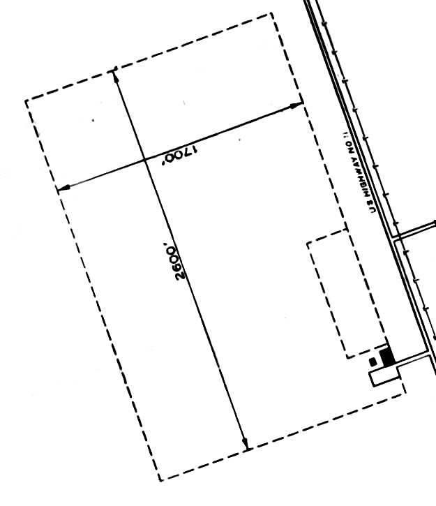
The 1945 AAF Airfield Directory (courtesy of Scott Murdock) described Cicero Airport as a 100 acre rectangular property
having a turf all-way field measuring 2,600' northwest/southeast by 1,700' northeast/southwest.
A single 100' x 60' concrete block hangar & another building were depicted on the southeast side.
The field was described as being owned & operated by private interests.
It was depicted as Cicero Airport on the 1947 USGS topo map.
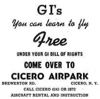
A circa 1940s ad for flight training at Cicero Airpark.
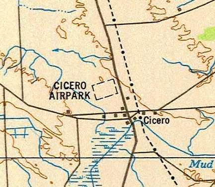
The 1949 USAF Target Complex Chart (courtesy of Chris Kennedy) depicted “Cicero Airpark” as a rectangular outline.
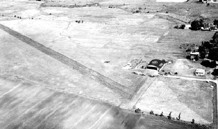
A 1951 aerial view looking northwest at Cicero Airpark (courtesy of Mark Hess)
depicted the field as having a single east/west runway, with an arch-roof hangar on the northeast side.
Vince Sbardella recalled, “The Cicero Airport [was] where I acquired my private pilot's license in 1955.”
A 1956 aerial photo depicted 2 single-engine aircraft parked around Cicero's hangar.
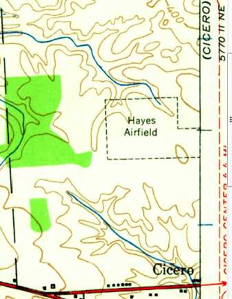
The 1957 USGS topo map depicted “Hayes Airfield” as an irregularly-shaped property outline.
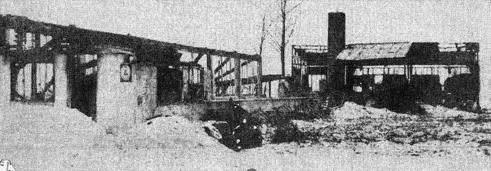
An undated photo of the twisted skeleton of the Cicero Airpark hangar from a January 1959 fire.
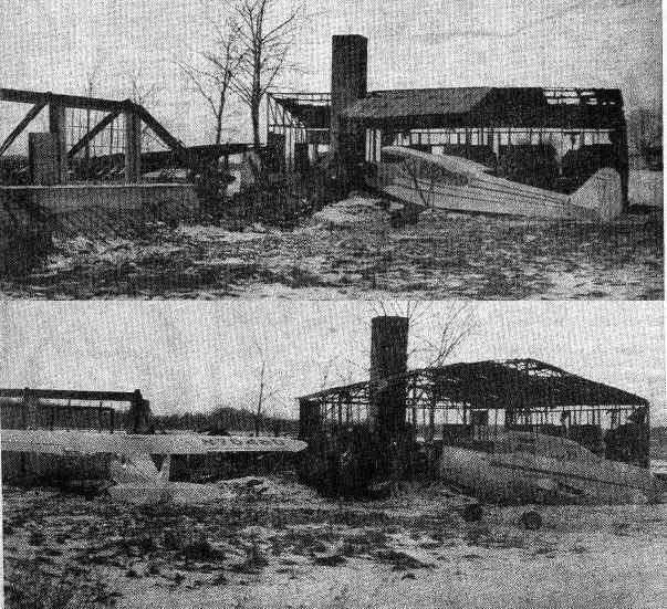
Two undated photos of 2 aircraft in front of the twisted skeleton of the Cicero Airpark hangar from a January 1959 fire.
It was still depicted as Cicero Airport on the 1964 Albany Sectional Chart.
It was evidently renamed Michael Field at some point between 1964-67,
as that is how it was labeled on the 1967 Albany Sectional Chart.
It described Michael Field as having a 3,000' unpaved runway.
The 1969 Albany Sectional Chart depicted Michael Field as having a 2,600' paved east/west runway.
The last aeronautical chart depiction which has been located of Michael Field was on the February 1970 Albany Sectional Chart.
A 1972 aerial photo showed 11 single-engine aircraft parked on the northeast side of the field.
The 1978 USGS topo map depicted Michael Field as having a single east/west runway, with a single hangar on the northeast side.
According to Tony Alesci, “Michael Field was last run as an active airport by William 'Bill' Michael & his son Michael 'Mickey'.
Bill died in the early 1990s & Mickey continued to run it afterwards.
It was a one-man show. Mick did it all from aircraft maintenance to mowing the lawn & the flight instruction.
In the mid-1990s snow collapsed his hangar ruining several of his aircraft.”
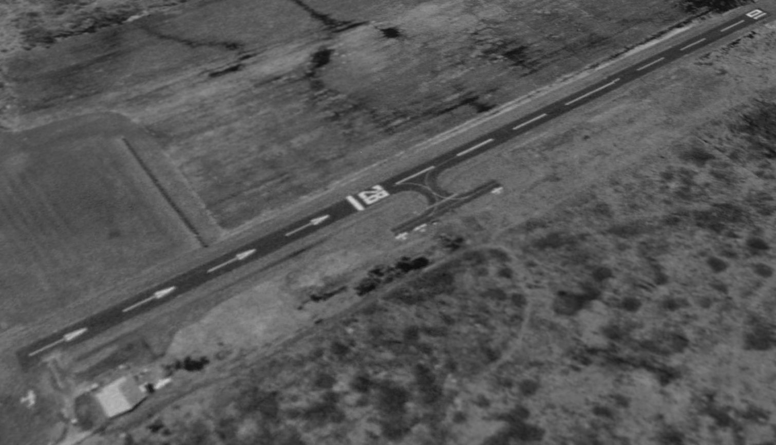
A 1995 USGS aerial view looking southwest depicted Michael Field as having an asphalt east/west runway.
An asphalt parking ramp had been added along its north midpoint at some point between 1972-95.
A total of 5 single-engine aircraft were visible on the field.
Runway 28 had a significantly displaced threshold nearly halfway down its runway length.
According to Tony Alesci, “Sadly in the late 1990s Mickey fell victim to carbon monoxide while flying, crashed and died.
There was no one to take Mickey's place & the airport though legally open was dormant.”
Felix Geraets recalled, “Cicero airfield was operated by Bill Michael's son for a couple of years.
He got killed in an accident. After that,nobody took over & the airport went downhill fast.”
According to Peter Ricciardiello, Michael Field's Runway 28 displaced threshold “was most probably due to the proximity of both the busy 2-lane Brewerton Rd
and the power lines that paralleled this street, both of which ran perpendicular & close to the runway.”
When I was finishing up my Private pilot certificate out of nearby Syracuse Hancock International in 2002,
my instructor would take me to Michaels Field to practice short-field landings & takeoffs in the school’s Cessna 172.
KSYR’s Class C airspace had a very small semi-circle carved out of the inner shelf for this airport.”
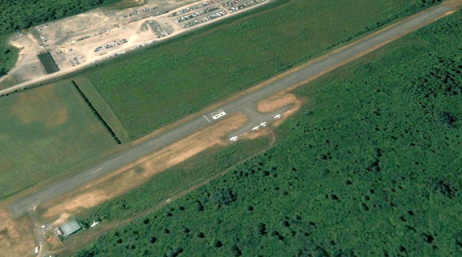
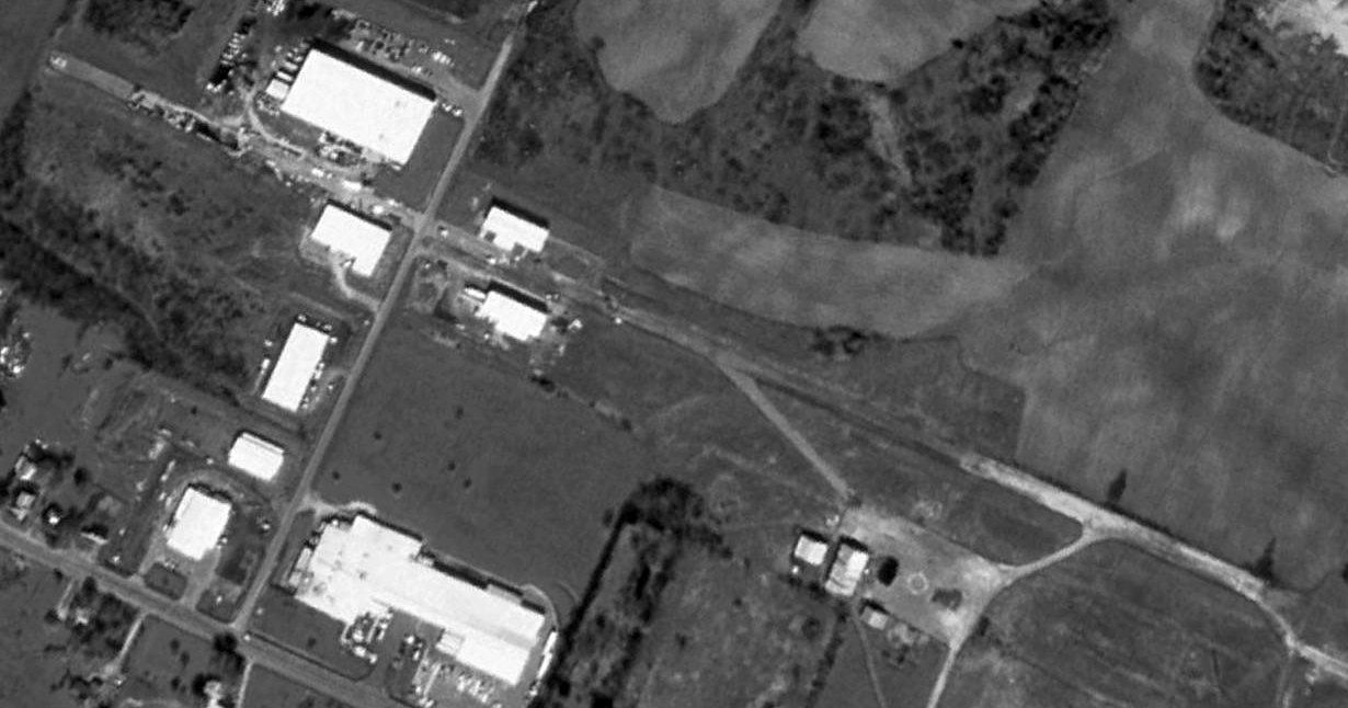
Perhaps the peak of Micheal Field's usage was seen on a 7/13/05 aerial view looking southwest,
in which a total of 6 light aircraft were visible on the field.
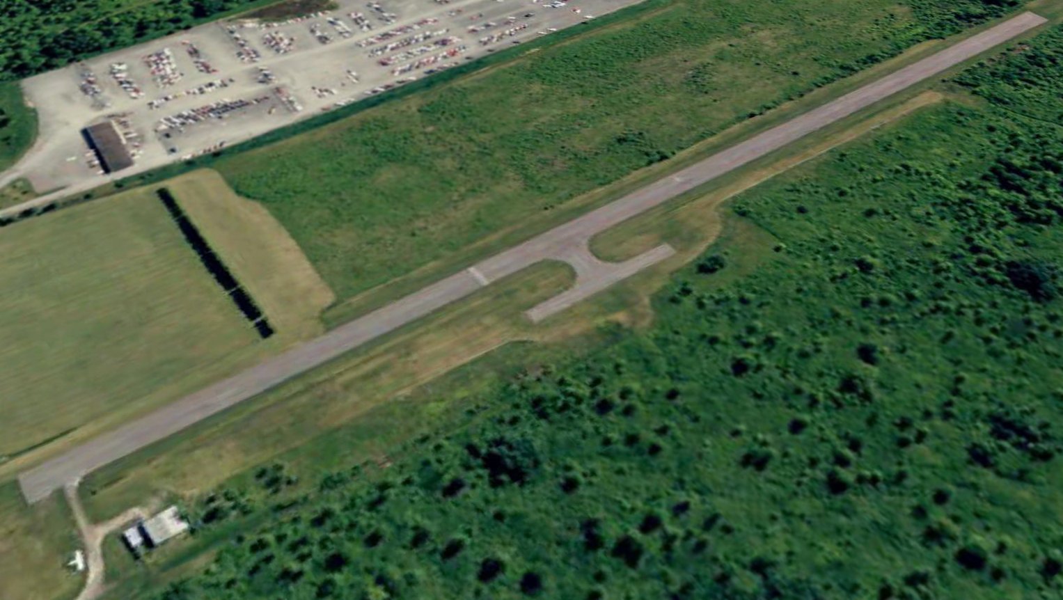
A circa 2008 aerial view looking north at the Micheal Field runway & hangar, with a tailless light aircraft next to the hangar.
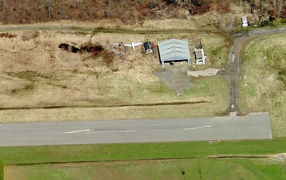
The last photo which has been located showing an aircraft at Micheal Field was a 5/4/09 aerial view looking southwest.
One aircraft (missing its horizontal stabilizer) was parked near the hangar (bottom-left), but the runway numbers were no longer visible.
Micheal Field was evidently closed (for reasons unknown) at some point between 2009-2010, as a 6/3/10 aerial view looking southwest
showed closed-runway X symbols painted along the runway, and no aircraft on the field.
As of 2011, street maps labeled the site as “Michael Field – Onondaga Flight School Airport”.
Tony Alesci reported in 2012, “A few years back a couple of men bought the place as well as Syracuse Suburban Airport.”
A 2015 aerial view showed Michael Airport remained in an unchanged configuration.
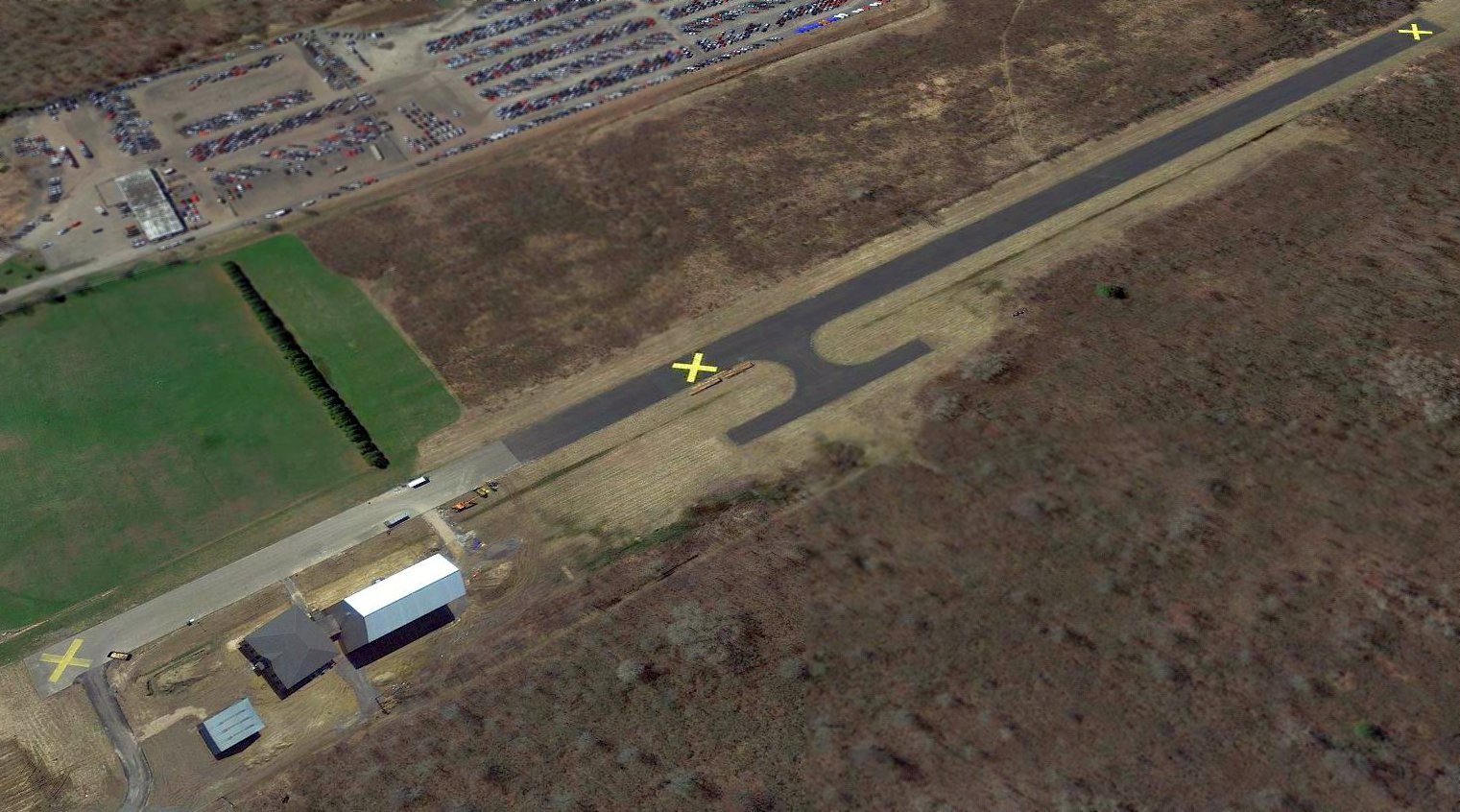
A 2017 aerial view looking southwest showed Michael Field's runway & hangar remained intact,
but 2 buildings had been built adjacent to the northeast side of the runway at some point between 2015-2017.

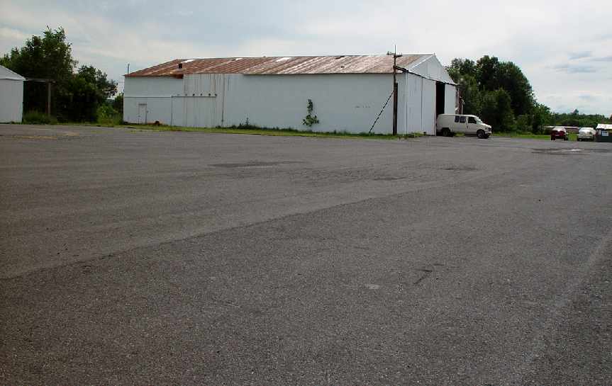
A 4/13/18 photo by Ron Plante of the sign for Michael Airfield.
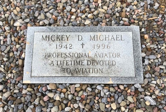
A 4/13/18 photo by Ron Plante of Mickey Michael's memorial plaque at Michael Airfield.
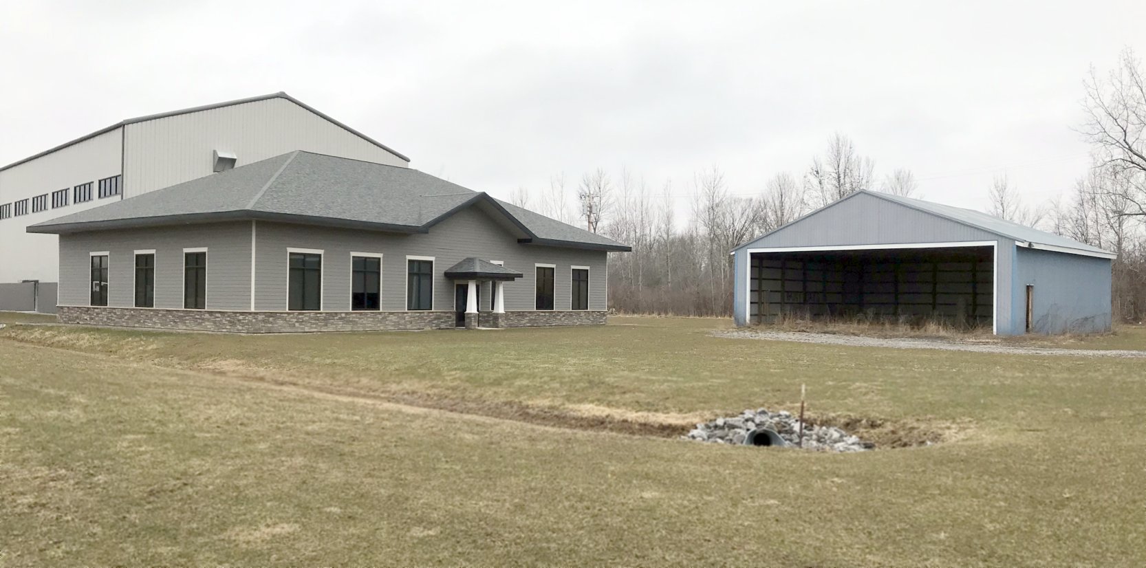
A 4/13/18 photo by Ron Plante of a hangar & 2 newer buildings at Michael Airfield.
A 4/13/18 photo by Ron Plante looking west along Michael Airfield's former Runway 28, showing 2 buildings which were built after the airport's closure.
The site of Michael Field is located northwest of the intersection of Route 31 & Route 11.
____________________________________________________
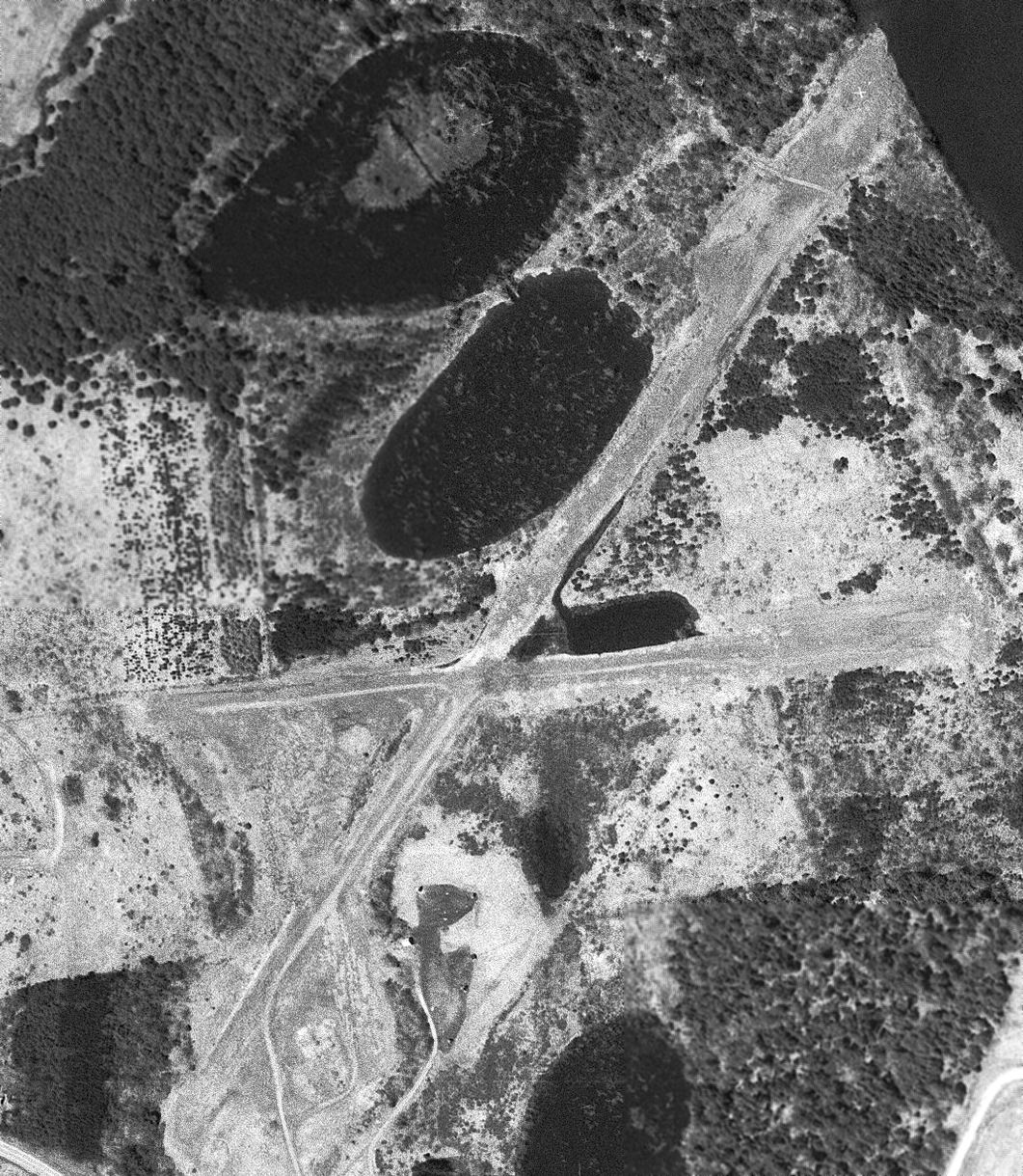
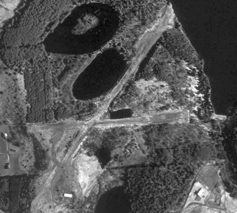
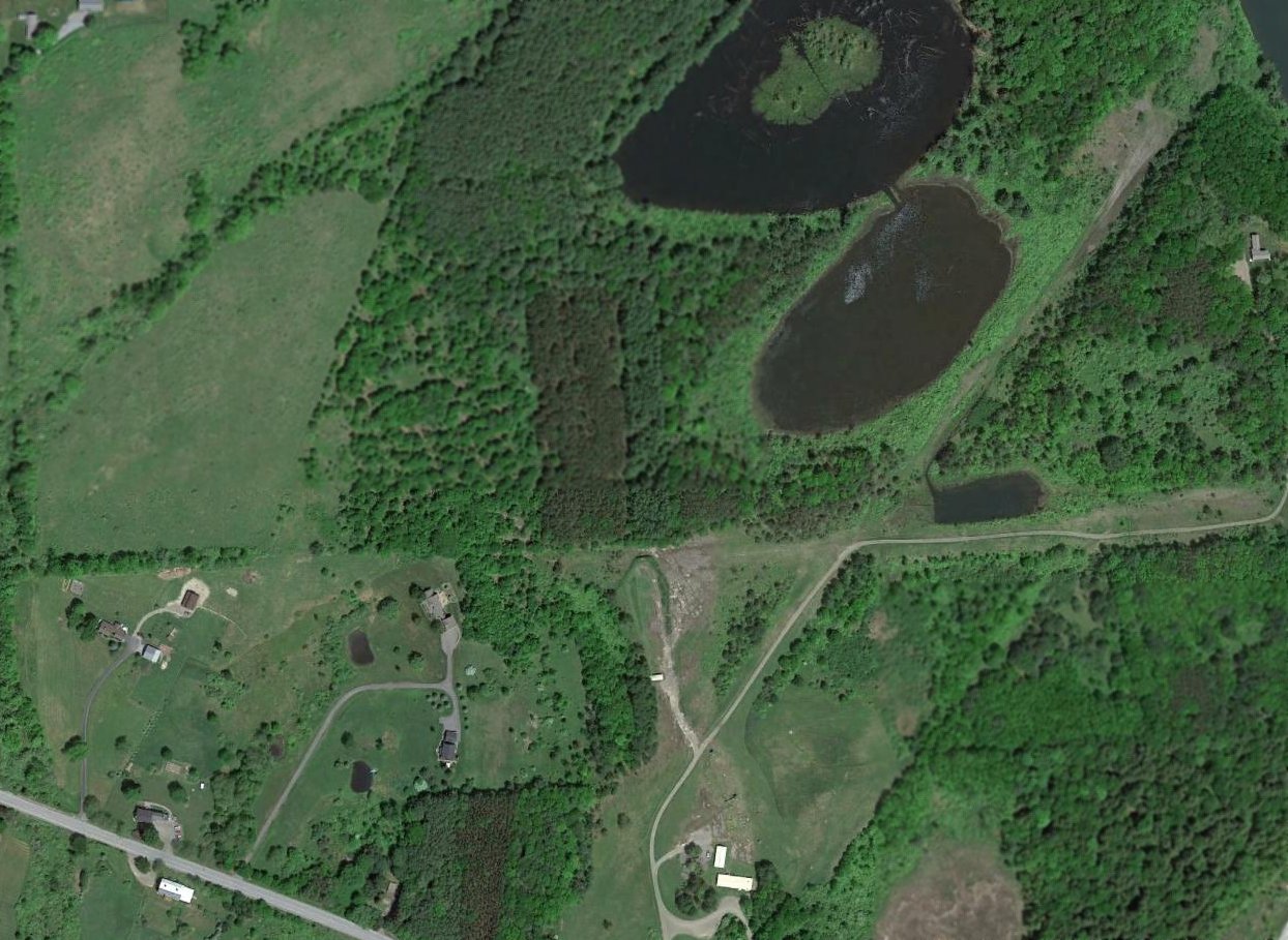
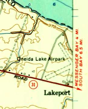
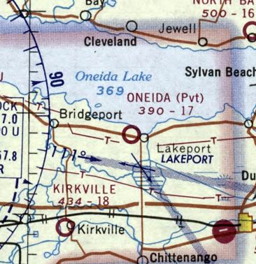
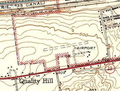
Oneida Lake Airport & Seaplane Base, Lakeport, NY
43.15, -75.878 (Northeast of Syracuse, NY)
Oneida Lake Airport, as depicted on the 1948 USGS topo map.
This general aviation airport was evidently established at some point between 1946-48,
as it was not yet depicted on the July 1946 Albany Sectional Chart.
The earliest reference which has been located of Oneida Lake Airport came from Bob Roosevelt,
who recalled, “Oneida Lake Airport & Seaplane Base... I was born September 1946 & lived at this airport with my family.
My father, Robert E. Roosevelt (owned Safe Wings, Inc.) was proprietor for 3 airports: Oneida Lake, Canasota Municipal, and Kirksville.
He built Oneida Lake Airport & Seaplane Base.
Mr. Timmerman owned the property & leased it to Fremac Marine.
I have many fond memories of Dad & me. He taught me how to fly at a very young age.”
The earliest depiction which has been located of Oneida Lake Airport was on the 1948 USGS topo map,
which depicted it as a commercial/municipal airport.
Ron Centner recalled, “The airstrip at Fremac's Marine in Lakeport...
As a young boy, my father would take my brother & myself fishing out from Lakeport Bay.
My father always kept his boat moored or anchored out at a livery down at the end of lake road, called 'George Deer's' boat livery.
It was right next door to the northeast extension of the runway.
There was also a slip or marina for floatplanes right at the end of the northeast extension at the edge of the bay.
My father would let us walk a path through the bushes over to the slip where about a half-dozen of small single-engine floatplanes were tied up.”
The earliest aeronautical chart depiction which has been located of Oneida Lake Airport was on the January 1950 Albany Sectional Chart.
It depicted Oneida Lake Airport as having an 1,800' unpaved runway.
The earliest photo which has been located of Oneida Lake Airport was a 1955 aerial view.
It depicted 2 grass runways in an “X” shape, with 4 light single-engine planes parked near some small buildings on the south side.
A seaplane base at the northeast end of the northeast/southwest runway had 5 inlets carved into the lake shore,
with 3 light single-engine floatplanes parked at their ends.
The 1957 USGS topo map depicted Oneida Lake Airport as having 3 unpaved runways, with 2 small buildings on the south side.
A 1957 aerial view of Oneida Lake Airport depicted 3 light single-engine planes parked near some small buildings on the south side,
and 1 light single-engine floatplane parked on a seaplane ramp on the northeast side.
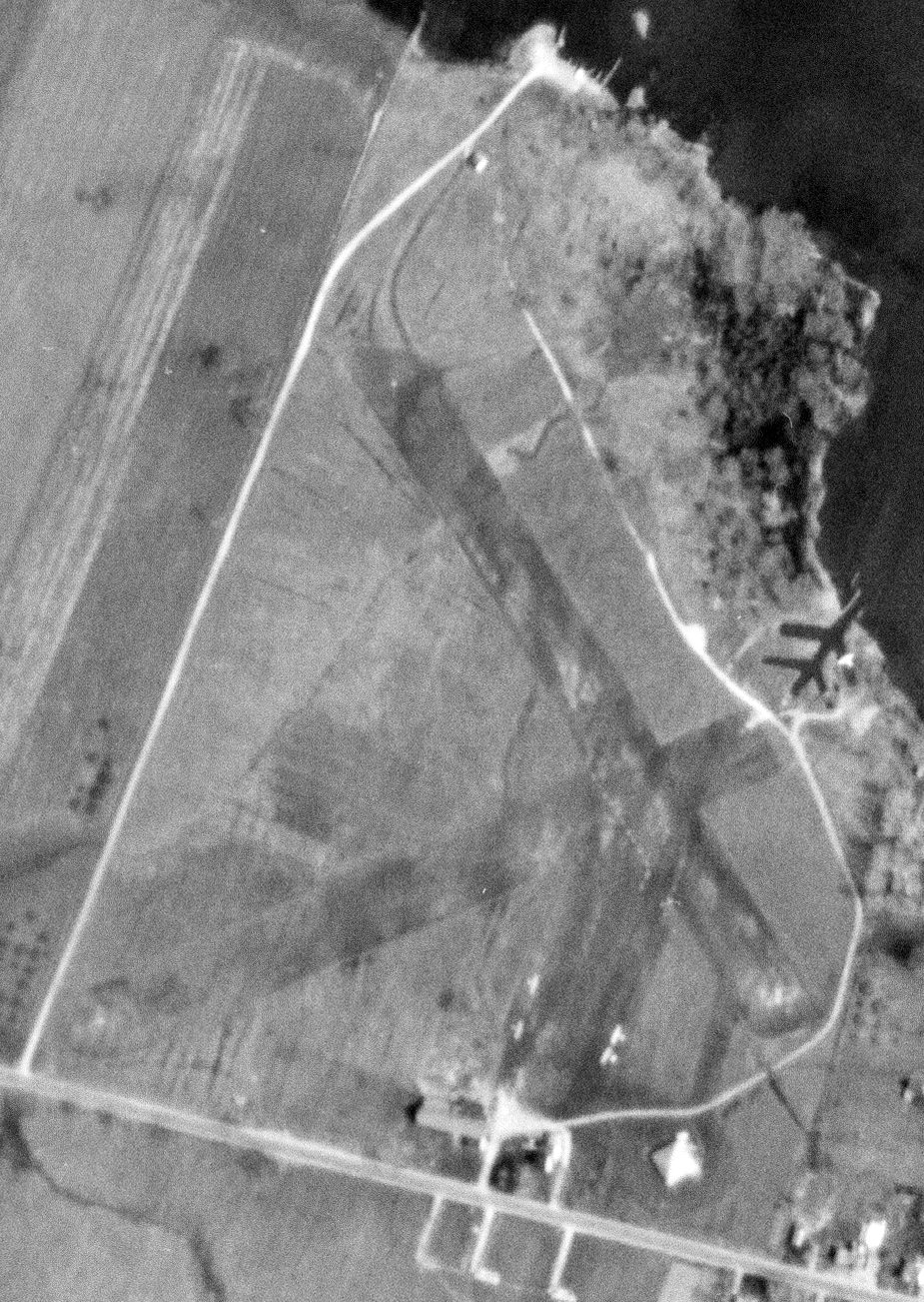
The only photo which is available showing Oneida Lake Airport while it was open was a 5/7/58 USGS aerial view.
It depicted 2 grass runways in an “X” shape, with 4 light single-engine planes parked near some small buildings on the south side,
and 1 light single-engine floatplane parked at the seaplane base at the northeast portion.
Bob Roosevelt recalled, “I lived at this airport with my family until 1961.”
The last aeronautical chart depiction which has been located of Oneida Lake Airport was on the February 1970 Albany Sectional Chart.
It depicted Oneida Lake as a private airfield with a 1,700' unpaved runway.
Oneida Lake Airport was evidently closed (for reasons unknown) at some point between 1970-72,
as a 1972 aerial photo showed 2 grass runways in a “X” shape, but a boat dealer occupied a portion of the property south of the runway intersection,
and there were no planes visible on the field or at the seaplane base at the northeast end.
Oneida Lake Airport was no longer depicted at all on the 1985 USGS topo map.
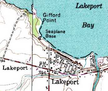
Only a “Seaplane Base” was still depicted on the 1993 USGS topo map – the runways & airport had ceased to be depicted at all.
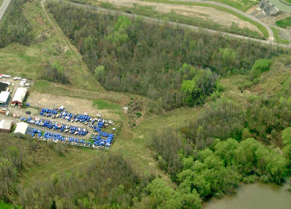
A circa 2008-2011 aerial view looking west showed the outline of 2 grass runways in a “X” shape were still recognizable at the site of Oneida Lake Airport.
A boat dealer occupied a portion of the property south of the runway intersection.
A 6/3/11 aerial view depicted the site of Oneida Lake Airport still having the recognizable outline of 2 grass runways in an “X” shape.
The site of Oneida Lake Airport is located northwest of the intersection of Lake Street & Lake Road.
____________________________________________________
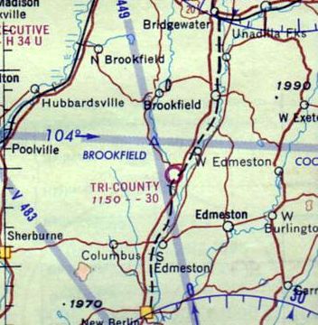
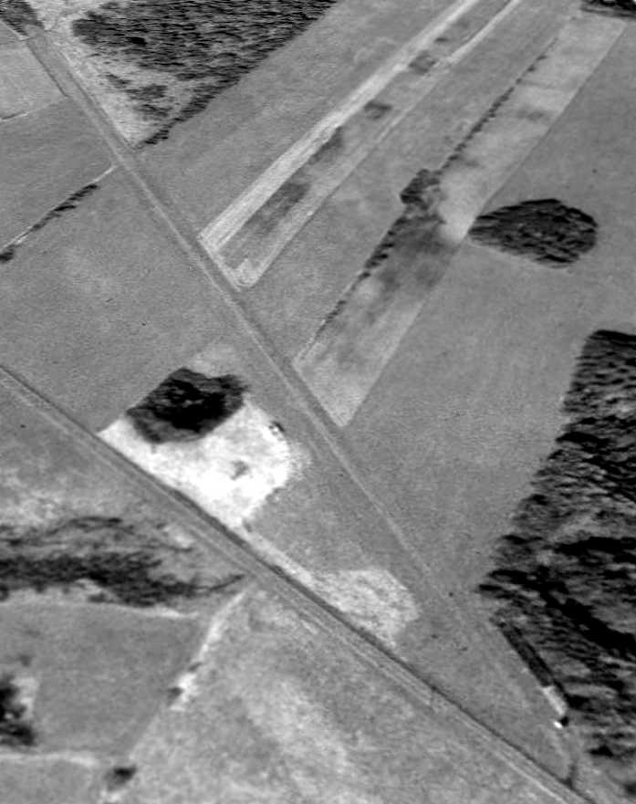
Tri-County Airways Airport (NY53), West Edmeston, NY
42.74, -75.3 (Northwest of New York, NY)
Tri-County Airport, as depicted on the 1964 Albany Sectional Chart.
Vern Maine recalled, “My first airplane ride as a kid was in a J-3 Cub at NY53 Tri-County Airport in the 1950s,
a little grass strip on an old rail bed in West Edmeston, along side Route 8 & the Unadilla River.
It was the result of cooperation by 3 farmers, presumably interested in flying, who agreed to contribute their respective piece of the land required for the strip.”
This airport may be unique in that the runway was built along a ripped-up former railway bed.
No airfield was yet depicted at this location on the May 1960 Albany Sectional Chart.
According to its FAA Airport/Facility Directory entry, Tri-County Airways Airport was activated in October 1961.
The earliest depiction which has been located of Tri-County Airport was on the 1964 Albany Sectional Chart,
which depicted it as having a 3,000' unpaved runway.
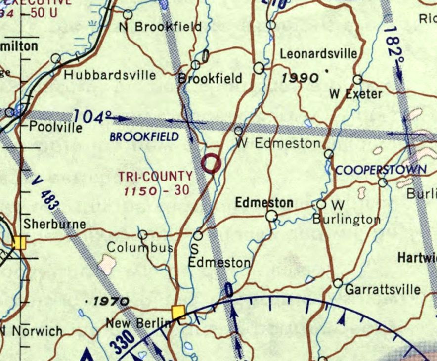
The February 1970 Albany Sectional Chart depicted Tri-County Airport as having a 3,000' unpaved runway.
The 1990 USGS topo map shows the railroad passing right through the alignment of what would eventually become Tri-County's runway,
but does not yet depict the airport.
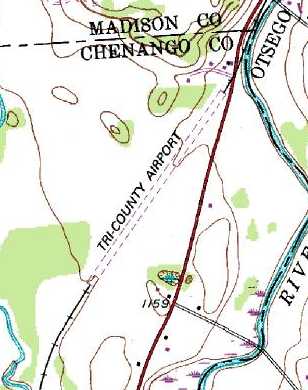
The 1994 USGS topo map depicted the railroad running right up to both ends of the Tri-County Airport's unpaved runway.
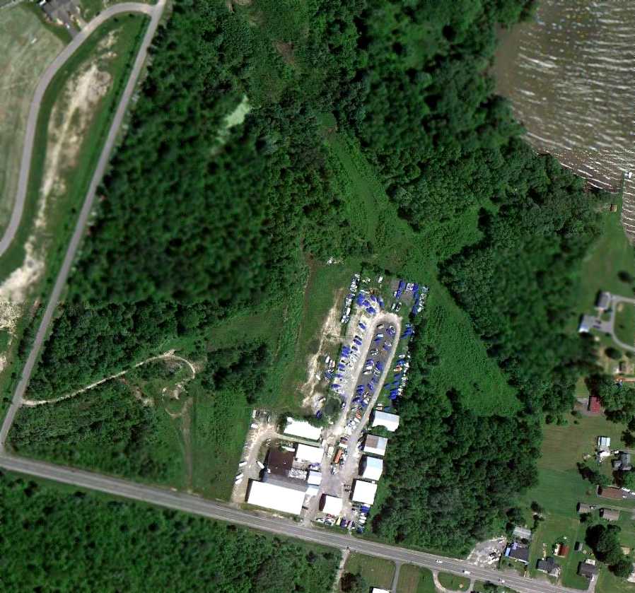
The oldest photo which has been located of Tri-County Airport was a 5/17/97 aerial view looking southwest,
which showed a single unpaved runway, with a single small building on the northeast side.
The earliest photo which has been located showing aircraft at Tri-County
was a circa 2006-2011 photo looking west at a shed on the north side, which appeared to hold 2 or 3 Cessnas.
According to Vern Maine, the hangar spanned “6 bays”.
A 5/4/09 aerial view looking southwest at Tri-County Airport showed a single unpaved runway, with a single small building on the northeast side.
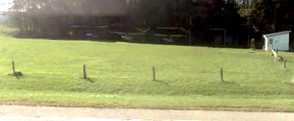
A 2010 photo by Vern Maine of Tri-County “of my RV-3 in the hangar from my last flight there.
In hindsight, I guess it does look a little rickety & run-down.”
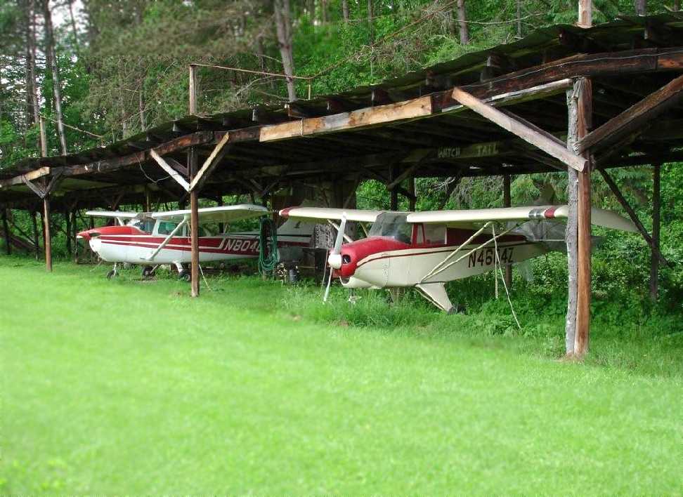
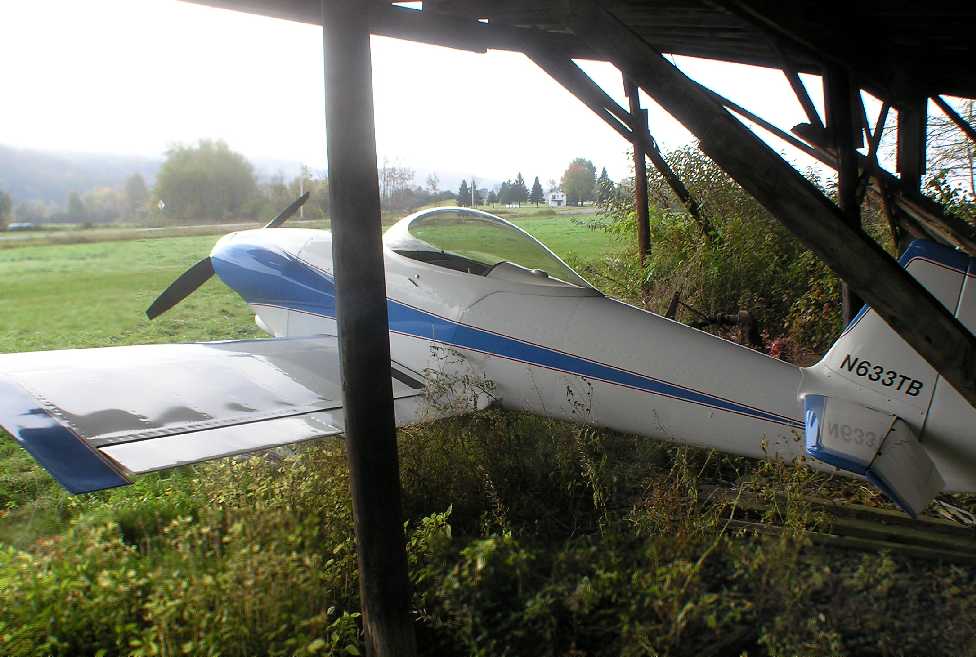
The last photo which has been located of Tri-County Airways Airport was a 6/11/10 photo (courtesy of John King)
of a Cessna 172 & a “Piper Colt that my wife used to own about 15 years ago that was based there.”
In 2011, its last year of operation, Tri-County Airways Airport's FAA Airport/Facility Directory entry
described it as a private field having a single 2,804' turf Runway 4/22.
The owner & manager was listed as Marvin Maxson, and the field was said to have 5 single-engine aircraft based on the field.
Vern Maine recalled of Tri-County, “I flew in many times over the years from my home in New Hampshire
to visit my parents over the hill in Brookfield, right up to 2010.
The old hangar collapsed last winter [2010].”
The last depiction which has been located of the Tri-County Airport was on the 2011 Sectional Chart.
It depicted Tri-County as a private field having a 2,800' unpaved runway.
Vern Maine reported of Tri-County, “The runway was plowed over this year, 2011 and put into corn.
A sad day. No one but me seems to care.”
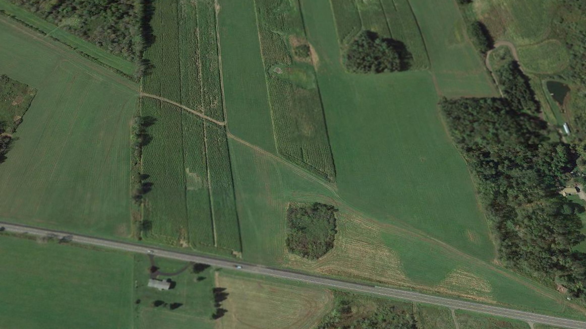
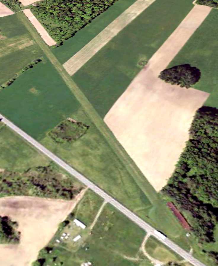
A 2017 aerial view looking west at the site of Tri-County Airport showed the alignment of the former runway is still recognizable, but the hangar at the north end (bottom-right) was gone.
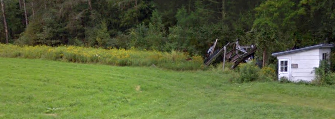
A 2018 photo looking west showed the remains of the Tri-County Airport hangar.
Tri-County Airways Airport is located southwest of the intersection of Route 8 & County Highway 99.
____________________________________________________
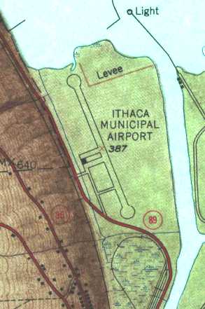
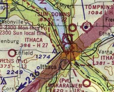
Ithaca Municipal Airport, Ithaca, NY
42.455, -76.52 (Northwest of New York, NY)
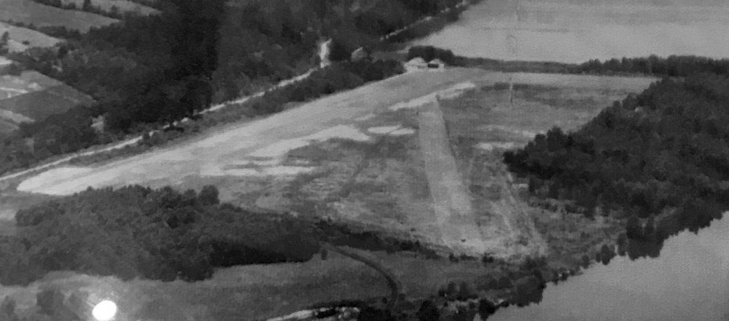
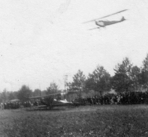
A 1916 aerial view looking northwest at Ithaca Airport (courtesy of Ron Plante).
The original airport for the town of Ithaca was located on the southern edge of Cayuga Lake.
The date of construction of Ithaca Municipal Airport has not been determined.
The Ithaca Airport is believed to have been the 2nd airport in New York State, according to the website of the current Ithaca Airport.
According to the Centennial of Flight website (via Chris Kennedy), the Thomas Brothers Aeroplane Company moved to Ithaca in 1914,
so the airfield may date from that time.
The earliest depiction which has been located of Ithaca Airport
was a 1916 aerial view looking northwest (courtesy of Ron Plante, who found the photo on display in 2018 at the Empire State Aerospace Museum).
The photo depicted Ithaca Airport as having 2 unpaved runways, with 2 hangars at the northwest corner.
A 1919 photo of the first Thomas-Morse MB-3, 40092, which conducted its early flight testing at Ithaca Airport.
A January-March 1919 photo of the sole Thomas-Morse S-6 at Ithaca Airport.
A circa 1920 photo of a very rare Tellier T.3 flying boat inside a hangar at Ithaca Airport (courtesy of Eileen Brackett).
According to Eileen Brackett, “The plane in the hangar needing repair was probably the one that grandfather crashed & they brought it back to the airport.”
A circa 1920s photo of a Curtiss JN-4 Jenny biplane overflying another at Ithaca Airport (courtesy of Eileen Brackett).
Eileen Bracket observed, “I believe [it was taken during] an airshow as there are a ton of people standing in the trees.”
A 1927 photo of a an large number of aircraft & spectators at Ithaca Airport (courtesy of Eileen Brackett).
Barbara Hughes recalled, “My parents, Herbert & Dorothy Peters owned & operated the Ithaca Flying Service at the Ithaca Airport.
Dad born in 1900, started at the airport probably in his 20s. By 1927 he had 3 little girls to nurture when most people thought if God meant you to fly, you'd have wings!
He delivered air mail by dropping it out of the plane.
He piloted for aerial shots for some early motion pictures filmed in Ithaca.
Lindbergh & Amelia Earhart came to our airport & we owned the sister ship of the Spirit of Saint Louis.
The first hangar was at the north end of the property, a pretty swampy area loved by duck hunters.
Dad would shoo them away when planes were active, sometimes rewarded with a duck or two for the table.”
The earliest map depiction which has been located of Ithaca Airport
was on a 1929 NY Legislative Report (courtesy of Tom Heitzman).
It described Ithaca Airport as a 110 acre irregularly-shaped sod field, having 3 runways, the longest measuring 3,000' northwest/southeast.
The airfield was said to be owned by the city, and operated by Thomas Morse Aircraft Corporation.
The 1929 Rand-McNally Standard Indexed Map with Air Trails of NY (courtesy of Chris Kennedy)
described Ithaca Field as a municipal airport, operated by the Thomas-Morse Aircraft Corporation.
The airfield was said to measure 2,700' x 1,500'.
The Airport Directory Company's 1933 Airports Directory (courtesy of Chris Kennedy)
described Ithaca Municipal Airport as having 2 sod runways, 3,000' northwest/southeast & 2,600' north/south.
The earliest aeronautical chart depiction which has been located of Ithaca Airport was on the June 1933 Albany Sectional Chart.
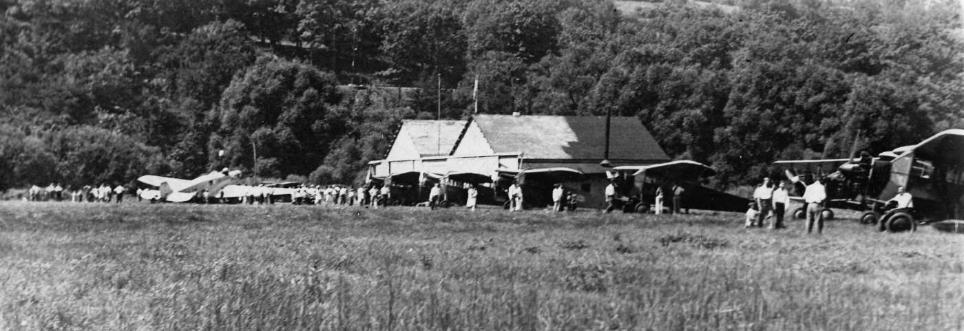
A circa 1930s photo of the hangar at Ithaca Airport (courtesy of Eileen Brackett).
Barbara Hughes recalled, “The Works Progress Administration was responsible for the much improved, larger hangar & runways.
I believe Dad was its manager from the start of the new building & perhaps for a while the earlier hangar.”
His passion was engines & flying. Some of the earliest manufacturers of small planes would bring them to Dad to test out.
He was 6 foot 4 inches, tall for the time, and 'Pete' had to give his stamp of approval before production would continue.
That really means he could get in & out, and there were no 'dumb bunny' mistakes in its workings.
I recall Cornell Professors inviting him up to lecture the aeronautical engineering classes, he had such a solid understanding of flight.”
An aerial view looking northwest at the Ithaca Municipal Airport
from The Airport Directory Company's 1937 Airports Directory (courtesy of Bob Rambo).
The directory described the field as having a single 2,700' north/south asphalt runway,
along with a 2,250' east/west turf strip.
A single hangar was depicted on the west side of the field.
Barbara Hughes recalled, “The hangar was large in my mind's eye. I know we tipped the Cubs up into dollies on their noses so we could stack them. It held a lot that way.
Dad's personal plane had its own special corner. The huge heavy metal doors we'd roll closed on the north & south sides of the hangar each night.
I recall maybe 8-10 T hangars for the customers who owned their own planes.
There was also a building next to the apron where Link classes were held during WW2.
We were training pilots, it seemed day & night at that time, the need was so great.
Inside the hangar was the office where Mom & clerks kept track of flights & hours flown.
There was a waiting room then the shop where I recall the planes being stripped of their 'skin', motors refurbished & new fabric stretched & sprayed with dope.
I was told to stay out at those times, but loved the smell!”
An 8/18/42 aerial view looking northwest from The 1945 AAF Airfield Directory (courtesy of Scott Murdock)
depicted Ithaca Municipal Airport as having a single paved runway, with several light aircraft on the ramp
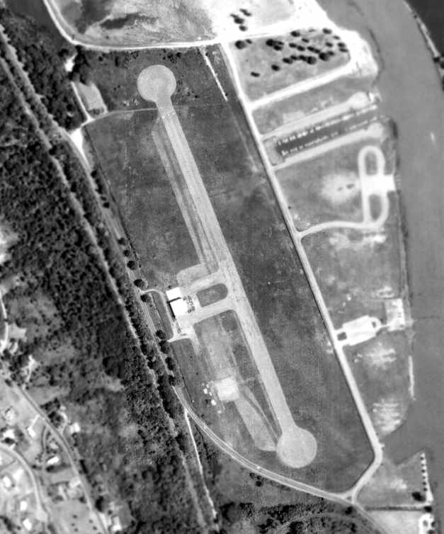
A 1938 aerial view depicted the Ithaca Municipal Airport as having a single northwest/southeast paved runway,
with a single hangar on the west side of the field.
The April 1944 US Army/Navy Directory of Airfields (courtesy of Ken Mercer)
described Ithaca as having a 2,500' unpaved runway,
and indicated that Navy flight operations were conducted from the field.
The December 1944 Army/Navy Directory of Airfields (according to Ron Plante)
described a Ithaca as having a 2,500' hard-surface runway.
According to the website of the current Ithaca Airport,
"Cecil Robinson began conducting aerial photography mapping for the government out of Ithaca Municipal Airport.
His two 4-place monoplanes became the cornerstone of Robinson Airlines at the end of the Second World War.
Shortly thereafter, Robinson Airlines was growing & their operation was moved to the new East Hill Airport,
opened by Cornell University in 1948."
[This new East Hill Airport eventually became the present-day Ithaca Airport].
The 1949 USGS topo map depicted Ithaca Municipal Airport as having a single northwest/southeast paved runway,
with taxiways leading to a single hangar on the west side of the field.
A 1954 aerial view depicted the Ithaca Municipal Airport as largely unchanged compared to the 1938 photo.
Several aircraft were visible in front of the hangar on the west side of the field.
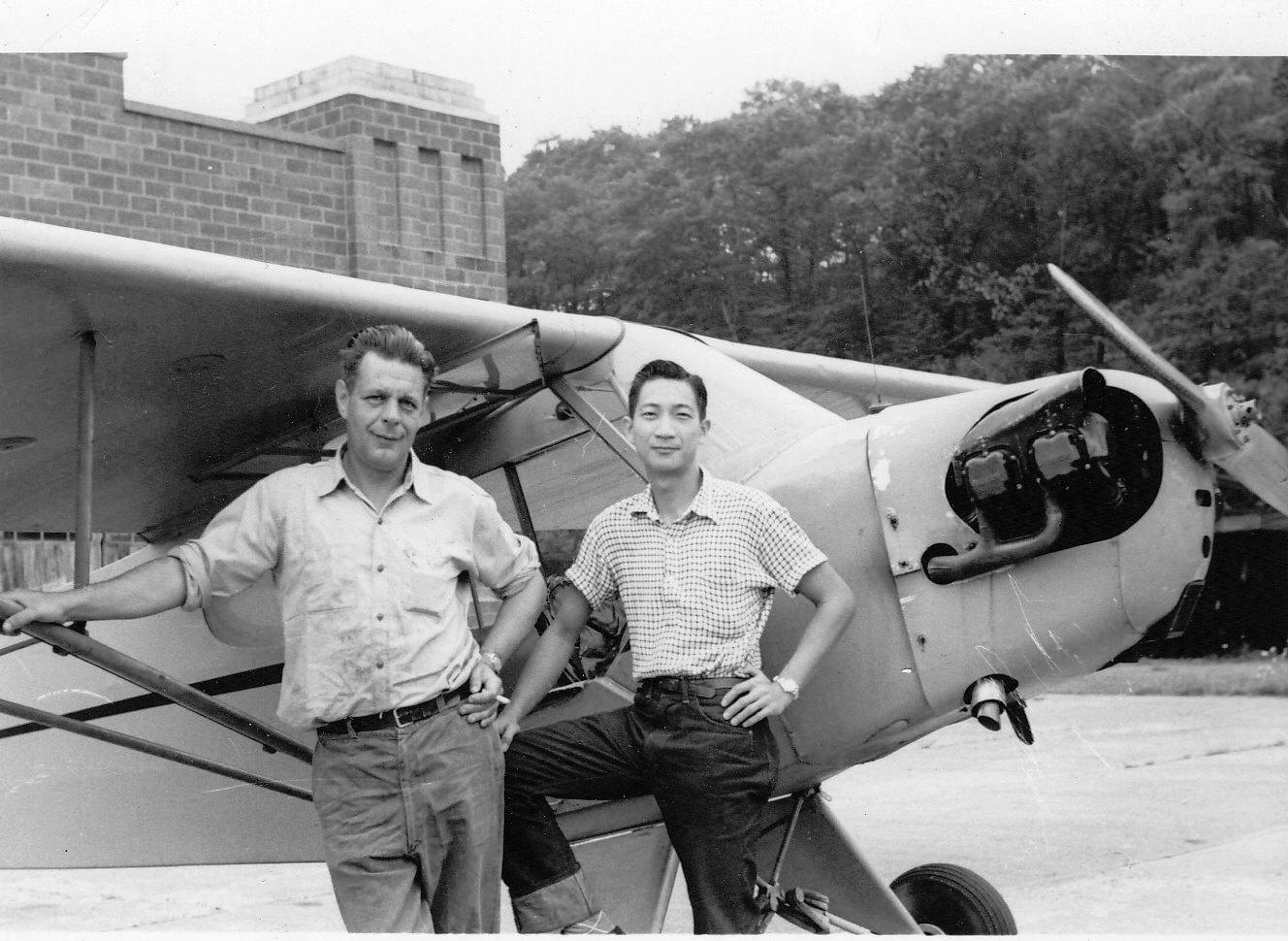
A 1954 photo of Mert Doyle & Chi Lee in front of a Piper Cub & the hangar at Ithaca Airport (courtesy of Eileen Brackett).
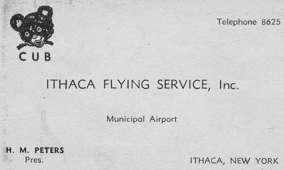
A circa 1950s photo of the Ithaca Flying Service business card (courtesy of Eileen Brackett).
Barbara Hughes recalled, “Dad [Herbert Peters] held the 'title' of being the longest Fixed Base airport operator in the country,
I believe up until the time he retired & chose not to renew his lease of land from the city. That was around 1960.”
The 1962 Albany Sectional Chart (courtesy of Mike Keefe)
depicted Ithaca Municipal Airport as having a 2,700' hard surface runway.
Ron Plante recalled of the original Ithaca Airport, "This closed before we moved to nearby Cortland in 1962,
but a teenager in the 1960s I recall picnics in Cass Park & seeing the hangar, which later became a theater."
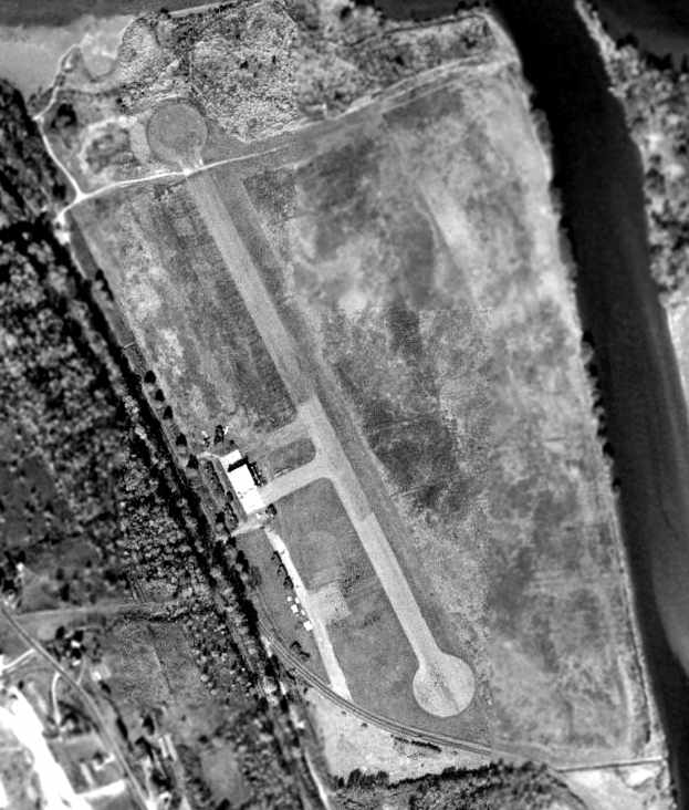
In a 1964 aerial view of the Ithaca Municipal Airport the field was still completely intact,
but the runway was unmarked & no aircraft were visible on the field.
Other sources claim Ithaca Municipal Airport closed in 1966.
By the time of the 1967 Albany Sectional Chart (courtesy of Mike Keefe),
the original Ithaca Airport was no longer depicted at all.
A 1968 aerial view showed Ithaca Municipal Airport remained intact,
but 3 closed-runway X symbols had been painted on the runway at some point between 1964-68.
In 1975, the Hangar Theatre was opened in the original hangar from the former airport.
By the time of a 1980 aerial view, only a southern portion of the runway pavement still remained,
but the hangar still remained standing.
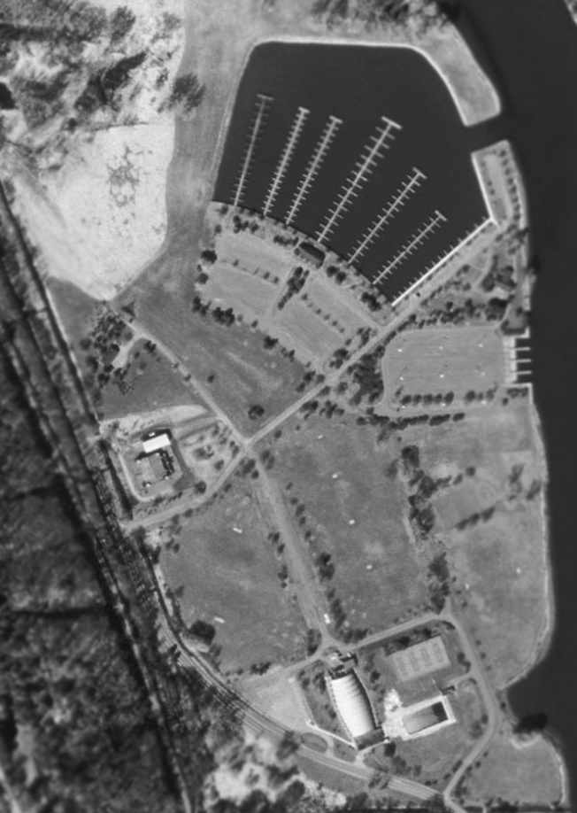
The 1995 USGS aerial photo showed that the former hangar still remains standing (left-center of photo),
as well as what appears to be the southern half of the former asphalt runway
(running south-southeast toward the light-colored building at the bottom of the photo).
A marina inlet had been dug over the northern area of the former airport.
As of 2004, the Hangar Theatre continues to operate in the original hangar from the former airport.
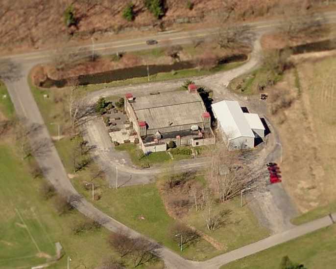
A circa 2006 aerial view looking west at the former hangar at the site of the original Ithaca Airport.
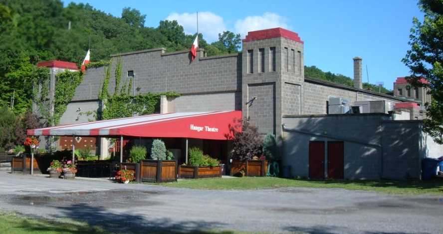
A 2008 photo by Ron Plante of the former hangar at the site of the original Ithaca Airport.
The site of the original Ithaca Airport is located east of Route 89, in Cass Park.
Thanks to Ron Plante for pointing out this airfield.
____________________________________________________
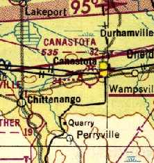
Canastota Airport (1B8), Canastota, NY
43.07, -75.77 (East of Syracuse, NY)
An 8/28/28 photo of a crowd in front of an unidentified biplane at the dedication of Canastota Municipal Airport (courtesy of Tom Heitzman).
According to Canastota Village Historian David Sadler, “Amelia Earhart dedicated the Canastota Municipal Airport on 8/28/28.
Otto Herrmann was one of the leading organizers to establish an airport in Canastota.”
The earliest depiction which has been located of Canastota Municipal Airport was a 8/28/28 photo of a crowd in front of an unidentified biplane at the airport's dedication (courtesy of Tom Heitzman).
However the Canastota Airport was not yet depicted on the June 1933 Albany Sectional Chart,
even though it depicted Airway Beacon #34 at the eventual site of the airport.
The earliest directory listing of Canastota Airport which has been located
was in The Airport Directory Company's 1937 Airports Directory (courtesy of Bob Rambo).
It described Canastota as an auxiliary airfield having two 2,000' sod runways, oriented east/west & northeast/southwest.
A beacon on a tower with red course lights was said to flash a characteristic "4".
Canastota Airport still was not yet depicted on the 1938 Albany Sectional Chart,
just the Airway Beacon #34 at the eventual site of the airport.
The earliest aeronautical chart depiction which has been located of Canastota Airport was on the January 1940 Albany Sectional Chart.
Canastota Airport was dedicated as a base of operations for the Civil Air Patrol on 7/3/43,
according to a 7/4/43 Syracuse Post-Standard article (according to CAP Major Nancy Bridges).
The earliest photo which has been located of Canastota Municipal Airport
was a circa 1943-45 aerial view looking north from the 1945 AAF Airfield Directory (courtesy of Scott Murdock).
CAP operations at Canastota were evidently extremely brief, though,
as they were transitioned from Canastota Airport to Hayes Airfield on 9/5/44 (according to CAP Major Nancy Bridges).
Canastota Airport was turned back to the village of Canastota effective 9/1/44,
and a hangar built by CAP was also given to the village.
The April 1944 US Army/Navy Directory of Airfields (courtesy of Ken Mercer) described Canastota Airport as having a 2,200' unpaved runway.
The 1945 AAF Airfield Directory (courtesy of Scott Murdock) described Canastota
as a 192 acre rectangular property having 2 “sod & gravel (rough)” runways, the longest being the 2,200' east/west strip.
The field was said to have 5 wooden hangars, the largest being a 40' x 38' structure.
Canastota Municipal Airport was described as being owned by the City of Canastota, and operated by the Civil Air Patrol.
The 1946 USGS topo map depicted Canastotata Municipal Airport as having a single east/west runway, labeled generically as "Airport".
A cluster of several small buildings was situated on the southeast corner of the field, and the beacon was depicted on the south side of the runway.
Bob Roosevelt recalled, “My father, Robert E. Roosevelt (who owned Safe Wings, Inc.)
was proprietor for 3 airports: Oneida Lake, Canasota Municipal, and Kirksville.”
The runway at Canastota had evidently been lengthened at some point between 1944-50,
as the 1950 Albany Sectional Chart (courtesy of Mike Keefe)
depicted Canastota as having a 3,200' unpaved runway.
According to Brien Miller, “The original strip was something like 2,000-2,300' long.
According to the pilots at the field, some time in the late 1940s or early 1950s somebody decided to buy and renovate 3-5 surplus P-51s.
That's when the field got it's extra 800-900' or so on the west end -
and it was very obvious because they didn't level the west end as it should have been done.
The field had a slight rise at the departure end of [Runway] 27 as it was,
with the addition, there was a bump & a bit more uphill to go.”
A 1956 aerial photo showed a dozen light aircraft at Canastota.
Bill Ryan recalled, “I worked at Canastota as a kid pumping gas & towing gliders. I knew Herb's dad & Robbie his brother.”
George Johnson recalled, “I remember flying into Canastota Airport in 1958 on my solo cross-country.
I was surprised to see an entire Canadian squadron of P-51s all over the airport & for sale for the huge sum of $2,300.”
Vince Sbardella recalled, “Canastota Airport... to which I frequently flew my 1946 Swift, in 1959-60.
The P-51 Mustangs... there were 16 of them parked there, beginning in 1959, for about 5 years, after which they were scrapped.
They had been been purchased from the Province of Saskatchewan Air National Guard, by a contractor in Dewitt NY,
with the intention of selling them to the newly installed Castro government of Cuba, with whom he had negotiated a contract.
When Castro fell out of favor with the Eisenhower administration, in 1960, the State Department stopped the sale, and they just sat at Canastota.
I have a few photos of my Swift beside one, and nose to nose.
One of them was sold to an entity in IN that was converting them to 2-place civilian aircraft.
A pilot from Lake Central Airlines came to Canastota to fly one to IN.
He trimmed the rudder 10 degrees left, instead of right, for takeoff, resulting in running through some airplanes on the south side of the runway, and overturning in a plowed field.”
Bob Sollien recalled, “Back around 1959 or 1960 my father Earl Sollien became the manager of the Canastota Airport & it’s flight instructor.
In Canastota we lived just across the road from the airport on the other side of Route 5 - a few houses up the hill from Joe Tornatore’s place.
He taught there for a couple of years.”
Gary Kennedy recalled, “I took my first flying lessons in Canastota in spring & summer of 1960.
My father Robert Kennedy managed the airport for Don Anklin. I was 14 years old then.
We played in those P-51s in 1960.. The last one left in summer of 1960.. I heard a different story of why & how they were there.
My first instructor was Hugh Scafe. When I was 16 I soloed there on 11/22/62 in a J-3 Cub, my flight Instructor was Earl Sollien.
I have never not thought of Canastota every time I flew during my 34,000 pilot hours, owning 3 airplanes: a Cub & 2 Tri Pacers to specifically remind me of Canastota Airport.”
Mark Hrutkay recalled, “This is the airport where in 1960-62 or so the RCAF P-51s came through.
There were about 25 Mustangs (civilian) on the field which were being prepared to ship to Central America, and points south.
There was one that crashed there in about 1961 which got torque-rolled over the hill on the left of the runway (big field in top of picture) on takeoff.”
Canastota gained a paved runway at some point between 1950-62, as the 1962 AOPA Airport Directory described Canastota Municipal Airport
as having a total of 3 runways: a 3,200' paved Runway 9/27, a 1,500' turf runway 4/22, and an 800' turf Runway 18/36.
The operator was listed as Canastota Aircraft, Inc.
Mark Hrutkay recalled, “Canastota... my father had a GC1B Swift there.
[In photos of the ramp], The lower right hand corner has a circle in the pavement. That was the main ramp.
The Fixed Base Operation hangars were on the left of that.
A square & round building [was] the hangar that Dad had the Swift in with Leo & Eddie,
the 'Ercoupe Brothers' who were 2 electricians that each had Ercoupes.”
Mark continued, “In about 1965 there was a MAJOR windstorm that about wiped out the airport.
Every hangar was flatenend except the FBO & the one dad's plane was in.
There was a long set of T-hangars between the FBO & dad's hangar which fell over.
Planes had their wings bent when ties-downs didn't break & flipped over when they did. A real disaster.”
Sterling Brisbin recalled, “Canastota Airport was the site of my first general aviation experience as a boy in the late 1960s,
when my father's business partner, Gordon Wheler, was kind enough to take me on a flight in his Cessna 210 that was based there.
He let me fly the takeoff & I still remember trying uselessly to counteract the torque swerve to the left with right aileron!”
The Canastota Airport, as depicted on the 1969 Albany Sectional Chart (courtesy of John Voss).
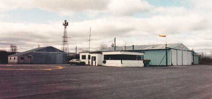
An early 1980s photo by Brien Miller looking southwest at Canastota Airport's main buildings.
Brien reported, “This was the main area off the ramp. The ramp had a compass rose painted on it but with not headings marked, just an extra large north pointer.
The white building in the foreground was the FBO: run by a guy named Joe Tornatore; Joe was always good about plowing the airport in the winter.
The old beacon is visible in this shot. The beacon was originally designed only to be seen east/west -
as that was the mail route used: Albany – Schenectady - Utica (Riverside) – Canastota - Syracuse - then west.
The blue-green building on the right was Herb Reuter's Aircraft Sales & Repair.
Herb (as I recall being told) was an ex Pan Am Clipper A&P - his German accent was quite heavy.
He also had an early WWII Link flight simulator parked in that building.
The grey-brown building on the left under the beacon was a mystery building. Never saw it open - nobody talked about it.
Still to this day have no clue as to who owned / used it & what was kept in it.
The wind sock shows a strong west wind favoring Runway 27.”
The only photo which has been located showing aircraft at Canastota Airport was an early 1980s photo by Brien Miller looking south Several Cessnas.
Brien reported, “That's the field's Cessna 152 Aerobat in the compass rose.”
The 1982 AOPA Airport Directory (courtesy of Ed Drury) described Canastota Municipal Airport
as having a 3,200' paved Runway 9/27 & a 1,500' turf runway 5/23.
The operators were listed as Canastota Aircraft Company, Reutter Aircraft Service, and Bisha Avionics.
Herb Reutter recalled, “My father & and brother operated the airport until it closed by order of the city in the early 1980s.
I was all set to return to my roots & join the family business
after the City fathers had voted to accept Federal funding to extend & reorient the paved runway.
It was going to be a major upgrade, and would have allowed small business jets to land,
which would have been good for the business.
The city fathers later changed their minds & voted to close the airport
and make it into an industrial park reasoning that they would make more money that way.
In reality, developers who owned nearby land were anxious to rid the area of the 'noise' & make their property more valuable.
My father had to move his business to Oneida County Airport
and leave the hangar & shop he had invested his money in.
In reality, it turned out to be a good move.
A longer commute from his home maybe,
but he ended up with more business & better accommodations at Oneida.
And as he put it, he didn't have to deal with the fickle small town politics anymore.
Actually he had more descriptive words for the Italian city fathers.”
Brien Miller recalled, “The demise of Canastota was purely political:
the local mayor wanted the land to the east to build apartments on with his brother-in-law.
Initially, the idea was quashed but he played dirty & managed to get the Fixed Base Operator removed.
He then sited an 'industrial development park' at the far end of Runway 27 that actually required a road to be driven across the runway.
He claimed that the airport would be a boon to such a park - but his goal was to kill it.
This he did in a later effort - but the town was going downhill under his poor leadership
and both the airport & the industrial park closed.
While Kamp's demise was foreseeable; Canastota's was simply wrongful greedy local politics
and a waste of a fine & historic airfield at which Amelia Earhart once landed.”
According to Canastota Village Historian David Sadler, Canastota Municipal Airport closed on 12/31/89.
The Canastota Airport was still depicted on the 1993 USGS topo map,
even though it was evidently already closed by that point.
A 1994 USGS aerial view looking northwest at the site of Canastota Airport
showed that several buildings had been built directly adjacent to the west side of the former paved runway,
which was also being used to store some kind of unidentified items (trailers?).
The entire length of the runway remained intact, and the number "9" was still intact on the western end of the runway.
The former ramp on the southeast side of the field also remained intact, along which were several buildings (possible former hangars?).
A 2002 photo by Mark Hrutkay of “the hangar next to the main terminal (which is gone).
They used to have Republic Seabees in there (2 or 3 of them).”
Mark Hrutkay recalled, “I was last there in about 2003 & there were houses built in the right side of the picture over part of the field.”
Herb Reutter reported in 2005, “The grand industrial park [which was intended to replace the airport]
is now hodgepodge of dilapidated buildings.”
A circa 2006 aerial view appears to show that the remaining hangar has been modernized (recovered) or replaced.
Canastota Village Historian David Sadler reported, “I successfully petitioned the Village of Canastota
to have a historical marker placed at the entrance on NY Route 5 & Dominic Bruno Boulevard (the former airport access road).”
A 2008 photo by Peter Ricciardiello looking east
along the remains of Canastota's “Runway 9 approach end, with the faded runway number still visible.
This end of the runway is nothing more than a collection of tires, pallets, and trailers as seen in the picture.
Very sad end to what was once a very exciting ribbon of asphalt.”
A 2019 aerial view looking northwest at the site of Canastota Airport showed that the northwest end of the runway pavement remained,
although the eastern portion had been removed & covered with new buildings & roads.
A portion of the ramp also remained (bottom-right), along with a former hangar & 2 other possible airfield buildings.
The site of Canastota Airport is located at the intersection of Route 5 & Dominic Bruno Boulevard.
Thanks to John Buck for pointing out this airfield.
____________________________________________________
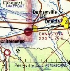
Kamp Airport (1B4), Durhamville, NY
43.135, -75.65 (East of Syracuse, NY)
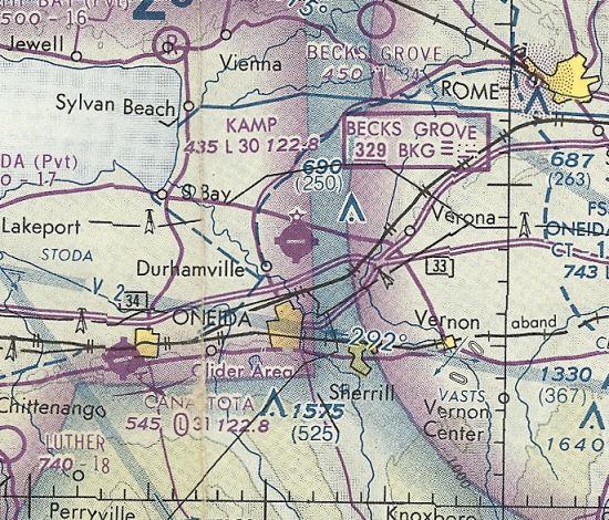
Kamp Airport, as depicted on the December 1979 NY Sectional Chart (courtesy of Ron Plante).
This small general aviation airport was evidently built at some point between 1976-79,
as it was not yet depicted on a 1956 aerial photo or the June 1973 NY Sectional Chart (courtesy of Ron Plante),
nor listed in the 1976 AOPA Airport Directory (according to Chris Kennedy).
The earliest depiction which has been located of Kamp Airport
was on the December 1979 NY Sectional Chart (courtesy of Ron Plante).
It depicted Kamp Airport as having a single east/west paved 3,000' runway.
Brien Miller recalled, “Kamp Airport was started by Bernie Kamp in answer to both some flying club politics
at both Canastota & another small airport just east of Lake Oneida.
Kamp's main hangar & FBO sported a decent fly-in lunch room but the runway was always narrow & its edges in bad shape.
You risked sucking broken asphalt into a prop if you got to close to the edge.
The parking area was even worse with its white pebble ground cover.
Also the end of Runway 28 was just short of one whopping tree.
The grass north/south strip was wide & generous but was crossed by the improved surface strip
and was a nasty bump if you landed late & had to roll out over it.
The power lines south of the field were no advantage either.
I much preferred flying out of Canastota, but when it closed the club first moved to Kamp.”
The 1982 AOPA Airport Directory (courtesy of Ed Drury) described Kamp Airport as having a single 3,000' asphalt Runway 10/28,
listed the operator as Kamp Airport.
Kamp Airport was owned by Bernard & Marylin Kamp.
Mark Bailey recalled flying into Kamp Airport in the early 1980s.
"Kamp was a favorite place for us Aero Clubbers to fly most any Saturday we could.
The airport was busy then & sported a nice little cafe run by Susie.
Kamp also had a number of pancake breakfasts as well as an air show for a number of years.
There were trees on the west side of the field on the approach,
but other than that, it was a nice little field, and I am sorry to see it go."
The 1985 USGS topo map depicted Kamp Airport as having a single east/west runway.
Dan Leinbach recalled, “I remember popping over to Kamp with my dad in the Grumman Tiger his flying club owned.
To this probably 8-10 year old at the time, Kamp had THE BEST hamburgers anywhere.
Around 1990, the club (Ideal Flying Club) purchased a Rockwell Commander 114.
The Commander was at Kamp, getting some kind of work done on it.
As we returned to the aircraft, my mom asked 'Is the prop supposed to have that notch in it?'
Maybe 6 inches from the tip of the blade, there was a good inch-deep gouge.
When turning around on the broken asphalt, my dad had apparently picked up a chunk of it; he's lucky it didn't lose the blade tip on the short flight to KUCA.”
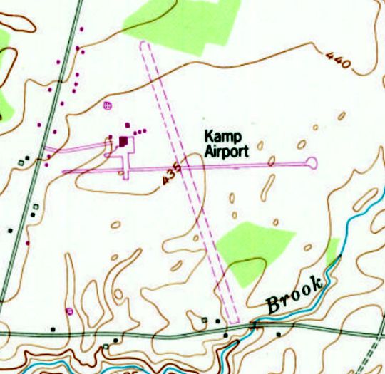
The 1993 USGStopo map depicted Kamp Airport as having a paved east/west runway an unpaved northwest/southeast runway,
with a ramp & several small buildings on the northwest side.
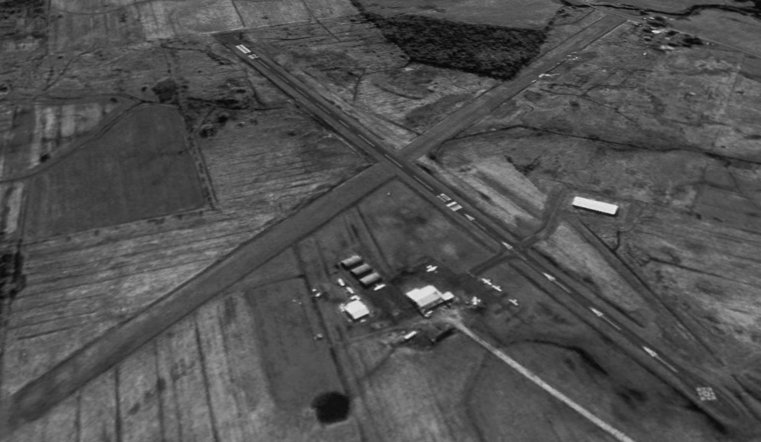
A 1994 USGS aerial view looking southeast depicted Kamp Airport as having a total of 5 light single-engine aircraft visible on the field,
parked around a cluster of small buildings & hangars on the northwest corner of the field.
Another building or hangar was located southwest of the runway intersection.
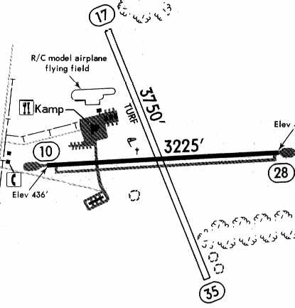
The 1995 Jeppesen Airport Directory depicted Kamp Airport
as having a 3,225' paved Runway 10/28 & a 3,750' unpaved Runway 17/35.
The offices of Kamp Air Aviation Inc. were depicted on a ramp northwest of the runway intersection,
and a radio-controlled model airplane flying field was depicted just north of the ramp.
Dan Leinbach recalled, “My personal experience with Kamp came around 1997.
The sole soft-field landing I have logged was at Kamp. [The] good bump when crossing the paved surface - I can attest to that.
It was one heck of a kick - enough to float me across the paved surface on that occasion.”
John Reep recalled of a visit to Kamp Airport, “in 1998... I purchased an Aero Commander Lark from a fellow in Chittenango, NY.
The airplane was not in particularly great condition,
and when I took off for Syracuse, I couldn't get the radios to cooperate.
Through the scratchy, weak radios, Syracuse approach advised me to head elsewhere,
and for some reason I had turned east.
I saw an airport on the chart & found it on the ground, and went to land there for fuel.
This airport turned out to be Kamp Airport.”
John continued, “It had, as I recall, one or 2 large hangars, painted with red & white stripes.
There were quite a few airplanes on the ramp. The place had certainly seen better days.
Inside, there were 2 or 3 old-timers.
There was a pilot shop which mainly consisted of a glass display counter with items like fuel testers & other basics.
I bought a sectional chart & fuel. There was also a kitchen right there in the place which seemed long abandoned.
Overall, the airport looked like a place that had once had a fine heyday but had become forgotten & forlorn.
I wished I had been there when it was at its peak.”
John reported that he was “amazed” to learn that Kamp Airport was evidently built in the 1970s.
“I would have guessed it was at least 10 years older than that.
I guess the place looked older than it really was.
When I departed it's long & very narrow paved runway,
I felt like I was leaving behind a part of General Aviation history; and I guess I really was.”
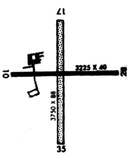
Kamp Airport was still listed in the 2001 AOPA Airport Directory.
The field was described as having a 3,2,25' asphalt Runway 10/28 & a 3,750' turf Runway 17/35.
The operator was listed as Kamp Air Aviation, Inc.
Note that the crosswind runway was incorrectly depicted as being perpendicular to the paved runway.
Brien Miller recalled, “I believe that Bernie [Kamp] passed away
which was the beginning of the end of Kamp Airport as the neighbors were hostile to it.
The [flying] club eventually moved to Syracuse International.”
Jeffrey Miller recalled, At Kamp Air Aviation I was Director of Maintenance at the time of its closing due to sale to the Oneida Indian Nation.
The Nation contemplated continuing operation of the property as an airport as I was asked to have a personal meeting with the Nation's employee
whose responsibility it was to determine if it was feasible & profitable enough to fit their guidelines.
Although my meeting was a positive one, the Oneida Indian Nation decided not to undertake an aviation business as an addition to their varied portfolio.
The airport became a storage facility for them.
The Kamp family became my extended family as seeing the end of the dream of Bernie Kamp to build & operate a successful airport ended early 2001.”
According to the 2003 Annual Report of the NY Department of Transportation,
Kamp Airport was one of 2 public use airports in NY which closed in 2002 (the other was Angola).
"This airport was purchased by the Oneida Indian Nation, which closed it for aviation use."
[I guess that's fair, after all, given that we took the property from them a few hundred years ago!]
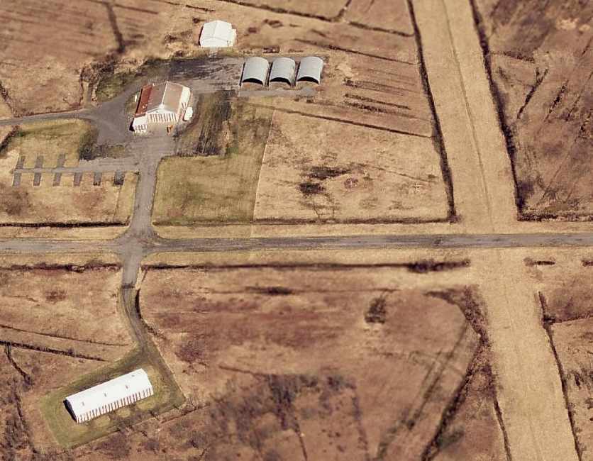
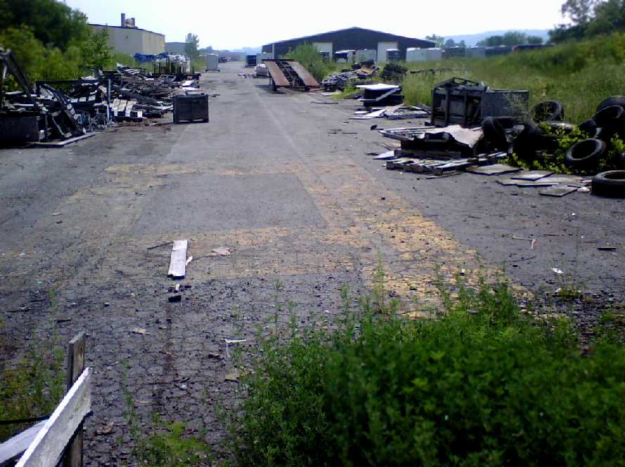
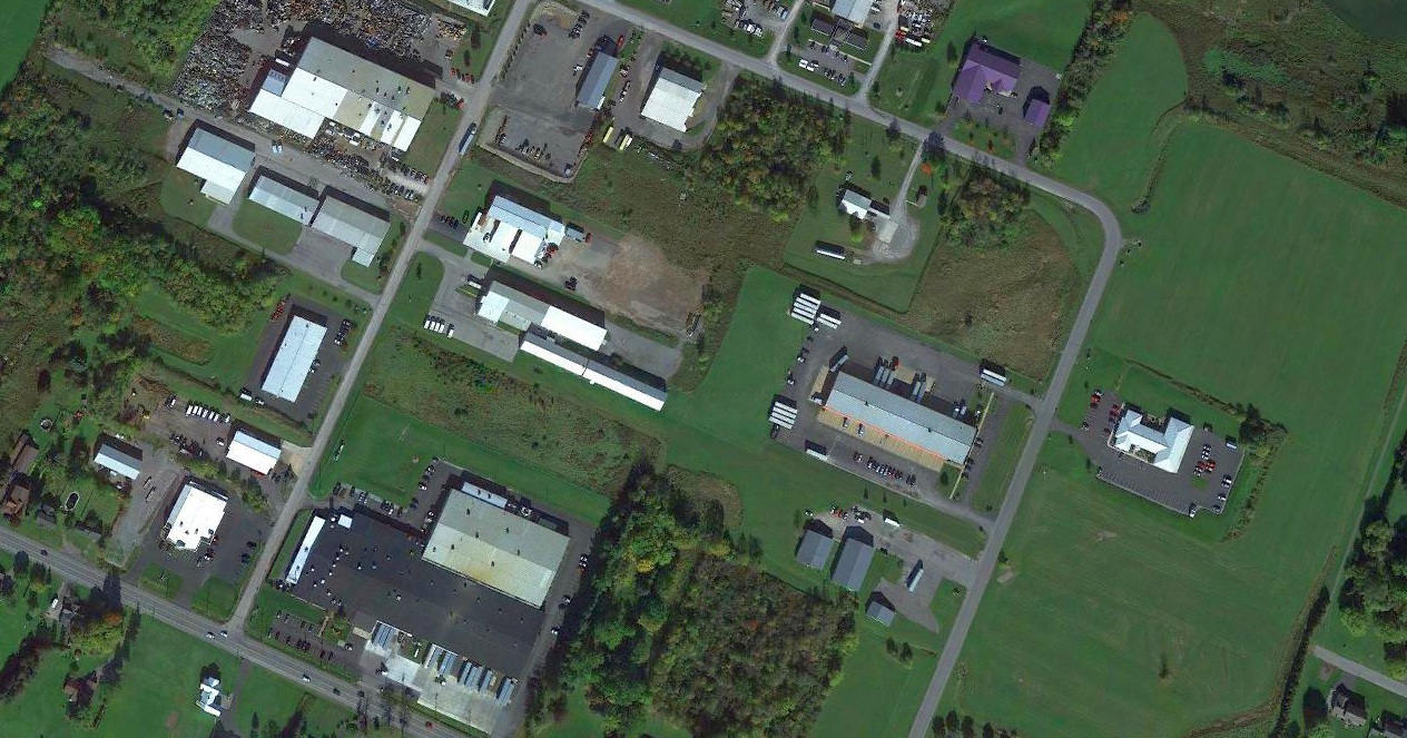
A circa 2006 aerial view looking north at the former hangars which remain at the site of Kamp Airport.
A 2008 aerial view by Phil Brooks looking east at Kamp Airport shows that the site remains intact,
with all of the hangars remained standing.
However the paved runway had deteriorated considerably.
A 2015 aerial view looking southeast depicted Kamp Airport remained intact though deteriorated.
Kamp Airport is located southeast of the intersection of Route 31 & Irish Ridge Road.
____________________________________________________
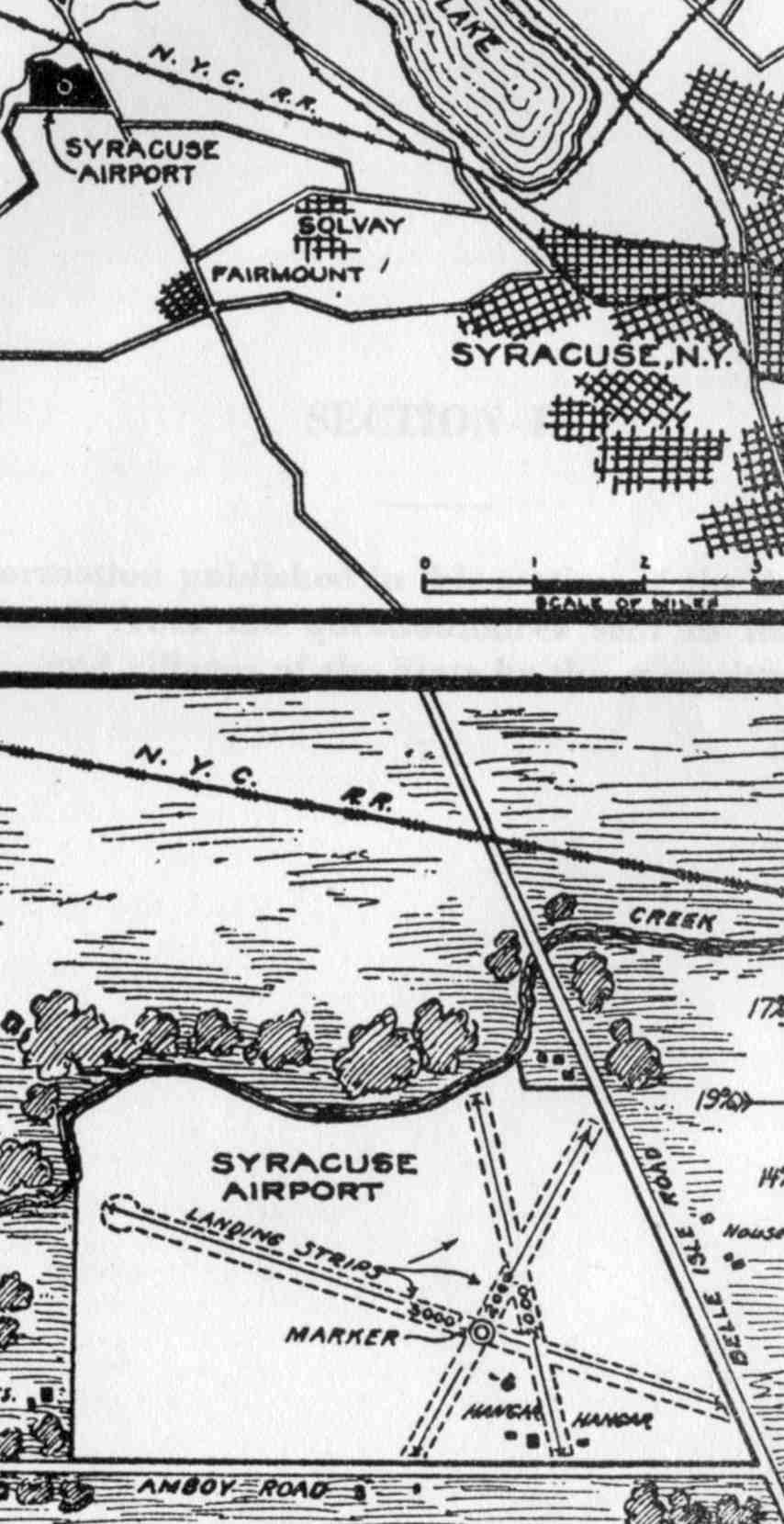
Syracuse Municipal Airport, Amboy, NY
43.07, -76.26 (Northwest of Syracuse, NY)
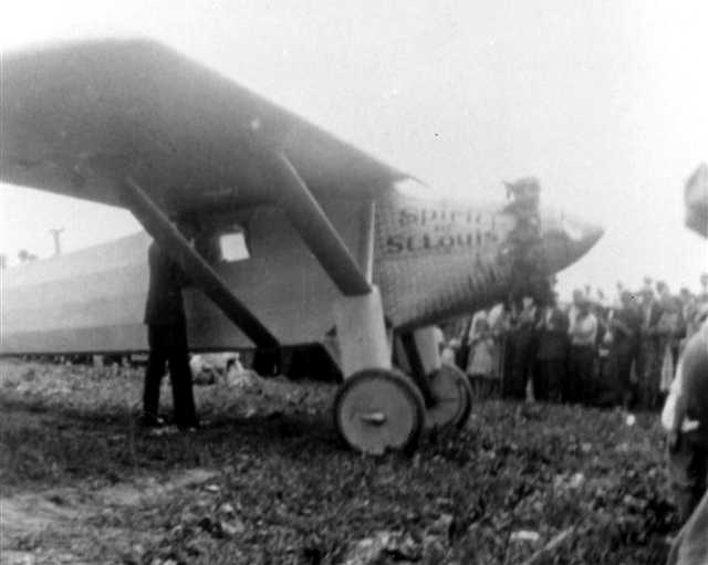
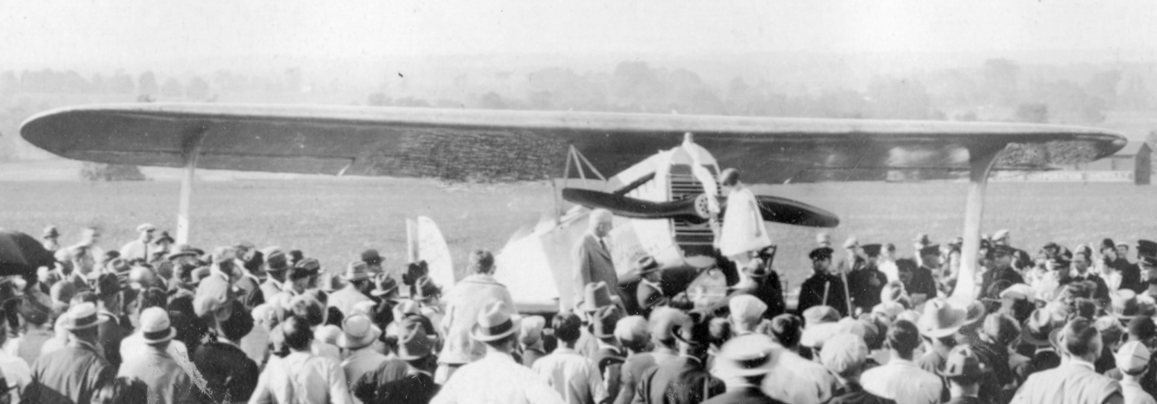
A 1927 photo of Charles Lindbergh in front of his “Spirit of St.Louis” at Syracuse Airport.
to a crowd of 2000 people in 1927
According to the web site of the Syracuse Airport Aircraft Rescue & Fire Fighting Department (courtesy of Drew Van Horne),
the City of Syracuse (led by mayor & former WW1 flier Charles Hanna)
purchased the former Hinsdale farm in Amboy for $50,000 in 1926,
after deciding that Syracuse should have its own municipal airport.
The "Old Hinsdale Field" site was chosen as it was very level & offered room for expansion
(according to the Syracuse Hancock Field web site, courtesy of Drew Van Horne).
Syracuse City Airport (Municipal Field) officially opened in 1927,
and was operated by the city parks department.
The earliest photo which has been located of Syracuse Airport
was a 1927 photo of Charles Lindbergh in front of his “Spirit of St.Louis” at Syracuse Airport.
He was greeted by a crowd of 2,000 people.
Thousands flocked to the grass strip for air shows that featured famed aviators & personalities of the day
such as Amelia Earhart, Kate Smith and Lowell Thomas.
The first airmail arrived at Syracuse City Airport on 5/1/28.
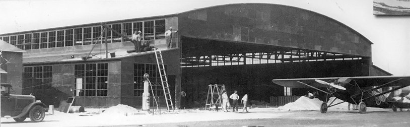
A large hangar was constructed at Syracuse Airport by the General Aviation Company in 1928.
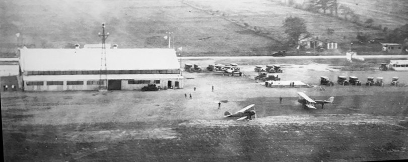
A circa late 1920s aerial view of 3 planes, a hangar, and a beacon tower at Syracuse Airport (from the Syracuse Regional Aviation Museum, courtesy of Ron Plante).
A 1929 NY Legislative Report (courtesy of Tom Heitzman) described Syracuse Airport as a 137 acre rectangular property having 3 runways,
the longest measuring 3,000' northwest/southeast.
The airfield was said to be owned & operated by the City of Syracuse.
The 1929 "Rand-McNally Standard Map of NY with Air Trails" (courtesy of Chris Kennedy)
described Syracuse Municipal Airport as having a 2,000' x 3,600' field.
A 1929 photo of the construction of Syracuse Airport's Lipe Hangar (from the Syracuse Regional Aviation Museum, courtesy of Ron Plante).
It became the airport's main hangar, and was named after Charles Lipe (President of General Aviation Company), who paid $140,000 for its construction.
Syracuse Airport's terminal building was built by the city in 1929.
American Airways' Ford Tri-Motors were routinely touching down on the airport's 3 grass runways by 1931.
On 8/28/33 aviator Wiley Post landed at the Syracuse Airport in his "Winnie Mae".
A circa 1933 photo of the Mayor Rolland Marvin (2nd from right) & members of his administration
at the Syracuse Airport terminal building (from the Syracuse Regional Aviation Museum, courtesy of Ron Plante),
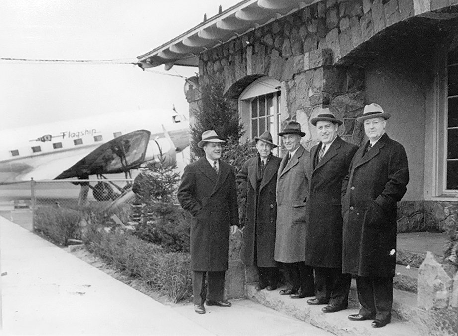
with an American Airlines Douglas DC-3 airliner in the background.
The earliest aeronautical chart depiction which has been located of Syracuse Municipal Airport was on the June 1933 Albany Sectional Chart.
A circa 1930s photo of the original 1928 General Aviation Company hangar at Syracuse Airport (from the Syracuse Regional Aviation Museum, courtesy of Ron Plante).
By the late 1930s it was used as a repair service school, after 2 larger hangars had been constructed.
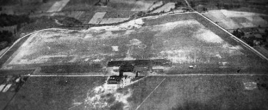
An undated aerial view looking north at Syracuse Municipal Airport,
from The Airport Directory Company's 1937 Airports Directory (courtesy of Bob Rambo).
The field was described as having 2 sod runways,
with the longest being a 3,125' east/west strip.
The aerial photo in the directory depicted 2 hangars & at least one other building.
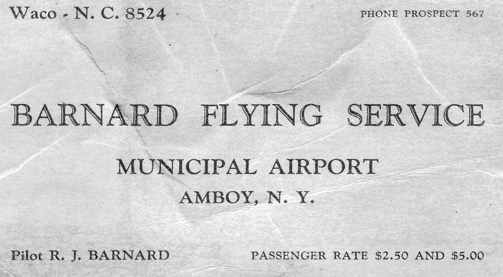
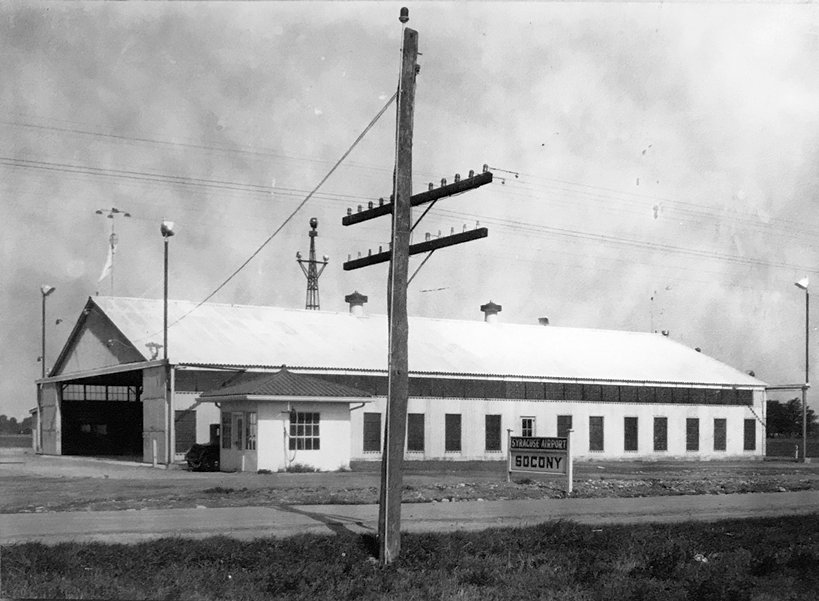
An undated business card for “Barnard Flying Service, Municipal Airport, Amboy” (courtesy of Tom Heitzman).
A 9/6/38 aerial view of Syracuse Municipal Airport (from Cornell University, courtesy of Chris Kennedy)
showed that the field had been been upgraded with paved runways by 1938.
It was depicted as having 3 paved runways, oriented northwest/southeast, northeast/southwest, and north/south.
Two hangars were depicted in the aerial photo.
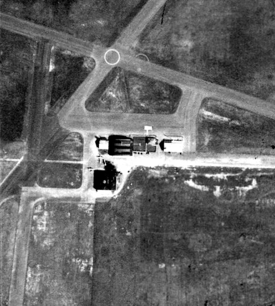
A closeup from the 9/6/38 aerial view (from Cornell University, courtesy of Chris Kennedy)
showed 2 planes among the hangars at Syracuse Municipal Airport.
Airline traffic quickly outgrew Syracuse Municipal Airport,
and by the end of the 1930s, it was already somewhat behind the times.
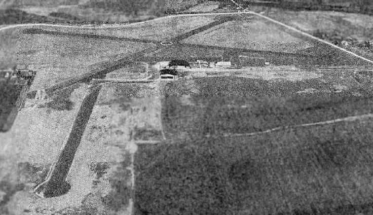
An aerial view looking north at the Syracuse Municipal Airport,
from The Airport Directory Company's 1941 Airports Directory (courtesy of Chris Kennedy).
The field was described as having three 3,000' paved runways, oriented northwest/southeast, northeast/southwest, and north/south.
Two hangars were depicted in the aerial photo.
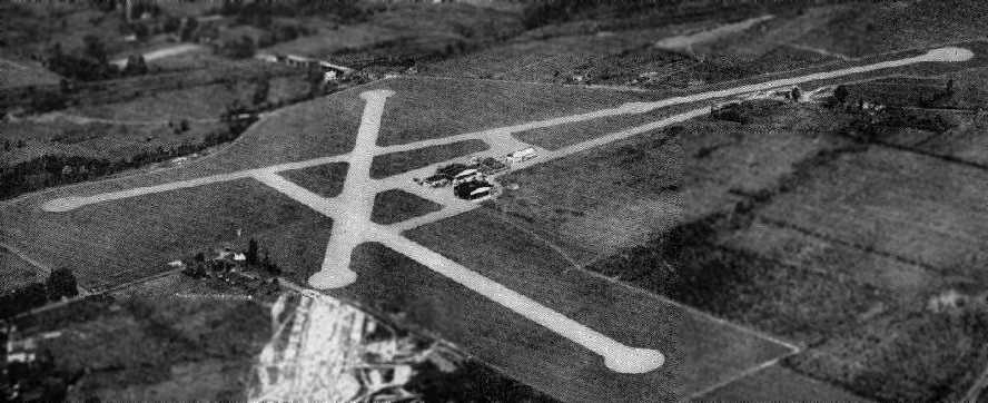
showing the field to have 3 paved runways, and several hangars southeast of the runway intersection.
Note the construction in the foreground, to extend the northeast/southwest runway further to the southwest.
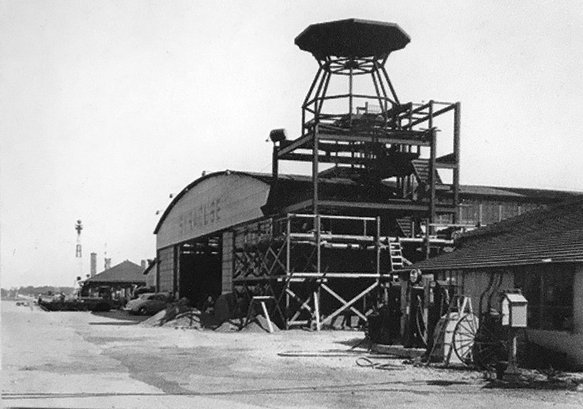
A 1941 photo of the Syracuse Airport control tower under construction (from the Syracuse Regional Aviation Museum, courtesy of Ron Plante).
With the outbreak of WW2, several local flying instructors at the Airport were pressed into military duty
and the Amboy City Airport became a flight training center.
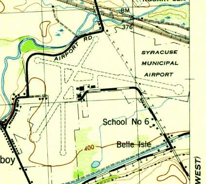
The 1943 USGS topo map depicted Syracuse Municipal Airport as having 3 runways
and a ramp with several buildings south of the runway intersection.
The April 1944 US Army/Navy Directory of Airfields (courtesy of Ken Mercer)
described the field as having a 5,000' hard-surfaced runway,
and indicated that Army operations were conducted from the field.
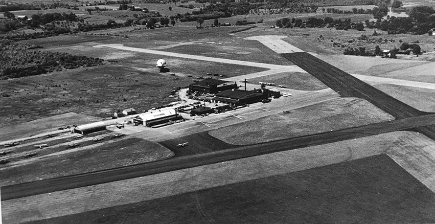
A 1947 aerial view looking souhwest at Syracuse Airport (from the Syracuse Regional Aviation Museum, courtesy of Ron Plante),
showing a blimp behind the hangars, and several dozen light aircraft.
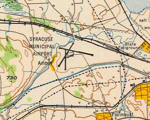
The 1949 USAF Target Complex Chart (courtesy of Chris Kennedy)
depicted Syracuse Municipal Airport as having 3 paved runways
(with the longest being a 4,000' northwest/southeast strip),
and a ramp with at least 2 hangars south of the runway intersection.
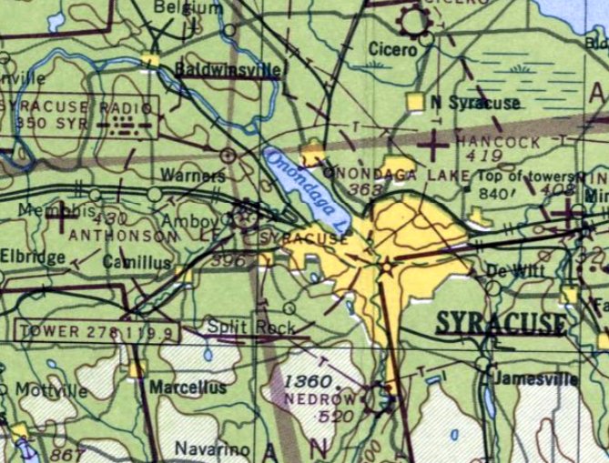
The last aeronautical chart depiction which has been located of Syracuse Municipal Airport was on the July 1949 Albany Sectional Chart.
The much larger Syracuse Army Air Base was rededicated on 9/17/49 as the new Clarence E. Hancock Airport,
replacing Syracuse Municipal Airport.
Syracuse Municipal Airport was no longer depicted on the January 1950 Albany Sectional Chart.
The original Syracuse Airport eventually became a chemical waste bed for Allied Chemical & Dye Corporation by 1951.
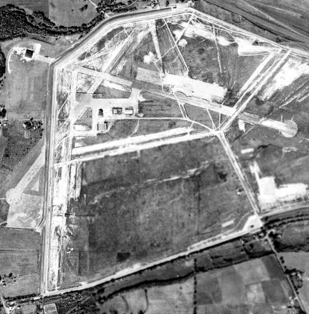
A 10/5/51 aerial view of the site of Syracuse Municipal Airport (from Cornell University, courtesy of Chris Kennedy)
showed that the field had been redeveloped as a dumping site,
but the hangars still remained standing, and most of the length of the runways remained intact as well.
A single hangar appeared to have been built on the northwest end of the northwest/southeast runway at some point between 1941-51.
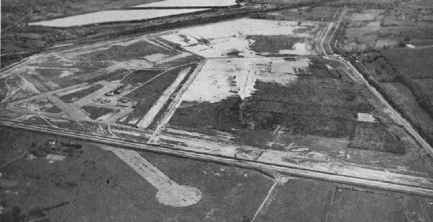
Remains of 2 runways were still visible, as well as the ramp & the foundations of hangars.
A 1956 aerial view showed that the hangars had been removed at some point between 1950-56.
The southern & eastern portion of the airport site was labeled as "Tailings Pond" on the 1957 USGS topo map.
A 1972 aerial photo showed the majority of the land of the former airport had been thoroughly covered-over by a landfill,
with the exception of the southwestern portion of the northeast/southwest runway.
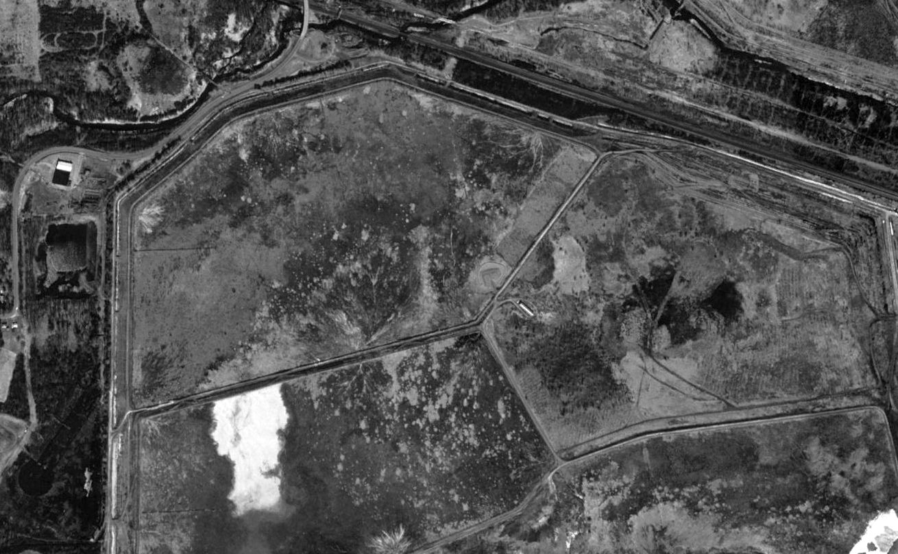
A 1994 USGS aerial view showed the site of Syracuse Municipal Airport had been largely covered-over by a landfill.
However, a close inspection reveals the distinctive remains of the southwest end of the former northeast/southwest runway,
complete with its distinctive turnaround at the end of the runway,
along with a former hangar on the northwest portion of the site.
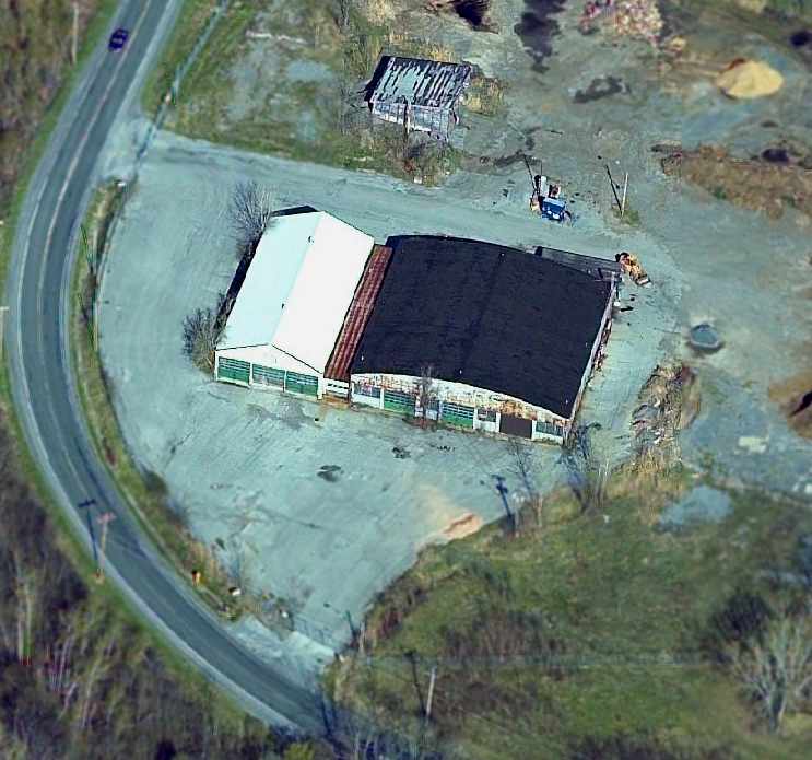
A circa 2001-2005 aerial view looking east at the former hangar which remains standing
on the northwest side of the former Syracuse Municipal Airport.
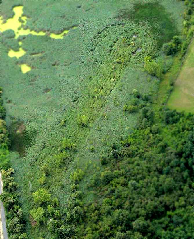
A circa 2001-2005 aerial view looking south at the southern end of the former northeast/southwest runway,
complete with a distinctive circular turnaround pad.
Although overgrown, the presence of asphalt has mad the outline of the former runway still remain perceptible.
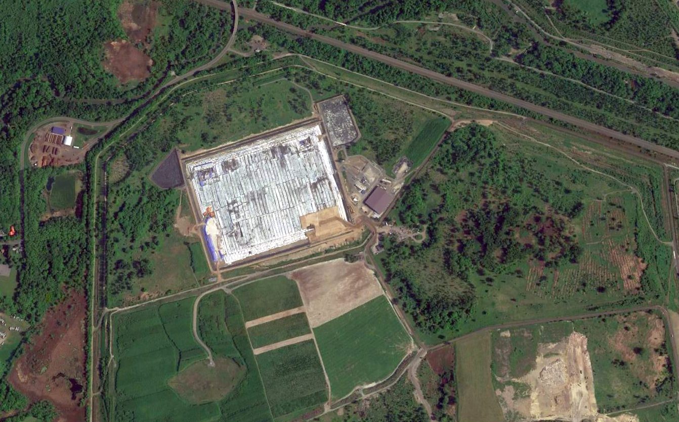
A 2015 aerial view of the site of Syracuse Municipal Airport shows the distinctive remains of the southwest end of the former northeast/southwest runway,
along with a former hangar on the northwest portion of the site.
Christian O'Brien reported in 2019, “The former hangar by the old Amboy airport site no longer exists & the site that it was (that was the end of one of the airport runways) is now used as a county compost site.”
The site of Syracuse Municipal Airport is located east of the intersection of Route 173 & Airport Road, appropriately enough.
Thanks to Chris Kennedy for pointing out Syracuse Municipal Airport.
____________________________________________________
Nedrow Airpark (NY38), Nedrow, NY
42.965, -76.145 (South of Syracuse, NY)
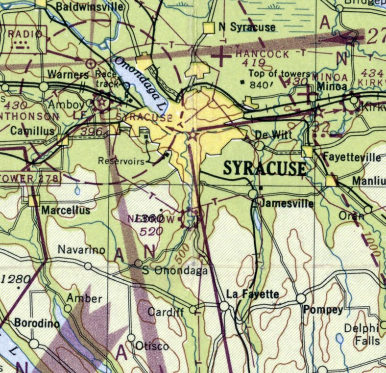
Nedrow Airpark, as depicted on the January 1948 Albany Sectional Chart.
The date of construction of this small general aviation airport had not been determined.
Nedrow Airpark apparently dates back to before 1926,
as that is when "Nedrow Field" was considered by Syracuse Mayor Charles Hanna
as one of several sites for a new Syracuse Municipal Airport
(according to the Syracuse Hancock Field web site, courtesy of Drew Van Horne).
Nedrow was not chosen (for reasons not specified), but instead continued to operate as a general aviation airport.
However, no airfield at this location was depicted on the May 1935 Albany Sectional Chart
nor visible on a 9/6/38 aerial photo,
nor depicted on subsequent aeronautical charts through the January 1947 Albany Sectional Chart.
The earliest depiction which has been located of Nedrow Airpark was on the January 1948 Albany Sectional Chart.
It depicted Nedrow as a commercial/municipal airport.
According to Pat Lyons, “The Airpark was operated by my father, Francis W. 'Red' Lyons
for approximately 10 years starting around 1949/50.
I remember the grass runways well, as it was my job as a kid to cut the grass with an old tractor we had.
The office was at the far north end of the field & there were a few (5) small hangars on the east side of the strip.
A wind sock stood at the entrance to the park in the far northeast corner.
I believe my father had a 10 year lease from the Onondaga Nation on the property.
My father was a very well-known pilot, flight instructor & regional flight examiner for the area.
He was known as 'Mr. Aviation of Our Community'
and there is a plaque honoring him at the current terminal of Hancock International Airport in Syracuse.”
The 1950 Albany Sectional Chart (courtesy of Mike Keefe) described Nedrow Airpark as having a single 2,100' unpaved runway.
Bill Wilcox recalled "Nedrow Air Park was there in 1950-52.
I was a senior at Mexico NY & we had a gym cadet from Syracuse University who used to fly to school.
The SU flying club had at least one J-3 [Cub] they kept there.
I remember flying back to Syracuse with Joe, and on one occasion I went there with a friend of his for a ride."
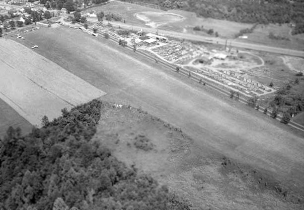
The earliest photo which has been located showing Nedrow Airpark was a 1954 aerial view looking northeast,
which 7 single-engine aircraft parked amidstsome small hangars on the north side of a north/south grass runway.
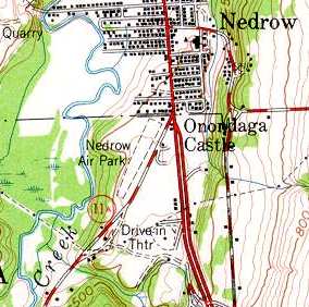
The 1955 USGS topo map depicted Nedrow Air Park as having a single unpaved northeast/southwest runway.
Vince Sbardella recalled, “In 1957-58 I had a J-5 Cub Cruiser at Nedrow Airport, and was acquainted with 'Red' Lyons.”
The 1962 AOPA Airport Directory described Nedrow as having a single 2,100' turf Runway 18/36, and listed the operator as Nedrow Airpark Inc.
According to Eric Hansen (Lockheed Martin Test Pilot), "As a high school senior in 1966, our Air Force family moved to Syracuse, NY.
I had received my private pilot's license in Arkansas only a few months before,
and I was looking for a place to rent flying time to keep up my 'habit'.
My father was assigned as the Professor of Aerospace Studies at Syracuse University,
and the Air Force had a contract with Nedrow Air Park to provide flight screening for ROTC cadets who were potential pilot candidates.
I got a special rate there."
"The chief pilot & airport manager was Marty Springer, who had a Clark Gable look, with slicked back black hair & a mustache,
a bit rough around the edges, and wore an old leather flight jacket most of the time."
"The field was paved, and had the proverbial 50' trees at the north end,
requiring more than the usual pilot technique for landing, since the full 2,100' was only usable for takeoff.
I rented Cessna 172s there often enough to stay current,
as I finished high school & completed my 4 year degree at Syracuse University."
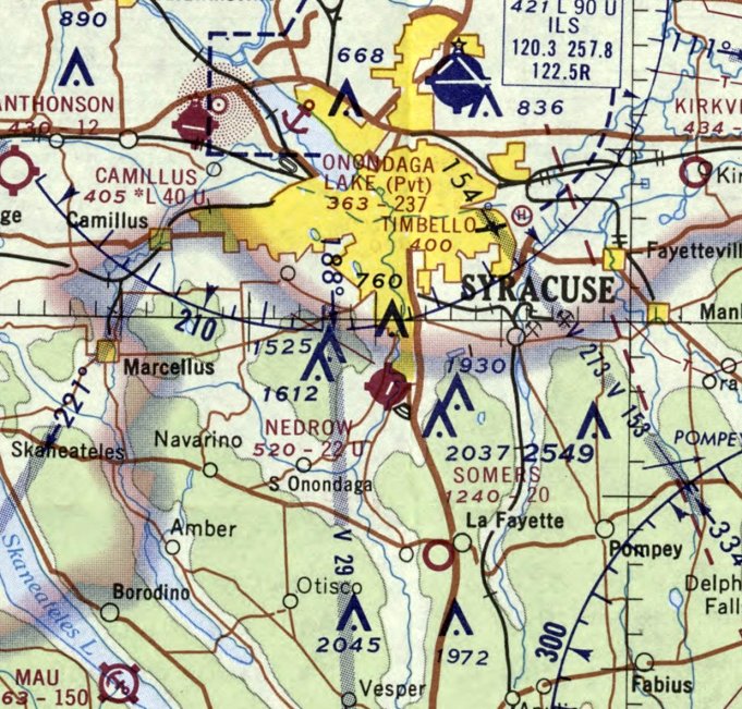
Nedrow Airpark was depicted on the February 1970 Albany Sectional Chart as having a single 2,200' paved runway.
Eric Hansen recalled, "My last flight out of Nedrow was in June of 1972, when I was sent to Oklahoma to become an Air Force pilot myself."
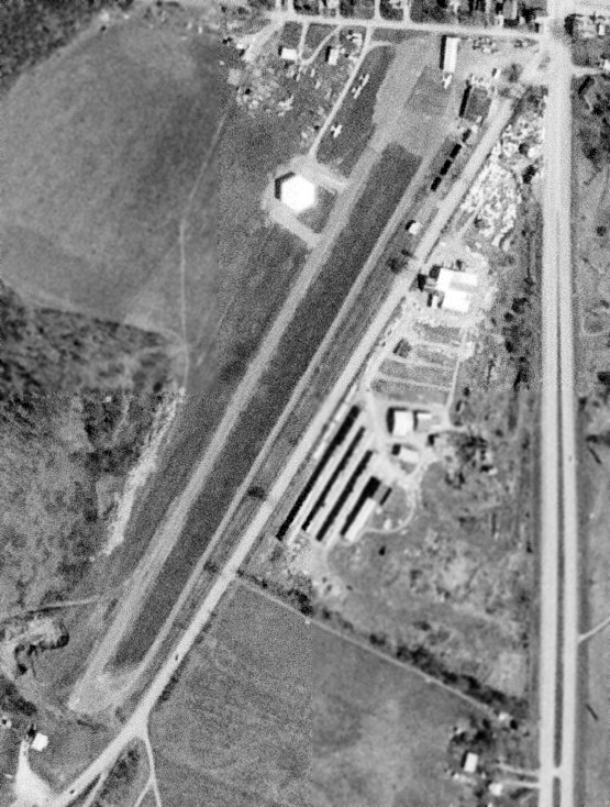
A 5/21/72 USGS aerial view depicted a total of 4 single-engine aircraft parked amidst some small hangars on the northeast side of Nedrow Airpark.
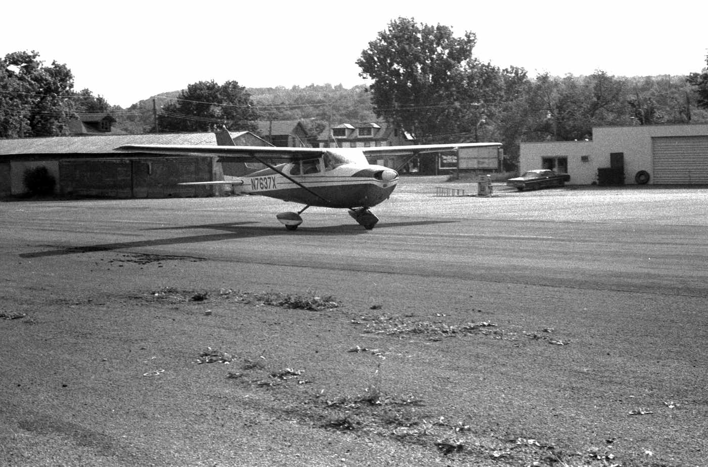
The last photo which has been located showing Nedrow Airpark while open
was a 6/3/74 photo by Alan Reddig looking east at Carl & K.C. Jeronimo departing in a Cessna 172 from Nedrow's Runway 21.
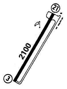
Nedrow Airpark was still depicted as an active airport in the 1979 Flight Guide (courtesy of Chris Kennedy).
It was depicted as having a single 2,100' paved Runway 3/21, with a parallel taxiway on the east side.
A total of 5 small buildings (hangars?) were depicted on the northeast corner of the field.
Nedrow Airpark was evidently closed within the next year,
as it was depicted as a closed airport on the 1980 Sectional Aeronautical Chart (courtesy of Ed Drury).
According to Brien Miller, “Nedrow was another sore point to local pilots, although that wasn't a strip I went into.
It was a fairly nice little valley-style field & one of the few in the area with a north/south alignment - due mostly to being in the vale of the Onondaga valley.
But the Onondaga Indian Tribe leveraged a law & took the property as well as a swath of the village.
Locals fought viciously but the tribe had a solid treaty.
It took them less than a week to convert the airport into a junk yard, bingo hall, and liquor store.
The South Syracuse pilots who flew from there remain bitter to this day.
Most moved to Cortland's Chase Field.”
In addition to Nedrow Airpark's single runway, the 1988 USGS topo map depicted a parallel taxiway,
a small ramp with 2 buildings at the north end of the runway,
and what appeared to be a hexagonal hangar west of the runway.
A 1995 USGS aerial view looking west showed Nedrow Airpark's runway & buildings still appeared to be completely intact.
A circa 2005 aerial photo looking north at the former hexagonal hangar, runway, and ramp at the former Nedrow Airpark.
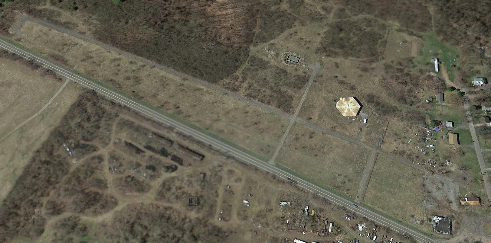
A 2017 aerial view looking west at the remains of the Nedrow Airpark. What a shame to see the aviation facilities of this nice little grassroots airport going to waste.
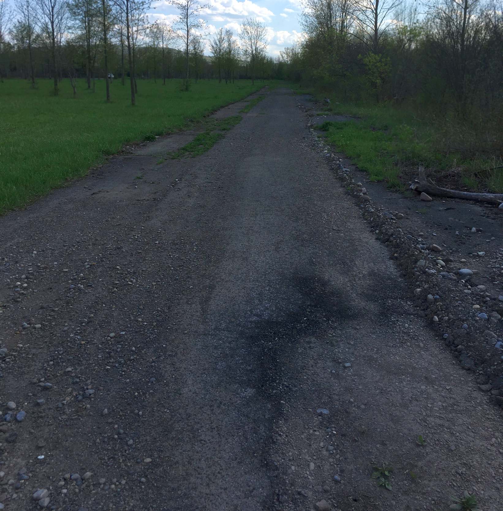
A 5/9/18 photo by Christian O'Brien of the remains of the paved runway at the site of Nedrow Airpark.
Christian reported, “I walked the full length of the runway at the old Nedrow Airpark & apart from being overgrown in places most of the pavement is still there.
I flew a paper airplane as a symbolic & silent protest while walking down the runway.
The site doesn't seemed to be used for anything & there's no sign of any future development.”
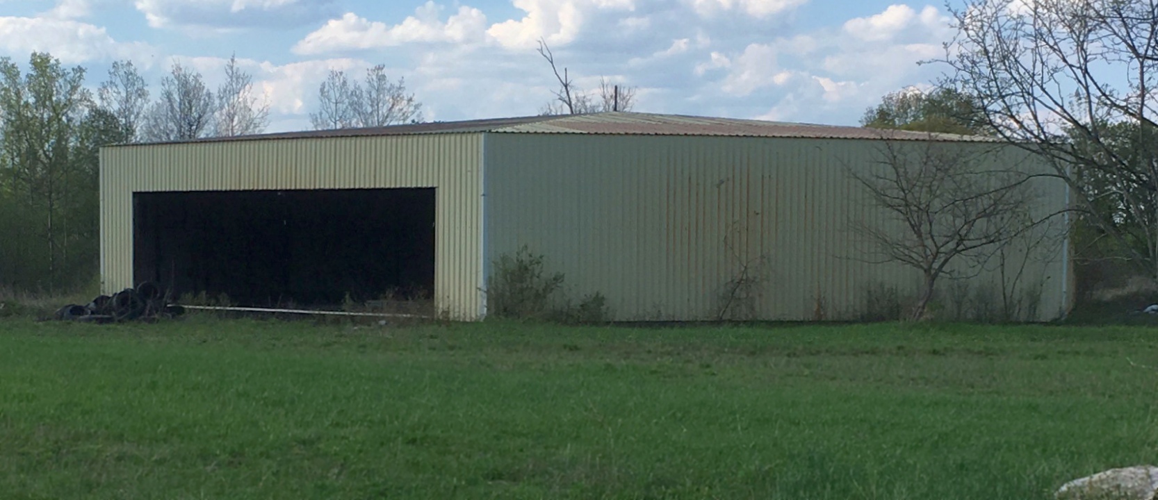
A 5/9/18 photo by Christian O'Brien of the former hexagonal hangar at the site of Nedrow Airpark.
The site of Nedrow Airpark is located within the Onondaga Reservation, southwest of the intersection of Route 11A & West Conklin Ave.
____________________________________________________
Since this site was first put on the web in 1999, its popularity has grown tremendously.
If the total quantity of material on this site is to continue to grow,
it will require ever-increasing funding to pay its expenses.
Therefore, I request financial contributions from site visitors,
to help defray the increasing costs of the site
and ensure that it continues to be available & to grow.
What would you pay for a good aviation magazine, or a good aviation book?
Please consider a donation of an equivalent amount, at the least.
This site is not supported by commercial advertising –
it is purely supported by donations.
If you enjoy the site, and would like to make a financial contribution,
you
may use a credit card via
![]() :
:
Please consider checking the box to make a monthly donatation.
For a mailing address to send a check, please contact me at: paulandterryfreeman@gmail.com
If you enjoy this web site, please support it with a financial contribution.
please contact me at: paulandterryfreeman@gmail.com
If you enjoy this web site, please support it with a financial contribution.
____________________________________________________
This site covers airfields in all 50 states.