Abandoned & Little-Known Airfields:
Alabama: Mobile area
© 2002, © 2023 by Paul Freeman. Revised 1/7/23.
This site covers airfields in all 50 states: Click here for the site's main menu.
____________________________________________________
Please consider a financial contribution to support the continued growth & operation of this site.
(Original) Atmore Airport / Atmore Intermediate Field (revised 8/21/21) - (Original) Brewton Municipal Airport (revised 10/2/22)
Davis Airport / Idle Hour Airport (revised 10/31/21) - Faircloth NOLF (revised 6/22/22) - Foley Municipal Airport (original) / Barin NAAS (revised 10/22/21)
Fort Morgan Airfield (revised 1/7/23) - Grove Hill Municipal Airport (revised 8/12/21) - Klumpp Field (added 10/22/21) - Magnolia NOLF (revised 12/8/20) - McKee Airport (added 12/7/21)
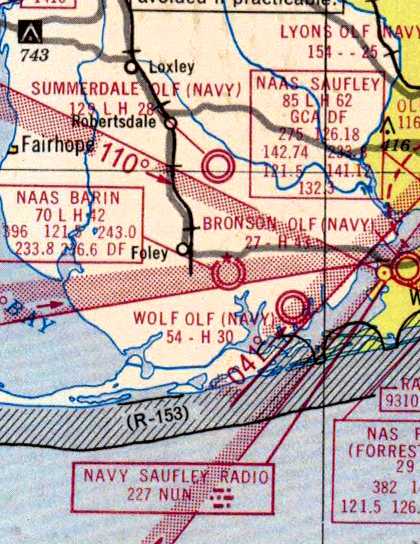
Oak Airport (revised 1/7/23) - Silverhill NOLF (revised 10/22/21) - Summerdale NOLF (revised 11/16/20) – Reimer Field / Wilson Field (revised 1/20/21) - Wolf NOLF / Field 27016 (revised 6/22/22)
____________________________________________________
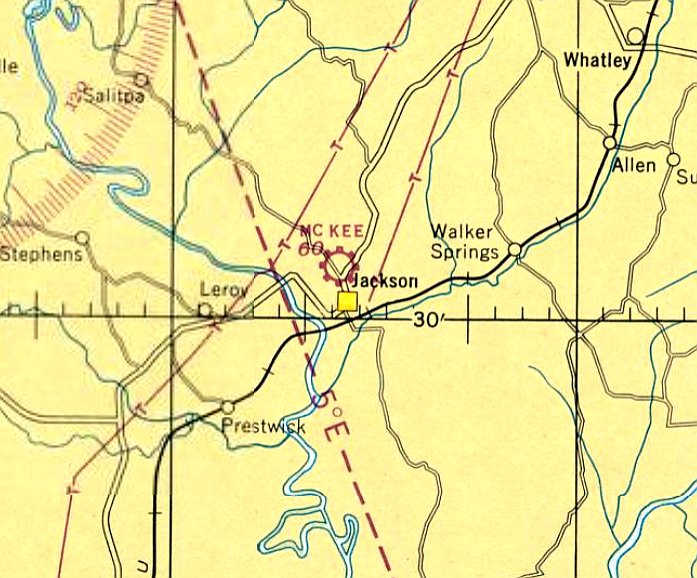
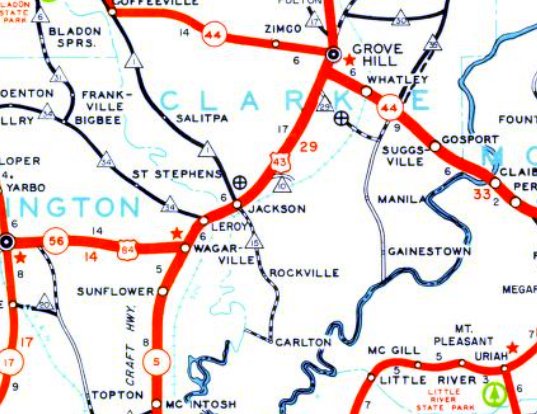
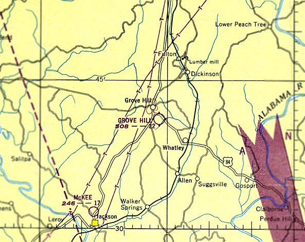
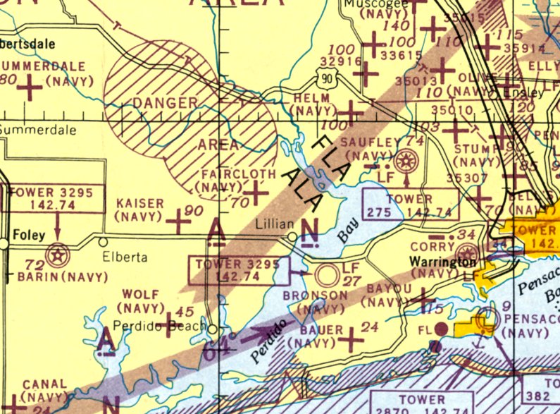
31.536, -87.901 (Northeast of Mobile, AL)
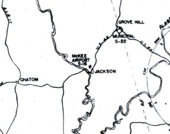
McKee Airport, as depicted on the February 1947 Mobile Sectional Chart (courtesy of Rob Grant).
Jackson's first airport was a short-lived little field adjacent to the north side of the town.
McKee Airport was evidently established at some point between 1946-47 (like hundreds of other small airports in the post-WW2 US aviation boom),
as it was not yet depicted on the 1946 Mobile Sectional Chart.
The earliest depiction which has been located of McKee Airport was on the February 1947 Mobile Sectional Chart (courtesy of Rob Grant),
which depicted McKee as a commercial/municipal airport.
McKee Airport, as depicted on the 1948 AL State Highway Map (courtesy of Rob Grant).
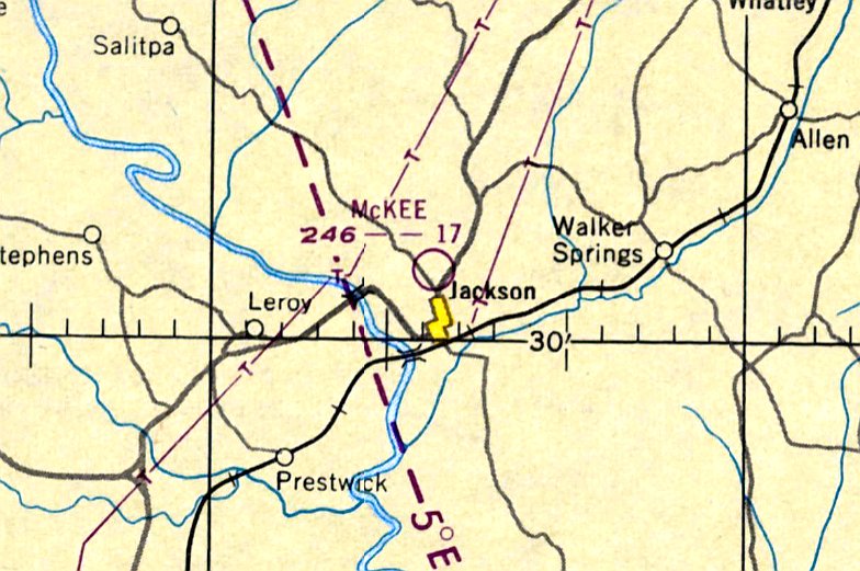
The last aeronautical chart depiction which has been located of McKee Airport was on the February 1950 Mobile Sectional Chart (courtesy of Rob Grant).
It depicted McKee Airport as having a mere 1,700' unpaved runway.
McKee Airport, as depicted on the 1954 AL State Highway Map (courtesy of Rob Grant).
The last map depiction which has been located of McKee Airport was on the 1955 AL State Highway Map (courtesy of Rob Grant).
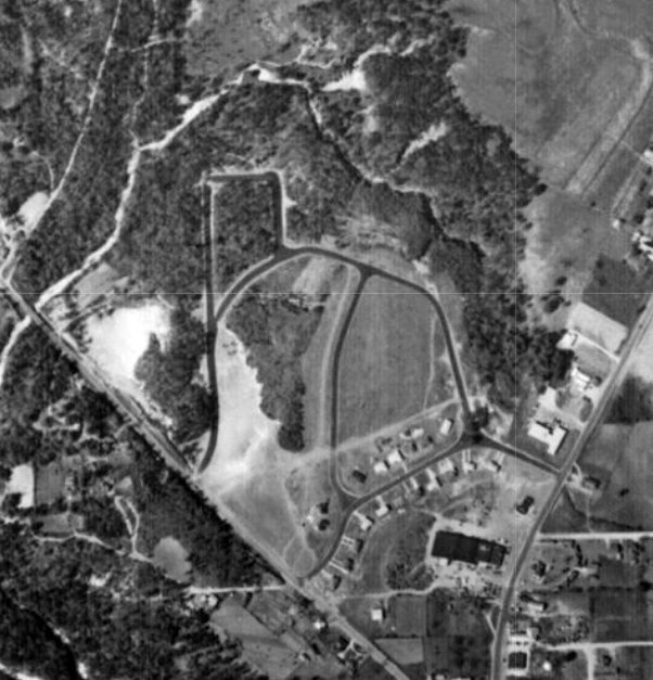
McKee Airport was evidently closed (for reasons unknown) at some point between 1950-55,
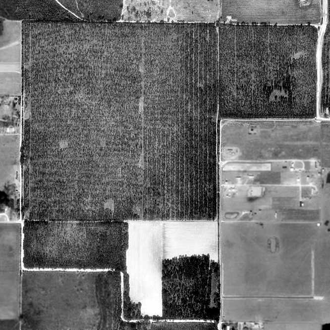
as a 1955 aerial photo (courtesy of Rob Grant) showed houses having been built over the airport site.
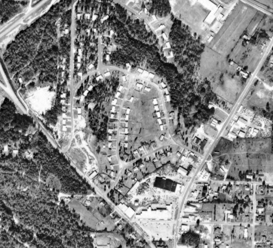
A 1966 aerial photo (courtesy of Rob Grant) showed even more houses covering the McKee Airport site.
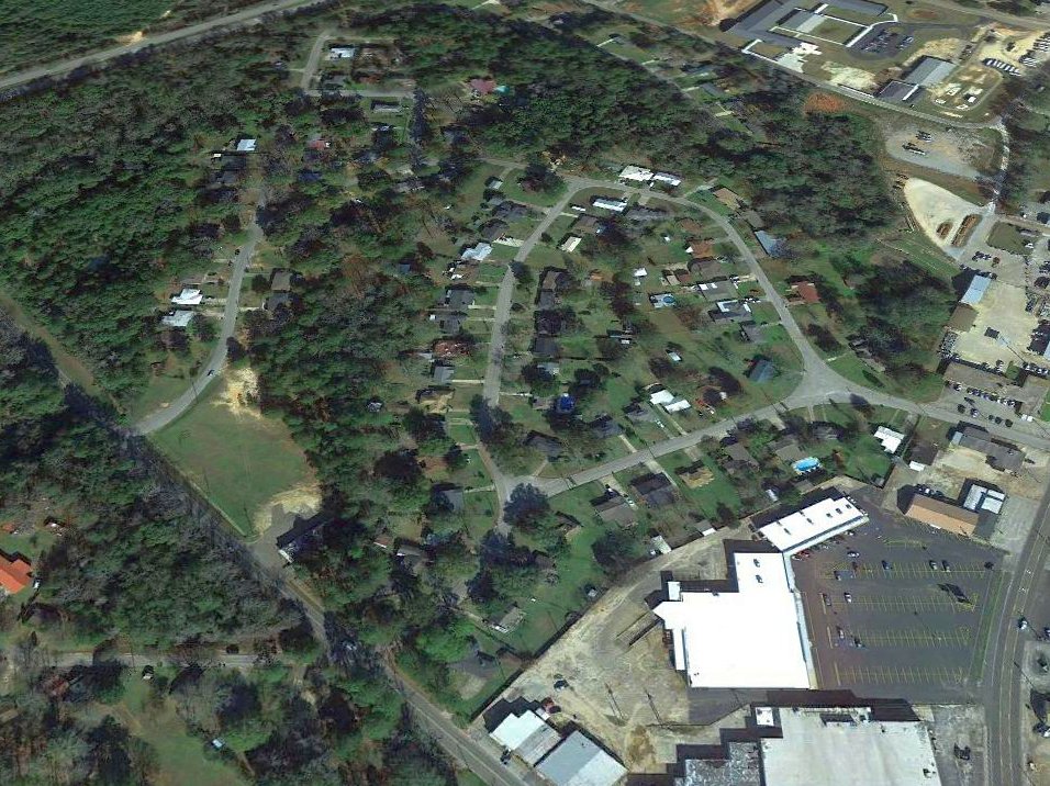
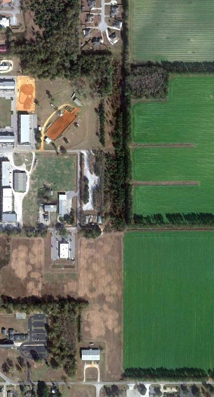
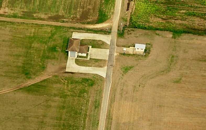
A 2016 aerial view looking north showed no trace remaining of McKee Airport.
Thanks to Rob Grant for pointing out this airfield.
____________________________________________________
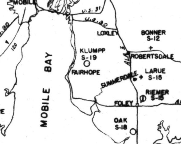
Klumpp Field / Klump Airport (AL78), Fairhope, AL
30.527, -87.854 (Southeast of Mobile, AL)
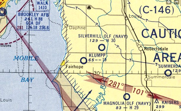
Klumpp Field, as depicted on the August 1953 Mobile Sectional Chart (courtesy of Rob Grant).
Fairhope’s first airport was Klump Field, owned by John Klumpp (according to John's obituary, courtesy of Rob Grant),
The date of establishment of Klumpp Field has not been determined.
The earliest depiction which has been located of Klumpp Field was on the August 1953 Mobile Sectional Chart (courtesy of Rob Grant),
which depicted Klumpp as having a 1,900' unpaved runway.
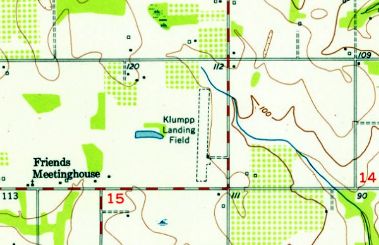
The earliest topo map depiction which has been located of Klumpp Field was on the 1953 USGS topo map (courtesy of Rob Grant).
It depicted “Klumpp Landing Field” as having a single unpaved north/south runway.
Klumpp Field was described in the August 1953 Airdrome Directory (courtesy of Rob Grant) as having a single 1,900' runway.
The 1954 Baldwin County Highway Map (courtesy of Rob Grant) depicted which depicted Klumpp as having a 1,900' runway.
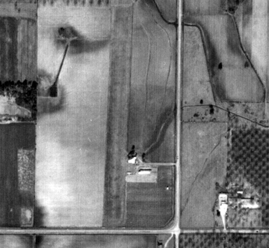
The earliest photo which has been located of Klumpp Field was a 1955 aerial view (courtesy of Rob Grant).
It depicted Klumpp Field as having a single grass north/south runway, with 1 light single-engine plane & 2 small buildings on the southeast side.

A 1960 aerial view (courtesy of Rob Grant) depicted Klumpp Field in an unchanged configuration, but there were no aircraft visible on the field.
A 1974 aerial view (courtesy of Rob Grant) depicted Klumpp Field in an unchanged configuration, but there were no aircraft visible on the field.
The last aeronautical chart depiction which has been located of Klumpp Field was on the June 1999 New Orleans Sectional Chart (courtesy of Ron Plante),
which depicted Klumpp as a private airfield having a 2,200' unpaved runway.
Klumpp Field owner John Klumpp passed away in 2007 (according to his obituary, courtesy of Rob Grant).
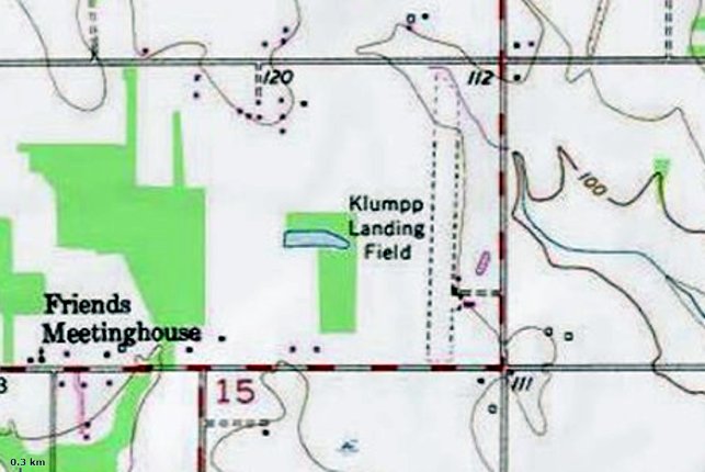
The 2013 USGS topo map (courtesy of Rob Grant) still depicted “Klumpp Landing Field” as having a single unpaved north/south runway, with a few small buildings on the southeast side.
As of 2013, the FAA's Airport/Facility Directory (courtesy of Rob Grant) described Klumpp Airport as owned by Phyllis Klumpp, and it still listed the manager as John Klumpp.
It was said to have a single 2,200' turf Runway 17/35.
Klumpp Field was evidently closed at some point between 2013-17,
as it was no longer depicted on the May 2017 New Orleans Sectional Chart.
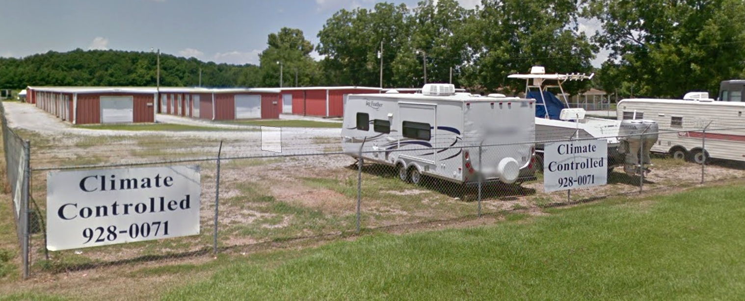
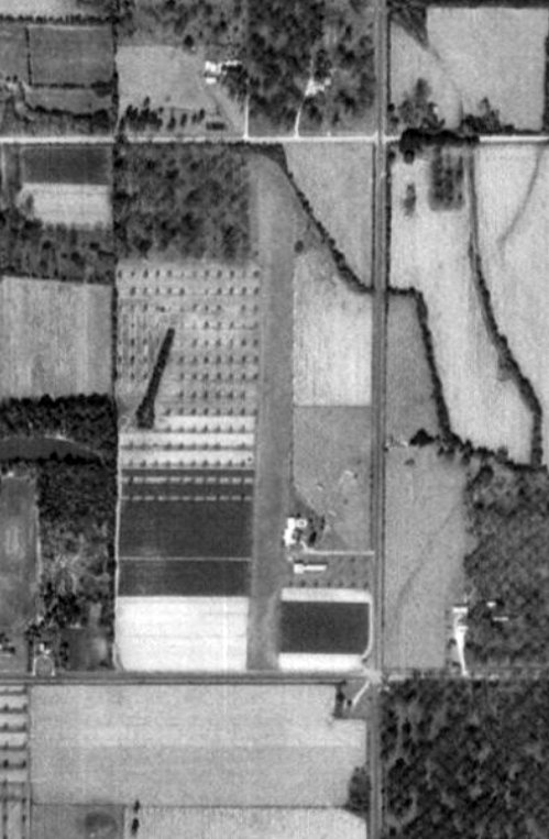
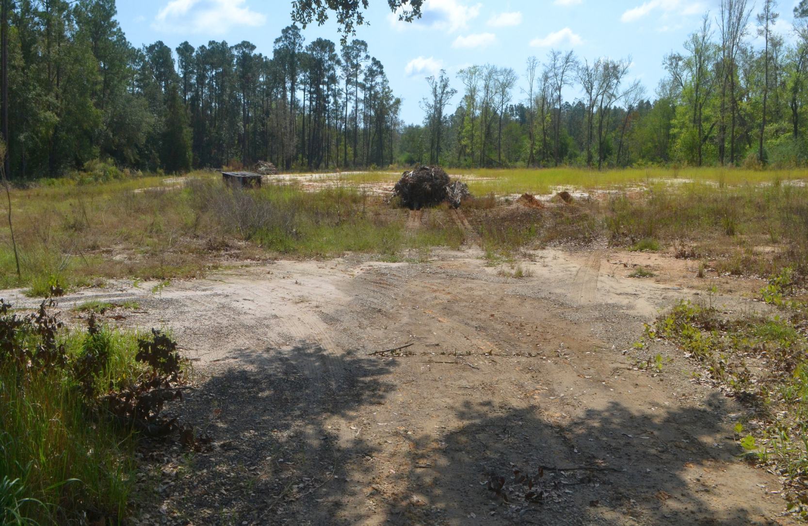
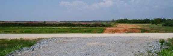
A July 2019 photo (courtesy of Rob Grant) looking west at the site of the Klump Field hangar, now a self storage facility.
A July 2019 photo (courtesy of Rob Grant) looking north at the site of the Klump Field runway.
A 2020 aerial view looking northwest showed the Klumpp Airport runway appeared intact, though no aircraft were visible on the field.
____________________________________________________
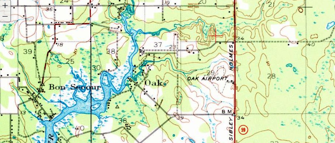
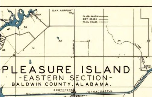
30.319, -87.685 (Southeast of Mobile, AL)
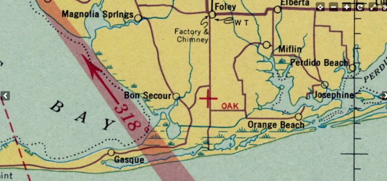
Oak Airport, as depicted on the February 1937 Mobile Sectional Chart (courtesy of Rob Grant).
Foley's first airport was located several miles south of town.
Oak Airport was evidently established at some point between 1936-37,
as it was not yet depicted on the September 1936 Mobile Sectional Chart.
The earliest depiction which has been located of Oak Airport was on the February 1937 Mobile Sectional Chart (courtesy of Rob Grant),
which depicted Oak Airport as an auxiliary airfield.
Oak Airport, as depicted on the 1937 Baldwin County Highway Map (courtesy of Rob Grant).
The 1938 Airport Directory (courtesy of Rob Grant) described Oak Field as being privately-owned,
with a irregularly-shaped sod field having 2 runways measuring 3,000' northeast/southwest & 2,600' east/west.
Oak Airport was the location of Seminole Air Service, which provided primary flight training (according to Rob Grant).
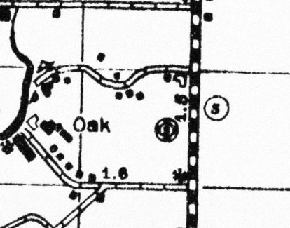
The earliest topo map depiction which has been located of Oak Airport was on the 1941 USGS topo map (courtesy of Rob Grant).
It depicted Oak Airport as an irregularly-shaped property outline, with several small buildings on the southeast side.
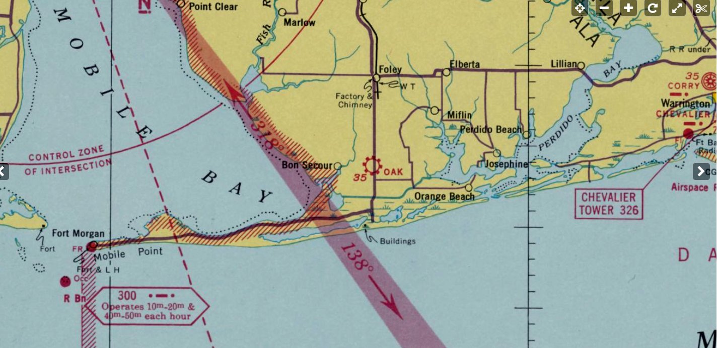
The 1941 Mobile Sectional Chart (courtesy of Rob Grant) depicted Oak Airport as an commercial/municipal airport.
Oak Airport was still depicted on the December 1942 Mobile Sectional Chart (according to Rob Grant).
Oak Airport was evidently closed at some point between 1942-44,
as it was no longer depicted on the January 1944 Mobile Sectional Chart.
It was presumably closed due to WW2 security concerns, like many other small civilian airports along the coasts.
Oak Airport was still not depicted on the February 1947 Mobile Sectional Chart.
Oak Airport was evidently reopened at some point in 1947, as it was once again depicted on the August 1947 Mobile Sectional Chart as a commercial/municipal airport.
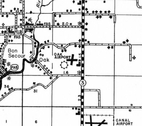
The 1950 Baldwin County Highway Map (courtesy of Rob Grant) depicted Oak Airport as having 2 runways.
A 1950 Pleasure Island map (courtesy of Rob Grant) depicted Oak Airport as having a few small buildings on the east side.
The earliest photo which has been located of Oak Airport was a 1955 aerial view.
It depicted Oak Airport as having 2 unpaved runways, with several small buildings & 4 or 5 light single-engine aircraft parked on the east side.
The last depiction which has been located of Oak Airport was on the August 1956 Mobile Sectional Chart.
It was described as having 2 turf runways, the longest being 2,000', with fuel & repair service available.
Oak Airport was evidently closed (for reasons unknown) at some point between 1956-57,
as it was no longer depicted on the February 1957 Mobile Sectional Chart.
A 1981 aerial photo showed the site of Oak Airport had become overgrown, with no trace remaining of the runways,
but possibly some foundations or other remains of the former airport buildings on its east side.
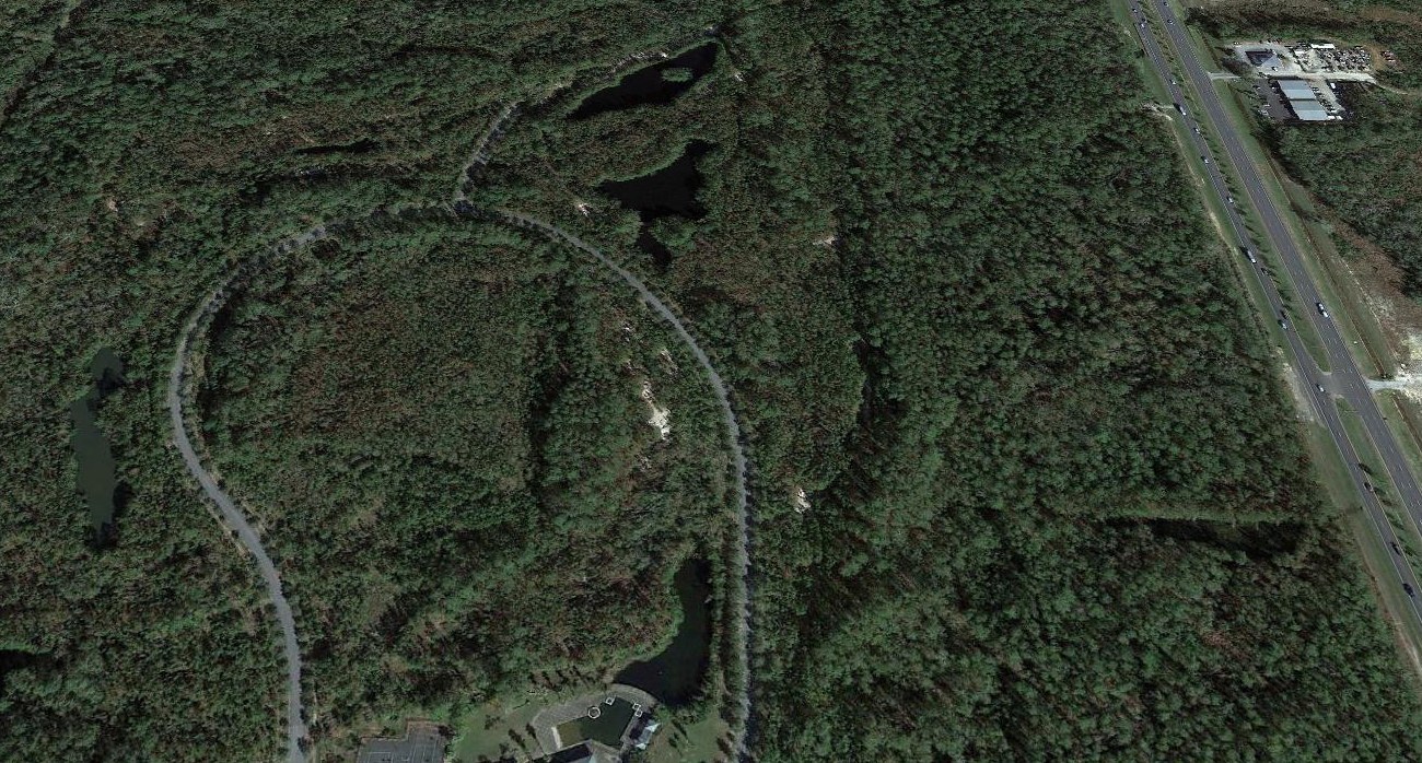
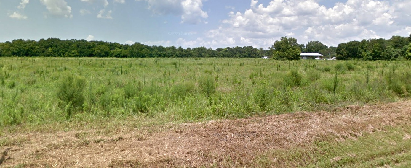
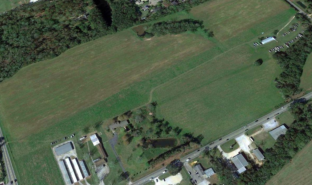
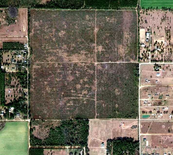
A 2020 aerial view looking north showed no trace of Oak Airport, with the property largely wooded.
Thanks to Rob Grant for pointing out this airfield.
____________________________________________________
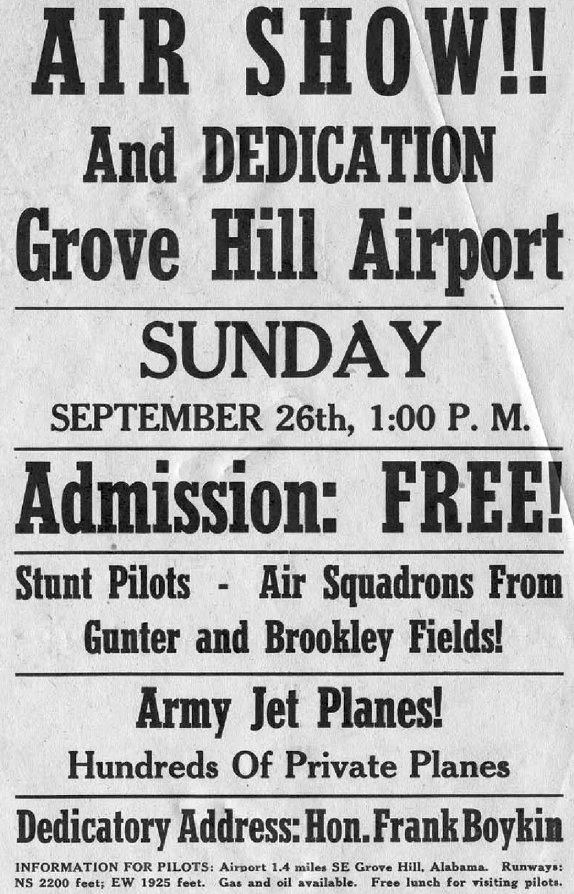
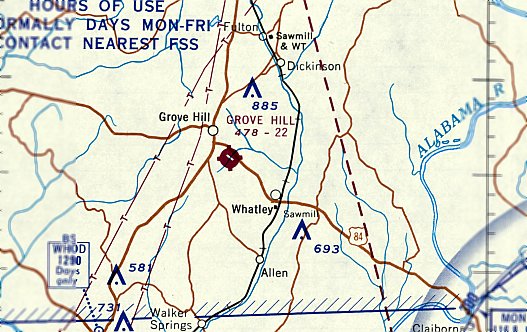
Grove Hill Municipal Airport (3A0), Grove Hill, AL
31.691, -87.762 (Northeast of Mobile, AL)
An announcement for the 9/26/48 Grove Hill Airport Dedication (courtesy of Rob Grant).
Grove Hill Municipal Airport was not yet depicted on the August 1946 Mobile Sectional Chart.
According to its FAA data, Grove Hill Municipal Airport was activated in August 1948.
A flyer announced an Air Show & Dedication on 9/26/48 for Grove Hill Airport (courtesy of Rob Grant).
The earliest depiction which has been located of Grove Hill Municipal Airport was on the February 1949 Mobile Sectional Chart.
It depicted Grove Hill Municipal Airport as having a 2,200' unpaved runway.
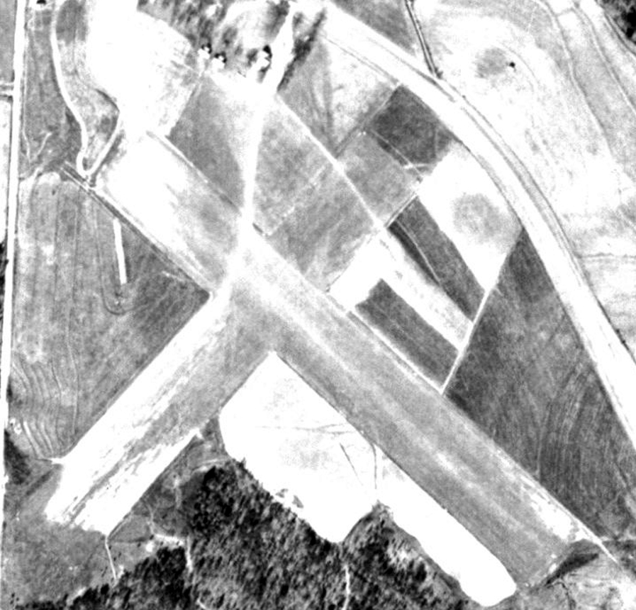
The earliest photo which has been located of Grove Hill Municipal Airport was a 1951 aerial view (courtesy of Rob Grant).
It depicted Grove Hill as having 2 perpendicular unpaved runways, with 3 T-hangars on the north side.
There were no aircraft visible on the field.
A 1956 aerial view (courtesy of Rob Grant) depicted Grove Hill Municipal Airport in an unchanged fashion.
Grove Hill Municipal Airport evidently gained a paved runway at some point between 1956-66,
as a 1966 aerial view (courtesy of Rob Grant) showed the northwest/southeast runway had been paved.
The February 1968 Mobile Sectional Chart depicted Grove Hill Municipal Airport as having a 2,200' paved northwest/southeast runway.
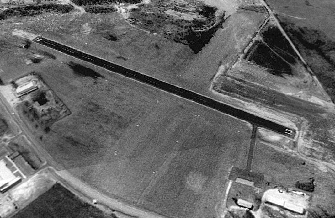
A 1992 aerial view looking southwest showed Grove Hill Municipal Airport as having an asphalt Runway 13/31 & a grass crosswind runway.
The T-hangars previously seen on the north side had been replaced by a few larger hangars.
FAA statistics show that for the year ending 2/23/10, Grove Hill Municipal Airport conducted an average of 7 takeoffs or landings per day,
and had a total of 6 based aircraft: 5 single-engine & 1 multi-engine.
The last photo which has been located showing an aircraft at Grove Hill Municipal Airport was a 2013 aerial view looking southwest,
which showed a single-engine Cessna on the ramp.
It also shows that the crosswind runway had been closed at some point between 1992-2013,
with buildings having been built over both ends of the former crosswind runway.
A 2016 aerial view looking southwest showed Grove Hill Municipal Airport to remain intact, but devoid of any aircraft.
On 10/18/17 the Alabama Department of Transportation conducted an inspection of Grove Hill Municipal Airport,
and found safety issues of obstructions to the airport's Runway 13 approach,
causing a recommendation that the airport be closed until the safety issues were resolved.
The FAA received notice dated 11/26/19 from the Town of Grove Hill requesting the permanent closure of Grove Hill Municipal Airport, to be effective 12/28/19.
Thanks to Rob Grant for pointing out this airfield.
____________________________________________________
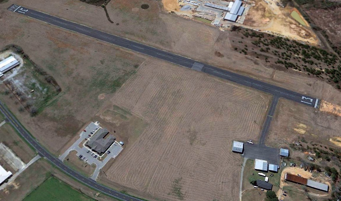
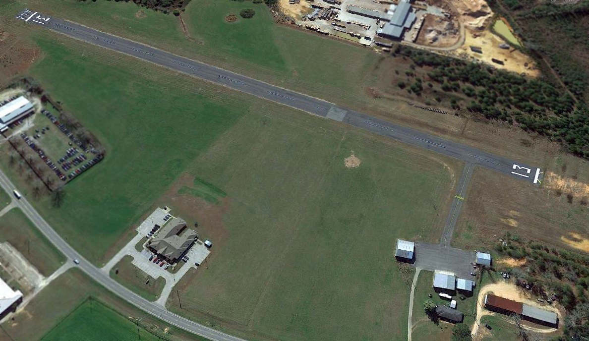
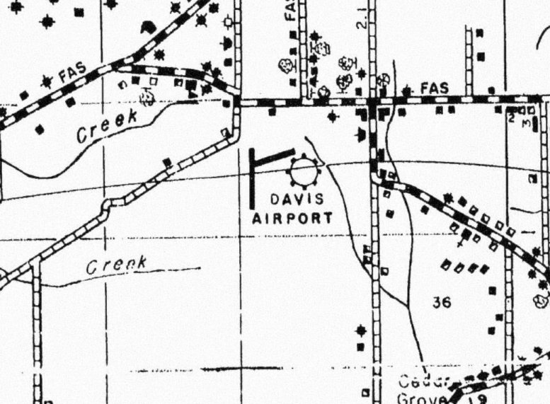
Davis Airport / Idle Hour Airport, Theodore, AL
30.58, -88.26 (Southwest of Mobile, AL)
Davis Airport, as depicted on the February 1949 Mobile Sectional Chart (courtesy of Ron Plante).
Davis Airport was evidently established at some point between 1945-46,
as it was not yet depicted on the July 1945 Mobile Sectional Chart.
The earliest depiction which has been located of Davis Airport was on the August 1946 Mobile Sectional Chart,
which depicted Davis as an auxiliary airfield.
The February 1949 Mobile Sectional Chart (courtesy of Ron Plante) depicted Davis as having a 2,400' unpaved runway.
The earliest photo which has been located of Davis Airport was a 1952 USGS aerial photo.
It depicted the airport on the east side of Airport Road, having one north/south grass runway, and 7 single-engine aircraft parked near a building on the northeast side.
A 1952 county highway map (courtesy of Ron Grant) depicted Davis Airport as having 2 runways.
Davis Airport was evidently renamed Idle Hour Airport at some point between 1952-66,
as that is how it was depicted on the February 1966 Mobile Sectional Chart (courtesy of David Stevenson).
It depicted Idle Hour as having a 2,400' unpaved runway.
Idle Hour Airport apparently moved to the west side of Airport Road at some point between 1952-67,
as compared to the 1952 aerial view, an 11/27/67 USGS aerial view showed a somewhat larger airfield on the west side of the road,
with 3 grass runways, and over a dozen light aircraft & several buildings on the northeast side.
The previous location on the east side had been abandoned – the north/south grass runway was still clear, but there were no buildings or aircraft.
Ralph Hood recalled, “Idle Hour Airport... There was a fascinating man there who had a slew of airplanes & pieces of airplanes that he said he was 'rebuilding.'
I don't think most of them had been touched since the 12th of never.
He had the old airplane that Roscoe Turner flew with the lion cub.
I was selling aviation insurance at the time, and had on a jacket & tie.
He took one look at me & growled, 'You with the damned FAA?'
I said no, 'Then how come you git that tie on?' I told him I was in the aviation insurance business, and he said, 'That's just as damned bad.'
Then he showed me everything & told me the stories. I rather wonder about some of the stories, but they were all entertaining.
Sometimes I think I might be the only person who ever landed there.”
Craig Roberts described his experiences at Idle Hour Airport
in a an article entitled “Time Spent at Idle Hour” in the January 2002 issue of AOPA Pilot (courtesy of Jim Hackman).
Dan Villani recalled, “In late Summer 1965, I was taking flying lessons from Ferguson Flying Service (operating out of Ferguson airport in Pensacola).
I wanted to do a solo cross-country to the Mobile area but was not checked out in Fergie's 150 yet, just the Champ 7AC, which had no radio.
I located Idle Hour on the sectional chart & decided to fly there. It was 55 miles from Ferguson, and at that time I needed 50 miles to log a flight as cross-country.
My path took me well south of the military & civil controlled airports in Mobile proper,
and I kept my altitude high enough over Mobile Bay so that I was always within gliding distance of land.
I found Idle Hour, and I honestly don't remember whether it had one runway or three. Whichever was the case, I read the windsock wrong & landed downwind.
Do you know how ineffective the heel brakes on a 7AC are? After stopping my landing roll, and turning to taxi back to the 'ramp' such as it was,
I swear my wingtip cast a shadow on the cows grazing just outside the fence.”
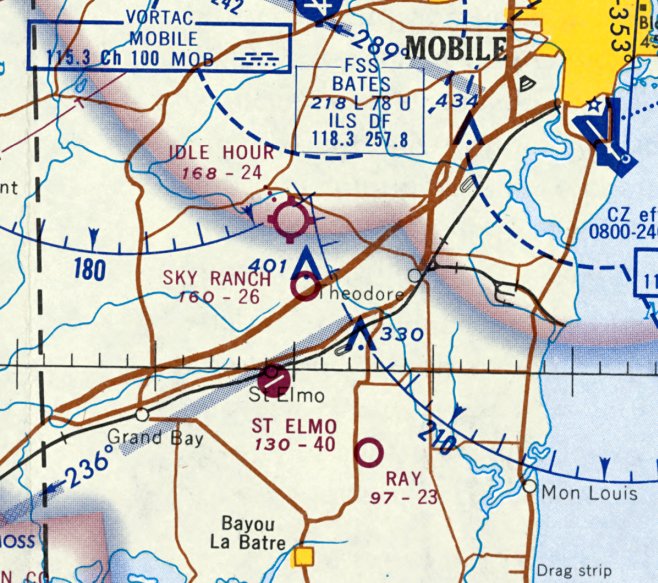
The February 1968 Mobile Sectional Chart depicted Idle Hour as having a 2,400' unpaved runway.
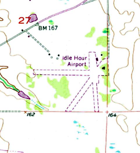
The 1974 USGS topo map depicted Idle Hour Airport as having 3 unpaved runways, with several small buildings on the northeast side.
The 1983 USGS topo map continued to depict Idle Hour Airport in an unchanged fashion.
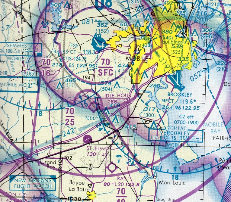
The last aeronautical chart depiction which has been located of Idle Hour Airport was on the December 1983 Mobile Sectional Chart.
It depicted Idle Hour as having a 2,700' unpaved runway.
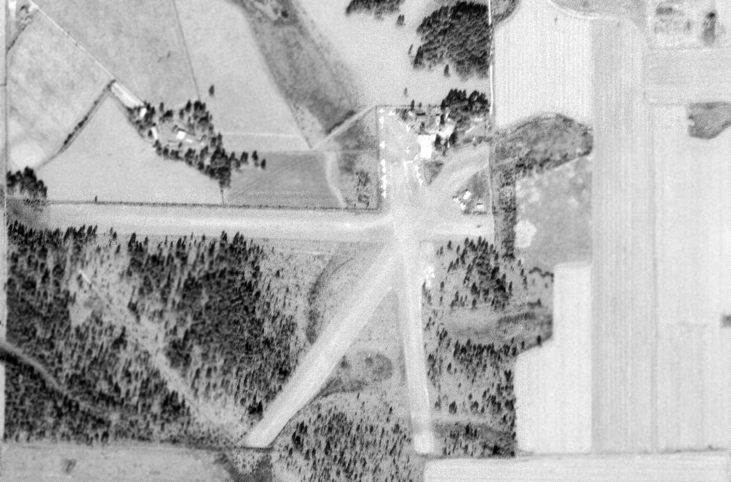
Idle Hour Airport had been abandoned (for reasons unknown) at some point between 1983-97,
as a 1997 USGS aerial view showed no trace of the runways, with the site having become an open field.
Most of the buildings had been removed, with the exception of a few small buildings.
An 11/12/13 aerial view showed a few small buildings remaining as the only trace of Idle Hour Airport.
The site of Idle Hour Airport is located southwest of the intersection of Route 34 & Airport Road, appropriately enough.
____________________________________________________
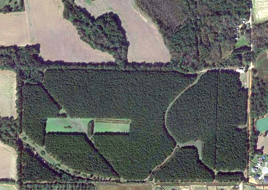
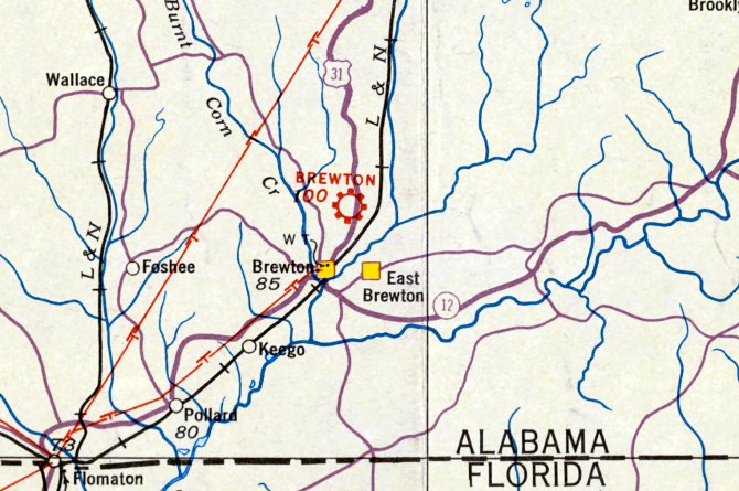
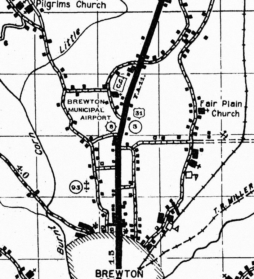
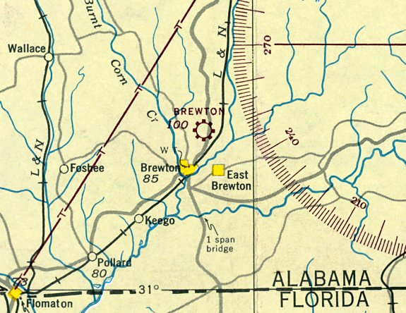
(Original) Brewton Municipal Airport, Brewton, AL
31.148, -87.07 (North of Pensacola, FL)
The original Brewton Municipal Airport, as depicted on the August 1935 Mobile Sectional Chart.
The original Brewton Municipal Airport was on the north side of the town.
An article entitled “Airport here to be ready to use soon” in the 11/29/28 Brewton Standard (courtesy of Bill Grasha) reported,
“Brewton's Municipal Airport, which will be located 1 mile north on the city limits on Montgomery Highway, is rapidly being cleared of trees & other obstructions
and it is expected that the field will be ready for use with the next few weeks.”
An article entitled “Legion post to stage air show” in the 1/17/30 Montgomery Advertiser (courtesy of Bill Grasha) reported,
“Numerous private & commercial airplanes will will attend the aviation meet at the Brewton Municipal Airport.”
The earliest depiction of which has been located of Brewton Municipal Airport was on the August 1935 Mobile Sectional Chart.
It depicted Brewton as a commercial/municipal airport.
Brewton Municipal Airport, as depicted on a 1937 Escambia County Highway Map (courtesy of Rob Grant).
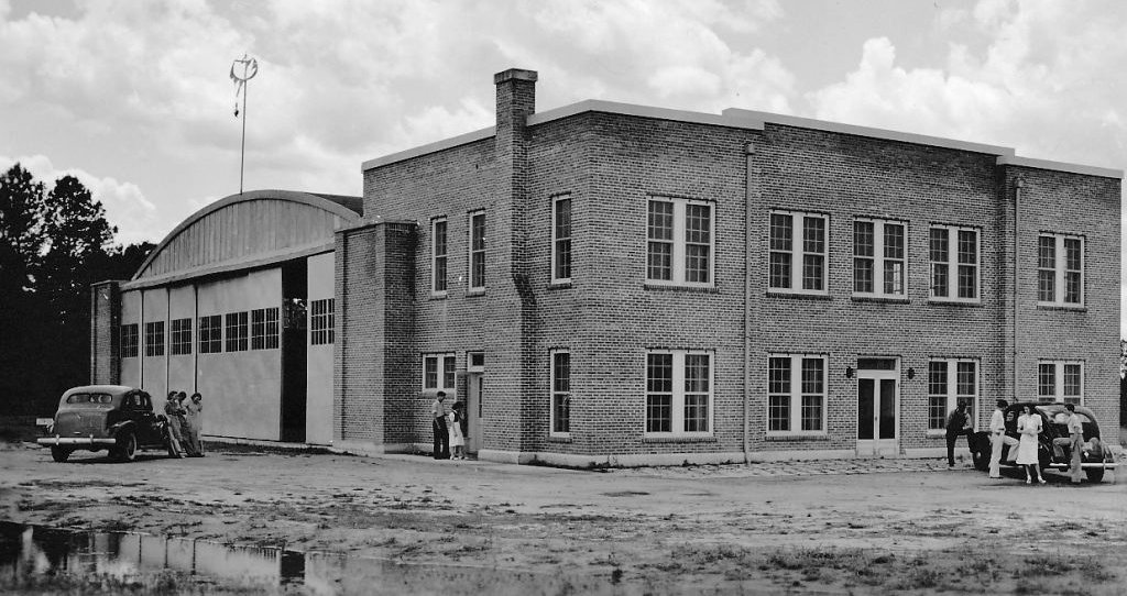
The earliest photo which has been located of Brewton Municipal Airport was a 4/24/39 photo (courtesy of Rob Grant) of the hangar & adjacent country club building.
The photo was captioned, “Capacity of hangar 4 aircraft, 96,000 square feet floor space in hangar.
Sponsored by AL Aviation Commission, City of Brewton as co-sponsor.
Approximate cost including 9-hole golf course, landing field, hangar, and club: $26,453.”
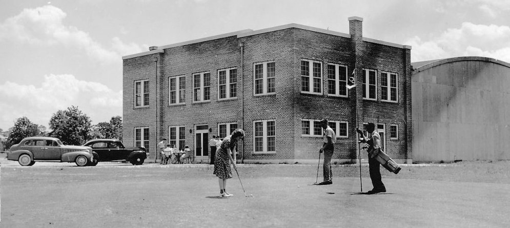
A 4/24/39 photo (courtesy of Rob Grant) captioned, “Students of Brewton City High School on #9 hole of golf course at Brewton Country Club, with club & hangar in background.
Landing field & golf course are combined unit with 5,000' of runway.”
According to the book “Images of America Brewton & East Brewton” (courtesy of Brian Rehwinkel), golfers had to sometimes get out of the way when a plane landed.
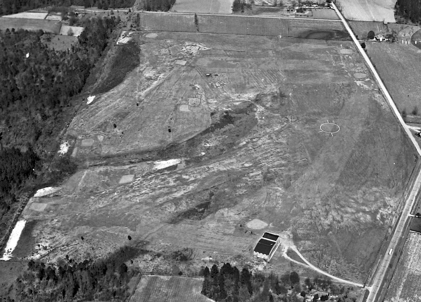
The only aerial view which has been located showing the original Brewton Municipal Airport while in operation was a 2/16/43 aerial view (National Archives photo, courtesy of Brian Rehwinkel).
It depicted Brewton as having an irregularly-shaped grass airfield with an airport circle marking on the east side & a hangar on the south side.
According to the 10/1/43 Army & Navy Directory of Airports (courtesy of Brian Rehwinkel),
Brewton Municipal Airport was listed as being used by the Navy, but the notes also indicated, “Part of golf course.”
The last depiction of which has been located of the original Brewton Municipal Airport was on the January 1944 Mobile Sectional Chart.
It depicted Brewton as a commercial/municipal airport.
The 1945 AAF Airfield Directory (courtesy of Scott Murdock) described Brewtown Municipal Airport
as an 87 acre rectangular property 2.3 miles north of the city,
having 2 sod runways, measuring 2,300' northwest/southeast & 1,800' northeast/southwest.
The field was said to have two 80' x 60' brick & steel hangars.
Brewton Municipal Airport was described as being owned by the City of Brewton, but not to be in operation (presumably closed for civilian flying during WW2).
and operated by the Civil Aeronautics Administration.
The original Brewton Municipal Airport was no longer depicted on the July 1945 Mobile Sectional Chart.
It was evidently replaced after WW2 by the larger Navy airfield on the south side of the town which was reused as the replacement Brewton Airport.
A 1953 aerial photo (courtesy of Rob Grant) showed the golf course at the original Brewton Municipal Airport site,
but the hangar still remained standing on the south side.
A 1958 aerial photo still showed the former hangar remained standing at the site of the original Brewton Municipal Airport.
The site of the original Brewton Municipal Airport was labeled as “Country Club” on the 1961 USGS topo map,
but the hangar was still depicted.
A 1998 aerial photo showed the Brewton Airport clubhouse & hangar had been demolished at some point between 1982-98,
and replaced with a more recent building & a swimming pool, erasing the last trace of the original Brewton Municipal Airport.
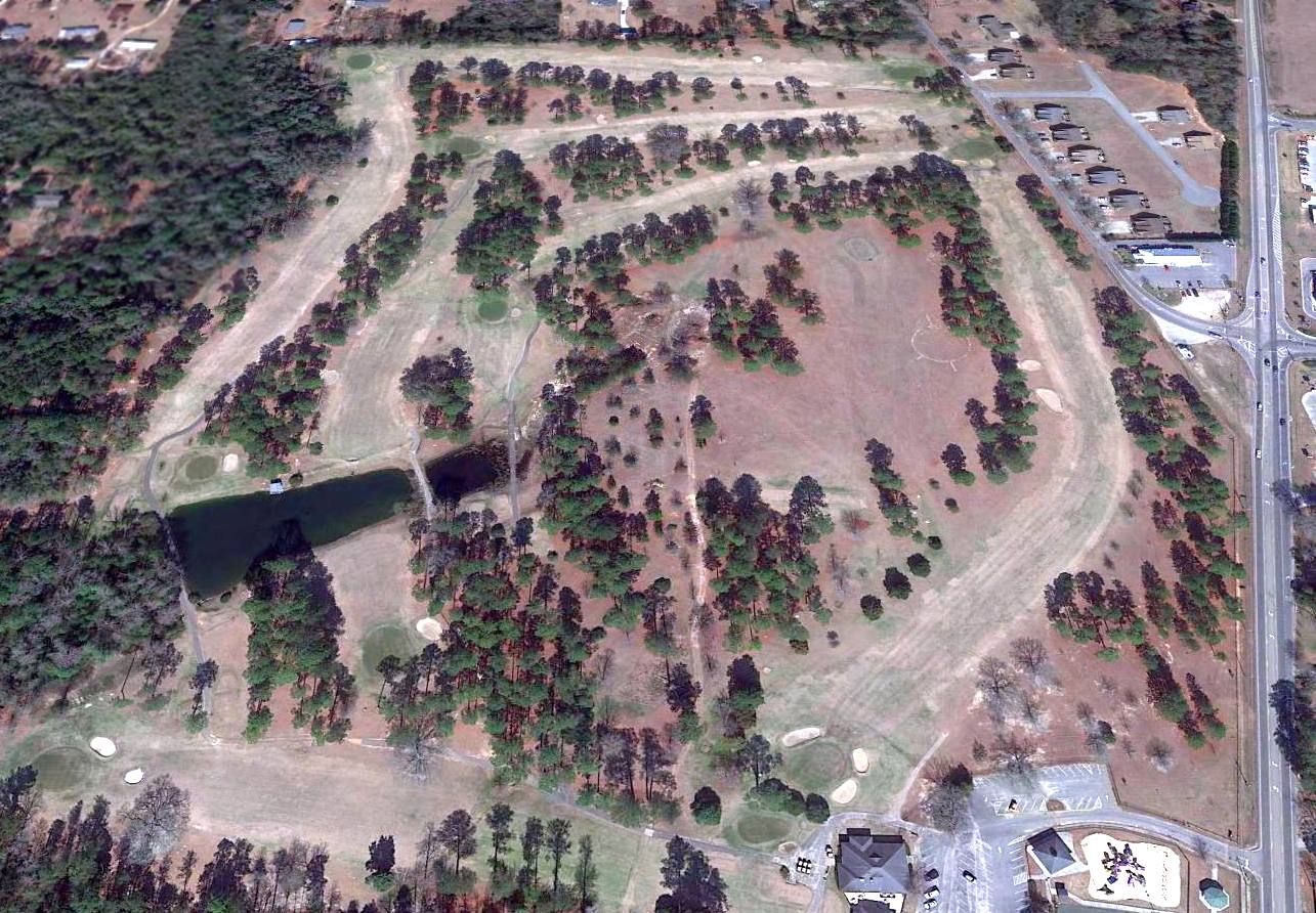
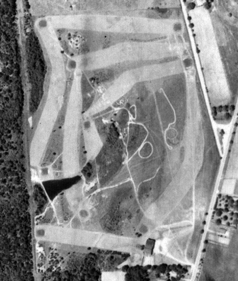
A 2015 aerial view looking north showed the golf course remained at the site of the original Brewton Municipal Airport.
Brian Rehwinkel noted, “One other interesting thing about this former airport is the landing circle still remains– complete with the lines indicating the direction of the runways.
You can see the circle on the eastern portion of the golf course – still clear after over 70 years!”
The site of the original Brewton Municipal Airport is the Dogwood Hills Golf Course, northwest of the intersection of Route 3 & Lovelace Lane.
____________________________________________________
(Original) Atmore Airport / Atmore Intermediate Field, Atmore, AL
31.08, -87.58 (North of Pensacola, FL)
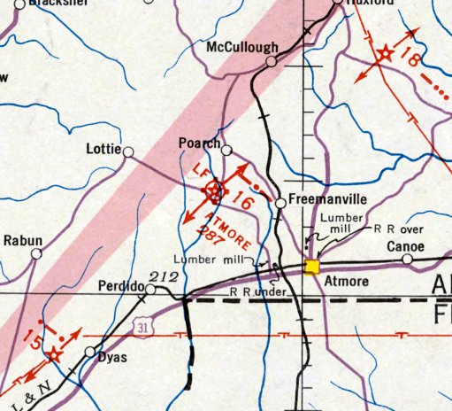
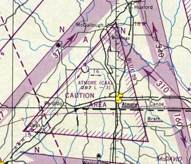
Atmore Intermediate Field, as depicted on the August 1935 Mobile Sectional Chart.
The original Atmore Airport, to the northwest of the town, was evidently established in the 1930s as one of the Commerce Department's network of Intermediate Fields
for the use of commercial aircraft along airways between major cities.
The earliest depiction of which has been located of Atmore Airport was on the August 1935 Mobile Sectional Chart.
It depicted Atmore as Commerce Department Airway Site 16.
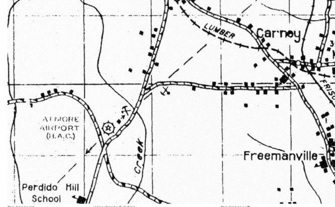
“Atmore Airport (B.A.C.)”, as depicted on the 1937 Escambia County Highway Map (courtesy of Rob Grant).
A 1938 airport directory (courtesy of Rob Grant) described Atmore Airport as Department of Commerce Intermediate Field Site 16 along the New Orleans – Atlanta Airway.
It was described as a irregularly-shaped sod field having 4 runways, with the longest measuring 3,200' northwest/southeast.
A shed had a roof marked “16 NO-A”.
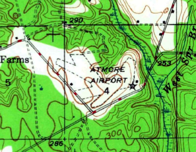
The 1942 USGS topo map depicted Atmore Airport as having 4 unpaved runways, with a beacon & 1 small building on the east side.
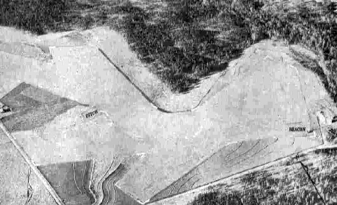
The only photo which has been located of Atmore Intermediate Field was a 2/7/43 aerial view looking northeast
from the 1945 AAF Airfield Directory (courtesy of Scott Murdock).
It depicted Atmore as having 4 unpaved runways, with a beacon on the east side.
The 1945 AAF Airfield Directory (courtesy of Scott Murdock) described Atmore Intermediate Field
as a 98 acre irregularly-shaped property having 4 sod runways, the longest being the 3,100' west-northwest/east-southeast strip.
The field was said to not have any hangars, to be owned by private interests, and operated by the Civil Aeronautics Administration.
The last aeronautical chart depiction which has been located of the original Atmore Airport was on the February 1950 Mobile Sectional Chart.
It depicted “Atmore (CAA)” as being Airway Site 16, and having a 3,100' unpaved runway.
Atmore Airport was evidently closed (for reasons unknown) at some point in 1950, as it was no longer depicted on the 1950 Escambia County Highway Map (according to Rob Grant).
Dave Weaver recalled, “My father, David Weaver, leased the land that had been the [original Atmore] airfield in December 1950.
Everything that could be tilled, was. Previous landing areas were fields of soybeans, cotton, etc.”
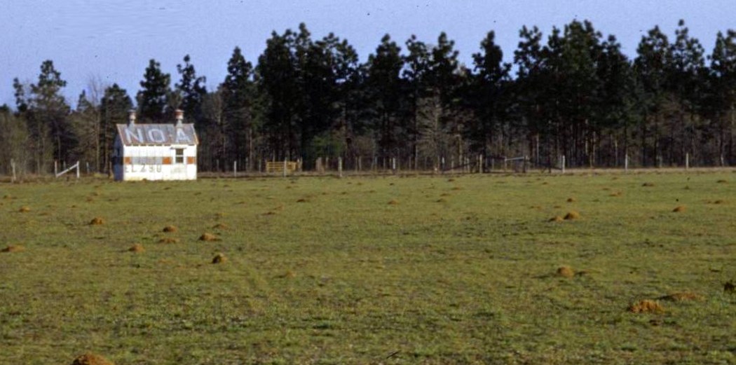
A late 1950 – early 1951 photo (courtesy of Dave Weaver) of the Atmore Airport building taken late 1950 or early 1951.
Note the “NO-A” marking on the roof, indicating Atmore Intermediate Field's location along the New Orleans – Atlanta Airway.
The field elevation of 290' is painted along the wall.
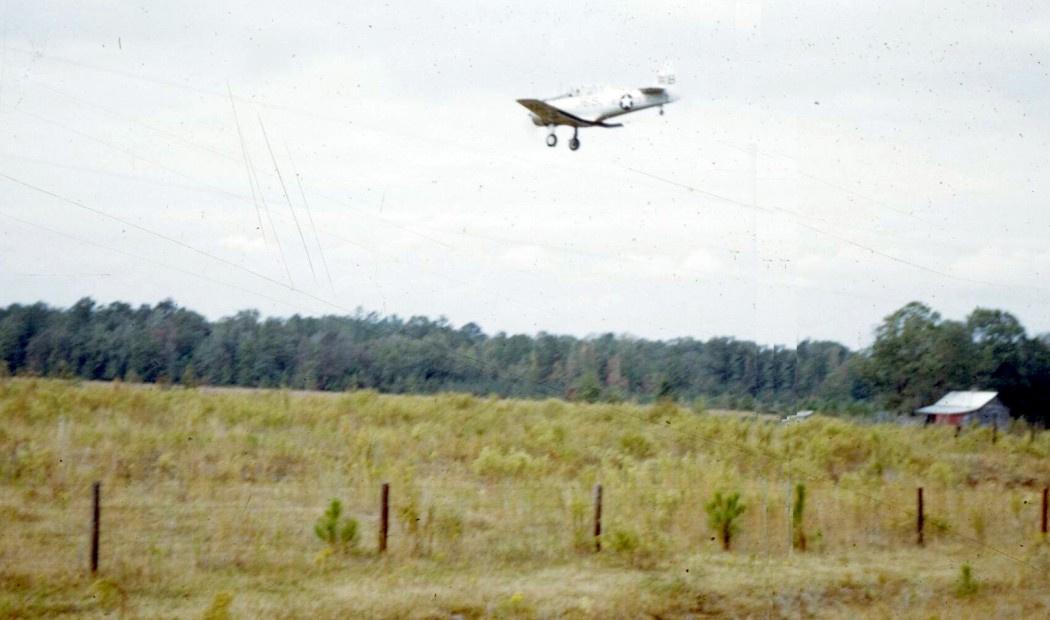
An early 1951 photo (courtesy of Dave Weaver) of a Navy SNJ trainer from making a low pass over the former Atmore Airport.
Dave Weaver noted “Since it appears the field had not been yet cultivated, I think that photo dates to very early 1951.”
A circa 1952-53 photo (courtesy of Dave Weaver) of a pilot & plane which had landed in the field of the former Atmore Airport, which Dave Weaver noted “ was now cultivated.”
Dave recalled, “Since this location was stilled listed on Sectional Charts, we would have a plane occasionally make an emergency landing.
This happened several times over the approximate 3 years we lived there.
My dad gave one of them low-octane tractor gas. The engine quit on take-off & the plane crashed, with minor damage.”
Atmore Airport was no longer depicted on the February 1955 Mobile Sectional Chart.
The 1983 USGS topo map no longer depicted the original Atmore Airport, instead depicting an empty unlabeled clearing.
An 11/2/13 aerial view showed no trace remaining of Atmore Intermediate Field, which remains an open agricultural field.
The site of Atmore Intermediate Field is located southeast of the intersection of Ewing Drive & Brightside Road.
____________________________________________________
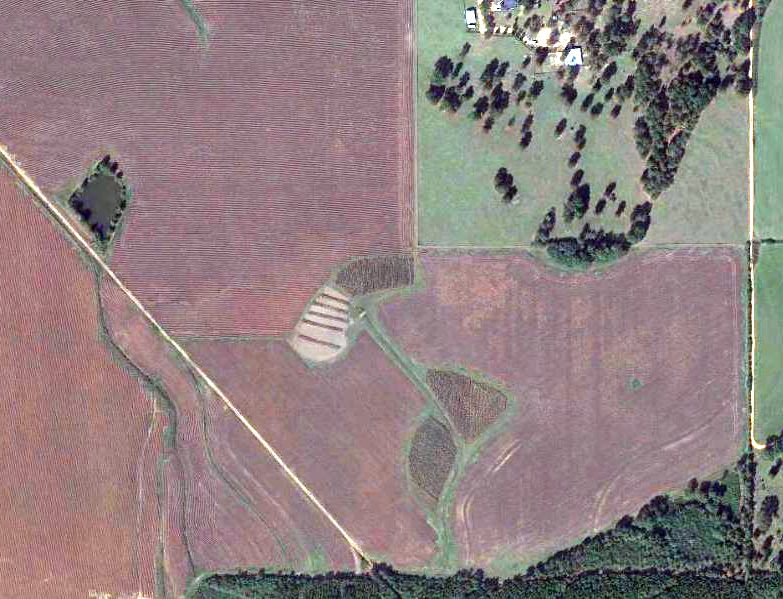
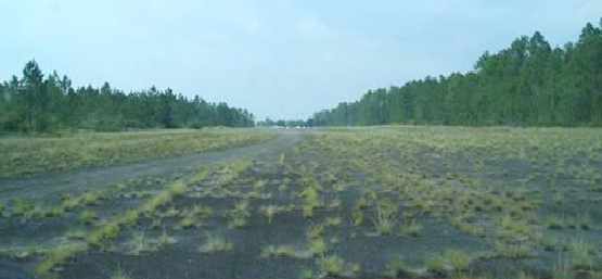
Reimer Field / Wilson Field, Foley, AL
30.42, -87.68 (West of Pensacola, FL)
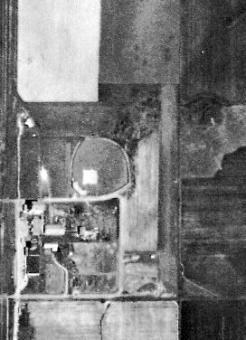
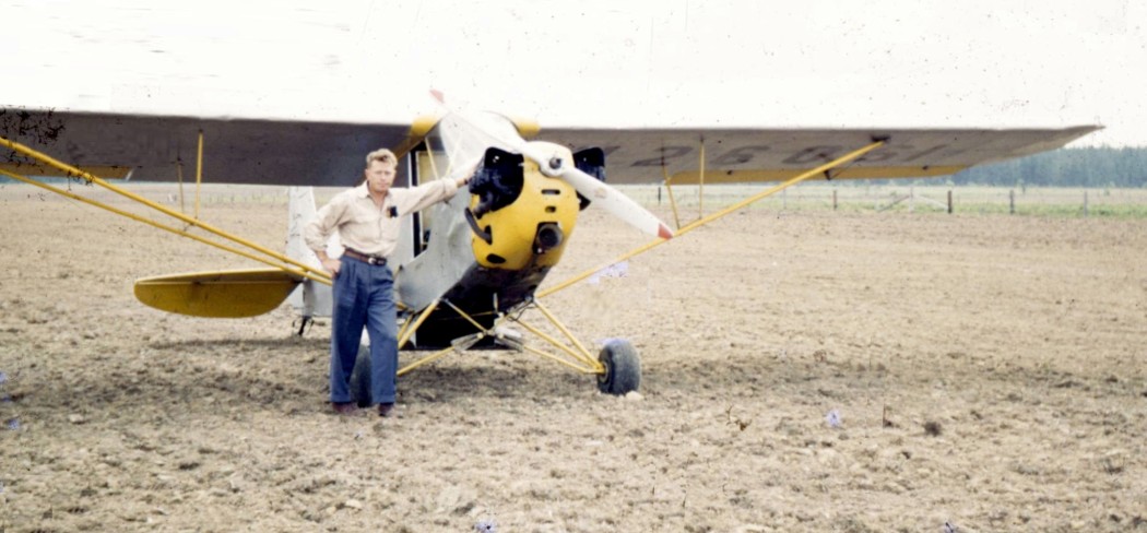
A 3/29/55 USDA aerial view of Reimer Field (courtesy of Dallam Oliver-Lee).
The date of establishment of Reimer Field has not been determined.
Reimer Field was not depicted on the 1949/52/55/60 Mobile Sectional Charts.
The earliest depiction of which has been located of Reimer Field was
on a 3/29/55 USDA aerial view (courtesy of Dallam Oliver-Lee).
It depicted Reimer Field as having a single north/south runway.
Reimer Field, as depicted on the 1957 USGS topo map (courtesy of Dallam Oliver-Lee).
Reimer Field may have been closed (for reasons unknown) at some point between 1957-60,
as it was no longer depicted at all on the 1960 USGS topo map (courtesy of Dallam Oliver-Lee)
or the February 1961 Mobile Sectional Chart.
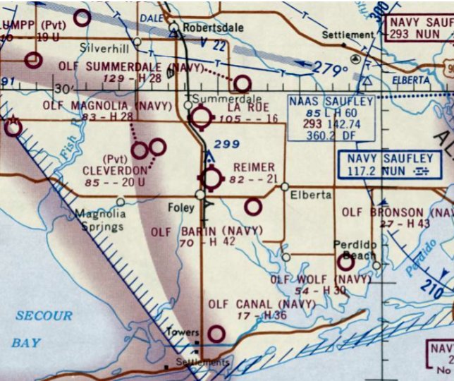
The earliest aeronautical chart depiction which has been located of Reimer Field was on the February 1965 Mobile Sectional Chart.
It depicted Reimer Field as having a 2,100' unpaved runway.
The January 1971 New Orleans Sectional Chart depicted Reimer Field as having a 2,100' unpaved runway.
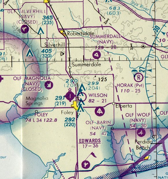
Reimer Field was evidently renamed Wilson Field at some point between 1971-80,
as the 1980 New Orleans Sectional Chart depicted Wilson Field as having a 2,100' unpaved runway.
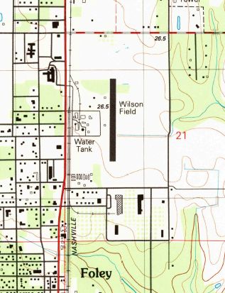
The 1980 USGS topo map (courtesy of Dallam Oliver-Lee) depicted Wilson Field as having a single north/south runway,
with a few small building along the west side.
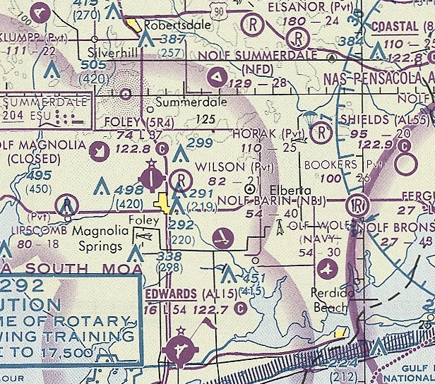
The last aeronautical chart depiction which has been located of Wilson Field was on the June 1993 New Orleans Sectional Chart (courtesy of Ron Plante).
It depicted Wilson Field as a private airfield having a 2,100' unpaved runway.
Wilson Field was evidently closed (for reasons unknown) at some point between 1993-99,
as it was no longer depicted on the June 1999 New Orleans Sectional Chart (courtesy of Ron Plante).
Wilson Field still appeared clear in a 1997 USGS aerial view (courtesy of Dallam Oliver-Lee),
but there were no aircraft visible or other signs of recent aviation use.
A 1/3/12 aerial view (courtesy of Dallam Oliver-Lee) showed trees covered the north half of the Wilson runway,
but the southern half remained clear.
The site of Wilson Field is located of the intersection of North Cypress Street & East Fern Avenue.
____________________________________________________
Faircloth Naval Outlying Landing Field, Lillian, AL
30.45, -87.47 (West of Pensacola, FL)
"Faircloth (Navy)", as depicted on the July 1945 Mobile Sectional Chart.
Photo of the airfield while in use has not been located.
Fairlcloth NOLF was one of the large numbers of satellite airfields used to support Navy flight training in the Pensacola area.
No airfield was yet depicted at this location on a 12/2/40 USDA aerial photo (courtesy of Dallam Oliver-Lee).
Faircloth NOLF was evidently built at some point between 1940-45,
as it was not depicted at all on the 1943 USGS topo map or the January 1944 Mobile Sectional Chart.
It was also not listed among active airfields in the 1944 US Army/Navy Directory of Airfields (courtesy of Ken Mercer).
The earliest depiction of Faircloth which has been located was on the July 1945 Mobile Sectional Chart,
which depicted “Faircloth (Navy)” as an auxiliary airfield.
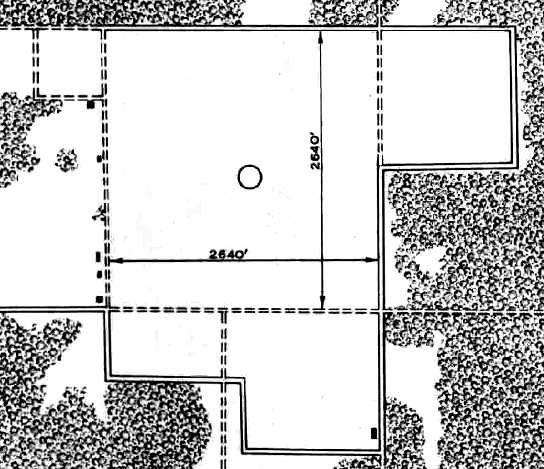
The 1945 AAF Airfield Directory (courtesy of Scott Murdock) described “Bronson Field Auxiliary (30014 Faircloth Outlying Field)”
as a 160 acre square property containing a 2,640' square sod landing area.
The field was not said to have any hangars, to be owned by the U.S. Government, and operated by the Navy.
The earliest photo which has been located of Faircloth NOLF was a 1/5/51 USDA aerial view (courtesy of Dallam Oliver-Lee).
It depicted Faircloth as an irregularly-shaped grass field.
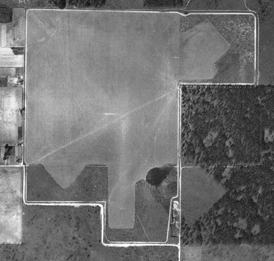
A 1955 Soil Conservation Service Photo of Faircloth Field (courtesy of Thomas Kallsen of the University of Alabama Map Library).
The last aeronautical chart depiction which has been located of Faircloth Field was on the February 1959 Mobile Sectional Chart.
It depicted "Faircloth OLF (Navy)" as having a 3,400' unpaved runway.
Faircloth Field was evidently closed at some point in 1958, as it was no longer depicted on the August 1959 Mobile Sectional Chart or subsequent Sectional Charts.
In a 1/4/58 USDA aerial view (courtesy of Dallam Oliver-Lee),
very prominent white outlines had been added around all 3 Faircloth runways.
According to Brian Rehwinkel, Faircloth was attached to NAAS Bronson,
and was apparently the last grass airfield the Navy used for fixed-wing aircraft (used by the Navy into some point in the 1960s).
Gordy Paige recalled, “Regarding Faircloth, I can attest to it’s having been active as late as June 1964
as it was my favorite field for touch & go's in the T-34B when I was in primary training at NAAS Saufley.
At that time it was 'active' in the sense that a crash crew would be parked there during operating hours.
There were no other facilities at the field.”
Richard Plutt recalled, “I flew out of Faicloth in 1969. We used it on a routine basis in 1969 (T-34 Mentor).
Faircloth was one of my favorite fields because it was grass.
It's not everyday you get to land a tri-wheeled aircraft on grass.”
Joe Mazza recalled, “I can attest to the fact that it was still operating as an OLF in late 1968 when I went through Navy flight training,
The sharply-outlined runways is exactly how it looked in 1968.
'Operating' only means it was used for landing practice & there was a crash crew there when it was.”
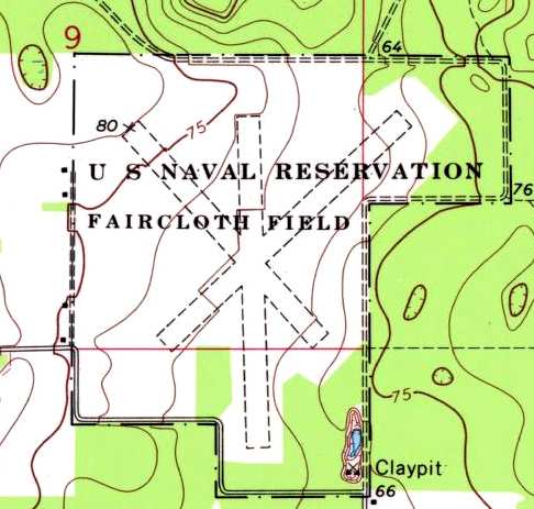
The 1970 USGS topo map (from the University of Alabama Map Library)
still depicted the property as "U.S. Naval Reservation Faircloth Field".
It depicted the field as consisting of 3 grass runways, with the longest being the 3,000' north/south strip.
Donald Davis recalled, “Faircloth was still being used in the summer of 1972.
We used it to shoot low approaches & to practice our foul weather break landing procedures.
We didn’t do touch & go’s. Only low approaches.”
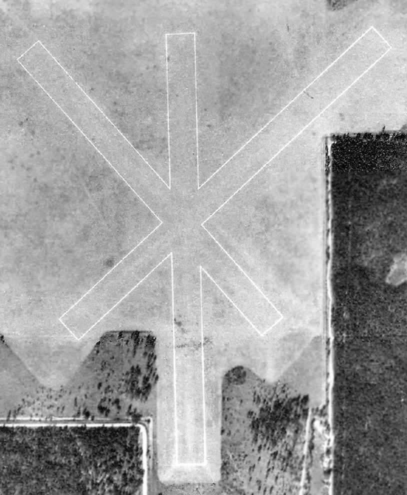
In a 1/22/73 aerial photo of Faircloth (courtesy of the FL DOT, via Brian Rehwinkel),
the grass runways at Faircloth were very sharply outlined.
The prominent white runway outlines were still visible on an October 1975 USGS aerial view (courtesy of Dallam Oliver-Lee).
The white runway outlines had been removed by the time of a 3/5/78 USGS aerial view (courtesy of Dallam Oliver-Lee).
The airfield area still appeared to be cut grass on a 2/2/81 USGS aerial view (courtesy of Dallam Oliver-Lee).
The airfield area appeared to start to become overgrown on a 4/3/85 USGS aerial view (courtesy of Dallam Oliver-Lee).

A 1987 photo of Faircloth NOLF by John Voss.
The 3 grass runways at Faircloth were still depicted on the 1987 USGS topo map, but the property was not labeled at all.
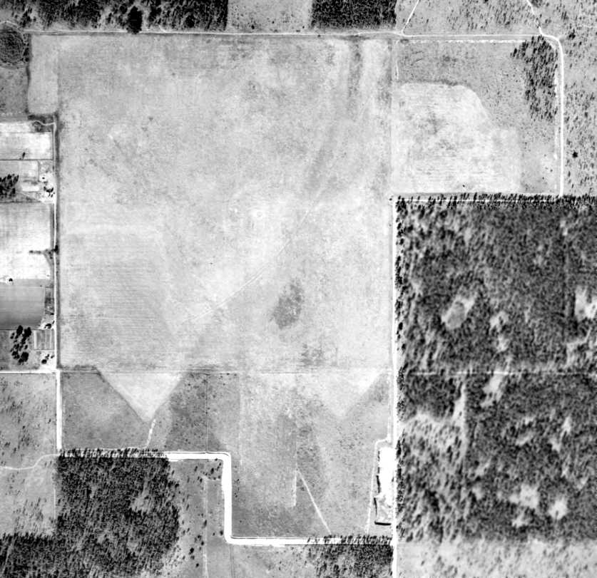
In the 1997 USGS aerial photo, the former airfield area had been reused for farming,
and no trace of the former military airfield appeared to remain.
Paul Freeman visited the site of Faircloth NOLF in 2006. Not a trace of a former airfield was still perceptible.
A 1/3/12 aerial view (courtesy of Dallam Oliver-Lee) still showed the property outline of Faircloth NOLF,
but there was nothing else recognizable as a former airfield.
The site of Faircloth NOLF is located northeast of the intersection of Faircloth Road & Sycamore Road.
____________________________________________________
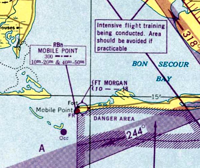
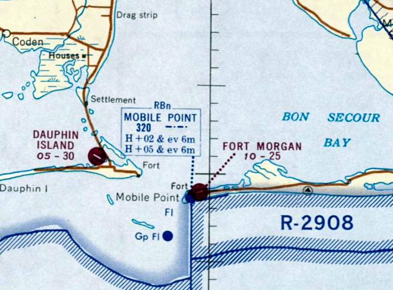
Fort Morgan Airfield, Fort Morgan, AL
30.23, -88.02 (Southwest of Pensacola, FL)
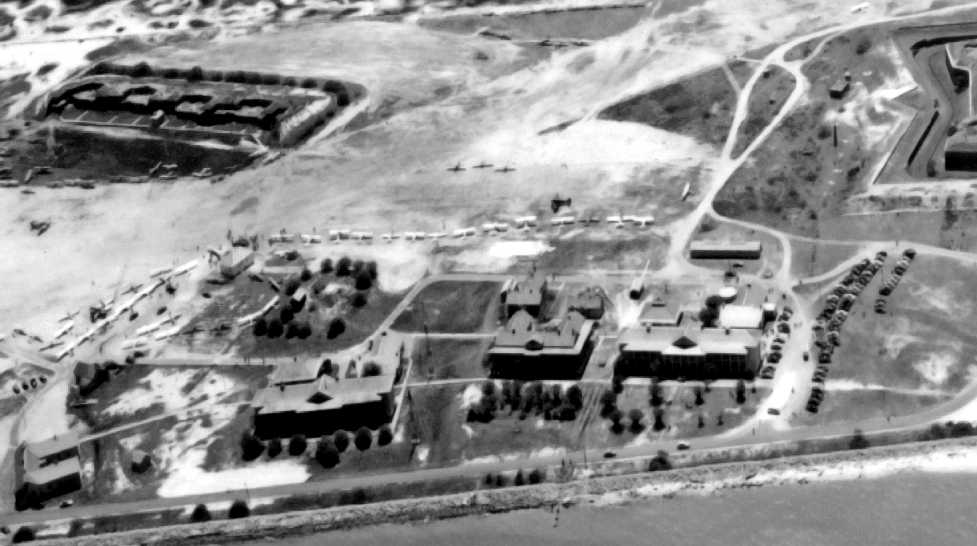
A circa late 1949 / early 1950 aerial view looking south at dozens of light planes on the Ft. Morgan Airfield
(courtesy of the University of South AL Archives, via Harley Flowers).
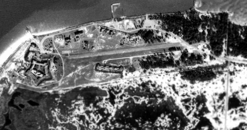
This airfield was located on the tip of a peninsula at the entrance to Mobile Bay,
next to the much-older Fort Morgan (which was used during WW2 as a coastal defense installation).
The Fort Morgan Airfield was not yet depicted on the 1942 USGS topo map
or listed among active airfields in the 1945 AAF Airfield Directory (courtesy of Scott Murdock).
According to Harley Flowers, the 1946 Volumes 18-19 of the AL Conservation Magazine described that
“The site had been turned over to the state in 6/28/46 by President Harry Truman
as the result of a bill sponsored by Congressmen George Grant & Frank Boykin
for the creation of a public recreational center including a Hotel, restaurant, boat harbor & dock facilities & amusement center
with the provision that should the state ever use it for any purpose other than a public recreational center the title will revert to the government.”
According to Harley Flowers, 1949 Volume 14 Issues 17-29 of the AL News Magazine described that
“The airport was being constructed to support the new Fort Morgan Inn, a joint project of 1st District Congressman Frank Boykin & T. J. 'Ben' Restor.
They leased the area from the state in 1946 & converted it into a resort, complete with hotel accommodations, fishing facilities & restaurant.”
According to Harley Flowers, Volumes 8-9 of the AL Local Government Journal
described that “Asa Rountree, Director of the AL Department of Aeronautics announced in his AL Aviation Activities
that bids on grading & paving the apron, taxiways & access road for the Fort Morgan Municipal Airport had been initiated on 8/24/49.
The low bidder was Burgreen Construction Company of Athens AL with a bid of $48,682.”
The earliest depiction which has been located of the Ft. Morgan Airfield
was a circa late 1949 or early 1950 aerial view looking south (courtesy of the University of South AL Archives, via Harley Flowers),
which showed several dozen light planes parked around 2 runways,
possibly for the airport's dedication.
The Fort Morgan Airfield was not depicted on the the February 1950 Mobile Sectional Chart.
According to Harley Flowers, the 1950 AL Conservation Magazine described that “The Fort Morgan Airport was dedicated on 4/16/50.
More than 250 planes had landed on the sodded runways, hailing from AL, FL, LA, and MS.
In total over 2,000 people attended the ceremony arriving by plane & car.”
According to Harley Flowers, “Mobile Aviation” by Billy Singleton described that “The Fort Morgan State Park Airport
was the first state owned airport constructed for recreational purposes.
The airport was intended to provide convenient access to the state park & beaches.”
The earliest aeronautical chart depiction which has been located of the Fort Morgan Airfield was on the August 1950 Mobile Sectional Chart.
It depicted Fort Morgan as having a mere 1,800' unpaved runway.
Veronice Lawrence recalled, “In August 1953 a friend & I landed a Piper Pacer 135 at Ft Morgan.
At that time a grass strip NE/SW was the only runway. With us was my 45 year old father on his first & only flight.”
The Aerodromes table in the August 1954 Mobile USAF Sectional Chart (courtesy of Chris Kennedy)
described Fort Morgan Airfield as having 2 runways, with the longest being an 1,800' turf strip.
The airfield type was categorized as "Limited",
which was defined as "Not regularly attended, or without services and facilities for public, but public at large not prohibited."
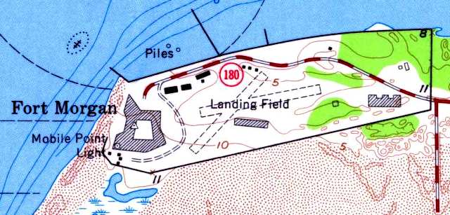
The 1958 USGS topo map (from the University of Alabama Map Library) depicted the Ft Morgan Airfield as consisting of two 2,000' unpaved runways.
A building was directly south of the runway intersection.
According to David Jarrell, “That building is Battery Bowyer, a 10-inch rifle battery built in 1898.
It likely had nothing to do with the airfield, as no plane could fit inside.”
According to Harley Flowers, “Mobile Aviation” by Billy Singleton described that
“In 1959 the east/west runway was paved to allow the field to be used during periods of wet weather.”
A 1960 aerial photo (courtesy of Rob Grant) depicted Fort Morgan's newly paved east/west runway.
The Aerodromes table on the August 1962 Mobile Sectional Chart (courtesy of Chris Kennedy)
described Fort Morgan as having 2 runways, with the longest being a 2,500' bituminous strip.
The last aeronautical chart depiction which has been located of the Fort Morgan Airfield was on the February 1968 Mobile Sectional Chart.
It depicted Fort Morgan as having a 2,500' paved northeast/southwest runway.
According to Harley Flowers, “Mobile Aviation” by Billy Singleton described that
“The airport was closed in 1970 when the US Coast Guard constructed a radio tower at the west end of the runway.”
The Ft Morgan Airfield was no longer depicted on the January 1971 New Orleans Sectional Chart.
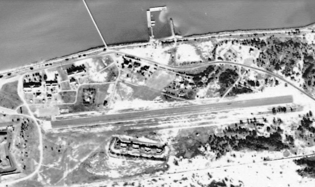
A 1974 Soil Conservation Service aerial photo of the Fort Morgan airfield,
courtesy of Thomas Kallsen of the University of Alabama Map Library.
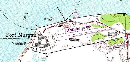
The Fort Morgan airfield was still depicted on the 1982 USGS topo map,
but labeled simply "Landing Strip".
It was depicted as consisting of a single 2,500' east/west runway.
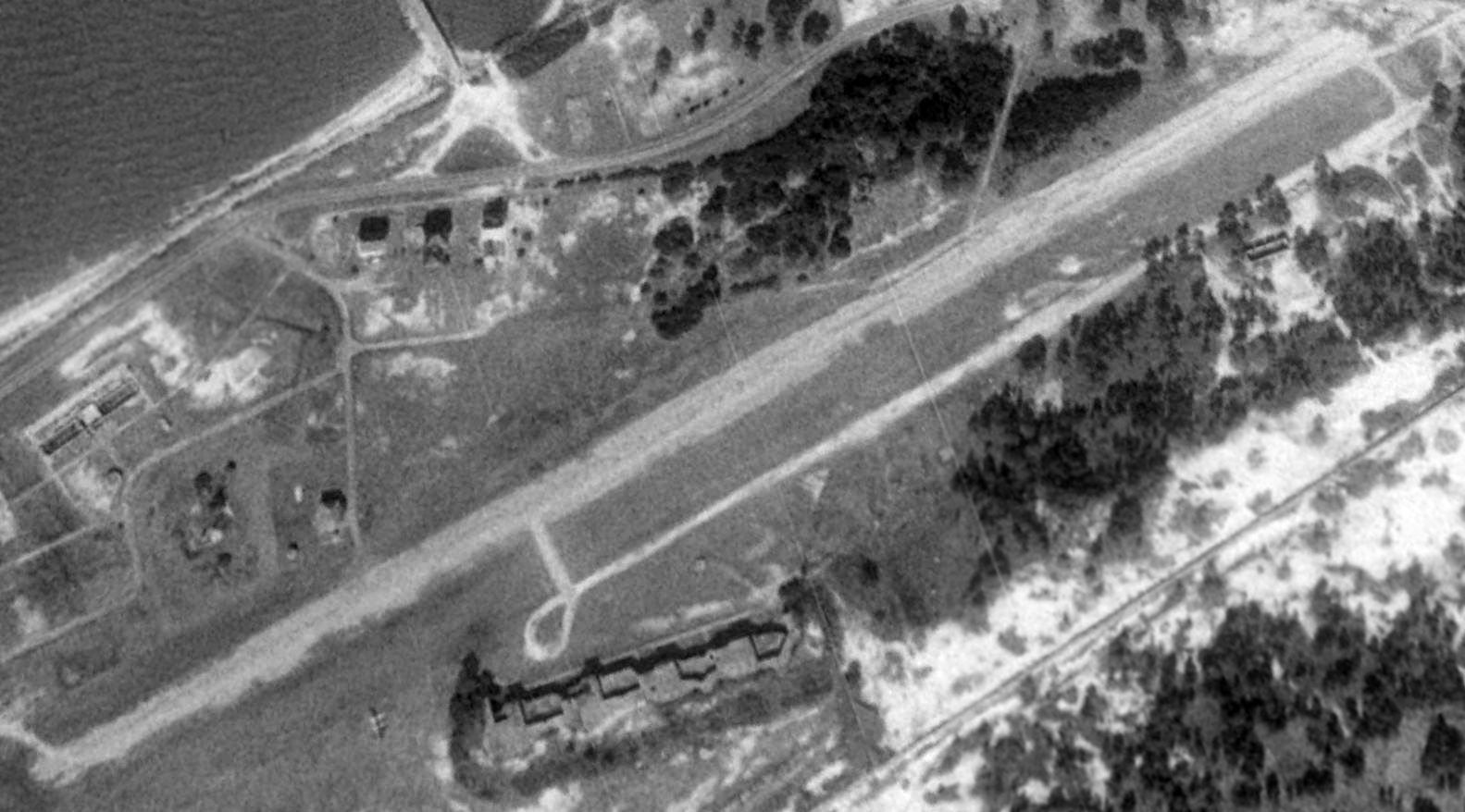
A 1992 USGS aerial view looking northeast showed the Ft Morgan runway was still quite recognizable, although it appeared to be quite deteriorated.
A parallel taxiway ran along the south side of the runway.
Thomas Kallsen reported, "I was last at Fort Morgan in 2000, and the runway was full of potholes & weeds."
John Wienand reported in 2006, “The Fort Morgan strip is not traversable today except in a 4-wheel drive vehicle.
There are potholes that would flip your plane; you cannot see them until you are right up on them.”
David Jarrell reported in 2006, “There are no obvious remains of any hangar facilities at the site.”
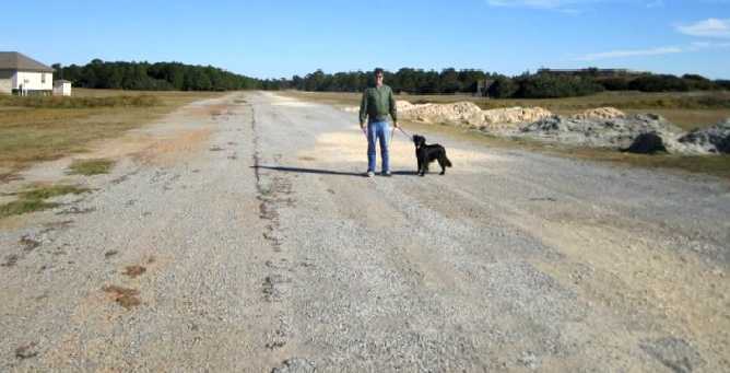
A January 2010 photo of Ben Montgomery of the Ft. Morgan runway, “taken from the West end of the runway & facing East.”
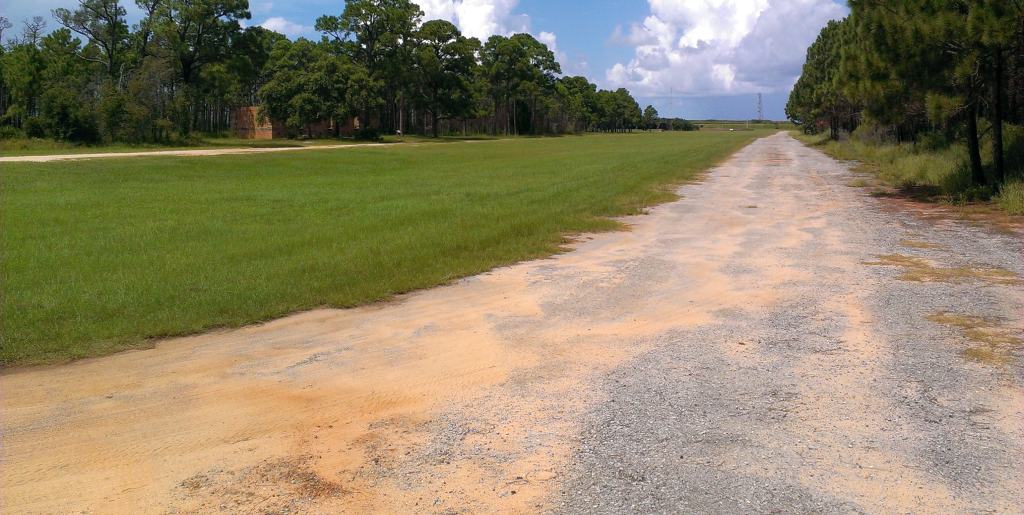
An 8/10/13 photo by John Bailey at Fort Morgan “looking West down the runway with the taxiway in the background.”
A 2017 aerial view looking northeast showed the Ft Morgan runway was still quite recognizable although deteriorated.
____________________________________________________
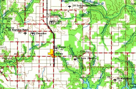
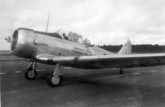
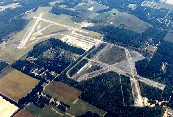
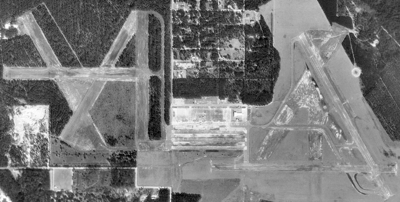
Foley Municipal Airport (original) / Barin Naval Auxiliary Air Station (NBJ), Foley, AL
30.39, -87.64 (West of Pensacola, FL)
The original Foley Municipal Airport was located on the southeast side of the town.
It was evidently constructed circa 1933-34,
as a circa 1933-34 photo (courtesy of Dallam Oliver-Lee) showed the Foley Municipal Airport under construction.
However, Foley Municipal Airport was not depicted on Mobile Sectional Charts from 1935-42, nor on the 1941 USGS topo map (courtesy of Dallam Oliver-Lee).
With the outbreak of WW2, the Navy determined the need for additional auxiliary airfields
to support flight training at Pensacola NAS.
The Navy leased the Foley Municipal Airport in 1942, and purchased 656 adjoining acres to the east.
The former Foley Municipal Airport became the West Field, and a new East Field was constructed alongside.
Together these 2 fields were commissioned as NAAS Barin Field.
The earliest photo which has been located of Barin Field was a photo of Santa Claus arriving at Barin Field for the base's 1942 Christmas party
in the Barin Field Commanding Officer's SNJ, flown by Cdr. Brigg.
Interestingly a 1943 USGS topo map (courtesy of Dallam Oliver-Lee) showed a rectangular clearing oriented northwest/southeast,
which was unlabeled but presumably depicted one of Barin Field's runways.
The earliest aerial view which has been located of Barin Field
was a 2/7/43 aerial view looking north from the 1945 AAF Airfield Directory (courtesy of Scott Murdock).
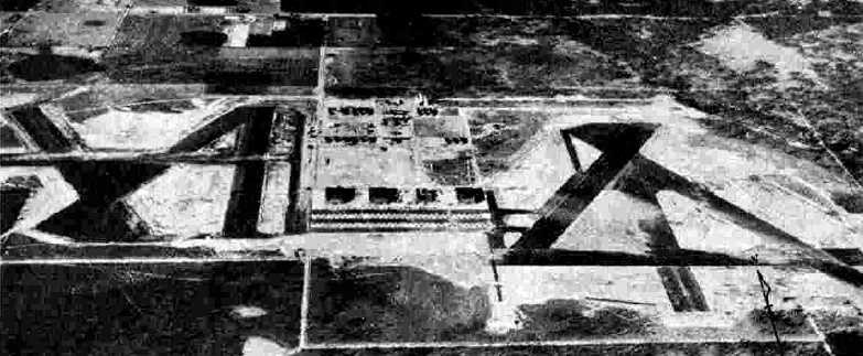
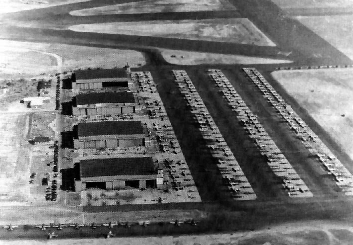
It depicted the 2 fields at Barin as each having 4 asphalt runways,
in between of which was a common ramp with 4 large hangars.
Barin training at first consisted of torpedo bomber & fighter instruction.
In 1943, the torpedo training moved to Corry Field, leaving Barin to concentrate on the fighter program.
SNJs were the primary trainer used.
Other aircraft used at Barin included OS2U Kingfishers, SNVs, and N2S Stearmans.
The 1943 USGS topo map (courtesy of Dallam Oliver-Lee) still did not depict any airfield at this location.
At one point Barin had one of the highest fatality rates among all Navy & Army airfields:
with 40 fatalities in its first 2 years,
earning it the nickname "Bloody Barin".
W. Gibson served at Barin as an instructor in SNJs, and recalled,
"My memory of the high loss rate at Barin Field
is that the CO insisted on having trainees fly when the weather was not suitable.
My memory also is that Walter Winchell (the radio & newspaper reporter) had a son killed there
and that Winchell raised a major stink, bringing the loss-rate problem to such a high level
that the Navy could not avoid do something about it.
Bronson, which did the same training, had a very minor loss rate."
A 7/5/43 aerial view looking west at Barin's West Field (the former Foley Municipal Airport),
showing all 4 of the large hangars.
A WW2-era view of Barin NAAS (National Archives photo).
A WW2-era photo by Curtiss Silvernail (restored by Bill Grasha) of the Barin's hangars & flightline.
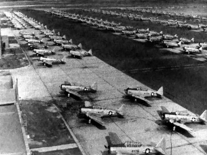
A WW2-era photo by Curtiss Silvernail (restored by Bill Grasha) of endless rows of SNJ trainers at Barin.

The earliest aeronautical chart depiction which has been located of NAAS Barin Field was on the January 1944 Mobile Sectional Chart.
The 1945 AAF Airfield Directory (courtesy of Scott Murdock) described Barin Field
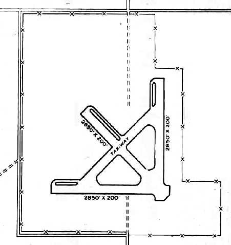
as a 960 acre irregularly-shaped property containing 8 asphalt runways, the longest being the East Field's 4,100' northwest/southeast strip.
The field was said to have 4 wooden hangars measuring 240' x 165', to be owned by the U.S. Government, and operated by the Navy.
Barin was listed as having the following auxiliary fields:
26125 Canal Outlying Field (later reused as Jack Edwards Airport), 28431 Magnolia Outlying Field ,
29436 Silverhill Outlying Field, 29625 Summerdale Outlying Field, and 27016 Wolf Outlying Field.
Barin Field closed in 1947, but was reopened in 1948 for maneuver training as an Outlying Field.
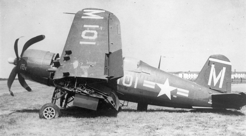
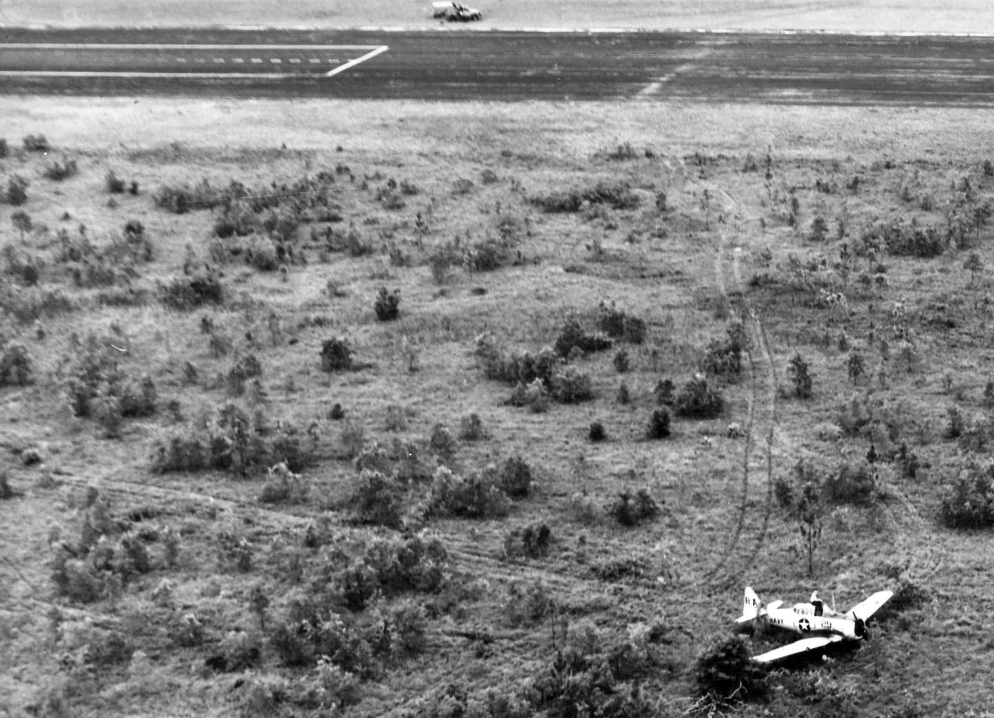
A 1948 photo of a slightly beaten-up F4U-5 Corsair fighter after the commanding officer of VF-21 landed it short after engine failure at Barin Field.
Barin Field was fully reactivated in 1952 during the Korean War to train pilots in TBMs, ADs, F8Fs, and F6Fs.
Seymour Commanday recalled, “Barin Field... I was stationed there from early 1952 through early 1954 as a Link Trainer operator.
As a part of our training we were required to fly about once a month, generally in the back seat of an SNJ used for gunnery training.
Our aircraft was flown by the instructor & towed the target sleeve.
We would fly out to the Gulf of Mexico & 6 SNJs piloted by students would fire at the target sleeve.
Luckily, none of the student 0.30 caliber guns hit our aircraft.”
R.M. Tvede Jr. recalled, “Barin Field... I was an instructor there from October 1953 - August 1956.
It was NAAS Barin Field, with a base Commanding Officer who, along with running the base itself, was responsible for Basic Training Unit 3 (BTU-3).
However, BTU-3 was split in two, each directly managed by an Officer-in-Charge.
BTU-3G was the gunnery unit to which I was assigned. The other unit was the BTU-3 Carrier Qualification (can’t remember what really came after the hyphen).
Graduating from BTU-3G, students went next door for CQ in the SNJ (this was before T-28s).
I was one of 20 or so instructors. We were all very busy.
From October 1953 – August 1956, in the SNJ, I made 1,105 flights, 1,220 flight hours, and 1,085 landings at Barin (20 riding in back seat?).
From November 1955 – August 1956, in the T-28, I made 38 flights, 50 flight hours, and 43 Landings at Barin.”
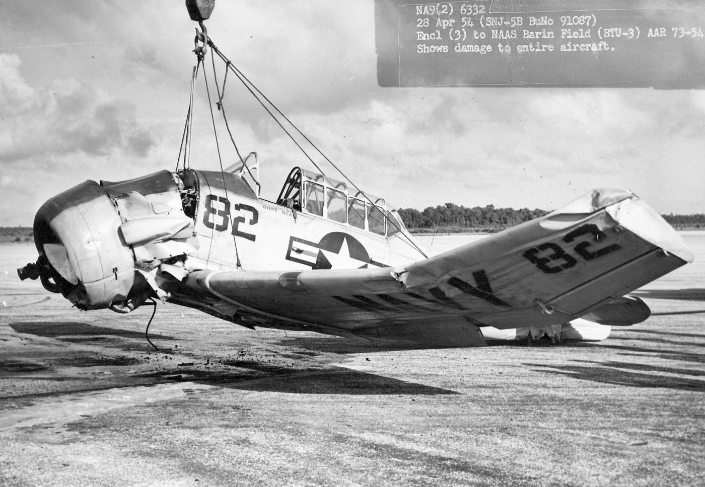
A 4/28/54 photo of a crane lifting the wreckage of an SNJ-5B Texan of Basic Training Unit 3 at NAAS Barin Field, showing damage to the entire aircraft (from the National Museum of Naval Aviation).
R.M. Tvede Jr. recalled, “In fall of 1955 we got a bunch of T-28s & were to phase out the SNJs as the pipeline starting at Whiting was being thus converted.
Lt. Tom Davis put together a proposed gunnery syllabus & came the day to try it out,
I got to drag the target to lift off & proceeded to the Gulf.
Six or seven instructors in their T-28s followed, sans ammunition for the wing pod gun (0.50cal ?).
Everybody had a ball - but back at the ready room, bad news soon arrived, and the party was over - we had put too many wrinkles in the T-28 wings/fuselages.
All but 2 or 3 T-28s were permanently parked; the 2 or 3 were used for other purposes
(weather checking, individual flights to meet annual instrument & night flight hour goals, etc).
Never had a worry of being shot down.
Only bullet holes in an airplane were in a propeller (the 0.30 caliber gun shot through the prop arc & the synchronizer evidently didn’t do its job)!”
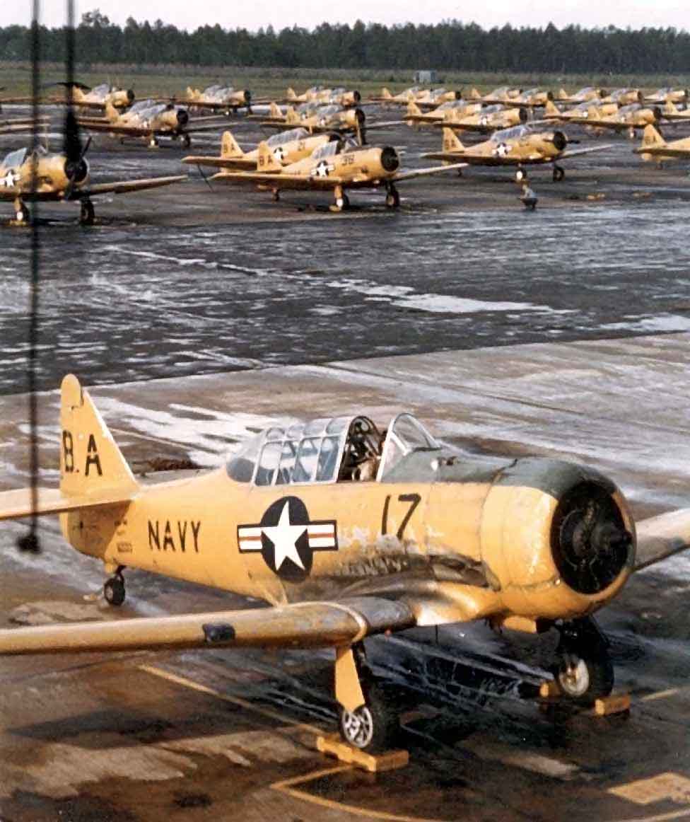
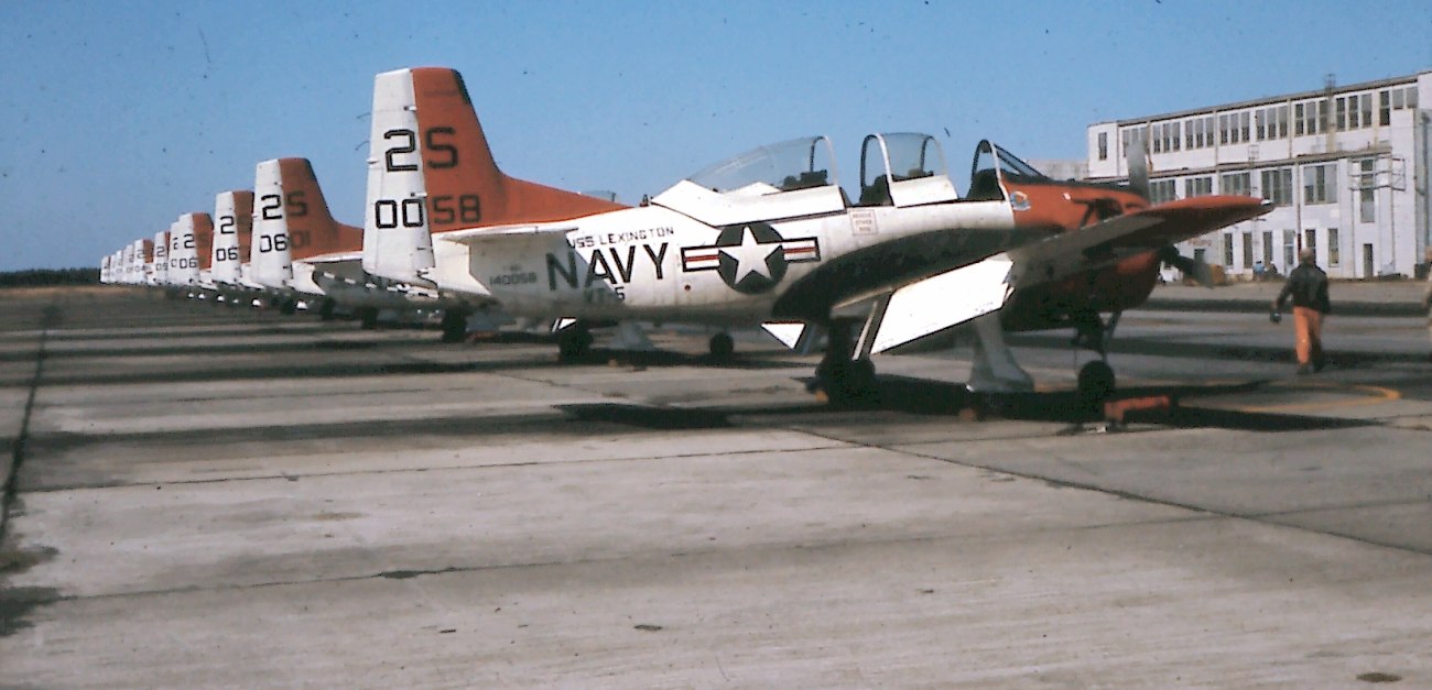
A 1954 color photo (restored by Bill Grasha) of SNJ Texans on the Barin ramp.
R.M. Tvede Jr. observed, this photo “is of the CQ group.
Gunnery planes were all in the BA 300 series.
We used the western-most hangar - but, except for hurricanes, it was never used for airplane service/storage.”
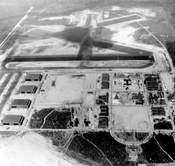
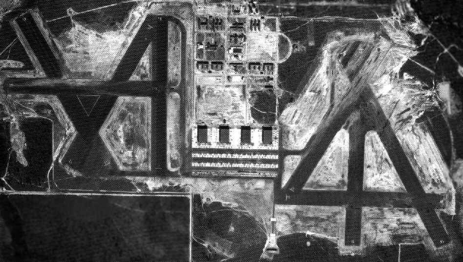
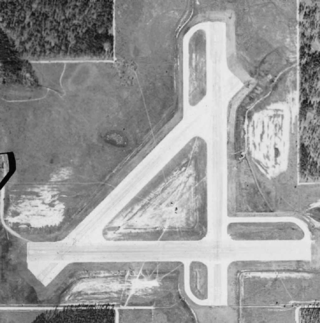
A 3/29/55 USDA aerial photo (courtesy of Dallam Oliver-Lee) showed the 4 paved runways of Barin West Field.
A 3/29/55 USDA aerial photo (courtesy of Dallam Oliver-Lee) showed a large number of aircraft on the Barin Field ramp.
A 3/29/55 USDA aerial photo (courtesy of Dallam Oliver-Lee) showed the 4 paved runways of Barin East Field.
An undated photo of a row of Navy T-28 Trojans in front of a NAAS Barin hangar.
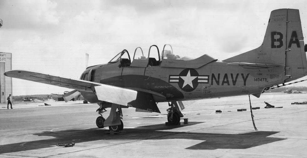
A 1956 USN photo of a T-28C Trojan at NAAS Barin (courtesy of John Voss).
A 1956 aeronautical chart (courtesy of Oliver Dallam-Lee) depicted NAAS Barin as having a 4,200' paved runway.
OLF Barin, as depicted on the 1957 USGS topo map (courtesy of Dallam Oliver-Lee).
Barin closed for a second time in 1958,
but kept some aircraft for day field training, mainly simulated carrier landings.
Dick Talbert recalled, “I served in the US Navy 1959-61.
While stationed at Saufley Field I was assigned as a driver of an old WWll Dodge power wagon ambulance,with a corpsman.
We traveled 6 days a week by navy bus, with Crash Crew personnel & Navy and Marine Corps cadets to Barin Field.
We departed Saufley at 5am, setup next to an MB5 Crash truck on the carrier deck painted runway at the crack of dawn, and stayed until sunset.
Hot miserable duty. The students flew T-28s. At first the LDO directed them with flags. Latter the Meatball mirror was introduced.
I did this for approximately 8 months. After that I was assigned as an MB5 driver crew chief at Saufley.
The days were long hot & tiring & often tragic.”
A 11/6/60 USDA aerial photo (courtesy of Dallam Oliver-Lee) appeared to show 3 of Barin's hangars still standing.
In 1962, Barin’s West Field, the original Foley Municipal Airport, was returned to the City of Foley.
It was apparently never reused as an airfield again.
An undated photo (restored by Bill Grasha) of the Barin control tower on top of a hangar.
The windows of the control tower appeared to be covered, so presumably this photo is from after the base was closed.
According to John Wienand, “The Navy sold the cantonment area to a private owner in 1962.
All the military buildings were removed.”
"OLF Barin (Navy)" was depicted on the 1964 Mobile Sectional Chart (courtesy of John Voss),
but the remarks said, "Closed. OLF to NAS Pensacola."
A 10/6/66 Soil Conservation Service aerial view of Barin Field (from the University of Alabama Map Library).
A 10/6/66 Soil Conservation Service aerial view of Barin Field (from the University of Alabama Map Library) showed a row of planes on the ramp,
but 3 of the 4 hangars had been removed.
Charles Waugh recalled, “I was a Naval Aviator who went through Whiting as a student in 1966
and after receiving my wings in February 1967 was immediately sent back as a flight instructor for a year from mid-1967 to mid-1968.
I learned to fly aboard the ship at Barin & since I was a basic instruments instructor used to do a high altitude (from 14,000') penetration over Brewton at the end of each flight.
Penetration was a way for a single-piloted aircraft to make a very steep high speed dive from high altitude through an overcast & into the clear below the clouds.
This made for minimum time on instruments (read safer) as a single-piloted aircraft.”
"OLF Barin (Navy)" was still listed as closed on the January 1976 New Orleans Sectional Chart (courtesy of Chris Kennedy).
A 2/8/76 USGS aerial photo showed runway markings still perceptible on both Barin West & East Fields.
At some point after 1976, Barin was reopened as a Navy satellite airfield.
Veronice Lawrence recalled, “In the aftermath of [Hurricane] Fredrick [September 1979]
a part of Barin Field was being used as a collection point for timber (pulp wood) that was blown down during the hurricane.
That was because Barin was near the Intercoastal Canal for barge traffic to the paper mills in Mobile & Pensacola.”
The 1980 New Orleans Sectional Chart depicted the 4 runways of Barin's East Field as “OLF Barin”, but nothing was depicted of West Field.
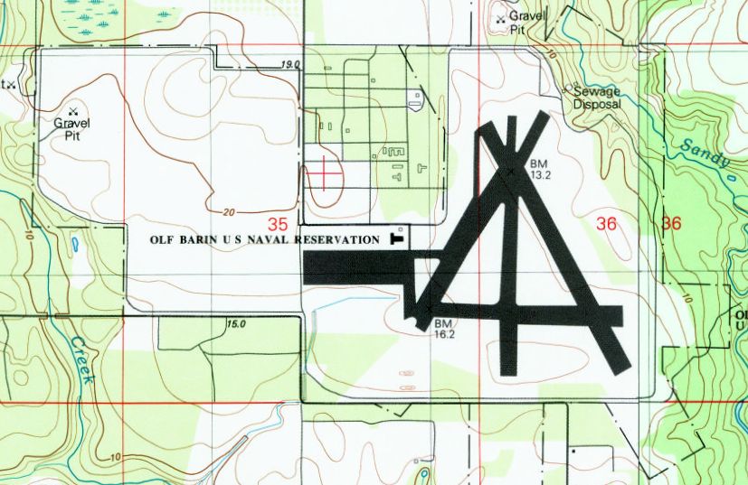
The 1980 USGS topo map labeled the overall property as “OLF Barin U.S. Naval Reservation”,
but only the runways of East Field were still depicted – nothing was depicted on the site of West Field.
A 1987 photo by John Voss of a post-WW2 building at Barin Field.
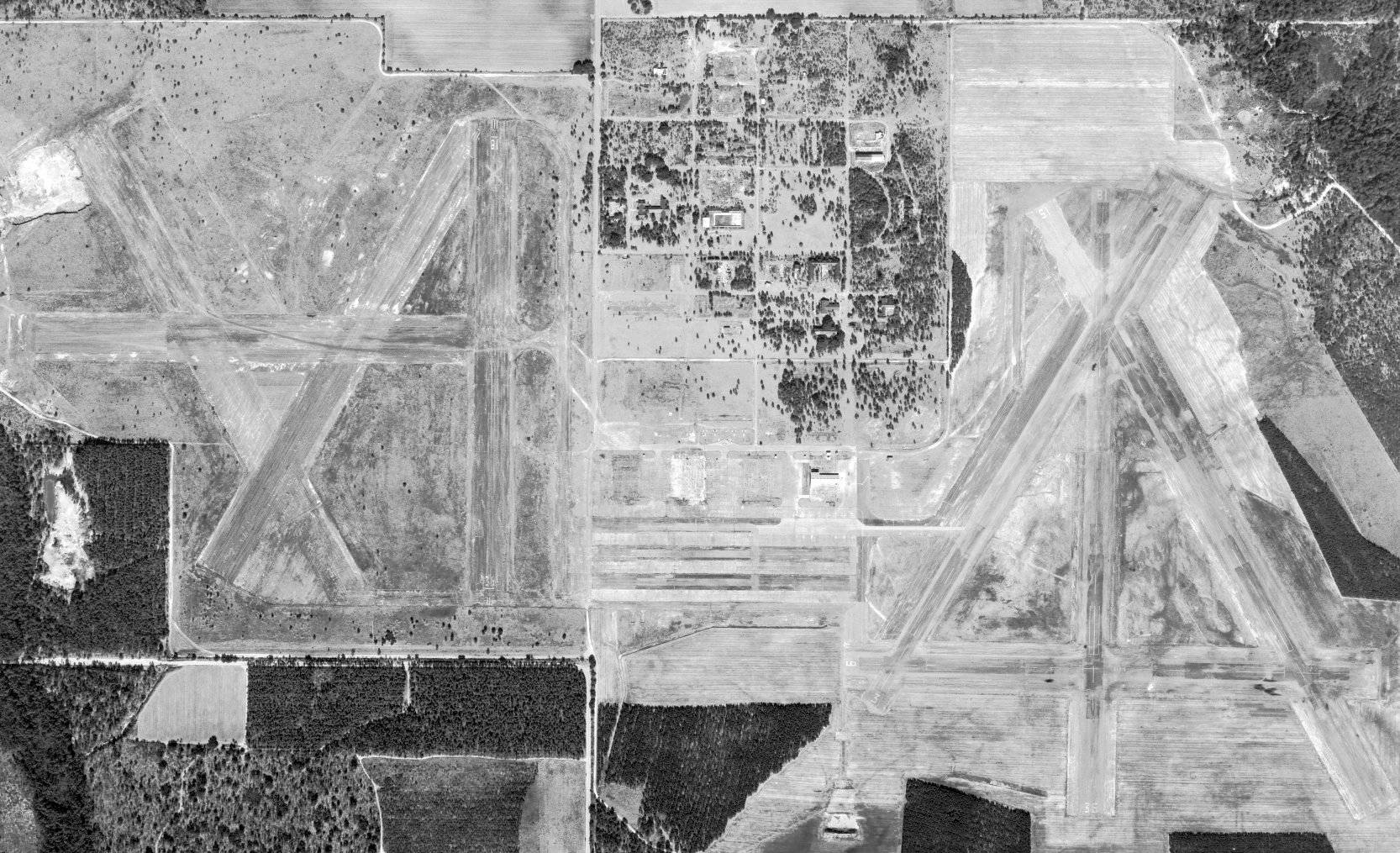
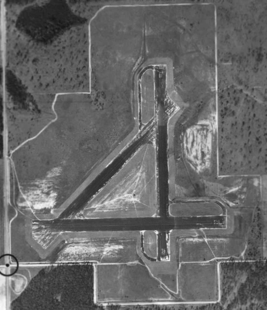
A 1988 aerial view looking southeast at Barin, showing the still-active East Field in the background,
and the abandoned West Field in the foreground, before it was bisected by a new highway.
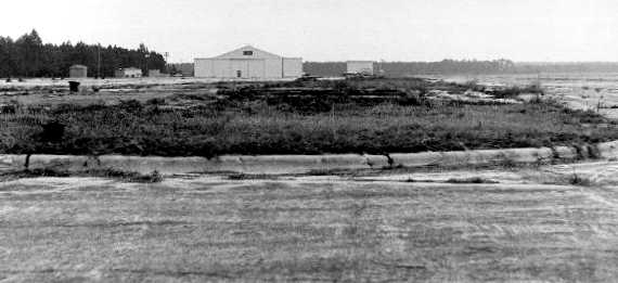
A 2/4/89 photo by Robert Lawson of Barin Field hangar.
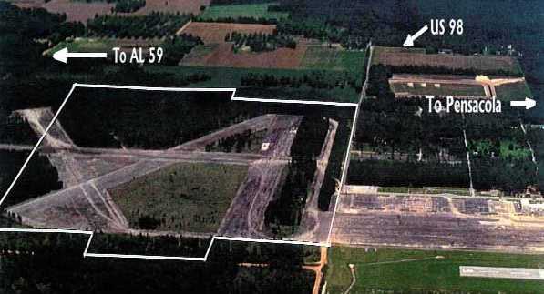
A circa 1980s-90s aerial view looking north at Barin West Field & the ramp,
before highway construction bisected the West Field..
A circa 1990s aerial view looking southeast at Barin, showing the currently active East Field in the background,
and the abandoned West Field in the foreground, with a new 4-lane Foley Beach Express highway being built right through it.
As of the late 1990s, the East Field was still used as a satellite airfield for nearby Pensacola Naval Air Station.
Two runways were still maintained (9/27: 3,275' long & 15/33: 4,000' long).
The Airport Facility Directory included the remarks,
"Used for practice instrument approaches by military T-34 aircraft."
The West Field of 4 runways was abandoned.
The last photo which has been located showing both West & East Fields still intact was a 2/17/97 USGS aerial view (courtesy of Dallam Oliver-Lee).
According to Whiting Field T-34 instructor Bob Adair, "Barin OLF is manned daily by a Runway Duty Officer
(a T-34 pilot manning a UHF radio & coordinating incoming traffic) and a crash crew.
The RDO is provided by Whiting Field (Training Air Wing 5)
and the field is used mostly for Student Pilot landing practice.
Every so often a civilian inbound to Jack Edwards tries to land here."
The Navy planned to eventually conduct training at Barin using the new T-6A Texan II, the replacement for the T-34.
To accommodate the longer runway requirements of the T-6A,
that would require acquiring Clear Zone land under the Runway 27 approach at Barin.
Mark Morgan recalled, “When I hit Barin in 2003, the parkway was under construction & you could still find foundations & small structures scattered about.”
A 1/30/04 aerial view (courtesy of Dallam Oliver-Lee) showed a new 4-lane Folley Beach Express
was being built right through the center of the West Field runways.
East Field's northeast/southwest runway pavement had also been removed at some point between 1997-2004,
leaving it with only 2 runways.
A 2005 photo by Tom Marcotte (restored by Bill Grasha) of a Navy T-34C Turbo Mentor at Barin East Field.
Tom observed, “The East Field is still in use by the Navy.
I saw a T-34C parked there, some emergency vehicles, and some T-34C's doing circuits.
The facility seemed to be in good condition save for the fence being corroded.”

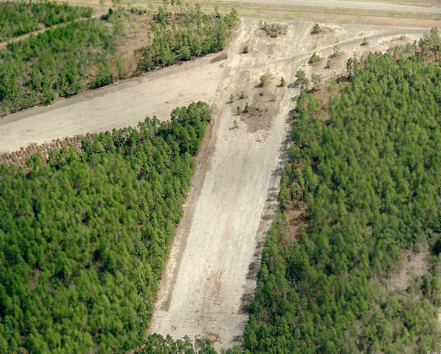
A 2005 photo by Tom Marcotte looking at the east/west runway on the east side of the highway at the abandoned Barin West Field.
Tom reported, “Barin West is of course closed long ago,
and is now bisected by the new Gulf Shores Beach Access 4-lane road.
The elevation of the new road is a good bit lower than the field elevation of Barin West, so it took me a while to find it.
The surface is in poor condition as the asphalt has released a great deal of pebbles & other FOD.
I could not find any other airport related signs at Barin West.”
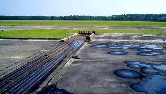
A 2006 photo by John Wienand of the massive steel tracks which previously held the doors of a hangar at Barin.
John Wienand reported in 2006, “The East Field is still used by the Navy.
The West Field is bisected by a highway & used for hurricane debris storage (until it rots).
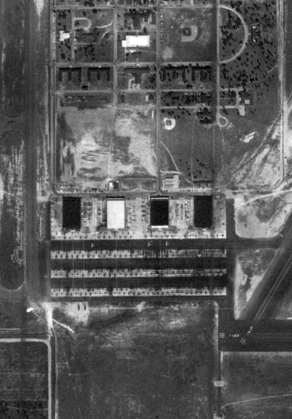
I am standing in the middle of an aircraft ramp that at one time held 400 aircraft.
There is the occasional sound of a T-6 buzzing the field doing touch & go's.
I am in the middle of what had to be millions of dollars of infrastructure all now quiet,
except the sound of passing cars & that pesky trainer.”
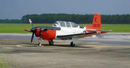
A 2006 photo by John Wienand (enhanced by Bill Grasha) of a Navy T-34C at Barin.
John observed, “There is always this one plane parked there. Someone gets to fly to work.”
A 2006 photo by John Wienand, “At the southernmost portion of the West Field ramp looking north.
A huge ramp. Now a huge waste.”
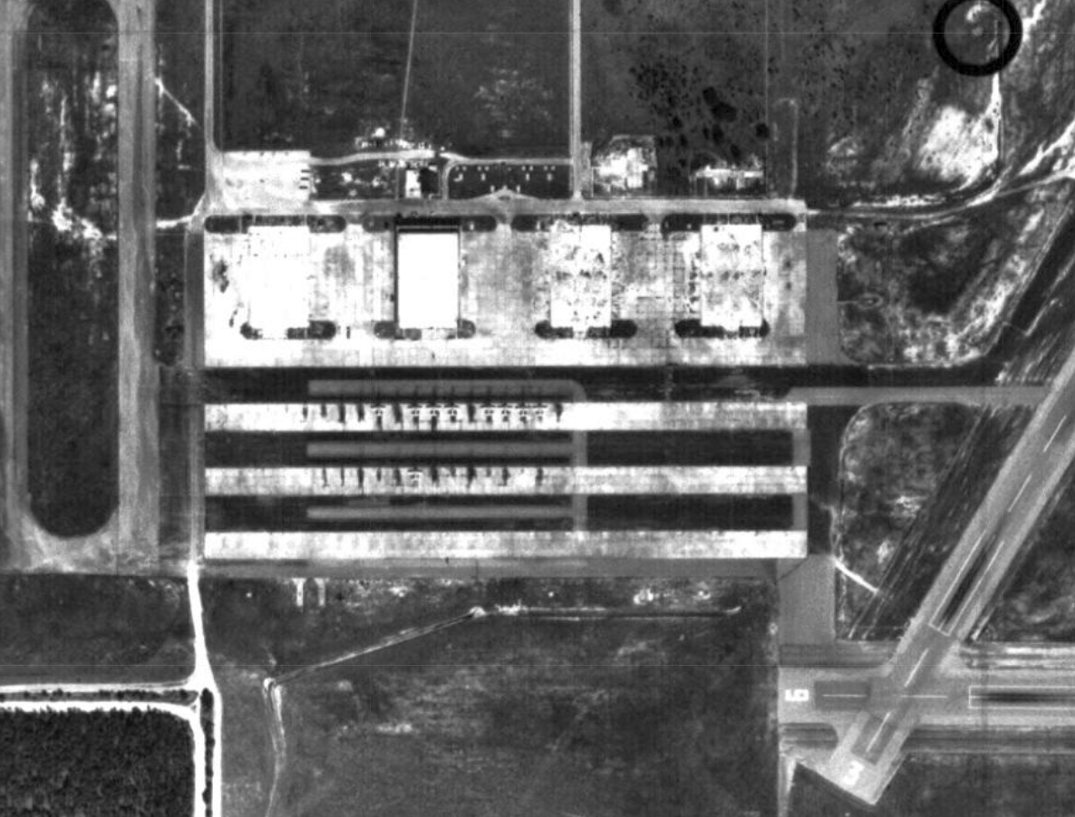
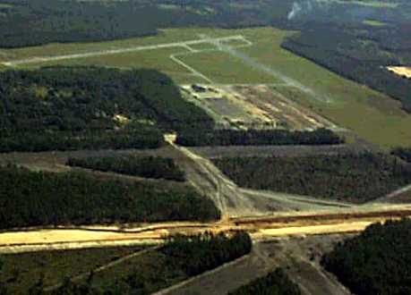
A circa 2006 aerial view looking east at the Barin ramp, showing the foundations still visible from the former hangars,
the recent-construction operations building, a single T-34C Mentor, and a helipad.
A circa 2006 aerial view looking east at the west end of the Barin West runways.
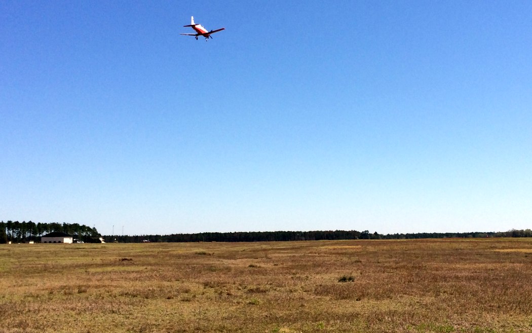
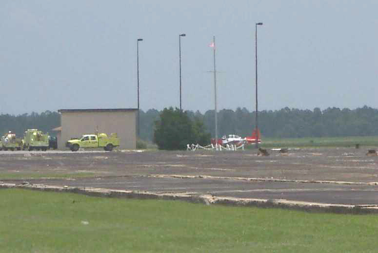
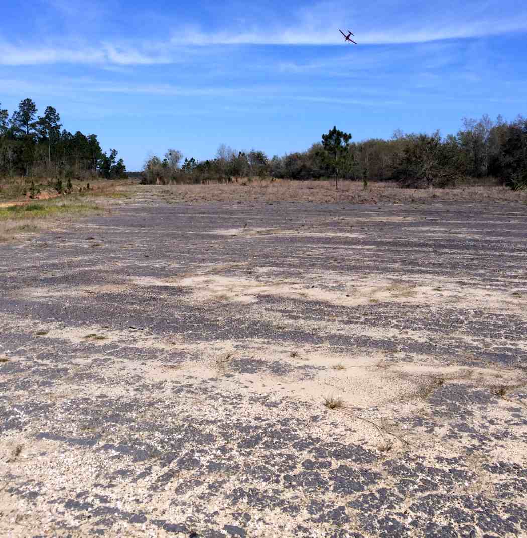
A 3/31/14 photo by Timothy Williamson of a Navy Beechcraft T-6 Texan II trainer at Barin. Timothy reported, “They were doing touch & gos.”
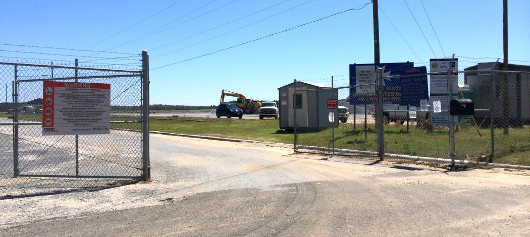
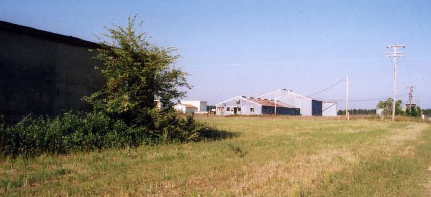
A 3/31/14 photo by Timothy Williamson of the Barin Field entrance gate.
A 3/31/14 photo by Timothy Williamson looking east along an abandoned Barin Field taxiway,
with a Navy Beechcraft T-6 Texan II trainer overhead doing a touch & go into Barin's East Field.
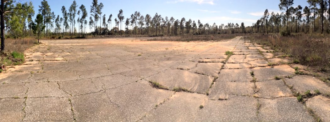
A 3/31/14 photo by Timothy Williamson looking west along 2 abandoned runways of Barin's West Field.
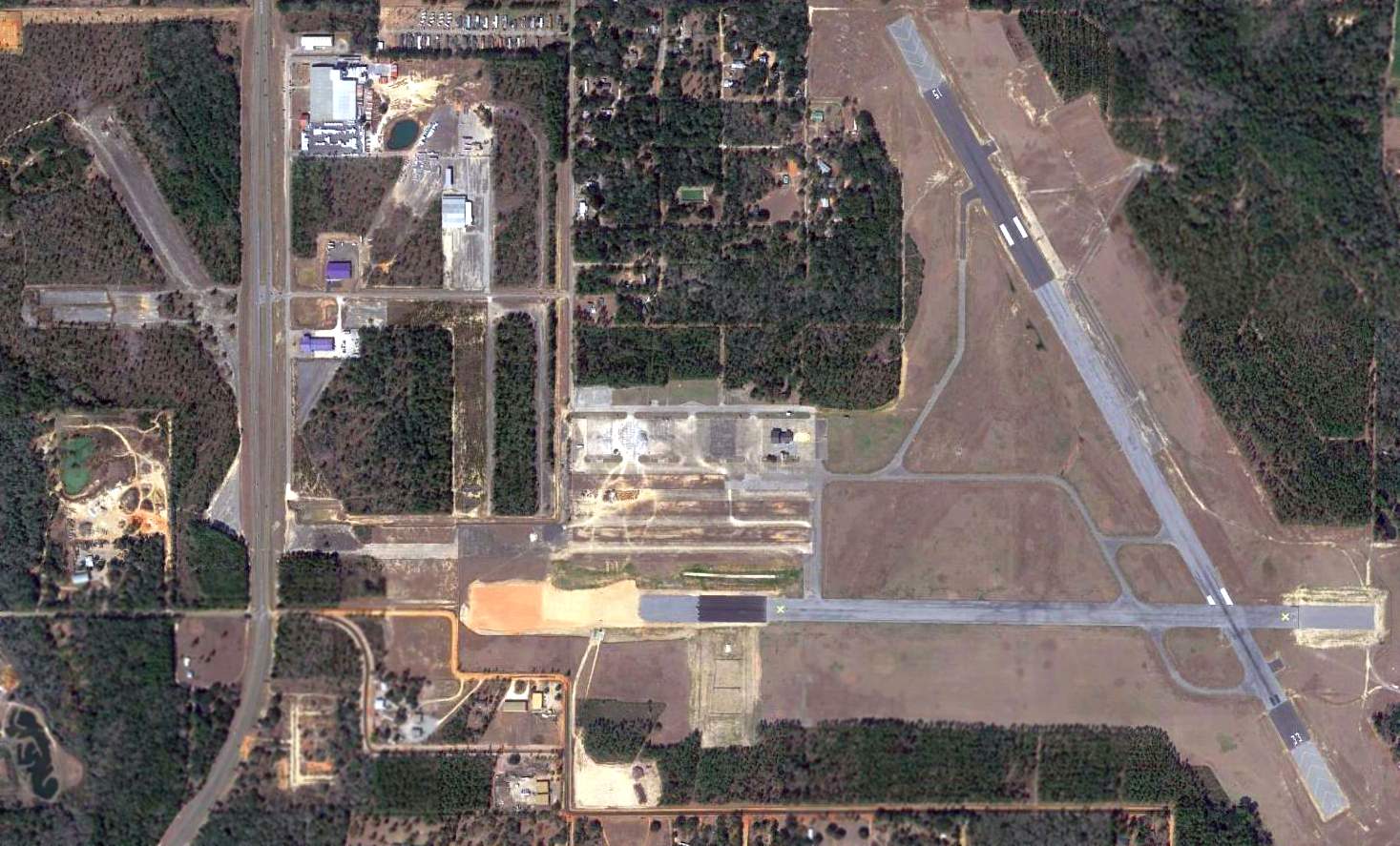
A 2015 aerial view showed the remains of Barin's West Field along with the still operational East Field.
A 2/21/20 photo by Mark Morgan of the remains of Barin West Field.
Mark Morgan reported, “Foley & the county are using what's left of the West Field for the depositing of rubble from the hurricane
and what with all the front-end loaders & BIG trucks loaded with debris roaring around, I didn't get to pursue too much in the way of tracking down former runways & ramp.”
A 2/21/20 photo by Mark Morgan of a Navy Beechcraft T-6 Texan II trainer landing at Barin East Field.
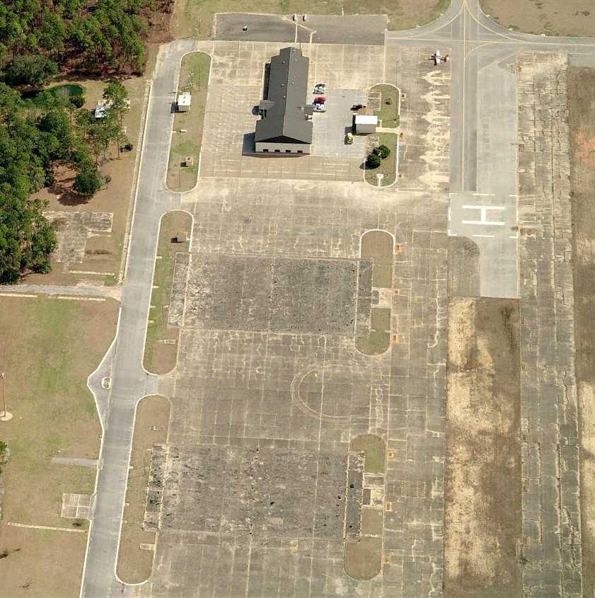
A 2/21/20 photo by Mark Morgan of buildings & the ramp at Barin East Field.
See also: http://www.pafw.com/barin.htm
____________________________________________________
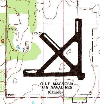
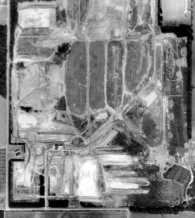
Naval Outlying Field 28431 / Magnolia Naval Outer Landing Field, Marlow, AL
30.46, -87.77 (Northwest of Pensacola, FL)
NOLF 28431, as depicted on the January 1944 Mobile Sectional Chart.
No airfield was yet depicted at this location on the 1943 USGS topo map (courtesy of Dallam Oliver-Lee).
Naval Outlying Field 28431 was built as one of the large number of WW2-era satellite airfields used by NAS Pensacola.
The earliest depiction which has been located of NOLF 28431 was on the January 1944 Mobile Sectional Chart.
“Barin Field Auxiliary (28431 Magnolia Outlying Field)”, as depicted in the 1945 AAF Airfield Directory (courtesy of Scott Murdock).
It described “Barin Field Auxiliary (28431 Magnolia Outlying Field)” as an irregularly-shaped property having 3 bituminous 2,850' runways.
The field was not said to have any hangars, to be owned by the U.S. Government, and operated by the Navy.
The earliest photo which has been located of Magnolia OLF was a 7/9/54 of an SNJ-5B Texan of NAAS Barin Field's Basic Training Unit 3
pictured after departing the runway at Magnolia Field (from the National Museum of Naval Aviation).
OLF Magnolia, as depicted on the 1957 USGS topo map (courtesy of Dallam Oliver-Lee).
An 11/12/60 USDA aerial view (courtesy of Dallam Oliver-Lee) depicted OLF Magnolia as having 4 asphalt runways.
"OLF Magnolia (Navy)" was depicted on the 1964 Mobile Sectional Chart (courtesy of John Voss),
along with the remarks, "Intensive Student Pilot Training."
The runway configuration was listed as 4 asphalt runways, with the longest being 2,850'.
The last photo which has been located showing Magnolia OLF still in operation
was a 1966 Soil Conservation Service Photo (courtesy of Thomas Kallsen of the University of Alabama Map Library).
According to Buford King, “Magnolia began operating as a landfill in 1972.
Baldwin County leased the property from the Navy originally
and eventually bought the property from the federal government’s General Services Administration.”
Hwoever "OLF Magnolia (Navy)" was still depicted as an active airfield
on the January 1976 New Orleans Sectional Chart (courtesy of Chris Kennedy).
It was labeled "Magnolia Airport (Navy)" on the 1978 USGS topo map,
but that does not necessarily prove the airfield was still open at that point.
Magnolia was evidently closed at some point between 1976-80,
as it was labeled "OLF Magnolia (Navy) (Closed)"
on the 1980 New Orleans Sectional Chart (courtesy of Robert Brown).
As depicted on the 1986 USGS topo map, the Magnolia airfield consisted of three 2,800' runways.
The outlines of the former 4 paved runways were still (barely) recognizable in the 1997 USGS aerial photo,
as all of the runway pavement had evidently been removed at some point between 1976-97.
Nearby resident John Wienand reported in 2006, “Magnolia OLF has been used as a landfill for 20 years.
The runways are all gone, all infrastructure is all gone.
I live about 3 nautical miles from it & never know it was there (I'm upwind though).
You can't find so much as a chunk of asphalt, the did such a wonderful job of converting it.
Retention ponds are spread all over the property.”
A 2006 photo by John Wienand of the southwest corner of the former Magnolia airfield property.
The road in the foreground is of recent construction (does not date from the property's airfield days).
Buford King reported in 2006, “OLF Magnolia is now the Magnolia Landfill.
Magnolia Landfill is operated by the Baldwin County Commission - commonly referred to simply as ‘The County.’
I am the Environmental Compliance Coordinator for the all Landfills operated by Baldwin County,
and my office is at Magnolia in the red building depicted in the photo.
Some of the old runways are still in existence; I’d guestimate that probably 10–15% of the old runway asphalt remains but is in obvious disrepair.
The remnants of the eastern-most runway are difficult to see, but they are there.
We also have a remnant of the ‘center’ runway remaining,
but like the ‘eastern’ runway it is obscured by years of soil building up & covering the asphalt & is difficult to see in the aerial photo.
We have an auxiliary entrance that FEMA contractors use, and I believe that auxiliary entrance is one of the original entrances.”
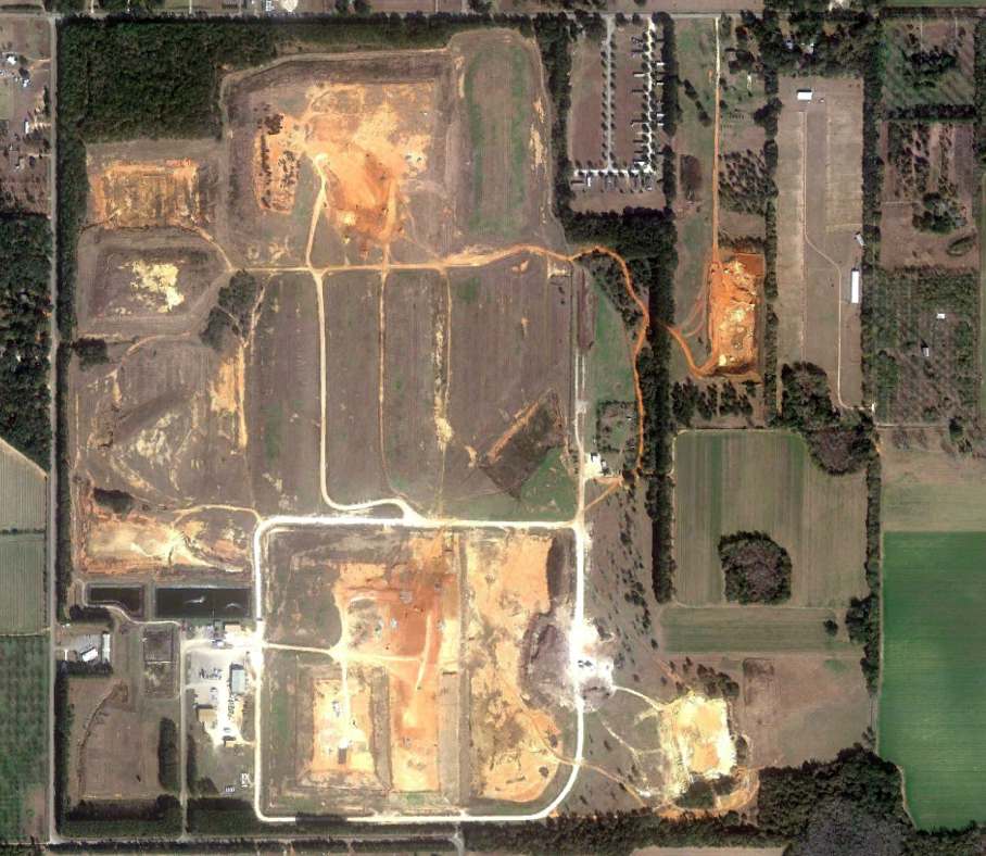
A 1/13/12 aerial view (courtesy of Dallam Oliver-Lee) showed the landfill replacing any recognizable trace of the former Magnolia airfield.
____________________________________________________
Naval Outlying Field 29436 / Silverhill Naval Outer Landing Field (NQB), Silverhill, AL
30.56, -87.82 (Northwest of Pensacola, FL)
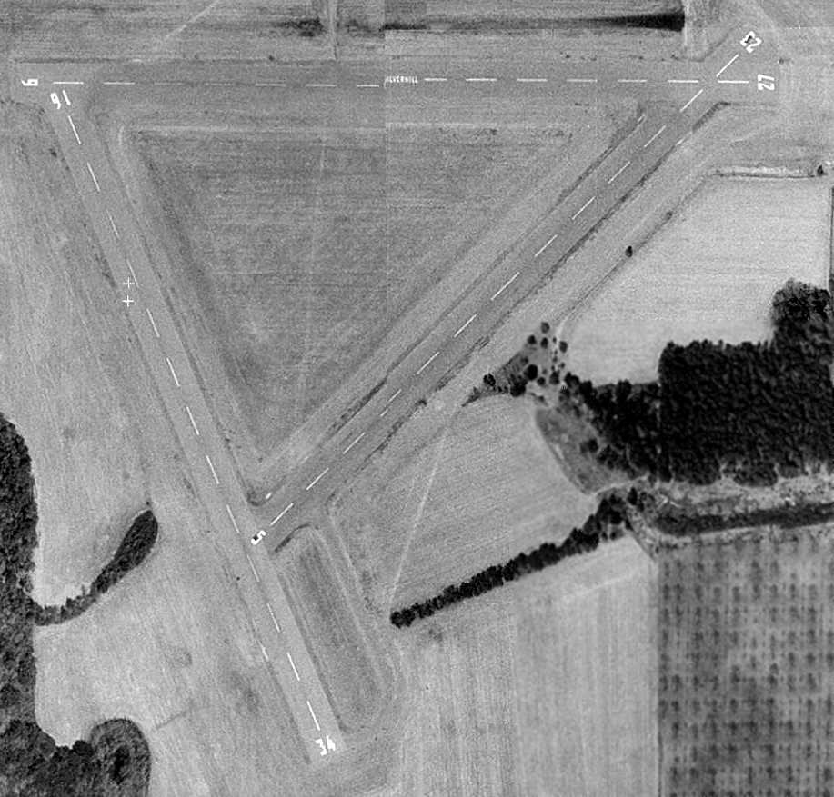
NOLF 29436, as depicted on the January 1944 Mobile Sectional Chart.
This airfield was built as one of the large number of WW2-era satellite airfields used by NAS Pensacola.
The earliest depiction which has been located of Naval Outlying Field 29436 was on the January 1944 Mobile Sectional Chart.
“Barin Field Auxiliary (29436 Silverhill Outlying Field)”, as depicted in the 1945 AAF Airfield Directory (courtesy of Scott Murdock).
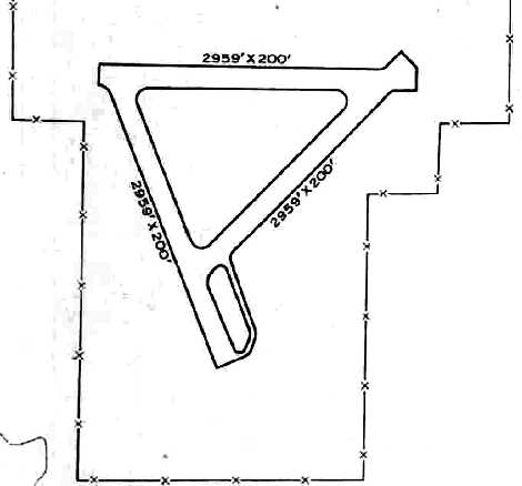
The directory described Silverhill Outlying Field as an irregularly-shaped property having 3 bituminous 2,959' runways.
The field was not said to have any hangars, to be owned by the U.S. Government, and operated by the Navy.
The earliest photo which has been located of the Silverhill airfield was a 4/7/52 aerial view (from the University of AL Map Library).
It depicted Silverhill as having 3 asphalt runways.
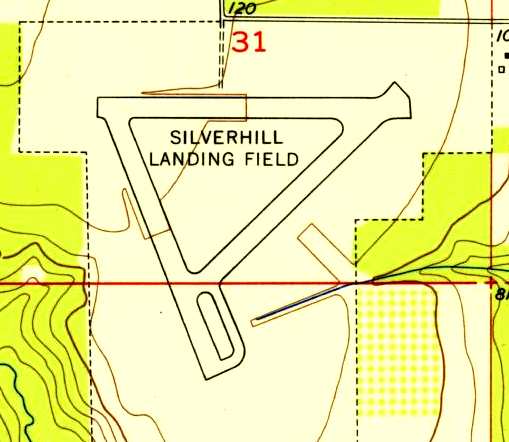
USGS topo map 1953 (courtesy of the University of Alabama Map Library).
"OLF Silverhill (Navy)" was depicted on the 1964 Mobile Sectional Chart (courtesy of John Voss),
along with the remarks, "Intensive Student Pilot Training."
The runway configuration was listed as 3 asphalt runways, with the longest being 3,000'.
Nearby resident John Wienand recalled, “It seems like they used the fields a lot when I was a Cub Scout, about 1968,
but by 1972 a lot of activities had stopped at a lot of the fields & they became abandoned in place.
They used to be able to leave the fire trucks in the stations at night unattended.”
Silverhill was evidently closed at some point between 1964-80, as it was labeled "OLF Silverhill (Navy) (Closed)"
on the 1980 New Orleans Sectional Chart (courtesy of Robert Brown).
Silverhill was evidently reopened at some point between 1980-87, as a 1987 photo by John Voss showed a T-34C Turbo Mentor at Silverhill.
A 2/15/97 USGS aerial photo showed Silverhill to have three 3,150' asphalt runways: 5/23, 9/27 & 16/34.
According to Whiting Field T-34 instructor Bob Adair,
"Silverhill is an active OLF, its Runway Duty Officer is from Wing 6 at NAS Sherman.
It is used by both Whiting & Sherman T-34s for the bounce pattern."
The Navy plans to eventually conduct training at Silverhill using the new T-6A Texan II,
the replacement for the T-34.
To accommodate the longer runway requirements of the T-6A,
this will require the extension of a Silverhill runway.
Strangely, although Silverhill is still used by the Navy,
it is not listed among active airfields in the published FAA data.
Nearby resident John Wienand repored in 2006, “Crash trucks drive out everyday though now,
and the town has a policeman there.”
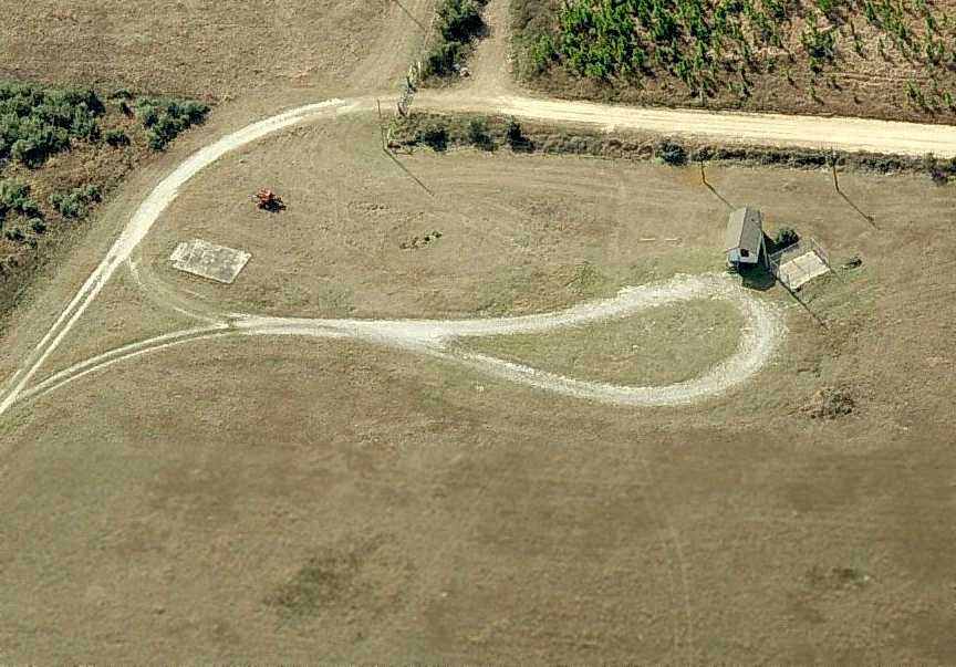
A circa 2006 aerial view looking north at the fire station & operations shack on the north side of Silverhill.
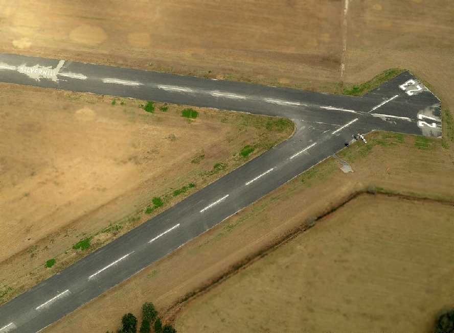
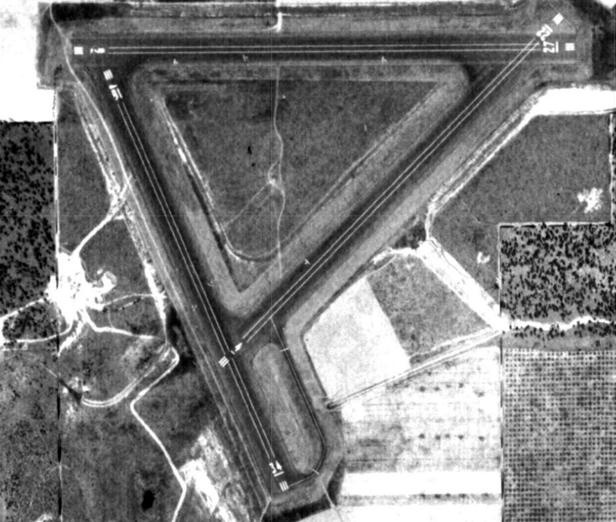
A circa 2006 aerial view looking north the east end of the Silverhill runways, showing the “Silverhill” lettering painted on the midpoint of Runway 9/27.
Several cars were parked along either end of Runway 5/23.
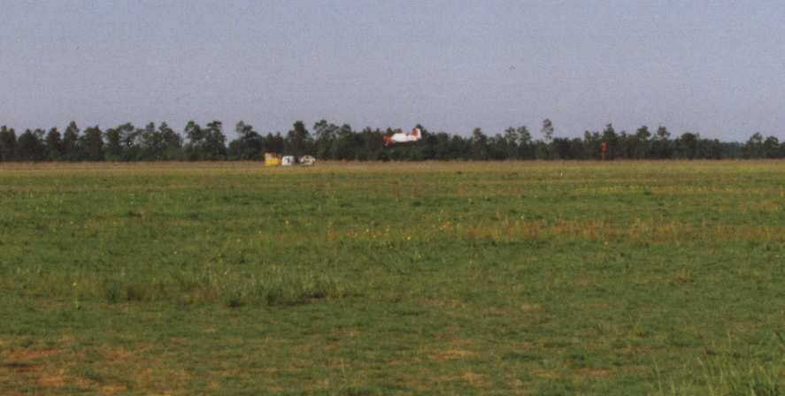
Rick Matthews reported, “As of June 2010 the field is still in use, attended, well maintained.
The sign by the road identifies it as an OLF of Whiting NAS (Milton, FL).”
A 1/13/12 aerial photo still showed the Silverhill runways marked as open.
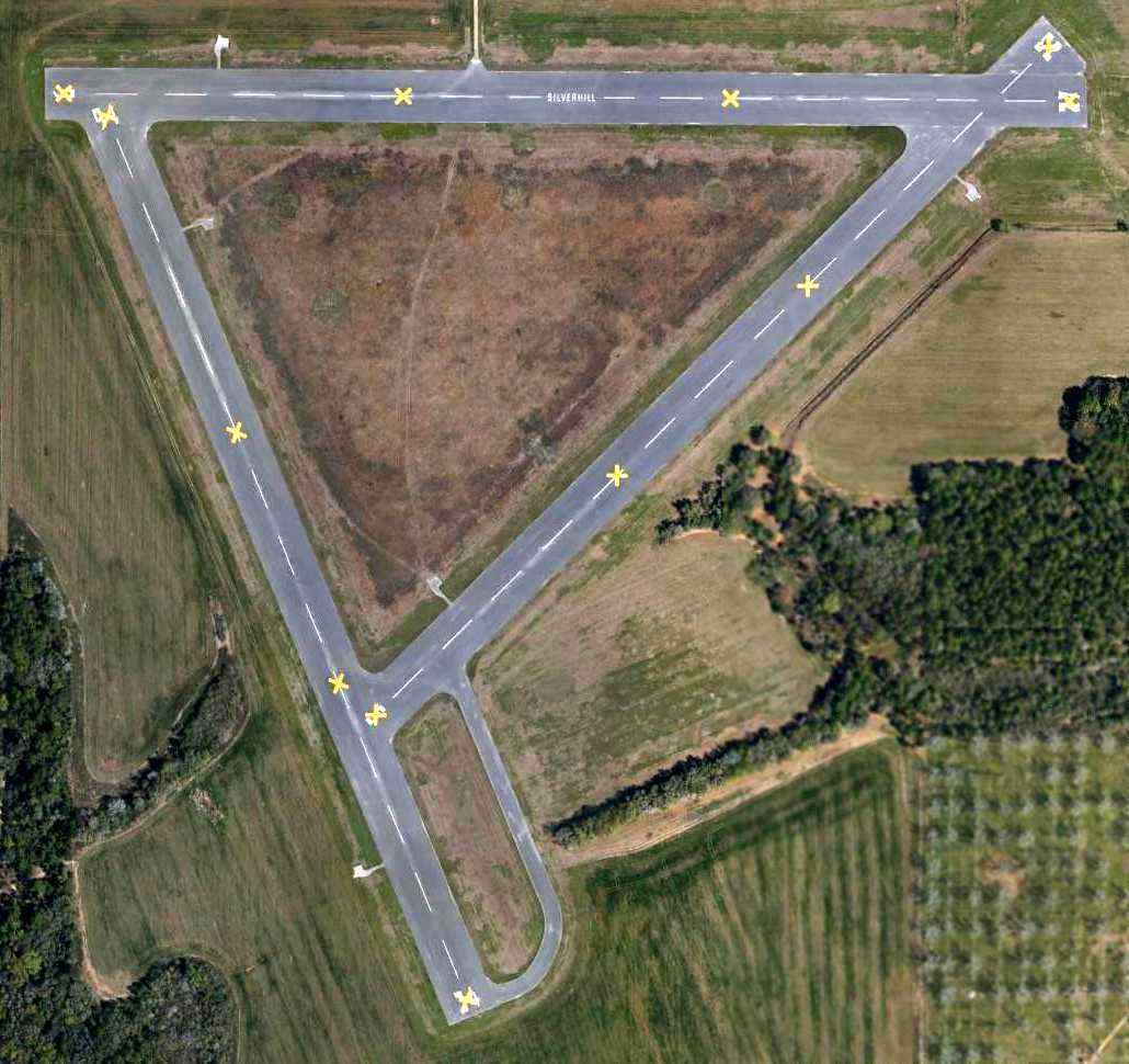
Silverhill was apparently closed at some point between 2012-2013, as a 3/2/13 aerial photo (courtesy of Edward Sheldon) showed yellow closed-runway “X” symbols painted on each runway.
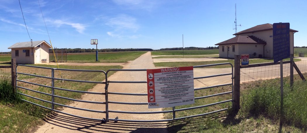
A 3/31/14 panoramic photo by Timothy Williamson of the buildings at the entrance gate to NOLF Silverhill.
See also: http://www.pafw.com/aerial_photos11.htm
____________________________________________________
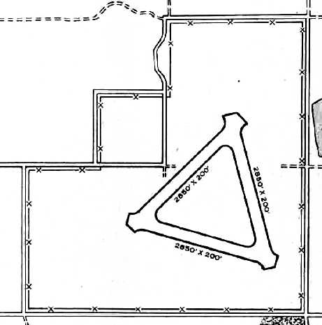
Naval Outlying Field 29625 / Summerdale Naval Outer Landing Field (NFD), Summerdale, AL
30.51, -87.65 (Northwest of Pensacola, FL)
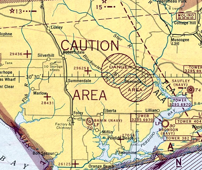
NOLF 29625, as depicted on the January 1944 Mobile Sectional Chart.
Naval Outlying Field 29625 / Summerdale Field was built as one of the large number of WW2-era satellite airfields used by NAS Pensacola.
Naval Outlying Field 29625 was evidently established at some point between 1942-44,
as it was not yet depicted on the December 1942 Mobile Sectional Chart.
The earliest depiction which has been located of Naval Outlying Field 29625 was on the January 1944 Mobile Sectional Chart.
The NOLF 29625 designation indicated that it was located on a 296 degree magnetic heading & 25 NM distance from the parent field (NAS Pensacola).
“Barin Field Auxiliary (29625 Summerdale Outlying Field)”, as depicted in the 1945 AAF Airfield Directory (courtesy of Scott Murdock).
It described “Barin Field Auxiliary (29625 Summerdale Outlying Field)” as having 3 bituminous 2,8250' runways.
The field was not said to have any hangars, to be owned by the U.S. Government, and operated by the Navy.
Strangely, the Summerdale airfield was not on depicted on the 1949 Mobile Sectional Chart (according to Chris Kennedy),
but rather than was a circular "Danger Area" at that location.
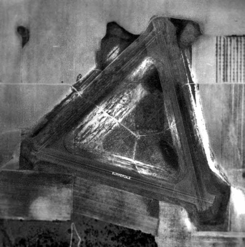
The earliest photo which has been located of the Summerdale airfield
was a 1955 Soil Conservation Service Photo (courtesy of Thomas Kallsen of the University of Alabama Map Library).
It depicted Summerdale as having 3 paved runways, with the airfield's name painted on Runway 10/28.
A 1956 aeronautical chart (courtesy of Oliver Dallam-Lee) depicted Summerdale OLF as having a 2,800' paved runway.
OLF Summerdale, as depicted on the 1957 USGS topo map (courtesy of Dallam Oliver-Lee).
Mel Shettle recalled, “During my time in Navy flight training in the early 1960s, Summerdale was reserved for instructors for the 'Safe for solo check' for T-34s from VT-1 at Saufley.
Solo students were not allowed to land there. The T-34s would land & the instructor would get out of the airplane.
The student would then make a few touch-&-goes while the instructor observed from the ground. If your landings were satisfactory – you passed!”
"OLF Summerdale (Navy)" was depicted on the 1964 Mobile Sectional Chart (courtesy of John Voss),
along with the remarks, "Auxiliary practice field."
The runway configuration was listed as 3 asphalt runways, with the longest being 2,850'.
The 1980 New Orleans Sectional Chart depicted the 3 runways of “OLF Summerdale”.
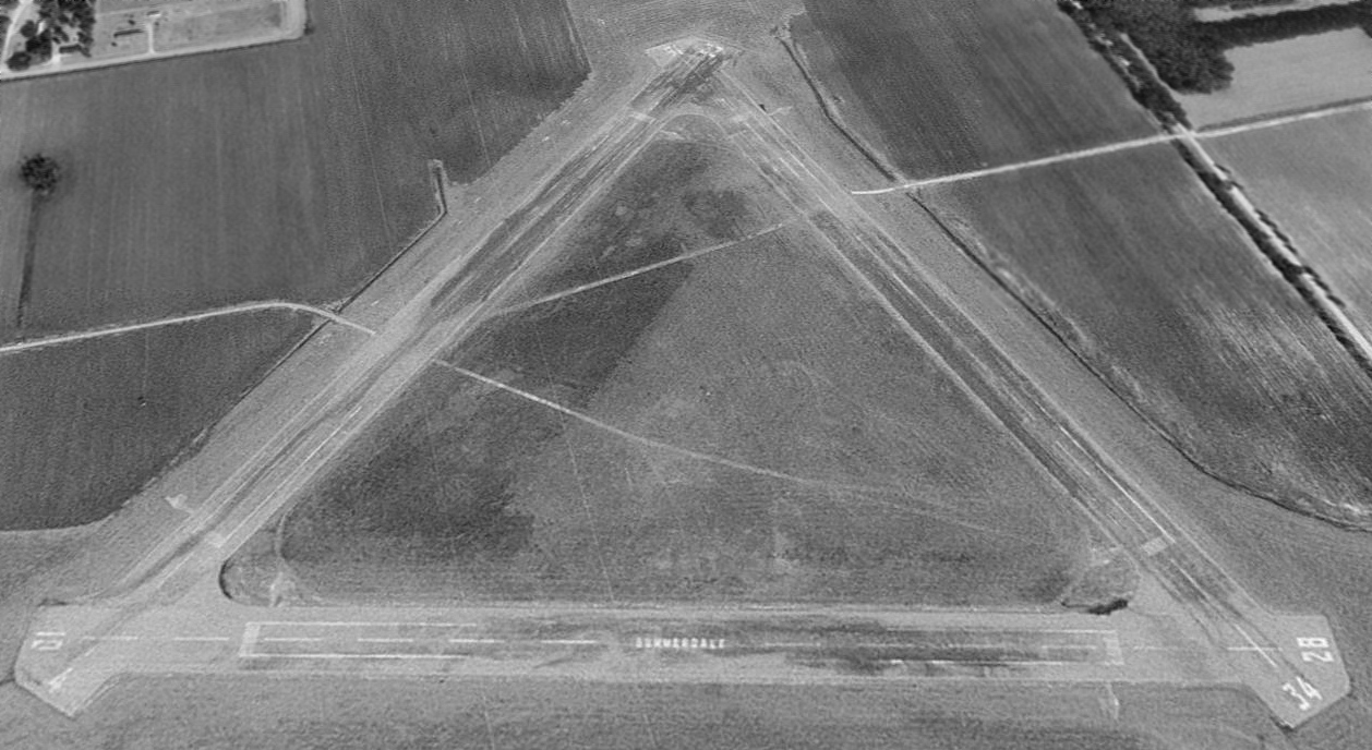
A 1994 USGS aerial view looking northeast depicted Summerdale as having 3 paved runways, with the airfield's name painted on Runway 10/28.
Summerdale is still used as satellite airfield for Whiting Field Naval Air Station.
The airfield consists of three 2,850' runways: 4/22, 10/28 & 16/34.
The Airport Facility Directory data includes the remark: "Airport used for touch & go's only.
Attended by crash crew for training of military T-34 aircraft."
According to Whiting Field T-34 instructor Bob Adair, "Summerdale is kept in working order,
and when another field in Alert Area 292 is closed the Runway Duty Officer relocates to Summerdale.
Summerdale is utilized for practice emergency landing patterns by T-34s
but they are limited to one aircraft at a time & only to low approaches due to it being unmanned."
The Navy plans to eventually conduct training at Summerdale using the new T-6A Texan II, the replacement for the T-34.
To accommodate the longer runway requirements of the T-6A, this will require the extension of a Summerdale runway.
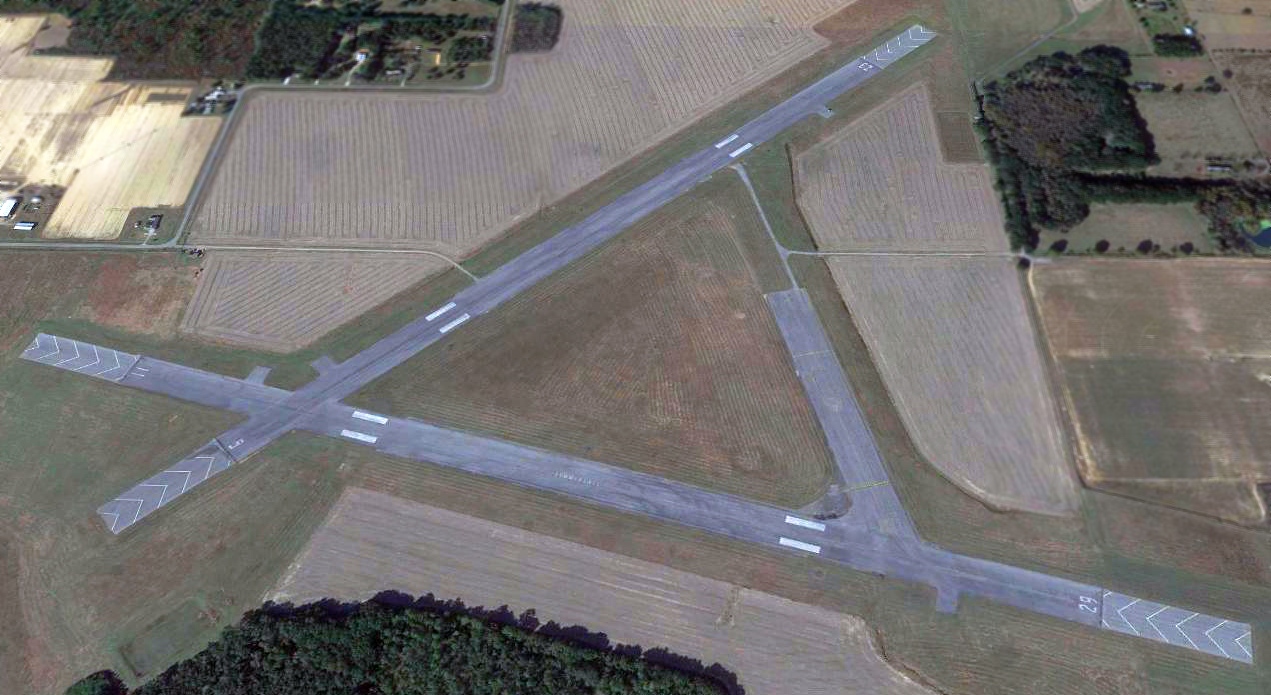
A 2012 aerial view showed Summerdale remained in its original runway configuration.
A 2013 aerial view showed that 2 of Summerdale's runways were in the process of being lengthened for T-6A flight operations,
but Runway 16/34 had been closed & half of its pavement removed.
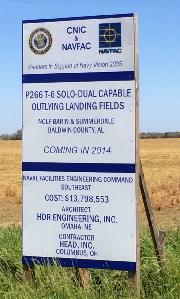
A 3/31/14 photo by Timothy Williamson of a sign at Summerdale Field proclaiming the Navy's 2014 plans for upgrading it to a “Solo-Dual Capable Outlying Field”.
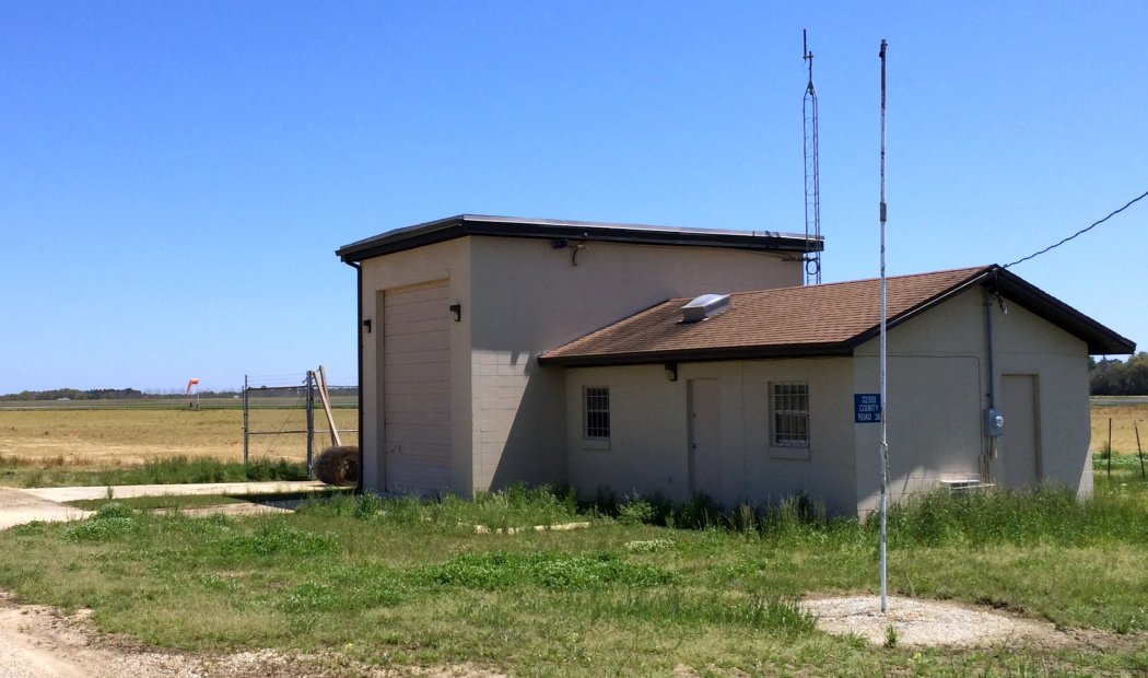
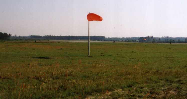
A 3/31/14 photo by Timothy Williamson of the extensive building infrastructure at Sumemerdale Field, with the windsock visible in the background.
As seen in a 2019 aerial view looking north, 2 of Summerdale's runways remain marked as active.
Mel Shettle reported in 2020, “Now Summerdale is used by T-6s from Whiting & the runways have been extended to accommodate the T-6s.”
See also: http://www.pafw.com/aerial_photos12.htm
____________________________________________________
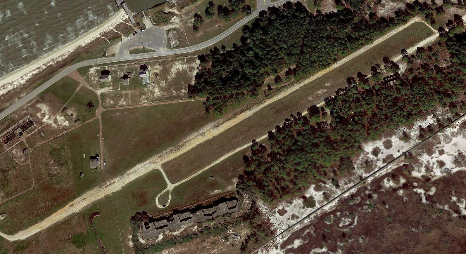
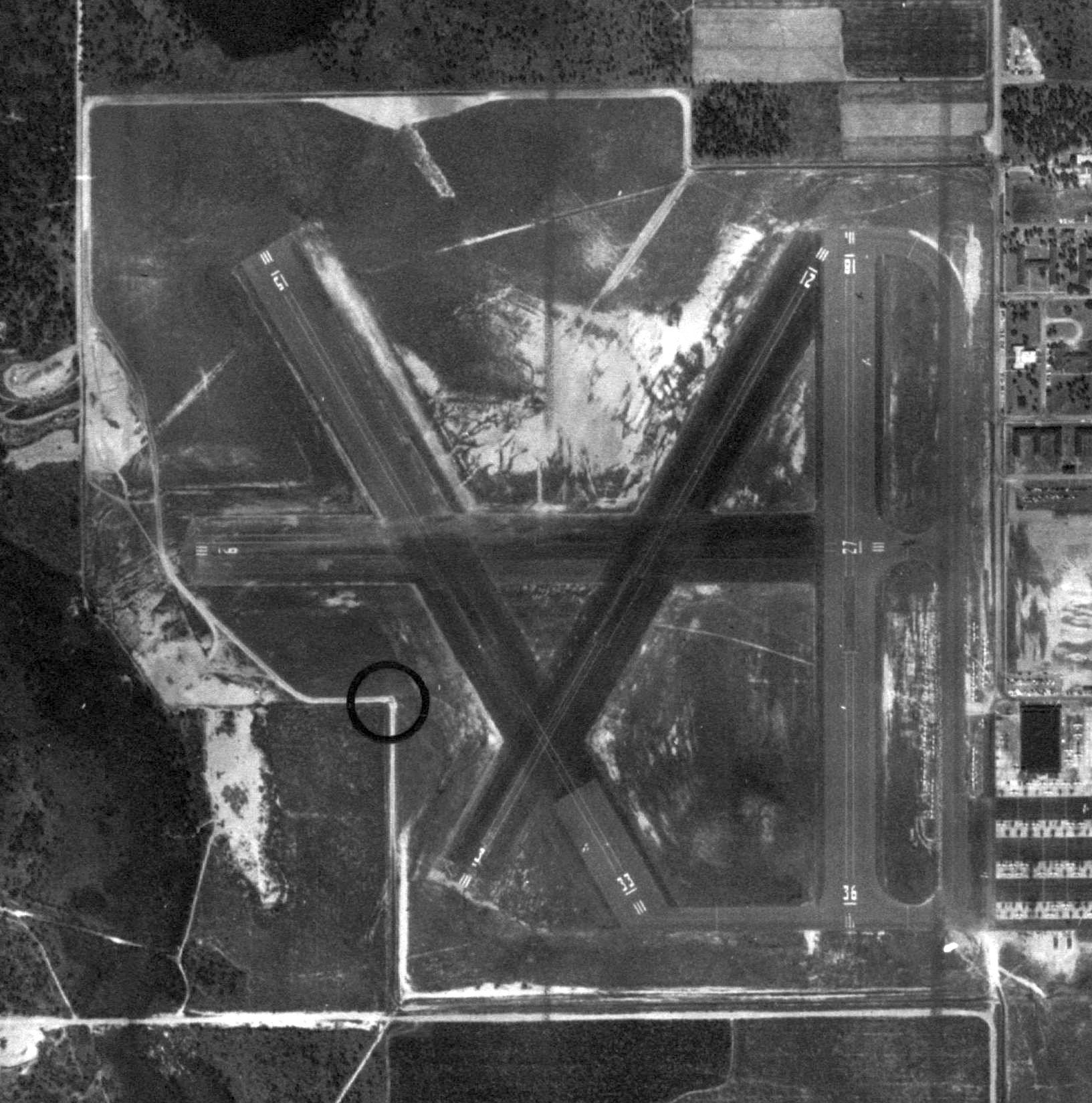
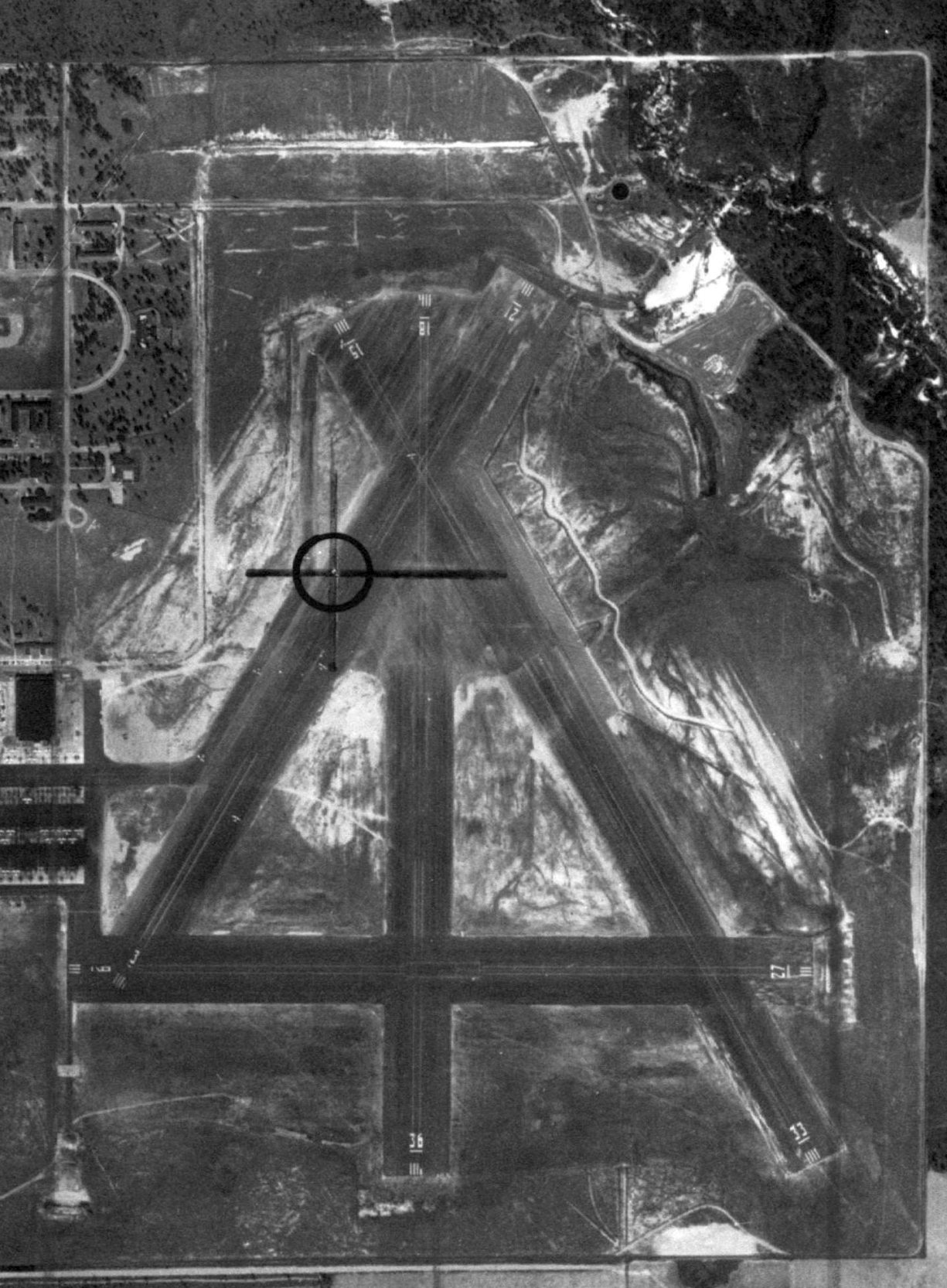
Wolf Naval Outer Landing Field / Field 27016 (NHL), Orange Beach, AL
30.344, -87.541 (West of Pensacola, FL)
Field 27016, as depicted on the January 1944 Mobile Sectional Chart.
Wolf Naval Outlying field was built as one of the large number of WW2-era satellite airfields used by NAS Pensacola.
Wolf NOLF was evidently built at some point between 1942-44,
as it was not yet depicted on the December 1942 Mobile Sectional Chart.
The earliest depiction which has been located of Wolf Field was on the January 1944 Mobile Sectional Chart,
which depicted Field 27016 as an auxiliary airfield.
The 1945 AAF Airfield Directory (courtesy of Scott Murdock) described “Barin Field Auxiliary (27016 Wolf Outlying Field)”
as having 3 asphalt 3,000' runways.
The field was not said to have any hangars, to be owned by the U.S. Government, and operated by the Navy.
Wolf Field, as depicted on the July 1945 Mobile Sectional Chart.
The earliest photo which has been located of Wolf OLF was a 1/5/51 USDA aerial view (courtesy of Dallam Oliver-Lee).
It depicted the field as having 3 paved runways & taxiways.
There did not seem to be any buildings associated with the airfield.
Wolf OLF, as depicted on a 1955 Soil Conservation Service aerial view (courtesy of Thomas Kallsen of the University of AL Map Library).
A 1956 aeronautical chart (courtesy of Oliver Dallam-Lee) depicted Wolf OLF has having a 3,000' paved runway.
OLF Wolf, as depicted on the 1957 USGS topo map (courtesy of Dallam Oliver-Lee).
"OLF Wolfe (Navy)" was depicted on the 1964 Mobile Sectional Chart (courtesy of John Voss).
The runway configuration was listed as 3 asphalt runways, with the longest being 3,000'.
The 1980 New Orleans Sectional Chart depicted the 4 runways of “OLF Wolf”.
A 1987 photo of Wolf NOLF by John Voss.
According to Whiting Field T-34 instructor Bob Adair, "Wolf is not used but kept in working order.
It was cleared & painted this year [2002].
It is too close to the Pensacola Class C airspace,
but some T-34 pilots use it as a 'Low Altitude Power Loss to a paved field' training aid."
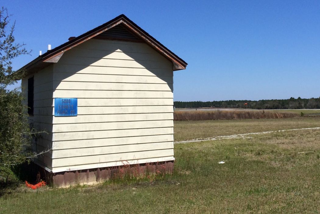
A circa 2006 aerial view looking south at the only building on Wole NOLF – what appears to be an operations shack,
along with an unidentified foundation – a former fire station?
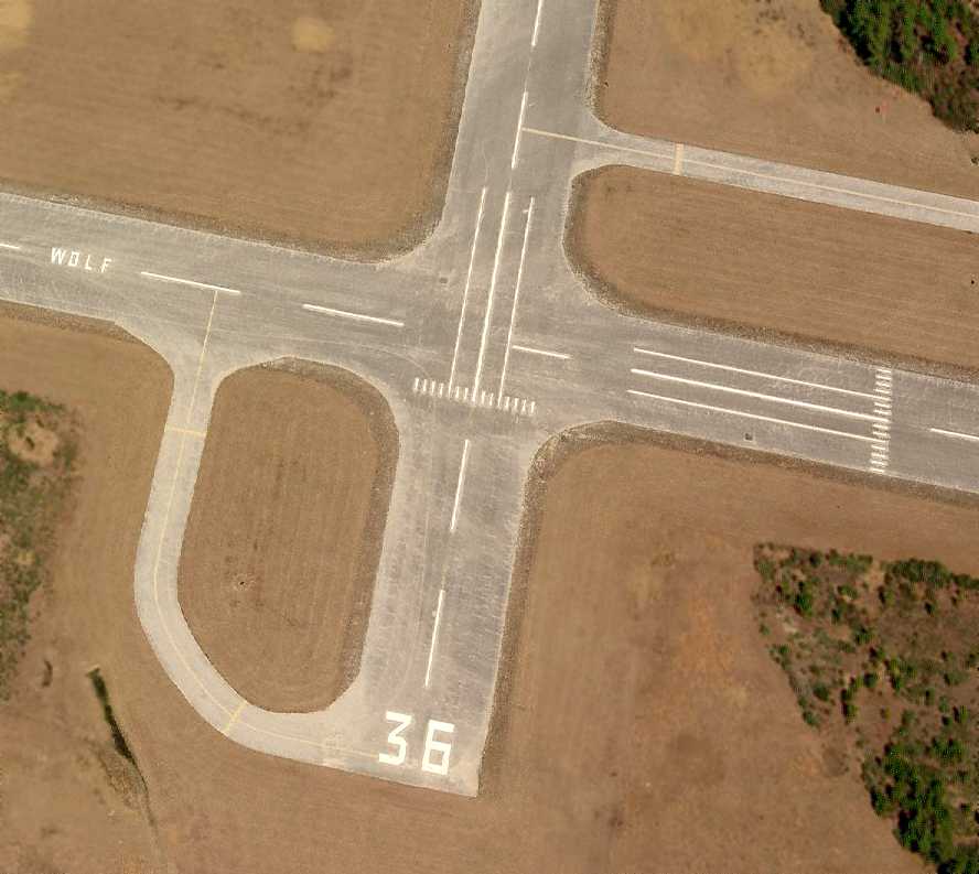
A circa 2006 aerial view looking north at the Wolf runways, showing the “Wolf” lettering painted on the midpoint of Runway 9/27.
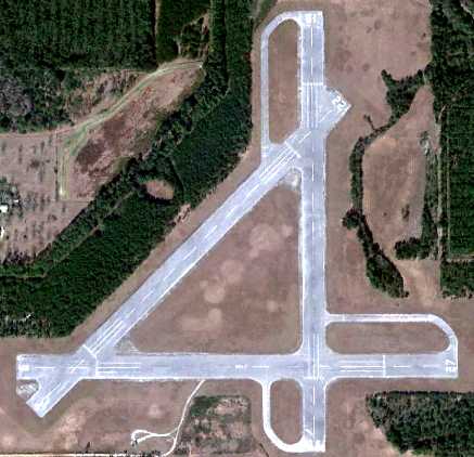
A 1/3/12 aerial view of Wolf OLF (courtesy of Dallam Oliver-Lee) showed that 3 runways were still marked: 18/36, 9/27 & 4/22.
A 3/31/14 photo by Timothy Williamson of the extensive building infrastructure at Wolf Field, with the windsock visible in the background.
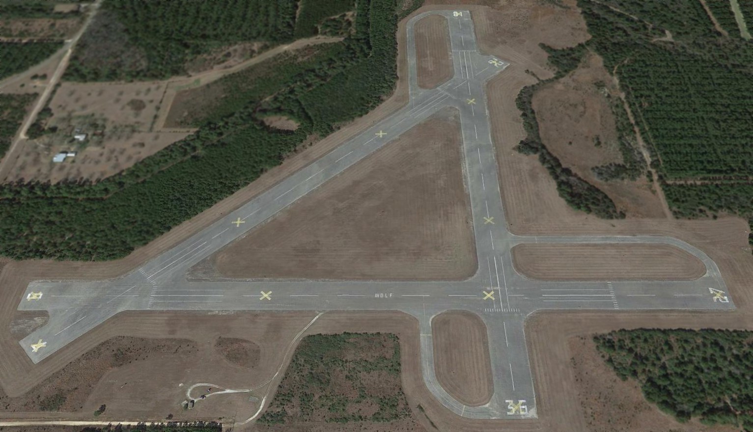
A 2015 aerial view showed that all 3 of Wolf Field's runways had been painted with yellow closed-runway “X” symbols.
See also: http://www.pafw.com/aerial_photos9.htm
____________________________________________________
Since this site was first put on the web in 1999, its popularity has grown tremendously.
If the total quantity of material on this site is to continue to grow,
it will require ever-increasing funding to pay its expenses.
Therefore, I request financial contributions from site visitors,
to help defray the increasing costs of the site
and ensure that it continues to be available & to grow.
What would you pay for a good aviation magazine, or a good aviation book?
Please consider a donation of an equivalent amount, at the least.
This site is not supported by commercial advertising –
it is purely supported by donations.
If you enjoy the site, and would like to make a financial contribution,
you
may use a credit card via
![]() :
:
Please consider checking the box to make a monthly donatation.
For a mailing address to send a check, please contact me at: paulandterryfreeman@gmail.com
If you enjoy this web site, please support it with a financial contribution.
This site covers airfields in all 50 states.